Tag Archive for: City of Houston

All Parties Still Focused on Finding Solution for Adding Flood Gates to Lake Houston Dam

Initial options that the City of Houston explored for adding more flood gates to the Lake Houston Dam struggled to achieve a high enough Benefit/Cost Ratio. However, all parties involved are still hopeful that a solution can be found. They are now evaluating yet another option. It would add gates in the earthen (eastern) portion of the dam.

Looking south over eastern portion of Lake Houston Dam at area under consideration for five new tainter gates. The spillway is out of frame to the right. Picture taken on 7/22/22.

More Gates Would Create More Room For Floodwaters

Flooding devasted the entire Lake Houston Area during Harvey. Since then, Mayor Pro Tem Dave Martin has led an effort to find a way to lower the lake faster in advance of a storm. This would create extra room in the lake for floodwaters. And that would reduce the risk of flooding homes and businesses around it.

Currently, the dam has a fixed height spillway. That makes releasing water in advance of a storm difficult. The dam does have several small gates, but they have only 1/15th the release capacity of the gates on Lake Conroe. Adding more gates would help release water faster…to keep up with water coming downstream.

It would also let managers wait to start a release until they were certain a storm would not veer away. That would help avoid wasting water if forecasts are not accurate.

The Dual-Role Dilemma

The City built Lake Houston in 1953 to supply water. Making the dam play two roles – water supply and flood mitigation – poses a challenge.

In 2017, immediately after Hurricane Harvey, Martin began leading the effort to transform the dam to play a dual role. This would let Lake Houston provide our region with needed drinking water and reduce flood risk. 

New Timeline Longer Than Hoped, But Still Shorter Than Usual

A project of this magnitude normally takes up to twelve years. However, Martin worked with federal, state, and local officials to shorten the timeline. Martin now hopes the project will take no longer than seven years. While acknowledging that he hoped completion would happen in as little as five years, Martin also cites unexpected technical and cost challenges related to the aging dam.

Difficulty of Finding Best Alternative

The age of the Lake Houston Spillway, built in 1953, has proven to be a bigger obstacle than expected. Engineers initially proposed six different alternatives for adding different types of gates in different locations, with variations on several.

As engineers started precisely calculating costs and benefits of preferred approaches, they weighed those against environmental impacts, construction challenges, safety risks, and available budget.

During that process, engineers discovered hidden challenges with some options that initially looked promising. At this point, they have determined that all six initial options cost more than the federally funded amount of $48 million. 

A Complicated Path Forward

So now engineers are focusing on finding the optimal solution while Martin and others explore options to pay for it.

Martin says the City of Houston, Texas Division of Emergency Management and Federal Emergency Management Agency are working together to find the option with the highest Benefit to Cost Ratio (BCR). 

Acceptable BCRs for projects like this range from .75 to 1, according to Martin. Preliminary engineering studies found that two crest-gate alternatives (already evaluated) yielded only .48 – largely due to the aging structure of the existing spillway, which drove up costs. 

City Expects Answer on Latest Option Before October

Currently, the City has paused the final-design phase of the project while engineers evaluate Alternative 1A. That now consists of five new tainter-gates (not six or twelve as previously reported) on the earthen embankment east of the spillway. 

The comprehensive, final BCR analysis for the embankment alternative should be completed by the end of September 2022. The preliminary engineering report suggested the 1A alternative could reduce flood heights by half a foot for a cost of $47.3 million with a BCR of .89. So initially, on the surface, this appears feasible.

Martin Widens Search for Funding

While engineers work to find the best BCR, Martin is leading an effort with BOTH state and federal partners to find additional funding for the project. 

For instance, Martin is working with outgoing State Representative Dan Huberty and incoming State Representative Charles Cunningham to seek funds in the upcoming Texas Legislative Session. Martin says that state dollars do not require BCRs like federal dollars do.

While all the challenges would have discouraged many, Martin says they have fortified his resolve. He vows to find a path forward. Martin promises an update in his regular fall public meeting in October and hopes to have an attractive BCR for alternative 1A.

Interim Flood-Mitigation Measures Still In Place

In the meantime, the City of Houston will continue its existing Lake Houston pre-release strategy. It calls for lowering the lake when forecasters predict three or more inches of rain in the San Jacinto Watershed. Since Hurricane Harvey, the City has lowered the lake more than twenty times and successfully avoided flooding.

Thanks to Key Contributors 

Martin acknowledges the continuing contributions of Congressman Dan Crenshaw, Governor Greg Abbott, Lt. Governor Dan Patrick, Commissioner Tom Ramsey, State Representative Dan Huberty, State Representative-Elect Charles Cunningham, TDEM-Chief Nim Kidd, Mayor Sylvester Turner, Chief Recovery Officer Stephen Costello, and Harris County Flood Control District. 

Martin says, “All parties are committed to constructing these additional gates to help ensure protection against future flood events.”

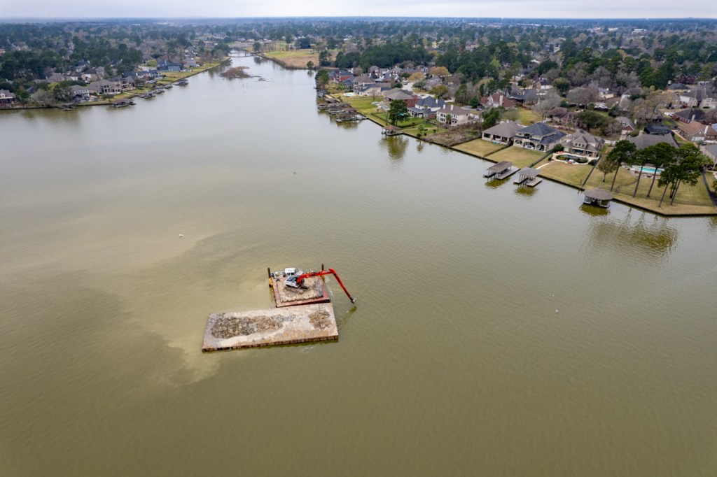
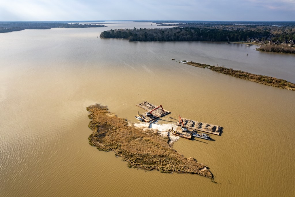
Posted by Bob Rehak on 8/4/2022

1801 Days since Hurricane Harvey

Construction of Northeast Water Purification Plant Past Halfway Mark

The City of Houston’s new $2 billion Northeast Water Purification Plant between Lake Houston and Beltway 8 East is now more than 50% complete. The last monthly progress report posted on GreaterHoustonWater.com was from more than a year ago. At the time, it showed construction 55% complete. Since then, the City has continued to post detailed periodic construction updates. The latest was in March 2022. It featured 79 pages of photos that dramatize the complexity of such a huge project. A flyover of the plant on 7/22/22 showed even more progress.

The latest timetable shows completion of the first phase early next year and completion of the second in 2025.

Project Benefits

The plant will provide enough treated surface water to reduce subsidence, which causes much of our flooding problems according to the City of Houston and the Harris-Galveston Subsidence District.

The Harris-Galveston Subsidence District says that land subsidence is caused by the withdrawal of groundwater. For that reason, regulations have been put in place to limit the use of groundwater.

By 2025, surface water must supply at least 60 percent of our water. The plant should meet that objective. And, it will wean 80% of the region off groundwater by 2035.

The plant expansion will supply 320 million gallons per day of treated water capacity in addition to the current 80 million gallons per day. So, capacity will quintuple by completion.

Then and Now Pictures Show Progress


The last time I posted about this project, construction was kicking into high gear back in September of 2020. Below are five pairs of photos from then and now that show how far it has come.

intake plant
September 2020
July 2022

The two pipelines leading to the Northeast Water Purification Plant are each 9 feet tall!


Northeast Water Treatment Plant
September 2020. Looking west toward Beltway.
July 2022

September 2020
July 2022

September 2020
July 2022

Improved Techniques

According to the City, “The expansion will include conventional treatment processes like the existing plant that help coagulate, settle, filter, and then disinfect water.” Quality will exceed Texas Commission on Environmental Quality requirements. 

In addition, says the City, an advanced oxidation process called ozonation will disinfect water to help ensure that harmful organisms such as Giardia and Cryptosporidium are eliminated. Ozonation also helps eliminate taste and odor causing compounds, which improves the aesthetic quality of the water supplied by the Northeast Water Purification Plant.

Posted by Bob Rehak on July 28, 2022

1794 Days since Hurricane Harvey

RV Resort Still Leaking Stormwater into County Park

The detention basin at the Laurel Springs RV Resort was supposed to have been a dry-bottom pond. Despite one of the driest springs on record, it’s still holding water. And it’s still leaking into Harris County Precinct 3’s Edgewater Park. Despite:

History of Discharges

The leak in question is in the exact place where contractors dug a trench through the south wall of the detention pond. They discharged silt that spread out for hundreds of feet into the wetlands of the park. Then they laid pipes in the trench and covered them up.

But somehow silty, oily stormwater still seems to be escaping into the wetlands from where the pipes were.

5/15/22
Photo taken 5/15/22. Leak in same area where trench and pipes were.
Close up cropped from shot above. Note ripples on rushing water.
5/22/22
Same area photographed again on 5/22/22.
Close up cropped from 5/22/22 shot. Again note running water and oily film on it.

One wonders why the pumps in the approved drains are still not working. See bottom center in photo below.

Laurel Springs RV leaking pond
Wide shot taken from over Laurel Springs Lane on 5/22/22 showing location of approved drain (bottom center) and extent of construction.
Forms being laid for next concrete pour. Will there be enough space between RV slots to open doors? Picture taken from over railroad tracks.

Obviously, from all the standing water, they still have a little work left to do on drainage.

Still No Replacement Trees Planted

Photo taken on 5/18/2022 showing swath of trees that contractors cut in county park (left).

The developer also has a lot of work to do replanting trees. Note the wide swath outside the fence in the photo above that stretches for approximately 750 feet. That’s where the contractor destroyed trees in the county park.

Posted by Bob Rehak on 5/22/2022

1727 Days since Hurricane Harvey

The thoughts expressed in this post represent opinions on matters of public concern and safety. They are protected by the First Amendment of the US Constitution and the Anti-SLAPP Statute of the Great State of Texas.

Mitigation Update: 3rd Anniversary of First Elm Grove Flood

Back in 2019, portions of Elm Grove and North Kingwood Forest Villages flooded twice. The first time occurred on May 7th. According to Harris County Flood Control District’s (HCFCD) report on the storm, “A 30-min rate of 2.9 inches was recorded at US 59 and the West Fork of the San Jacinto River and a 1 hour rate of 4.0 inches.”

“380 structures were flooded in the Elm Grove Village subdivision and other nearby subdivisions in the northern portions of Kingwood.”

Investigation by HCFCD the following day revealed that “… the flooding was potentially caused by development upstream in Montgomery County that sent large volumes of sheetflow into the subdivisions and Taylor Gully.” This video shows the sheetflow pouring out Perry Homes’ Woodridge Village property into homes along Village Springs Drive.

Perry contractors had clearcut 267 acres without installing the required detention ponds when the rain hit.

In the three years that followed, I posted 242 reports about every aspect of that flood and a second one during Imelda. The second flood affected two to three times more homes in the same areas.

The floods triggered multiple lawsuits which Perry Homes, its subsidiaries and contractors finally settled late in 2021.

What It Looked Like

Shady Maple the night of the May 7 2019 flood
Escape. In Elm Grove on Shady Maple the night of the May 7, 2019 flood.
High water rescue
Rustling Elms Bridge in Elm Grove underwater as school bus tries to cross it.
Water in Keith Stewart's home on Shady Maple after May 7th flood in 2019.
Water rising at night in Keith Stewart’s home on Shady Maple after May 7th flood in 2019.

Catalog of Flood Mitigation Efforts

Ever since the Elm Grove floods, Harris County, HCFCD, the City of Houston, Congressman Dan Crenshaw’s team and others have worked diligently to reduce future flood risk.

On this Mother’s Day weekend, it may bring flooded families comfort to understand how far we have come. Much remains to do, but much has already been done, or at least started.

Major Maintenance on Taylor Gully

Even before the second flood, HCFCD undertook a major maintenance project on Taylor Gully to remove accumulated sediment and restore channel conveyance.

The project began in 2019. Work extended downstream to the natural portion of the channel. It finished in 2021.

Taylor Gully maintenance
HCFCD working to remove sediment buildup in Taylor Gully near the Maple Bend Bridge in January of 2021. The work began upstream near Rustling Elms in July 2019.

Kingwood Area Drainage Analysis and Taylor Gully Study

In 2019-20, HCFCD, Lake Houston Redevelopment Authority (TIRZ 10), and City of Houston teamed up to conduct a drainage analysis for all streams in the Kingwood area. A recommendation to prioritize engineering of drainage improvements along Taylor Gully (including Woodridge) came out of that study.

The Flood Control District began preliminary engineering study on the Taylor Gully improvements in 2021. HCFCD anticipates presenting results during late summer or early fall this year.

Purchase of Woodridge Village By County and City

In early 2021, the Flood Control District and the City of Houston partnered to acquire the 267.35-acre Woodridge Village property for approximately $14 million.

They closed on the purchase of Woodridge Village in March 2021.

Houston Mayor Pro Tem Dave Martin lobbied the City to purchase about 70 acres of the property.

HCFCD will use the remaining 194.35 acres of the Woodridge site for stormwater detention. That will help reduce flood risk.

Crenshaw Earmarks

Congressman Dan Crenshaw secured an earmark for $1.6 million for engineering of flood mitigation improvements along Taylor Gully. The engineering should shrink the floodplain. That will effectively remove 387 structures from the floodplain and has the potential to remove another 62.

Crenshaw also has another earmark pending for $10 million to actually construct the improvements recommended by the study.

Local groups must spend earmarks during the fiscal year in which Congress approves them. So funding can’t get too far ahead of the engineering.

Taylor Gully Preliminary Engineering Study

The Taylor Gully study will look at Woodridge in conjunction with other potential Taylor Gully improvements. However, HCFCD must perform additional preliminary engineering to further evaluate specific alternatives for Woodridge and determine the best. 

During each study, HCFCD will hold Community Engagement Meetings to present alternatives and gather feedback.

Excavation & Removal Contract

In January 2022, HCFCD began work on a Woodridge Excavation and Removal (E&R) project.

Start of the new floodwater detention basin that could double the capacity on Woodridge Village.This pond should ultimately expand beyond the lone trees in the middle of the frame near the top. Photo taken 4/30/22.

E&R projects provide a head start on the excavation process and risk reduction. They can start before the design of a stormwater detention basin. Contractors excavate a set amount of material within an agreed-upon timeframe and general area.

The excavation can also potentially provide interim stormwater storage while awaiting the design and construction of the final stormwater detention basin.

As of April 30, 2022, 36,421 cubic yards of material has already been removed from the site. See photo above taken that day. The project will remove as much as 500,000 cubic yards of soil and other material.

Woodridge will remain an active construction zone for up to three years.

Have a Happy Mother’s Day this weekend.

Posted by Bob Rehak on 5/6/2022

1711 Days since Hurricane Harvey and 1096 Days since May 7, 2019

The thoughts expressed in this post represent opinions on matters of public concern and safety. They are protected by the First Amendment of the US Constitution and the Anti-SLAPP Statute of the Great State of Texas.

Case Finally Closed on Lake Conroe Association Lawsuit against City, SJRA

In April, 2021, a Montgomery County District Court dismissed the Lake Conroe Association’s lawsuit against the City of Houston for its Lake Lowering Policy. In August 2021, the court dismissed the same case against the SJRA with prejudice. The Lake Conroe Association (LCA) and several Lake Conroe residents appealed the decisions.

Then on April 20, 2022, LCA and the other appellants asked that the Court dismiss their appeal. Neither the City, nor SJRA, opposed the motion. Three judges of the Ninth District Court of Appeals in Beaumont then unanimously dismissed the appeal. Case closed.

“Takings” Claim Disputed

Lake Conroe Association contended that the SJRA’s lake lowering policy amounted to a “taking” of residents’ property.

The City of Houston and SJRA contended that the water at issue did not belong to lakefront homeowners. It belonged to the State of Texas and the City. Therefore, the Lake Conroe Association had no basis for a “takings” claim.

Sources close to the process said that before the matter was heard on appeal, the LCA realized it would never win. So its leaders decided to drop the case and avoid more legal fees.

Clearing the Way for Lake-Lowering Policy to Remain in Effect

This clears the way for the SJRA’s seasonal lake lowering policy to remain in effect during construction of additional floodgates on the Lake Houston Dam. The policy helps ensure that extra “storage capacity” (parking space for water) remains in Lake Conroe during the rainiest months in spring and the peak of hurricane season.

This reduces chances of another devastating release that floods downstream residents during a major storm, such as Hurricane Harvey. The SJRA released 79,000 cubic feet per second during Harvey, one third of all the water coming down the West Fork between Humble and Kingwood.

However, as time went by, Lake Conroe residents became upset with the policy. That led to a contentious confrontation between upstream and downstream residents, as well as the lawsuit.

2022 Version of Lake-Lowering Policy is a Compromise

Over time, the SJRA has reduced the amount of lowering in its policy. Currently, the spring lowering is one-half foot below 201 during April and May, the level of the conservation pool in the lake. Originally, it was one full foot below 201. Most people call that the “normal” level. However, the mean level of Lake Conroe is below that about two-thirds of the time. (See last table below.)

Current Lake Conroe Level

Evaporation and low rainfall currently have Lake Conroe at 200.8, or about 3 inches above the new seasonal target level and 3 inches below the conservation pool.

Currently Lake Conroe’s level is at 200.8 feet and the City of Houston (COH) has not called to lower the lake further.

A close reading of the policy reveals that for the lake lowering to begin, the City of Houston must call for the water.

Below-Average Rainfall Has Delayed Need for Spring Release

However, below-average rainfall for the last two months has delayed the need for a spring release from Lake Conroe this year. Much of the state is now in drought.

Montgomery and northern Harris Counties are currently rated as “abnormally dry.” Southern Harris, Fort Bend and Waller Counties all have “moderate drought.”

Jace Houston, general manager of the SJRA, said, “We haven’t had a big rain in a long time and there’s no significant rain in the foreseeable future. The feeling is that evaporation will soon take the lake down to the target level. The City of Houston must initiate the lowering. If we get a lot of rain, we’ll start releasing again.”

Time for Healing

In addition to reducing the spring lake lowering, the 2022 policy lowers Lake Conroe to 200.5 in August and 200 in September – both a half foot higher than the original policy.

Hopefully, this compromise will help upstream and downstream residents live together now that the lawsuit has been dismissed. It’s time for some healing.

Posted by Bob Rehak on 4/22/2022

1697 Days since Hurricane Harvey

How Blocked Up Is Rogers Gully?

On March 1, I posted about how dredgers had moved from the East Fork to Rogers Gully. Rogers Gully enters Lake Houston at the Walden Country Club. In my opinion, it has the worst mouth bar of all the channels that enter Lake Houston, with the exception of the East and West Forks of the San Jacinto. Harris County Flood Control finished dredging the channel itself almost two years ago. But the mouth bar is the City’s responsibility.

I went back to see how much of the mouth bar remained this morning and was shocked. The two dredges are still sitting far offshore, approximately where they were on March 1.

Here are several pictures that show their position this morning, 3/11/22.

Looking west from the mouth of Rogers Gully toward the dredges about a quarter mile away and the eastern shore of Lake Houston in the background.
Reverse angle. Looking over one of the two dredges toward the mouth of Rogers Gully.

Curious about why the dredges were working so far out, I asked State Representative Dan Huberty “Why?” Huberty, who secured money for the dredging, texted back a one-line answer.

“Can’t get into Rogers Gulley without dredging their way in.”

State representative dan huberty

Wow. I knew Rogers Gully was bad. But I had no idea it was that bad. This could be like getting to the East Fork from the West Fork. It took crews three months to dredge their way through the channel south of Royal Shores that connects the two forks.

It’s been almost two weeks since they started working here. And this area is far wider than the Royal Shores channel. Rogers Gully has apparently formed a wide and long “underwater” delta that extends far beyond the above-water portion.

So in answer to the question in the headline, “How blocked up is Rogers Gully?” It’s baaaad.

This underscores the need to establish a perpetual maintenance dredging program for Lake Houston, something the Army Corps recommended back in 2018 and that Brown and Root recommended in 2000. It’s not just about recreation. It’s about ensuring long-term water-supply capacity in the lake.

Posted by Bob Rehak on 3/11/22

1655 Days since Hurricane Harvey

City Seeks Your Feedback on Equity Indicators Survey

The City of Houston is launching its “Equity Indicators” project by asking for your comments to one important question: What makes a community equitable?

Reflecting Houston’s Diversity

Houston is the most diverse city in the nation, but despite the strength of our diversity and multiculturalism, Houstonians experience vast racial and ethnic disparities. The Equity Indicators Project will facilitate broader conversations on equity and inclusion, take active steps to measure disparities, and have leaders across multiple sectors be held accountable for taking action to increase equitable outcomes for all Houstonians.

The city is seeking feedback from community members to ensure that this project is reflective of Houston’s diversity and multiculturalism.  Visit houstontx.gov/equity to share your thoughts on what makes a community equitable between March 6 until April 2.

“In a city where 146 languages are spoken, we must use every tool possible to ensure that every Houstonian’s voice is being heard,” said Mayor Sylvester Turner. “This survey is a direct, impactful way to participate in making the city, its services, and its opportunities more accessible to people regardless of their background.”

Houston Mayor Sylvester Turner
File Photo: Houston Mayor Sylvester Turner speaking at the Kingwood Community Center

Project Sponsored By…

The Equity Indicators project is led by the Planning and Development Department, Mayor’s Office of Resilience and Sustainability, and Complete Communities, and ties to the vision and framework for a resilient community outlined in the Resilient Houston strategy. The city has partnered with Rice Kinder Institute for Urban Research using the methodology developed by CUNY- Institute for State & Local Governance to focus on key indicators for equity in Houston. The Shell Foundation has funded this initiative that focuses on six themes:

  • Economic opportunity
  • Health
  • Public Safety
  • Environmental and Climate Risks
  • Built Environment
  • Access and Inclusion

How Data Will Be Used

The data analysis will result in an overall Equity Indicators Score for the City of Houston.  The public, city departments, city programs, and community service organizations can track the score to document progress and change over time.  The numerical value is based on a 100-point scale.  A high score signifies Houston’s level of success toward building an equitable city, whereas a low score represents a high level of inequity and more opportunity for improvement.

For More Information or Printed Survey…

A printed survey card will also be available at city locations. Houstonians with questions or needing assistance filling out the survey may call 832-393-6637.  For more information, visit Equity Indicators online atwww.houstontx.gov/equity.

Thought Starters: Aspects of Equity Measured by Various Indices

It seems everybody has a way to measure equity these days. Without trying to influence your opinion, I would simply reprint this list of indexes compiled by the Brookings Metropolitan Policy Program.

Posted by Bob Rehak on 3/9/2022 based on a press release by COH and info compiled by Brookings

1653 Days since Hurricane Harvey

City De-Silting Channel Under Kingwood Drive Near High School

Last week, the City of Houston started clearing debris from the culverts under Kingwood Drive near Kingwood High School. Local flood-fighter Chris Bloch has been working for years behind the scenes to document drainage issues such as this one and convince local officials to address them.

Un-named and Long-Forgotten Tributary Finally Getting Attention

One of Bloch’s latest investigations has been an uncatalogued and long-ignored channel under Kingwood Drive. It helps drain Kingwood High School into Bens Branch. But it doesn’t show up anywhere on Harris County Flood Control District maps.

HCFCD’s Flood Education Mapping Tool. Red oval indicated approximate area of uncatalogued ditch.

Two Feet of Sediment Block Culverts Under Kingwood Drive

Bloch says, “The channel originates at Kingwood High School’s athletic fields. The ditch is narrow and full of sediment and vegetation. Side channels, which empty into this ditch, are also full of sediment and vegetation. This is the only ditch providing storm water drainage from the high school campus.”

The high school building suffered $67 million in damages during Harvey and lost another $10 million in contents.

The ditch in question passes through three culverts under the Westbound lanes of Kingwood Drive. They are obstructed by 24 inches of sediment and debris. See below.

Blocked culverts under Kingwood Drive are finally being cleared. Photo courtesy of Chris Bloch.

“Debris indicates stormwater runoff from the campus passes over Kingwood Drive due to the poor conveyance capacity of this ditch.”

Chris Bloch, Kingwood Resident and Retired Engineer

“If cleared of sediment, the cross section area of the three culverts would total 60 square feet.

More Blockages Downstream

After crossing under Kingwood Drive, the ditch funnels water into a 24-inch corrugated plastic culvert. That carries it across the Kingwood Country Club Driving Range. “This cross-sectional flow area of this culvert is only about 5% of the total area of the three culverts that pass under Kingwood Drive,” says Bloch.

Later, as the ditch crosses two fairways on its way to Bens Branch, sediment and vegetation again partially block it. They also partially block the three culverts under Centerpoint’s easement near Bens Branch.

Bloch believes, “Maintenance and improvement of this ditch upstream of these outfalls would significantly improve drainage of the high school campus.”

Ensuring Long-Term Maintenance

“Although the Harris County Flood Control District (HCFCD) has no property rights for this channel, the District may be willing to partner with property owners to improve drainage,” says Bloch. “The original channel was reported to have been installed by Humble ISD (HISD) prior to the existence of the driving range.”

Bloch says he has been communicating with HISD, HCFCD and the City of Houston about the poor condition of this ditch since 2020. “I recently communicated with Mayor Pro Tem Martin’s office about this ditch and spoke with Mayor Pro Tem Martin himself about it. The de-silting is another small step forward for flood mitigation in Kingwood. I appreciate the involvement of Mayor Pro Tem Martin.”

“Recently, HCFCD indicated they would be willing to partner with the property owners of this ditch to improve drainage. Hopefully, once the City completes the sediment removal of the channel on the Kingwood Drive right of way, HISD and the Country Club can get together with the HCFCD to improve drainage across the Country Club property to Bens Branch,” says Bloch.

To see Bloch’s full report, click here.

Posted by Bob Rehak with thanks to Chris Bloch and Mayor Pro Tem Dave Martin

1650 Days since Hurricane Harvey

City Inspector Finds No Problems At RV Park. 311 Says “Case Closed.” Martin’s Office Says “Not So Fast.”

After photos showed clear construction permit violations at the Laurel Springs RV Resort, a City inspector said he found no problems there. Then, 311 closed the case. But Mayor Pro Tem Dave Martin’s office said another group was investigating. Martin’s chief of staff did not elaborate.

Discharging Silty Stormwater into County Park

On Saturday, I photographed the contractor digging a trench to let silty stormwater out of the detention pond into Harris County Precinct 4’s Edgewater Park.

stormwater runoff
RV Park Drains its construction pond into Harris County Precinct 4’s new Edgewater Park in background.

This violated the terms of the developer’s construction permit. The trees behind the trench belong to Harris County Precinct 4 Park System. And the construction permit clearly states that “stormwater runoff shall not cross property line.”

Note first sentence on approved drainage plan.

Discharging across property lines also violates state law. See Chapter 11.086 of the state water code.

Then on Monday morning, I photographed the contractor covering up pipe that creates a permanent outfall onto County property.

Contractors laying pipe under wall of detention pond to send stormwater into Edgewater Park
Contractors covering up pipe that will convey future discharges. Photographed yesterday.

So I filed a complaint with the City’s 311 system at the request of Mayor Pro Tem Dave Martin’s District E staff.

Finally, today (Tuesday morning), I tried to photograph the drain/trench again. But contractors had covered it up and repaired the dike. If you hadn’t seen the previous pictures, you would never suspect a drainpipe was there (except for some black silt fencing around the intake which will be taken down).

By Tuesday morning, contractors had repaired the pond wall. Area circled in red is the outfall, covered with water.

Extent of Silty Runoff

The silty stormwater ran almost all the way down to Hamblen Road.

Water should have gone under Laurel Springs Lane and into the detention pond above via COH storm sewer. However, the contractor discharged it into the park instead. Note sediment-laden water in foreground.
A large portion of the park appears to be inundated with silty discharge.
Looking north toward detention pond on RV site from over Edgewater Park. Note silty water in foreground.

City Inspector Found No Violations

As I reviewed Tuesday’s images, I received an email from 311 saying the inspector found no problems and that 311 had closed the case. Obviously, the 311 operator didn’t clearly communicate the nature of my complaint. It was about stormwater runoff and construction-permit violations, not a fence line encroachment.

And clearly, the inspector didn’t:

  • Look at the approved drainage plan that showed the outfall should be going into the City storm sewer under Laurel Springs Lane.
  • Understand that draining water onto neighbor’s property violates the construction permit and state regulations.
  • Know the trees below the construction site belong to the County Park. He thought they belonged to the contractor. (See below.)
Response from 311 to complaint about construction stormwater violations. No pictures were attached despite text of email.

Inspector Felt Discharging into County Park Was Best Management Practice

To add insult to injury, the inspector characterized discharging into Edgewater Park’s vegetation as a contractor best management practice (BMP). Obviously, he thought the trees belonged to the contractor. He didn’t bother to explore who owned the land below the construction site or how far south the discharge had traveled.

Responses like this give the City a black eye.

I immediately emailed Mayor Pro Tem Dave Martin’s office about the 311 response. Jessica Beemer, his chief of staff, responded that the case wasn’t really closed. She said a different group had been assigned to investigate the complaint. But, as of this writing, she did not elaborate.

The TCEQ hopes to respond to a separate complaint by tomorrow. And I met several Harris County employees investigating the construction this morning in response to other complaints.

Stay tuned. More news to follow. This isn’t over yet.

Posted by Bob Rehak on 2/1/2022

1617 Days since Hurricane Harvey

The thoughts expressed in this post represent opinions on matters of public concern and safety. They are protected by the First Amendment of the US Constitution and the Anti-SLAPP Statute of the Great State of Texas.

Dredgers Still Nibbling Away at East Fork Mouth Bar

Mechanical dredging is sloooooooooow. Two months after my last dredging update, contractors are still working on the same portion of the East Fork Mouth Bar complex just north of the entrance to Luce Bayou. The sand bar is question is one of many in the area that popped up after Harvey and Imelda.

Pictures Taken on 1/28/22

I took the first three images below this morning.

Looking East across the San Jacinto East Fork from Kingwood toward Luce Bayou in upper right. North is to the left. Photo taken on 1/28/22.
Dredgers are now working on a small island just upstream from Luce. But there’s a lot of work yet to do. Photo taken on 1/28/22.

The San Jacinto East Fork Mouth Bar grew more than 4,000 feet in length during Harvey and Imelda. River depth was reduced to 3 feet, according to boaters. That reduced conveyance of the river and contributed to flooding of homes on both sides.

This damage map shows that almost 1300 homes flooded in the East Fork watershed during Harvey. However, it’s not clear how far upstream any backwater effect extended from the East Fork mouth bar.

Looking south, downstream toward Lake Houston and the FM1960 causeway. Photo taken on 1/28/22.

Earlier Images

Compare the photo above taken today to the one below taken two months ago.

Comparable shot taken on 11/30/21, two months ago.

Since November, dredgers have eliminated the remainder of the bar in the distance and reduced the size of the one in the foreground.

See a satellite image of the full bar below before dredging started.

Contractors have removed sediment from the area outlined in red since dredging began in October 2021.

It took three months just for contractors to dredge their way through the Royal Shores channel to get to East Fork (July, August, September 2021). East Fork dredging started in October last year. Removing sediment from the area in red above has taken four months. But it’s only a small portion of the work that needs to be done as you can see in the second image above that looks upstream.

Naturally, residents are asking, “How much more does the City intend to do?” The answer to that question is still unsettled.

Vendor for Long-Range Dredging Plan Still Not Decided

In August of last year, the City of Houston started searching for a consultant to develop a long-range dredging plan for Lake Houston. The timetable in the Request for Qualifications (Page 4) stated that the City hoped to select a vendor by November, approve the contract in December, and start work in January.

The project attracted a lot of attention. Thirteen companies expressed interest. And eleven signed up for a pre-bid conference. However, the purchasing agent for the City, Bridget Cormier, stated that “The City has not yet made a decision, nor a recommendation for award yet.” She explained, “We are still in the evaluation phase and have requested additional information from suppliers that moved forward in the process.”

Posted by Bob Rehak on 1/28/2022

1613 Days since Hurricane Harvey