Why You Build Detention Ponds First
A best practice in the construction industry is to build detention ponds before you clear all the land. In Elm Grove and North Kingwood Forest, we saw what can happen when you don’t. Contractors cleared 277-acres before installing sufficient detention pond capacity. The result: hundreds of homes flooded needlessly. Twice. And silt poured into Taylor Gully which had to be excavated at public expense.
Staging Construction, Temporary Seeding, Mulching Not Used to Reduce Sedimentation
Harris County Stormwater Quality Management Regulations discourage clearcutting large sites all at once. See section 4.2.3.1, Stormwater Pollution Prevention (SWPPP) During Construction. The text states, “The clearing, grubbing and scalping (mass clearing or grading) of excessively large areas of land at one time promotes erosion and sedimentation problems. On the areas where disturbance takes place the site designer should consider staging construction [emphasis added], temporary seeding and/or temporary mulching as a technique to reduce erosion. Staging construction involves stabilizing one part of the site before disturbing another [emphasis added].“
But those rules don’t apply in Montgomery County. So you often see developers trying to build detention ponds as they build (or even after they build) the rest of the site.
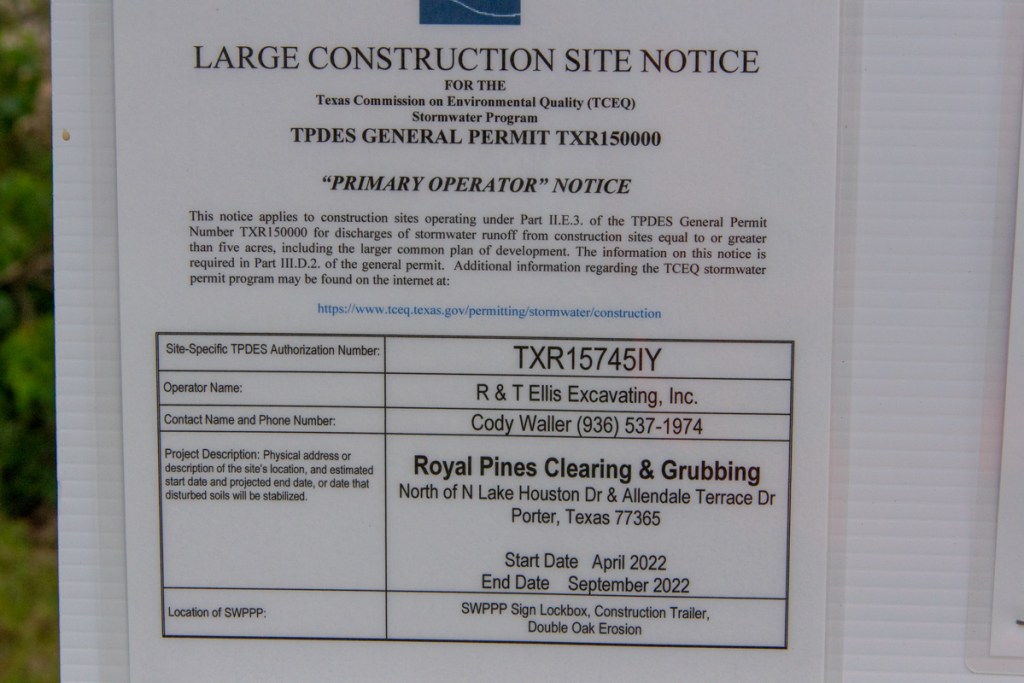
Case in Point: Preserve at Woodridge
Such is the case at the Preserve at Woodridge…which promises “resort-style amenities.”

Plans show that more houses will go in on the right.
Meanwhile, compare the detention ponds below. One is a white, chalky mess with dirt still piled around the edges. The other: pretty clean. Of course, residents pay to keep it that way.


The sad part of this: downstream residents will pay the price. And because this is another development just north of the county line, that will be Kingwood. The last time, the developer pumped stormwater into the drainage ditch, the silt traveled miles down Ben’s Branch.
Why Bring In Clay?
I asked an expert in floodwater detention basin construction, why the developer would bring in clay? The answer: “To create a wet-bottom pond.” Developers sell those as residential amenities. I applaud that. But my point is this. Had they completed the detention pond first, it could have been growing grass to reduce sedimentation while they developed the rest of the property. That approach seemed to work well at the New Caney High School ISD West Fork High School.

Lest you think I’m a MoCo basher, let me point out this. The detention pond above is also in MoCo.
Posted by Bob Rehak on 5/24/22
1729 Days since Hurricane Harvey
The thoughts expressed in this post represent opinions on matters of public concern and safety. They are protected by the First Amendment of the US Constitution and the Anti-SLAPP Statute of the Great State of Texas.