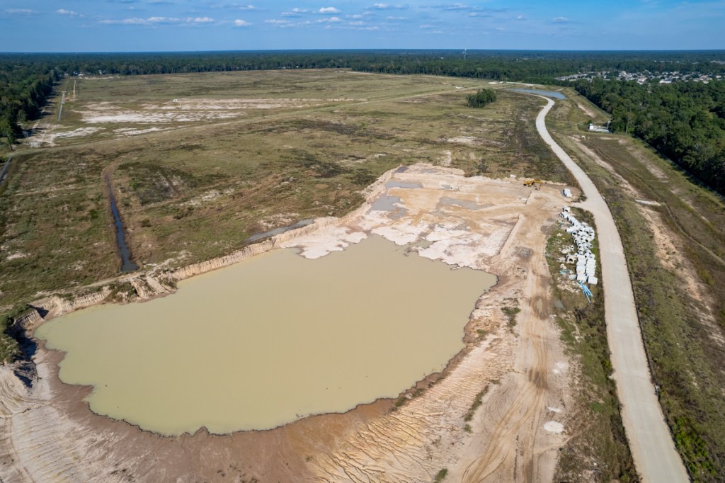
Harris County Flood Control District (HCFCD) says that, as of 10/31/22, Sprint Sand and Clay has hauled off 66,094 cubic yards of dirt from Woodridge Village. That means, despite the slowing real estate market, that the company has exceeded its Excavation and Removal contract minimum within nine months of the first year.
Objective of Excavation
The objective of the contract: to get a head start on the removal of up to 500,000 cubic yards of dirt from what will eventually become the sixth stormwater detention basin on the Woodridge Village property. Woodridge forms the headwaters of Taylor Gully.
Community Meeting Will Reveal Findings of Engineering Study
HCFCD is now planning a community meeting to share the results with affected residents before the end of the year.
It’s not clear yet exactly:
How much additional detention Woodridge will need
How much channel widening Taylor Gully will need
Whether any bridges need to be replaced
How upstream improvements will affect residents farther downstream.
The preliminary engineering report should address all those questions.
Photos from September and October
In the meantime, a parade of dump trucks visits the Woodridge site most days to haul off dirt from where the sixth basin will go. The sixth basin could double stormwater detention capacity on the site – if Sprint excavates all 500,000 CY.
Sprint’s contract calls for them to remove a minimum of 60,000 cubic yards per year or 5,000 per month.
The September and October pictures below show how far Sprint has come in the last six weeks.
End of September 2022End of October.Sprint has not gone much farther, but they have gone deeper.
See pictures taken below from the reverse angle. The majority of the work now takes place at the far end.
Extent of excavation on September 24.End of October 2022.
Groundwater appears to be seeping into excavated areas.
HCFCD did not confirm WHY Sprint appears to be digging shallower. Amy Stone, a HCFCD spokesperson, did say however that the site contains multiple types of soil. The volume removed in a particular location may relate to demand for a particular type.
More news about the community meeting and study findings when it becomes available.
Posted by Bob Rehak on November 1, 2022
1890 Days since Hurricane Harvey
https://i0.wp.com/reduceflooding.com/wp-content/uploads/2022/11/20221031-DJI_0038.jpg?fit=1200%2C799&ssl=17991200adminadmin2022-11-01 13:00:172022-11-02 14:38:13Woodridge Village Excavation, Taylor Gully Updates
A new Woodridge Village Stormwater Detention Basin that could almost double detention capacity on the site continues to move forward slowly as housing starts slow. The trend at Woodridge seems consistent with other excavation and removal (E&R) contracts countywide.
Meanwhile, the first draft of a preliminary engineering study for the Woodridge site and Taylor Gully is complete and going through management review at Harris County Flood Control District (HCFCD).
Status of E&R Contract on Woodridge Village Site
As of mid-September 2022, Sprint Sand and Clay had removed 57,785 cubic yards of dirt from a planned detention basin on the Woodridge Village property in Montgomery County. Sprint is working under an E&R contract with HCFCD. The contract calls for them to remove up to 500,000 cubic yards at a minimum of 60,000 cubic yards per year or 5,000 per month.
Looking NE across new basin. Last month, it extended as far as the middle of the far pile of concrete pipes on the right.
So the company, which began work in February, has virtually met its first year minimum after eight months. However, the rate has slowed somewhat in recent weeks as housing starts have slowed due to a rise in interest rates. In the last four weeks for which totals are available (8/22/22 – 9/18/22), Sprint has removed only 3,045 cubic yards. To date, that brings the total excavated to 12% of the contract max.
Housing starts in the South have been especially hard hit. According to the Census Bureau, starts in August fell 13.5% compared to July and 15.4% compared to a year ago. That depresses demand for fill dirt and makes it harder for Sprint to find buyers for it.
Under the terms of its HCFCD E&R contract, Sprint gets only $1,000 for removing up to 500,000 cubic yards, but has the right to resell all the dirt at market rates. That’s how it makes its profit.
Woodridge Vs. Countywide Data
To see whether Woodridge was an anomaly or part of a trend countywide, I asked HCFCD to show readers the bigger picture. Alan Black, Deputy Director of Engineering and Construction supplied the data below. The chart shows the trend in all HCFCD E&R contracts countywide going back 10 years.
Source: HCFCD via FOIA Request
All data is open to interpretation. But I see three main “regions” in the chart above.
The first is pre-flood bond – before August 2018. With the exception of a few blips, excavation remained below 5,000 cubic yards per month. That’s roughly equal to the average being removed from Woodridge Village each month.
The second is a huge spike that occurred after flood-bond approval. it peaked at almost 35,000 cubic yards per month as HCFCD readied engineering studies on more than 180 projects countywide.
Third, HCFCD had a sharp falloff at the start of the pandemic in January 2020. After things stabilized, we see a gradual rebuilding. It coincides with a housing boom and is followed by another gradual drop-off. The latter coincides with rising interest rates and falling housing starts.
Regardless, the trend in the last few months does not bode well for those concerned about finishing the new Woodridge Stormwater Detention Basin quickly.
Looking W.The new Woodridge Village stormwater detention basin at the top of the frame could eventually fill most of the area between the road on the left and the ditch on the right.
Status of Preliminary Engineering Study on Taylor Gully
IDCUS submitted the first draft of its results several months ago.
Amy Stone, HCFCD spokesperson
Since then, HCFCD staff has reviewed it and asked IDCUS to take a closer look at some areas, said Stone. At this point, the revised draft is working its way up to HCFCD top management for final review and comment. HCFCD has started preparing a presentation for all those affected in the area and exploring the best dates for a community input session.
Assuming HCFCD management doesn’t ask IDCUS for more revisions, we should know recommendations and next steps this fall. Following a public comment period, more changes may need to be made to engineering plans before design and construction start.
Folks who flooded in Elm Grove and North Kingwood Forest as well as others farther downstream in Mills Branch and Woodstream Village eagerly await the findings. More news when it becomes available.
Posted by Bob Rehak on 9/30/2022
1859 Days since Hurricane Harvey
https://i0.wp.com/reduceflooding.com/wp-content/uploads/2022/09/20220930-DJI_0714.jpg?fit=1200%2C799&ssl=17991200adminadmin2022-09-30 18:09:322022-10-01 07:59:53New Woodridge Village Detention Basin About 12% Excavated, Engineering Study Almost Done
Looking NW at Woodridge Village days before Imelda. During the storm, water flowed toward the circle, bottom right, with little to slow it down. Overflow went into surrounding streets.See video below taken from ground level.September 19, 2019. Sheet flow from the Woodridge Village development flows down Village Springs in Elm Grove.Family evacuating through North Kingwood Forest. Car submerged during Imelda at the end of Village Springs adjacent to Woodridge. People living in campers while restoring their homes from the May 7, 2019 flood were flooded again.
Security cam time lapse footage in Elm Grove on east side of Taylor Gully.Depth of flood in Elm Grove was about two feet at this house.Elm Grove debris pile after Imelda flood.Abel Versa had to grab his car to avoid slipping in ankle-deep muck on Village Springs.The bridge over Taylor Gully at Rustling Elms in Elm Grove caught debris flowing downstream.
Before the clearcutting, these areas had not flooded – even during Hurricane Harvey.
Lessons Lost
Lawsuits against the Woodridge Village developer and its contractors quickly followed. And flood victims won a major settlement. But the clearcutting lessons learned in court seem to be lost on other developers.
Lately, it seems that developers all around northern Harris, southern Montgomery, and Liberty Counties have employed clearcutting.
Mavera is clearing 2,015 acres at FM1314 and SH242.
Preserve at Woodridge is building 13-homes to the acre on 17 clearcut acres adjacent to a tributary of Bens Branch.
These represent just a few of the clearcutting stories I’ve covered in the last few months. So far, they’ve been lucky. We haven’t had any tropical storms like Imelda.
But still, risk remains. You’d think developers would hedge that risk by leaving some trees. They reduce erosion. Suck up rainwater. Slow down runoff. And filter water that may overflow detention basins.
But it’s their property. And your problem if we get another Imelda.
Posted by Bob Rehak on September 19, 2022
1847 Days since Hurricane Harvey and 3 years since Imelda
https://i0.wp.com/reduceflooding.com/wp-content/uploads/2019/09/Elm-Grove-9.19_68.jpg?fit=1500%2C1000&ssl=110001500adminadmin2022-09-19 20:49:442022-09-19 23:52:38Imelda’s Third Anniversary Brings Clearcutting into Focus
Tomorrow is the fifth anniversary of Hurricane Harvey. Many in the Lake Houston Area have asked, “Are we safer now?” The answer is yes, but we have a long way to go to achieve all our goals. Here’s a five-year flood-mitigation report card. It describes what we have and haven’t accomplished in 29 areas. So get ready for a roller coaster ride. I’ll leave the letter grades to you.
Lake Houston Area Mitigation
1) Dredging
The most visible accomplishment in the Lake Houston Area since Harvey is dredging. The City and Army Corps removed approximately 4 million cubic yards of sediment blocking the West and East Forks. Before dredging, River Grove Park flooded six times in two months. Since dredging, it hasn’t flooded once to my knowledge.
West Fork mouth bar after Harvey and before dredging. Now gone, but not forgotten.
Potential location for new tainter gates east of the spillway portion of the dam (out of frame to the right.
3) Upstream Detention
To reduce the amount of water coming inbound during storms, the San Jacinto River Basin Master Drainage Study identified 16 potential areas for building large stormwater detention basins. Unfortunately, they had a combined cost of $3.3 billion and would only reduce damages by about a quarter of that.
So, the SJRA recommended additional study on the two with the highest Benefit/Cost Ratio. Their hope: to reduce costs further. The two are on Birch and Walnut Creeks, two tributaries of Spring Creek near Waller County. Expect a draft report in February next year.
Funding these would likely require State assistance. But the Texas Water Development Board’s San Jacinto Regional Flood Planning Group has just recently submitted its first draft report. The draft also recommended looking at detention basin projects on West Fork/Lake Creek, East Fork/Winters Bayou, and East Fork/Peach Creek.
Building them all could hold back a foot of stormwater falling across 337 square miles. But funds would still need to be approved over several years. We’re still a long way off. Results – on the ground – could take years if not decades.
4) “Benching”
The Regional Flood Planning Group also recommended something called “benching” in two places along 5 miles of the West Fork. In flood mitigation, benching entails shaving down a floodplain to create extra floodwater storage capacity. Like the detention basins, benching is still a long way off…if it happens at all.
5) West Fork Channel Widening
Finally, the Regional Flood Planning Group recommended widening 5.7 miles of the West Fork to create more conveyance. But again, at this point it’s just a recommendation in a draft plan.
San Jacinto River Authority
6) SJRA Board Composition
After Harvey, many downstream residents accused SJRA of flooding downstream areas to save homes around Lake Conroe. At the time, SJRA’s board had no residents from the Humble/Kingwood Area. So Governor Abbott appointed two: Kaaren Cambio and Mark Micheletti. Cambio later resigned due to a potential conflict of interest when she took a job with Congressman Dan Crenshaw. That leaves Micheletti as the lone Humble/Kingwood Area resident on a seven-person board. However, the SJRA points out that the Board’s current president, Ronnie Anderson, represents Chambers County, which is also downstream.
State Representative Will Metcalf, who represents the Lake Conroe area, introduced a bill to limit SJRA board membership to upstream residents. Luckily for downstream residents, it failed.
7) Lake Conroe Lowering
SJRA identified temporary, seasonal lowering of Lake Conroe as a strategy to reduce downstream flood risk until completion of dredging and gates projects in the Lake Houston Area. The lowering creates extra storage in the lake during peak rainy seasons. After SJRA implemented the plan, Lake Conroe residents objected to the inconvenience. They sued SJRA and the City, but lost. After discussion with all stakeholders, the SJRA quietly modified its plan. It still lowers the lake, but not as much.
8) Lowering Lake Houston
Houston also started lowering Lake Houston, not seasonally, but in advance of major storms. The City has lowered the lake more than 20 times since beginning the program. That has helped to avoid much potential flooding to date.
9) Lake Conroe Dam Management
SJRA applied for and received several TWDB grants to enhance flood mitigation and communications in the San Jacinto River Basin. One involves developing a Lake Conroe Reservoir Forecasting Tool. SJRA has also worked with San Jacinto County to develop a Flood Early Warning System.
Finally, SJRA’s Lake Conroe/Lake Houston Joint Reservoir Operations Plan is on hold pending completion of the City’s plan to add more gates to the Lake Houston dam. Such projects may help reduce the risk of releasing unnecessarily large volumes of water in the future.
However, the location is controversial. Geologists say it wouldn’t reduce sediment in the area of greatest damage. Environmentalists worry that it could increase sedimentation through a “hungry-water” effect and open the door to river mining. And I worry that, even if successful, the pilot study would not be extendable. That’s because it relies on partnerships with sand miners. And other tributaries to Lake Houston do not have sand mines or as many sand mines.
Sand bar blocking West Fork after Harvey. The Corps has since removed it.
Federal Funding
It’s hard to get good grades on your flood mitigation report card without funding.
$1.6 million for HCFCD for Taylor Gully stormwater channel improvement.
$1.6 million for HCFCD for Kingwood Diversion Channel improvement.
$1.67 million for Harris County for the Forest Manor drainage improvement project in Huffman.
$8.2 million from FEMA the Westador Basin stormwater detention project on Cypress Creek.
$9.9 million from FEMA for the TC Jester storm water detention basin on Cypress Creek.
Crenshaw also has backed community requests for more funding in Fiscal 23. They include:
$8 million for the Lake Houston Dam Spillway (Gates).
$10 million for the Woodridge Stormwater Detention Basin (see below).
$10 million for a Cedar Bayou Stormwater Detention Basin.
Harris County Flood Control
19) Channel Maintenance and Repair
Harris County Flood Control has already completed several maintenance projects in the Lake Houston Area. In Kingwood, those projects include Taylor Gully, Ben’s Branch, parts of the Diversion Ditch and other unnamed ditches. In Atascocita, HCFCD also completed a project on Rogers Gully. Upstream, HCFCD is working on the third round of repairs to Cypress Creek. Batch 3 includes work at 12 sites on 11 channel sections. I’m sure the District has maintenance projects in other areas, too. I just can’t name them all.
Bens Branch near Kingwood High School after sediment removal.
In 2019, uncontrolled stormwater from the Woodridge Village development twice flooded approximately 600 homes in Elm Grove Village and North Kingwood Forest. HCFCD and the City purchased Woodridge from Perry Homes last year. HCFCD soon thereafter started removing sediment from the site to create a sixth stormwater detention basin that would more than double capacity on the site. At the end of last month, contractors had removed approximately 50,000 cubic yards out of 500,000 in the contract. This gives HCFCD a head start on excavation while engineers complete the basin’s final design.
21) Local Drainage Study Implementation
HCFCD authorized four studies of the drainage needs in the Lake Houston Area. They completed the Huffman and Kingwood studies. Atascocita and East Lake Houston/Crosby started earlier this year and are still underway.
The Kingwood study measured levels of service in all channels and outlined strategies to improve them to the 100-year level. The first two projects recommended: Taylor Gully and the Kingwood Diversion Ditch. Neither has started construction yet. But see the notes under funding above.
The Huffman Study recommended improvements to FM2100, which TxDOT will handle. It also recommended dredging in the East Fork near Luce Bayou which the City has completed. Finally, it recommended a bypass channel for Luce. However, pushback from residents forced cancellation of that project.
22) Buyouts
HCFCD completed buyouts of 80+ townhomes on Timberline and Marina Drives in Forest Cove last month. Contractors demolished the final run-down complex in August. That should improve property values in Forest Cove.
Completion of demolition of one of the last Forest Cove Townhome Complexes in July 2022.
23) Regulation Harmonization
Harris County Flood Control and Engineering have been working to get municipalities and other counties throughout the region to adopt certain minimum drainage regulations. I discussed the importance of uniformly high standards in last night’s post. So far, about a third of the governments have upgraded their regs. A third are still deciding whether to act. And the remainder have taken no action. There has been little movement in the last six months.
City of Houston
As mentioned above, the City has taken a lead role in dredging, adding gates to Lake Houston, and proactive lake lowering. In addition, the City has helped with:
24) Bridge Underpass Clean-Out
The City of Houston successfully cleaned out ditches under Kingwood Drive and North Park Drive in at least six places. Bridges represent a major choke point during floods. So eliminating sediment buildups helps reduce flood risk in areas that previously flooded.
Excavation of Bens Branch under Kingwood Drive by City crews.
The lowest score on the flood-mitigation report card probably goes to LSGCD.
26) Subsidence
The Lone Star Groundwater Conservation District has started pumping groundwater again at an alarming rate. Projected subsidence near the Montgomery County Border equals 3.25 feet, but only 1 foot at the Lake Houston dam. That could eventually tilt the lake back toward the Humble/Kingwood/Huffman area and reduce the margin of safety in flooding. That’s bad news.
Sand Mining Regulations
Twenty square miles of West Fork sand mines immediately upstream from I-69 have exposed a swath of floodplain once covered by trees to heavy erosion during floods. Mathematically, the potential for erosion increased 33X compared to the normal width of the river. Sand mines were also frequently observed releasing sediment into the river. And the dikes around the mines often wash out.
So in 2019, the Lake Houston Area Grassroots Flood Prevention Initiative (LHAGFPI) began meeting with legislators, regulators and the Texas Aggregate and Concrete Association (TACA). The goal: to establish comprehensive Best Management Practices (BMPs) for the sand mining industry in the San Jacinto River Basin.
27) Mine Plan/Stabilization Reports Now Required
TCEQ adopted new regulations, effective January 6, 2022. They required miners to file a ‘Mine Plan’ by July 6, 2022 and also a ‘Final Stabilization Report’ when a mine is played out.
28) Vegetated Buffer Zones (Setbacks)
The new regs also stipulate undisturbed vegetative buffer zones around new mines. Buffer zones aid in sediment filtration and removal by slowing surface water. They also strengthen dikes.
The new regs require a minimum 100-foot vegetated buffer zone adjacent to perennial streams greater than 20 feet in width. However, for streams less than 20 feet wide, the buffer zone is only 50 feet for perennial streams, and 35 feet for intermittent streams.
29) Reclamation Bonds
Unfortunately, the Flood Prevention Initiative could not convince TCEQ to require ‘reclamation bonds.’ Other states use such bonds to prevent miners from abandoning mines without taking steps to reduce future erosion, such as planting vegetation.
My apologies to any projects or parties I omitted. Now it’s your turn. Give grades to those you think have done the best job on YOUR Harvey flood-mitigation report card.
Posted by Bob Rehak on 8/26/22
1823 Days since Hurricane Harvey and one day from Harvey’s Fifth Anniversary
https://i0.wp.com/reduceflooding.com/wp-content/uploads/2021/04/20210416-DJI_0406.jpg?fit=1200%2C900&ssl=19001200adminadmin2022-08-26 22:09:382022-08-27 12:10:28Harvey: A 5-Year Flood-Mitigation Report Card
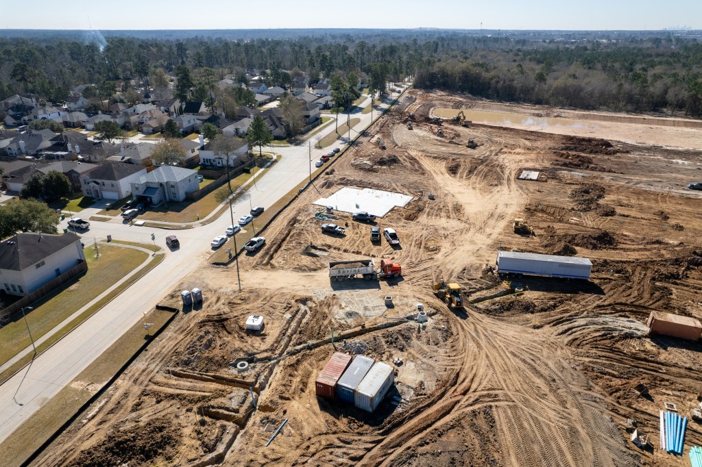
The pace of excavation and removal of up to 500,000 cubic yards of soil from Woodridge Village has slowed slightly in recent months. That may be due to rising interest rates, which have slowed housing starts. Contractors use excavated dirt to elevate homesites in new developments. But the Census Bureau says housing starts in June 2022 fell 6.3% below the June 2021 rate.
Woodridge Village Background
Woodridge Village was the failed 670-acre Perry Homes development that twice contributed to flooding hundreds of homes in Kingwood’s Elm Grove and North Kingwood Forest Villages in 2019. Harris County and the City of Houston bought the property in 2021 to help reduce flood risk. They plan to do this by building another detention basin.
Perry left the site about 40% short of the floodwater detention capacity needed to meet current Atlas-14 requirements. Since then, Harris County Flood Control District (HCFCD) entered into an “Excavation and Removal” contract (E&R) with Sprint Sand and Clay to begin removing additional soil. The goal: to get a head start on building an additional detention basin that would meet OR exceed Atlas-14 requirements.
During July, Sprint removed approximately 6,400 cubic yards of dirt.
HCFCD spokesperson Amy Stone
To date, Sprint has removed 48,860 yards of material. That’s 18,860 cubic yards more than the contract minimum for six months. And 1,400 cubic yards more than the minimum for July. So you can see that the rate of removal is dipping slightly.
At almost 50,000 cubic yards for 6 months (or 100,000 yards per year), it would take 5 years for Sprint to reach the maximum. However, by contract, Sprint has 36 months. If Sprint continues to average 6,000 cubic yards per month for another 30 months, it would remove a total of 229,000 cubic yards before the end of the contract term ([30×6000]+ 49,000).
So at some point, Sprint will have to sprint to catch up if they want to remove all 500,00 cubic yards.
Recent Photos Show Growth of Basin
Here’s what the site looked like before and after July’s excavation activity.
End of June
Excavation at end of June 2022. Note where the upper right boundary of the pit stops relative to the storm-sewer pipes at far right.
End of July
End of July 2022. Looking south over eastern edge of pond. Newly excavated area is at left (darker dirt).
About E&R Contracts
E&R contracts provide a head start on construction of detention basins before completion of their final design.
Sprint has agreed to remove up to half a million cubic yards of soil for only $1000. But it makes its money back by selling the soil for a profit on the open market. This provides virtually free excavation to taxpayers and virtually free raw material to Sprint. HCFCD has spent only $230 on the project so far. But the tradeoffs are speed and certainty.
The property above forms the headwaters of Taylor Gully. When HCFCD finishes its Taylor Gully study, things may change.
Final Needs Contingent on Outcome of Taylor Gully Study
Expanding Detention On Woodridge Village so that no channel improvements are necessary.
Determining amount of detention and channel improvements necessary to ensure no adverse impact all the way to Lake Houston.
Finding the optimum balance between maximum flood protection and minimum construction costs.
Deliverables include:
Channel and basin layouts
Estimates of benefits for various levels of storms (100-year, etc.)
Right-of-way requirements
Cost estimates for right-of-way acquisition, engineering and construction management.
Performance metrics, i.e., estimated acreage of land inundation, number of structures in floodplain, number of structures flooded and miles of inundated roadway.
A scoring matrix to rank alternatives.
The red dots show location of current excavation relative to entire scope of Idcus project, from yellow polygon on left to end of red line in forest on right.
Idcus should be done with the study soon. In the meantime, residents will have to settle for the virtually free head start we get.
Posted by Bob Rehak on 7/31/2022
1797 Days since Hurricane Harvey
1182 Days since May 7, 2019
1049 Days since TS Imelda
https://i0.wp.com/reduceflooding.com/wp-content/uploads/2022/07/20220729-DJI_0263.jpg?fit=1200%2C799&ssl=17991200adminadmin2022-07-31 13:45:182022-07-31 13:59:52July Update: Woodridge Village Excavation Rate Slows Slightly
As of the end of June 2022, Harris County Flood Control District (HCFCD) had removed 42,483 cubic yards of dirt from the Woodridge Village property in Montgomery County. The dirt is part of an excavation and removal (E&R) contract that allows removal of up to 500,000 cubic yards. That amount would double the floodwater detention capacity on the site and help reduce the risk of flooding in Elm Grove and North Kingwood Forest along Taylor Gully. Heavy rains in May and September of 2019 flooded approximately 600 homes in the area.
History of Project
Harris County purchased Woodridge with the City of Houston from Perry Homes in February 2021. At the time of purchase, the site had enough detention capacity to meet pre-Atlas 14 requirements in Montgomery County. But Atlas-14 requirements call for about 40% more. Hence the need to increase floodwater detention capacity.
Looking NE at Woodridge Village before start.Start of E&R Contract on January 27, 2022. Tree Line on right is the Montgomery/Harris County Line. Harris is on right.January 29, 2022February 27, 2022March 28, 2022April 30, 2022May 22, 2022June 13, 2022, 41,174 cubic yards of material removed from the siteJune 30, 2022, 42,483 cubic yards of material removed
Excavation & Removal Contract
E&R contracts provide a head start on construction of detention basins before completion of their final design.
Sprint has agreed to remove up to half a million cubic yards of soil for only $1000. But it gets to sell the soil for a profit on the open market. This provides significant savings to taxpayers by minimizing trucking and disposal fees.
By contract, Sprint has up to 36 months. If Sprint continues removing dirt at the rate of about 8,000 cubic yards per month, they should remove another 248,000 cubic yards before the end of the contract term.
With the dirt already removed, that would only put them at 290,00 cubic yards at the end of three years. So at some point, Sprint will have to sprint to catch up if they want to remove all 500,00 cubic yards.
An engineering study currently underway includes the Woodridge property. HCFCD has the flexibility to change the E&R contract if necessary to accommodate any design requirements that emerge from the study.
Community engagement should be scheduled soon to gather input from area residents on the proposed project and to present project alternatives.
Posted by Bob Rehak on 7/1/2022
1767 Days since Hurricane Harvey
https://i0.wp.com/reduceflooding.com/wp-content/uploads/2022/07/20220630-DJI_0989.jpg?fit=1200%2C799&ssl=17991200adminadmin2022-07-01 11:37:202022-07-01 11:59:26Progress Report: Woodridge Village Excavation and Removal Contract
Back in 2019, portions of Elm Grove and North Kingwood Forest Villages flooded twice. The first time occurred on May 7th. According to Harris County Flood Control District’s (HCFCD) report on the storm, “A 30-min rate of 2.9 inches was recorded at US 59 and the West Fork of the San Jacinto River and a 1 hour rate of 4.0 inches.”
“380 structures were flooded in the Elm Grove Village subdivision and other nearby subdivisions in the northern portions of Kingwood.”
Escape. In Elm Grove on Shady Maple the night of the May 7, 2019 flood.
High water rescue
Rustling Elms Bridge in Elm Groveunderwater as school bus tries to cross it.
Water rising at night in Keith Stewart’s home on Shady Maple after May 7th flood in 2019.
Catalog of Flood Mitigation Efforts
Ever since the Elm Grove floods, Harris County, HCFCD, the City of Houston, Congressman Dan Crenshaw’s team and others have worked diligently to reduce future flood risk.
On this Mother’s Day weekend, it may bring flooded families comfort to understand how far we have come. Much remains to do, but much has already been done, or at least started.
HCFCD working to remove sediment buildup in Taylor Gully near the Maple Bend Bridge in January of 2021.The work began upstream near Rustling Elms in July 2019.
Kingwood Area Drainage Analysis and Taylor Gully Study
In 2019-20, HCFCD, Lake Houston Redevelopment Authority (TIRZ 10), and City of Houston teamed up to conduct a drainage analysis for all streams in the Kingwood area. A recommendation to prioritize engineering of drainage improvements along Taylor Gully (including Woodridge) came out of that study.
The Flood Control District began preliminary engineering study on the Taylor Gully improvements in 2021. HCFCD anticipates presenting results during late summer or early fall this year.
Purchase of Woodridge Village By County and City
In early 2021, the Flood Control District and the City of Houston partnered to acquire the 267.35-acre Woodridge Village property for approximately $14 million.
Houston Mayor Pro Tem Dave Martin lobbied the City to purchase about 70 acres of the property.
HCFCD will use the remaining 194.35 acres of the Woodridge site for stormwater detention. That will help reduce flood risk.
Crenshaw Earmarks
Congressman Dan Crenshaw secured an earmark for $1.6 million for engineering of flood mitigation improvements along Taylor Gully. The engineering should shrink the floodplain. That will effectively remove 387 structures from the floodplain and has the potential to remove another 62.
Crenshaw also has another earmark pending for $10 million to actually construct the improvements recommended by the study.
Local groups must spend earmarks during the fiscal year in which Congress approves them. So funding can’t get too far ahead of the engineering.
Taylor Gully Preliminary Engineering Study
The Taylor Gully study will look at Woodridge in conjunction with other potential Taylor Gully improvements. However, HCFCD must perform additional preliminary engineering to further evaluate specific alternatives for Woodridge and determine the best.
During each study, HCFCD will hold Community Engagement Meetings to present alternatives and gather feedback.
Start of the new floodwater detention basin that could double the capacity on Woodridge Village.This pond should ultimately expand beyond the lone trees in the middle of the frame near the top.Photo taken 4/30/22.
E&R projects provide a head start on the excavation process and risk reduction. They can start before the design of a stormwater detention basin. Contractors excavate a set amount of material within an agreed-upon timeframe and general area.
The excavation can also potentially provide interim stormwater storage while awaiting the design and construction of the final stormwater detention basin.
As of April 30, 2022, 36,421 cubic yards of material has already been removed from the site. See photo above taken that day. The project will remove as much as 500,000 cubic yards of soil and other material.
Woodridge will remain an active construction zone for up to three years.
Have a Happy Mother’s Day this weekend.
Posted by Bob Rehak on 5/6/2022
1711 Days since Hurricane Harvey and 1096 Days since May 7, 2019
The thoughts expressed in this post represent opinions on matters of public concern and safety. They are protected by the First Amendment of the US Constitution and the Anti-SLAPP Statute of the Great State of Texas.
https://i0.wp.com/reduceflooding.com/wp-content/uploads/2019/05/Escape-e1588895116724.jpg?fit=1200%2C900&ssl=19001200adminadmin2022-05-06 19:52:552022-05-09 20:21:03Mitigation Update: 3rd Anniversary of First Elm Grove Flood
A new floodwater detention basin that will ultimately more than double the capacity of Woodridge Village is expanding slowly but steadily. To date, 33,159 cubic yards have been excavated! The pictures below show progress since the start of work in late January.
First truckloads of of excavated material leave the southwest corner of the site on 1/27/22.Looking SW.Wider shot taken on same day looking NE looking in opposite direction. The new basin will eventually expand to cover most of the area within the road, tree-line on the left, and the ditch that bisects the property from left to right.Photo taken on 2/14/22 shows the excavation expanding. Looking SW.Four days later.2/18/22. Looking SW toward entrance.Another three days later, on 2/21/22.3/10/223/22/22 after a 2.26 inch rain.3/28/22. Looking NE.4/17/22. Looking SW.Basin will ultimately expand to green boundary.
Sprint has agreed to remove up to 500,000 Cubic Yards of dirt for only $1,000. However, it has the right to sell the dirt at market rates to make a profit. But the dirt can only elevate structures outside of current floodplains.
Three Months Into Contract, Beating the Minimums
When Perry Homes finished its planned floodwater detention basins, it had enough capacity to hold a hundred year rain as defined by pre-Atlas-14 standards. But capacity fell 40% short of Atlas-14 requirements.
The addition of the new detention basin should take capacity well beyond Atlas-14 requirements and create a safety margin that accommodates additional upstream development.
Excavation under an E&R contract can have ups and downs. When construction booms, excavation moves along quickly. But when construction slows, excavation can, too. However, the contract does have minimum excavation requirement of 10,000 cubic yards per month written into it.
At 36,000 cubic yards after roughly 2.5 months, Sprint exceeds the minimum. But if that rate continues, it could take another four years to reach 500,000 cubic yards.
At some point, the county may choose to step in and pay market rates for excavation to speed things up. But until then, every truckload hauled out of Woodridge Village by Sprint will reduce the ultimate cost.
Posted by Bob Rehak on 4/18/2022
1693 Days after Hurricane Harvey
https://i0.wp.com/reduceflooding.com/wp-content/uploads/2022/04/20220417-DJI_0241.jpg?fit=1200%2C799&ssl=17991200adminadmin2022-04-18 17:12:172022-04-18 17:20:21Progress Report New Woodridge Village Floodwater Detention Basin
Sprint Sand & Clay, the company hired by Harris County Flood Control to excavate 500,000 cubic yards of dirt from Woodridge Village, began hauling some of it to the controversial Laurel Springs RV Resort near Lakewood Cove this morning.
Wake-Up Calls
My phone started blowing up before breakfast with dozens of complaints about Sprint truck traffic. So, I began investigating. I first went to the Woodridge Village site. Drone photos and on-the-ground observations revealed that Sprint was indeed hauling dirt from the Woodridge Village excavation site.
SW corner of Woodridge Village taken Wednesday 2.9.22. Sprint trucks line up to haul off dirt.
I followed one of the trucks all the way to Laurel Springs Lane where I observed it dumping its load. Along the way and at each end, I saw many more Sprint trucks – up to four at a time. There was a veritable parade of dump trucks making round trips along Woodland Hills Drive, Kingwood Drive, Chestnut Ridge, and Laurel Springs Lane.
Orange truck from above enters RV site several minutes later and turns toward detention pond.The orange truck dumps its load just north of the pond near an area marked as the 500-year floodplain. Other equipment spreads it out.
Will Storm Drains Be Adequate?
Sprint trucks had also dumped dirt near a new “north entrance” to the site.
In the shot above, note the ponding water from 0.2 inches of rain more than a week ago. The contractor’s Stormwater Pollution Prevention Plan describes this soil as “silty sand” to a depth of 18 inches (Page 18).
They may want to recheck that before installing more storm drains.
Other Issues Noted Today
Most trucks that I observed used what has now become the “south” entrance. The fresh load of bullrock laid down days ago has already been covered with mud. That accounts for all the dirt tracked into the street. While the storm sewers were still unprotected from dirt, at least a street sweeper was onsite today.Another unprotected storm sewer and contractor taking water from City fire hydrant. Photo courtesy of Robin Seydewitz.All the dump trucks I observed were this large size, not the kind that holds 10 cubic yards.
Good News/Bad News
The start of serious excavation at Woodridge Village comes as welcome news to the people of Elm Grove and North Kingwood Forest who flooded twice in 2019. However, it’s equally worrisome to the people of Forest Cove and Lakewood Cove. Many expressed concerns about potential flooding.
Risks from Building Up Land
Should existing residents be concerned about that? Yes, was the answer I got from one respected hydrologist who spoke on condition of anonymity. He likened the built-up area to a berm and said that “You don’t want a berm to stop overland sheet flow.”
The elevation survey shown below comes from the RV park’s Stormwater Pollution Prevention Plan. It shows that the land naturally slopes from northeast to southwest. Building up the RV property would definitely prevent water from the NE from flowing in that direction. Sheet flow would divert south along Laurel Springs and put an evacuation route at risk.
Survey shown in developer’s Stormwater Pollution Prevention Plan shows elevation going from 83.1 in the NE to 61.4 in the SW, a difference of more than 20 feet.
East to west along the southern boundary, the elevation drops from 67 feet at Laurel Springs to 61 feet near the railroad tracks.
Another risk is that sheet flow with nowhere else to go could back up Lakewood Cove storm sewers at the same time that the RV park is trying to pump water into them to compensate for its undersized detention pond.
If someone sustains water damage on their property due to a neighbor’s property, questions as to who may be liable may arise. Surface water runoff — most often caused by excess rainwater — is the common culprit. Texas law holds landowners responsible for damage to neighboring property due to diversion of surface water.
I received a copy of the RV Park’s SWPPP plan today from the TCEQ. Parts of it made me laugh out loud. For instance, the section about “Receiving Waters, Wetlands and Special Aquatic Sites” said:
“No existing wetlands or other special aquatic sites have been identified at or near this site [Emphasis added].”
Page 18 of Laurel Springs RV Park SWPPP prepared by Construction Eco Services
Obviously, they didn’t glance across the southern property line or consult the National Wetlands Database. I can’t wait to read the rest of this plan to uncover more gems.
From US Fish & Wildlife Service National Wetlands Inventory Mapper. The RV Park is going in just above the large green area labelled PF01A Future Edgewater Park.
Posted by Bob Rehak on 2/9/22
1625 Days since Hurricane Harvey
https://i0.wp.com/reduceflooding.com/wp-content/uploads/2022/02/20220209-DJI_0838-e1644458655903.jpg?fit=1200%2C799&ssl=17991200adminadmin2022-02-09 20:26:572022-02-09 23:01:35Dirt Excavated from Woodridge Being Used to Build Up Laurel Springs RV Resort
Harris County Flood Control District (HCFCD) contractor Sprint Sand & Clay has started laying out, clearing and excavating a large, new detention pond that will more than double capacity on Woodridge Village. Woodridge contributed to flooding hundreds of homes along Taylor Gully twice in 2019.
When the developer clearcut approximately 270 acres, the loss of forests and wetlands decreased natural detention capacity on the land. This should help restore it.
Project Outline Becoming Visible
Last week, Sprint started building a construction road into the site. This week it appears that they also dug a shallow trench outlining the perimeter of the pond and started clearing brush within it.
Photograph taken looking NE from SW corner of Woodridge Village. New detention pond will go in foreground. The shallow trench may be the outline of the new basin. Contractor appears to be staying “inside the lines.”Earth-moving equipment worked Saturday and was back at it Monday morning, 1/31/2022.
How the Math Works Out
Sprint will ultimately excavate approximately 500,000 cubic yards of fill which translates to 310 acre feet. When Perry left the site, it had constructed 271 acre feet of detention. The site needed another 108.4 acre feet of detention pond capacity to meet Atlas-14 requirements, but will get 310 (the number of acre feet in 500,000 cubic yards). That almost triples the required additional volume and more than doubles the current capacity…all for $1000.
The $1000 is the out of pocket cost to taxpayers. Under the terms of it’s E&R contract, Sprint will make its profit by selling the dirt it excavates to third parties out of the floodplain. Their contract obligates them to excavate at least 5000 cubic yards per month. There is no monthly max.
In case you have kids or grandkids who like playing with dump trucks, 500,000 cubic yards works out to 50,000 loads. That equals the number of fingers and toes on 2,500 kids. And that’s way more than all the students in Kingwood Park High School!
Turn this into a learning exercise!
About E&R Agreements
E&R agreements provide an opportunity for making progress in advance of future basin construction. These agreements essentially provide a head start in the excavation process before the detention basin is fully designed and constructed.
Residents should beware of heavy equipment entering and leaving the site. The site will remain fenced through the completion of construction.
HCFCD expects to hold public meetings beginning in April to discuss other possible uses, i.e, recreation, restoration, etc., on the site. More news to follow.
Posted by Bob Rehak on 2/2/22, repeating digit day.
1618 Days since Hurricane Harvey
https://i0.wp.com/reduceflooding.com/wp-content/uploads/2022/02/20220131-DJI_0675-2.jpg?fit=1200%2C799&ssl=17991200adminadmin2022-02-02 21:47:482022-02-02 21:47:51Woodridge Village Detention Basin Capacity Doubling