Tag Archive for: dredging

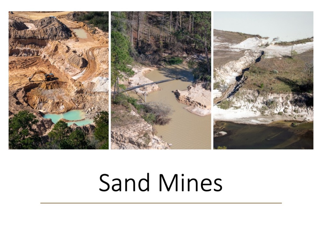
Triple PG Mine Appears to Violate Injunction

Triple P.G. Sand Development LLC appears to have violated provisions of an injunction by dredging before its trail and flooding neighboring properties with industrial waste water.

Texas Attorney General Ken Paxton is suing the mine for discharging millions of gallons of process wastewater into the headwaters of Lake Houston last year. On November 25th, 2019, the mining company (operated by a cardiologist from Nacogdoches, Tx., Prabhakar Guniganti, MD), agreed to the terms of a temporary injunction. Within days, his employees apparently started violating it.

Terms of Injunction

In part, the injunction stipulated that the defendant shall:

  • Not conduct any dredging operations at the Facility.
  • Not engage in any operations at its Facility that discharge process wastewater, nor shall Defendant engage in any operations at the Facility that produce process wastewater that must be discharged off Defendant’s property without express prior approval from TCEQ.
  • Immediately and permanently cease and prevent all discharges of any Industrial Waste and/or Process Wastewater from the Facility into or adjacent to waters in the state.
  • Not allow any discharge of water that is in or has ever been in the Facility’s Dredge Ponds without the express prior approval of TCEQ.

Aerial Photos Show Potential Violations

The aerial photos below show that within eight days of agreeing to the injunction, the mine started pumping process wastewater OVER BERMS into a pit that then overflowed onto the property of adjoining landowners and lands adjacent to White Oak Creek.

Before showing you the photos, let me show you a satellite image that helps illustrate the relationship between the different elements of this report.

Overview of mine, area drainage and adjoining properties in Montgomery County.
Note the location of the mine’s stockpile in the satellite photo above for orientation when viewing the photos below.
Brownish creek to right of mine is Caney Creek.
Blue line shows approximate path of White Oak Creek through forest.
Red oval shows adjoining properties in area of interest.
Solid red line shows ditch around perimeter of mine.
Green lines show approximate locations of breaches in Attorney General’s lawsuit.

The lot lines are from the Montgomery County Appraisal District Web Site. The properties within the red oval belong to multiple people or trusts. Guniganti owns the large forested areas outside the red oval and west of the mine. However…

Water pumped out of the mine’s wastewater pond is now flooding neighboring properties within the red oval that he does not own. The mine also dug a ditch around the perimeter of its property (solid red line) through dense forest that channels the process wastewater toward White Oak Creek (solid blue line) and the wetlands along it. It’s not clear, though, whether the wastewater has actually entered the creek yet; the forest canopy limits visibility. Regardless, the injunction says they can’t discharge waste adjacent to waters of the state.

No Flooding That Lasted Months of Adjoining Properties Until Injunction

None of the historical satellite images in Google Earth dating back to 1989 show flooding in the red oval. Some of the properties in the red oval lie in the 100-year flood plain. However, there has been no widespread flooding in this area since Imelda on September 19, 2019.

Nor has there been prolonged flooding as far as I can determine. Photos taken of this exact location on 9/27/2019, ten days after Imelda, show no flooding of the adjacent properties. Likewise, the property was not flooded on 9/14/2017, two weeks after Harvey. I can find no evidence that this area has ever flooded for months before.

Looking south toward stockpile in background. Properties in the forested strip do not belong to Guniganti. On 9/27/2019, ten days after Imelda, they showed no flooding.

For months, I’ve been watching waste water build higher and higher in the area above until it overflowed the pit and invaded neighboring properties. That made me curious and prompted a review of thousands of aerial photos. Here’s what I found.

Photos Taken In November Before Injunction Show Neighboring Land Still Not Flooded

The neighboring properties were NOT flooded on November 4, 2019 (before the injunction). Notice the level of water in the foreground pit – higher than after Imelda, but still waaaay short of overflowing.

Think of the November 4th photo below as the “before” shot. Compare it with other photos below taken from December through March 2020.

Properties in the red oval are between the pit in the foreground and stockpile in background. Note level of water in pit. Photo taken November 4, 2019, looking south. The mine’s process waste water enters the pit immediately to the left of the trees.

After Injunction, Mine Starts PUMPING Waste Water OVER Dike

Eight days AFTER the injunction, on December 3, 2019, I flew over the mine again. I noticed that the mine was pumping water out of its main waste water pond and into the pit in the photo above. But the pit had not yet overflowed. Here’s how the pumping looked. (Note: You can even see the pumping from outer space if you zoom in on this area within Google Earth and look at the Dec. 1 satellite image.)

Close up of pump taken on 12/3/2019. The pumping operation can also be seen in Google Earth satellite photo dated 12/1/19.

On January 20, Pumping Continues From Different Location

I flew over the mine again on January 20, 2020; the pumping from and into the same pits continued – but from a different location.

Looking West. Notice the line running from the arc in the wastewater pond (diagonally from center to lower right).
Looking south. The same line dumps water into the trench (bottom left). The trench then carries the water south (toward the top of the frame) to fill the pond next to the stockpile and flood adjoining properties with waste water.
Looking SE. Here’s what it looked like closer up. Notice the waste water extending into the tree line and ending at the stockpile (upper right). The same pond that had plenty of excess capacity in September and November was now overflowing.
Looking south. This wider shot shows the flooding wastewater curled around the stockpile and headed south into the woods where White Oak Creek flows toward the mine.
Looking SE. Close up of the waste water turning the corner around the stockpile.

From where you lose visibility of the ditch under the forest canopy to White Oak Creek is about 80 yards according to Google Earth.

Floodwaters Even Higher on February 13

On my February 13, 2020, overflight, I captured the following images. They show the floodwater had risen even higher and backed up farther.

Looking SW. On February 13th, the flooding wastewater appeared even higher.
Looking SE. It still curled down the ditch on the west (right) side of the mine and flowed into the woods toward White Oak Creek

Water backed up so far, it even flowed into the utility corridor at the north end of the mine.

Looking East. Water in utility corridor at north end of mine on February 13, 2020

In March, Possible Dredging Observed, Still Flooding Neighboring Properties

In March, one of the first things I noticed was the dredge. The cutterhead, which had been elevated for months, was now DOWN. That usually indicates the dredge is working. And that’s something the injunction prohibited.

Dredge with its cutter head down usually means active dredging.

The pond next to the waste water pit overflowed onto neighboring properties even more. It came right up to the road. Note the huge difference between the levels of the two ponds below.

Note how high the water level is in the pond at the top of the frame compared to the waste pit at the bottom.
Looking SW. Floodwaters stretch into adjoining properties. Stockpile is behind trees in upper left.
Looking SE. Floodwater still fills the ditch running south along west side of stockpile.
Looking NW at wastewater flooding adjoining properties. Stockpile is in lower left.
Looking SE. Adjoining properties are in tree strip in front of stockpile. Notice waste water among the trees.
Looking north from over stockpile toward vast area flooded with waste water.
Looking west. Even more of utility corridor is flooded in March.

Water In, Water Out

Miners use water to clean silt out of the sand before shipment. Note the damp sand coming off the conveyor belts.
Looking south. A river of waste water is seen leaving the processing equipment on March 6, 2020.
Looking NW. The silt-laden waste water even forms a delta in the waste pit. Flooded properties are on the other side of the road that cuts diagonally through the frame from middle left to upper right.

So water is leaving the processing equipment and going into the waste pit. It has to come in from somewhere. But where? As you can see from the photos below, the supply lines for the processing equipment come from the dredge pond.

Looking west. Water goes into the processing equipment from the dredge pond.
Looking North. Wide shot showing dredge with cutterhead down and discharge pipe leading back to shore.

In the shot above, you can see that the lowest pond in the whole operation is the pond receiving ALL the waste water. Why is that?

The Big Questions and Some Possible Answers

So it appears that the mine is pumping water out of the dredge pit, into the waste pit, and finally into the surrounding forest. The big questions are these.

  • Why is the mine keeping the level of the water in the waste pit so low?
  • Why is the mine flooding the surrounding forest and neighboring properties with industrial waste water?
  • Is the waste water polluting White Oak Creek?

To hypothesize some answers to those questions, let’s look at two pictures: the first from February and the second from March.

Looking south. February 20, 2020. Miners have been removing sand from area with all the tracks in the center and the big pond at the lower left.

From this one photo, we can see that to avoid dredging (per the injunction), the miners have started surface mining. But the level of mining is getting down to a) the water table, and b) the level of the waste pit.

Looking NW. March 6, 2020. Three weeks later, mining is now BELOW level of water in the waste pit.

Note the differing levels of water in the forest (top) and waste pit (middle). Also note that the level of the surface mining has now gone far below the level of sediment in the waste pond.

From this photo (and others in the series) we can conjecture what happened. Please note: I have no proof of this. It is only conjecture.

Theory for the Discharge

I suspect that the mine realized that if it were to continue filling orders while it waited for trial on June 22, 2020, it would need to start surface mining AND mine below the level of water in the waste pit. So, I’m guessing they started lowering the level of the pond to keep mining as long as possible.

I’m also guessing that the terms of the injunction and heightened scrutiny by the TCEQ meant they could no longer make excuses about discharging water into the creek. So they discharged into the forest instead…most of which Guniganti owns except for that strip north of the stockpile. If the discharge drained into White Oak Creek deep in the forest, at least it wouldn’t be visible.

Is Discharge Reaching White Oak Creek?

Is the waste-water pollution reaching White Oak Creek? Because of the dense forest canopy, that’s impossible to determine from the air. One could only tell from the ground. And because Guniganti owns all the land around the mine (except for the properties in the red circle), the only way to determine that would be by trespassing. That makes it impossible for ordinary citizens to spot any illegal discharge, such as Tony Buzbee did when he was running for Mayor of Houston. Fortunately, the TCEQ has the right to inspect the property from the ground if it suspects a violation of the restraining order. And they are investigating this.

Summary of Potential Violations

This whole affair once again raises questions about whether sand mines should be permitted in floodways. This mine actually sits at the confluence of TWO. Which is part of the reason why it was sued by the attorney general in the first place. Both Caney and White Oak Creeks captured the pit last year and the TCEQ estimates millions of gallons of process waste water were discharged without a permit into the headwaters of Lake Houston.

Meanwhile, Triple PG appears to be discharging again without the benefit of storms to blame the behavior on. They also appear to be violating terms of their injunction by:

  • Dredging
  • Discharging process wastewater
  • Producing process wastewater that had to be discharged off their property.
  • Discharging water that had been in the Facility’s Dredge Ponds.
  • Discharging Industrial Waste and/or Process Wastewater adjacent to waters of the state (White Oak Creek)

I have contacted the TCEQ twice already about whether they permitted any of these activities. They have not responded yet, citing the ongoing investigation. However, I must believe that had they permitted the activities, they would not be investigating and would have replied immediately. They visited the site yesterday.

Posted by Bob Rehak on March 13, 2020

927 Days after Hurricane Harvey and 176 since Imelda

The thoughts expressed in this post represent opinions on matters of public concern and safety. They are protected by the First Amendment of the US Constitution and the Anti-SLAPP Statute of the Great State of Texas.

Whittling Down the San Jacinto West Fork Mouth Bar

The State of Texas, Harris County and the City of Houston are whittling down the mouth bar of the San Jacinto West Fork – teaspoon by teaspoon. Just kidding; it only feels that way.

At the planned rate, the partners will remove approximately one third to one half of the planned 400,000 cubic yards of sediment by the start of hurricane season. But after waiting two and a half years since Hurricane Harvey, any and all progress is welcome! I’m not complaining.

The Mouth Bar Immediately After Harvey

Harvey deposited massive amounts of sediment in the area where the San Jacinto meets Lake Houston.

The mouth bar two weeks after Hurricane Harvey. With the exception of the treed areas on the extreme right, Harvey deposited virtually all the sand you see here plus more that you can’t see underwater.

The Army Corps of Engineers dredged a 600-acre area south of the mouth bar three feet deeper last summer. However, they barely touched the part of the mouth bar above water.

The mouth bar created a sediment dam behind the Lake Houston Dam that contributed to flooding more than 4100 structures in the Humble, Kingwood, and Atascocita areas.

Why Mouth Bar Formed Where It Did

The mouth bar formed where it did because the river water slows down when it meets the lake. The lower velocity causes sediment to drop out of suspension and accumulate faster.

While the Corps used hydraulic dredging to remove 500,000 cubic yards from the mouth bar in three months, the current phase uses mechanical dredging. Partners hope to remove another 400,000 cubic yards in 12 months. The process resembles whittling in that workers remove small chunks at a time.

Big Machines Dwarfed by Size of Job

Mechanical dredging uses large excavators. They load the sediment on pontoons. Tugs then push the pontoons upriver to a placement area. There, skid loaders remove the sediment and put it in trucks. The trucks cart it inland.

The excavators are currently nibbling away at the southern edge of the bar. I took all photos below on 3/6/2020.

Excavators are nibbling row after row, like from an ear of corn. This shot shows the immensity of the task.
They load one pontoon while another waits. The West Fork now has its own shuttle service. Unfortunately, round trip is still more than two hours.
These double pontoons can carry an estimated 160 cubic yards. Project goal: 400,000 cubic yards. That’s about 2,500 round trips for the pontoons.
Keeping the pontoon balanced requires coordination.
Tugs then push the pontoons upstream.
Dock of the placement area on Berry Madden’s property south of the West Fork, opposite River Grove Park boat dock on north shore.
From there, trucks haul the sediment inland out of the floodway, about a mile from the river. And the cycle repeats itself.

Mechanical vs. Hydraulic Dredging

The whole process resembles a five-mile long conveyor belt. It involves excavators, pontoons, tugs, trucks and more. Both mechanical and hydraulic dredging have advantages and disadvantages. Hydraulic dredging takes more time to mobilize, but re-suspends less sediment, and costs less per cubic yard of sediment removed. Mechanical dredging, on the other hand, can mobilize much faster.

At this point, returning to hydraulic dredging feels like a distant dream. No one is commenting on the possibility. But this picture speaks volumes.

Former Army Corps command post for West Fork Emergency Dredging project

It shows the once-bustling, but now-empty Army Corps command post. Just three months ago, it was filled with dredge pipe, spare parts, construction trailers, pontoons, booster pumps, survey boats, and more. Getting all that equipment back will be difficult.

Posted by Bob Rehak on 3/12/2020

926 Days since Hurricane Harvey

New Aerial Photos of River Grove Park Show Extent of Dredging Project

Since Hurricane Harvey, KSA has worked diligently to restore the damage to River Grove Park. It has been a massive job. Harvey filled in the lagoon in front of the boardwalk; left five feet of sand in the parking lot, disc golf course, and playing fields; and deposited a sand bar more than a quarter mile long and 12 feet high in front of the boat dock.

River Grove Waterfront on 9/14/2017, two weeks after Harvey. Lagoon filled in, five feet of sand filled the parking lot, and a 1400-foot, 12-foot-high sandbar blocked off the drainage ditch that empties the western third of Kingwood.

Army Corps Restored River Access

The Army Corps cut a channel through the sand bar that blocked the drainage ditch that empties the western third of Kingwood. That was a huge sigh of relief for a large part of Kingwood. But much work remained to restore the park itself. Among the last items on the agenda: restoring the lagoon and boat ramp access.

Dredging of Boat Dock Area and Lagoon

In late February 2020, KSA contractor Kayden Industries removed a 50-foot strip of vegetation that had grown up on sandbars in the lagoon. Then last week, they began dredging.

It’s hard to capture the scope of dredging operations from the ground – especially with access restricted for safety reasons. But last week, I did a flyover and captured these pics from a helicopter.

Looking west toward the River Grove Boat Ramp and Lagoon. Photo taken March 5, 2020. The dredge started by the boat dock and is working upstream now in the lagoon. Note the dewatering plant in the parking lot and the growing pile of spoils waiting for removal on the right.

In the photo above, you can see the 50-foot strip where Kayden removed vegetation. That will be the limit of dredging. KSA plans to remove 4-5 feet of sand from this area. The area still covered with grasses will remain wetlands. It will provide cover, habitat and food for birds and other species. That should help make River Grove a destination for birders again.

Harvey deposited sand several feet deep on the peninsula that defines the River Grove lagoon. That unfortunately killed many of the trees there. The wetlands remaining in the lagoon are now more important than ever. Eagles nest in the trees in the upper right of this photo on Romerica property.
The dredge started in the area in front of the boat dock and is working its way upstream in the lagoon. Water from the dredge goes through a floating pipe to a dewatering plant in the parking lot. Water is then returned to the lake in a closed-loop process.

A Bit of the Oil Field Comes to River Grove

The dewatering plant separates sand and sediment from the water before returning the water to the river. This is the same type of equipment used in oilfields to separate drilling cuttings from drilling mud, before recycling the mud.

Expected Finish By End of March

KSA expects the dredging project to finish by the end of March, weather permitting. However, the boat ramp may not open immediately. The heavy equipment has damaged the asphalt in the parking lot. Repairs and restriping may take a few weeks more.

Originally, KSA expected to remove 10,000 cubic yards of sediment. The contractor now predicts they will remove 11,000 to12,000 cubic yards to complete the scope of work.

Other Park Improvements

The good news: When all of this is done, River Grove Park should be back and better than ever. During repairs, KSA decided to:

  • Convert several of the soccer fields from “league fields” to “public fields.” Residents have long requested that change.
  • Change the speed bumps to milder speed humps in the traffic circle. Boaters have long requested that.

Posted by Bob Rehak on 3/9/2020

923 Days since Hurricane Harvey

River Grove Dredging Begins

River Grove dredging has finally begun. Silt and sand deposited by Hurricane Harvey 2.5 years ago is being removed from two areas: the boat launch and boardwalk. KSA obtained a final permit from the City of Houston and equipment arrived yesterday.

Boardwalk First Priority

As you can see from these pictures, the contractor wasted no time. Equipment has already started removing silt from in front of the boardwalk.

Mechanical dredging equipment excavates area near boardwalk.
Additional equipment is being staged from the parking lot.
Contractors closed off the parking lot adjacent to the boat launch for public safety.
Contractors have already started removing the top layer of vegetation adjacent to the boardwalk that sprouted since Harvey.

Pictures From Immediately After Harvey

A huge sandbar deposited by Hurricane Harvey blocked the Kingwood Diversion Ditch which drains the western third of Kingwood. Note sand covering the parking lot. It was 5 feet deep in places. Taken 9/14/2017.

The Army Corps dredged a channel through the sandbar above to allow the ditch to empty into the river. However, the Corps’ equipment was too big to maneuver safely near the boat launch. That created the need for a second dredging program with more precise equipment.

The lagoon in front of the boardwalk was badly silted in. Taken 9/14/2017.

Pictures Taken February 2020 Before Start of Dredging

Photo taken 2/13/2020 shows how vegetation grew up on silt in lagoon.
Aerial photo of boat launch area taken on 1/20/2020 shows that Army Corps opened up the drainage channel to the river. However, the area near the boat launch remains too shallow for most boats to launch safely.

Dredging and cleanup should take about 6 weeks. Completion will make eager boaters and park visitors very happy. River Grove has long been one of the most popular parks in Kingwood.

Posted by Bob Rehak on 2/18/2020

903 Days after Hurricane Harvey

Houston Mayor Sylvester Turner Supports Continuing to Lower Lake Conroe Seasonally to Help Mitigate Flooding

On January 10, Mayor Sylvester Turner wrote the SJRA Board to support continued lowering of Lake Conroe. “This temporary measure,” said the Mayor, “will help mitigate against future flooding until permanent flood gates can be installed and dredging of the San Jacinto’s West Fork can be completed.”

Reminding LCA Who Owns the Water

The Mayor also reminded the Lake Conroe Association (LCA) that the City of Houston owns two thirds of the water in Lake Conroe.

Changing the LCA Narrative

Turner also addressed an LCA narrative that claims Lake Conroe was not built for flood control. It was built for drinking water, they say. But the letter changes that narrative. It says, “While the lake was originally constructed as a reservoir for drinking water, the Houston region has become increasingly prone to flooding due to population growth, development and more frequent storms with record rainfall. Both the City of Houston and the State of Texas recognize that flood control must be a consideration. The proactive release water is an effective measure until more permanent solutions can be completed.” See the full text of the Mayor’s letter below.

I have not always agreed with Mayor Turner, but I support him wholeheartedly on this.

Clash of Political Titans

Tuesday, Montgomery County Commissioners will vote on a resolution recommending to END the seasonal lowering of Lake Conroe.

I suspect Harris County Commissioners and the governor may enter this fray before the final vote.

Posted by Bob Rehak on 1/14/2019

868 Days after Hurricane Harvey

West Fork Mouth Bar Dredging Set to Start As TWDB Considers Grant to Extend Program

On December 30, 2019, the City of Houston issued a Notice To Proceed (NTP) for debris removal services. Specifically, that means the large silt deposit at the confluence of the West Fork of the San Jacinto River and Lake Houston. The area is commonly known as the “mouth bar.” See below.

Mouth Bar of the San Jacinto West Fork looking upstream. Picture from 12/3/2019.

Mechanical, Not Hydraulic Dredging

The City hired DRC Emergency Services, LLC (DRC) under an existing contract to begin mechanical dredging of the mouth bar “this week,” according to Houston Mayor Pro Tem Dave Martin.

Mechanical dredging differs from hydraulic dredging. With hydraulic dredging, contractors continuously pump sediment from the river to a placement area onshore via long pipelines. With mechanical dredging, they scoop it out of the river and dump it on barges. Then they ferry the barges to the placement area where trucks transport the sediment to its final location.

Hydraulic dredging takes less time once started, but the prep can take months. Mechanical dredging takes longer, but can start immediately.

The City will begin the hydraulic dredging with $6 million of FEMA money left over from Hurricane Harvey debris removal funds. The Texas Division of Emergency Management and Governor Greg Abbott allocated that money specifically for Lake Houston and approved the remaining funds for mouth-bar dredging.

Two-Phase Grant

Next week, another $30 million should become available to extend the program. SB500 earmarked that money for dredging of the San Jacinto East and West Fork Mouth Bars. The Texas Water Development Board (TWDB) will consider Harris County’s grant application. Approval is expected.

The grant application proposes removing sediment in two distinct phases:

  1. Near and at the mouth bar on the West Fork of the San Jacinto River
  2. In the East Fork of the San Jacinto River AND other locations in Lake Houston.
Mouth Bar on East Fork San Jacinto grew 4,000 feet since Harvey.

Phase-One Funding and Objectives

To complete Phase 1, Harris County proposed taking $10 million of the $30 million to provide a total $16 million for DRC dredging operations.

Phase 1 should remove a minimum of 400,000 cubic yards (CY) of material in eight to twelve months. The Army Corps of Engineers previously removed 500,000 cubic yards from the West Fork Mouth Bar for $17 million in about three months.


During Phase 1, the County will begin some activities for Phase 2. They include:

  • Hydrographic surveys of the West and East Forks, and Lake Houston
  • Development of plans and specifications
  • Identification and permitting of additional disposal sites
  • Competitive bidding

Since the TWDB grant money can only be used for dredging, Harris County will pay for the activities above out of the 2018 HCFCD Bond Program. The fund allocated $10 million for dredging in Lake Houston.

Phase-2 Funding and Objectives

The remaining $20 million from the $30 million TWDB grant will go toward Phase 2 dredging.

During Phase 2, Harris County, City of Houston (COH), HCFCD, SJRA, and Coastal Water Authority (CWA) will develop and execute a plan for the COH or CWA to assume all long-term dredging operations on Lake Houston.

The County does not intend to assume long-term responsibility for maintenance dredging of a City property, i.e., Lake Houston.

TWDB Meets Next Week to Approve Grant

The Texas Water Development Board (TWDB) will meet on Thursday, January 16, 2020, to approve the $30 million grant. “We are in the final stages of agency approval to continue dredging the lake and river,” said State Representative Dan Huberty. His amendment to SB500 last year dedicated the money for dredging this area. “By approving this amount, the legislature as a whole made a clear and concise statement that Lake Houston and the San Jacinto River are vital resources for the entire region and must be maintained.”

SB500 was a supplemental appropriations bill. The grant itself will technically come from the new Texas Infrastructure Resiliency Fund, created last year by SB7. Senator Brandon Creighton authored SB7.

Harris County Engineer John Blount submitted the grant application to TWDB in late December after receiving approval from County Commissioner’s Court.

“Due to the urgency of this issue, multiple entities worked together to craft a plan that could be executed immediately, allowing the first phase to begin as soon as possible,” said Huberty.

Kudos Go To…

“I would like to thank everyone who has worked to create the final grant program under the supplemental funds we received from the Legislature,” said Huberty. “It would have not been possible without Governor Greg Abbott, Lieutenant Governor Dan Patrick, Speaker Dennis Bonnen, former Appropriations Chairman John Zerwas, Senate Finance Chairwoman Jane Nelson, State Senator Brandon Creighton, Chief Nim Kidd, Mayor Sylvester Turner, Chief Recovery Officer Stephen Costello, Harris County Commissioner’s Court, Harris County Engineer John Blount, Harris County Flood Control District Executive Director Russell Poppe, Harris County Flood Control District Deputy Director Matt Zeve, Houston Mayor Pro Tem Dave Martin and many more.”

To View TWDB Board Meeting Live

Tune in to the live TWDB Board Meeting next Thursday, January 16, 2020 at 9:30 AM by visiting: http://texasadmin.com/tx/twdb/.

Posted by Bob Rehak on 1/8/2019

863 Days since Hurricane Harvey and 111 since Imelda

Lake Conroe Association Misleads Area’s Own State Representative and Senator

The problem with incendiary lies: once you start them, they’re hard to stop. In its initial meetings with area residents, the Lake Conroe Association (LCA) told people that West Fork dredging was done. Therefore, said the LCA, the SJRA should stop the temporary seasonal lowering of Lake Conroe.

Lie Takes on Life of Its Own

People believed the lie. They started putting up web sites and YouTube videos to spread the word. Soon, the lie took on a life of its own. And it became impossible for the LCA to stamp it out – even if they were so inclined, which they aren’t.

Residents started writing their state reps. And soon Will Metcalf who represents the Lake Conroe Area took up the cry. See the letter below dated Jan. 6.

A week before Representative Metcalf sent this letter to the SJRA Board, the City of Houston pulled the trigger on the next phase of West Fork dredging. It will start this week, says the City. Now, Metcalf doesn’t just have egg on his face; he has a whole omelette. Made from stale eggs and rancid ham.

State Senator Robert Nichols wound up with the same omelette on his face.

Whole Series of Lies, Half-Lies and Logical Fallacies Spread by LCA

The LCA fueled this whole sad, sorry food fight that embarrassed their own representatives with an entire a SERIES of lies, half-lies and logical fallacies that it fed to unknowing people.

For instance, in addition to “the dredging is done”, I see and hear these comments constantly:

  • Because the East Fork flooded during Imelda and Lake Conroe didn’t release water, that proves we don’t need to keep lowering Lake Conroe.
  • The Lake Conroe release during Harvey comprised only 5% of the water going through Lake Houston.
  • All of Kingwood was built in a flood plain. Kingwood people should just move to higher ground.
  • Kingwood’s flooding problems come from upstream developers.
  • No scientific study supports the lowering policy.
  • Lake Houston wants to make the lowering of Lake Conroe permanent.
  • They should lower Lake Houston.

For the Record…

To set the record straight:

  • West Fork dredging is NOT done. Just the portion FEMA paid for.
  • The East Fork and West Fork are in different watersheds. Imelda affected the East Fork, but not the West. Plum Grove got 33 inches of rain while Lake Conroe got two.
  • The Lake Conroe release during Harvey comprised ONE THIRD of the water coming down the West Fork where approximately 80-90% of all the damage occurred in the Humble/Kingwood area.
  • All of Kingwood was not built in a flood plain. For instance, 110 out of 250 of my neighbors in Kings Forest were not in a flood plain yet still flooded. We live more than TWO MILES from the river.
  • Some of Kingwood’s flooding problems come from upstream developers. But that’s a separate issue; they have nothing to do with West Fork flooding due to Lake Conroe releases.
  • The SJRA did commission an engineering study that supported lowering Lake Conroe.
  • Lake Houston IS and HAS BEEN lowered…longer than Lake Conroe.
  • No responsible/knowledgeable person that I know in the Lake Houston area is talking about making the lowering of Lake Conroe permanent.

To correct some of these misperceptions, I met the president of the LCA last year for a whole day. More recently, I spent an hour on the phone with him. I thought I had corrected these misperceptions. But they keep recurring. This is NO accident; this is intentional.

Posted by Bob Rehak on 1/8/2020

862 Days after Hurricane Harvey and 111 since Imelda

The thoughts expressed in this post represent opinions on matters of public concern and safety. They are protected by the First Amendment of the US Constitution and the Anti-SLAPP Statute of the Great State of Texas.

San Jacinto West Fork Before-After Photos Show Dramatic Conveyance Improvements from Dredging

After a year of dredging, the Army Corps and its contractors are gone. Even though they didn’t get all of the West Fork Mouth Bar, they made dramatic conveyance improvements on the West Fork as these before/after photos show.

Sand Island Before Dredging

The first was a blockage that dredging contractors nicknamed “Sand Island.” It sat in the middle of the river just downstream from River Grove Park in Kingwood. According to the Corps, it blocked 90% of the river.

Sand Island formed during Hurricane Harvey. Boats that drew 18 inches of water could not navigate upstream past this giant sandbar. Photo taken 9/14/2019.

Sand Island After Dredging

Sand Island is now Gone Island. Photo taken 12/3/2019.

The Corps removed approximately 15 feet of sand over a 15 acre area that was 566.7 feet wide at its widest point. An acre is about the size of a football field. So this would be like stacking sand on a football field 225 feet high (15×15)! And that doesn’t even include the sand they removed from the channels on either side of the island in the background.

Sand Island Dredging Profile.

Diversion Ditch Bar Before Dredging

A second huge sand bar deposited by Harvey blocked the Kingwood Diversion Ditch, also at River Grove Park. The Diversion Ditch empties the western third of Kingwood. Approximately 600 homes flooded above this one blockage. They were in Barrington, Kingwood Cove, Trailwood, Kingwood Lakes and Kings Forest.

Diversion Ditch (center left) was virtually closed off by a new sandbar deposited by Harvey. Photo taken 9/14/2017.

Army Corps measurements show that at its highest point this bar measured 10 feet about the water surface. It forced water coming out of the ditch to make a 90 degree left turn where it then hit another downstream blockage.

Diversion Ditch Bar After Dredging

Photo taken 10/2/2019 after dredging opened up the channel and reduced the downstream bar.
Photo of same area taken on 11/4/2019, but looking upstream.

The Corps dredged a channel 150 feet wide through this bar to a depth of 35 feet above sea level. That’s about 7.5 feet below the normal water surface elevation of the Lake. The channel narrowed to 50 feet wide where it meets the mouth of the ditch.

From the highest point on the bar to the target depth, the Corps removed 17.5 vertical feet of sand. From the mouth of the channel to the outer edge of the bar measured 750 feet.

Comparison in Satellite Images from Google Earth

Here’s how this section of the river looked from a satellite BEFORE dredging. The numbers refer to the discussions above.

Here’s how it looked AFTER. (Note this image was taken on 2/23/19 and the dredge was still removing sand island.

Altogether, the Corps removed approximately 2.3 million cubic yards of sediment. Even if the Corps didn’t finish the mouth bar, that’s a lot to be grateful for. Thank you, FEMA, Army Corps, Great Lakes Dredge and Dock and Callan Marine.

Have a merry Christmas!

Posted by Bob Rehak on 12/24/2019

847 Days after Hurricane Harvey

Big Stories to Watch in 2020

As we enter 2020, keep your eyes on these stories.

Elm Grove Lawsuits and Mitigation

In 2019, Elm Grove flooded twice with runoff from the Perry Homes/Woodridge Village development in Montgomery County. Hundreds of homeowners sued Perry Homes’ subsidiaries (PSWA and Figure Four Partners) and their contractors.

On 12/17/19, attorney’s for the plaintiffs filed a fourth amended petition. Since the original filing, plaintiffs have named Double Oak Construction and Texasite LLC as additional defendants.

The judge set a jury trial date for July 13, 2020. To date, Perry Homes has done nothing to reduce the threat of flooding from their job site.

The 268-acres clear-cut acres that contributed to Elm Grove Flooding.

That brings us to the subject of mitigation.

What can be done to restore the safety of residents?

Perry Homes has demonstrated no interest in reducing the threat to downstream flood victims.

Protecting homeowners will require massive intervention from an outside source. But who? And how?

Harris County Bond Fund Mitigation Projects

In 2019, Harris County Flood Control began work on 146 of 239 of the projects identified in their $2.5 billion flood bond.

Many of those projects required studies and partners. Three affecting the Lake Houston Area are:

Many projects could actually enter the construction phase next year.

Recommendations from each study should come out in 2020. Then many more projects will get underway.

Upstream Development

In 2019, we saw what upstream development did to homes in Elm Grove and North Kingwood Forest bordering Taylor Gully.

I recently learned of two new developments in the Ben’s Branch watershed.

  • A developer intends to build 18 acres of apartments where the woods adjacent to the new St. Martha Church now stand.
  • Another developer intends to build hundreds of homes on tiny lots on an 80-acre site just north of St. Martha’s.

These two projects represent dozens of others gobbling up farm and forest land in southeast Montgomery County.

This drainage ditch feeds into Ben’s Branch at Northpark Drive. The 18 acres of trees on the other side of the ditch could soon become apartments.

Businesses such as the St. Martha School and Kids in Action already flooded twice this year. So did dozens of homes along Ben’s Branch.

Additional upstream development has the potential to make flooding even worse. This is like death by a thousand cuts. Residents just don’t have the time or energy to monitor each development to ensure that owners follow rules and regulations for wetlands, floodplains, drainage, etc. Neither evidently does Montgomery County. Which brings us to…

Montgomery County Standards and Enforcement

Montgomery County competes for development by touting its lack of regulations. That’s a huge problem for downstream residents.

  • Montgomery County still bases flood maps on data from the 1980s.
  • Large parts of the county remain unmapped for flood hazards.
  • The County last updated its Drainage Criteria Manual in 1989.
  • Developers ignore many provisions within it.
  • County Commissioners voted to leave loopholes open that allow developers to avoid building detention ponds.
  • The County even paid an engineering company to investigate itself for its role in the Elm Grove Disaster.

You get the idea. If you thought some benign government entity watched over new developments to protect downstream residents, think again. Below you can see the 80-acre site I mentioned above.

Source: USGS National Wetlands Inventory.

Note how it was covered in wetlands. Developers did not ask permission from the Corps to remove them. They just decided on their own that they didn’t need to ask.

Below, you can see how virtually half the site is in a flood zone or floodway.

Source: FEMA’s national flood hazard layer viewer. Brown = 500 year flood plain, aqua = 100 year, cross-hatched equals floodway.

Here’s how it looks in Google Earth. Developers have already cleared the site.

Developers intend to build high-density homes in the floodplains. They will also build their detention pond in the floodway. Those hazard areas will likely expand when and if the County incorporates new Atlas-14 data into their flood maps.

Layout for Brooklyn Trails development in Montgomery County

None of this seems to bother the leadership of Montgomery County. And that’s a bigger problem than any one development.

In 2020, expect more focus on the decision-making process and decision makers who have created a permissive culture of indifference to flooding problems.

Sand Mines

Sand mines operate so closely to the San Jacinto that their walls frequently break and pour polluted process water into the drinking water for 2 million people. If they get caught, they pay a small fine and continue operating with impunity.

Left: Liberty Materials Mine in Conroe that undercut five pipelines carrying highly volatile liquids. Center: Triple PG mine in Porter where erosion during Imelda exposed one natural gas line and threatens 5 more HVL pipelines. Right: Another Liberty Materials mine that allegedly dumped 56 million gallons of white goop into the West Fork.

Upstream Detention

During Harvey, the release of 80,000 cubic feet per second from Lake Conroe added to downstream flooding. The goal: to find enough upstream detention capacity to help offset future releases. The San Jacinto River Basin Study will examine that possibility. It’s unlikely that one reservoir will provide enough capacity. However, multiple smaller reservoirs may.

Peak flow map during Harvey.

The study partners will release their results in the second half of 2020. Land acquisition and construction could take several additional years.

Dredging

Dredging is another essential element of flood mitigation on the West Fork of the San Jacinto. Sand buildup near the mouth of the river has created a giant sediment dam. The Army Corps removed three feet in a dredging effort that ended on Labor Day. But much remains.

Luckily, State Representative Dan Huberty sponsored legislation that allocated another $30 million. The Harris County Flood Bond allocated $10 million. The City of Houston allocated $6 million. Plus two more grant requests are still pending that could increase the total even more. And a disposal site for the material has already been permitted.

Mouth Bar of the West Fork. Photo taken 12/3/2019.

Last week, Harris County commissioners voted to proceed with additional dredging. Project managers are studying the most cost effective ways to proceed. We should see more dredging soon.

This money could also be used on the growing mouth bar of the East Fork.

State Highway 99 Extension

The extension of the Grand Parkway (State Highway 99) east and south to I-10 will open up vast new expanses of forest and farmland to high density development. The biggest threat will be to the East Fork watershed as construction moves through southeast Montgomery County and the northeast tip of Harris County into Liberty County.

Eastward clearing for SH99 has reached Caney Creek near Lake Houston Park.

Those are my predictions for the biggest stories of 2020. There’s a lot of good news in the forecast and much to remain vigilant about. Life seems to be a constant struggle between those who would increase and decrease our margin of safety when it comes to flooding.

Posted on 12/21/2019 by Bob Rehak

844 Days after Hurricane Harvey

The thoughts expressed in this post represent opinions on matters of public concern and safety. They are protected by the First Amendment of the US Constitution and the Anti-SLAPP Statute of the Great State of Texas.

The Biggest Stories of 2019

With 2019 almost behind us, we should look back to see what we accomplished on flood mitigation. Tomorrow, I’ll take a look at the stories that will likely define 2020.

Limited Dredging

In 2018, FEMA and the Army Corps announced that they would dredge 2.1 miles of the San Jacinto West Fork when they were given authority to dredge 8 miles. Questions immediately started to swirl about why they were not dredging all the way to Lake Houston. The answer was “part of the mouth bar was there before Harvey and we can only spend disaster relief funds on what Harvey deposited.”

The mouth bar as it existed shortly after Hurricane Harvey. Photo taken 9/14/2017.

After arguing for more than a year with the City about how much sediment FEMA deposited, the Corps finally decided to dredge 500,000 cubic yards from a 600 acre acre in front of the mouth bar. They finished on or about Labor Day. Then the dredging contractors waited several more weeks to see if there would be an additional assignment. There was not. They then departed in October.

Regardless, they left the biggest blockage in the river. Imelda washed a tremendous amount of sediment downriver. In mid-October, RD Kissling sent me a photo from his kayak. He as standing in water less than knee deep 700 yards south of the mouth bar. It’s important to understand that sand bars are like ice bergs. You only see the tip above water. Most of the bar exists below water. And much of this mouth bar remains to be removed.

We need to cut a channel through this area to the lake to restore conveyance of the river. If Harvey couldn’t blow this dune out of there, nothing will.

To learn more about this controversy, search this site using the key words “mouth bar.”

Flood Mitigation Legislation: A Big Win

No one budgets for disasters, such as Hurricane Harvey. So after the disaster, cities and counties had to scramble for grant money to even qualify for matching funds from the Federal government. More than two and a half years after the event, money is finally starting to trickle down to the areas that need it to implement flood mitigation projects. That’s thanks in large part to Senator Brandon Creighton who authored Senate Bill 7.

SB7 creates dedicated Texas Infrastructure and Texas Infrastructure Resiliency Funds for flood control planning and the funding of flood planning, mitigation, and infrastructure projects. The Texas Water Development Board is finalizing rules for the distribution of those funds right now. SB500, a supplemental appropriations bill, includes funding for SB7 and an amendment that would dedicate $30 million for dredging at the confluence of the San Jacinto and Lake Houston. State Representative Dan Huberty authored the amendment to SB500 that provides the $30 million.

For more information about legislation affecting this area, see the Legislation page of this web site or search using the key words “SB7” or “SB500.”

Sand Mining Legislation: One Small Gain, Some Big Losses

Activists statewide pushed for legislation to reign in the excesses of an out-of-control aggregate industry. Here in the Houston area, State Representative Dan Huberty introduced HB 907. It passed and doubles the penalties for not registering a sand mining operation. It also increases the frequency of inspection from every three years to two years and established a registry of active sand mines.

Picture of the West Fork of the San Jacinto the day it turned white (11/4/2019). The TCEQ later issued a notice of enforcement to the Liberty Materials mine upstream for dumping 56 million gallons of white goopy pollution into the West Fork. Water samples indicated 25 times the normal amount of suspended solids.

That was the only bill that the high powered lobbyists of TACA (the Texas Aggregate and Concrete Association) would allow to pass. That’s mostly because their members are already registered.

However, other important bills died in committee due to the lobbying power of TACA.

  • HB 908 would have provided for penalties up to $50,000 for water code violations and every-other-year inspections.
  • HB 909 would have created best management practices for sand mines.
  • HB 1671 would have extended water quality protections to the West Fork of the San Jacinto currently enjoyed by the John Graves District on the Brazos and attached penalties for non-compliance with best practices defined under HB909.
  • HB 2871. Would require sand mines and other aggregate production operations to acquire a reclamation permit and to file a performance bond ensuring reclamation.

For more information about sand mining in the Lake Houston area, see the Sand Mining page of this web site. You can also search on the key words “sand mining, TACA, Triple PG, TCEQ, breach, Liberty, and white water.”

High Rises Near the Floodway of the West Fork

Early in the year, two investors from Mexico announced plans to build a series of high rises surrounded by more than 5000 condos in the floodplains and wetlands near River Grove Park. Their company, Romerica, proposed to build the high rises on land that was deed restricted to single family residential development. They even proposed underground parking!

Artist’s conceptual drawing of a high-rise development called The Herons: Kingwood.

The tallest buildings would have been 500 feet and located on the edge of the current floodway. That floodway will almost certainly expand in light of new Atlas-14 rainfall data. The developers also announced a marina that would have held 640 40-foot boats and 200 jet skis. There were no evacuation routes that would have remained above water in the event of a flood.

A massive public outcry arose. More than 700 people and organizations filed letters of protest with the Army Corps, TCEQ and the US Fish and Wildlife Service. In the end, regulators showed good judgment and common sense. The Corps withdrew Romerica’s permit application.

The developer’s web site now says the project is on hold, pending improvements to the West Fork and Lake Houston.

For more information on this development, see the High Rises page of this web site or search for the key words “Romerica, high rises, eagle, or The Herons.”

The $2.5 Billion Flood Bond Equity Flap

When the wording for Harris County’s historic $2.5 billion flood bond offering was worked out in early 2018, leaders from the Humble/Kingwood area in Precinct 4 argued to include the notion of an equitable distribution of funds. Why? Historically the Flood Control District had focused more on projects in other parts of the county, especially Precinct 1, that Precinct 4.

Humble/Kingwood voters turned out in record numbers to support the bond. It passed. But when it came time to implement the projects, Commissioner Rodney Ellis from Precinct 1 tried to redefine equity to mean reparations for historical discrimination, i.e., slavery.

In one meeting after another, Ellis’ ringers showed up in commissioners court to complain about discrimination in the distribution of funds for buyouts, construction spending, and more. Yet in every category, Ellis’ precinct already had the lion’s share of funding.

This is an on-going controversy that affects everyone in the Lake Houston area. Ellis is looting transportation dollars from Precinct 4. You have to hand it to Ellis. Even if he doesn’t know what equity means, he knows how to work the system.

For more information on this topic, search this site using the key words “equity or Ellis.”

Proposition A

In 2010, voters managed to get a referendum on the ballot that would create a dedicated fund for drainage improvements. It passed by a narrow margin. Almost immediately, city officials started using the money it raised for other purposes.

Meanwhile, the Supreme Court of Texas ruled that the language in the summary of the referendum on the ballot was misleading. It failed to disclose that the money would be raised through a new tax. So the Court ordered a revote.

In 2018, the Mayor “resold” the fee by saying, “If you want a lockbox around the money, vote FOR Proposition A. If you don’t want a lockbox around the money, vote AGAINST it.”

It was another artful dodge. There was nothing in the language of the bill to create a lockbox. The language in Prop A was almost identical to the original bill. But the funding formula was even looser!

Unaware voters once again approved the fee. And the Mayor continued to divert money from the fund. These diversions became a central element in the Mayoral campaign this year after thousands of people flooded in May and again during Imelda.

Nevertheless, the Mayor won re-election.

To learn more about this topic, search this site using the key word “Proposition A.”

10 New Gates for Lake Houston

The flood gates on Lake Conroe can release water 15 times faster than the gates on Lake Houston. During Harvey, that bottleneck contributed to the flooding of thousands of homes. A study showed that additional gates would have lowered the water level by almost two feet in the event of another Harvey. During smaller storms, the gates would also help pre-release water faster to create a buffer against possible flooding.

Lake Houston can shed water at 10,000 cubic feet per second. Lake Conroe can shed it at 150,000 cubic feet per second.

The City of Houston applied for a grant from FEMA and the Texas Division of Emergency Management to add ten new gates. FEMA approved the project. It’s happening in two phases. The first includes design and an environmental survey. The second includes construction. Each will take 18 months. We’re now six months into Phase One.

Details of dam improvement project.

For more information on this topic, search this site using the key word “gates.”

Temporary Seasonal Lowering of Lake Conroe

After Harvey, people in the Lake Houston area started pleading for more upstream detention, dredging and gates. Dredging started immediately. The project to add more gates to the Lake Houston spillway has also started. Upstream detention is still years way. The San Jacinto Watershed Study is only now beginning to identify possible locations.

To help provide Lake Houston area residents with an additional buffer against flooding while officials worked on these mitigation measures, the SJRA Board voted to lower the level of Lake Conroe seasonally and temporarily. One foot during the rainiest months in Spring and two feet during the peak of hurricane season.

Many lakefront property owners on Lake Conroe, however, claim the lowering hurts their property values and damages their bulkheads. Buses full of protesters showed up at the December SJRA Board meeting wearing red shirts that say, “Stop the Drop.” So many came that two busloads full of people had to be turned away.

Angry Lake Conroe residents showed up at the last SJRA board meeting in busloads.

Net: the policy to lower Lake Conroe temporarily is under assault. The SJRA will likely vote on whether to continue the policy in February. The SJRA will hold two additional meetings at the Lonestar Convention and Conference Center in January and February to give everyone who wants to provide input a chance to do so.

For more information on this topic, search this site using the key words “lake lowering.”

Flooding from Upstream Development

By far, the biggest and saddest story of the year had to be the flooding of Elm Grove Village, North Kingwood Forest, and even many homes in Porter. Not once, but twice this year. In each instance, runoff from Perry Homes’ newly clearcut 268-acre Woodridge Village development spilled over into surrounding streets and homes. Perry Homes filled in natural streams and wetlands without an Army Corps permit. And they still have not even installed 25% of the detention capacity required for an area that large.

The evacuation of Elm Grove after Perry Homes clearcut 268 adjoining acres.

They haven’t even finished the detention ponds they started, in direct violation of a promise to the City of Houston. In fact, Perry Homes has shown no interest in resolving the problems it created. They have scarcely done any work on this site since August. Meanwhile hundreds of residents live under the heightened threat of flooding.

This is another issue that will carry over into 2020.

For more information on this topic, search this site using the keywords “Perry Homes, Woodridge Village, Figure Four Development, PSWA, Elm Grove, Spurlock, cease and desist, detention, what went wrong, North Kingwood Forest, or drainage criteria.”

There’s your digest of the biggest stories of 2019. 2020 to follow.

Posted by Bob Rehak on December 19, 2019

842 Days after Hurricane Harvey and 92 since Imelda

The thoughts expressed in this post represent opinions on matters of public concern and safety. They are protected by the First Amendment of the US Constitution and the Anti-SLAPP Statute of the Great State of Texas.