HCFCD Incorporates $3 Billion of Studies, Projects into State Flood Plan
On Tuesday, 4/25/23, Harris County Commissioners gave Harris County Flood Control District (HCFCD) approval to incorporate almost $3 billion worth of studies and projects into the first State Flood Plan. The approval will make the studies and projects eligible for future funding from the State Flood Infrastructure Fund.
The San Jacinto Region 6 Flood Planning Group will first incorporate the requests into its regional flood plan. The Texas Water Development Board (TWDB) will then compile a master list of projects throughout the state and rank order them.
TWDB is working toward a September 1, 2024, deadline
Being in the new state flood plan will now be a prerequisite for applying for Texas Flood Infrastructure Fund grants and loans. If you’re not in the plan, you will not even be eligible to submit an application until the next revision of the flood plan. That could take another five years. So this is a good and timely move by HCFCD.
Agenda Item 136 Contained 136 Requests
Harris County Commissioners Court Agenda Item #136 read, “Request for approval of the Flood Control District’s Flood Management Evaluations and Flood Mitigation Projects to be included in the Amended San Jacinto Regional Flood Plan, for incorporation into the Texas State Flood Plan.”
The backup states: “All identified FMEs and FMPs in the Regional Flood Plan will be incorporated into the State Flood Plan, which once adopted by the State of Texas, will enable the Flood Management Evaluations and Flood Mitigation Projects to become eligible for future TWDB Flood Infrastructure Funding.”
Here is the list of the 136 evaluations and projects added to the state flood plan. The categories include:
- 102 “evaluations” totaling $43,150,000. Flood Management Evaluations (FMEs) include such things as surveys, studies, preliminary engineering reports, etc.
- 34 projects totaling $2,928,966,000. Flood Management Projects (FMPs) include construction, which explains the much larger number.
All projects are technically in the San Jacinto watershed (see map below). However, Harris County breaks projects down even further by sub-watersheds. It calls one the San Jacinto, which creates some confusion. For clarity, HCFCD’s San Jacinto sub-watershed includes the East and West Forks, Lake Houston, and the main stem of the river down to Galveston Bay. HCFCD also recognizes 22 other sub-watersheds. All were included to some degree in the list of projects.
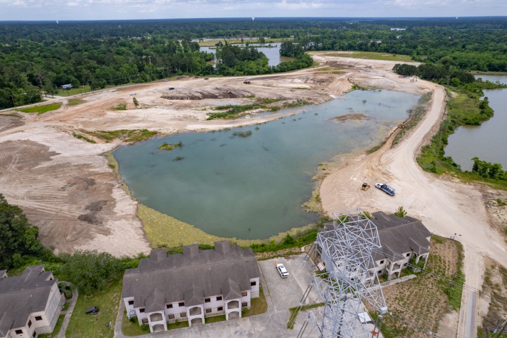
Of the 34 construction projects, HCFCD included two in the San Jacinto sub-watershed totaling $128.8 million out of the $2,928,966,000, or 4.4% of the total. They are the Kingwood Diversion Ditch ($82.3 million) and Taylor Gully ($46.5 million).
Deadlines Looming
The deadline for incorporating FMEs and FMPs into region flood plans is May 14, 2023. The 15 Regional Flood Planning Groups (RFPG) will submit their amended regional flood plans to TWDB by July 10, 2023. The TWDB must combine the approved regional flood plans into a single state flood plan and deliver it to the Legislature by September 1, 2024.
To keep with the bottom-up approach of the regional flood planning program, TWDB has elected to utilize only RFPG-reported data for ranking.
How TWDB Will Rank Items
TWDB has proposed a scoring matrix to rank FMEs and FMPs throughout the state. The criteria differ for the two categories. Proposed criteria in the:
- FME category include flood-reduction benefits such as the number of structures, people, critical infrastructure, acres, miles of roadway removed from the floodplain, and cost projections.
- FMP category also weighs factors such as social vulnerability; environmental benefits; flood severity; life and safety; and operations and maintenance costs.
Note, however, that the legislature may change the criteria. One flood expert said legislators are evaluating the fairness of the benefit/cost ratio, for instance.
The TWDB website contains this note. “While inclusion in the state flood plan is a requirement for eligibility for future FIF project funding, the associated rankings are not intended for allocating state funding. Future funding decisions will occur through a separate TWDB process if and when funds are appropriated by the Texas Legislature. How the state flood plan project ranking may be considered in future flood project funding prioritization and allocation processes remains to be determined although it is anticipated that the state flood plan ranking will be at least one of the considerations.”
Harris County’s prioritization framework includes many of the same factors proposed by TWDB. But the County’s weights vary radically. For instance, TWDB gives 2.5% weight to social vulnerability and Harris County gives social vulnerability 20% – eight times more. However, only TWDB criteria will affect the final statewide rankings.
Initial Funds No Longer Available
Texas initially funded the Flood Infrastructure Fund with $770 million after voters passed Proposition 8, a constitutional amendment, in 2019. All of that money has either been distributed or committed.
Future projects will require a new infusion of cash from the state legislature. TWDB declined to say what that might be. However, an interested “legislature watcher” said appropriations ranging from $300 to $700 million have been discussed to cover projects throughout the state. He suspects the final total will be a compromise somewhere in the middle of that range.
Alternative Sources of Funding
Obviously, $300 million statewide won’t cover a $3 billion ask from Harris County, not to mention projects elsewhere.
So I asked HCFCD if it was pursuing alternative sources of funding for some of these projects. HCFCD answered “yes.”
A spokesperson said, “The Flood Control District is actively working to identify funding opportunities through grants, loans and other funding mechanisms, including for some projects included on the Region 6 Regional Flood Planning Group list. Including these projects on the State Flood Plan list serves to demonstrate the need for flood mitigation projects in the region, as well as to allow for future funding opportunities.”
Harris County Vs. Regional Projects
TWDB established 15 regional flood planning groups. Each represents a major river basin in Texas. Region 6 represents all or parts of 11 counties drained by the San Jacinto. See below.

The list of projects submitted by Harris County focused overwhelmingly on projects inside Harris county, though a few do have components that spill over county lines.
HCFCD and the San Jacinto Regional Flood Planning Group have both tried to reach out to municipalities, neighboring counties and MUDs throughout the entire watershed. But many reportedly don’t have experts skilled in filling out the lengthy TWDB applications. Many also don’t have the seed money to attract matching funds for flood projects. Whether that disadvantages people at the edges of the county and beyond remains to be seen. It could take years to tell.
However, HCFCD says that at this time, “We are not aware of any major projects outside of Harris County that were not included on the State Flood Plan list. ”
Posted by Bob Rehak on 4/28/23
2068 Days since Hurricane Harvey