How to Find and Verify Flood-Related Information: Part II
This is Part II in a series about how to find and verify flood-related information. Yesterday’s post focused on finding good information about flood vulnerabilities. This second part will focus on reviewing developers’ plans. The second can compound the first.
The very first sentence of the Texas Water Code § 11.086 begins with a warning not to flood your neighbors. It says, “No person may divert or impound the natural flow of surface waters in this state, or permit a diversion or impounding by him to continue, in a manner that damages the property of another by the overflow of the water diverted or impounded.”
The second sentence declares that a person injured by diverted water may sue to recover damages. Of course, at that point the damage has already been done. Lawsuits are expensive and take years. And the defendant, usually a developer, will always point to plans prepared by a professional engineer and approved by a government body. Suing them will require expert witnesses. And the defendant will likely claim that you wouldn’t have flooded except for an Act of God.
Lawsuits are tall, expensive mountains to climb. So concerned residents near new developments are better off closely scrutinizing plans before they’re built and closely monitoring construction to ensure developers follow the plans.
You can’t stop development. But you can ensure developers play by the rules.
But how do you find and verify their plans?
Need to Find and Verify Info
If you notice a large piece of property for sale near you, monitor it closely. Check with the listing agent. Also check Houston’s Plat Tracker website. It’s updated before every meeting of the Planning Commission and shows items on their agenda. Houston also maintains a map-based website that shows projects in various stages of approval throughout the City and its extra-territorial jurisdiction.
Leap into action if you find a potential cause for concern near you. The next step is to obtain the development’s plans, the drainage impact analysis and soil tests. The developer must prove “no adverse impact” to people and properties downstream.
How you obtain those plans and studies depends on the development’s location. If inside a municipality, check with your city council representative. If you live outside a municipality, your best starting point will probably be your county engineer or precinct commissioner.
The plans are public information and must be provided in response to Freedom of Information Act (FOIA) Requests.
Signed, Stamped, Approved and So Obviously Wrong
In every case I reviewed during the last four years where someone flooded because of a new development, something jumped out of the plans that should have raised concerns for reviewers, but didn’t.
For instance, after Colony Ridge engineers apparently mischaracterized soil types, Plum Grove flooded repeatedly. The engineer said soils would let more water soak in than actually could. That meant the developer didn’t have to build as many detention ponds and could sell more lots. But it also contributed to flooding homes downstream.
Another example, the engineers for Woodridge Village claimed there were no floodplains on the property when there were. The property just hadn’t been surveyed yet.
In those cases, multiple other issues surfaced after close review. Wetlands that had been ignored. Substandard construction of detention ditches that led to severe erosion. Failure to implement stormwater quality controls. Failure to follow plans. Ignoring Atlas-14 requirements that led to undersizing detention ponds by 40%. And more.
In another development, I spotted safety issues related to river migration that had been ignored. Underground parking next to the floodway of the San Jacinto River. Failure to consider flood evacuation.
Concerned citizens must learn how to obtain and review such plans for potential problems or hire a consulting engineer.
Here are some things I’ve learned to look for.
Soil Tests
Are they accurate? Were the samples taken at representative points? Or did they conveniently ignore wetlands? Permeability of the soils will affect the amount of detention needed. The level of the water table could affect the amount of detention provided.
- Highly permeable soils like sand have a high rate of infiltration and will let developers get away with less detention. Clay-based soils will require more. One engineer told me, “Soils like Colony Ridge reported don’t exist in the State of Texas.”
- If plans call for a ten-foot deep detention pond, but the soil test encounters a shallower water table, that will compromise the pond’s capacity. Capacity should be calculated from the top of standing water, not the bottom of the pond. If the pond is already half full, that half shouldn’t count.
You can check the soils that a developer reports against the USDA national soil database.
Floodplain Issues
Floodplain maps in Harris County are currently being revised. That may not be the case in surrounding counties. The lack of updated flood maps endangers current residents, by letting developers build to old and ineffective standards.
Developers often try to beat the implementation of new requirements. This happened in the case of Woodridge Village. It’s also happening in the case of the Laurel Springs RV Park and Northpark South along Sorters-McClellan Road. The entrance to the Northpark development sits in a bowl. A quick check of the elevation profile on the USGS National Map confirmed that. During Harvey, local residents tell me that not even high-water rescue vehicles could get through that intersection. Put the Cajun Navy on standby now.
Wetland Issues
Filling wetlands requires an Army Corps permit for some, but not all wetlands. Whether they fall under the Corps’ jurisdiction depends on how far up in the branching structure of a watershed they are. Those near the main stem are jurisdictional. Three levels up may not be.
The US Fish and Wildlife service has thoroughly documented wetlands in this area. Check their National Wetlands Database and appeal to the Corps if you find a problem. At a minimum, the developer may be forced to buy mitigation credits somewhere nearby, which could help reduce flooding.
Drainage Issues
Is a new development’s detention pond capacity adequate? Is it based on the right percentage of impermeable cover? If the pond(s) fill up, where will the water go?
Calculating detention capacity requires math skills most people don’t have. But you can check the basis for the calculations. Are plans based on new Atlas-14 requirements? Are plans meeting current Houston and Harris County requirements?

In the case of the RV park, the developer will provide roughly half the current capacity requirement thanks to a grandfather clause in the regs. You can find construction guidelines for Houston, Harris County, MoCo and Liberty County on the Reports Page under the Construction tab.
Also see where they’re routing excess water in case of an overflow.
In the case of the Laurel Springs RV Park, the developer said they would route the water to a detention pond near Hamblen and Laurel Springs in anything greater than a two year rain. See below.


Missing Details from Drainage Impact Analysis
I have requested additional details three times from the City but still have not received them. I suspect they may not exist. All other plan requests have been filled.
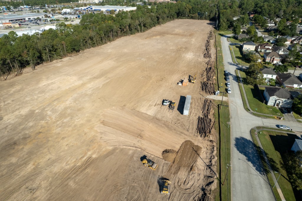
So what happens when the Lakewood Cove detention pond fills up? Or gets covered up in a flood? Overflow from the RV park will contribute to flooding someone downstream.
The developer also said excess capacity would get to the Lakewood Cove pond by overland sheet flow. That could threaten homes on the southwest corner of Lakewood Cove – visible in the middle of shot above.
But a City engineer reviewing the plans said overflow would follow the railroad tracks on the western side of the RV park. Hmmmm. Two engineers – one who developed the plans and another who approved them – 180 degrees apart. What’s a concerned citizen to do?
If the engineers who develop and review such plans were always right, no one would ever flood. But we do. So always find and verify those plans.
To see the first part of this series, click here.
Posted by Bob Rehak on 11/29/2021
1553 Days since Hurricane Harvey
The thoughts expressed in this post represent opinions on matters of public concern and safety. They are protected by the First Amendment of the US Constitution and the Anti-SLAPP Statute of the Great State of Texas.