Construction of HCFCD Greens Bayou Flood Mitigation Projects in High Gear
One of the largest watersheds in northern Harris County is Greens Bayou. It drains 212 square miles with a population of more than half a million people. It encompasses portions of the cities of Houston and Humble.
Greens Bayou and its tributaries have flooded homes and businesses numerous times in the last two decades. Tropical Storm Allison in 2001 and Hurricane Harvey in 2017 produced devastating floods thanks to large floodplains and high-density development.
An Equity Priority
As a result of high percentages of low-to-moderate income neighborhoods as you work your way east and south along the bayou, flooding in Greens received a high priority in the Harris County’s Equity Prioritization Framework.
Harris County Flood Control District currently has three projects in construction along Greens Bayou with more on the way. One of the three is virtually complete. When I photographed it today, I found contractors doing a final inspection. Here’s a rundown of current and future projects.

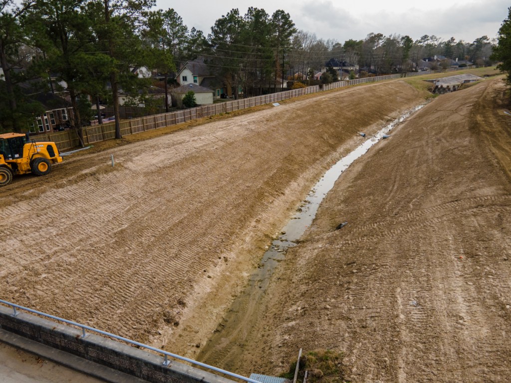
Project #1: Cutten Stormwater Detention Basin
HCFCD is currently excavating a massive 235-acre stormwater detention basin near Cutten Road and State Highway 249. It will reduce flooding risks in the Greens Bayou watershed by taking in excess stormwater during heavy rain events and then releasing it slowly back to the bayou when the threat of flooding has passed.

The project is budgeted at $16.2 million. And it is approximately one-quarter complete. I took the pictures below on 4/20/21.


Project #2: Aldine Westfield Stormwater Detention Basin
Further down the bayou, the Aldine Westfield Stormwater Detention Basin is located just north of Beltway 8 and east of Aldine Westfield Road. The first phase of this project is virtually complete. It sits in a no-fly zone for drones because of its proximity to Bush Intercontinental Airport. So you will have to make do with a ground-level construction photo stitched together in Photoshop from five separate exposures.


South and north segments are being constructed in two phases because of environmental permitting. Eventually, the two basin compartments will connect via a 48-inch pipe and will outfall into Greens Bayou.
The first phase above cost $7.7 million. The second will cost $11.3 million.
HCFCD
Because of the location just south of Bush Intercontinental Airport, this basin will not have a permanent pool. Reason: to avoid attracting waterfowl which could create a hazard to aviation.
The two basins will eventually hold approximately 1,250 acre-feet, or more than 407.3 million gallons, of stormwater that otherwise might flood homes and businesses during heavy rain events. The benefits of this project are best understood as part of a suite of projects – Progress Greens – that will work together to reduce flooding risks within the 213 square miles of the Greens Bayou watershed.
Part of Project Greens
Project Greens is a suite of flood damage reduction projects. The Harris County Flood Control District is taking the lead in some, with grant assistance from the Federal Emergency Management Agency (FEMA). In others, the U.S. Army Corps of Engineers will design and construct the project, with partnership assistance from the Flood Control District.
All projects under the Progress Greens umbrella will function together to reduce flooding risks and damages for residents and businesses within the 213 square miles of the Greens Bayou watershed.
The Aldine Westfield Stormwater Detention Basin project is and will be funded both through the Flood Control District’s Capital Improvements Program and the 2018 Bond Program. If partnership funds are not available, the project will be funded totally from the 2018 Bond Program as a “Local Only” project.
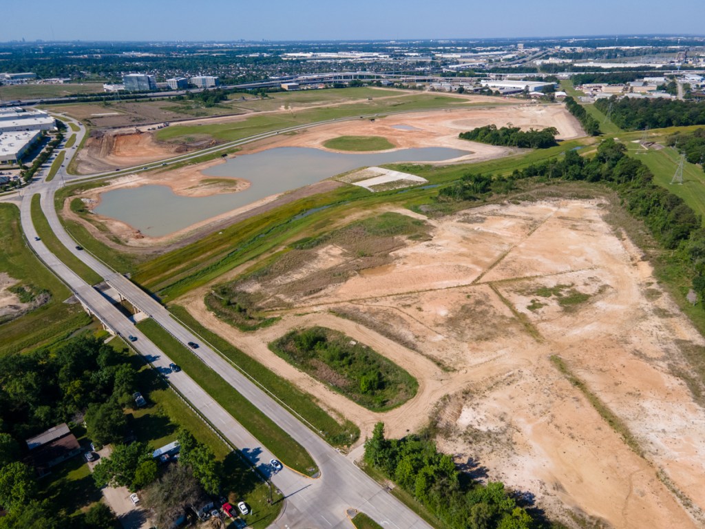
Project #3: Lauder Stormwater Detention Basin
The Lauder Stormwater Detention basin is another 2-phase project. Phase One, just north of Lauder Road and west of JFK Boulevard, will cost $18 million when complete. Phase Two will cost another $20.5 million and be located west of Phase One in parts of the Castlewood subdivision which HCFCD has bought out. Harris County Commissioners Court accepted the Preliminary Engineering Report and authorized the design and construction of Phase Two of the stormwater detention basin.

When complete, the Lauder Stormwater Detention Basin will hold at least 1,200 acre-feet, or more than 391 million gallons of excess stormwater. According to HCFCD, the project will reduce risk in more common 10 percent (10-year) floods, but would be overwhelmed in a much larger storm.

While driving around this area, I noticed a new home ten-feet up on stilts, while older homes sat at ground level. Commercial and industrial development around Bush Intercontinental Airport has literally swamped this area. This Lauder Basin is also part of Progress Greens.
The photos below show the status of Phase One construction on 4/20/21.


The Lauder Stormwater Detention Basin project is being funded both through the Flood Control District’s Capital Improvements Program (for design) and through the 2018 Bond Program (for construction).
Total Cost for Greens Bayou Projects in Construction
Altogether, construction of these three projects will cost approximately $42 million. Phase Two of Aldine Westfield and Lauder basins will cost another $31.8 for a total of almost $74 million. Phase 2 of the Aldine Westfield construction will kick off this summer. And Phase 2 of the Lauder project will start next winter.
Posted by Bob Rehak on 4/29/2021
1330 Days since Hurricane Harvey