
Large areas within this mine are unvegetated and unmined, making them more susceptible to erosion.
Introduction
This post ties together months of research. It began with observations about Texas sand mines that did not seem to follow best practices adopted in the rest of the world.
My comments do not apply equally to all sand mines; some sand mines already follow these recommendations to varying degrees. My goal is not to condemn sand mines in general, but to suggest opportunities for improvement in some.
This post contains 75 footnotes at the end. Follow them back to hundreds of photos, posts, studies, presentations and articles that illustrate the issues at hand.
Background
During Hurricane Harvey, millions of cubic yards of sand and silt migrated downstream into the Lake Houston area.[1],[2] Some originated from natural sources.[3] Some also likely originated from approximately 20 square miles of sand mines that have sprung up around the headwaters of Lake Houston.[4] The exact proportion by source is difficult to determine. However, the sand mining industry denies responsibility.[5]
Industry’s main argument is that floodwater inside the mines has insufficient velocity to carry sand and silt outside of the mine and into the river. However, photographic evidence, gravel deposited in dunes downstream, and USGS floodwater velocity measurements, taken together, contradict this argument.[6],[7]
Industry also cites a Brown & Root regional sedimentation survey for the San Jacinto Watershed. It showed that suspended solids in Cypress and Spring Creeks were greater than in the West Fork.[8] This study was conducted in the late 1990s and published in 2000 before the rapid growth of sand mining on the West Fork. Section 1.3.3 also cautions that these samples were taken at low-flow periods and should not be used to predict sedimentation during floods, when most sediment migrates.
“…the sediment load estimates presented herein may not adequately account for … sediment load during significant flood periods. … The monitoring program should be conducted during and following major flood events to verify the dominant sediment movements [emphasis added].”[9]
The sand mining industry, in essence, is saying, “Because more suspended solids come from Spring and Cypress Creeks during low flow periods, sand can’t be coming from the West Fork during floods,” a logical fallacy.

Sand mines in floodway. Sand bars within mine were caused during “river capture”. They prove sand was carried downstream. This photo taken on 10/28/2018 (after Harvey) also shows repairs to mine wall. During floods, the river tries to cut across meanders, runs through the mines, and scours pits.
This contention ignores several key facts:
- The landscape has changed dramatically since the Brown & Root report due to the rapid growth of sand mining.
- Sedimentation issues arise primarily as a result of floods, not normal flows.
- The sand mining industry is distorting Brown & Root findings.
- The vast majority of sand mines are on the West Fork and lie downstream from the Lake Conroe Dam, which released 79,100 cubic feet of water per second (cfs) during Harvey. That brought the West Fork peak flow in the area of the mines up to 130,000 cfs – 60% more peak flow than Spring Creek (82,100 cfs) and 364% more than Cypress Creek (28,100 cfs).[10]
- Sedimentation surveys of Lake Houston during the last 20 years show an increasing rate of sedimentation consistent with the growth of sand mining.[11],[12]
All of this suggests that sand mines contribute to AND increase natural rates of sedimentation.

After slowly building for years, the sand bar at the mouth of the West Fork has virtually tripled in size since 2015, threatening homes, businesses and infrastructure. The current Army Corps Emergency Dredging project will not address this and it is not clear where the money will come from to do so.
As the floodwaters from Harvey receded, massive amounts of sand became apparent. It clogged the San Jacinto River.[13] It left nearly continuous, bright, white trails of sand all the way from mines to the mouth of the San Jacinto – far in excess of the volume that was in the river before the flood.[14] It blocked drainage ditches.[15] It contributed to flooding that damaged thousands of homes and businesses.[16]
Removing these blockages could cost taxpayers and government hundreds of millions of dollars. The Army Corps of Engineers is already spending almost $70 million to dredge a two-mile stretch of new sand bars and dunes blocking the West Fork and local drainage ditches.[17] These blockages contribute to higher floods with smaller rains and continue to put Lake Houston area communities at increased risk for flooding.[18]
Dredging the remaining 11 miles of the West and East Forks in the Humble, Kingwood and Huffman areas will cost even more. Harris County Flood Control has included $50 million for dredging those reaches in its 2018 flood bond referendum and is seeking three partners to contribute similar amounts. If that is enough to restore normal flow to the East and West Forks, the total cost of dredging would be $270 million.
However, that may not be enough. A recent report compiled by two Lake Houston area geologists[19] studied the size and impact of a large sand bar at the mouth of West Fork that now causes the West Fork to flow uphill before it reaches Lake Houston. The size of this one sand bar alone likely exceeds the scope of USACE’s current dredging project by several fold.[20]
Many states and countries have established best management practices (BMPs) for sand mining to avoid such costs, and to help reduce erosion and consequent damage.[21]
If these BMPs were universally practiced by Texas sand mines, they could help increase margins of safety, reduce risks associated with future flooding, and reduce the costs associated with cleanup.
The first two recommendations below are already practiced in Texas, but only on a small portion of the Brazos River.[22] The other recommendations represent things that Texas sand mines should do to improve performance relative to the best management practices elsewhere.[23]
Recommendations
- Locate mines outside of floodways.
- Establish performance bonds to cover the cost of cleanup.
- Increase the width of dikes.
- Decrease the slope of dikes.
- Control erosion with vegetation.
- Replant areas not actively being mined.
- Avoid clearing areas that will not soon be mined.
- Protect stockpiles from flooding.
- Mine only above the thalweg (deepest part of the river).
- Establish performance bonds to guarantee remediation of breaches and/or repurposing of mined areas once mining is complete
Discussion
-
Locate mines outside of floodways.
A precedent exists. The 79th Texas Legislature enacted Senate Bill 1354, creating the John Graves Scenic Riverway on the Brazos River. This established a pilot program that will last until 2025. Its goal: to enhance water-quality protection by establishing specific regulations for quarries within the watershed. Regulations adopted under SB 1354 require a permit that forces new mines to operate outside of the 100-year floodplain.[24]
Prohibited activities include the operation of any quarry within 1,500 feet of a navigable water body, subject to specific exceptions.[25]
Currently, all but one sand mine on the San Jacinto lies partially or wholly within a floodway.[26] A common definition for a floodway is “the main channel of the river during a flood.” As Harvey proved, operating within a floodway puts both the mines and downstream communities at risk.
Miners prefer floodways because they typically contain concentrated deposits of sand. Less overburden also makes sand less expensive to mine. This increases profitability.[27]
However, when floodwaters invade mines, they can carry sand and silt downstream. Satellite and aerial images taken during and after Hurricane Harvey show that the river breached dikes, flowed across point bars, eroded stockpiles, destroyed a road, and carried exposed sand and sediment downstream.[28],[29]
While miners profit from mining in floodways, downstream communities bear the cleanup costs. Who will pay that cost? Currently, the answer is tax and rate payers through the City of Houston, Harris County, Coastal Water Authority, State of Texas, and Federal Government.[30]
When sand mines choose to operate in the floodway, industry profits and taxpayers take the loss.
Taxpayers are, in effect, forced to subsidize sand and gravel mines by bearing the clean-up costs.
By allowing mines to locate within floodways and then externalize costs, the State encourages risky behavior that can flood homes and damage entire communities.[31] In the future, not permitting mines to operate in floodways could reduce flood risks.
Some say, “You can’t regulate for 1000-year events like Harvey. That would damage industry.” That criticism, however, ignores the USGS report on peak streamflows during Harvey.[32] Issued in July 2018, it reclassified storm probabilities for areas affected by Harvey.
USGS now estimates, based on flow data at the Grand Parkway and the West Fork, that Harvey was NOT a 1000-year storm. USGS now says that a storm with the volume of Harvey has a 2.4 annual exceedance probability. That would make Harvey a 42-year storm.[33] On the East Fork, which received more rainfall during Harvey than the West Fork, the situation is even more dire. The sand mine on Caney Creek, which sits at the confluence of twofloodways, received a 33-year flood. And according to USGS, Harvey was only the fourth highest flood on record for that gage.[34]
Moreover, given the height and width of some mine dikes on the West Fork, it does not even take a storm of Harvey’s magnitude to breach dikes. Historical satellite imagery shows that West Fork mine dikes have been breached repeatedly, including during a non-tropical storm in 2015.[35]
-
Establish performance bonds to cover the cost of cleanup.
Performance bonds are another major provision of the John Graves pilot program. Although performance bonds in that area ensure restoration and reclamation of mines, the strategy could be applied on the San Jacinto to ensure cleanup and repairs after floods.[36]
It is unclear whether a coalition of governmental entities will even be able to cover cleanup costs from Harvey. If it is possible, it could take years to build the coalition and budget funds for remediation. That delays cleanup and increases flood risk for more than a quarter million people.[37]
Therefore, mining companies that choose to operate in floodways should post performance bonds that guarantee cleanup can be completed in time to reduce risk from additional flooding.
This simple provision will help ensure a true cost accounting for sand that doesn’t allow mines to externalize mitigation costs associated with risky practices (i.e., locating mines in floodways, operating with dikes that won’t withstand the pressure of floods, etc.).
-
Increase the width of dikes.
This point is related to #1 above about setbacks from rivers. Mines create dikes, in most cases, by not removing a thin strip of natural land between dredging pits and rivers. Currently, some mines operate so close to the river’s edge that floodwaters breach their dikes repeatedly.[38]
The wider the dikes, the stronger and less likely they are to fail. Wider dikes with gentler slopes can also sustain natural vegetation which binds their soil and reduces erosion. Wider dikes create a greater safety margin over time, especially against erosion on the cut bank sides of rivers. Wider dikes, if forested, can slow currents entering/leaving mines and trap sand.[39] And finally, wider dikes give the river room to expand during floods; that’s because some mines pile sand on top of natural dikes to increase their height. This artificially constricts the cross section of the river.
Engineers say that mechanical protections, which are prone to failure during high flows, are a poor substitute for natural protection.[40]
Because of the high volume of flow down the San Jacinto West Fork, especially when Lake Conroe opens its flood gates, 50-foot and 100-foot wide dikes have proven ineffective.[41]
Pits may operate for decades. During that time, their dikes may be eroded from both sides, especially when operators mine below the level of the thalweg (deepest part of the river bottom). When operators mine below the thalweg, levee breach, river capture, and subsequent erosion are virtual certainties during large flood events.[42]
For all these reasons, many states and countries often require greater setbacks between mines and rivers than Texas does. Texas has no requirement according to correspondence with the TCEQ, although it does require a 50-foot setback from adjoining property, and some might consider the river adjoining property because it belongs to the State of Texas.[43]
In contrast, many states require a 100-foot setback. Malaysia requires 50 meters. Some countries require 100 meters. Canada requires 450 meters for mining tar sands. Alaska requires a 1000-foot setback from all public water sources.[44] Louisiana requires a 1000-foot setback from public water supply wells.[45]

Washed out road INSIDE sand mine during Harvey. To all those who say currents inside the mines during a flood are not strong enough to pick up sand, I say, “Explain this.” Image from 8/30/2017.
San Jacinto floods have breached even 100-foot dikes because of the high volume of flow, especially when the SJRA releases water from the Lake Conroe dam.[46] SJRA reported that during Harvey, the flow at Highway 99 was 130,000 cubic feet per second, far higher than on Spring or Cypress Creeks.[47] One West Fork mine operator stated that the Good Friday flood of 2018 breached his dikes – even when there was norelease from the Lake Conroe Dam.[48]
The San Jacinto River Authority has been forced to release water from the Lake Conroe Dam in each of the last three years to preserve the dam during heavy rains. The amounts ranged from 7,000 to almost 80,000 cubic feet per second.[49]
High release rates, added to already heavy rainfalls, illustrate why it may be difficult to establish one safe setback distance for all of Texas. Considering site-specific criteria such as proximity to dams and highly developed areas, slope of floodplains, width of floodways, potential peak flows, and location of cutbanks may yield safer setbacks.[50]
In general, though, the wider the setback, the stronger the dike, the greater its resistance to erosion (especially over time), the less risk to the mine, and the safer downstream communities are.
-
Decrease the slope of dikes.
BMPs in other states and countries also recommend gently slopingdikes to strengthen their resistance. They frequently recommend ratios of 1:3 or 1:4 (height:width).[51] Malaysia recommends up to a 1:10 ratio because low slopes help establish vegetation.[52] The near-vertical slope of many West Fork dikes means they receive direct, rather than glancing blows from floodwater.
Angled surfaces deflect and diffuse incoming energy. Nowhere is this principle more evident than in the design of military, supersonic aircraft that handle wind forces at thousands of miles per hour.[53]
-
Control erosion with vegetation.
Sloping dikes more gradually strengthens their resistance to floods, but by itself will not prevent erosion, especially on cutbanks. Planting them with grass and/or native trees and other vegetation can bind the soil, slow water down, reduce erosion and help retain sand within the mine boundaries.[54]
Virtually all states and countries recommend planting native grasses and trees to help bind soil.[55] Revegetating after plants have been removed can take years. Therefore, the best, cheapest and simplest practice is to leave native vegetation in place and simply not remove it wherever possible when constructing mines
-
Replant areas not actively being mined.
Mining has exposed 20 square miles of sand surface to erosion along the West Fork between I-45 and I-69 and along the East Fork in Porter.[56] Not all of that area is actively being mined. Loose sand, exposed to floodwaters, exposes downstream communities to unnecessary risk. Replanting with native grasses and trees can bind the soil, reduce water velocity and reduce erosion during floods. Keeping soil in place is the best way to keep it out of rivers.
Louisiana best management practices state: “It is prudent to practice good soil conservation and seed bare ground during the post-mining phase to aid in minimizing and/or reducing the potential for stormwater to wash sediment loads from unvegetated areas into nearby waterways. Natural regeneration takes time and during that process much sediment could be washed away as sheet, rill or gully erosion over that period.”[57]
-
Avoid clearing areas that will not soon be mined.
Delay grubbing until the last possible moment to reduce erosion and risk from floodwaters. (Same theory as #6.)
The Louisiana best management practices for sand mining state: “It is very important to only clear and grub acreage needed for the immediate term. Clearing or grubbing too much land too early in the construction phase of the mining operation will dramatically increase the potential for environmental impacts from surface water runoff and will increase the costs to control runoff from the mining site.”[58]
Large areas of mines on both the East and West Forks have been grubbed years before they were mined. These areas then flooded and contributed disproportionately to downstream sedimentation.[59]
-
Protect stockpiles from flooding.
Sand in stockpiles is especially vulnerable during floods because it is so loose. During Harvey, sand mines adjacent to Kingwood lost four of six stockpiles completely. Another eroded severely. Only one escaped with little loss, the one on the highest ground, protected by a large swath of trees. Mines that locate stockpiles in floodways risk losing their entire inventory and contributing disproportionately to downstream sedimentation.[60],[61]

Half of this mine lies within not one, but two floodways (cross-hatched areas). The part of the stockpile that eroded most is in the the 100-year floodplain. See right side of red circle.
-
Mine only above the thalweg.
Thalweg is pronounced taal-veg. It is a geological term for the deepest part of a river. West Fork sand mines remove sand to depths approaching 50 feet. That’s far below the West Fork’s thalweg.
The greater the differential between river bottom and pit bottom, the greater the likelihood of pit capture[62]during floods. Water migrates from areas of high pressure to low and from high elevation to low. With dikes of only fifty feet or less, river capture of mines is a virtual certainty during floods.[63],[64] This increases river bottom erosion upstream. It alters the gradient of the river. And it creates a hungry water effect downstream that contributes to bank erosion, property loss, tree loss, infrastructure damage, and increased sedimentation.[65]
All these things happened during Harvey when the river ruptured dikes and cut across point bars through sand pits.
In separate reviews of scientific literature and on-site studies, Ladson and Judd, and Jacobs Engineering described the ways rivers capture pits.[66]
- Lateral migration of the river channel into the pit
- Sub-surface piping from surface water into pits and subsequent failure of pit walls
- Water cascading into a gravel pit as flood waters rise
- Erosion by water returning to the river from the pit as the flood recedes.
Ladson and Judd also found that floodplain mining can have delayed impacts.[67]
- “The low-resistance…high-flow conveyance path provided by the open area of a gravel mine can alter floodplain hydraulics during high flows.”
- “Mining on floodplains may reduce groundwater levels on adjacent areas where water is removed by pumping and may affect groundwater quality.”
- “Floodplain mines may lead to river channel changes that include erosion, bed degradation and damage to infrastructure.”
Sand removed from a pit also creates a void that induces river water as well as ground water from surrounding areas to migrate into the pit. This can reduce the flow in the river and negatively impact aquatic species.
When the water table drops below the level of roots, surface vegetation can also die back, contributing to more erosion.[68]
Finally, mining below the thalweg loots water from river authorities. Mines use state property to process their product without paying for it, unlike smaller businesses and individuals, who must pay fees to subsidence districts, water authorities and municipalities based on usage.[69] Pits expose more water to air, increasing evaporation and water loss.
By mining above the level of the thalweg, all these problems can be reduced or avoided, including those of fairness and equitable treatment.
10. Establish performance bonds to guarantee remediation of breaches and/or repurposing of mined areas once mining is complete.
Reclamation or remediation of sand mines, and repair of breaches should also be covered by performance bond(s). Obtaining a permit requires a mine to file a remediation plan, but it does not force mines to remediate. Operators can simply walk away from pits, creating safety hazards, eyesores, and economic development headaches for communities.[70]

Defunct Humble sand mine on North Houston Road just north of Townsend Blvd. Note steep, unvegetated slopes, lack of berms, and lack of fencing, all violations of best practices in most states. Luckily, this pit will be filled with spoils from the Army Corps dredging project and then graded to match surroundings.
On the positive side, mines can be turned into lakes for residential communities, storage pits for spoils, parks, storm water detention facilities, marinas and wetlands.[71]
But these all represent costs long after all the profit has left the site with the last sand truck. Abandoned pits and equipment, in some cases, remain eyesores in the community that discourage economic development.[72]
In two observed cases, mine dikes were damaged in storms, yet no one repaired the breaks for years. West Fork mine dikes have remained broken for three years in one case and six in another, while rainwater has washed accumulated pit sediment into the river.[73],[74]
Performance bonds should cover not just the cost of remediation but also the cost of maintenance (i.e., mowing, watering, fencing, etc.) until abandoned property can stabilize and/or be sold.
Conclusion:
Rates of sedimentation on the West Fork have increased rapidly in recent years.[75] This likely was the result of three unusually heavy rains in 2015, 2016, and 2017. Harvey was the coup de grâce.
It was also a wake-up call. It exposed the weaknesses in Texas regulations. It underscored the importance of adopting common-sense best management practices like those outlined above to help improve public safety, reduce damage to infrastructure, and avoid such widespread flood damage to homes and businesses in the future.
The consequences of ignoring these recommendations potentially include:
- Destruction of downstream communities through increased flooding…again
- More loss of life
- Unfair imposition of remediation costs on taxpayers
- Hidden “subsidies” that distort the true cost of cement and its usage
- Loss of faith in the ethical standards of businesses and the free enterprise system
- Loss of faith in government institutions to protect people and property
- Loss of home and business values
- Reduction of property tax income to city and county governments
- Reduction in perception that Texas is a desirable place to live.
If we are to maintain faith in government, private enterprise and free markets, we must have a full and fair cost accounting that recognizes the damage and cleanup costs due to sand from mines. These costs have been externalized by miners. For decades, this issue remained invisible because the problem was sub-acute. That made it easy for government to “kick the can down the road.” Harvey changed all that.
The problem is now critical and must be addressed.
Increased rates of sedimentation are putting Lake Houston itself at risk. The Lake currently represents the source of drinking water for approximately 600,000 people. But the City of Houston expects to have 2 million people using surface water from the lake within the next few years as new water treatment plants come online. The increasing rate of reduction in its capacity conflicts directly with the expected increase in customers.
Destruction like we experienced during Harvey is rarely caused by one thing. It results from multiple failures on multiple levels. They compound each other. To restore and maintain margins of public safety, we need to address each cause. To the extent that sand mines contributed to the problem, they can also help solve it by modifying business practices as described above.
How You Can Help
This is an election year. TACA has tripled its lobbying budget. But TACA can’t vote and you can. Make this an election issue and quiz each candidate for their positions on common sense regulations affecting sand mines.
These are my opinions of a matter of public policy protected under the First Amendment of the U.S. Constitution and the Anti-SLAPP statutes of the great State of Texas.
For a downloadable, printable copy of this document including footnotes, click on Best Management Practices for Sand Mines.
Posted by Bob Rehak on August 1, 2018
338 Days since Hurricane Harvey
#####
Footnotes
[1]https://reduceflooding.com/2018/07/06/army-corps-of-engineers-awards-dredging-bid-on-west-fork-emergency-project/. USACE will remove 1.8 million cubic yards from a 2 mile stretch where some of the worst deposits are found. When complete, eleven miles will remain to be dredged. The cost to remove sediment from the first 2-miles is $69,814,060.
[2]https://reduceflooding.com/2018/07/27/why-we-must-remove-mouth-bar-on-west-fork-of-san-jacinto/
[3]Spring and Cypress Creeks
[4]https://reduceflooding.com/2018/05/22/where-did-all-the-sand-come-from/
[5]https://reduceflooding.com/2018/06/07/taca-spells-out-industry-position-on-societal-and-environmental-benefits-of-sand-mining/
[6]https://reduceflooding.com/2018/06/23/do-local-sand-mines-follow-best-management-practices/
[7]https://reduceflooding.com/2018/07/25/a-closer-look-at-sand-issues-on-the-east-fork-of-the-san-jacinto/
[8]https://reduceflooding.com/wp-content/uploads/2018/03/BrownRoot-Dredging-Recs.pdf
[9]Page 15, https://reduceflooding.com/wp-content/uploads/2018/03/BrownRoot-Dredging-Recs.pdf
[10]https://reduceflooding.com/wp-content/uploads/2018/03/Hurricane-Harvey-Peak-Inflows-36×24.pdf
[11]https://reduceflooding.com/2018/07/01/a-model-for-the-future-of-the-san-jacinto/
[12]https://reduceflooding.com/wp-content/uploads/2018/03/Harvey-Flood-Full-Length-8.pdf
[13]https://reduceflooding.com
[14]See 450+ photos at https://reduceflooding.com/gallery/
[15]https://reduceflooding.com/2018/03/19/how-deep-was-the-sand-deposited-by-harvey-at-river-grove-park/
[16]https://reduceflooding.com/2018/06/10/damage-map-neighborhoods-in-lake-houston-area-hardest-hit-by-harvey/
[17]https://reduceflooding.com/2018/07/06/army-corps-of-engineers-awards-dredging-bid-on-west-fork-emergency-project/
[18]https://reduceflooding.com/2018/04/11/army-corps-finishes-sedimentation-survey-field-work-on-first-leg-of-west-fork/and https://reduceflooding.com/2018/04/03/4-33-inches-of-rain-created-the-third-largest-flood-in-16-years-on-the-east-fork-of-the-san-jacinto/
[19]https://reduceflooding.com/wp-content/uploads/2018/07/Mouth-Bar-Rev-16.pdf
[20]https://reduceflooding.com/wp-content/uploads/2018/07/Mouth-Bar-Rev-16.pdf
[21]https://reduceflooding.com/sand-mining/
[22]https://reduceflooding.com/2018/07/01/a-model-for-the-future-of-the-san-jacinto/
[23]Personal observations derived from a study of best and actual practices
[24]Page 6, https://www.tceq.texas.gov/assets/public/comm_exec/pubs/sfr/087_08.pdf
[25]Page 5, https://www.tceq.texas.gov/assets/public/comm_exec/pubs/sfr/087_08.pdf
[26]https://hazards-fema.maps.arcgis.com/apps/webappviewer/index.html?id=8b0adb51996444d4879338b5529aa9cd
[27]Consultation with three different geologists
[28]https://reduceflooding.com/2018/06/23/do-local-sand-mines-follow-best-management-practices/,
[29]https://reduceflooding.com/wp-content/uploads/2018/03/West-Fork-Sand-Stockpiles2.pdfand https://reduceflooding.com/2018/07/25/a-closer-look-at-sand-issues-on-the-east-fork-of-the-san-jacinto/
[30]Item CI-61, Page 8 in project list of Harris County Flood Bond Proposal, https://www.hcfcd.org/media/2881/2018bondprojecttable2018-07-19-1600.pdf
[31]https://reduceflooding.com/2018/06/10/damage-map-neighborhoods-in-lake-houston-area-hardest-hit-by-harvey/and https://reduceflooding.com/2018/07/25/a-closer-look-at-sand-issues-on-the-east-fork-of-the-san-jacinto/
[32]https://reduceflooding.com/wp-content/uploads/2018/07/sir20185070.pdf
[33]https://reduceflooding.com/2018/07/11/usgs-report-on-peak-streamflows-during-harvey-significantly-revises-flood-probabilities/ Note: this number is currently being verified by USGS, Harris County Flood Control and FEMA.
[34]Page 9, Gage 08070500, line 32, https://reduceflooding.com/wp-content/uploads/2018/07/sir20185070.pdf
[35]https://reduceflooding.com/2018/06/23/do-local-sand-mines-follow-best-management-practices/
[36]Page 7, https://www.tceq.texas.gov/assets/public/comm_exec/pubs/sfr/087_08.pdf
[37]Lake Houston Area Chamber of Commerce estimates current population is 286,000.
[38]https://reduceflooding.com/2018/06/23/do-local-sand-mines-follow-best-management-practices/
[39]https://reduceflooding.com/2018/05/04/two-modest-proposals-to-reduce-the-amount-of-sand-coming-downstream/
[40]Page 2, https://reduceflooding.com/wp-content/uploads/2018/07/Jacobs_and_Moroka_2015_Risk_assessment_of_floodplain_mining_pits_in_the_mid-Goulburn_Valley.pdf
[41]https://reduceflooding.com/2018/07/22/how-floodplain-mining-can-lead-to-river-capture/
[42]https://reduceflooding.com/2018/07/22/how-floodplain-mining-can-lead-to-river-capture/
[43]Correspondence with TCEQ.
[44]See https://reduceflooding.com/sand-mining/ Compare best practices from various states and countries by searching on the word “setbacks” within regulations from various states and countries.
[45]Page 18, https://reduceflooding.com/wp-content/uploads/2018/06/LouisianaRecommendedBMPs.pdf
[46]https://reduceflooding.com/2018/07/22/how-floodplain-mining-can-lead-to-river-capture/
[47]https://reduceflooding.com/wp-content/uploads/2018/03/Hurricane-Harvey-Peak-Inflows-36×24.pdf
[48]Conversation between SJRA board members and mine executive during mine tour.
[49]https://reduceflooding.com/wp-content/uploads/2018/05/2018_FloodWarn_Training_Kingwood.pdf
[50]See Section 3.3, https://reduceflooding.com/wp-content/uploads/2018/07/Jacobs_and_Moroka_2015_Risk_assessment_of_floodplain_mining_pits_in_the_mid-Goulburn_Valley.pdf. This report contains an excellent discussion of mitigation strategies for both new and existing pits beginning on page 47.
[51]Compare best practices found on this page: https://reduceflooding.com/sand-mining/
[52]https://reduceflooding.com/wp-content/uploads/2018/06/Malaysia-Sand-mining.pdf
[53]http://www.migflug.com/jetflights/the-10-fastest-aircraft-in-the-world.html
[54]Page 47, https://reduceflooding.com/wp-content/uploads/2018/07/Jacobs_and_Moroka_2015_Risk_assessment_of_floodplain_mining_pits_in_the_mid-Goulburn_Valley.pdf
[55]For example, see page 11 of Louisiana Best Management Practices for description. https://reduceflooding.com/wp-content/uploads/2018/06/LouisianaRecommendedBMPs.pdf.
[56]Estimate calculated from Google Earth.
[57]Page 29, https://reduceflooding.com/wp-content/uploads/2018/06/LouisianaRecommendedBMPs.pdf
[58]Page 20, https://reduceflooding.com/wp-content/uploads/2018/06/LouisianaRecommendedBMPs.pdf
[59]https://reduceflooding.com/2018/07/25/a-closer-look-at-sand-issues-on-the-east-fork-of-the-san-jacinto/
[60]https://reduceflooding.com/gallery/page/15/
[61]https://reduceflooding.com/wp-content/uploads/2018/03/West-Fork-Sand-Stockpiles2.pdf
[62]https://reduceflooding.com/wp-content/uploads/2018/07/Austrailia-Ladson-Mining-River-Stability.pdf
[63]https://reduceflooding.com/2018/07/22/how-floodplain-mining-can-lead-to-river-capture/
[64]Page 20, https://reduceflooding.com/wp-content/uploads/2018/07/Jacobs_and_Moroka_2015_Risk_assessment_of_floodplain_mining_pits_in_the_mid-Goulburn_Valley.pdf
[65]Pages 251-255, https://reduceflooding.com/wp-content/uploads/2018/07/Austrailia-Ladson-Mining-River-Stability.pdf
[66]Page 251, https://reduceflooding.com/wp-content/uploads/2018/07/Austrailia-Ladson-Mining-River-Stability.pdf
[67]Page 250, https://reduceflooding.com/wp-content/uploads/2018/07/Austrailia-Ladson-Mining-River-Stability.pdf
[68]Page 255, https://reduceflooding.com/wp-content/uploads/2018/07/Austrailia-Ladson-Mining-River-Stability.pdf
[69]Personal experience as a business owner.
[70]https://reduceflooding.com/2018/07/01/a-model-for-the-future-of-the-san-jacinto/
[71]https://reduceflooding.com/wp-content/uploads/2018/06/TACA-White-Paper.pdf
[72]https://reduceflooding.com/2018/06/07/taca-spells-out-industry-position-on-societal-and-environmental-benefits-of-sand-mining/
[73]https://reduceflooding.com/2018/06/07/taca-spells-out-industry-position-on-societal-and-environmental-benefits-of-sand-mining/
[74]https://reduceflooding.com/2018/06/23/do-local-sand-mines-follow-best-management-practices/
[75]https://reduceflooding.com/2018/07/27/why-we-must-remove-mouth-bar-on-west-fork-of-san-jacinto/


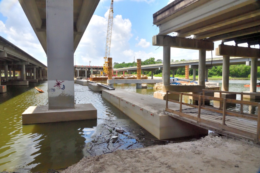


 Grading the road.
 Dock area shaping up.


