In the Tuesday 8/23/22 Harris County Commissioners Court Meeting, Harris County Flood Control District (HCFCD) will deliver the results of a study on the Greens Bayou mid-reach area. The study shows that when the Aldine-Westfield Phase 2 and Lauder Phase 2 Basins are complete, the area will be protected from a 10-year flood (10% annual chance). But the study doesn’t stop there. It also recommends building another large detention basin and increasing channel conveyance to protect the area in a 25-year flood (4% annual chance).
10-Year Protection Achieved
Back in 2003, HCFCD started working on a plan to bring much needed flood reduction to the area between Veterans Memorial and JFK along Greens. That stretch covers 11 miles of Harris County Precincts 1 and 2.
Locations of improvements along Greens Bayou.Red is proposed.
Also since 2003, NOAA has developed new Atlas-14 rainfall probability estimates.
Atlas 14 rainfall probabilities for northern Harris County
The new estimates show that northern Harris County could experience 30-40% more rain than previously estimated in major events. With both rainfall and detention basin capacity increasing, the question became, “Where do things stand?”
This new engineering study shows that the four existing detention basins (Kuykendahl, Glen Forest, Aldine-Westfield and Lauder) should protect homes and businesses in a 10-year flood. But achieving greater protection will require something more.
Four Alternatives to Increase Capacity
Engineers looked at four different alternative combinations of stormwater detention capacity and/or channel conveyance improvements to provide more protection. Each alternative involved the proposed Hardy Stormwater Detention Basin shown in red on the map above.
Alternative 1 – Building a 3,000 acre-foot basin
Alternative 2 – Smaller 2,000 acre-foot basin with more room for recreation
Alternative 3 – Same as #2 but also with channel conveyance improvements
Alternative 4 – Only conveyance improvements; no additional storage capacity
Alternative 5 – Build nothing else. Stop with existing basins.
The engineers recommended Alternative #3 – given sufficient funding. It would achieve a 25-year system capacity in general. The area immediately downstream of I-45 would achieve closer to a 10-year system capacity. And the area immediately downstream of the Hardy Tollroad would be closer to a 50-year capacity.
The proposed and existing improvements would create enough storage to hold a foot of rain falling across 16.4 square miles!
Cost: A mere $196 million on top of the $126 million already invested in the other four basins. Compared to Alternative 5, #3 would protect another 25 structures in a 10-year flood, 173 in a 50-year, and 239 in a 100-year. HCFCD did not list a number for a 25-year event. But we can assume it’s somewhere south of 173.
Phase 1: 3.6 miles of channel conveyance improvements
Phase 2: 3.5 miles of channel conveyance improvements and 500 acre-feet of stormwater detention
Phase 3: 3.5 miles of channel conveyance improvements and 500 acre-feet of stormwater detention
Phase 4: Final 1,000 acre-feet of stormwater detention
The slide below shows how much the existing and new improvements would shrink the 25-year floodplain. Mentally subtract the purple areas to see before and after.
Purple represents the extent of the floodplain without improvements. Blue shows the extent with improvements.
Almost $200 million of additional studies, analysis, models and mapping
$27.9 billion in projects.
The projects spread throughout the entire watershed. But here, I’ll focus on those in the northern portion of Harris and the southern portion of Montgomery Counties for brevity.
Halls Bayou
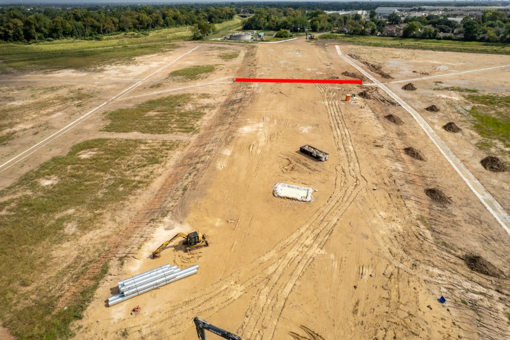
The Flood Planning Group recommends five projects in Halls Bayou totaling $99.65 million, all in collaboration with Harris County Flood Control District (HCFCD). They include:
Channel conveyance Improvements on several tributaries
Stormwater detention improvements near Hardy West
Stormwater detention and channel conveyance improvements along the main stem.
These projects had a positive 1.46 Benefit/Cost Ratio PLUS additional community benefits hard to quantify. They would remove the floodplain from more than 3,000 structures and benefit more than 9,300 people. See pages 5-14 through 5-16.
White Oak Bayou
The Flood Planning Group recommends five channel improvement and detention basin projects for $120 million along White Oak Bayou. The flood planning group determined a benefit/cost ratio of .80 for these projects, meaning costs exceeded benefits. Regardless, they feel there are many community benefits that cannot be quantified. They include removing flood risk from seven miles of roads. See pages 5-15 through 5/18.
Greens Bayou
Greens Bayou would receive $120 million of improvements (construction costs only). They include projects in Fountainview Sections 1 & 2, Castlewood Sections 3 & 4, North Forest, Mid-Reach Greens, Parkland Estates, and Humble Road Place.
A bypass channel under the railroad that parallels US 59 could reduce upstream water surface elevations during extreme events. And a mitigation basin downstream would absorb any adverse impacts in Parkland Estates and Humble Road Place from the bypass channel.
The BCR for all Greens Bayou improvements equals 2.13, meaning benefits double costs. More than 20,000 individuals and 2,000 structures would benefit. See pages 5-18 through 5-20.
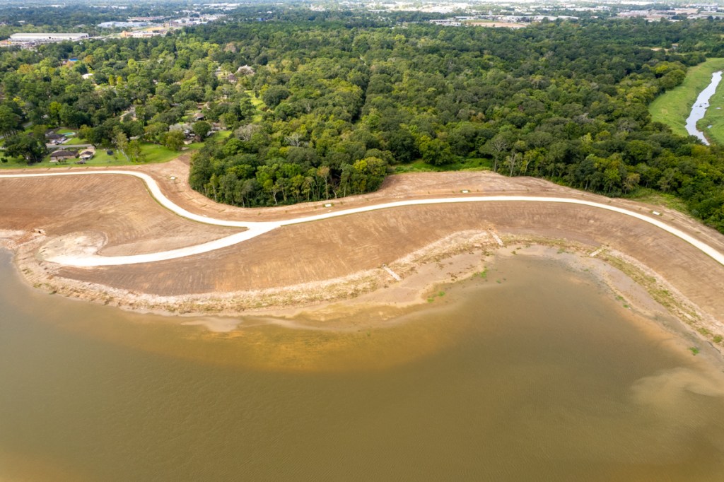
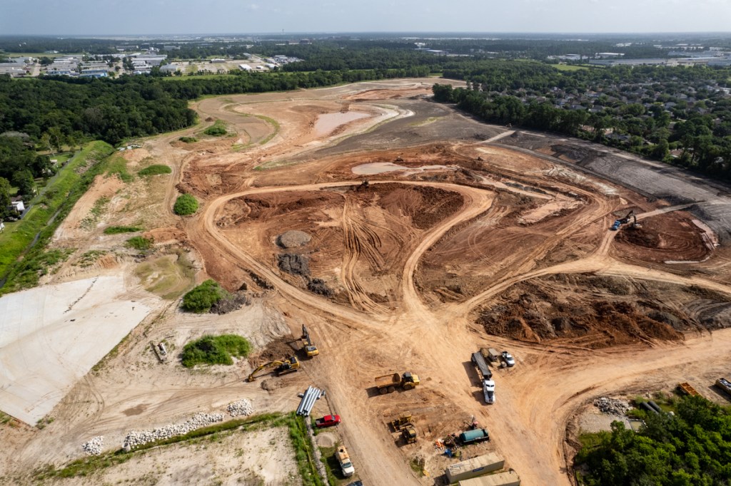
San Jacinto River
The Flood Planning Group recommends numerous projects associated with the East and West Forks of the San Jacinto River and their tributaries. It based these recommendations on the San Jacinto River Regional Watershed Master Drainage Plan and a 2018 LiDAR study. See pages 5-21 through 5-31.
Caney Creek
Recommendations include channelizing part of Caney Creek and offsetting that with two dry-dam detention basins: one at FM1097 and the other at SH105. Together, they would store more than 40,000 acre feet of stormwater. That’s enough to hold a foot of stormwater falling across 62.5 square miles! Channelization would occur near the confluence of Caney Creek with the East Fork. That’s near Lake Houston and East End Parks. The projects would remove 42 miles of roadway and 2,422 structures from the 1% annual chance floodplain.
East Fork
A 48-ft tall concrete dam would create a 1.60-mile-long earthen impoundment that captures runoff from Winters Bayou. The dry dam would have five reinforced 10×10 concrete culverts and twin 300′ backup spillways. It would cover almost 2,500 acres and hold 45,000 acre feet of floodwater. That’s enough to hold a foot of stormwater falling over 28.8 square miles.
Lake Creek
Lake Creek would receive some channelization and two dry-dam detention basins holding 37,250 acre feet of storage, enough to hold a foot of stormwater falling over 58 square miles.
Peach Creek
Recommendations also call for partial channelization and two dry-dam detention basins along Peach Creek.
The Walker Detention basin would occupy 1,200 acres, hold 36,000 acre feet of stormwater, and cost $200 million.
The SH105 Detention basin would occupy 3,000 acres, hold 36,000 acre feet, and cost $400 million.
The total 72,000 acre feet of capacity would hold a foot of stormwater falling over 112.5 square miles.
Spring Creek
This project would channelize 15.7 miles of stream at I-45 and through the Woodlands. It would also create two detention basins on Birch and Walnut Creek tributaries to help reduce flood risk downstream. Together, the projects would create more than 35,000 acre feet of floodwater storage capacity, enough to hold a foot of rain falling over 54.8 square miles. The report did not break out the costs.
West Fork
The Flood Planning Group recommends widening and channelizing 5.7 miles of the West Fork near Highway 242. They would create 12,400 acre feet of mitigation storage by widening the river to 750 feet and creating a 2-foot bench above the stream bed. That would involve shaving down the floodplain to 2 feet above the waterline.
Farther downstream, in the Kingwood Area, they would also increase conveyance by widening a 5-mile-long stretch of the West Fork with 3,500-foot wide of benching. This project would require 923 acre-feet of mitigation storage
That would increase total floodwater storage in both locations by 13,423 feet – enough to hold a foot of rain falling across 20.9 square miles.
Other portions of the recommendations stress the need for additional strategies. They include but are not limited to:
A regional approach to flood mitigation
Floodplain preservation
Natural solutions
Minimum building setbacks
More stringent building codes
Better drainage regulations
Uniform regulations across the watershed
Adoption of standards for determining “no adverse impact”
Also note, that these recommendations would take decades to implement and that many would need to be implemented in a specific order. For instance, the State would need to build detention upstream before widening channels downstream. One helps mitigate the other. Without that, you could help people upstream, but hurt people downstream. That flies in the face of HCFCD principles.
On the Harris County Commissioner’s Court agenda for today are two Harris County Flood Control District (HCFCD) “transmittals.” One will update commissioners on flood-bond spending to date. The other will update commissioners on the progress of new flood maps (the MAAPnext program). They are items 269 and 270 on today’s agenda.
Transmittals are reports by departments. Commissioners don’t usually discuss them unless one of the commissioners wishes to make comments for some reason. So, I’m calling them to your attention here.
Flood-Mitigation Spending Through Third Quarter Reaches $865 Million
About half of the $865 million spent on flood mitigation since voters passed the bond in 2018 has come from bond funds. The rest has come from grants and local partnerships. See pie chart below on left.
The left pie chart underscores the importance of partnership funding.
The map below shows where flood-bond spending has occurred.
Flood-mitigation spending by watershed since approval of flood-bond in 2018.
The winner in the $weep$take$: HCFCD spent almost $154 million on Brays Bayou.
Other leading watersheds (rounded to nearest million) in flood-bond spending included:
$81 million in Addicks Reservoir
$76 million on Greens Bayou
$76 million on Cypress Creek
$50 million on Little Cypress Creek
$46 million on White Oak Bayou
$32 million on Clear Creek
With a few exceptions, this spending reflects the influence of the Harris County Flood-Bond Equity Prioritization Framework implemented in 2019. That framework gives highest priority to low- to middle-income watersheds with a high social-vulnerability index. Thus, tiny Halls Bayou has received more assistance than the largest watershed in the county – the San Jacinto River. And Brays Bayou has received almost 11 times more assistance than Buffalo Bayou.
Two notable exceptions are:
Vince Bayou which is almost totally inside the City of Pasadena and is therefore primarily Pasadena’s responsibility.
Little Cypress Creek which is part of HCFCD’s experimental Frontier Program. The Frontier Program aims to prevent future flooding by buying up land on the cheap before it’s developed. HCFCD then sells detention basin capacity to developers to help make back its investment.
Other Insights Gained from Report
Most projects are ahead of schedule and on budget. Good news!
More than half of buyouts have been completed and enough funding apparently remains to complete the rest.
Progress continues on the $124 million FEDERAL Flood Damage Reduction project on White Oak Bayou, where six stormwater detention basins will hold almost a billion gallons of stormwater. That’s equivalent to about a foot of stormwater falling over almost 5 square miles.
An earlier version of this report generated some controversy. People in some watersheds didn’t believe the reported expenditures. Members of the Northeast Action Collective questioned whether any projects had started in their watersheds. They demanded immediate cancellation of projects in Kingwood and transfer of Kingwood’s funds, so that projects in Halls and Greens Bayou could start immediately.
That’s, in part, why I wrote “How to Find and Verify Flood-Related Information: Part I.” Flood-mitigation projects are hard to spot from the ground. Construction almost always happens out of sight behind tall fences and dense tree lines. After construction, the projects are often disguised as parks. For those who doubt, I recommend confirming the existence of projects from the air.
I haven’t confirmed every project in the county, but I have spot-checked many. And I have yet to find discrepancies between what HCFCD reports and what I can see from the air.
C-25, a Halls Bayou Detention pond now under construction by HCFCD. The bayou runs through the trees in the foreground.New basin at Hopper and US59 on a tributary of Halls Bayou.Lauder Detention Basin on Greens Bayou as of 10/12/2021. Phase One of a two-phase project is nearly complete.Cutten Road detention basin on Greens Bayou continues its relentless expansion.Phase 1 of the Greens Bayou Aldine-Westfield Basin on left is complete. Phase 2 on right is now beginning.
For more information that includes watershed spending data before the flood-bond, check out the funding page.
MAAPnext Effort About to Be Turned Over to FEMA
Harris County Flood Control (HCFCD) estimates it has completed 86% of its part of the flood-map updates. HCFCD will deliver drafts of the new maps to FEMA in January for review and kick off a campaign of public meetings at the same time. The public will see draft maps in February. A public comment period of 90 days will follow. And FEMA hopes to release preliminary flood insurance insurance rate maps by mid-year next year.
I have had a peek at the new maps and reports. And I must say, the effort should result in a dramatic leap forward in flood-risk understanding. Individualized reports will inform homeowners of their flood risks from a variety of different sources, including street flooding. The prototype of the website is very user friendly.
After receiving preliminary maps from HCFCD, it typically takes FEMA another 18-24 months to release final, official flood maps. That gives affected property owners time to comment and appeal. The process looks like this.
MAAPnext milestones as of the end of 2021.
Posted by Bob Rehak on 11/30/2021
1554 Days since Hurricane Harvey
https://i0.wp.com/reduceflooding.com/wp-content/uploads/2021/11/20211130-Screen-Shot-2021-11-30-at-10.31.04-AM-2.jpg?fit=1200%2C836&ssl=18361200adminadmin2021-11-30 12:47:472021-11-30 12:47:51Where Flood-Bond Spending Is Going, When New Flood Maps Will Be Released
Location of HCFCD’s Cutten Floodwater Detention Basin
The basin includes 5 separate Basin Compartments (BCs). One is on the north side of the Bayou (BC5) and four are on the south side (BC1-4).
The $16.2 million expansion will add 866 acre-feet of stormwater storage capacity to the previous 677 acre-feet. That’s enough to lower the water surface elevation by .36 feet throughout the surrounding floodplain.
When complete, the 235-acre complex will have enough capacity to hold a foot of stormwater falling over 2.4 square miles.
Photos Taken 10/15/2021 Show Current Construction Status
Looking E at the extension of Greens Road between BC3 (right) and BC4 (left). Red line indicates path of culvert under roadbed.Looking W in opposite direction. Greens Bayou is on right. Greens Road (coming from top of frame) will be extended south along ridge that bisects BC3 and BC4 in foreground. BC1 and BC2 are in background on either side of Greens Road. Hollister cuts through the frame from left to right.Looking NW across Hollister toward yet another detention pond, BC5.Looking SW across the intersection of Hollister (left) and Greens Road (right). Excavation of BC1 still has a way to go. On Friday, muddy conditions were slowing down the work, but if you look closely, you can still see heavy equipment working in the distance.
How Ponds Will Work with Bayou, Surrounding Developments
These ponds will function two ways. They will take stormwater:
Out of Greens Bayou when it starts to overflow.
Directly from surrounding subdivisions before it gets into the bayou.
It’s important to understand that County/Municipal neighborhood drainage and HCFCD infrastructure often pre-date current building and development codes, as they do in this area.
As cities and precincts re-grade and reconstruct streets with more and bigger storm sewers that get water out of neighborhoods faster, that water needs a place to go – without flooding others downstream.
In this area, these ponds will be that place. Everything has to work together. The very first sentence of the Texas Water Code Section 11.086 states, “No person may divert … surface waters in this state … in a manner that damages the property of another…”
Stormwater detention basins like these also provide greenspace and recreational opportunities, such as public parks.
HCFCD expects to complete the Cutten Project in the summer of 2022.
The Woodridge site already contains five small detention ponds and HCFCD has room in the center to add more. Perhaps the Woodridge site will look somewhat like this one before things are all over.
The basin sits east of Aldine-Westfield Road at Beltway 8 North just south of Bush Intercontinental Airport.
Aldine-Westfield Basin location
Photos from April and October
Here’s how that looks from the air.
Looking NE from over Beltway 8 and Aldine-Westfield Road in a helicopter in May. Phase 1 in foreground had just been completed. Red rectangle indicates approximate location of Phase 2 which had not yet started. Note airport in backgroundand Greens Bayou in foreground.
I didn’t have a helicopter this morning and I wasn’t able to safely launch a drone because of air traffic. However, I did manage to grab some ground-level shots from the entrance to the Phase 2 construction site on Aldine-Westfield road.
Photo taken on 10/15/2021 from Aldine-Westfield Road shows that clearing of Phase 2 has begun.The site is currently in the clearing phase.
The photo above was actually stitched together from seven shots in Photoshop. In person, the area cleared looks much larger than it does above. Here’s another shot of the area taken from the air back in April that better shows its size.
Photo of Phase 2 area (right) taken in April this near. Note the pipeline corridor (left of center) that bisects the property.
About HCFCD’s Excavation and Removal Program
HCFCD has owned both portions of this site for years. They have been part of the District’s Excavation & Removal Program since 2005. The program lets contractors take and use dirt from the site for other projects outside of the floodplain – at no cost to the District or taxpayers.
Now, however, the Aldine-Westfield project is kicking into higher gear thanks to 2018 flood-bond dollars.
Details About Aldine Westfield Project
This two-phase stormwater detention basin will reduce the risk of flooding in the mid-reach stretch of Greens Bayou by taking in excess stormwater during heavy rain events and then releasing it slowly back to the channel when the threat of flooding has passed.
Phase 1 holds approximately 667 acre-feet of stormwater and Phase II will hold another 600 acre-feet. Two 5’x4′ reinforced concrete boxes will connect the two phases and outfalls into Greens Bayou.
Together, the two basins will have enough capacity to hold a foot of rain falling over 2 square miles.
Phase 1 cost $7.4 million and Phase 2 will cost $12.2 million, for a total of almost $20 million.
Part of Larger Greens Bayou Plan
The Aldine Westfield Stormwater Detention Basin is part of a comprehensive flood risk reduction plan for the mid-reach stretch of Greens Bayou. That plan includes construction of 11 miles of channel conveyance improvements and four stormwater detention basins:
Aldine Westfield (Phase I complete; Phase II under construction)
The subdivision drainage improvements will be handled by the Harris County Engineering Department. They include increasing the capacity of storm sewers and curb inlets, repairing outfall pipes, and reconstructing roadside ditches. In the Humble area, subdivisions scheduled for the improvements include Fountainview Sections 1 & 2, Humble Road Place, and Parkland Estates. These subdivisions are just south of Beltway 8 near US59.
Harris County Flood Control District gave this project the name C34. It’s project ID is P500-06-00-E005. These alpha-numeric descriptions do little to communicate the beauty of this massive pond complex. See below.
Phase I Lauder Basin Photos Taken 10/12/21
Looking south from over Greens Bayou (right).HCFCD contractors have begun to plant grass, but much still remains to plant including trees. Also, the ponds will have aquatic plants that improve water quality.
Looking north from north pond. Culverts will convey stormwater at a controlled rate from ponds to Greens Bayou at top of frame.The cut through the tree line by the bayou appears to be an overflow spillway.
Water flows from one pond into another within the 90-acre complex.
Looking south toward Lauder from north end of pond. That’s JFK Blvd. in the upper left.
Looking south from the Lauder Road entrance to the pond complex in Phase 1. That’s Aldine ISD’s Mead Middle School in the background.Note the drainage ditch running off into the distance and read the caption below.
Looking north from Lauder Road. Notice how water from the ditch above (P138-01-01 in map below) is channeled into ponds now at the lower left instead of going directly to Greens Bayou. Also note excavation equipment being loaded on flatbed trucks for removal.
The Flood Control District has received an $11.5 million grant from the U.S. Natural Resources Conservation Service to help construct these ponds.
Phase II Still Being Designed
The detention basin shown above was purchased by the Flood Control District as undeveloped land in 2000. However, Phase II required buyouts.
Looking west from over Phase I. Phase II when complete will occupy the wooded area in the upper right.Phase 1 is on right (E005), Phase 2 on left (E006). Phase 1 is in its final stages. Phase 2 is still in the design phase. Notice how each pond detains water from long channels before releasing it into Greens Bayou.
Phase II is immediately west of Phase I. It will be located on the property of the former Castlewood Subdivision, Sections 1 and 2. HCFCD completed preliminary engineering for Phase 2 in January 2021. The project is now in the design phase. It is budgeted for $20.5 million and scheduled to start construction in the summer of 2022.
Castlewood was built in the early 1960s in the Greens Bayou floodplain. It was also built in a former floodway of Greens Bayou before the bayou was rerouted and straightened circa the 1950s. Development occurred many years before the advent of Harris County’s first floodplain maps and associated development regulations in the 1980s. Since the late 1970s, there have been more than a dozen recorded flood events in the area.
Together, Phases 1 & 2 comprise more than 200 acres – an area about 25% larger than Kingwood’s largest park – East End Park.
When complete, the ponds in both phases will have enough capacity to hold a foot of water falling across a two-square mile area. That’s water that won’t be going into Greens Bayou immediately during a big storm.
Posted by Bob Rehak on 10/14/2021
1507 Days since Hurricane Harvey
https://i0.wp.com/reduceflooding.com/wp-content/uploads/2021/10/DJI_0535.jpg?fit=1200%2C799&ssl=17991200adminadmin2021-10-14 14:00:432021-10-14 14:04:42Phase I of Giant Lauder Detention Basin on Greens Bayou Nears Completion
I have made two major changes to ReduceFlooding.com by adding a new page dedicated to “Funding” and removing the “High Rise” page from the menu.
High-Rise Issue No Longer Topical, Funding Is
Funding is a hot topic at the moment and the high-rise battle is over…at least for now. Even though I removed the high-rise page from the menu, I did not delete it. Historical researchers can still find it by searching for “High Rise.” If the topic becomes active in the future, I will restore it to the menu again.
The Funding page is broken into two parts. The left contains a summary of the equity debate and how it has evolved in the last three years. It also contains links to the volumes of data obtained from Harris County via Freedom-of-Information-Act requests, as well as statistical analysis of the data. The right part contains links to every related post published since the equity debate started.
Collecting all information related to funding in one place should make it easy for people to find information about their watersheds and where their money is going.
The thoughts expressed in this post represent opinions on matters of public concern and safety. They are protected by the First Amendment of the US Constitution and the Anti-SLAPP Statute of the Great State of Texas.
https://i0.wp.com/reduceflooding.com/wp-content/uploads/2021/07/Screen-Shot-2021-07-29-at-5.57.05-PM.png?fit=762%2C404&ssl=1404762adminadmin2021-07-29 17:58:302021-07-29 18:00:29Changes to ReduceFlooding: New “Funding” Page
By the time Phases I and II are complete, the detention ponds will hold 1,600 acre-feet of of stormwater. That’s enough to hold a foot of rain falling across two and a half square miles.
According to HCFCD’s website, construction on Phase I should finish by the end of this year. Phase II should start next year. The two projects have a combined budget of $38.5 million.
If you don’t believe the Flood Control District website, check out Google Earth, or the satellite views in Google Maps and Apple Maps. This project is so big, you can see it from outer space.
Satellite image from Google Earth taken on 11/16/2000. Phase I construction has advanced considerably since then. See below.
The following photos were all taken on Sunday, 7/25/2021, around noon.
HCFCD Lauder Detention Basin Phase I. Looking north across Lauder towards Greens Bayou in background and Bush Intercontinental Airport in distance.NE corner of HCFCD Phase I Lauder Detention Basin, looking east towards JFK Blvd, just south of Greens Bayou.Looking south from over Greens Bayou toward Lauder and the Aldine ISD Mead Middle School in distance.HCFCD Lauder Detention Basin on Greens Bayou. Excavation is now focusing on the pond closest to Lauder in the distance.When I last photographed this basin in April, the area for that last pond was being cleared.Phase II will be built in the wooded area beyond the current Phase I construction.
Still Don’t Believe the Project Exists?
Think the photos are some kind of Photoshop trick? Visit the site yourself. Construction is bustling. On Sunday, around noon, I watched dozens of trucks coming and going while I took the photos above. Here’s how to get there.
Lauder Detention Basin location
Counterfeiting the Currency of Communication
The bizarre thing about this project is that the politicians who say it doesn’t exist are the ones who funded it. Go figure. Such is the sad, sorry state of politics in America today.
I’ve even talked to professors, professional engineers, MBAs, and PhDs in engineering who claim this and similar projects in Halls and Greens Watersheds don’t exist!
Worse yet, they refuse to look at the pictures, go to the construction site, review Flood Control’s website, or trust audited county spending data.
Language is the currency of communication. It’s how we cooperate. How we get things done. It’s one thing to disagree over project priorities. But another to claim projects don’t even exist when they do.
As a consequence, public policy has become divorced from reality. This is worse than being duped by misinformation. It’s the unwillingness of people, even including some journalists, to review available information that helps the public make informed decisions. And it doesn’t bode well for your region.
Posted by Bob Rehak on 7/28/2021
1427 Days since Hurricane Harvey
https://i0.wp.com/reduceflooding.com/wp-content/uploads/2021/07/20210724-DJI_0232.jpg?fit=1200%2C799&ssl=17991200adminadmin2021-07-26 22:35:482021-07-26 23:42:17Lauder Basin: Another Flood-Mitigation Project that Doesn’t Exist According to Some
Members of the Northeast Action Collective (NAC) have falsely alleged “historic racism” in the allocation of flood-mitigation funds. And without evidence, the group also cited “a rising white supremacist movement” in Harris County as a reason to move money from high-income to low-income watersheds “as quickly as possible.”
Analysis of historical funding data obtained from Harris County via a Freedom of Information Act (FOIA) Request shows that minority and low-income watersheds have received the lion’s share of funds since 2000. Yet at the 6/29/21 Harris County Commissioners Court meeting, NAC members claimed the opposite.
From Baseless to Bizarre
“Historic racism” and “white supremacy” were just two of dozens of baseless and bizarre claims in the group’s manifesto.
NAC also claimed that:
It is “fighting for better drains and more regular drain upkeep.” NAC then blames the Harris County Flood Control District (HCFCD) for being insensitive to residents needs. Perhaps that’s because HCFCD is not responsible for street drainage; the City and (in unincorporated areas of Harris County) Precinct Commissioners are.
“The City won’t pay attention to neighborhoods where Black and Brown people live” … even as they complained to County Commissioners.
HCFCD has “underfunded” Greens and Halls Bayous for decades while ignoring the fact that the entirecounty was underfunded before the 2018 flood bond.
HCFCD needs more transparency, even though NAC ignored readily available information about HCFCD spending.
The flood bond was supposed to counteract historic racism, even though the language approved by voters never mentions race.
These claims deserve closer scrutiny. Let’s look at some of the most serious falsehoods.
Racial Equity Not in Flood-Bond Language
NAC claims the flood-bond promised racial equity in the distribution of funds; it didn’t. The text of the flood bond never mentions race, minorities, historic underinvestment, income, social justice, social vulnerability or any of the other things NAC says it does. Those concepts were all heaped onto the one mention of “equitable” in the bond language (paragraph 14G). It puts equity in a geographic context with a prefatory clause focused on politicalboundaries. (“Since flooding issues do not respect jurisdictional or political boundaries, the Commissioners Court shall provide a process for the equitable distribution of funds…).
Areas, such as Lake Houston, asked to include that because flood mitigation requires upstream detention in other counties. The inability to cross political boundaries for flood mitigation would handicap areas near the county line forever.
Historic Racism Not Evident in Funding
NAC claims “historic racism” in flood mitigation funding, but refuses to acknowledge historic advantages in funding:
Eight minority and low-income watersheds (out of 23 total) received 71% of all HCFCD capital funds between 2000 and Harvey. ($1.1 billion out of $1.5 billion.) The other 15 higher income watersheds split the remaining $400 million. So “historic racism” in funding does not exist, at least not in Harris County and not at HCFCD. See links to data and related articles below.
Out of 23 watersheds, Halls and Greens Bayou Watersheds alone received $222 million between 2000 and Harvey. That’s 15% of all funding during those years.
They also received another $200 million out of $1.1 billion spent since Harvey – 18%.
HCFCD Capital-Improvement Spending between 2000 and Harvey arranged by percentage of low-to-moderate income (LMI) residents. Halls has the highest LMI % and Little Cypress the lowest.The top eight watersheds (darker blue) have LMI percentages above 50%; the others below. Data obtained via FOIA request.
“Rising White Supremacist Movement” Not Seen in Funding or Evidence
NAC claims, “The most viable path to equity is to reallocate money for projects in wealthier watersheds to projects in watersheds with predominantly BIPOC and LMI residents.” (BI-POC stands for Black, Indigenous and People of Color. LMI stands for Low-to-Moderate Income.) But NAC doesn’t stop there.
Because of “a rising white supremacist movement in Texas and the county, and decades of underinvestment, the only strategy rooted in justice is to move as much money as quickly as possible to low-income watersheds.”
Northeast Action Coalition
Then NAC claims that its members do not believe that “current HCFCD leadership is actually committed to racial equity or justice.” I guess they don’t get out in the neighborhood much and look at all the flood-mitigation projects going in!
The NAC manifesto also demands, “full transparency on spending.” Yet:
HCFCD supplied historical funding data going back more than two decades. NAC and partner organizations ignored it.
All HCFCD spending is audited.
HCFCD’s website details spending and projects in each watershed.
It also shows – by watershed – all active construction and maintenance projects, and their value.
All HCFCD expenditures are approved by Commissioners in open, public meetings.
When Commissioners Ellis and Garcia claim that all the funding is going to rich watersheds and none to poor watersheds, they should know better. They approved all the money going to low-income areas!
The Real Problem
In the 18 years between 2000 and Harvey, the Flood Control District had only $1.5 billion to spend on capital improvement projects. Even with partner funding, that works out to only a little more than $80 million per year. According to multiple sources, for decades HCFCD had to save up money – sometimes for years – to afford construction projects. So, in some years, there were NO flood-mitigation projects at all, anywhere in the county.
Despite that, eight LMI watersheds received $1.1 billion out of $1.5 billion total dollars. That’s 71% of all capital spending – hardly “historic racism” or evidence of “white supremacy.” The other 15 more affluent watersheds combined got only 29%.
The sad fact is that no one in Harris County got enough flood-control dollars to prevent flooding before Harvey. It took Harvey to wake voters up to the need for better flood control.
In fairness, as I have shown in related articles below, minority, low-income watersheds did suffer a disproportionate share of damage in the last two decades. But dollars have flowed to that damage. Those damaged communities have received the vast majority of flood-mitigation funds.
Halls and Greens didn’t flood because of racism. And shouting racism from the rooftops won’t fix their flooding problems. It will only cloud issues and divide people.
For More Information
In early March, I submitted a FOIA request to Harris County for capital improvement funds by watershed dating back to 2000. Here is the county’s response: HCFCDs historical construction funding by watershed.
I then compiled a summary spreadsheet that includes related information, such as population and watershed size, also supplied by the County in response to my FOIA request.
The thoughts expressed in this post represent opinions on matters of public concern and safety. They are protected by the First Amendment of the US Constitution and the Anti-SLAPP Statute of the Great State of Texas.
https://i0.wp.com/reduceflooding.com/wp-content/uploads/2021/04/20210426-DJI_0567.jpg?fit=1200%2C900&ssl=19001200adminadmin2021-07-07 15:15:552021-07-07 21:20:05Baseless Claims of Historic Racism, White Supremacy in Allocation of Flood Funds
Third of an eight-part series on flood-mitigation funding in Harris County
Some people and their representatives in low-to-moderate-income (LMI) watersheds have complained that they get “no” flood-mitigation funding and that the money is all going to richer watersheds. Allegedly, that’s because home values are higher there and thus favor higher benefit/cost ratios (a sort of systemic racial discrimination). But is that true? Do higher home values in a neighborhood really translate into “projects funded”? No. The allegation ignores many other factors that enter into funding, such as damage and population density. Density is two to three times higher in low-income neighborhoods and that influences damage totals. When you look at funding outcomes as opposed to a sliver of the mitigation process, low-income neighborhoods get far more money. Here’s how it breaks down.
Where Money is Really Going
Recently, I obtained flood-mitigation funding data for every watershed in Harris County via a Freedom of Information Act (FOIA) request. It sheds new light on this subject.
In addition to the quartile comparisons I did in earlier posts, I also compared the top quartile (six watersheds) to the rest with one exception in each group noted in previous posts and the footnote below.* The data showed that six watersheds with the highest percentages of LMI residents (meaning low income) have received 56.8% of HCFCD spending out of the 21 remaining watersheds since 2000.
Harris County Flood Control District data obtained via FOIA request.
A second pattern also clearly emerged from the data. Long before “equity” guidelines were put in place, HCFCD spending closely tracked flood damage. It still does. And the most damage occurred in lower-income watersheds.
In this post, I will examine both trends by looking at six watersheds with the highest percentages of LMI residents. They include Brays, Greens, Sims, Halls, Hunting and White Oak Bayous.
As a group, they:
Comprise 30.9% of the square miles in the county
Received 56.8% of total spending – $1.52 billion of the $2.6 billion spent by HCFCD since 2000.
That’s more than 15 higher income watersheds combined.
Dollars Flow to Damage
But if you stopped there, you could conclude that these six watersheds were getting more than 2-3X their fair share of funding. However, also consider that they had 144,754 out of the 222,739 structures damaged in Harris County during Allison, Tax Day, Memorial Day and Harvey floods.
One thing is certain: these six watersheds have not been at the “back of the bus.” They received more than $1.5 billion out of $2.6 billion invested by HCFCD since 2000.
The data DISPROVES discrimination on an income or racial basis. Money is not going disproportionately to rich neighborhoods. Far from it. It’s going disproportionately to poor and minority neighborhoods. However, that is also where the most flood damage occurred. Let’s take a closer look at each of the six low-income watersheds.
Brays Bayou:
Received 19% of total spending since 2000, but represents just 6% of the county’s area.
Received more than half a billion dollars since 2000, the most of any watershed, and about one-fifth of all flood-mitigation spending in 23 watersheds in 21 years.
Received the second most funding since Harvey ($130,685,844.43).
Got 4 times the average and 7 times the median of flood-mitigation funding for all watersheds.
It certainly seems like an outsized injection of flood-mitigation funds. But the improvements also protect some major infrastructure and employment centers including the Texas Medical Center. See this photo essay taken from the air.
Also consider that Brays had the most damage in four major storms (Allison, Tax Day, Memorial Day, Harvey) – 32,194 structures flooded.
Brays has the fifth highest percentage of low-to-moderate income residents (58%).
HCFCD construction is on-going in this watershed.
Greens Bayou:
Commissioners Ellis and Garcia often cite Greens Bayou as a “back-of-the-bus” watershed. They also say, that if the County doesn’t fix it, “we’ll have blood on our hands.”
Greens received the 3rd most dollars since 2000 and the 2ndmost since Harvey. That’s 11% and 14% of all HCFCD spending respectively during those two time periods. Only in Harris County politics can you call second place out of 23 “back of the bus.”
But Greens also had the second most damage in four major storms (28,815 structures).
Greens Bayou has the sixth highest percentage of LMI residents in the county (57%).
HCFCD construction is also on-going in this watershed.
Halls Bayou:
Mr. Ellis and Mr. Garcia also consider Halls Bayou funding to be “back of the bus.” It comprises only about 2.4% of the county but received almost 5% of total spending since 2000. It also received:
The fourth most funding per capita ($841.77)
The third most funding per square mile ($3,031,912)
The eighth most funding since 2000 ($128 million).
Halls has the highest percentage of LMI residents (71%) in Harris County.
HCFCD construction is on-going in this watershed.
Sims Bayou:
Sims Bayou runs through the southern part of the county. It:
Ranks as the 8th largest watershed.
Received the 6th most funding since 2000 ($165,013,368)
Has the 7th largest population (310,537)
Has the 5th highest population density (3755 per sq. mi.)
Had the 6th most damage (18,122 structures)
Sounds proportional and it is.
However, these calculations do not include $254 million, which the U.S. Army Corps of Engineers spent on Sims between 1990 and 2015 (by itself) for a major flood-reduction project. The Corps’ contribution to Sims Bayou alone was almost 10% of all HCFCD spending since 2000 ($2.68 billion).
If you add the Federal contribution to HCFCD’s funding, Sims would have ranked second on the list of flood-mitigation dollars received since 2000. Only Brays received more.
Sims has the third highest percentage of LMI residents (65%).
Hunting Bayou
Hunting Bayou is one of the county’s smaller watersheds. It comprises 31 square miles or 1.7% of the county’s land mass. That ranks it as the 19th largest bayou out of 23. And it has the 14th largest population (78,213). Yet, since 2000, it has:
Had the seventh most damage (15,728 structures)
Received the third most dollars per capita since 2000 ($952.18)
Received the fourth most dollars per square mile ($2,402,908)
Hunting Bayou has the second highest percentage of LMI residents (69%).
HCFCD construction is on-going in this watershed.
White Oak
White Oak Bayou is the sixth largest watershed in Harris County. Yet it received 13% of the flood-mitigation funding since 2000 – $349 million, the second highest total of any watershed. It also ranked second in dollars received per square mile – $3.14 million.
But also consider that it had the third highest number of damaged structures – 24,989 in Allison, Tax Day, Memorial Day and Harvey floods combined.
51% of the residents in White Oak qualify as low-to-moderate income.
HCFCD construction is on-going in this watershed.
Damage-to-Dollar Rankings
“Damaged structures” and funding received had the highest correlation of any relationship I tested. For math majors, the coefficient was .86. That’s high. A perfect correlation would be 1.0. For the less technically inclined, see the table below.
Contrary to the “rich-watersheds-get-all-the-money” narrative, flood-mitigation funding, data shows that HCFCD is putting the most moneyin the hardest hit watersheds.Dollars flow to damage.
Many projects in these lower income watersheds are still under construction or preparing for it. And major storms have not yet tested many recently constructed improvements. Regardless, their residents are safer than they otherwise would be. And they can take some comfort in knowing that the system is working for them, not against them.
Posted by Bob Rehak, based on information compiled from a FOIA request and Federal Briefings
1394 days since Harvey
*Omits Vince Bayou in low-income group because it is entirely within the City of Pasadena, which has responsibility for it. Includes White Oak Bayou instead. Also omits Little Cypress, which has a very small population and is an experiment by HCFCD in preventing future flooding.
The thoughts expressed in this post represent opinions on matters of public concern and safety. They are protected by the First Amendment of the US Constitution and the Anti-SLAPP Statute of the Great State of Texas.
https://i0.wp.com/reduceflooding.com/wp-content/uploads/2021/06/Six-v.-15.jpg?fit=1200%2C679&ssl=16791200adminadmin2021-06-23 10:00:382021-06-23 10:01:21Six Low-Income Watersheds Receive More Funding than 15 Higher Income Watersheds Combined