Tag Archive for: Greens Bayou

Six Low-Income Watersheds Receive More Funding than 15 Higher Income Watersheds Combined

Third of an eight-part series on flood-mitigation funding in Harris County

Some people and their representatives in low-to-moderate-income (LMI) watersheds have complained that they get “no” flood-mitigation funding and that the money is all going to richer watersheds. Allegedly, that’s because home values are higher there and thus favor higher benefit/cost ratios (a sort of systemic racial discrimination). But is that true? Do higher home values in a neighborhood really translate into “projects funded”? No. The allegation ignores many other factors that enter into funding, such as damage and population density. Density is two to three times higher in low-income neighborhoods and that influences damage totals. When you look at funding outcomes as opposed to a sliver of the mitigation process, low-income neighborhoods get far more money. Here’s how it breaks down.

Where Money is Really Going

Recently, I obtained flood-mitigation funding data for every watershed in Harris County via a Freedom of Information Act (FOIA) request. It sheds new light on this subject.

In addition to the quartile comparisons I did in earlier posts, I also compared the top quartile (six watersheds) to the rest with one exception in each group noted in previous posts and the footnote below.* The data showed that six watersheds with the highest percentages of LMI residents (meaning low income) have received 56.8% of HCFCD spending out of the 21 remaining watersheds since 2000.

Harris County Flood Control District data obtained via FOIA request.

A second pattern also clearly emerged from the data. Long before “equity” guidelines were put in place, HCFCD spending closely tracked flood damage. It still does. And the most damage occurred in lower-income watersheds.

In this post, I will examine both trends by looking at six watersheds with the highest percentages of LMI residents. They include Brays, Greens, Sims, Halls, Hunting and White Oak Bayous. 

As a group, they:

  • Comprise 30.9% of the square miles in the county
  • Received 56.8% of total spending – $1.52 billion of the $2.6 billion spent by HCFCD since 2000.

That’s more than 15 higher income watersheds combined.

Dollars Flow to Damage

But if you stopped there, you could conclude that these six watersheds were getting more than 2-3X their fair share of funding. However, also consider that they had 144,754 out of the 222,739 structures damaged in Harris County during Allison, Tax Day, Memorial Day and Harvey floods.

One thing is certain: these six watersheds have not been at the “back of the bus.” They received more than $1.5 billion out of $2.6 billion invested by HCFCD since 2000. 

The data DISPROVES discrimination on an income or racial basis. Money is not going disproportionately to rich neighborhoods. Far from it. It’s going disproportionately to poor and minority neighborhoods. However, that is also where the most flood damage occurred. Let’s take a closer look at each of the six low-income watersheds.

Brays Bayou:
  • Received 19% of total spending since 2000, but represents just 6% of the county’s area.
  • Received more than half a billion dollars since 2000, the most of any watershed, and about one-fifth of all flood-mitigation spending in 23 watersheds in 21 years.
  • Received the second most funding since Harvey ($130,685,844.43).
  • Got 4 times the average and 7 times the median of flood-mitigation funding for all watersheds.

It certainly seems like an outsized injection of flood-mitigation funds. But the improvements also protect some major infrastructure and employment centers including the Texas Medical Center. See this photo essay taken from the air.

Also consider that Brays had the most damage in four major storms (Allison, Tax Day, Memorial Day, Harvey) – 32,194 structures flooded. 

Brays has the fifth highest percentage of low-to-moderate income residents (58%).

HCFCD construction is on-going in this watershed.

Greens Bayou:

Commissioners Ellis and Garcia often cite Greens Bayou as a “back-of-the-bus” watershed. They also say, that if the County doesn’t fix it, “we’ll have blood on our hands.” 

Greens received the 3rd most dollars since 2000 and the 2nd most since Harvey. That’s 11% and 14% of all HCFCD spending respectively during those two time periods. Only in Harris County politics can you call second place out of 23 “back of the bus.” 

But Greens also had the second most damage in four major storms (28,815 structures). 

Greens Bayou has the sixth highest percentage of LMI residents in the county (57%).

HCFCD construction is also on-going in this watershed.

Halls Bayou:

Mr. Ellis and Mr. Garcia also consider Halls Bayou funding to be “back of the bus.” It comprises only about 2.4% of the county but received almost 5% of total spending since 2000. It also received:

  • The fourth most funding per capita ($841.77)
  • The third most funding per square mile ($3,031,912)
  • The eighth most funding since 2000 ($128 million).

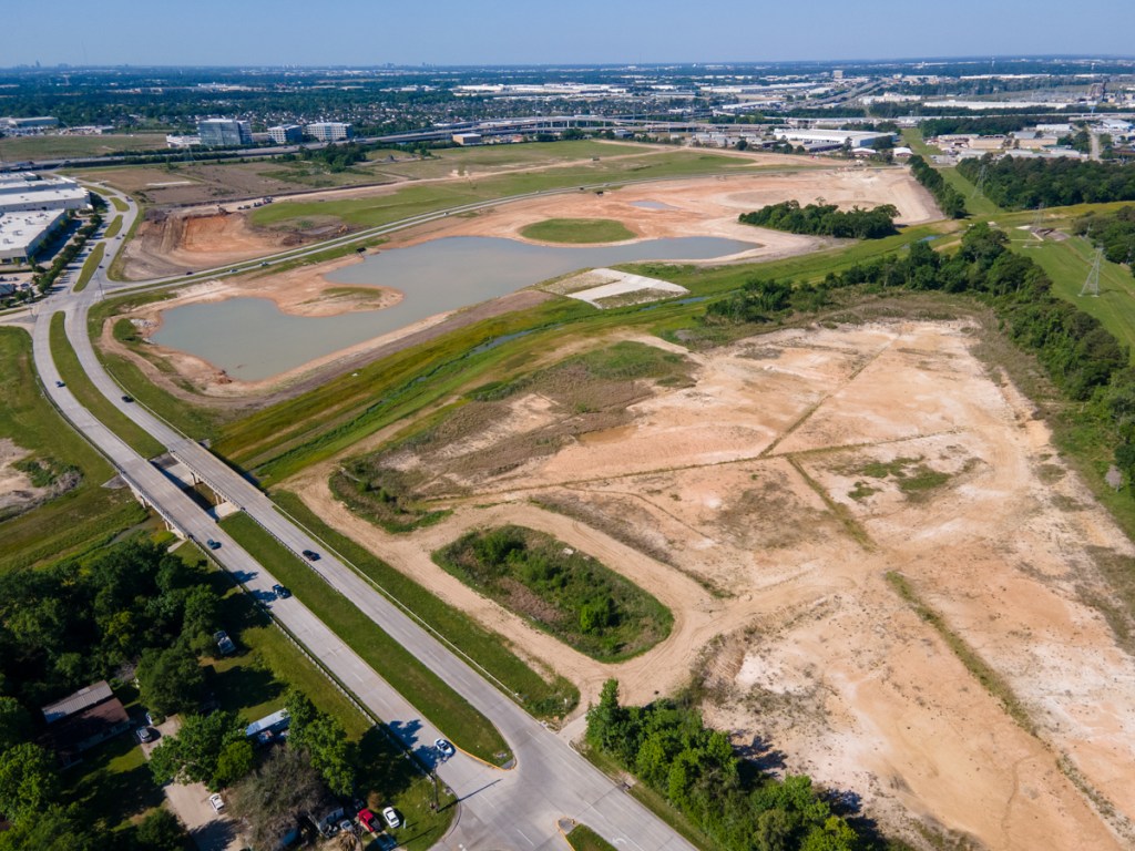
Residents still believe they received “nothing,” but I photographed eight large detention ponds recently completed or under construction. Four are right next to US 59.

Halls has the highest percentage of LMI residents (71%) in Harris County.

HCFCD construction is on-going in this watershed.

Sims Bayou:

Sims Bayou runs through the southern part of the county. It:

  • Ranks as the 8th largest watershed.
  • Received the 6th most funding since 2000 ($165,013,368)
  • Has the 7th largest population (310,537)
  • Has the 5th highest population density (3755 per sq. mi.)
  • Had the 6th most damage (18,122 structures)

Sounds proportional and it is. 

However, these calculations do not include $254 million, which the U.S. Army Corps of Engineers spent on Sims between 1990 and 2015 (by itself) for a major flood-reduction project. The Corps’ contribution to Sims Bayou alone was almost 10% of all HCFCD spending since 2000 ($2.68 billion).

If you add the Federal contribution to HCFCD’s funding, Sims would have ranked second on the list of flood-mitigation dollars received since 2000. Only Brays received more.

Sims has the third highest percentage of LMI residents (65%).

Hunting Bayou

Hunting Bayou is one of the county’s smaller watersheds. It comprises 31 square miles or 1.7% of the county’s land mass. That ranks it as the 19th largest bayou out of 23. And it has the 14th largest population (78,213). Yet, since 2000, it has:

  • Had the seventh most damage (15,728 structures)
  • Received the third most dollars per capita since 2000 ($952.18)
  • Received the fourth most dollars per square mile ($2,402,908)

Hunting Bayou has the second highest percentage of LMI residents (69%).

HCFCD construction is on-going in this watershed.

White Oak

White Oak Bayou is the sixth largest watershed in Harris County. Yet it received 13% of the flood-mitigation funding since 2000 – $349 million, the second highest total of any watershed. It also ranked second in dollars received per square mile – $3.14 million.

But also consider that it had the third highest number of damaged structures – 24,989 in Allison, Tax Day, Memorial Day and Harvey floods combined.

51% of the residents in White Oak qualify as low-to-moderate income. 

HCFCD construction is on-going in this watershed.

Damage-to-Dollar Rankings

“Damaged structures” and funding received had the highest correlation of any relationship I tested. For math majors, the coefficient was .86. That’s high. A perfect correlation would be 1.0. For the less technically inclined, see the table below.

Contrary to the “rich-watersheds-get-all-the-money” narrative, flood-mitigation funding, data shows that HCFCD is putting the most money in the hardest hit watersheds.Dollars flow to damage.

Many projects in these lower income watersheds are still under construction or preparing for it. And major storms have not yet tested many recently constructed improvements. Regardless, their residents are safer than they otherwise would be. And they can take some comfort in knowing that the system is working for them, not against them. 

For more information, see: 

Posted by Bob Rehak, based on information compiled from a FOIA request and Federal Briefings

1394 days since Harvey 

*Omits Vince Bayou in low-income group because it is entirely within the City of Pasadena, which has responsibility for it. Includes White Oak Bayou instead. Also omits Little Cypress, which has a very small population and is an experiment by HCFCD in preventing future flooding.

The thoughts expressed in this post represent opinions on matters of public concern and safety. They are protected by the First Amendment of the US Constitution and the Anti-SLAPP Statute of the Great State of Texas.

Three More Major Projects on Greens Bayou Completed Recently by HCFCD, Army Corps

Tuesday, I posted about three Harris County Flood Control District (HCFCD) floodwater-detention projects in construction on Greens Bayou. But HCFCD and the Army Corps recently completed three more. All three in the latter category started in 2015 – before the flood bond.

Magnitude of Recent Mitigation Investment on Greens

Looking at all six (in construction + recently completed) helps one understand the magnitude of investment in this watershed during the last six years.

The combined cost of all six projects totals more than $222 million.

HCFCD.org

The map below shows the locations of the recently completed projects in black; those still in construction are red. This post will focus on #4, #5 and #6 below.

#4, #5 and #6 represent three projects started in 2015 and recently completed.

#4: Greens Bayou Federal Flood Risk Management Project

The Greens Bayou Federal Flood Risk Management Project, also known as the Antoine Stormwater Detention Basin, lies just east of the Cutten Basin, discussed Tuesday. The U.S. Army Corps of Engineers Galveston District (Corps) and Harris County Flood Control District broke ground in 2015. Phase I cost $58 million. Phase II cost $21.4 million. And channel improvements cost $5.7.

Location of stormwater basin shown in yellow. Cutten basin is to left. Orange brackets show scope of channel improvements.

Phase I included approximately 3.7 miles of channel conveyance improvements from Cutten Road to Veterans Memorial Drive and approximately 108 acres of stormwater detention storage near the intersection of Antoine Drive and Beltway 8.

Phase II construction began in late 2016. It included completion of the north cell of the basin, located north of West Greens Road and excavation of the south cell, which is located south of West Greens Road.

From Google Earth Pro. Most recent satellite image is from 2/11/2019. For more recent construction shots, see below.

The Corps designed and built the project. It also planted trees, shrubs, and grasses on disturbed areas. These features will improve stormwater quality, support wildlife and provide opportunities for recreational benefits.

West Greens Drive bisects the Antoine basin, dividing it into two parts. However, box culverts connect them and they function as a single detention pond. The completed basin holds approximately 1,650 acre-feet, or 538 million gallons of stormwater. To put that in perspective, it holds a foot of rain falling over a 2.5 square mile area, or half a foot falling across 5 square miles!

Looking SW at the Antoine Stormwater Basin on Greens Bayou. Greens Drive bisects the project. Beltway 8 North is in background. Greens Bayou flows diagonally through the frame from right to left. Photographed on 4/22/2021

As part of a cost sharing arrangement, the Flood Control District purchased the 138-acre detention basin site. HCFCD also acquired other property and easements, and relocated utilities. The District will maintain the basin and channel in perpetuity.

#5: Kuykendahl Stormwater Detention Basin

Kuykendahl Stormwater Detention Basin sits on a 288-acre property near Kuykendahl Road and Ella Boulevard along an unnamed tributary of Greens Bayou.

The Kuykendahl Basin is the top purple area.

Contractors removed 3.61 million cubic yards of soil from the site. It holds 2,325 acre-feet, or 757.6 million gallons of stormwater. That’s a foot of rain falling across 3.6 square miles, or half a foot falling across 7.2.

2019 satellite image from Google Earth Pro of Kuykendahl Basin still under construction.

Following construction, contractors planted 22.19 acres of native tree and shrubs, and 12.79 acres of stormwater quality-treatment wetlands. They also created 14.04 acres of other wetlands to replace those impacted by construction.

What the Kuykendahl Basin looks like today, complete with picnic area.

Native, woody, riparian vegetation stabilizes banks, shades water, and creates habitat for birds.

FEMA awarded $39.2 million to the Harris County Flood Control District, under the Hurricane Ike Hazard Mitigation Grant Program (HMGP), for construction of this and another stormwater detention basin (see #6 below). The Flood Control District contributed matching funds for both projects. 

Ceres Environmental Services Inc. constructed the two basins for $63.7 million. Combined, they were the largest construction contract ever managed by the Flood Control District up to that time. The two basins reduced or removed flooding risks and damages from more than 1,100 structures along Greens Bayou. “Avoided damage” exceeds $90 million in every flood. 

Both projects (#5 and #6) are part of Progress Greens, a suite of flood damage reduction projects in the Greens Bayou watershed. All projects under the Progress Greens umbrella will function together to reduce flooding risks and damages for residents and businesses within the 213 square miles of the Greens Bayou watershed.

#6: Glen Forest Stormwater Detention Basin

The Glen Forest Stormwater Detention Basin lies southeast of the Kuykendahl Basin on a 160-acre site east of Interstate 45 and slightly north of Beltway 8. See P500-08-00 in the map below.

The Glen Forest project is at the purple location on the right.

The Glen Forest Basin project removed approximately 2.15 million cubic yards of soil in three connected cells. The completed basin holds approximately 894 acre-feet, or 291.3 million gallons of stormwater. That’s 1.4 square miles one foot deep or 2.8 square miles a half foot deep.

2019 satellite image from Google Earth Pro of Glen Forest Detention Basin at Beltway 8 North and 45 while still under construction.

Basin design included 2.75 acres of native tree and shrub plantings and 0.81 acres of stormwater quality treatment wetlands. 

Natural-channel design features, such as those in #5 above, provide environmental and water-quality enhancement.

The finished project today. Looking WNW from Imperial Valley Drive and Greens Road toward I-45 in background.

Regulation Vs. Mitigation

Areas both up and downstream from these ponds have extremely high-density commercial, industrial and residential development. Drive up Kuykendahl or Imperial Valley, for instance, and you will find mile after mile of apartment complexes. There’s little room for water to soak in during rainstorms.

More sensible development regulations that mandated onsite detention ponds when this area was being built might have prevented a lot of flood damage and heartbreak. Mitigating flood issues is always far more expensive, difficult and time consuming than preventing them. And many times, mitigating them after the fact is not even possible because of the shortage of land.

Value of Coalitions and Cooperation

Projects like the three above don’t happen without the combined efforts of elected representatives at the county, city, state and federal levels, plus community groups such as the Greens Bayou Coalition (GBC).

According to Jill Boullion, former director of the GBC, “The GBC advocated for $55 million in USACE funding from 2009 to 2015 for the Antoine Basin (Project #4) alone. We made many trips to DC, Galveston and Dallas to meet with elected officials, US Army Corps, Office of Management and Budget, and others. The Obama administration finally approved the funding! That was my first advocacy project and, boy, did I learn a LOT!!!”

The moral of that story: never underestimate the value of coalitions and cooperation in moving these projects forward.

Posted by Bob Rehak on 4/22/21

1332 Days since Hurricane Harvey

Construction of HCFCD Greens Bayou Flood Mitigation Projects in High Gear

One of the largest watersheds in northern Harris County is Greens Bayou. It drains 212 square miles with a population of more than half a million people. It encompasses portions of the cities of Houston and Humble.

Greens Bayou and its tributaries have flooded homes and businesses numerous times in the last two decades. Tropical Storm Allison in 2001 and Hurricane Harvey in 2017 produced devastating floods thanks to large floodplains and high-density development.

An Equity Priority

As a result of high percentages of low-to-moderate income neighborhoods as you work your way east and south along the bayou, flooding in Greens received a high priority in the Harris County’s Equity Prioritization Framework.

Harris County Flood Control District currently has three projects in construction along Greens Bayou with more on the way. One of the three is virtually complete. When I photographed it today, I found contractors doing a final inspection. Here’s a rundown of current and future projects.

Greens Bayou runs roughly parallel with the North Belt before turning south and eventually joining Buffalo Bayou. Projects 1 and 3 are large scale detention projects under construction. Phase 1 of Project 2 is virtually complete.

Project #1: Cutten Stormwater Detention Basin

HCFCD is currently excavating a massive 235-acre stormwater detention basin near Cutten Road and State Highway 249. It will reduce flooding risks in the Greens Bayou watershed by taking in excess stormwater during heavy rain events and then releasing it slowly back to the bayou when the threat of flooding has passed.

Map of the Cutten Detention site courtesy of HCFCD.

The project is budgeted at $16.2 million. And it is approximately one-quarter complete. I took the pictures below on 4/20/21.

Looking SW at the Cutten Basin with the Beltway 8/SH249 intersection in the background. Greens Bayou flows diagonally from the upper right to lower left.
Tunnels under Greens Road will let water flow from the northern section to southern
Looking NE across Hollister Road toward another section of the basin that will connect to the rest via tunnels.
A relentless carousel of trucks carries away one layer of the basin after another.

Project #2: Aldine Westfield Stormwater Detention Basin

Further down the bayou, the Aldine Westfield Stormwater Detention Basin is located just north of Beltway 8 and east of Aldine Westfield Road. The first phase of this project is virtually complete. It sits in a no-fly zone for drones because of its proximity to Bush Intercontinental Airport. So you will have to make do with a ground-level construction photo stitched together in Photoshop from five separate exposures.

Looking SE at Phase One of the Aldine Westfield Basin. Contractors have just finished planting trees to stabilize the slopes. Phase Two has yet to start. It will be to north (left) of this basin.
Phase One has just completed. Phase Two is in permitting.

South and north segments are being constructed in two phases because of environmental permitting. Eventually, the two basin compartments will connect via a 48-inch pipe and will outfall into Greens Bayou.

The first phase above cost $7.7 million. The second will cost $11.3 million.

HCFCD

Because of the location just south of Bush Intercontinental Airport, this basin will not have a permanent pool. Reason: to avoid attracting waterfowl which could create a hazard to aviation.

The two basins will eventually hold approximately 1,250 acre-feet, or more than 407.3 million gallons, of stormwater that otherwise might flood homes and businesses during heavy rain events. The benefits of this project are best understood as part of a suite of projects – Progress Greens – that will work together to reduce flooding risks within the 213 square miles of the Greens Bayou watershed.

Part of Project Greens

Project Greens is a suite of flood damage reduction projects. The Harris County Flood Control District is taking the lead in some, with grant assistance from the Federal Emergency Management Agency (FEMA). In others, the U.S. Army Corps of Engineers will design and construct the project, with partnership assistance from the Flood Control District. 

All projects under the Progress Greens umbrella will function together to reduce flooding risks and damages for residents and businesses within the 213 square miles of the Greens Bayou watershed.

The Aldine Westfield Stormwater Detention Basin project is and will be funded both through the Flood Control District’s Capital Improvements Program and the 2018 Bond Program. If partnership funds are not available, the project will be funded totally from the 2018 Bond Program as a “Local Only” project.

Project #3: Lauder Stormwater Detention Basin

The Lauder Stormwater Detention basin is another 2-phase project. Phase One, just north of Lauder Road and west of JFK Boulevard, will cost $18 million when complete. Phase Two will cost another $20.5 million and be located west of Phase One in parts of the Castlewood subdivision which HCFCD has bought out. Harris County Commissioners Court accepted the Preliminary Engineering Report and authorized the design and construction of Phase Two of the stormwater detention basin.

The photos below show the status of Phase One.

When complete, the Lauder Stormwater Detention Basin will hold at least 1,200 acre-feet, or more than 391 million gallons of excess stormwater. According to HCFCD, the project will reduce risk in more common 10 percent (10-year) floods, but would be overwhelmed in a much larger storm.

While driving around this area, I noticed a new home ten-feet up on stilts, while older homes sat at ground level. Commercial and industrial development around Bush Intercontinental Airport has literally swamped this area. This Lauder Basin is also part of Progress Greens.

The photos below show the status of Phase One construction on 4/20/21.

Looking north from the construction entrance at Lauder Road.
Looking East at the Lauder Basin construction staging area.

The Lauder Stormwater Detention Basin project is being funded both through the Flood Control District’s Capital Improvements Program (for design) and through the 2018 Bond Program (for construction).

Total Cost for Greens Bayou Projects in Construction

Altogether, construction of these three projects will cost approximately $42 million. Phase Two of Aldine Westfield and Lauder basins will cost another $31.8 for a total of almost $74 million. Phase 2 of the Aldine Westfield construction will kick off this summer. And Phase 2 of the Lauder project will start next winter.

Posted by Bob Rehak on 4/29/2021

1330 Days since Hurricane Harvey