Save the Date: Kingwood Area Drainage Analysis

Harris County Flood Control District (HCFCD) will hold a Virtual Community-Engagement Meeting for the Kingwood Area Drainage Analysis project: 10/20 at 6:30 PM.

Study Purpose

The purpose: to inform residents about the status of the project and share findings to date.

The Kingwood Area Drainage Analysis focuses on “evaluating the existing drainage level of service for the 32.3-mile open channel network within the greater Kingwood area and identifying the drainage infrastructure which will improve the network’s level of service.” 

What That Means

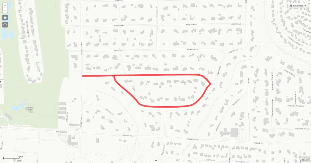
The San Jacinto River Master Drainage Study examined the major streams around Kingwood. But this study examined every stream and ditch within Kingwood. From Taylor Gully, Ben’s Branch and the Diversion Ditch on down to the smallest ones.

When originally constructed, engineers designed ditches to convey a 100-year rain without flooding homes or businesses. However, over time, many have filled in with sediment – often so gradually, the process is invisible. Such ditches may need cleaning out. See below.

Ditch between Valley Manor and Twin Grove where it goes under Kingwood Drive. Capacity dramatically reduced by sedimentation and vegetation. Photo courtesy of Chris Bloch.

Also, new upstream development, such as Woodridge Forest and Woodridge Village, may be contributing additional stormwater to ditches during heavy rains. So those ditches may need expansion.

Instead of being able to safely convey a 100-year rain, ditches now might only be able to convey, for example, a 25- or 50-year rain because of such factors.

“Identifying drainage infrastructure which will improve the network’s level of service” means “figuring out what it will take to make them safely convey a 100-year rain again.”

Partially Funded by Lake Houston Redevelopment Authority

The Flood Control District has entered an interlocal agreement with the Lake Houston Redevelopment Authority (TIRZ 10) to partially fund this drainage study. Bonds approved by Harris County voters on August 25, 2018, have funded the rest.

Public Participation Important

Community engagement is an important component of the Bond Program. You live here. You know where the problems are and how high water gets. Your participation is necessary to ensure your safety. Speak up now BEFORE HCFCD begins implementing the program.

If you know of a problem HCFCD is not addressing, you need to tell them.

The virtual Community-Engagement Meeting will be held on: 

  • Tuesday, October 20, 2020 
  • 6:30 p.m. to 7:30 p.m.
  • Join online at PublicInput.com/Kingwood
  • Or by phone at 855-925-2801 with Meeting Code: 9541

Meeting Format and Other Details

The meeting will begin with a brief presentation to share project updates, followed by a moderated Q&A session with Flood Control District team members. 

You can submit questions and comments throughout the presentation. Any comments not addressed during the Q&A session will receive a response after the event.

A recorded version of the meeting will be available on the Flood Control District’s website and YouTube channel after the event. 

Meeting accommodations can be made for those with disabilities. If needed, please contact 346-286-4152 at least 48 hours prior to the meeting.

The Kingwood Area Drainage Analysis Technical Report Executive Summary will be available online prior to the October 20, 2020, Community Engagement Meeting at www.hcfcd.org/F14.

For questions, please contact the Flood Control District at 346-286-4000, or fill out the comment form online at www.hcfcd.org/F14.

Posted by Bob Rehak on 10/7/2020

1135 Days after Hurricane Harvey

Woodridge Village Detention Ponds Pass Another Test

Back on June 25, 2020, the Woodridge Village detention ponds passed their first modest test when they retained a 2.32-inch rain that fell in a little more than an hour. The mostly excavated, but not-quite-finished ponds eroded badly, but no one in Elm Grove or North Kingwood Forest flooded. Then came Beta.

Design Capacity of Detention Ponds

LJA Engineering designed the Woodridge Village detention ponds to hold only a 12-inch rain in 24 hours. And the night before the storm, forecasters predicted Beta could drop 12 inches in the Lake Houston Area. Beta had already dumped 15-inches just a few miles south. All this created high anxiety. But in the end, the Lake Houston Area received less rain.

Elm Grove resident Jeff Miller measured just 5.5 inches in his rain gage – well within the theoretical design capacity of the detention ponds. But that was almost exactly the amount that flooded Elm Grove on May 7, 2019.

Ponds 40% Short of Atlas-14 Requirements

On top of that coincidence, other factors contributed to the anxiety felt by residents. LJA did not design the ponds to meet new Atlas-14 rainfall requirements; they’re 40% short. Nor did LJA acknowledge floodplains or wetlands on the property when they calculated detention requirements. All of these factors contributed to flooding Elm Grove last year and called LJA’s ethics into question.

So it was a welcome relief when the people of Elm Grove rolled out of bed Wednesday morning to find they didn’t flood.

How Well Did Ponds Perform?

Here’s what the ponds looked like after about five to six inches of rain. All photos were taken shortly after Beta’s rain stopped on Wednesday, 9/23/2020.

Looking north at N3 Detention Pond along eastern border of Woodridge Village where it joins the east-west portion of Taylor Gully. Note pond is a little less than half full, not surprising for a rain that was a little less than 50% of the design capacity.
Likewise, the massive N2 detention pond on the western border was less than half full.
Looking SE across the empty N1 pond on the western border. It had already drained into N2.

Two Failures in N3 Pond

However, there were two failures, both in the N3 pond. Neither was mission critical.

Water could not get into N3 without overflowing the edge of the pond, causing erosion. Stormwater seems to want to collect here. This same area eroded badly in a previous storm.
In a second place along N3, erosion blew out the entire western wall.

Overflow Spillway Apparently Not Used

The overflow spillway at the county line between the concrete lined channel and the S2 detention pond was apparently not needed during Beta. There were no signs of erosion (see below) that were present after previous floods.

Rain was spread out enough that it appears water from Taylor Gully and N3 stayed in the concrete-lined channel rather than using the emergency overflow spillway that leads back into the S2 detention pond (right) and the twin culverts.

Nevertheless, despite recently planting grass along the banks of the ponds, Perry Homes still has a significant erosion problem. Note the color of the water in Taylor Gully at the top of the image above. The company is redepositing silt in the ditch, which HCFCD just cleaned out.

Living Under the Threat of Bad Planning

A big test of these ponds will be a 12-inch rain. If the ponds can successfully detain that much rain without flooding Elm Grove, we will know they at least function as planned…despite their 40% shortfall in capacity.

But the ultimate test will be when we get a larger rain. LJA Engineering and Perry Homes did NOT design them for that.

Unless Harris County and the City can piece together a deal to buy this property and build more detention, residents could flood again. The real disaster scenario here could be the purchase deal falling through. If Perry or some other builder develops this property, downstream residents will forever live under the threat of that 40% shortfall.

Posted by Bob Rehak on 9/24/2020 with thanks to Jeff Miller

1122 Days since Hurricane Harvey and 371 since Imelda

The thoughts expressed in this post represent opinions on matters of public concern and safety. They are protected by the First Amendment of the US Constitution and the Anti-SLAPP Statute of the Great State of Texas.

Beta Feeder Band Could Dump 1-2″ Per Hour; Street Flooding Possible

Feeder Band Approaching from South

RadarScope image as of 2PM 9/21/2020

Jeff Lindner, Harris County Meteorologist noted at 1:35 PM that a feeder band of heavy rainfall from Tropical Storm Beta is moving from northern Brazoria and northern Galveston Counties into southern Harris and Fort Bend Counties.

Lindner says that “rainfall amounts of 1-2 inches per hour will be possible under this band for the next 1-2 hours. This may lead to street flooding in typical areas of poor drainage.” Rates above 2 inches per hour will generally flood streets.

According to Space City Weather, currently, it looks like these storms may produce 2 to 3 inches of rain total as they slowly progress northward, so they could impact the afternoon and evening commute home.

Beta Weakening As It Approaches Landfall

The center of Beta is nearing landfall on the TX coast near Matagorda Island with 45mph winds.

At its 1 p.m. update, the National Hurricane Center said the storm weakened this morning. Sustained winds dropped from 50 to 45 mph. The storm’s central pressure also rose from 996 to 999 mb, another sign of weakening. Welcome signs!

Heavy Rainfall From Training Feeder Bands Will Continue

Heavy rainfall threat in bands to the east and northeast of the center will continue into tonight and Tuesday. “This threat will not subside until the center of the circulation is east of the area on Wednesday,” says Lindner.

Lindner further expects “No significant changes to the rainfall totals. Amounts of 4-8 inches are most likely with isolated higher amounts. But these higher totals will likely be strongly correlated to training feeder bands.”

Posted by Bob Rehak on 1/21/2020 based on data from the National Hurricane Center, Space City Weather and Jeff Lindner, Harris County Meteorologist.

1119 Days after Hurricane Harvey and 368 after Imelda

Harris County Commissioners Approve Negotiation of Earnest Money Contract for Woodridge Village

Harris County Commissioners Court just approved a motion authorizing negotiation of an earnest money contract with Figure Four Partners, Ltd. (Item 14G on today’s agenda). The contract will lock in the purchase price of 267.35 acres in Montgomery County for the Woodridge Village stormwater detention basin. The amount: $14,019,316 – $5,100,770 below the appraised value.

However, this is not yet a decision to purchase the property.

Conditions Must Still Be Met Before Purchase

The City of Houston still must meet certain conditions and commitments before the actual purchase comes up for a vote. Within 120 days, the City must:

  • Enter into an inter-local agreement with the County to purchase the property.
  • Contribute half the purchase price in cash or land
  • Agree to share equally in the cost of development and maintenance
  • Adopt Atlas 14 and update fill mitigation requirements at least as stringent as the County’s.

Ellis Tried to Add More Conditions

In at least five previous meetings, Precinct One Commissioner Rodney Ellis successfully delayed the vote by adding new conditions to the motion.

True to form, he tried again today. He wanted to use the purchase as leverage to get the City to adopt his “equity” guidelines. Those guidelines rank flood bond projects in his district above those in others.

Harris County Precinct One Commissioner Rodney Ellis

Garcia Also Wanted to Add New Condition

Precinct 2 Commissioner Adrian Garcia also wanted to add a new condition. He wanted to get the City to give Harris County Flood Control District (HCFCD) a place on the City’s planning commission. At this point in the meeting, it looked like the motion could die again.

However, Houston Mayor Pro Tem DAVE MARTIN assured Precinct 2 Commissioner Adrian Garcia that he would fight to get HCFCD a place on the Planning Commission. Garcia then decided to vote for the motion. Earlier this month, the two jointly requested the Planning Commission to consider higher flood mitigation standards in their planning decisions.

How Vote Went Down

Garcia emphasized that he didn’t like the Woodridge Village motion per se, but that he trusted Martin to get the County a seat on the planning commission. Thus, he would vote for the Woodridge earnest money proposal.

Veteran observers of Commissioners Court say this was the first time Ellis, Hidalgo and Garcia contemplated splitting their vote. Previously, they have always voted as a block.

Commissioners Jack Cagle and Steve Radack had already voted for the motion. When Garcia flipped, Ellis and Judge Lina Hidalgo read the handwriting on the wall. They also voted for the Woodridge earnest money contract at that point. The final vote: 5-0.

What Comes Next

At this point, final language of the Inter-Local Agreement with the City must be hammered out in the next 120 days. The City must also agree to the conditions listed above by:

  • Identifying land worth half the purchase price
  • Contributing assets or cash equal to half the purchase and development costs
  • Updating certain regulations affecting flood plain development

It also seems to me that the County must develop plans for Woodridge so that it can estimate costs and how much the City will have to contribute.

Finally, Perry Homes and its subsidiary, Figure Four Partners, must agree to all the conditions and sign the earnest money contract.

There is still a long road ahead for this deal. But today was a great step forward. At least we’re on the road now, thanks in large part to Commissioner Jack Cagle and Houston Mayor Pro Tem Dave Martin who refused to let this deal die.

Posted by Bob Rehak on 9/15/2020

1113 Days after Hurricane Harvey and 362 since Imelda

City Making Good Progress on Forest Cove Ditch Rehabilitation Project

In late July, the City of Houston’s Stormwater Action Team began a ditch rehabilitation project in Forest Cove. The City predicted the project would take until November 24, weather permitting.

Forest Cove Ditch Rehab project location.

The project area includes Cypress Lane and Palmetto Lane. The map above shows the project limits highlighted in red. 

Scope of Work

The scope of work for the ditch rehabilitation project includes: 

  • Regrading and re-establishing of the roadside ditches
  • Replacing of the culverts and resetting them to match the flow line of the ditch
  • Replacing the driveway where the culverts are replaced
  • Increasing the capacity of any culverts less than 24 inches in diameter
  • Removing any unpermitted culverts or other encroachments in the City Right of Way. 

Project Approximately on Schedule

I drove by the project earlier in the week and it appeared that the City had completed approximately a quarter to a third of the project in about a quarter of the time. That means they are on schedule or slightly ahead.

Ditch rehab already completed in Forest Cove

From the looks of things, it appears the City is doing exactly what it promised.

For More Information

For more information, please contact Mayor Pro Tem Dave Martin’s office at (832) 393-3008 or via email at districte@houstontx.gov.

Posted by Bob Rehak on 9/10/2020

1108 Days after Hurricane Harvey

Living With Flooding

“Living with Flooding” by Jim Blackburn, J.D., answers many of the questions ordinary people have about flooding in Harris County. For instance:

  • What are the different causes of flooding?
  • What should I look for when buying a home?
  • How much of the county is really in a flood zone?
  • Do I need flood insurance?
  • How high should my home be above street level?
  • Am I in a floodplain?
  • Are floodplain maps accurate?
  • How far inland can storm surge from a hurricane spread?
  • How high should I elevate a house if I am in a coastal zone?
  • Why did I flood if I’m nowhere near a stream?
  • Who is responsible for fixing flood problems?
  • Whom should I call if I need help?
  • And more. Much more.

School districts throughout Harris County should make this required reading before graduation from high-school.

“This document should be considered as a beginning—an attempt to put in one place the type of information that will help Houston and Houstonians come out of the next flood in reasonably good shape,” says Blackburn.

About Jim Blackburn

Blackburn is Professor in the Practice of Environmental Law, Department of Civil and Environmental Engineering, Rice University. He is also Co-director of Rice’s Severe Storm Prediction, Education and Evacuation from Disaster (SSPEED) Center and a Faculty Scholar at the Baker Institute.

Minor parts of the document are dated now; Blackburn wrote it just months after Hurricane Harvey. For instance, it lists several officials who lost elections in 2018. But, by and large, he offers durable advice.

Learning to Live with Flooding

The premise behind Blackburn’s primer: we can never fully control flooding, so we need to learn to live with it. In that spirit, he offers 32 pages of practical advice.

A Vision for the Future

In addition to addressing the questions above, Blackburn lists several high-level, necessities for living with flooding.

Flood Smart Citizens Who Participate

“…we need to have an informed, flood-literate, and engaged populace. We get the government that we demand.” And “If we don’t demand and fight for a high-quality flood management, we will not get it.”

Make Room For Bayous and Creeks

“We have built too close to most of the area’s bayous and creeks.” “If water is given more space, we will discover, much like the Dutch, that we can co-exist with the water. But we should always respect it.”

Flood-literate Politicians

“We need politicians that are flood-literate, who can think for themselves about these issues.” Flooding is one of the greatest threats to “public health, life, and economic prosperity in this area.”

Focus on Those Who Are Here Now

“Our leaders must focus on those who live here now rather than those who are coming.” “Our attention should be on fixing the problems of existing, developed areas.” Not building the Grand Parkway to assist new development.

Transparency

“Nothing is more important going forward than transparency in our flood control efforts and thinking.”

It’s hard to argue with any of these recommendations. Just a week before the third anniversary of Harvey, the greater Houston area still grapples with many of these issues.

  • Developers encroaching on floodways and floodplains.
  • Politicians who see lax regulation and enforcement of flood regulations as a tool to compete for new development.
  • The Grand Parkway expansion, arcing like an arrow across flood-prone farmland – with no vision for how to handle the runoff it could bring from hundreds of thousands of acres of new development.
  • Politicians diverting money from where voters intended it to go.

If we had another Harvey next week, scholars like Blackburn would write post-mortems that look very much like Living with Flooding. Except the intro would start with “We told you so.”

Posted by Bob Rehak on 08/18/2020 with thanks to Jim Blackburn and the Baker Institute

1085 Days since Hurricane Harvey

Living with Flooding Copyright © 2017 by the James A. Baker III Institute for Public Policy of Rice University.

San Jacinto River Watershed Virtual Meeting Tonight Will Unveil Specific Recommendations to Reduce Flooding

I can’t urge you enough to watch the San Jacinto Watershed Master Drainage Plan Meeting tonight at 6:30.

Flooded Street by Julie Yandell. During Harvey.
Flooded Street during Harvey. Photo by Julie Yandell.

Updating of River Models Leads to New Insights

I previewed the presentation this morning and was extremely impressed. The study partners have updated or created hydraulic and hydrologic models for 535 miles of major streams in the river basin. They’ve also integrated the models and accounted for new developments across 3000 square miles in seven counties.

As a result, we now have a much better understanding of:

  • Where water comes from
  • Which areas have the highest potential for flooding
  • Where large regional detention basins can be placed to reduce flooding.
  • Other strategies to reduce flooding.

New Flood Maps, Sedimentation, Better Warning Systems

You don’t want to hear about this stuff second hand. The presentation also includes discussions of:

  • How much flood plains have really expanded compared to current FEMA maps.
  • Sedimentation and strategies to reduce it
  • Improving flood warning systems

If you’re flooded, or are concerned that you might, don’t miss this. This study will be the cornerstone of grants applications to mitigate flooding in the region.

Cornerstone of Lake Houston Area Mitigation Efforts

Two years ago, before the flood bond vote, community opinion coalesced around a three-part solution to flooding in the Lake Houston Area.

  • Reduce/delay the input by increasing upstream detention
  • Increase the throughput by dredging blockages
  • Speed up the output with additional gates on the Lake Houston Dam.

Tonight, you will get a chance ask questions of the people who have been studying those options and others for 18 months. Here’s how to log in:

Thursday, August 13, 2020

6:30 p.m. to 7:30 p.m. 

Join online at PublicInput.com/SanJacMasterPlan

Or by phone at 855-925-2801 with Meeting Code: 9742 

Order the pizza now.

This study is a cooperative venture of FEMA, Harris County Flood Control, SJRA, City of Houston and Montgomery County.

Posted by Bob Rehak on August 13, 2020

1080 Days after Hurricane Harvey

The Remarkable Restoration of River Grove Park After Harvey

Yesterday, Dee Price, Kingwood Service Association (KSA) President, gave a presentation about the restoration of River Grove Park after Hurricane Harvey to the Lake Houston Chamber’s BizCom meeting.

The storm deposited so much sand in this park, there were times when I doubted it could be restored. The park’s comeback is a remarkable tribute to a handful of dedicated volunteers and contractors (led by Dee Price and Bruce Casto), with big assists from the people of Kingwood, the Army Corps of Engineers and Kayden Industries.

Here are the slides and text from Price’s presentation to the BizCom meeting. The presentation also includes information about KSA, which newcomers may find helpful.


Dee Price BizCom Presentation on River Grove Park

Good Morning. I’m going to spend a few minutes talking about the recovery of Kingwood’s River Grove Park from the impact of Hurricane Harvey. But first let me give you a brief overview of the Kingwood Service Association aka KSA.

KSA is a Texas non-profit corporation that was chartered in September 1976 by the Kingwood developer. Its stated purpose is to provide for community, civic, and social welfare in the Kingwood area and to promote the health, safety, and welfare of the Kingwood area residents.

Carrying out this purpose has evolved over the years as Kingwood became part of the City of Houston.

Representing 32 community and commercial associations throughout Kingwood, KSA has continued to be a focal point in working community-wide issues that impact multiple villages in Kingwood.

KSA owns, operates, and maintains the five major parks in Kingwood. It also maintains the two major entries into Kingwood at Kingwood Drive and North Park Drive. KSA actually owns the entrance area on Kingwood Drive on which the ponds are located.

Like many areas in Kingwood, River Grove Park was heavily impacted by Hurricane Harvey. A huge amount of sand was deposited in the park. In addition, many of the park facilities suffered a significant amount of damage. The pictures on the slide above illustrate the amount of damage suffered.

It took a significant amount of effort to recover from the damage caused by the hurricane. First, we had to remove 364 truckloads of sand. We had to drill a new well, pressure wash all of the park facilities, and repair the damage to the facilities. We also had to restore the sports fields closest to the river that had been inundated by sand deposits.

The final step of dredging the portion of the river along the park’s perimeter had to be put on hold until the US Army Corps of Engineers completed their project to dredge the San Jacinto River. The Corps removed the big sand bar formed during Harvey that was blocking access to the river from River Grove Park. This was a big help to KSA and very much appreciated.

Once the Corps was finished with their dredging project, KSA was able to proceed on its project to dredge the area along its boardwalk and boat ramp. The picture shows that a large amount of sand was deposited in the area by Harvey.

Since the dredging had been put on hold for 3 years, vegetation took hold on the sand and had to be removed before the dredging itself could begin.

Once the vegetation was removed the removal of the sand could proceed. Ultimately, the project removed 10,000 cubic yards of sand, dewatered the sand on-site using a dewatering machine, and then hauled off the sand to an approved location.

The project took 3 months to complete including working during the early stages of the Covid-19 pandemic. The boat ramp, which was closed in 2017 after Hurricane Harvey, was re-opened in April 2020 and has been heavily used since that time.

The last slide is a picture of the park after the first stage of recovery had been completed and the park was re-opened in March 2018. That concludes my discussion. Thank you very much.


The spirit and tenacity of volunteers in Kingwood are one of the things that make this such a great place to live.

Posted by Bob Rehak on 8/7/2020 with thanks to Dee Price, KSA, the KSA Parks Committee, Bruce Casto, Kayden Industries, the Army Corps of Engineers and people of Kingwood

1074 Days since Hurricane Harvey

West Fork Mouth Bar Getting Snack Sized

Mechanical dredging is slowly but surely downsizing the San Jacinto West Fork Mouth Bar. It’s still about a billion times larger than a snack-sized McDonald’s Oreo McFlurry, but it’s a vast improvement over what it was. It now appears to be about one third of its size in January when most people would have called it super sized.

A Sisyphean Task

Snack-sized puns aside, the job is a Sisyphean task. For those not familiar with the term, Sisyphus was a figure from Greek mythology who angered Zeus. Zeus sentenced him to rolling a boulder up a hill for the rest of eternity only for it to roll back down again every time he got near the top.

Historians and storytellers see many morals in the tale. Be persistent. Work hard. Never give up.

And so it is with those three lonely excavators working on giant sand bar at the mouth of the West Fork where it meets Lake Houston.

Day in and day out, they remove one bucketful at a time. Six months after they started, much of the above-water portion of the sand bar has now been removed. But they still haven’t started to address the matter of cutting a channel that connects the dredged portion of the river with the lake.

Meanwhile, more sand and silt comes down river with every storm.

Comparing Post-Harvey with Recent Photos

Still, if you compare post-Harvey photos with photos taken recently, you can see progress.

Dredgers are slowly reducing the dam behind the dam.

Looking south toward FM1960 in 2017.
Looking south today. Little length has been removed, but the width is about a third of what it was after Harvey. Photo taken 6/16/2020.

The dredgers keep nibbling the south edge of the bar, taking row after row of sand, much like eating an ear of corn.

Looking west, upstream, from eastern end. Photo 7/5/2020.
Western tip of bar is now only a little wider than the tracks of one excavator. 7/5/2020.
Looking east at sunrise on 7/5/2020. Note FM1960 bridge in the extreme upper right.

In the next few months, they may run out of room to maneuver on the bar.

Survey Boat Spotted on Lake Last Week

Residents recently reported seeing a survey boat out on Lake Houston. That’s a good sign. It says that the City, County and State are now looking at what should come next with the $30 million that State Rep. Dan Huberty got the legislature to commit last year as an amendment to SB500. Harris County Flood Control also committed $10 million to dredging in the 2018 flood bond fund.

The City is currently funding the mechanical dredging with $6 million left over FEMA disaster recovery funds. Those should be running out soon if they haven’t already.

To my knowledge, no one has yet addressed the issue of long-term maintenance dredging, although everyone acknowledges the need for it. That river just keeps on bringing sediment.

Posted by Bob Rehak on 7/6/2020

1042 Days after Hurricane Harvey

Perry Detention Ponds Pass First Modest Test, But Eroded Badly

The official rain gage at West Lake Houston Parkway and the West Fork San Jacinto recorded 2.32 inches of rain between 7 and 9 a.m. this morning. That was officially a 1-year rain. (See Atlas-14 chart below.) As rains go, it was not a severe test; it was more like a pop quiz.

After the rain subsided, Taylor Gully in Elm Grove was less than half full.

The good news: Taylor Gully was well within its banks and no one in Elm Grove or North Kingwood Forest flooded. The bad news: Perry’s detention ponds experienced severe erosion, enough to warrant repairs and perhaps delay the schedule.

The even worse news: Harris County’s meteorologist, Jeff Lindner predicts another one to two inches of rain tonight with isolated totals of three to four.

West Lake Houston Pkwy. Gage Showed 2.32 Inches In 2 Hours

24 hour rain totals for WLHP gage showed bulk fell in 2 hours.

2.32 inches in two hours qualifies as a one-year rain according to the new Atlas-14 rainfall precipitation frequency estimates. Even if you considered the entire 3.12 inches in 24 hours, it would still only be a one year rain.

Atlas 14 Precipitation Frequency Table for the Kingwood Area.

Aerial Images Show How Perry Detention Ponds Performed

These aerial images taken shortly after noon today when the rain stopped show that:

  • The detention ponds are starting to do their work and hold back water.
  • That kept the level in Taylor Gully manageable
  • The overflow spillway between S2 and the concrete-lined channel was apparently not needed.

However, the images also show that:

  • Portions of the detention pond walls severely eroded and appear to have collapsed in places.
  • The water in the N1 pond overcame temporary dirt barricades sending water and silt down to N2.
  • The newly excavated N2 was entirely covered with water for the first time. It also received a significant amount of erosion.
  • N3 merges with Taylor Gully to form one large detention pond that holds water all the way from the northern end of the pond to the county line.
  • Rain has halted construction for the last two days and could delay it into next week.
Expanded, giant N2 detention pond was covered entirely with water for first time. Looking West toward western border of Woodridge Village.
However, erosion re-deposited large amounts of soil within the pond. Looking North along Western Border of Woodridge Village.
Rainwater entering the site from Joseph street in Porter (center left) shows by comparison how much silt the Perry water held. Looking north along western border of Woodridge Village.
Still looking north, but farther up western border, you can see silt slumping into ditch.
Looking SE toward Elm Grove and North Kingwood Forest from the NW corner of site. Water coming in N1 pond from left exited right, down the western border. Water washed out a temporary dirt barrier that appeared designed to hold water in the pond.
Looking east. Note erosion from former utility corridor on left that has turned into a new drainage ditch along northern edge of property.
Looking at western wall of N3 which runs along eastern border of Woodridge Village.
Another portion of the western wall of N3 shows severe erosion.
Standing water from rest of property is slowly making its way into detention ponds.
Looking South along eastern border toward Taylor Gully. At present, N3 (bottom left) simply merges with the concrete channel by S2 (top right). It appears to have nothing to control the outflow.
Looking north along eastern border. Silt fences prove inadequate at stopping erosion. In fact, most of site has no silt fences.

More Rain Likely Tonight

Jeff Lindner, Harris County meteorologist, says that today’s wet pattern should remain in place through the weekend, contrary to earlier predictions that saw rain chances ending by Friday.

Storms currently in the Gulf near Corpus Christi are tracking toward Houston late tonight and Friday morning. They will probably not be as severe as this morning’s storms. With that said…the air mass remains tropical over the region and excessive rainfall rates of 2-3 inches per hour will be possible, warns Lindner.

As of 6 p.m. Thursday, the National Weather Service decided NOT to issue another flash flood watch for tonight, but stay alert to see if a more significant threat may develop.

Expect rainfall amounts of generally 1-2 inches tonight with isolated totals of 3-4 inches.

To Get Up-to-the-Minute Forecasts and Stream Alerts

You can always find up to the minute weather forecasts at this National Weather Service page.

To check on rising rivers and major streams, visit the Harris County Flood Warning System, and click on channels and channel status simultaneously. To see further upstream, click on All Gages. That will show you the status of gages operated by the SJRA in Montgomery County.

Posted by Bob Rehak on 6/25/2020

1031 Days since Hurricane Harvey and 280 since Imelda

The thoughts expressed in this post represent opinions on matters of public concern and safety. They are protected by the First Amendment of the US Constitution and the Anti-SLAPP Statute of the Great State of Texas.