What Happens When Flood Maps Don’t Illustrate True Risk

3/25/25 – Almost eight years after Hurricane Harvey and a massive region-wide effort to update flood maps, FEMA still features maps on its website based on decades-old data that don’t come close to showing true flood risk. The old maps cause confusion among homebuyers who may not understand their limitations. And that helps developers pursue and profit from risky ventures in floodplains.

Three-Year Delay for New Maps and Still Counting

FEMA has yet to release maps based on recent Atlas-14 data developed after Hurricane Harvey. Harris County Flood Control District (HCFCD) anticipated release of FEMA’s new preliminary maps three years ago and release of the final maps by now. See the timeline below published in 2020.

Source: Screen Capture from Harris County Flood Control District MAAPnext site in 2020.

I requested the release date for the new maps from Harris County and Federal officials. However, they did not respond.

Delays Contribute to Confusion about Safety of New Developments

The delays have contributed to confusion about the safety of new developments near or in floodplains.

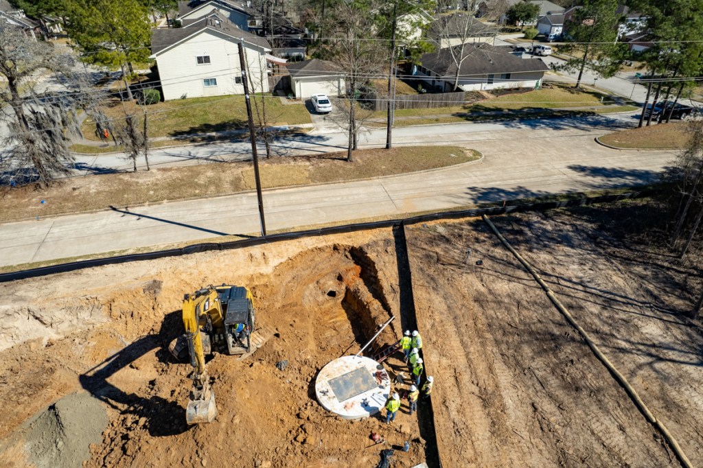
Take, for instance, the lawsuit between the City of Houston and one of the area’s largest developers. According to a Texas Supreme Court decision released last Friday, the Signorelli Companies want to develop more than 500 lots near the San Jacinto East Fork as part of The Commons of Lake Houston.

Plats show most of the lots outside the current 100-year floodplain. But floodplains will reportedly expand by 50-100% when the new flood maps come out. At that point, most if not all the lots will likely be deep in the floodplain.

So, the City imposed higher elevation requirements for homes in anticipation of the new flood maps. That triggered a property-rights lawsuit by the developer, which claimed the City’s requirements made the property “undevelopable.”

Sometimes We Just Never Learn

Sometimes, it feels as if we just never learn. I understand a company’s desire to make money from its land. But unsuspecting homebuyers could lose their life savings. Worse, more people could die.

Flood insurance is becoming unaffordable for many. Insurance companies are fleeing high-risk areas.

And we haven’t even mentioned yet the costs of flood mitigation, disaster relief, buyouts, and restoration of the natural ecosystems – that already protect people for free.

In my opinion, for the public good, some land just shouldn’t be built on.

The Commons of Lake Houston Proposal

The flood map for the Commons area on the East Fork was last updated in 2007. It is based on data acquired after Tropical Storm Allison in 2001. New Atlas 14 rainfall data is 30-40% higher than previous estimates and represents the current best efforts of scientists.

The map below shows the extent of those 100- and 500-year floodplains in 2007 maps as dotted lines superimposed over a proposed new section of the Commons called the Crossing.

Close up of plat. Floodway is to left of heavy dotted line. 100-year and 500-year floodplains are shown as lighter dotted lines farther right.

Two Pictures Worth 2,000 Woods

These two pictures, sent to me by a nearby resident of an existing home on higher ground in the Commons, illustrate the problem.

First image shows extent of the Harvey flood. Second shows Signorelli’s proposed development. High water mark during Harvey identified as Position 1.

Think such a flood can’t happen again in your lifetime? That Harvey was a thousand-year storm?

It almost happened again in May 2024 during a no-name storm a month before the start of hurricane season. The screen capture below shows historical HCFCD data from a gage just upstream from the Commons. Note the last three entries.

Historical flood heights from Harris County Flood Warning System Gage at East Fork and SH99.

That no-name storm produced flooding almost five feet higher than Imelda and only about four feet lower than Harvey. It was the second highest flood at that location since HCFCD started keeping records!

Will We Repeat Mistakes of the Past?

The thing about floodplains is that they keep growing with upstream development – especially as other developers push into wetlands near rivers and streams. And the area upstream from the Commons is growing very quickly.

At some point (like now), it may make more sense to donate this land to an organization such as the Bayou Land Conservancy, Houston Parks, or Texas Parks and Wildlife. That would offer the developer some tax benefits. That could also help protect the public, protect lenders, help hold down insurance rates, provide recreation, and reduce future mitigation costs. It would even likely add value to homes on higher ground.

Posted by Bob Rehak based on 3/25/25

2765 Days since Hurricane Harvey

The thoughts expressed in this post represent opinions on matters of public concern and safety. They are protected by the First Amendment of the US Constitution and the Anti-SLAPP Statute of the Great State of Texas.

New Flood Warning System in Bryan Will Save Lives

The Texas Water Development Board (TWDB) has released a story about a new flood warning system in Bryan that will save lives and protect property. TWDB helped fund the system, which reportedly cost a fraction of most hardscape projects.

The system consists of sensors on bridges that are linked to flashing lights. They warn motorists when water has topped the bridge.

Screen capture from TWDB Video of new Bryan system.

The system reduces the lag time between when water goes over a road and authorities can block it off.

How Most Flood Related Deaths Happen

“That’s very important because most flood-related deaths occur because of people trying to drive or walk through flood water of an unknown depth. A lot of times it’s moving very fast. And so it’s very important to alert people as fast as we can,” said Sam Vernon, Assistant City Engineer for the City of Bryan.

Flashing Beacons Save Lives

Jacob Torres, a Civil Engineer with Torres & Associates, said, “We’re trying to minimize that delay to essentially zero. Folks that are traveling within proximity to a crossing that’s about to flood are going to be informed through visual, automated flashing beacons that are going to instruct them and guide them to turn around, don’t drown.

Jeff Walker, Executive Director of the TWDB added, “These kinds of projects are not that expensive as opposed to hardscape and, you know, big capital projects. But they save lives.” Walker also said, “Texas leads the nation in deaths from drownings from low water crossings.”

To see the full TWDB video, click here.

Could Benefit Harris County

While Harris County has a sophisticated Flood Warning System, that is the envy of most other areas, it does not include flashing warning lights near flood hot spots. It consists of hundreds of bridge-mounted gages. The Harris County system warns people over the internet when floodwaters will overtake bridges and roads and neighborhoods. However, during Harvey, most communication systems were knocked out.

I have a friend on the Harris County Community Resilience Flood Task Force who lost five family members during Harvey. Floodwaters swept them off a bridge over Greens Bayou as they were trying to evacuate.

A system like Bryan’s could be a valuable addition to Harris County’s Flood Warning System. Most of the gage infrastructure and electronic communications are already in place. We just need to link them to the flashing lights so panicky people fleeing a flood don’t make fatal miscalculations.

Posted by Bob Rehak on 3/14/24

2389 Days since Hurricane Harvey

ASFPM Catalogs, Explains Flood-Mitigation Strategies: A Review

The Association of State Flood Plain Managers has an excellent, educational website called FloodRiskReduction.org. In a few pages, it explains floodplains, sources of flooding and how to understand flood risk. It also breaks down 39 flood-mitigation strategies for property owners, buyers, renters, community associations, officials, representatives, and others.

Part of the site’s magic is a search feature that helps readers zero in on strategies that might help them. It lets users filter strategies by factors such as cost, effort required, maintenance, type of real estate, foundation type, condition of structure and more. The strategies cover everything from DIY projects to those that require professionals.

Finally, the site comes with a list of resources to help implement the strategies.

Organized for Action

I love the organization of this site. Everything about it is designed to help people take action to protect themselves and their property.

“Flood risk is not static. It changes constantly due to development, erosion, land use changes, subsidence of the land, changes in rainfall patterns, sea level rise, and other factors.”

FloodRiskReduction.org

Focused on Mitigating Effects, Not Causes

Whereas ReduceFlooding.com gives concrete examples of how such factors interact in a small area so we can mitigate the causes, FloodRiskReduction.org skips to mitigating their effects.

It focuses mainly on telling people how to protect themselves and their property from rising floodwaters. In that sense, it’s a fundamentally different, but complimentary approach.

Wide Range of Strategies

The strategies range from home elevation to waterproofing, building relocation, grading and more. Much more. There’s even a section on demolishing a structure and rebuilding it outside of the floodplain and harm’s way.

Not for the faint of heart. Home of man who elevated his home by himself to get it above neighborhood flooding.

My favorite, however, is “Flood-free site selection.” It talks about identifying flood hazards and their frequency as part of the home buying and/or homebuilding process. It focuses on avoidance as a form of mitigation.

Each of the strategies comes with a series of concrete steps you can take to reduce your flood risk.

For instance, “flood-free site selection” includes discussions of how to:

  • Review FEMA flood maps
  • Review nearby flood-protection structures such as dams
  • Examine historical records
  • Seek advice from local experts, such as floodplain managers.

Compare Options for Exploration

As you might expect from the photo above of a man who elevated his home by himself using a series of car jacks, ASFPM’s site comes with a long list of cautions and disclaimers.

Regardless, FloodRiskReduction can help educate people about their options in an afternoon. It’s a quick, simple list of thought-starters and a great way to compare options to explore.

For ease of future reference, I will post a link to the ASFPM site in the links page of ReduceFlooding.com.

Posted by Bob Rehak on 2/12/24

2358 Days since Hurricane Harvey

Gulf Disturbance Could Increase Fire Danger

(11AM 8/20/23 and updated at 7PM) Here’s something you don’t often see – a tropical disturbance that could increase fire danger more than flood risk.

The 8am 7-day tropical outlook from the National Hurricane Center shows that Tropical Storm Emily has formed in the Atlantic. Separately, a disturbance lingering over the Bahamas has finally crossed over Florida and moved into the Gulf. However, the latter storm will likely miss Houston as it veers south into the lower Texas Coast and northern Mexico. That means…

8AM update on Aug 20, 2023 from NHC

Twelve hours later, another tropical storm formed in the Atlantic – Franklin. And NHC increased the chances for formation for the two orange disturbances to 70%.

8PM update on Aug 20, 2023 from NHC

High winds from the storm combined with the lack of rain and dry vegetation could actually increase fire danger north of I-10.

Jeff Lindner, Harris County Meteorologist

Rainfall Chances for North Houston Area Slight

Unfortunately, the still unnamed Gulf disturbance will likely bring little rain to the Houston area. The 72-hour cumulative prediction from the National Weather Service shows about a quarter inch of rain south of I-10 and a tenth of an inch north of it.

As of Sunday morning, the disturbance is centered south of the Florida panhandle.

That big clear area over the southern plains and Texas is the high pressure system that has dominated our weather for the last month. It forms a barrier that will likely block the lower pressure system in the Gulf from moving north toward Houston.

High Winds, but Little Chance of Flooding

Jeff Lindner, Harris County meteorologist predicts that tropical moisture will begin to arrive along the Texas coast on Monday with offshore scattered activity increasing through the day.”

Lindner believes that I-10 will be a good dividing line between higher coastal rain chances and lower inland chances late Monday into Tuesday.

Said Lindner, “There will likely be a strong south to north rainfall gradient over the region … with rain chances in the 50-60% range near the coast, 30-40% along I-10, and generally less than 30% north of I-10. 

Lindner expects wind gusts up to 30 knots on Monday and Tuesday as the storm passes. He also predicts that seas will build 5-9 feet for most offshore waters. He also predicts that tides will be elevated late Monday into Tuesday, but he doesn’t expect them to reach critical thresholds or cause any issues along the coast or in the inland bays.

Inland winds will increase Monday into the 15-20 mph range with higher gusts. Ironically, the biggest threat from this storm may be fire.

Lindner predicts that the high winds inland along with low humidity and critically dry vegetation will support an enhanced fire danger for those areas along and north of I-10. “Fires could quickly spread in these conditions,” warns Lindner.

Red Flag Warnings

At 2:39 PM, Lindner announced that red flag warnings had been issued for most counties in SE Texas including Harris, Montgomery and Liberty.

Potentially dangerous fire weather conditions will exist on Monday as the tropical system approaches. It will increase the pressure gradient across much of SE TX. Humidity values will decrease through Monday and reach below 30% during the afternoon and early evening hours.

Fuels loads are critically dry over the region, said Lindner. “Small fire will grow rapidly. Fires continue to exhibit aggressive behavior in pine areas and winds on Monday.Ccanopy crown runs will make containment lines challenging.

Fire conditions have deteriorated to those similar to August and September 2011 when several large devastating fires occurred over portions of SE and central Texas.   

Extreme Drought Conditions Persist

In fact, the U.S. Drought Monitor shows that the Lake Houston Area is in Extreme Drought.

What have temperatures and rainfall been compared to the 30-year average?

Temperatures so far this year have been consistently above the average for the last thirty years (green line compared to yellow line). Rainfall (blue and red bars) has been both above and below average. April and May were both above average. But June, July and August have been far below.

According to the Harris County Flood Warning System, the West Fork San Jacinto gage at US59 last received rain on July 23rd – four one-hundredths of an inch!

Obviously, this is not the time for outdoor burning! In fact, the Texas A&M Forest Service shows that most Texas counties currently have burn bans.

Posted by Bob Rehak on 8/20/2023

2182 Days since Hurricane Harvey

Houston Updating Hazard Mitigation, Emergency Plans

The City of Houston’s Office of Emergency Management is updating its Hazard Mitigation Plan and Comprehensive Emergency Management Plan. Hazard mitigation is about lessening the severity of future disasters. Emergency Management is about responding to disasters after they happen.

Hazard Mitigation Plan Still Needs Input

Public meetings for the Hazard Mitigation Plan Updates are complete, but you can still take an online survey through February 20.

The Hazard Mitigation Plan guides actions the City will take to reduce risk and impacts from disasters over the next five years and beyond. It also allows Houston to receive funding from the Federal Emergency Management Agency (FEMA) to reduce our community’s vulnerability to disasters.

The City’s goal is to prevent damage before it occurs, save lives, protect property, and limit the cost of recovery throughout Houston. The Hazard Mitigation Plan is important for our City to be safe and resilient.

Please take the survey. It will help the City understand our area’s priorities when mitigating hazards such as flooding. The online survey takes about only about five minutes to complete.

The Office of Emergency Management will release the draft plan in March 2023. The public comment period will extend through April. Then FEMA and the Texas Division of Emergency Management will review and approve it before the City Council adopts it. The plan should carry us through 2028.

Comprehensive Emergency Management Plan Meeting, Survey

The purpose of the Comprehensive Emergency Management Plan (CEMP) is to help prepare for, respond to, and recover from disasters.

The CEMP helps the City provide services and support to residents before and after a disaster occurs.

One public meeting remains on February 23rd at 6PM. It will be at the CDC building at 3517 Irvington Boulevard, Houston, TX 77009. You can also attend virtually via FaceBook Live.

So help the City better prepare for disasters. The community meeting will provide a forum both to raise awareness and collect feedback from the community. Topics discussed during the meeting will include:

  • Emergency plan development
  • Mitigation actions resulting from a flood or hurricane
  • Evacuation routes, hubs and processes
  • How to stay involved and become better prepared.

For more information visit https://www.houstonoem.org/pages/plans-programs or call 713-884-4500.

While visiting the OEM website, make sure to sign up for emergency alerts. I did so after Harvey and have found the alerts very helpful on numerous occasions since then, including floods, tornados, hail- and windstorms.

Points to Emphasize

Two of my greatest concerns are evacuation routes and floodplain development. During Harvey, we saw how water came up quickly in the middle of the night without warning. This cut people off from emergency escape routes. All three major evacuation routes out of Kingwood (Hamblen, Kingwood Drive, and Northpark Drive) were impassable to many people.

Evacuation Route during Harvey
Hamblen Road during Harvey. Photo courtesy of Jim Balcom.
Harvey evacuation. Sally Geiss
Kingwood Drive and West Lake Houston Parkway during Harvey. Photo courtesy of Sally Geis.

Posted by Bob Rehak on 2/15/2023

1996 Days since Hurricane Harvey

Clean Sweep for Royal Pines

Developers of the new Royal Pines subdivision at the north end of West Lake Houston Parkway have made a clean sweep. They appear to have finished clearing and grubbing more than 200 acres. See the pictures below taken on 9/17/22.

Looking east toward the Triple-PG mine in the background. The current terminus of West Lake Houston Parkway is in upper right.
Clearing began in April. Still looking east. Country Colony is in upper right.
Piles of dead trees being turned into mulch. Looking S toward West Lake Houston Parkway, top center.
Looking W. Not a tree left standing on where homes will be built. Nor a tree left standing between Royal Pines and Country Colony on left.

Trees As “Nuisance”

For most developers, including this one, trees are a nuisance. You have to work around them. They make it difficult to work the earth. And they often die later because of compaction of their roots by heavy machinery. Also, for smaller lots, there may not be enough room to leave trees and build a home at the same time.

But wholesale destruction like this can also contribute to flooding. We saw that a half mile southwest of Royal Pines at Woodridge Village when contractors cleared almost 700 acres before installing stormwater detention basins.

But beyond flood risk, marketing suffers. Marketers often try to build awareness by building a mystique around brands. Their goal: turn buyers into brand ambassadors. By preserving trees, Kingwood turned tens of thousands of families into brand ambassadors.

Missing Magic

It’s the most effective form of advertising possible. But Royal Pines won’t have it. Let me retell a true story that dramatizes the principle.

I’ll never forget one Christmas Eve when our kids were young. At dusk, snow started falling gently. I called the family together to witness the magic moment as Christmas music played in the background.

As we huddled at the front door, two deer strolled in front of us. You should have seen the kids’ eyes light up. They wanted to know which of Santa’s deer they were. It was our best Christmas ever.

You can’t buy publicity like that. More than 30 years later, I still tell that story.

Sadly, the kids who live in Royal Pines will likely never know a magic moment like that.

Oh, someone will eventually buy each home … even the ones in the flood plain. But the developer won’t have word-of-mouth advertising like I and my neighbors gave the original Friendswood Development Company. They won’t have tens of thousands of happy customers bragging about their community. Instead they’ll have a name that likely triggers a cynical comment as potential buyers enter the subdivision for the first time.

Impact of Clearcutting on Runoff, Water Quality

Clearcutting does more than drive wildlife away. It also increases runoff and reduces water quality. To see a simple experiment that dramatizes the impact, check out this 90-second video.

Progression of Clearcutting to Date

Also see the progression of clearing at Royal Pines during the last six months in these related posts.

Posted by Bob Rehak on 9/17/2022

1845 Days since Hurricane Harvey

202.8 Acres of Royal Pines Gone. Was It Necessary?

Since April 2022, I’ve documented the ever-widening clearing of the new Royal Pines subdivision at the north end of West Lake Houston Parkway. See what the development looked like in:

At the end of August, it appeared as though the clearing was close to complete. Massive piles of dead trees remain to haul away. But the cleared area closely matches the general plan shown below.

Looking ENE across the new, barren Royal Pines subdivision
Looking SSE from NW corner of Royal Pines
Looking WNW across Country Colony and Royal Pines, the clearing in the background.
General Plan for Royal Pines. Click here for higher resolution version.

Why Developers Clearcut: Pragmatism, Profit, Affordable Product

All across the region we see this same scenario played out over and over again. Why?

Bloomberg points out, “Money, of course. For homebuilders, trees are a nuisance. To keep a tree alive while building on a lot, they have to keep heavy equipment far away so they don’t compact the soil above its roots. They also can’t push soil up around the trunk. Preserving trees means keeping the topography of the lot unchanged, which often doesn’t fit their plans.” 

Memphis Daily News interviewed the president of the local homebuilders association there. The article says that “a developer’s stance on clear-cutting trees often depends on landscape and lot sizes. It’s easier to save trees on larger lots because they allow more room to work.”

“If a developer goes in and he decides he’s going to do two-acre lots, trees are no issue and they’re going to stay,” said Tim Wilson, president of the Memphis Area Homebuilders Association’s executive board. “But if a builder decides the best use for a piece of property is 40-foot lots, then the trees are coming down, every single one of them. That’s because there is no room for a house and a tree on a 40-foot lot.”

Majority of Lots 40-42 Feet

Exploring the links below will show you the general plan and layouts for the first three sections of Royal Pines. Most of the lots are, in fact, 40 to 42 feet wide:

The rising costs of land, borrowing, and building materials are forcing developers to squeeze more homes into smaller spaces to keep the homes affordable. In the Preserve at Woodridge, the lots are even smaller: 13 to the acre instead of 4-6.

That increases impervious cover. Unless sufficient detention and retention basins slow the water down, accelerated runoff increases the time of concentration downstream. That builds faster, higher flood peaks.

Effect of Urbanization on Peak Stream Flows” by Dr. William Dupre, professor emeritus from the University of Houston.

Impact on Environment

Sciencing.com points out that clearcutting also has other environmental impacts. They include erosion, pollution and flooding. “

“The roots of trees hold moisture and keep soil in place, protecting it from washing away during wind and rain. This erosion can also lead to flooding in waterways. Because trees are no longer holding the soil in place, rain flushes the sediment into waterways. … That can impact the river’s ability to flow properly and cause flooding.”

White Oak Creek

All along White Oak Creek, new developments are springing up. At 242 and FM1314, Mavera wetlands have bitten the dust.

Farther east, White Oak runs through the massive Valley Ranch area and the new Amazon transportation facility at 59 and 99.

Then Royal Pines borders White Oak as you get to West Lake Houston Parkway.

Finally White Oak joins Caney Creek, the East Fork San Jacinto and Lake Houston. (See below.)

White Oak Creek Watershed from the Texas Watershed Viewer.

All this clearcutting has the potential to increase runoff, erosion and sedimentation that could require future dredging…at public expense.

Eventually, the ground cover and forest canopy will regrow. But what about in the meantime? Neighbors have been lucky so far unlike those in Elm Grove and North Kingwood Forest.

Posted by Bob Rehak on 9/5/22

1833 Days since Hurricane Harvey

Flood Watch Starting 7PM Tonight

Jeff Lindner, Harris County Meteorologist, has released another update on the approaching storm. Not much has changed since last night except that:

Here’s where things stand as of noon on Monday, 3/21/2022.

Severe Weather Risk from Tonight into Early Tuesday.

Gulf moisture quickly returned to the region overnight. Scattered light showers are moving quickly from south to north. An upper level storm system is approaching from West Texas with strong lift ahead of it. Conditions will favor strong to severe thunderstorms in our area by mid to late afternoon over the warm air mass.

All of north Houston falls into the “enhanced risk” area for severe weather tonight. Updated at mid-day.

All of north Houston falls into the “enhanced risk” area for severe weather tonight.

The National Weather Service does not assign a mathematical probability to the definition of Enhanced Risk, but note that it is the mid-point (3) on a 5-point scale.

Tornados may form, especially in any supercells that may form in this area. The Brazos Valley area will see the highest tornado threat, according to Lindner. But the National Weather Service Storm Prediction Center extends the area of 10% risk to the entire north and northeast Houston area. Large hail and damaging winds will also be possible with these storms.

The NWS Storm Prediction Center (SPC) gives a large part of Texas a 10% chance for tornadoes tonight. An even higher risk area is NW of Houston.

The SPC also gives a 30% chance of large hail and damaging winds to west, north and northeast Houston.

The worst large-hail probabilities are west of us, but our area still has a 30% probability.

Severe Threat Gives Way to Heavy Rainfall Threat During Night

According to Lindner, the severe threat will gradually transition to a heavy rainfall threat during the night as the pre-frontal trough slows over the Houston area. Formation of a line or two of training thunderstorms will be possible. Models point toward the US 59 corridor northeast of Houston and about 40 miles to the northwest as the most likely area of cell training.

The red area indicates a 40% chance of excessive rainfall. It includes areas from the northwest side of Houston east to roughly US59 and the Lake Houston Area. Updated 7:30am.

Lindner predicts rainfall amounts of 2-4 inches north of I-10 with isolated totals upwards of 6-7 inches. South of I-10, amounts of 1-2 inches look most likely. Given moisture levels, hourly rainfall rates of 2-3 inches per hour will be possible. Street flooding in urban areas is currently the greatest threat and the Tuesday morning commute may be impacted.

Runoff, River and Stream Report

While grounds are generally dry over the area, expected rainfall rates in short duration will generate rapid run-off. Rises on all creeks and bayous are expected tonight.

HCFCD modeled various contingency forecasts yesterday afternoon with different rainfall durations and amounts to see how area bayous and creeks would respond.

Most of the creeks and bayous will be able to handle 4-5 inches of rainfall in a 4-6 hour period or longer. Should parts of the area realize the higher isolated totals of 6-7 inches, there would likely be some concerns for channels reaching bankfull.

While uncertainty still exists on exactly where training lines will form, Lindner believes watersheds on the northern and northeastern sides of Harris County will be at greatest risk. He named:

  • Cedar Bayou
  • Luce Bayou
  • East and West Forks of the San Jacinto River
  • Cypress Creek
  • Spring Creek
  • Greens Bayou
  • Halls Bayou
  • Little Cypress Creek
  • Willow Creek

These watersheds will likely see some of the higher rainfall amounts and responses.

To view real-time stream levels and inundation reports, visit the Harris County Flood Warning System and click on a gage near you. Stay home tonight. Don’t roam. Let your fingers do the slogging.

Posted by Bob Rehak at 12:30 PM on 3/21/22

1665 Days since Hurricane Harvey

Laurel Springs RV Resort Construction Pushes Forward Despite Investigations

Despite investigations by local, county and state authorities into construction practices at the Laurel Springs RV Resort near Lakewood Cove, contractors seem to have stepped up the pace of construction. They’ve also launched a major cleanup effort around the detention pond. Contractors triggered a cease-and-desist letter from the County Attorney, with the threat of a lawsuit, after it became apparent the developer was emptying its stormwater into Harris County Precinct 4’s Edgewater Park contrary to permits and approved plans. Contractors also apparently cut down a wide swath of trees in the northern part of the park.

Photos Showing Construction Activity Since Last Friday

Looking west toward Sorters-McClellan Bridge over 59. Edgewater Park on left. RV Resort on right. Silt fence at the base of the pond corresponds to approximate southern boundary of RV Resort on survey. Taken 2/24/22.
Looking south along Laurel Springs Lane at freshly poured concrete at entrance. Taken 2/24. This afternoon (2/25), trucks were pouring more concrete.
Pipes being laid in northern part of RV Resort. Note water still ponding from rain in early January. Soil reports in the site’s stormwater pollution prevention plan claimed the soil was sandy loam which would have absorbed the rain by now.
Still no pipe from the corner of the detention pond leading to the pump housing in the round white concrete housing at top of frame. 2/23/22.

The detention pond was to have drained into the Lakewood Cove storm sewer system with the aid of pumps. But there’s no inlet yet at the pond.

Looking east toward Laurel Springs on 2/19/22.
Plans approved by City of Houston for pumping stormwater in detention pond into Lakewood Cove’s storm sewer system.
Contractors pulling up tree debris from below detention pond. 2/18/22. Looking SW.
Looking south toward Edgewater Park. Contractors initially piled the debris on the western (right) wall of detention pond, but ran out of room. They then started hauling it round to northern edge of pond where trucks are carting it away.

Investigations Still in Progress

Neither the County, City, nor Texas Commission on Environmental Quality would comment on the status of their investigations this week except to say that they are still ongoing. According to the Harris County District Clerk’s website, Harris County has not yet filed a lawsuit against the developer.

Overall, the developer appears to be cleaning up its act. But as you can see in the first shot, they seem to have made a significant and serious intrusion on Edgewater Park.

Posted by Bob Rehak on 2/25/22

1641 Days since Hurricane Harvey

The thoughts expressed in this post represent opinions on matters of public concern and safety. They are protected by the First Amendment of the US Constitution and the Anti-SLAPP Statute of the Great State of Texas.

RV Resort Getting Ready to Pour Concrete, Baffling Activity at Detention Pond

Construction activity at the Laurel Springs RV Resort near Lakewood Cove kicked into overdrive today as workers laid forms to prepare for concrete and more pipes went into the ground. Also, the detention pond seemed to change shape in ways that could reduce its capacity.

Getting Ready for Concrete

The shot below shows what will become the main entrance/exit opposite Mystic Glen Loop in Lakewood Cove.

Entrance/Exit to RV Resort. Concrete building pad for recreation center. The two rectangular areas in front of the three cargo containers will be the first RV pads. Blue pipes will carry fresh water.
Plans that correspond to the photo above.
Concrete forms also extend south toward the detention pond, out of sight at bottom of frame.

Baffling Work at Detention Pond

The work at the detention pond today was hard to explain. For the last few days, workers have pulled dirt and tree debris up onto the southwestern wall of the detention pond. Here’s how it looked yesterday around noon.

SW wall of RV Resort detention pond photographed on 2/17/2022.

Trucks have moved a portion of it to the western wall.

Looking east. Excavator loading debris onto truck which will back it around to the western wall (out of frame to the lower left). This and all photos below taken 2/18/22.
Truck transplanting debris on western wall.

The wide shot below shows where they have been piling it on the western wall and puts the activity in context.

Looking South toward Edgewater Park in background.
But it wasn’t all going to the western wall. Bulldozers spread some into the Laurel Springs RV Resort detention pond.
The area where contractors laid pipe between the pond (left) and ponding water (right).
Meanwhile, another bulldozer seemed to push dirt from the outside of the pond’s southern wall to the inside.
It appeared as though contractors were attempting to shift the entire wall to the north. If accurate, that could reduce the pond’s already constrained capacity.

Did the developer’s surveyors make a mistake initially? We shall know soon enough if the County conducts its own survey.

If that tree debris gets plowed into the pond wall, it could weaken the structural integrity of the pond as the woody material decays.

Reducing Pond Capacity?

I’m especially concerned about the potential loss of capacity in the detention pond. It already had only half the current capacity required to meet current City of Houston standards.

The further along construction gets, the harder it is to undo mistakes if they happen. So we need to monitor this closely.

Posted by Bob Rehak on 2/18/22

1634 Days since Hurricane Harvey

The thoughts expressed in this post represent opinions on matters of public concern and safety. They are protected by the First Amendment of the US Constitution and the Anti-SLAPP Statute of the Great State of Texas.