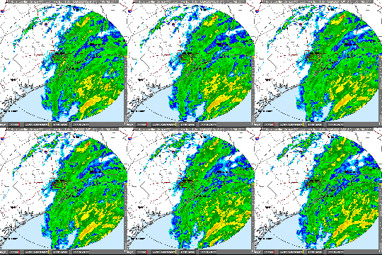
Beta Moving Ashore Today Then Likely Tracking Slightly South of Houston
As of 10:00 a.m. Monday morning, the National Hurricane Center (NHC) still shows the center of Tropical Storm Beta located offshore. The latest forecasts from the NHC predict that Beta will move onshore near Matagorda Bay, then move up the coastline toward League City.

The NHC also advises that the storm has picked up speed. Yesterday, they estimated 3 mph; today 7 mph.
No one seems to predict that the storm will intensify before landfall.
“Dry air continues to work into and wrap around the large wind field of Beta yielding the disorganized precipitation field with the system.”
Jeff Lindner, Harris County Meteorologist


Main Threat: Storm Surge
At this time, Beta’s main threat is to the coastline through storm surge. “Tides are currently running 4.0-4.5 feet in Clear Lake and across coastal sections of Harris County with several sites near the Gulf beaches running 4.0-4.5 feet. Coastal flooding is ongoing and will continue for much of the day. Several roadways are underwater along the coast and around Galveston Bay,” says Lindner.

Lindner continues, “As Beta makes landfall along the middle Texas coast later today, the storm will begin to slow and then turn ENE toward the upper TX coast. It will slowly weaken along the way. This track will keep onshore flow along the upper Texas coast tonight and Tuesday. Tides will remain high into the high tide tonight. Impacts along the coast will continue through the day and into tonight and likely Tuesday.”
Wind Forecast
The most likely arrival time of tropical storm force winds, if we get them, is later tonight.

Tropical storm force winds already cover a large part of the mid-Texas coast.

The storm will weaken as it moves toward the Houston Area and turn into a tropical depression. The further north you live from the coastline, the less intense winds will be.
Depending on where you live in Houston, you have a 30% to 100% chance of experiencing topical storm force winds. The Lake Houston Area is on the low end of that range. The National Weather Service predicts that the Lake Houston Area has a chance of seeing 39-57 mph winds. But Spaces City Weather advises that Beta is “not a significant wind threat.”
However, note that tropical-storm-force winds currently extend outward up to 175 miles (280 km) from the center of the storm.
Galveston has reported sustained winds of 39 mph and a gust of 43 mph during the past couple of hours.
Rainfall
Dry air has worked into the circulation of Beta, according to Lindner. “This has resulted in a more disorganized and scattered rainfall pattern. However, the system is still capable of heavy rainfall especially near the center later today and in bending structures east of the center for the next 48 hours.”
Models show several banding features developing during the next 48 hours over SE TX, But little consensus exists on where the heaviest rainfall totals may be.
Lindner advises that, “Given that much of the area will reside on the eastern side of a the tropical system, we should keep some level of concern of heavy rainfall and flooding in place through the next 48 hours.”
Lindner predicts that widespread rainfall amounts of 4-8 inches will be possible for areas along and south of I-10 with isolated totals of 10-12 inches under any training feeder bands. Totals to the north of I-10 will likely average 3-5 inches with isolated totals of 6-7 inches.
However, the NHC predicts slightly less rain. See the map below.

As long as the rainfall spreads out over the next 48 hours, most of the creeks and bayous can handle the expected rainfall amounts, Lindner says. But should any training develop, flash flooding would be possible.
Watches and Warnings in Effect
A Storm Surge Warning is in effect for Port Aransas, Texas to Rockefeller Wildlife Refuge, Louisiana. That includes Copano Bay, Aransas Bay, San Antonio Bay, Matagorda Bay, Galveston Bay, Sabine Lake, and Lake Calcasieu.
A Tropical Storm Warning is in effect for Port Aransas Texas to Morgan City Louisiana. That includes the Lake Houston Area.
National Hurricane Center
A TROPICAL STORM WARNING MEANS THAT TROPICAL STORM CONDITIONS ARE EXPECTED SOMEWHERE WITHIN THE WARNING AREA WITHIN 36 HOURS.
Lindner, the NHC and NWS all warn that tornadoes remain a threat with this storm. Especially, tonight and Tuesday.
Track
Yesterday, models predicted that Beta would track up US59 toward the Humble/Kingwood Area. However, today, forecasters think the storm will track closer to the coast. They put it on a line toward League City.
Wind shear will keep Beta’s track close to the coastline, but it will also affect the cyclone’s intensity along with land interaction. The closer the cyclone stays near the Gulf of Mexico, the more likely that bands of convection containing tropical-storm-force winds will continue to roll onshore the Texas coast through 36-48 hours.
Summary
Flash, urban, and isolated minor river flooding is possible, but the danger is “slight.”
National Hurricane Center
Net: Beta is still a threat. But it may be less of one than yesterday. That’s because of the dry air folding into the system and wind sheer which seem to be weakening it somewhat. Be hopeful, but cautious. Expect several inches of rain and high winds in the next two days with both tapering off Wednesday.
Posted by Bob Rehak on 9/21/2020 at noon based on data from NHC, NWS, Jeff Lindner, Space City Weather and Weather Live
1119 Days after Hurricane Harvey and 368 since Imelda


