Tag Archive for: sand mining

2023 Legislature Scorecard on Flood Issues: 2 Wins, 4 Losses, 1 Toss-up

The 2023 legislature scorecard, just five years after Hurricane Harvey, shows that flooding is fast becoming forgotten in Texas. Of the seven issues I tracked, the Lake Houston Area had two wins, four losses, and one that could be ruled a coin toss depending on your point of view.

In the Win Column

Let’s look at the good news first.

HB 1: More Floodgates for Lake Houston

Due to last minute heroics, HB 1 contained enough money earmarked for more gates to keep the project alive. A last minute phone-call campaign by hundreds of citizens making thousands of phone calls to key state legislators in the House and Senate succeeded in getting riders attached to the budget bill.

Few projects have inspired more hope among residents in the northeastern part of Harris County than the one to add more floodgates to the Lake Houston Dam. The Lake Houston Area Flood Task Force identified the project as one of the top priorities for the area.

The idea: to release water both earlier and faster in advance of major storms to create more storage in Lake Houston. Right now, Lake Conroe can release water 15 times faster than Lake Houston. And the release from Lake Conroe during Harvey was widely seen as one of the contributing factors to the flooding of so many homes and businesses in the Lake Houston Area.

The governor signed HB 1 on 6/18/23. It becomes effective on 9/1/23. With funding secured, Houston Mayor Pro Tem Dave Martin says final design on the gates is proceeding.

Lake Houston Gates Project
SB 1397: TCEQ Reforms

The TCEQ was under sunset review this year. No one proposed eliminating the TCEQ. But many people had ideas to improve it. They focused on two main areas: increasing transparency and improving enforcement.

The Sunset Commission recommended measures to improve public outreach, public notices, community input, and dissemination of public information, including the publication of best practices for sand mining.

The Commission also recommended updating the TCEQ’s enforcement practices to better focus on the riskiest actors and ensure staff treat potential violations consistently and based on severity. 

Breach in dike of Triple PG mine remained open for months, sending wastewater into Lake Houston. Texas Attorney General is now suing the mine.

The governor signed SB 1397 on 6/18/23. It becomes effective on 9/1/23.

In the Loss Column

SB 2431/HB 5338: Gulf Coast Resiliency District

These companion bills would have transformed the Harris County Flood Control District into the Gulf Coast Resiliency District. The new District would have been governed by a board appointed by the Governor instead of management hired by Harris County Commissioners.

The idea: to create regional solutions that benefitted all residents of Harris County, not just those that scored high on an equity formula.

The County fought the bill(s) tooth and nail. Each failed to get out of committee.

HB 1093: Financial Surety Guaranteeing Sand Mine Cleanup

The bill died in the House Natural Resources committee. It never even got a public hearing.

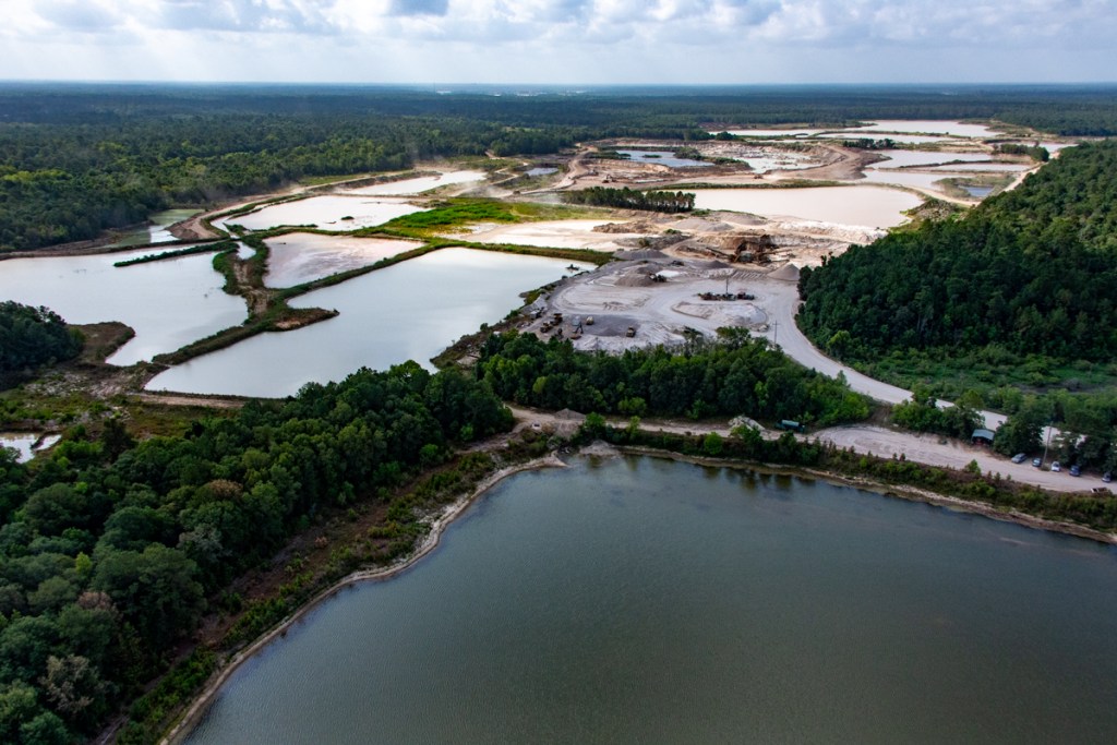
This bill would have required sand mining companies to post financial surety that would guarantee cleanup of mines before they were abandoned. Abandoned mines on both the San Jacinto East and West Forks are littered with the remains of once thriving operations. But when the sand played out, the miners walked away, leaving a legacy of blight for the public to clean up.

abandoned dredge
Abandoned dredge in mine on North Houston Ave. in Humble. Property is unfenced so kids can play on equipment.
HB5341: Lake Houston Dredging and Maintenance District

This bill also died in the House Natural Resources committee. House Bill 5341 would have created a Lake Houston Dredging and Maintenance District. Its purpose would be to remove sediment, debris, sand, and gravel  from Lake Houston and its tributaries to restore, maintain, and expand the Lake to mitigate storm flows. 

SB 1366: Flood Infrastructure Financing

This bill died in the Senate Finance committee. Senate Bill 1366 would have redirected surplus revenue from the economic stabilization fund to the Flood Infrastructure Fund. The State’s Flood Infrastructure Fund (FIF) has turned into one of the main sources of funding for Texas Water Development Board grants and one of the main ways that smaller counties and cities can fund flood projects. 

Passed but Failed
HB 1540: SJRA Reforms

HB 1540 passed. The bill implements reforms recommended by the Sunset Review Committee for the the San Jacinto River Authority. Many of those are good and needed reforms. They include provisions governing:

  • Gubernatorial designation of the presiding officer of SJRA’s board of directors;
  • Specific grounds for removal of a board member;
  • Board member training;
  • Separation of the board’s policy-making responsibilities and the staff’s managementresponsibilities;
  • Maintenance of complaint information; and
  • Public testimony at board meetings.

Approval should have been a rubber stamp. But at the last minute, Rep. Will Metcalf from Conroe offered an amendment that effectively fired Jace Houston, SJRA’s general manager and leader of the SJRA’s fight to reduce subsidence. The amended bill passed the Senate. Houston resigned effective 6/30/23. And now the Lone Star Groundwater Conservation District has no one to challenge unlimited groundwater pumping in Montgomery County.

Some in the Lake Houston Area who flooded during Harvey may rejoice at Houston’s departure. But differential subsidence is tilting Lake Houston upstream. It could make the Lake Houston Dam two feet higher relative to areas upstream near the county line. That could eliminate the safety margin above the floodplain for many homes in the next big flood.

subsidence in Harris County
Modeling shows 3 feet of subsidence near Harris/Montgomery county line, but only one foot at Lake Houston Dam.

As someone who had floodwater lapping at his foundation, I personally would put this one in the loss column.

The governor signed the bill on 6/18/23. It goes into effect on 9/1/2023.

Posted by Bob Rehak on 7/2/23

2133 Days since Hurricane Harvey

The thoughts expressed in this post represent opinions on matters of public concern and safety. They are protected by the First Amendment of the US Constitution and the Anti-SLAPP Statute of the Great State of Texas.

Cunningham Sponsors Bill to Ensure Restoration of Abandoned Sand Mines

Newly elected State Representative Charles Cunningham has introduced a bill aimed at restoring sand mines to productive use after operators cease production. Cunningham filed HB1093 in December and it was referred to the House Natural Resources Committee on 3/2/2023.

Aimed at Protecting Water Supply for 2 Million People

HB1093 amends Section 28A of the Texas Water Code. It applies to aggregate production operations (APOs) located within 1500 feet of the San Jacinto. It deals with the reclamation of such mines and ensure water-quality in the river(s) around them.

The goal is to reduce adverse water-quality impacts to the San Jacinto and Lake Houston which supply drinking water to more than 2 million people. Additional benefits will accrue to recreation, wildlife, and environmental safety.

Requirements in Bill

Before abandonment, the bill requires APOs to file a reclamation plan signed by a licensed engineer. Such a plan would typically include measures such as revegetation, erosion control, grading, soil stabilization, and backfilling. The plans must also address:

  • Removal of materials used in production, waste, structures, roads, equipment and railroads.
  • Slope stability for the walls of remaining detention ponds
  • Closure of waste disposal areas
  • Costs for all of the above
  • Financial assurance (such as a performance bond, typical in the construction industry) designed to enable cleanup without cost to taxpayers if the operator walks away from the site or declares bankruptcy.

While we need sand to make concrete, we need clean water even more.

Why We Need This Bill

Think these issues aren’t real? They’re all around us. See the pictures below taken recently.

Dredge at abandoned mine on North Houston Avenue in Humble.
More abandoned equipment at same mine.
Another abandoned sand mine in Humble. No grading of slopes or vegetation that retards erosion. Note commercial structures threatened by collapsing walls of pit.
Abandoned mine on East Fork in Liberty County should have had soil stabilized with vegetation.
Another shot from same mine. Old structures, materials not removed.
And another. There are no fences to keep children from playing on this abandoned dredge.
At the same mine on May 3, 2021. Note two breaches in dikes sweeping sand down the East Fork.
Excavator in abandoned mine on West Fork.
Collapsing dike of West Fork mine.
Abandoned mine (foreground) next to recreational facility on opposite side of West Fork at I-45.

Part of Sedimentation Problem

Lake Houston has lost 20,000 acre feet due to sedimentation and continues to lose on average 380 acre feet annually.

In the 1980s, only one or two small mines existed on the San Jacinto West Fork. Today, sand mines occupy more than 20 square miles in a 20 mile reach of the river between I-69 and I-45. And many empty their pits into the river.

An active mine empties one of its pits into the abandoned mine in the foreground which drains straight into the West Fork.

The montage below shows the effect of such issues on water quality where Spring and Cypress Creeks join the West Fork. The angles vary. But in each shot, the dirtier water comes from the West Fork. This is typical and easily visible on most days.

Water coming from area with mines typically appears siltier.

Cost of Dredging

To maintain the capacity of Lake Houston and the conveyance of its tributaries, the City of Houston and Army Corps have dredged almost continuously since Harvey. To date, they have removed almost 4 million cubic yards of sediment at a cost of $226 million.

From presentation by Stephen Costello, City of Houston Chief Recovery Officer.

The City needs even more money to continue the program and it’s all at your (taxpayers’) expense.

How You Can Help

You can bet that TACA (the Texas Aggregate and Concrete Association) will lobby against this bill. So show lawmakers it has your support.

Write to the Chairman of the Texas House Natural Resources Committee, Tracy O. King.

Also, submit public comments when the bill is going to be heard; I will let you know when that is. Here is the website to make Public Comments.

To learn more, consult the sand-mining page on ReduceFlooding.com.

Posted by Bob Rehak on 3/3/23

2012 Days since Hurricane Harvey

One of the Prettiest Places in Texas

When I first started exploring the forests north of Houston 40 years ago, I thought they were among the prettiest places in Texas.

The towering pines had a quiet beauty. They wrapped you in a blanket of solitude. Surrounded you with silence. Calmed the soul. Enabled a retreat from workday worries into a world of wonder.

Here, you could reconnect with the roots of life. Relax. Restore. Renew. Right outside your back door. I just had to live here! But a million other people had the same dream.

16 Lanes Later

The dream became so successful that we paved 16 lanes to it.

Looking North at I-69 and Kingwood from over the West Fork San Jacinto

The same thing happened along I-45. As one development after another sprang up, we found ourselves destroying what attracted us here.

The Pursuit of Loneliness

As I reflected on this, it reminded me of a book I read in 1970, The Pursuit of Loneliness by Phillip Slater. For thousands of years, Slater said, to be civilized meant to be citified. We love all the benefits of living in a city (such as jobs, shopping, medical care, and events), but we dream of a place in the country that lets us escape. So we buy some acreage, use up hours each day commuting. And wake up years later only to find that millions of us have collectively destroyed the very lifestyle we fought so hard to attain.

Changes We Ordinarily Can’t See

To see the changes we caused, you need to rise above the tree tops. Only from there can you comprehend how we have put our forests and rivers under a carving knife.

Here’s what I found from four hundred feet up as I flew last month from I-45 to I-69 down the San Jacinto West Fork in a helicopter – 20 square miles of sand mines in a 20 mile reach of the river – carved out of one of the prettiest places in Texas. Unfortunately, this isn’t the only such stretch of river like this in the region.

All that opaque blue water isn’t what you’d find on a Caribbean island. It’s likely loaded with chlorides or cyanobacteria.

Dreams Built on Sand

Ironically, it takes sand to make concrete. And it takes concrete to build 16 lanes to your dream home. It might be worth it when you live at the end of the road and they take the sand from someplace else. You can still enjoy the dream.

But when the 16 lanes go 20 miles beyond you, when someone tears up YOUR forest to get the sand, and destroys the beauty you built your dream around, it makes you wonder whether there is a better way.

Can we find the sand somewhere else? Can we define rules for mining that preserve our collective dream, perhaps by repurposing the mines after we have exhausted them? Can we give developers an incentive to preserve trees instead of clearcutting them? Hope springs eternal, as the poets say. Another legislative session starts in January. Stranger things have happened.

Posted by Bob Rehak on 8/10/22

1807 Days since Hurricane Harvey

The thoughts expressed in this post represent opinions on matters of public concern and safety. They are protected by the First Amendment of the US Constitution and the Anti-SLAPP Statute of the Great State of Texas.

The Hand of Sand Miners on the San Jacinto

The hand of sand miners weighs heavily on the San Jacinto watershed. Not all miners. But many.

While exploring the river basin by helicopter last week, the contrast between two scenes struck me: 1) The natural blanket of green in Lake Houston Wilderness Park. 2) Sand mines that lined the banks of the East and West Forks for miles.

The trees and natural wetlands inhibit floods. They slow floodwaters down, hold them back during heavy rains, and reduce erosion. The sand mines do not. They may provide some floodwater detention, but the pits are often filled to the brim and their dikes often break.

How you treat the land determines how it treats you. Especially during floods. This aerial photo essay shows how the San Jacinto River Basin used to look and how it looks today.

Lake Houston Wilderness Park

Peach and Caney Creeks border Lake Houston Wilderness Park on the west. The San Jacinto East Fork borders it on the east. The shot below represents the way the whole Lake Houston area used to be.

Looking across the 5000 acres of Lake Houston Wilderness Park – the largest urban nature park in America.

Compare That With These Shots

This first provides a direct comparison.

Sand mine on Caney Creek. Lake Houston Wilderness Park in upper right.

Below, note the difference in water levels between the creek and mine. No doubt, you also noticed a difference in water color. That bright blue/green in the mine water likely comes from high chloride levels.

Site of previous breach from mine into Caney Creek, the subject of a million-dollar lawsuit by the TCEQ and the Texas Attorney General.

More Mine Photos from West Fork

I’ll provide five more shots here, all from the West Fork San Jacinto. They represent more than 500 similar shots I took on 7/22/22.

No Swimming

When I see all this environmental degradation, my mind starts swimming – despite the scary water.

  • How much sediment gets swept downstream in floods?
  • Can this land ever return to productive use?
  • Do other cities allow mining in urban environments upstream from their water sources?
  • What effect does mining have on the water quality in Lake Houston?
  • What percentage of our water bills goes to cleaning up this water?
  • Why doesn’t Texas have performance bonds that ensure sand miners leave the land in habitable shape?

The sand makes concrete. It supports growth. But is all growth good?

  • Is growth in one area at the expense of public safety in another worthwhile?
  • Should we limit the concentration of mines in an area?
  • Why do mines expect the public to pay their cleanup and reclamation costs?
  • Is it safe to build mines below a dam that releases enough water during floods to break the mines’ dikes?
  • Are there no alternatives?

Cycle Continues

New Segment H of the Grand Parkway cutting east through forests will attract more subdivisions that require more sand for more concrete.

I encourage rebuttals from any mine owner who wishes to address these questions.

Posted by Bob Rehak on July 27, 2022

1793 Days since Hurricane Harvey

The thoughts expressed in this post represent opinions on matters of public concern and safety. They are protected by the First Amendment of the US Constitution and the Anti-SLAPP Statute of the Great State of Texas.

Bayou Land Conservancy Raises Concerns About SJRA Sand Trap Proposal

The Bayou Land Conservancy has added its voice to those raising concerns about the SJRA’s sand trap proposal for the San Jacinto River watershed. The pilot project began out of a desire to reduce sediment buildup in the mouth bar of the West Fork. But it has morphed into something very different – a trench through a sand bar more than 12 miles upstream.

In March 2022, the SJRA published its long-awaited proposal on sediment removal and sand trap development along with a brief summary. It now seeks public comment through April 29, 2022.

Location of recommended sediment trap outside Hallett mine
Sand bar on West Fork San Jacinto that would be used for pilot project outside Hallett mine. Note that the height of the freshly deposited sand is engulfing several medium sized trees. This location is downstream from several other large mines. Picture taken shortly after Harvey.

BLC’s General Concerns with Study

I posted my concerns on 3/27/22. Yesterday, the Bayou Land Conservancy (BLC) sent me a copy of its letter. It reflected some of the same concerns I had.

  • The study did not address what should be the main goal of sediment removal: excessive deposition in the area of the mouth bar downstream of US 59.
  • Managing mouth bar sediment deposition, and related flooding, should be kept at the forefront as this project moves forward.
  • Sand mining in the floodplain of the San Jacinto West Fork between 1995 and 2017 virtually quadrupled. More than 30% of the river’s flood plain is now being mined. That’s a huge problem that requires other types of solutions to reduce sedimentation from mines, such as improved Best Management Practices.

The group also suggested a need for greater oversight of sand mining by state regulators. It feels an inconsistency exists between in-stream mining via sand traps and the TCEQ’s newly adopted BMPs for sand mining.

BLC’s Specific Concerns re: Recommendation

BLC then went on to discuss the specific recommendation – rock-lined trenches through sand bars outside of sand mines. They listed three concerns:

  1. River migration and erosion: Changes in river course, including erosion and deposition of sediment, are naturally occurring processes. Installation of hardscape or mechanical features within the flowing part of the river will have an impact on this natural process and could lead to increased erosion in the area surrounding the facility, increased sediment transport downstream, and destabilization of the stream to the detriment of the surrounding and downstream communities.”
  2. Water quality: 85% of the drinking water needs of the Houston metropolitan region are met by Lake Houston, at the receiving end of the San Jacinto River. Instead of occasional turbidity increase during dredging of the mouth bar, sand trapping could create a long-term elevation in turbidity leading to increased water treatment costs for the entire region, transferring the cost to the public from private interests. Additionally, the riverbed contains chemical components that may need to be addressed in water treatment at additional public expense.”
  3. Accountability: the governing legislation created by HB1824 does not address the question of accountability should the private interest in the sediment trap fail to protect the public’s interest or go out of business without remediating the in-stream mining facility.”

More Study Recommended Before Implementation

BLC also recommended that two of the study’s recommendations deserve to be prioritized and expanded to provide as much accurate data as possible before sand-traps get further consideration:

  1. “Evaluate total annual sediment load transported to Lake Houston, including the area downstream of proposed sediment traps, and compare to anticipated trapped sediment loads.”
  2. “Perform further geomorphic assessment to address potential downstream instabilities due to removing sediment and to determine appropriate sediment removal volumes.”

BLC went on to encourage SJRA to extensively study the holistic sediment story of the upper San Jacinto River watershed. Previous studies point to Spring and Cypress Creeks as major contributors of sediment. BLC wants the sediment loads in those creeks studied as well as the areas downstream of the proposed sand traps.

The group continued, “A science-based, peer-reviewed, methodology of assessing the sediment budget of the watershed is imperative before assuming that removing sediment from any single location on the river will have a positive impact on mouth bar deposition. … Without a basis for understanding the sediment budget for the West Fork, it’s impossible to evaluate (or approve) this project.”

Rivers in Texas Are Public Property

BLC also pointed out that even though HB1824 exempted SJRA and Harris County Flood Control District from any requirement to obtain a permit, pay a fee, or purchase the material taken, in Texas the contents of a river belong to the citizens of the state. “Therefore we all have an interest in the results of this in-stream mining proposal,” said the group’s letter.

The letter concluded, “BLC recommends that extensive further study be undertaken to determine if in-stream mining, i.e. sand traps, will accomplish the stated goal of providing a long-term solution for managing the mouth bar deposition, without creating further instability to the river system and negative impacts to the surrounding and downstream communities.

Here is their full letter.

The Bayou Land Conservancy, one of the leading environmental groups in the Lake Houston watershed, preserves land along streams for flood control, clean water, and wildlife.

How Taking Sediment Out of a River Can Increase Erosion

Non-technical people may have trouble understanding how taking sediment out of a river can increase erosion. Basically, if you take too much out (more than the natural baseline of dissolved sediment), it can create a “hungry water” effect. Many academics have documented the hungry water effect. It’s especially noticeable downstream of dams, which are notorious for trapping sediment. Rivers with excess sediment transport capacity tend to erode their banks and streamed to compensate.

To Register Your Opinion

To register your opinions, pro or con, with the SJRA, email  floodmanagementdivision@sjra.net no later than April 29, 2022.

Posted by Bob Rehak on 4/9/2022 based on a Bayou Land Conservancy letter to SJRA

1684 Days since Hurricane Harvey

The thoughts expressed in this post represent opinions on matters of public concern and safety. They are protected by the First Amendment of the US Constitution and the Anti-SLAPP Statute of the Great State of Texas.

Price of Progress?

Some say that mining sand from our rivers and flood plains is the price of progress.

Looking west at part of Hallett Mine Complex bisected by the West Fork of San Jacinto. Photographed 1/1/22. The pond in the middle foreground is part of another abandoned mine adjacent to Hallett.

Pros and Cons

Sand has its benefits. We need it to make concrete. And we need concrete to accommodate a growing population. And a growing population creates income for builders, tradesmen and other businesses.

But mining sand also has several downsides. It alters the environment on a large scale. Wildlife lose habitat. Erosion increases. The sediment can contribute to flooding by forming dams and reducing conveyance downstream. Water quality also suffers. These are global problems.

Out of Sight. Out of Time. Out of Mind.

Sand mining mostly takes place in floodplains along rivers. Because our terrain offers no elevated viewpoints, the only way to see the mines is from the air. So for the vast majority of people, they’re out of sight, out of mind and, as a consequence, we’re out of time. More than 20 square miles of sand mines already border the San Jacinto West Fork between I-45 and I-69.

The Hallett mine complex in Porter and an adjacent abandoned mine now stretch 3 miles north to south and 2 miles east to west. And Hallett is just one of several such complexes on the West Fork.

New Best Management Practices recently adopted by the TCEQ for sand mining will help in the future. But much damage has already been done.

Where Do We Go From Here?

It’s time to start a conversation about the price of progress. How do we restore this land to another useful purpose in the long run? And who should pay for that?

Looking south from farther west at the end of the pond mentioned above. Note outfall to river, top left. Also note recent repairs to Hallett dike, bottom right.
Looking east across abandoned mine complex to left of river, which flows from bottom to top. New Northpark Woods subdivision is in upper left. Part of Hallett mine is on right.
Satellite photo from 2020 courtesy of Google Earth showing Hallett and adjacent abandoned mines.

The Long-Term Question

What do you do with an area this large when miners finish?

  • Do the ponds turn into recreational amenities and parks? (Not when left like those in the third photo!)
  • Who will plant grass and trees?
  • What do you do with the old equipment?
  • How do you turn these areas into detention ponds?
  • Who maintains them? (Montgomery County doesn’t even have a flood control district.)
  • What happens to bordering neighborhoods if rivers decide to reroute themselves through the pits?

Lots of questions. Little consensus.

When you start out to create a detention pond, it’s easy to plan recreation around it. But when the primary goal is mining, the end result can be dangerous, i.e., banks that cave in after miners walk away or kids playing on abandoned equipment.

Abandoned dredge at abandoned Humble mine on north Houston Avenue has been there since Harvey. Area is unfenced.
Rusting processing equipment left at same abandoned Humble mine near West Fork. This is between a driving range and a paintball park.

The new Best Management Practices do not require miners to post a performance bond that would ensure cleanup and conversion to a suitable post-mining use.

In some areas, city and county governments make arrangements with miners to take over abandoned mines. That seems like a decent idea to me. That may be the price of progress.

We need dialog on this issue – unless we’re willing to let private industry turn our rivers into eyesores.

Posted by Bob Rehak

1591 Days since Hurricane Harvey

The thoughts expressed in this post represent opinions on matters of public concern and safety. They are protected by the First Amendment of the US Constitution and the Anti-SLAPP Statute of the Great State of Texas.

Top Stories of 2021 in Review

Below are my personal picks for the top flood-mitigation stories of 2021.

The Fight for Funding

In 2019, Commissioners Court established “equity” guidelines that prioritized projects in Low-to-Moderate Income watersheds. Then this year:

Still no word from HUD on a possible direct allocation of $750 million. We may hear in January.

To help you follow this story, I make quarterly FOIA requests for Harris County Flood Control District spending and post the analyses on a dedicated funding page.

Sand-Mining Best Management Practices

Activists led by the Lake Houston Area Flood Prevention Initiative and the Bayou Land Conservancy petitioned the Texas Commission on Environmental Quality (TCEQ) to establish best management practices for sand mines in the San Jacinto watershed. We didn’t get everything we wanted, but we got a vast improvement over what we had. And the new BMPs may help reduce erosion that contributes to future floods in this area.

West Fork Sand Mine illustrates need for vegetative controls to reduce erosion.

Relentless Development

Fueled by low interest rates and flight from city crowds during Covid, suburban and rural development surged in 2021. Flood-mitigation felt like an afterthought in many developments. We saw that with Colony Ridge in Liberty County. Colony Ridge clearcut wetlands, paved over floodplains and ignored county regs designed to reduce erosion.

In the Kingwood Area, the Laurel Springs RV resort took advantage of a grandfathering clause in permitting to build a detention pond one-half the size of current requirements. These represent just two examples of many.

The Laurel Springs RV Resort got its detention pond approved one day before stiffer regs went into effect.

After Harvey, we saw how such practices made flooding worse. How soon we forget!

Houston Housing and Community Development Meltdown

Houston’s Housing and Community Development Department, which was responsible for distributing more than a billion dollars in Harvey disaster relief funds, came unglued again this year. Last year, it sued the Texas General Land Office to keep money it couldn’t give away. This year, the Department’s Director publicly denounced the Mayor of Houston for trying to steer multi-family housing subsidies to the Mayor’s former law partner. The Mayor claimed ignorance of the partner’s involvement and announced a City Attorney investigation which never materialized.

Meanwhile, flood victims were victimized a second time. Bureaucratic bungling denied aid to people who deserved it.

World War II And Lake Houston Gates

May 9, 2021, was 1349 days after Hurricane Harvey ravaged Texas and the Gulf Coast. That’s the number of days it took the US and its allies to win World War II. But during that time we’ve had few victories in the fight against future flooding in the Lake Houston Area with the exception of dredging, So far, we’ve mainly completed studies. And many of those are still in the works.

For instance, the City of Houston has been studying ways to increase the release capacity of the Lake Houston Dam. Right now, the release capacity is one-fifteenth that of the gates on Lake Conroe. That makes it difficult to shed water quickly before and during floods. FEMA gave the City money to study the problem, but is still finalizing recommendations. The City hopes to make an announcement in January.

Lawsuits

The Lake Conroe Association had its lawsuit against the SJRA thrown out of court…with prejudice. The LCA hoped to prohibit the SJRA’s policy of seasonal lake lowering, which was designed to help protect the Lake Houston Area until other flood mitigation efforts could be put in place.

The Texas Attorney General is still suing the Triple PG Sand Mine in Porter on behalf of the TCEQ. There has been little movement on the case in the last 18 months. The mine’s owner changed legal counsel in July 2020. A TCEQ representative says the AG has not given up. The two sides are still in discovery.

Approximately 1700 homeowners in the Lake Houston Area sued sand mines for contributing to flooding during Harvey. The cases were consolidated in the 281st Harris County District Court under Judge Sylvia Matthews. She recently set deadlines in the first half of next year for motions, depositions, joinder, expert witness testimony and more. The case is known as “Harvey Sand Litigation.”

Various lawsuits against the SJRA for flooding during Harvey are still working their way through the legal system.

Kingwood residents reached a settlement with Perry Homes, its subsidiaries and contractors this year over two floods that damaged hundreds of homes in Elm Grove and North Kingwood Forest during 2019. The incidents had to do with development of Woodridge Village, just across the Harris/Montgomery County line.

Woodridge Village

Harris County Flood Control District purchased Woodridge Village from Perry Homes in February this year and hired a contractor to begin doubling the current floodwater-detention capacity on the site. When complete, the additional capacity will help protect homes in Elm Grove, North Kingwood Forest and downstream along Taylor Gully.

Expansion of Dredging

After three and a half years of dredging in the San Jacinto West Fork, dredging has now moved to the East Fork. State Representative Dan Huberty secured $50 million earlier this year to extend the dredging program to other inlets around Lake Houston in the future.

East Fork Dredging. Photographed in early December between Huffman and Royal Shores in Kingwood. Looking south toward Lake Houston.

Bens Branch and Taylor Gully Cleanouts

In Kingwood, HCFCD finished excavating both Bens Branch and Taylor Gully to help restore their conveyance. Through gradual sediment built up, both had been gradually reduced to a 2-year level of service in places. That means they would come out of their banks after a 2-year rain.

Final phase of Bens Branch maintenance between Kingwood Drive and Rocky Woods. Note Kingwood High School in upper right.

Subsidence

Years of fighting over subsidence between the Lone Star Groundwater Conservation District and Groundwater Management Area 14 came to a head earlier this year. LSGCD fought any mention of subsidence in Desired Future Conditions (DFCs) for Montgomery County. GMA-14 wanted to include it, but finally recommended allowing each groundwater conservation district to make a subsidence measure optional. Unlimited groundwater pumping in southern Montgomery County could tilt Lake Houston toward homes at the northern end of the lake. That’s because subsidence would be greater there than at the Lake Houston Dam by TWO FEET.

GMA-14 will take a final vote on January 5 on the final DFCs. You still have time to protest.

Posted by Bob Rehak on 12/31/2021

1585 Days since Hurricane Harvey

TCEQ Approves New Best Management Practices for San Jacinto Sand Mining

This morning, the TCEQ approved new Best Management Practices (BMPs) for Sand Mining in the San Jacinto Watershed. The effort to inventory, establish and publish BMPs for sand mining began shortly after Harvey. This web site contains thousands of pictures and 210 posts about area sand mine operations.

But the real credit for today’s agreement goes to:

  • The Lake Houston Area Flood Prevention Initiative (FPI)
  • Bill McCabe and Dave Feille (now deceased), two FPI steering committee members
  • Dianne Lansden, FPI founder
  • The Bayou Land Conservancy
  • Bill Dupre, professor emeritus in Geology from the University of Houston
  • State Representative Dan Huberty.

Others, too numerous to mention also picked up the baton and worked tirelessly for years to reach an agreement with the sand miners.

West Fork Sand Mine that will be affected by new best management practices. Photographed in August

McCabe composed the short article below that describes the significance of today’s events.


History of Project

The Lake Houston Grassroots Flood Prevention Initiative (FPI) formed shortly after Hurricane Harvey, led by a group of citizens concerned with the area’s future.  Its goal: to seek out and remedy issues that made Harvey’s flooding more devastating than expected. Early on, one issue became evident as a major area of concern for future floods —the effect of sand mining on sediment and pollution in the San Jacinto Watershed.

We had looked at litigation, legislation and negotiation solutions as ways to address this situation. Other groups were already pursuing Litigation and Legislation. So, we decided to address the future through negotiation with the sand-mining industry.  

Negotiation with TACA

We contacted the Texas Aggregates and Concrete Association (TACA), the industry representative for sand miners, and began negotiations on Best Management Practices (BMPs).  

Starting with a blueprint of Best Management Practices for sand mining developed by other states, we re-formulated them to fit the Texas situation. For several months FPI, TACA, and other groups and individuals worked on a document we could present to the Texas Commission on Environmental Quality (TCEQ).  Many individuals, including Representative Dan Huberty, Jill Boullion with the Bayou Land Conservancy, and former City officials from Humble and Kingwood, worked with us to fine tune a document for presentation.

Because TACA and FPI could not fully agree on the requirements for sand mining BMPs in the San Jacinto River Watershed, we presented separate Petitions to TCEQ. TACA presented its on June 12, 2020. FPI presented its a week later.  

Scope of Petitions

Although they differed in several key areas, both Petitions followed the same basic pattern. We focused on a three part approach: Pre-mining, Mining and Post mining.  

Following submittal, TCEQ conducted a series of stakeholder meetings and public input requests. The Commission fine-tuned our proposals and developed its own Rules and Guidance Documents.  

View the original Petitions and subsequent modifications on the TCEQ website. See Rulemaking: Best Management Practices for Sand Mining in the San Jacinto River Watershed – Texas Commission on Environmental Quality – www.tceq.texas.gov.

Final Approval, a Good First Step

On December 15th, TCEQ Commissioners approved the new BMP Rules document. It will become effective early next year. Although we did not get everything we would have wished for, this is a very good start and will help to hold sand miners to an accountable standard in the future.  

Between the Rules Document (Subchapter J, Best Management Practices for Sand Mining Facility Operations Within the San Jacinto River Basin, Sections 311.101 – 311.103 of 30 TAC Chapter 311, Watershed Protection) and the associated Guidance Document developed by TCEQ, we now have a comprehensive standard for the sand-mining industry to follow.

By Bill McCabe on 12/15/2021

1569 Days after Hurricane Harvey

One-Click Submittal for Suggested Public Comments on Proposed Sand-Mining BMPs

For those wishing to submit comments about sand-mining Best Management Practices (BMPs), but who may feel daunted by the complexity, I’ve compiled a list. If you use a computer-based email application, you should be able to submit it with one click.

To automatically submit the suggestions, click this link.


It should address and title an email, then automatically insert the recommended text shown below. Don’t forget to insert your own contact information at the end of the email, before hitting the send button.

I have not tested the automated link with all email apps, browsers and platforms. So if you run into problems, just cut and paste the text between the separators below. Again, don’t forget to add your contact information.

Please share this with all your friends, family and neighbors. Ask them to submit the comments and share it, too.

Deadline: 8/19/21. 


Dear TCEQ,

After reviewing the Draft Proposed BMPs for Sand Mining in the San Jacinto River Basin, I have several comments that I would like you to consider.

  1. Geographic area should include “all tributaries draining into Lake Houston,” not a limited subset.
  2. Include provision that steps up enforcement. Operators already routinely violate too many of these BMPs.
  3. Introduction: Put the need for BMPs in perspective by including a sentence or two that talks about the $222 million spent by Federal, State, and Local governments to dredge the San Jacinto.
  4. Introduction: Add this thought. “The presence of the Lake Conroe dam can lull operators on the West Fork into a false sense of security. During Harvey, Lake Conroe released 79,000 CFS. All by itself, that would have qualified as the ninth largest flood in West Fork history, even if not a drop of rain had fallen anywhere else in the watershed. Such high rates of conveyance lead to high rates of erosion and sediment transport that require operators to exercise extreme caution in this environment and closely follow the BMPs below.”
  5. Introduction, include a sentence to this effect. “When deviating from standard BMPs, the operator must file documentation with the TCEQ which will be posted for public inspection and obtain written approval from the TCEQ.”
  6. Introduction: In the bullet point after “Geographic Location,” replace “hydrogeology” with “Surface and groundwater hydrology.”
  7. Introduction: After the sentence which ends with “…implemented by the sand mining operators,” Include the following. “All BMPs must be submitted to the Executive Director (ED) of the program for review and approval.” 
  8. 2.1: Replace “next anticipated storm” with “must repair or replace controls immediately when damage is noted during weekly inspections.”
  9. 2.1.1: Define the 100-foot buffer zone as “…measured from the stream bank to the closest disturbed area…”
  10. 2.1.1: After “and 35 feet for intermittent streams” insert the following: “Wider buffer zones might be necessary where riverbank erosion rates are high.”
  11. 2.2: Change Site operators must “inspect disturbed areas” to “inspect and document disturbed areas.”
  12. 2.2: After “…All structural controls must be in compliance with local rules and permitting requirements,” add: “including special restrictions for construction in a FEMA-defined floodway.”
  13. 2.2: Require that operators inspect all structural controls “once every seven (7) calendar days.”
  14. 2.2.5: Specify that “operators must measure and document the depth of sediment basins at least once a year, as well as before and after major floods.”
  15. 2.2.5: Add: “Special consideration must be given to stability of the outer dike (or levee) separating the pits from the vegetated buffer zone adjacent to the river. Lateral erosion of the river can result in breaching of the dike and potentially rerouting the river through the pit area (pit capture).”
  16. 2.2.5: Specify what operators must do “prior to discharge” to have a “permitted” discharge.”
  17. 2.2.6: In the sentence that ends with “…will not erode the receiving stream,” add “…or adjacent properties.”
  18. 2.2.10: Detention ponds big enough to hold an inch of rain seem wholly inadequate in an area where Atlas-14 specifies 16.9 inches for a 100-year event. Harris County Flood Control District recommends minimum detention volumes for developments at .65 acre feet per acre. That’s about 8 inches of rainfall. Please modify required depth.
  19. 3.1: Specify that TCEQ must approve the mine plan.
  20. 3.1: Mention that building mines in floodways requires extreme precautions for virtually every facet of mining. (This section currently makes no mention of floodways, yet virtually all San Jacinto mines are at least partially built in floodways.)
  21. 3.1: Replace the sentence that starts with “An evaluation of…” with “The susceptibility for erosion of on-site soils and lateral erosion rates of adjacent rivers must also be known in the pre-planning stages. If parts of the proposed mine are located in a FEMA-defined floodway, hydrologic and hydraulic analyses performed in accordance with standard engineering practice must demonstrate that the proposed encroachment will not result in any increase in flood levels or erosion of upstream, downstream, or adjacent properties.”
  22. 3.2.1: After the sentence that ends with “…other than TCEQ hold jurisdiction,” replace the next sentence with “Additional erosion controls or increased buffer widths may be needed where river erosion rates are high, receiving streams are listed in the Clean Water Act (CWA) 303(d), or critical facilities (e.g. bridges, pipeline or utility corridors) are adjacent to the proposed operation.”
  23. 3.2.1: Complete the sentence that starts with “Understanding site drainage can be obtained by using…” with “existing LiDAR and aerial photo images.” Delete the part about USGS Topographic maps which show a series of contour lines. Then modify the next sentence in that paragraph to read, “These images (combined with lower resolution USGS topographic maps) can be used to determine slope of the  ground surface through the site to identify drainage patterns.”
  24. 3.2.2: After the sentence that ends with “…water supply wells are located nearby,” add this sentence: “If present, waste management units must be located a minimum horizontal distance from adjacent water wells, in accordance with 16 Texas Administrative Code Chapter 76.”
  25. 3.3: Say “Topsoil material MUST be temporarily stockpiled for future use in post-mining activities.”
  26. 3.3: Add this thought. “Stockpiles may not be located in floodways.”
  27. 3.3.2: After, “…diverting upslope water around a planned area for disturbance is also good practice,” add “however, care must be taken to not have the diverted water result in increased downslope flooding.”
  28. 3.3.3: Change the sentence that starts with “Stockpile protection is most effective when…”, so that it reads, “Stockpile protection  is most effective when stockpiles are not located on the FEMA-defined floodway, are located away from concentrated flows of storm water, drainage courses, and inlets, and when are properly protected with perimeter sediment barriers and covered.”
  29. 3.3.3: After the sentence that ends with “…geoscientists certifying BMPs at the site,” add another sentence that reads, “Additional buffer width or structures may be required where critical structures such as pipeline or utility corridors are located.”
  30. 4.1: Add: “Operators should not dredge a vertical wall at the edge of buffer zones. This can lead to cave ins at the edges that decrease the width of the buffer zones. It may also not leave enough room to taper slopes enough to plant vegetation in the post-mining phase.”
  31. 4.5: Add “All fuel storage tanks must be located outside of floodways.” 
  32. 4.5: Add “New floodplain and floodway maps for the San Jacinto region should be released sometime in 2022 or 2023. Floodways are expected to expand by approximately 50%. Take this into account when planning placement of storage tanks.”
  33. 4.5: Add “Remove all fuel storage equipment and tanks before abandoning a mine.”
  34. 4.6: Add new section that includes this thought. 
  35. 5: Change the first sentence in the introduction to say, “The Post-Mining Phase stabilization plan must be approved by TCEQ, subject to input from the landowner and downstream property owners.”
  36. 5.1: Change “may” to “must” in the second sentence and delete several subsequent words so that it reads, “The following guidelines MUST be used to meet site stabilization objectives.”
  37. 6: Replace the entire introduction with the following: “Prior to operations beginning at a sand mining facility site or portion(s) of the site, an initial stabilization report must be submitted to the executive director for review and approval at (Address). The Initial Stabilization Report must, at a minimum, include and demonstrate that the items described below in section 6.1 Report Requirements will be addressed. This initial report will be updated annually to reflect current mobilization and reclamation areas.”
  38. 6.1: Add: “After completion of mining, remove all vehicles and debris that could be swept downstream in a flood.”
  39. 6.1: Under Structural Controls, after the sentence that ends with “…manage remaining onsite drainage,” add another sentence. “This includes making sure the outer dike (or levee) that separates the abandoned pits from the adjacent river is not breached due to lateral erosion of the river.”
  40. 6.1: Under High Walls, after “The permittee shall demonstrate that all remaining highwalls are stable and safe,” add the following. “This may mean leaving enough buffer between adjoining properties to taper slopes to a gradient that will allow the planing of vegetative controls that prevent erosion.”
  41. 6.1: Add: “Conservation easements on buffer areas, placed before mining, could be utilized to ensure community protection. Conservation easements placed post-reclamation would ensure that site ecology would be monitored, and restoration activities completed. An accredited land trust involved as a conservation partner would provide third-party documentation of adherence to the ecological practices outlined in these guidelines and provide community oversight that is currently missing.”
  42. Glossary: Add “Floodway (Regulatory Floodway) – the channel of a river or other watercourse and the adjacent land areas that must be reserved in order to discharge the base flood without cumulatively increasing the water surface elevation more than a designated height.”

If you would like to provide your own public comments, email Macayla.Coleman@Tceq.Texas.gov with the subject line “BMPs Guidance Document” by the close of business tomorrow.

To see the complete text of all proposed BMPs, click here.

For more explanation about the recommended comments, see these posts:

  1. Scope and Need for Proposed BMPs
  2. Setbacks from Rivers
  3. Vegetative Controls
  4. Structural Controls
  5. Pre-Mining Planning
  6. Mining Phase
  7. Post-Mining Phase
  8. Final Stabilization

Thanks in advance for taking the time to help.

This company lost property (red circles) when a sand mine left highwalls around it that collapsed into the pit.
Photograph of same areas taken on 8/17/2021.

Each of the recommendations above has a story behind it like these pictures tell. Please help by submitting public comments.

Posted by Bob Rehak on 8/19/2021

1451 Days since Hurricane Harvey

The thoughts expressed in this post represent opinions on matters of public concern and safety. They are protected by the First Amendment of the US Constitution and the Anti-SLAPP Statute of the Great State of Texas.

TCEQ Proposes BMPs for Post-Mining Phase, But Is There Any Incentive to Comply at That Point?

This is the seventh in a series about Best Management Practices (BMPs) proposed by the Texas Commission on Environmental Quality (TCEQ) for sand mines in the San Jacinto watershed. This post will focus on post-mining activities – what should happen after the mine ceases operations.

The six previous posts have talked about:

  1. Scope and Need for Proposed BMPs
  2. Setbacks from Rivers
  3. Vegetative Controls
  4. Structural Controls
  5. Pre-Mining Planning
  6. Mining Phase

As with previous posts, I will summarize the proposed BMPs and provide my comments at the end. Here is a link to the exact text of the BMPs proposed by the TCEQ.

Proposed Post-Mining BMPs

5  Post-Mining Phase

Post-Mining stabilization may depend on an agreement with a landowner; sometimes mines lease land, but often they own it.

Activities may involve stabilization of inactive pits or borrow areas with herbaceous perennial plants.

Stabilizing the soil helps prevent wind and water erosion from causing damage. It also improves the site’s aesthetic appeal and its ability to support wildlife.

This practice applies to sand borrow areas where soil has been replaced to approximate original conditions as well as where the soil profile has been removed.

5.1  Site Stabilization

Evaluate soil characteristics to help stabilize soil and prevent erosion. The following guidelines will help meet site-stabilization objectives.

Slope stability: Cut-and-fill slopes must not exceed 2:1 to provide stability. Gentler slopes (3:1) support seeding efforts better. Avoid long slopes to help prevent erosion, and allow access for seeding, mulching, and maintenance.

Diversions: Construct diversions at tops of slopes to divert runoff away from the slope banks to a stable outlet.

Chutes: Construct aggregate lined chutes or equivalent to conduct concentrated flow of water to stable outlets.

Soil Conservation: Reclaim abandoned roads by reshaping, recontouring, and resurfacing with topsoil. Seed them to grow vegetation. Remove structures such as bridges, culverts, cattle guards, and signs. Remove remaining sand stockpiles to eliminate potential for offsite discharge during stormwater flows.

Operators must practice good soil conservation and seed bare ground during the post- mining phase to aid in minimizing and/or reducing the potential for stormwater to wash sediment loads from unvegetated areas into nearby waterways. Natural regeneration takes time and during that process much sediment could be washed away as sheet, rill or gully erosion over that period.

If active revegetation is selected, seeds that are conducive to the season and type of soil present must be used to vegetate any bare areas. Mulching (using hay or erosion control blankets, for example) also aids in seed germination and helps prevent or minimize sheet, rill and gully erosion. The NRCS office can help in the proper selection of the types of seeds and nutrients required for proper vegetative growth.

5.2  Debris and Vegetative Waste Removal

Typical debris from sand mining usually involves trees and shrubs generated from the land clearing stage of the mining process. These trees and shrubs may be placed back into the mined portion of the property and covered with overburden material.

This debris can also be stockpiled and burned if the operator complies with the outdoor burning rule in 30 TAC §§111.201 – 111.202. For more information about complying with the outdoor burning rule, operators must refer to the TCEQ guidance document Outdoor Burning in Texas (RG-049),

All waste disposal for the site must be done in accordance with TCEQ Municipal Solid Waste Rules found in 30 TAC Chapters 330, 328, and 332.

5.3  Property Grading

After completion of mining activities, operators grade the property. This minimizes non-point source stormwater pollution (i.e., sediment fines) from impacting potential pathways such as streams, creeks, tributaries, lakes, etc.

Abandoned sand mine in Plum Grove left in shambles. Not replanted. Stockpiles not removed. Equipment abandoned onsite.
Same mine after heavy rains in early May. East Fork captured pit, swept through mine, and carried sediment downstream.
More breaches in same mine and more sediment being swept downstream.

Rehak’s Concerns about Post-Mining BMPs

Again, these post-mining BMPs are good as far as they go. However, there are gaping omissions.

One has to do with enforcement. Another has to do with abandoned equipment. While I’ve seen one sand mine on the West Fork that took great care to convert the site to suitable and aesthetic post-mining use, typically miners just walk away from the property and leave it in shambles.

One of the biggest concerns not addressed here: abandoned equipment that leaks oil, creates eyesores, and poses safety hazards.

Abandoned mine on North Houston Avenue in Humble, just blocks from downtown.
More equipment at same mine.
Submerged excavator at abandoned West Fork Mine
Abandoned equipment at abandoned East Fork mine. Has since been removed after complaint to TCEQ.
Abandoned dredge at same mine. Still there last time I looked in May.
Near vertical slopes at this abandoned mine will probably never revegetate until erosion grinds them down. They also pose safety hazards for children playing nearby. This particular mine is between a paint-ball facility and a driving range.

Another post-mining issue is that reclamation depends on the good will of the miner. When all the profit has left the site, what incentive does he have to spend money to reclaim the land.

Without performance bonds to ensure post-mining reclamation, I fear that most miners will leave their property like they have in these pictures. Performance bonds are a common practice in the construction industry; they ensure satisfactory completion of a project.

Without such bonds, there can be virtually no enforcement of these post-mining BMPs. What leverage does the TCEQ have at that point? An operator could just declare bankruptcy, walk away from his obligations, and re-incorporate under a different name. The owner of one of the abandoned mines shown above has his name associated with dozens of defunct organizations.

Public Comments Due by August 19

Please submit your thoughts on Post-Mining and other BMPs to the TCEQ. Email Macayla.Coleman@Tceq.Texas.gov with the subject line “BMPs Guidance Document” before August 19, 2021.

Posted by Bob Rehak on 8/16/2021

1448 Days since Hurricane Harvey

The thoughts expressed in this post represent opinions on matters of public concern and safety. They are protected by the First Amendment of the US Constitution and the Anti-SLAPP Statute of the Great State of Texas.