Tag Archive for: elm grove

Perry Homes Blames Elm Grove Flood Victims

In a court document filed today, Perry Homes LLC has answered Elm Grove flood victims and says the damages suffered by flood victims were their own fault.

Last month, lawyers for flood victims named Perry Homes LLC as an additional defendant. (Previously, only Perry’s subsidiaries and contractors had been named as defendants.)

Today, Perry Homes filed its “original answer” to the defendants’ claims in Harris County’s 234th Judicial District Court. Perry’s answer is anything but original. Not one of the twenty “cut and paste” defenses mentions anything specific to the case. And many blame the victims for their own damages.

Hopes and dreams of many Elm Grove families were dragged to the curb twice in 2019. This home was blocks from Taylor Gully. It flooded when sheet flow from Perry Homes’ property entered the streets of Elm Grove.

Perry Homes Asserts Claims Not True

Perry Homes is asking the Court to enter a judgment and let the Plaintiffs take nothing. The company claims plaintiffs’ allegations are not true and has issued a general denial.

In addition, Perry claims that:

  • Plaintiffs’ damages are a result of pre-existing conditions.
  • Damages resulted from an act of God.
  • Damages resulted from independent causes for which Defendant is not legally responsible
  • Damages were caused by acts, omissions, or negligence of third parties over which Defendant had no control
  • Plaintiffs shared the fault and therefore Perry shouldn’t be held wholly responsible.
  • Plaintiffs claims should be barred because Perry acted with care and complied with all laws.
  • Plaintiffs’ claims should be barred because plaintiffs somehow failed to mitigate their own damages (presumably decades before the damages occurred).
  • Plaintiffs have not fulfilled all conditions necessary to maintain the lawsuit.
  • Plaintiffs’ recovery, if any, should be subject to the one-satisfaction rule. (Under Texas law, the one-satisfaction rule states that a plaintiffs can only recover damages once. For instance they can’t recover total damages from Perry and then again from LJA Engineering, which was also named as an additional defendant).
  • Plaintiffs’ claim for pre-judgment interest is limited by the dates and amounts set forth in Chapter 304 of the Texas Finance Code. (The law specifies that the prejudgment interest rate is equal to the post-judgment interest rate applicable at the time of judgment. It also specifies that interest may not compound and when interest charges may start.)
  • Even if Perry is found to be at fault, damages should be limited according to Chapter 41 of the Texas Civil Practice and Remedies Code. Chapter 41 specifies standards of proof for exemplary damages.
  • Again, even if they are at fault, Perry should not be fined for exemplary or punitive damages. Exemplary and punitive damages, they claim, violate:
    • The Fifth, Sixth, Eighth and Fourteenth Amendments of the U.S. Constitution
    • Article 1, Sections 3 and 19 of the Texas Constitution
    • Due process and equal protection under the law

In regard to the last point, Perry Homes makes no mention of the laws that allow exemplary or punitive damages. Nor do they reference cases that point to standards of proof for exemplary or punitive damages.

For the complete text of Perry Homes’ “Original Answer,” click here.

Pleads “Further and In the Alternative” Thirteen Times

The lack of specificity in Perry Homes’ filing makes it difficult to decipher what the claims actually mean. However, Perry uses the phrase, “Pleading further, and in the alternative, and without waiving the foregoing…” 13 times. Basically that means, “If the judge or jury won’t buy X, we still reserve the right to plead Y.”

This is more than a shotgun defense; it’s a blunderbuss defense. But why would lawyers who get paid $1000/hour want to get to the point, tip their hand, or limit their client’s options?

Victim Blaming At Its Finest

There’s an undercurrent of victim blaming in much of Perry Homes’ points.

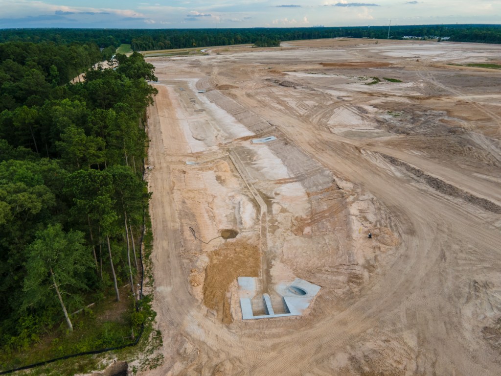
Perry subsidiaries have previously claimed that many Elm Grove homes were in the floodplain. Claiming victims should have somehow prevented flooding in homes that were built 40 years earlier – when they never flooded until Perry clearcut land immediately upstream from them – is the height of chutzpah.

I use that term in the sense of “brazenness” or “audacity.”

It’s like pleading that the shooting victim was at fault because he failed to get out of the way of the gunshot.

It ignores the fact that someone pulled a trigger. Collectively, Perry, its subsidiaries and contractors violated Section 9.2 of the Montgomery County Drainage Criteria Manual.

Section 9.2 states that “Pursuant to the official policy for Montgomery County, development will not be allowed in a manner which will increase the frequency or severity of flooding in areas that are currently subject to flooding or which will cause areas to flood which were not previously subject to flooding.”

Perry Homes’ victim blaming shows how Perry now thinks. Their bizarre logic – and the hollow claim that they followed all laws – explain a lot about why Elm Grove flooded. Perry today is a far cry from the company that Bob Perry founded in 1968.

Posted by Bob Rehak on 7/13/2020

1049 Days since Hurricane Harvey and 298 since Imelda

The thoughts expressed in this post represent opinions on matters of public concern and safety. They are protected by the First Amendment of the US Constitution and the Anti-SLAPP Statute of the Great State of Texas.

Perry Detention Ponds Pass First Modest Test, But Eroded Badly

The official rain gage at West Lake Houston Parkway and the West Fork San Jacinto recorded 2.32 inches of rain between 7 and 9 a.m. this morning. That was officially a 1-year rain. (See Atlas-14 chart below.) As rains go, it was not a severe test; it was more like a pop quiz.

After the rain subsided, Taylor Gully in Elm Grove was less than half full.

The good news: Taylor Gully was well within its banks and no one in Elm Grove or North Kingwood Forest flooded. The bad news: Perry’s detention ponds experienced severe erosion, enough to warrant repairs and perhaps delay the schedule.

The even worse news: Harris County’s meteorologist, Jeff Lindner predicts another one to two inches of rain tonight with isolated totals of three to four.

West Lake Houston Pkwy. Gage Showed 2.32 Inches In 2 Hours

24 hour rain totals for WLHP gage showed bulk fell in 2 hours.

2.32 inches in two hours qualifies as a one-year rain according to the new Atlas-14 rainfall precipitation frequency estimates. Even if you considered the entire 3.12 inches in 24 hours, it would still only be a one year rain.

Atlas 14 Precipitation Frequency Table for the Kingwood Area.

Aerial Images Show How Perry Detention Ponds Performed

These aerial images taken shortly after noon today when the rain stopped show that:

  • The detention ponds are starting to do their work and hold back water.
  • That kept the level in Taylor Gully manageable
  • The overflow spillway between S2 and the concrete-lined channel was apparently not needed.

However, the images also show that:

  • Portions of the detention pond walls severely eroded and appear to have collapsed in places.
  • The water in the N1 pond overcame temporary dirt barricades sending water and silt down to N2.
  • The newly excavated N2 was entirely covered with water for the first time. It also received a significant amount of erosion.
  • N3 merges with Taylor Gully to form one large detention pond that holds water all the way from the northern end of the pond to the county line.
  • Rain has halted construction for the last two days and could delay it into next week.
Expanded, giant N2 detention pond was covered entirely with water for first time. Looking West toward western border of Woodridge Village.
However, erosion re-deposited large amounts of soil within the pond. Looking North along Western Border of Woodridge Village.
Rainwater entering the site from Joseph street in Porter (center left) shows by comparison how much silt the Perry water held. Looking north along western border of Woodridge Village.
Still looking north, but farther up western border, you can see silt slumping into ditch.
Looking SE toward Elm Grove and North Kingwood Forest from the NW corner of site. Water coming in N1 pond from left exited right, down the western border. Water washed out a temporary dirt barrier that appeared designed to hold water in the pond.
Looking east. Note erosion from former utility corridor on left that has turned into a new drainage ditch along northern edge of property.
Looking at western wall of N3 which runs along eastern border of Woodridge Village.
Another portion of the western wall of N3 shows severe erosion.
Standing water from rest of property is slowly making its way into detention ponds.
Looking South along eastern border toward Taylor Gully. At present, N3 (bottom left) simply merges with the concrete channel by S2 (top right). It appears to have nothing to control the outflow.
Looking north along eastern border. Silt fences prove inadequate at stopping erosion. In fact, most of site has no silt fences.

More Rain Likely Tonight

Jeff Lindner, Harris County meteorologist, says that today’s wet pattern should remain in place through the weekend, contrary to earlier predictions that saw rain chances ending by Friday.

Storms currently in the Gulf near Corpus Christi are tracking toward Houston late tonight and Friday morning. They will probably not be as severe as this morning’s storms. With that said…the air mass remains tropical over the region and excessive rainfall rates of 2-3 inches per hour will be possible, warns Lindner.

As of 6 p.m. Thursday, the National Weather Service decided NOT to issue another flash flood watch for tonight, but stay alert to see if a more significant threat may develop.

Expect rainfall amounts of generally 1-2 inches tonight with isolated totals of 3-4 inches.

To Get Up-to-the-Minute Forecasts and Stream Alerts

You can always find up to the minute weather forecasts at this National Weather Service page.

To check on rising rivers and major streams, visit the Harris County Flood Warning System, and click on channels and channel status simultaneously. To see further upstream, click on All Gages. That will show you the status of gages operated by the SJRA in Montgomery County.

Posted by Bob Rehak on 6/25/2020

1031 Days since Hurricane Harvey and 280 since Imelda

The thoughts expressed in this post represent opinions on matters of public concern and safety. They are protected by the First Amendment of the US Constitution and the Anti-SLAPP Statute of the Great State of Texas.

Perry Contractors Now Focusing on Finish Work for Detention Ponds

Perry Homes’ current contractors have excavated 3X more detention pond volume in ten weeks than the previous contractors did in virtually two years. During this past week, they finished excavating three ponds on the northern section of Woodridge Village. Together, they comprise 77% of the total detention volume for the whole site.

Excavation Done, but Finish Work Remains

That doesn’t mean they’re totally done with the ponds. Recent aerial photos show that they still have much finish work to do. That includes:

  • Shaping the sides
  • Creating backslope swales
  • Installing pipes to funnel water from the swales into the ponds and channels
  • Ensuring water can flow out of Adams Oaks in Porter on the west side of the subdivision into Taylor Gully as it previously did
  • Creating concrete “pilot channels” in the center of the ponds and larger channels
  • Planting grass along the sides of the slopes to reduce erosion
  • Installing outflow control in several places to hold back floodwaters
  • Building maintenance roads around the ponds

Elm Grove resident Jeff Miller, who monitors the progress of construction daily, says crews are already hard at work on many of those tasks.

Ponds NOT Expanded Beyond Initial Plans

Miller has compared the width and depth of ponds to the initial plans and verified that the ponds are being built to original specifications. Since the ponds were designed to meet pre-Atlas 14 rainfall requirements, that means the site will still hold 30-40% less runoff than needed to meet current regulations.

Still, surrounding residents in Porter, North Kingwood Forest and Elm Grove who flooded twice last year will find three large ponds on the northern section a welcome addition. They provide some measure of extra protection. Residents will have four times more upstream detention volume than they had during Imelda.

Racing Against Risk

With the peak of hurricane season now less than two months away, Perry Homes is in a race against risk. The company may regret the six months of virtual inactivity between the completion of pond S2 and the start of work on ponds N1, N2, and N3 in early April.

The faster pace of current construction puts pressure on Harris County and the City of Houston to complete an offer if an offer will be made. Elm Grove residents lobbied the City and County to purchase the property and build a regional flood detention facility. They center would also help protect downstream residents on the East Fork and Lake Houston.

However, at a Kingwood Town Hall Meeting in February, Mayor Pro Tem Dave Martin announced that the City would not participate in a deal. He said it was the County’s responsibility.

In April, the County announced that it would consider purchasing the land if the City contributed land in lieu of cash to cover half the purchase price.

Then in May, the County increased its demands. The County now wants the City to contribute land in lieu of cash to cover half the purchase AND construction costs for creating additional detention.

County and City Clamp Down on Communications

Since then, the County has clamped down on communications regarding this subject. Rumors suggest that all parties are still trying to make a deal happen. But the County has denied all FOIA requests and referred them to the Texas Attorney General for a ruling on their denials. That often happens when negotiations are in progress, according to a knowledgeable source.

What Happens Next?

At the contractor’s current rate of progress, it’s entirely possible that contractors will complete all work on detention ponds in July.

The City and County blew through a May 15 deadline that Perry put on the deal. But a “For Sale” sign at the Woodland Hills entrance remains on the property.

With approximately $14 million dollars invested in the property, with hurricane season here, with lawsuits pending, and knowing that the amount of detention is insufficient to hold a 100-year rain, Kathy Perry must be sweating bombshells.

Ms. Perry may be hoping for a City/County offer, but she can’t be counting on one. If she were, she could have sold the dirt coming out of those detention ponds. Instead, however, she’s building up land elsewhere on the site to keep her options open and develop the site if a deal falls through.

That dirt will have to be moved again at taxpayer expense if the county builds additional detention ponds.

Pictures of Site as of 6/19/2020

Here’s what the site looked like as of 6/19/2020.

Looking NW from over Taylor Gully toward Pond N2, the largest on the property.
The connecting channel between N1 at the top of the frame and N2 along the western edge of the property has been excavated. Note the pilot channel that contractors have started in the distance.
At Mace Street in Porter, contractors created a concrete face for the twin culverts on the upstream side, but not yet on the downstream side. Note the earthen dam holding water back while contractors complete the pilot channel running off the bottom of the frame.
Above Mace Street, contractors are still putting in pipes between the channel and backslope swales.
The Webb street entrance to the site has been removed to connect N1 (out of frame on the top) with N2 (out of frame on the lower left).
Looking SE at N1.
Looking South at N3, which runs down the eastern edge of the property.
More pipes are being put in to channel water from backslope swales to the pond so water won’t erode the face of the pond. Not the rills already cut in the dirt.
Looking SE. The southern half of N3 where it connects with Taylor Gully in the upper right.
N3’s connection to Taylor Gully is now wide open. It’s not clear how this connection will be completed to release the water at a slow controlled rate.
The two culverts under the bridge over Taylor Gully should slow the water from N2 (upper right) and N1 (out of frame) down.

Need for Grass if Deal Not Reached Quickly

Note how the grass on the southern side of the gully has all died. That raises a question. If Perry, the City and County do not complete a purchase agreement soon, will Perry plant grass on the northern section to slow runoff. Right now, it’s all hard-packed dirt.

Most of northern section is hard packed dirt which increases runoff rate.

Planting grass over an area this large would be a big investment and might get in the way of construction if Perry decides to develop the land. But it will reduce flood and legal risks.

Posted by Bob Rehak on 6/20/2020

726 Days after Hurricane Harvey and 275 after Imelda

Woodridge Village Pre-Cristobal Detention Pond Update

Perry Home’s new contractors have excavated the vast majority of virtually all three detention ponds on the north section of Woodridge Village. That means they have almost completed 77% of the detention pond capacity for the whole site in two months. The previous contractors completed only 23% in approximately twenty months.

That represents approximately a 30x increase in productivity.

Overview of Woodridge Village Detention Pond Capacity

The pie chart below shows how that capacity breaks down. And the map shows where it is.

Percentage of detention pond capacity in acre feet for each of the five Woodridge Village ponds. Source: LJA Drainage Addendum.
General layout of detention ponds on Perry Homes’ property.

Contractors Scurry as Cristobal Churns in Gulf

Tropical Storm Cristobal could be a game changer next week if it hits Houston. It’s track is far from certain at this point, but the National Hurricane Center still puts Houston within the cone of uncertainty.

Cristobal has the potential to create massive erosion and set the work schedule back. The aerial photos below taken on 6/2/2020 show the current “pre-storm” status of construction for the three northern detention ponds. The two southern detention ponds were completed earlier this year.

N1 Nearing Completion of Excavation

N1 Starts at the northern boundary of the site and runs halfway down the western edge to Mace Street.

Looking north at N1 from Mace Street in Porter to the northern boundary.
The area between the culverts will eventually become an extension of Mace Street (top of photo) which will traverse the entire subdivision to Ford Road on the eastern side.
While some contractors continue excavating, others work on installing concrete pilot channels. Shown here, the pilot channel near Ivy Ridge in Porter.
The northern part of N1 is not yet complete. Contractors still use the Webb Street entrance (upper left as their main access point to the site. Note how height of road dwarfs excavator in pit.

Still Widening and Deepening N2 Pond

The area left of the diagonal road is the expansion of N2. The area near the diagonal embankment is deep enough to conceal trucks and excavators. However, the grassy triangle in the middle left was a previous detention pond constructed my Montgomery County in the early 2000s.
Contractors are deepening the MoCo pond a small amount to create additional storage capacity. The dirt is being used to build up other portions of the site.
Looking north along the western boundary from the southern part of the grassy triangle. Much work remains to extend the N1 channel south to N2. Jeff Miller reported today that contractors started working on this this morning.
On 6.3.20, contractors were removing dirt from the northward extention of N2 with three dump trucks running in a relay fashion. Photo courtesy of Jeff Miller.
Twin culverts installed in Taylor Gully will control outflow rates from N1 and N2.

N3 All Excavated

N3 cuts down the eastern side of Woodridge Village and joins Taylor Gully right above S2.

Looking north. Excavation of N3 appears complete although few of the finishing touches have yet been installed.
Looking south at the main body of N3.
N3 widens out about halfway down the eastern border.
Then it narrows down again to help control outflow speed as it approaches the junction with Taylor Gully.
Water from the entire site converges here. Erosion patterns, fence damage and grass matting show this is where the overflow started that contributed to the flooding of Elm Grove (right) and North Kingwood Forest (left) twice last year.

The pile of dirt in the picture above could be shoved into the connecting channel in the event that Cristobal should strike Houston. That would then help retain water in N3 until after the storm.

All the runoff from the approximately 200-acre northern portion of the site converges here and tries to make its way through a 3-foot culvert at the end of the concrete channel.

Uncertain Still Surrounds Corner of Chaos

Some Elm Grove and North Kingwood Forest residents have called the complex flow patterns in the photo above “The Corner of Chaos.”

Overflow from the concrete lined channel is supposed to go into the kite-shaped S2 pond, and then through the twin culverts into Taylor Gully. However, a hydrology consultant for the plaintiffs in flooding lawsuits contends that floodwaters went the other way. They escaped out of the inflow channel, he says. He further claims that LJA Engineering failed to model the performance of that connecting channel.

Diagram from consultant’s report.

If the design of the flow at this “Corner of Chaos” is flawed, there’s little contractors can do to fix that at this point without some major re-engineering.

In that regard, we should also remember that LJA designed these ponds before Atlas 14, so they will only hold approximately 60% of a 100-year rainfall as defined by Atlas 14 standards adopted in Harris County.

How Contractors are Temporarily Funneling Water into Ponds

Because storm drains are not yet installed, contractors are relying on temporary channels to intercept runoff and direct it to detention ponds.

Small ditches like one on right catch runoff and direct it to ponds for the time being.

Next Steps in Completing Detention Ponds

A modest amount of excavation remains to complete the full detention pond capacity.

But the capacity already in place should reduce flood risk compared to last year by more than 3X for storms equivalent to May 7 and September 19, 2019.

As some crews focus on completing excavation, others are putting the finishing touches on ponds. Those include concrete pilot channels, backslope interceptor swales, drain pipes, and culverts to control the rate of outflow.

Racing Against Hurricane Season

At this point, contractors are racing against time and the hurricane season. Cristobal underscores the risk of having waited for months to begin the three northern detention ponds in April. Had they begun them immediately after J. Carey Gray’s letter to Mayor Turn in October, they could easily have finished by now.

Posted by Bob Rehak on 6/4/2020 with thanks to Jeff Miller

1010 Days after Hurricane Harvey and 258 since Imelda

The thoughts expressed in this post represent opinions on matters of public concern and safety. They are protected by the First Amendment of the US Constitution and the Anti-SLAPP Statute of the Great State of Texas.

Heavy Rainfall Threat in Coming Days

Jeff Lindner, Harris County Flood Control Meteorologist just issued a heavy rainfall warning. Lindner notes that the line of strong thunderstorms currently moving across the area will drop rainfall amounts of 1-3 inches.

The good news: the leading edge of this line is becoming detached from the outflow boundary. That suggests storms will weaken as they move southward. Rainfall rates which were 2-4 inches earlier over N Waller and Montgomery Counties have lessened to near 1-2 inches. The main threat now is short duration street flooding in areas with the heaviest rainfall.

Tonight’s Forecast 

Lindner points to extremely active radar out west along the Rio Grande. He says that’s where the next round of weather will be developing. He expects it to move quickly toward our area tonight. Models show this line of storms quickly reaching the area between midnight and 400 a.m. But at the speed it’s moving, he predicts only another 1-2 inches for most areas with this line.

Intercontinental Radar as of 8PM Sunday night, 5/24/2020

Monday Prediction 

Continued high rain chances. The air may take much of the morning and early afternoon to recover from the early morning line of weather, but temperatures will only need to reach the low 80’s to trigger more storms. It will not take much heating to set things off, he warns. Storm motions could be fairly slow Monday afternoon and this could lead to excessive rainfall rates in a short period of time.

Tuesday-Thursday: Continued Threat 

Upper level disturbances remain parked over the state with rounds of storms at nearly any time. Heavy rainfall will continue to be a threat.

Rainfall Amounts Add Up Changing Nature of Threat 

Lindner concludes, “Moisture profiles certainly support heavy to excessive rainfall rates as seen today and if storms slow of train for a period of times totals could quickly add up. Grounds will saturate over time leading to increasing and eventually maximum run-off conditions…so the threat may grow from mainly street flooding to potential rises on area creeks, bayous, and rivers.”  

Lindner concedes that it’s hard to pinpoint any day or time or location that has a higher flood risk than another. “So we will just have to closely watch each convective episode and be prepared to react quickly,” he says.   

Impact of Today’s Rains on Elm Grove

Despite heavy rainfall this afternoon, Jeff Miller, an Elm Grove resident and frequent contributor, drove the streets of Elm Grove this evening. He notes that:

  • Streets still seem clear as of 8 p.m.
  • Taylor Gully is about half full, but water is flowing rapidly
  • Water level is about 2 feet from the top of the twin culverts at the Rustling Elms bridge.

Miller sees the possibility of that culvert being overflowed as a danger.

Posted by Bob Rehak on 5/24/2020 with reporting from Jeff Miller and Jeff Lindner

999 Days since Hurricane Harvey, 248 since Imelda, and four years since the last Memorial Day Flood.

One Year Ago: 415 Homes Flooded in All of Harris County; 380 of Those Bordered Woodridge Village

Harris County Flood Control District’s final report on the May 7, 2019, storm indicates that 415 homes flooded in all of Harris County. It also indicates that 380 of those bordered Perry Homes’ Woodridge Village development across the county line in Montgomery County.

That’s a whopping 91.5% of all flooded homes in the most populous county in the State. And the third most populous in the nation.

Report Cites Sheet Flow from Woodridge Village as Potential Cause

The heaviest rain that day fell on northeast Harris and southeast Montgomery Counties. However, the report also cited “large volumes of sheet flow” from Woodridge Village as the potential cause of flooding for those bordering the development. A jury in Harris County will decide the cause in two months.

At the time, Perry Homes’ contractors had clearcut virtually the entire 268-acre development but had only completed about 7% of the detention ponds.

High-water rescues in progress the night of May 7, 2019, on Shady Maple in Elm Grove Village, Kingwood. About one block south of Woodridge Village.

For official reports on this and other storms, see the Reports Page of this website. Click on the Major Storms tab.

Posted by Bob Rehak on 5/8/2020

983 Days after Hurricane Harvey and 367 Days after the May 7th Storm

One Year Ago Today, Streets of Elm Grove Turned into Rivers for First Time

May 7th is the anniversary of the first large-scale flood in Elm Grove history. On that day, more than 200 homes flooded on the streets south of Perry Homes’ Woodridge Village and the Montgomery County line. Homes that did not flood, even during Harvey.

Life After Harvey and Before May 7th

In the weeks leading up to May 7th:

Then The Rain Came

According to the gage at West Lake Houston Parkway and the West Fork, it started between 10 a.m. and 11 a.m. Then it picked up again between 11 a.m. and 12 p.m. when we got about 2.5 inches of rain. Then we got slammed between 3 p.m. and 5 p.m. when we got another 2.2 inches. Altogether, we got 5.64 inches before midnight.

Rainfall one year ago today.
Atlas 14 rainfall figures for Kingwood area.

The bulk of the rain, about 5.5 inches, fell in about a 12 hour period. That would make May 7th about a 5-year storm. The one-hour peaks during the storm never significantly surpassed the one-hour peaks during Harvey. Yet Elm Grove did NOT flood during Harvey and flooded disastrously on May 7th.

Act of God or Series of Missteps?

The Woodridge Village developer issued a terse statement saying that the flooding was an Act of God. But video showed sheet flow coming out of Woodridge Village.

And that helped trigger hundreds of lawsuits. Over the next year, hundreds of posts would piece together a series of missteps by the developer that turned a heavy rain into a disaster. Contributing factors included:

All of these factors would come into play when Elm Grove flooded again during Tropical Storm Imelda on September 19.

The judge in the lawsuits set a trail date for July 13, 2020. But COVID may delay that. Meanwhile, Harris County is trying to buy Woodridge Village from Perry Homes with the help of the City. We should have a final answer on that within two weeks.

Images from That Awful Day

While we wait, here are some pictures of that awful day and the immediate aftermath.

High-water evacuation in middle of night on Shady Maple Drive
HFD High-Water Rescue
Humble ISD school bus attempting to return kids home as sun started to set.
Erosion where S2 detention pond should have gone.
Log spearing warning sign at north end of Village Springs in Elm Grove
Dumpsters filled driveways for blocks as people gutted their homes.
Keyframe from Jim Zura drone video showing where S2 detention pond should be. Instead, only a muddy river.
Families carted precious belongings to the curb.
Keith Jennings bewildered dog as flood waters rose in his kitchen.

Encore Performance Just as People Moving Back Into Homes

As tragic as all these images are, the whole scene would repeat itself again in September, just as many people were moving back in to repaired homes. Except in September, 2x-3x more homes flooded.

Since then, many people have waited to repair their homes a second time until they can be sure that the source of the flooding has been fixed.

The hearts and prayers of the entire community go out to those who flooded so needlessly.

Posted by Bob Rehak on May 7, 2020 with images from flood victims

982 Days since Hurricane Harvey and 366 since last May 7th

The thoughts expressed in this post represent opinions on matters of public concern and safety. They are protected by the First Amendment of the US Constitution and the Anti-SLAPP Statute of the Great State of Texas.

Tools to Track Permit Applications for Developments Near You

Have you ever been flooded by a new development? Did you learn about the development AFTER bulldozers started knocking down trees? There’s a much better way. The City of Houston offers several tools to help you track applications for new developments long before the bulldozers start belching diesel fumes.

GIS PlatTracker Map

The first is an interactive, color coded GIS map that shows the status of all permit applications in the City and its ETJ (extra-territorial jurisdiction). The ETJ extends well beyond the boundaries of the City. Going up 45, it extends to 242. Going up 59, it extends to Roman Forest.

City of Houston PlatTracker map for Northeast Houston and Lake Houston Area as of 4/30/2020

If someone has applied for a permit to develop a piece of land, it will show up on the map. Notice the purple areas along the West Fork west of the Kingwood Country Club. That’s how I learned about the reactivation of Romerica’s plans.

The color of the parcels corresponds to the stage of the application. Clicking on the parcel pulls up an information panel that gives you more history including the date the developer submitted the application, when it will be reviewed, the review stage, and more.

Zoom in and out as wide as you want. Just be aware that the wider you zoom, the longer it takes the screen to refill with all the plat information. There’s a lot more of it!

As I zoomed out around Kingwood, the number of new developments that I was unaware of shocked me. If you want to see humongous changes, look south of Humble, east to Huffman, west to Spring, and north to Porter and New Caney. Kingwood is a relative island of quiet in a sea of change.

Other Related Interactive Maps

The PlatTracker Plat Map is just one of thirty other interactive maps that you can use to explore and monitor the City around you. They include, but are not limited to:

  • Land use
  • Water flood hazards
  • Governmental boundaries
  • Demographics
  • Annexation history
  • Address and Permit Information

PlatTracker Agenda/Spreadsheet

Once you have identified a development you are interested in, another site can help you learn more about when the Houston Planning Commission will consider applications related to the site. It will also give you:

  • Subdivision plat name
  • Application Number
  • Date Submitted
  • Subdivision type
  • Variance requests
  • Location on the Commission’s agenda
  • County
  • Council district
  • Precinct
  • Census Tract
  • Zip Code
  • School district
  • TIRZ (tax increment reinvestment zone) if any
  • Superneighborhood Council
  • Land Use
  • Number of Lots
  • Acreage
  • Appraisal district numbers
  • Developer Name
  • Applicant Company
  • Applicants Name
  • Phone Number

You can even download the latest documents related to the application.

For Planning Commission meeting dates and agendas, click here.

Situational Awareness for Concerned Citizens

Wow. Everything you need to put your mind at ease. Or stage a protest. All at your fingertips.

These are great tools for concerned residents and citizen activists.

I’m sure a lot of Elm Grove residents wish they had known about these tools before the bulldozers started knocking down trees in Woodridge Village.

For future reference, I’ve added links for these sites within ReduceFlooding’s Links Page under the Community heading.

Posted by Bob Rehak on 4/30/2020

975 Days since Hurricane Harvey

County Approves Elm Grove Deal with Two Conditions

Harris County Judge Lina Hidalgo conducting virtual discussion of the purchase of Woodridge Village Property.

In another marathon session that lasted more than 12 hours Tuesday, Harris County Commissioners finally approved a deal to purchase Perry Homes/Figure Four Partners’ Woodridge Village Property for $14 million. Woodridge contributed to flooding Elm Grove Village twice last year.

Two Conditions Still on Deal

The offer will be made to Perry Homes immediately. However, it will be with the understanding that the City of Houston must:

  1. Adopt Atlas 14 rainfall standards, including within its extra territorial jurisdiction.
  2. Deed $7 million worth of other land (unrelated to this deal) to the Harris County Flood Control District to help complete other flood mitigation projects.

If the City fulfills the conditions, the Perry land would be used to create regional flood-control detention.

Commissioner Cagle Optimistic

Immediately after the meeting, Commissioner Jack Cagle spoke with City of Houston Mayor Pro Tem Dave Martin who also serves as City Council Member for Elm Grove/Kingwood. According to aids, Cagle was optimistic that the City could meet the conditions.

The County treasurer doesn’t yet have permission to write a check, but this is progress.

Commissioner Cagle made the motion. Commissioner Garcia seconded. The motion carried unanimously.

Money for the purchase would come out of Flood Control District bond funds allocated for drainage improvements in the San Jacinto watershed.

Listen to the Commissioners Here

For a complete recording of the discussion and vote, click here. The “Russ” referred to in the audio is Russ Poppe, executive director of Harris County Flood Control District.

Posted by Bob Rehak on 4/29/2020

974 Days after Hurricane Harvey

Outcome of Commissioners Court Meeting Hopeful for Elm Grove

A marathon 10-hour meeting of Harris County Commissioners Court ended on a hopeful note for Elm Grove Village. But it was an emotional roller-coaster ride. Commissioners discussed whether to purchase Woodridge Village from Perry Homes and use it to build a giant detention facility to protect Elm Grove from future flooding.

The northern part of the 268-acre flood-prone Woodridge Village

Recap of Meeting

Before adjourning to executive session, commissioners discussed their concerns about a potential deal in open session. If you watched it live, you probably worried at that point. Commissioners Ellis and Garcia seemed to look for ways to kill any deal.

For instance, Ellis asked pointed questions about line items in the Flood Bond. He wanted to know what line item the money would come from for Elm Grove. Russ Poppe, Executive Director of the Flood Control District, explained that they set aside money for “San Jacinto Watershed drainage improvements in general.”

Ellis said, “But it wasn’t set aside for this?” Poppe replied that Elm Grove flooding happened after the Bond election, but that it fit the criteria for drainage improvements in the SJR watershed. And Ellis again said, “So it wasn’t set aside for this.”

Video of the meeting has not yet been posted.

Ellis, Garcia, Hidalgo Always Vote as Block

I’ve been told by reliable sources that since the last election, Hidalgo, Garcia and Ellis have ALWAYS voted as a block on every issue. So when they went into executive session, I bit my fingernails.

But when the commissioners and county judge came back from executive session, the feeling was more hopeful. We don’t have an agreement to approve a deal. But we have an agreement to keep negotiating.

What Harris County Still Wants

Here’s what commissioners want:

  1. HCFCD will formally request an extension from Perry Homes on its March 31 deadline. This should not be a problem. People aren’t exactly lining up to buy the jinxed Perry Homes property.
  2. HCFCD will also pursue an inter-local agreement with Montgomery County (MoCo) requesting that MoCo follow Atlas 14 guidelines – especially within the City of Houston’s (CoH) extra territorial jurisdiction. MoCo already has adopted the new higher standard since approving Perry Homes’ permits. However, their Atlas-14 standards differ slightly from Harris County’s because MoCo is further north and receives less rainfall. This should not be a deal killer either.
  3. HCFCD will also request an inter-local agreement with CoH. At a town hall meeting in March, the City made it abundantly clear that it would not contribute cash to a buyout. So in lieu of cash, Harris County will request that the City provide assets that could help Engineering or Flood Control complete County projects more cost effectively.

After that the meeting adjourned.

Thank You

Thanks to Precinct 4 Commissioner Jack Cagle who put this item on today’s agenda and has kept pushing it. Thanks also to everyone who wrote or called the commissioners requesting their support. Your efforts made a difference. Keep praying.

Posted by Bob Rehak on 4/7/2020

752 Days since Hurricane Harvey and 201 since Imelda