Tag Archive for: Colony Ridge

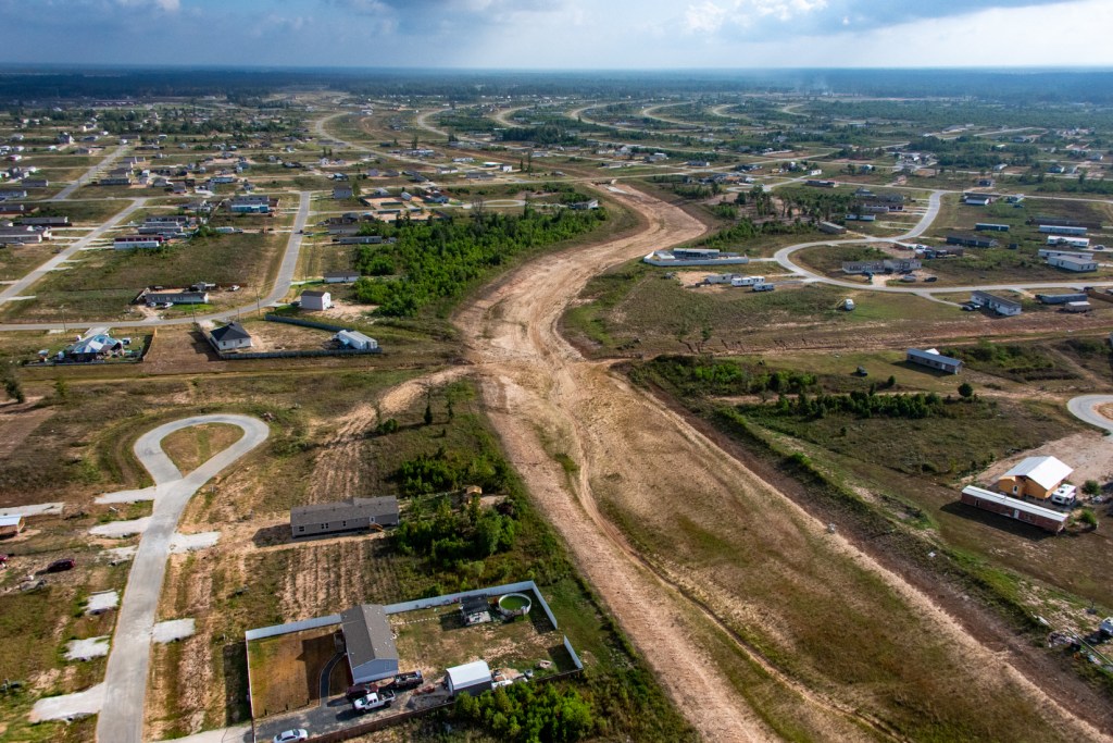
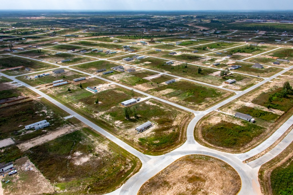
Colony Ridge Now 50 Percent Bigger than Manhattan

Recent expansion of the Colony Ridge development in Liberty County means that the controversial colonia is now 50 percent bigger than Manhattan.

By advertising exclusively to Hispanics under the name Terrenos Houston (translation: Houston Land), the developer has largely managed to fly under the radar of regulators as it rapidly expands.

Comparison Of Areas in Google Earth

Colony Ridge now occupies approximately 34.5 square miles. The developer also owns additional land in surrounding areas not yet under development or being developed under different names. But I have NOT counted those areas in this comparison.

Green area beneath clouds in top center has been cleared since this satellite image.

In contrast, Google Earth shows that the island of Manhattan occupies 22.8 square miles.

That means Colony Ridge is 51% larger than Manhattan. Yet few people have ever heard of Colony Ridge. As proud Texans, we need to change that.

Other Comparisons of Manhattan and Colony Ridge

Population

Of course, Manhattan still has the population edge over Colony Ridge: 1.6 million vs. something less. The exact population of Colony Ridge is unknown because many undocumented aliens live there who avoided the last census.

Commerce

And…

While Manhattan is a center of world commerce, Colony Ridge has a dollar store and an ice machine.


So Colony Ridge has some catching up to do in the “commerce” department.

Car Repair

Many people in Manhattan don’t bother to own cars, so repair places are few and far between.

But people need vehicles to get around in Colony Ridge; there is no public transit. Accordingly, the development has far more shade-tree mechanics.

And the parking is much easier and cheaper in Colony Ridge than Manhattan.

How many people in Manhattan can park 30 cars in their yard while they work on them?
Scenic Rivers

Manhattan is surrounded by iconic rivers. Colony Ridge has rivers of mud. But at least kids can play soccer in them during droughts.

River of mud in one small part of Colony Ridge
Trash

Manhattan is famous for its trash. In fact, trash there has helped decide mayoral elections going back decades. Colony Ridge doesn’t have a mayor, so trash is rarely an issue.

Common sight in Colony Ridge yards.

Advantage Colony Ridge…if you’re a hoarder.

Home Values

Manhattan is also famous for high-priced real estate. Colony Ridge is famous for its low-priced real estate. Advantage: Colony Ridge on that score. No wonder it’s growing so fast!

Tarps are popular roof alternatives in Colony Ridge. They hold down home repair costs.

That’s important. Look at the angle on the left front corner of the home above.

Parking Your Home

Manhattan has absolutely no place to park your home. However, Colony Ridge has thousands of acres. Advantage Colony Ridge…again!

Colony Ridge is the world’s largest trailer park.

Yes, in Colony Ridge, Liberty County has something to write home about.

Access

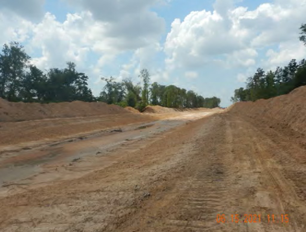
Manhattan is famous for its bridges and tunnels. So is Colony Ridge. This bridge on FM1010 has been washed out for six years.

Hurricane Harvey washed out the FM1010 bridge downstream from the main Colony Ridge drainage ditch.

I’d count this one a toss up, however. Why? It still can take hours to get into and out of BOTH Manhattan AND Colony Ridge.

Diversity

Manhattan is widely regarded as a cross-roads of the world and hosts the United Nations.

Colony Ridge IS the united nations…of South America, Central America, and Mexico in Liberty County.

Regardless, I’d have to give the diversity advantage to Manhattan. I don’t see the Colony Ridge developer taking any initiative to reach out to Poles, Jews, Italians, Irish, Asians, Germans, Czechs, Scandinavians, Indians, Africans or other ethnicities.

Fire Hydrants

In Manhattan, people are always tripping over fire hydrants and most buildings are sprinklered.

In Colony Ridge, though, they’ve learned to make do without all those trip hazards that can drive up the developer’s costs. Colony Ridge has a grand total of 59 hydrants in an area 50 percent bigger than Manhattan.

Hotel Costs

A hotel room in Manhattan can easily cost hundreds of dollars per night. But people can pitch tents in Colony Ridge and avoid all those pesky mini-bar fees while they work out their business deals.

Colony Ridge hotel
Colony Ridge Hotel

Plus, you’ll see waaaay more stars in Colony Ridge. Advantage: Liberty County.

Write Your Favorite Travel Guide

Surely everyone can agree that Colony Ridge deserves a place in all of the state’s travel guides. Colony Ridge is truly a tribute to what lack of regulation and enforcement can produce.

Let’s start a campaign to get it noticed. Write Fodors, National Geographic, TxDoT, Texas Highways, and Texas Monthly.

We have something unique in Colony Ridge that is a tribute to Texas ingenuity – a place that welcomes people without papers and makes entrepreneurs rich. Let’s put it on the tourist maps and focus the world’s attention on a true Texas marvel.

Posted by Bob Rehak on 9/17/2023

2210 Days since Hurricane Harvey

The thoughts expressed in this post represent opinions on matters of public concern and safety. They are protected by the First Amendment of the US Constitution and the Anti-SLAPP Statute of the Great State of Texas.

Damn the Downstream Consequences, Colony Ridge Expansion Continues Relentlessly

Damn the downstream consequences, including sediment pollution, increased flood risk and monstrous dredging costs. Colony Ridge, the controversial 30+ square-mile, Liberty County development that markets to Hispanics – while flaunting drainage, environmental and fire regulations – is clearing and paving thousands of additional acres.

Not even Google Earth can keep up with the developer’s relentless expansion. On 8/12/23, I flew over Colony Ridge in a helicopter and found huge areas where 3-week-old satellite imagery was already hopelessly out of date.

Google Earth image from 7/18/23. Red/yellow highlighted areas changed radically within three weeks.


With the exception of areas protected by the Houston-Conroe and Tarkington Bayou Mitigation Banks, the highlighted areas above have largely been cleared and/or paved.

The RED area now has paving not visible in the satellite image. The YELLOW area was being cleared and paving was just starting even though the image shows none of that. So what do these areas look like from a few hundred feet?

Pictures Taken 8/12/23 over Red Area

I shot the four pictures below on 8/12/23. They represent dozens of others. The red area already has most streets, but no fire hydrants.

Pictures Taken over Yellow Area

The two pictures below show some of the development activity taking pace in the yellow area.

Looking west across newly cleared area.
Looking N at part of Colony Ridge expansion.

What kind of homes will go here? To predict the future, look to the past.

Homes on Parade

Colony Ridge is the world’s largest trailer park. One Plum Grove resident who lives near a northern entrance to Colony Ridge says she routinely sees up to seven mobile homes per day going into the development – seven days per week.

It’s hard to know exactly how many new homes arrive each day, because there are other entrances. But if you assume the max for this one entrance, 50 homes a week times 52 weeks makes up to 2600 homes per year.

Colony Ridge Expansion
Manufactured home making its way through the main commercial area of Colony Ridge.
Room with a viewof severe erosion.

Note the erosion in photos above and below. It will make its way downstream into the East Fork San Jacinto. These ditches are typical of Colony Ridge. The eroded sediment will reduce conveyance of the river and contribute to flooding.

Poverty: The Mother of Pollution

Ghandi once said, “Poverty is the mother of pollution.” That’s certainly the case here. But I would modify the saying. While poverty may be the mother of pollution; greed is the father.

The poverty of the residents doesn’t cause sediment pollution. But a business plan built on high-interest-rate, owner financing that targets impoverished people with few options does.

The developer seems to have found a target market that is less concerned with their environment than survival.

It’s a market ripe for exploitation where corners can be cut. Residents have few options and can’t complain.

And the developer shows little interest in changing a business model that fuels relentless expansion and growth. Damn the downstream consequences.

In virtually every area I have photographed, he has not planted vegetation on the banks of the channels. Nor has he used silt fences or installed backslope interceptor swales to reduce erosion as Liberty County regulations require.

Instead of the developer bearing those costs, downstream residents in the Lake Houston Area do. Since Harvey, the Army Corps, Harris County and City of Houston have spent more than $220 million of your tax dollars to dredge excess sediment shed from rivers of mud like this.

Colony Ridge drainage ditch.
Working drainage is a luxury.

The poverty in Colony Ridge is crushing. I’ve seen people sleeping in tents trying to save enough money to buy a camper to live in.

No bathroom in sight. Do Liberty County health codes really allow this?
Christmas dinner. Enlargement of this photo from Christmas 2020 shows food on the table in the foreground.
One small part of Colony Ridge. The market for a piece of the American dream stretches endlessly in Liberty County.

The estimated population of Colony Ridge is now greater than the three largest cities in Liberty County (Cleveland, Dayton, and Liberty) put together. No one knows what the population is with certainty because of the large number of undocumented aliens who did not participate in the last census.

And the Colony Ridge developer is expanding into Harris and Montgomery Counties. ReduceFlooding will monitor progress of those areas to see if they, too, contribute to sediment accumulation, dredging costs, and flooding.

Posted by Bob Rehak on 9/9/23

Posted by Bob Rehak 2202 Days since Hurricane Harvey

The thoughts expressed in this post represent opinions on matters of public concern and safety. They are protected by the First Amendment of the US Constitution and the Anti-SLAPP Statute of the Great State of Texas.

As Wildfire Weather Sets In, Fastest Growing Area in Liberty County Fails to Meet Fire-Code Requirements

August 30, 2023 – Yesterday evening, multiple news organizations reported wildfires burning near Colony Ridge in Liberty County.

Yet large parts of Colony Ridge, the fastest growing part of the county, have few fire hydrants. Some areas have none at all. And in the areas that have them, fire hydrant spacing is 2-5X greater than codes specify, while pressure is reportedly half of what codes require. And according to some sources interviewed for this article, many hydrants allegedly don’t work.

All this increases residents’ fire risk and insurance rates – if they can even get fire insurance. Some say they can’t.

Former Plum Grove Mayor, LeeAnn Penton-Walker says she and Colony Ridge residents have been trying to alert the county judge, commissioners, engineer and fire marshal to the dangers since 2015.

Fire Safety Top of Mind as Drought Deepens

Meanwhile, fire safety is at the top of everyone’s mind as the current drought deepens amid relentless heat. A burn ban remains in effect across the region. The National Weather Service has posted red-flag warnings for today. A combination of very dry vegetation, low humidity and gusty winds could easily spark fires.

Note critical fire danger in Liberty County (center).

Jeff Lindner, Harris County’s meteorologist, says that numerous fires started around the region yesterday and we have similar conditions today. “Fires especially in pine canopies continue to exhibit extensive growth rates and fast forward motion with long lasting crown runs. Increasingly larger fires are requiring large amounts of resources for an extended period of time,” says Lindner.

Recent Pictures Show Vast Areas with Apparently No Hydrants

On August 12, as I flew over Colony Ridge in Liberty County, the scarcity of fire hydrants struck me. I did not see any. However, the Liberty County fire marshal told me that the developer was trying to bring the development up to code. I knew the development had at least a handful of hydrants from a story I did three years ago. But Colony Ridge has virtually doubled in size since then.

Below are four pictures from areas recently built out. Many lots in these areas have already been sold and occupied. So you should see fire hydrants. But I couldn’t, even when magnifying high-res versions of the images on a large screen.

These photos are representative of thousands of shots I have taken from helicopters over Colony Ridge.

Areas With Fire Hydrants Do Not Meet Code Requirement

I asked the county fire marshal for a list of hydrant locations, but he could not supply me with one. So I spent a full day criss-crossing the area and burning a tank of gasoline looking for them. I located 59. See the satellite images below.

In the first, note how hydrants are clustered in rows and columns. Also note how large parts of the development have none. That verifies what I saw from the air.

Southern part of Colony Ridge. Yellow pins mark location of hydrants.

In the satellite image above, for instance, note the:

  • Broad empty swath across the bottom
  • Another broad swath on the east running north to south
  • An empty area in the middle
  • Another empty area at the top.

The next satellite image shows eight fire hydrants in the most populated portion of the northern part of Colony Ridge.

Portion of the northern part of Colony Ridge

Altogether, Colony Ridge covers more than 30 square miles. It has almost doubled in size in the last two years. If my count is accurate, it now has only about two fire hydrants per square mile.

What Fire Codes Require

Even though the Liberty County Fire Marshal’s web page does not list a fire code, Bill Hergemueller, the fire marshal, said that the county follows 2018 IFC (International Fire Code) regulations. That code specifies maximum spacing of 500 feet, but Hergemueller said the county allows 600 feet. However…

On any given east-west street above, the fire hydrant spacing averaged more than 3000 feet. That’s more than half a mile!

Measurements taken in Google Earth

Fire hydrants on north-south streets have an average spacing of 1300 feet.

So considering both directions, the average spacing exceeds code requirements by 2-5X.

But again, most streets have absolutely no fire hydrants. That makes the distances to fire hydrants far greater! A Houston fire captain told me that his trucks carried at most 500 feet of fire hose.

To service areas such as Colony Ridge, volunteer fire departments use tanker trucks. They fill their tanks at a hydrant and then shuttle to the fire until it is extinguished.

In fairness, Hergemueller also pointed out that parts of the development are still expanding and that the IFC regs were adopted after Colony Ridge started developing in 2013.

Codes Largely Agree

Most national standards call for one fire hydrant every 200-500 feet depending on the type of development.

The 2018 IFC regulations used by Liberty County specify 200- to 500-foot spacing between fire hydrants, with a few exceptions, i.e., in areas where buildings have sprinkler systems.

National Fire Protection Association standards specify that for detached one- and two-family dwellings “fire hydrants shall be within five hundred (500′) feet… The maximum distance between fire hydrants shall not exceed 800 ft.”

Texas’ Local Government Code 233.061-C gives Liberty County the right to enforce its fire code retroactively. In other words, the county could force the developer to upgrade his infrastructure to meet current code requirements.

In addition to violating fire-hydrant spacing requirements, Colony Ridge has another problem: existing water mains may not have enough pressure to douse fires before they get out of control.

The IFC code requires a minimum 1000 gallons per minute. But Colony Ridge water mains reportedly only deliver 500 gallons per minute.

Alternatives to Hydrants Also Missing

A “fire-code standards” expert I talked to in another county said that in rural areas, the alternatives to hydrants include on-site infrastructure such as water storage tanks and ponds that firefighters could use as sources of water. However, Colony Ridge does not appear to have those. In fact, the developer has drained many of the ponds to build homes over them.

So volunteers fill a tanker truck at one of the working hydrants, drive to the fire, pump their water, and refill as necessary until a blaze is extinguished. The standards expert told me that is a common practice in rural areas.

But Colony Ridge is rapidly becoming “un-rural.” In fact, Colony Ridge is likely larger than the three largest cities in Liberty County put together, though it is difficult to say for sure because of the large number of undocumented aliens.

Colony Ridge now occupies an area that is one-third of the area inside Houston’s 610 loop. Can you imagine an area that size with only 59 fire hydrants? To put that number in perspective, I live in the City of Houston and have 9 hydrants – on my block!

Problems Retrofitting Older Areas with Hydrants

An engineer consulted for this article said that once streets are in, it’s difficult retrofitting neighborhoods with hydrants and larger water mains. Not impossible, but difficult. It requires tunneling under streets and driveways, and that rapidly becomes expensive. That’s why most developers put utilities in before they pave.

Who Will Pay for Water?

During my hydrant inventory, I noticed that most Colony Ridge fire hydrants contained this sign. It says, “Fire hydrant use requires registered meter with Quadvest. For emergencies, usage must be reported to Quadvest. Unlawful use prohibited and punishable by law.” Then it lists Quadvest’s address and phone number.

This fire hydrant gets so much use, they leave the covers off. Or is that a signal it doesn’t work?

It appears that someone will be charged for the water coming out of this hydrant. However, it’s not clear whether that will be fire victims, volunteer fire fighters, the municipal utility district or water-rate payers. At press time, sources had not returned phone calls to clarify who would pay.

Calls for Service Up as Colony Ridge Expands in Drought

By August 21, according to a Facebook Post, the Plum Grove VFD had already received 855 calls for service compared to 1,111 in all of last year. So, three per day last year. And so far, 3.7 per day this year. That’s a lot of demand on volunteers! One wonders how it affects their regular jobs.

Growth has no doubt played a role in the increase. So has the drought and an increase in wildfires.

Without hydrant spacing that meets fire codes, unsuspecting residents face extra risk and higher insurance costs – if they can even get insurance.

Remnants of a dream
Burned to the ground in Colony Ridge. Remnants of an American dream.

If any responsible parties would like to respond to this post, I will make space available.

Posted by Bob Rehak on 8/28/2023

2189 Days since Hurricane Harvey

The thoughts expressed in this post represent opinions on matters of public concern and safety. They are protected by the First Amendment of the US Constitution and the Anti-SLAPP Statute of the Great State of Texas.

Colony Ridge Stormwater Detention Basins, Ditches Fail to Meet Liberty County Standards

Colony Ridge, the world’s largest trailer park, fails to meet Liberty County regulations for the construction of stormwater detention basins and ditches. The development’s basins and ditches routinely lack erosion controls such as grass and backslope interceptor swales. The resulting erosion can reduce the conveyance of streams, increase flood risk and threaten property both inside the development and downstream. The failure to follow those regulations imposes a hidden tax on residents of Liberty and surrounding counties.

No Bare, Earthen Slopes Allowed

Page 100 of the Liberty County Subdivision and Development Regulations updated in 2019 states that, “All drainage facilities must be designed and maintained in a manner which minimizes the potential for damage due to erosion. No bare earthen slopes will be allowed.

Backslope Drain Systems Required

Pages 152 and 153 of the regulations also require backslope drain systems to “intercept sheet flow which otherwise would flow over the banks of drainage channels leading to erosion of the side slopes.” Swales behind the edges of basins and channels trap stormwater. Pipes then carry it to the bottom of the ditch or basin so that it won’t erode side slopes.

What Ditches/Detention Basins Should Look Like

The photo below shows a Harris County ditch with grass on the side slopes and pipes that lead from backslope swales to the bottom of the channel. Note how they reduce erosion and sedimentation.

Harris County ditch which follows regulations similar to Liberty County’s. Compare the Colony Ridge ditches below.

Compare Requirements to Photos

I took the pictures below on 8/12/23 from a helicopter while flying over Colony Ridge in Liberty County. Note the lack of grass and interceptor inlets/outlets. Also note the severe erosion that results.

Note severe erosion on banks of pond. Also note lack of backslope swales, inlets, and outlets in base of pond.
No backslope interceptor system. No grass.
No backslope interceptor system. No grass on sides of ditch.
Ditto.
Ditto

In some cases, the ditches and detention basins don’t even have perimeter maintenance roads and the erosion is cutting into people’s back yards.

Colony Ridge Household slipping into drainage ditch

Colony Ridge resident losing back of property due to ditch erosion.

The Largest Development Few Know About

Colony Ridge is large and growing rapidly. The satellite image below shows how it has virtually doubled in size within the last two years as it has grown from left to right and bottom to top. The large area in the lower left began developing around 2011. Those lines that look like hashmarks are thousands of mobile homes.

Colony Ridge Expansion
This satellite image taken in July 2023 does not even show the development’s current extent. Much of the area in the upper right below the clouds was cleared since then. See below.
Portion of Colony Ridge in upper right of satellite photo has now been cleared.

Colony Ridge already comprises more than 30 square miles. That makes it approximately one third the size of the area inside Houston’s 610 loop.

Mostly mobile homes and rivers of mud as far as the eye can see.

Erosion a Major Issue

Colony Ridge drains into three watersheds: the East Fork San Jacinto, Luce Bayou and Tarkington Bayou. And all of them drain into Lake Houston. That will make erosion from Colony Ridge Harris and Liberty County’s problem forever.

During floods, erosion will reduce the conveyance of downstream channels and rivers. Page 148 of the Liberty County Subdivision and Development Regulations has this to say about the effects of erosion and sedimentation.

  • “Erosion and sedimentation can have very serious effects on storm water drainage.”
  • “Erosion can cause slope failures, increase roughness coefficients, and generally reduce the efficiency of drainage channels. However, sediment deposition can clog drainage culverts and reduce the available conveyance in open channels.”
  • “Erosion can significantly reduce the maintainability of drainage facilities and increase the cost of maintenance by increasing the frequency with which repairs are required.”

LJA engineering wrote a letter to the Liberty County Engineer that underscores the need to plan ahead as the county transitions from rural to urban. “While limited regulation of development in a rural area may not significantly impact drainage issues, Liberty County is now challenged with explosive population growth and a particularly high percentage of socially vulnerable residents…” said the letter.

Hidden Cost to Downstream Residents

Most people in Harris County don’t even know that Colony Ridge exists. Yet the drainage practices there affect dredging costs downstream. The City of Houston, Harris County and Army Corps spent almost a quarter billion dollars dredging the headwaters of Lake Houston between Harvey and mid-2021.

Clearly, not all of that sediment came from Colony Ridge. However, the development practices in Colony Ridge and other developments like it will set the pattern for the future.

Developments are virtually impossible to change after people start building next to undersized basins and ditches that erode more with every substantial rain.

What You See Makes You Question What You Don’t See

Substandard construction practices make you wonder about engineering practices. Did Colony Ridge engineers produce reliable, accurate estimates of drainage needs? Are those ditches and detention basins sized properly? Will they hold enough runoff to protect residents?

Probably not. Even assuming engineers and contractors did their jobs properly (a big assumption), Liberty County still defines a 100 year/24 hour rainfall as 13.5 inches (see page 108), a rate associated with pre-Atlas 14 days.

Atlas 14 catalogs the current national precipitation frequency standards for every community in the U.S.

However, the phrase “Atlas 14” appears nowhere in the 2019 Liberty County Subdivision and Development Regulations.

But NOAA now defines a 100 year/24 hour rainfall for nearby Cleveland, TX, as 17.1 inches – a 27% increase above the current Liberty County standard. So in a hundred-year rainfall, everything you see in Colony Ridge will be 27% short of capacity. Few people likely understand this.

Consider also that NOAA is already working on replacing Atlas 14 with Atlas 15!

Posted by Bob Rehak on 8/16/23

2178 Days since Hurricane Harvey

The thoughts expressed in this post represent opinions on matters of public concern and safety. They are protected by the First Amendment of the US Constitution and the Anti-SLAPP Statute of the Great State of Texas.

Six Years After Harvey, Bridge Still Blown Out at Colony Ridge

Two weeks short of Harvey’s sixth anniversary, FM1010, the main north/south artery between Huffman and Cleveland is still blown out due to excessive, uncontrolled runoff from Colony Ridge. Colony Ridge is the world’s largest trailer park and it’s just upstream near the East Fork San Jacinto in Liberty County. The productivity loss of local residents could easily have added up to half of a billion dollars by now.

Photos taken 8/12/23

I took all the photos below from a helicopter on Saturday, 8/12/23.

Blown out portion of FM1010, aka the Huffman-Cleveland Road and Plum Grove Road
The washout forces tens of thousands of nearby residents to take detour.

During rush hours, the backups on FM2090 from traffic trying to get to US59 can stretch miles because of failure to repair this bridge.

The washed out bridge lies at the end of this 2-mile Colony Ridge water cannon.
This Colony Ridge drainage ditch, like most others, does not have backslope interceptor swales to help control erosion or runoff.

Neither does this part of Colony Ridge have detention basins to help reduce the amount of runoff flowing into the East Fork San Jacinto.

Estimated Cost of Delays

I wonder if it’s even possible to accurately calculate the number of “people hours” lost to the senseless washout of the FM1010 bridge. But I will try.

For the sake of argument:

  • Assume 10,000 commuters are inconvenienced for an hour a day (half hour each way).
  • Multiply that times 365 days and then again by 6 years. You come close to 22 million hours.
  • Now multiply that times $25/hour.

Assuming these numbers are even in the ballpark, the washout could have cost local residents more than half of a billion dollars. Geez! How much can a twin culvert bridge and some blacktop cost?!

Expansion Accelerates Despite Access Issue

But that hasn’t stopped the Colony Ridge developer from expanding.

Colony Ridge now comprises more than 30 square miles. It has virtually doubled in size in the last two years. Landsat photo from 7/18/23 courtesy of Google Earth.

The development started around 2010. It now occupies 50% more land than Kingwood, which is now more than 50 years old.

The developer must be banking on a rapid increase in demand. He reportedly advertises in Mexico and Central America. The pitch: “Own your piece of America.”

Here’s what that looks like:

Note how the back yard is eroding into the drainage ditch. Photo courtesy of Chris Russo.

Long-Time Plum Grove Resident Worries about Evacuation During Storms

The long ditch above drains into Rocky Branch. According to a long-time Plum Grove resident, the stream was completely invisible from FM1010 “back in 2008 and 2011 even.” Then, he says, “Colony Ridge excavators and dozers showed up.” They widened and deepened the stream, but on the Colony Ridge side of the culverts only! 

According to the resident, FEMA engineers have told Plum Grove that an actual bridge is now required to convey all the water and survive any length of time. 

The resident vividly recalls Hurricane Rita approaching the Texas coastline in 2005 – before Colony Ridge. He said, “There was complete gridlock thru the City of Plum Grove as people from the Crosby and Beaumont areas were trying to evacuate inland. Plum Grove Road was bumper to bumper for 3 full days. Residents could not leave or get back home due to the gridlock thru our little city. How will THAT play out when the next Cat IV or V storm approaches us now that all the dense forests have been cleared?”

Good question!

Posted by Bob Rehak on 8/13/23

2175 Days since Hurricane Harvey

The thoughts expressed in this post represent opinions on matters of public concern and safety. They are protected by the First Amendment of the US Constitution and the Anti-SLAPP Statute of the Great State of Texas.

Colony Ridge Buying Up Floodplain Land in Huffman

Colony Ridge Land, LLC, developer of the world’s largest trailer park in Liberty County, is buying up Harris County property in the floodplain of the East Fork San Jacinto. Since the property in the Cypress Point subdivision was originally platted, flood maps changed in 2001 and are in the process of changing again. Most of the properties face serious flood risk that the current flood maps may not communicate.

Land Remains Uncleared

Development has not yet started. The land is still heavily wooded…so much so, in fact, that dirt roads developed in the 1980s have become overtaken by trees and undergrowth. They are barely passable according to one person I talked to.

Colony Ridge has acquired at least 19 (but not all) properties within red area.
What the partially developed area looked like in 1988. Note unpaved roads nearest river.

Back in the late 1980s, the original developer cleared space for roads and platted the land going down to the East Fork. But today, paved roads stop about a quarter mile short of the river. From the air, those old dirt roads look like a slight indentation in the forest canopy.

Looking NE from over the utility corridor that forms the southern limit of the area. East Fork on right flows toward camera.
Looking NE from farther north. Old roadway appears as a crease in the jungle.
Still looking NE. Note how pavement on Birchwood Drive stops short of entering area.
Reverse angle looking S toward Lake Houston visible as blue streak below horizon in upper left. Lake Houston Park on right.

The Big Question

Why did the original developers stop short of paving roads all the way to the river? The answer likely has something to do with floodplains. Note in the image below how several of the lots border or lay within the floodway. Many more lay within the 100- and 500-year floodplains.

How Bad Could Flooding Be?

But those floodplain maps are outdated and can mislead. High-water marks established by HCFCD and contour maps by the U.S. Geological Survey suggest this property has flooded seriously at least 8 times in the last 20 years.

Elevation profile from USGS National Map

From the East Fork to the end of Oaknoll Drive, the elevation rises from approximately 42.5 feet to 67 feet. The 24.5-foot difference might sound like a lot. But consider this.

In 1994, the flood of record for the East Fork in this area (before Harvey), crested at 76.2 feet. That would have put the highest property near Oaknoll under 9 feet of water. The lowest property near the river would have been under 33.7 feet of water.

Then came Harvey. At the nearest gage, the East Fork crested at 81.2 feet.

That would have put the highest and lowest properties under 14.2 feet and 38.7 feet of water respectively.

All figures were computed using the elevation profile function in the USGS National Map, and cross referencing the results with the Harris County Flood Warning System gage at FM1485.

Even though most of the acquired properties are shown in the 500-year flood plain, most of them have been under water eight times in the 20 years since 1994.

Approximate high water marks from HarrisCountyFWS.org gage at FM1485 and East Fork.

In fact, most of the undeveloped lots likely flooded in an unnamed and already forgotten flood in April of this year.

HarrisCountyFWS.org.

Official Floodplains Expanding

Floodplains change with better understanding of the climate, upstream development, and better measurement technologies, such as LIDAR. Our current flood maps were developed after Tropical Storm Allison in 2001. But we’ve gotten a lot smarter about flood mapping since then.

That’s why Harris County Flood Control District and FEMA are updating flood maps for this area. The floodplains you see above will likely expand by 50% to 100% according to preliminary guidance from Harris County Flood Control. FEMA is in the process of certifying revised maps and should release them later this year or early next for public comment.

From MAAPnext.org.

Are Readings from FM1485 Analogous to Cypress Point?

Give or take few feet, the flood depths cited above are probably in the ballpark. Even if the high-water marks at Cypress Point are a few feet lower, they still represent serious flooding.

HarrisCountyFEMT.org shows that the width of the floodplain at FM1485 and Cypress Point, lower left, does not vary significantly.

One of the region’s leading hydrologists who has studied this area extensively felt the flood heights at FM1485 would translate well to Cypress Point where Colony Ridge is acquiring property. Colony Ridge has purchased at least 19 properties in the affected area. The map below shows where they are.

Note how virtually all purchases happened after Imelda, which would have put even higher properties under almost six feet of water.

Another property valuation report shows how the land value decreased 73% after Imelda in 2019. Colony Ridge purchased most of the properties in 2020. Bargain hunting?

Homes on Stilts Likely Unaffordable for Colony Ridge Target Market

It’s not clear what Colony Ridge plans to build on this property. However, the company has a history of selling land to Hispanic immigrants, then letting them clear their own lots and bring in trailer homes.

Many may not have a firm grasp of English. Few likely understand flood risk, especially the nuances of flood maps in flux. And Colony Ridge typically “owner finances,” meaning buyers don’t go through banks which would require flood studies and flood insurance before making a mortgage loan.

Alleged abuses are so common that whole websites have been set up to chronicle them.

Under today’s guidelines for developing land in floodplains, especially this deep in floodplains, homebuilders would likely have to elevate homes on stilts. And elevating homes 35 feet high would likely make them cost prohibitive for most of Colony Ridge’s primary target market.

Watch this one closely to make sure that no rules get broken.

Posted by Bob Rehak on 8/4/23

2166 Days since Hurricane Harvey

The thoughts expressed in this post represent opinions on matters of public concern and safety. They are protected by the First Amendment of the US Constitution and the Anti-SLAPP Statute of the Great State of Texas.

3738-Acre Property Developing Near Huffman

On 7/22/22, I photographed two new developments at different stages of completion east of Huffman-Cleveland Road and south of the Grand Parkway. Both are being carved out of a 3,738-ac tract owned by LH Ranch LTD.

A third part of that tract, west of Huffman-Cleveland Road, is in the planning stages and submitting plats for approval.

General Location

The first two developments are immediately east of Huffman-Cleveland Road and south of Meyer Road. See red area below.

Red outlined area contains the two new developments. The third area is to the west (left) of the red box.

One of the new developments will become a “lagoon community” called Saint Tropez. Another will become a residential community called Los Pinos. The third will also become a residential community.

Saint Tropez

Megatel Homes has begun clearing land for what it says will become a $2 billion lagoon community spanning 1,000 acres.

Looking SW from over Meyer Road at the first part of what will become Saint Tropez.

According to Megatel, the development will eventually feature 4,500 homes, an enormous manmade lagoon with white sand beaches, paddle-boarding, kayaking, a swim-up bar, surf simulator, a water slide tower, a playground, cabanas, soundstage, splash park, and more.

An entertainment district will offer a restaurant, bar, teen arcade, bowling alley, and a children’s immersive indoor play area. That will certainly change the character of the rural Huffman area.

The development will feature both single and multi-family housing. Single-family homes will range in size from 1,500 square feet to 4,000 square feet and sell for between $350,000 to $700,000 each.

Full construction plans and a drainage analysis are not yet available. At this time, the Harris County Engineering Department has only issued a permit for clearing the land, but it shows a general layout.

Plan submitted to Harris County Engineering to obtain clearing permit. Intersection of Meyer Rd. and FM2100 in upper left.

Los Pinos

South of Saint Tropez, the second development is much further along. For it, I have obtained both construction plans and a drainage analysis via a FOIA Request.

Looking SE from over FM 2100. Note the large, linear detention basin in the foreground running diagonally through the frame.
Drainage Features

Phase One of the 130-acre Los Pinos Project will have approximately 250 single-family residential lots. The 1/3rd-acre lots will have about 30% impervious cover.

Plans claim that the total detention storage will exceed Harris County Flood Control District’s (HCFCD) minimum storage requirements. They require 270.4 acre feet, but the developer will provide 366.3 – 26% more.

Phase One sits in the FEMA’s unshaded X zone (higher than the 500-year flood plain). So there is no requirement for floodplain mitigation.

Preston Hydrologic, Inc., which conducted the drainage analysis, says, “The proposed detention basin will reduce the maximum sheet flow depths downstream of the development, for storm events up to and including the 1% AEP storm.” AEP means annual exceedance probability. And 1% refers to a 100-year storm.

The tract drains to Key Gully and two unnamed tributaries within the Luce Bayou watershed. This development falls outside Houston’s city limits in unincorporated Harris County.

Looking east from over FM 2100. Note a second large linear detention pond on the right bracketing the development.

Water in this area naturally flows toward the southeast where it enters Luce Bayou. The detention ponds that bracket the development are designed to contain rain falling on the development and water trying to flow across it.

Map from Preston Hydrologic’s drainage analysis shows layout of detention basins.

Six interconnected, dry-bottom detention basins will mitigate the impacts of development, according to hydrologists. The lots in proposed Phase 1 will drain into Ponds 2 and 6. Ponds 1, 3, 4, and 5 will intercept runoff from undeveloped land.

Peak flow estimate indicates ponds should hold a 100-year rainfall and cut peak outflow roughly in half (red vs. blue curve)
Claims No Adverse Impact

Hydrologists claim the development will cause “no adverse impacts” compared to the pre-project drainage conditions of the receiving streams in the Luce Bayou watershed. That includes downstream properties within the City of Houston.

They also estimate that overland sheet flow will not cause any adverse impacts downstream of the project site. In fact, the hydrologists claim that the proposed project will reduce peak flow rates and runoff volumes to areas downstream. That, they say, will result in reduced ponding depths in the Huffman Hills subdivision and adjacent properties.

Small Part of Future Development

The 130-acre Los Pinos Phase One tract represents only 0.34% of the larger LH Ranch Tract from which it is carved. The hydrologists caution that future phases will require future studies of their own. They indicate that future uses of the LH Ranch tract may include additional single-family residential development, commercial development, and a wetlands mitigation bank.

Wetlands Mitigation

Plans considered by the Army Corps in January of 2021 show wetland mitigation areas on both the west and east.

The mitigation bank proposal showed that 25% of the LH Ranch tract would be set aside for mitigation.

The LH Ranch tract bridges two watersheds. The western portion drains to the East Fork. The eastern portion drains to Luce Bayou. Both eventually drain into Lake Houston. Much of the land was originally wetlands.

Image from same general area taken on January 2021 when tree canopy did not obscure ground. Note standing water.
Will Increased Runoff Increase Erosion?

The side slopes of the ponds will be grass lined and have backslope interceptor swales to reduce erosion.

Preston Hydrologic believes that the increased runoff from Los Pinos Phase One will not increase erosion in Key Gully. They base that opinion on three factors: a USGS estimate of soil-erosion potential in the area, reduced peak flow, and slower water velocity at the peak.

Potential Problems

Section 5.3 of the drainage analysis cites an inventory of potential problems. Among them: Colony Ridge. Preston’s report says, “Currently, a large developing area adjacent to the Harris-Liberty County line may create problems for water quantity and quality. This development is large-lot rural and uses underground septic systems located in the effective floodplain area of Luce Bayou. Additionally, it is possible that inadequate drainage infrastructure is being provided in the area, which could lead to a possible increase of floodwater peak flow rates downstream in Harris County.”

For the complete drainage analysis, click here.

Other LH Ranch Property West of FM 2100

West of FM 2100, LH Ranch LTD and Friendswood Development applied to the Houston Planning Commission for plat approval of a 927-acre parcel on 8/4/22. This parcel is immediately west of the two projects discussed above. It drains into the East Fork on the left edge of the map below.

No further details are available at this time. I will watch it closely in the future months. One thing is clear: Huffman will never be the same.

Posted by Bob Rehak on 8/9/22

1806 Days since Hurricane Harvey

The thoughts expressed in this post represent opinions on matters of public concern and safety. They are protected by the First Amendment of the US Constitution and the Anti-SLAPP Statute of the Great State of Texas.

Controversial Colony Ridge Development Doubles in Size

The Colony Ridge development in Liberty County, aka the world’s largest trailer park, has more than doubled in size in the last 3 years. Measurements in Google Earth show that Colony Ridge, which started clearing land in 2012, has expanded from approximately 8,000 acres in 2019 to almost 20,000 acres today. To put that in perspective, Kingwood comprises approximately 14,000 acres and took more than 40 years to build out.

Colony Ridge started developing on the left (west). It is expanding east and north.

Growing Pains

But the rapid growth of Colony Ridge has not come without pain:

Consequences of Poor Construction Practices

As a result of such drainage issues and exposed soils, more sediment flows downstream than otherwise would. This contributed to sediment buildups on the San Jacinto East Fork (see below). Those, in turn, reduce conveyance and contribute to downstream flooding – unless the public continues to spend millions on dredging.

East Fork Mouth Bar after Imelda but before recent dredging. Average river depth had been reduced to three feet.

Still Not Following Best Practices

Aerial photos taken on 7/22/2022 with Ken Williams and Bill Callegari, two fellow members of the Harris County Community Flood Resilience Task Force, show the current state of the development and construction practices in Colony Ridge. Sadly, not much has improved. For instance, the developer still piles dirt on the edge of ditches without protecting them with silt fences.

Note long drainage ditch cutting diagonally through middle of frame. Developer has piled dirt next to it (middle left of frame) without protecting ditch with silt fencing.
Major ditch cutting through older section is sill not protected with back-slope interceptor swales or vegetation. Erosion is rampant.

Water shooting down the ditch above created a major headache during Harvey. See below.

FM 1010 Still Washed Out

Floodwater from the ditch washed out FM 1010. This major N/S thoroughfare still needs repair…five years later!

Break in FM 1010, aka Plum Grove Road forces residents to detour for miles.

Photos Showing New Development

Area developed last year is starting to fill in with new trailer homes already. Note absence of fire hydrants…still.
Looking east at area still under construction.
Looking E from NE corner of development. Another area semi-cleared but still unpaved.

If there’s good news in these photos, it is that the developer appears to be leaving more natural ground cover in the newest areas. Still, without vegetation on the sides of ditches, without better construction practices, excess sediment could continue washing into the Lake Houston Area for years to come.

Ever Widening Circles

These images support the need to harmonize and enforce higher drainage standards throughout the region. Without change two things will happen:

  • Downstream residents will continue to pay the price for egregious development practices upstream.
  • Someday, the people who buy these lots will also become flood victims of similar new developments even farther upstream.

Will we continue to repeat mistakes of the past in ever widening circles? Will we continue to sow the seeds of future flooding? Or will we wake up to the fact that we are all part of one giant community?

Posted by Bob Rehak on 7/23/2022

1792 Days since Hurricane Harvey

The thoughts expressed in this post represent opinions on matters of public concern and safety. They are protected by the First Amendment of the US Constitution and the Anti-SLAPP Statute of the Great State of Texas.

How to Find and Verify Flood-Related Information: Part II

This is Part II in a series about how to find and verify flood-related information. Yesterday’s post focused on finding good information about flood vulnerabilities. This second part will focus on reviewing developers’ plans. The second can compound the first.

The very first sentence of the Texas Water Code § 11.086 begins with a warning not to flood your neighbors. It says, “No person may divert or impound the natural flow of surface waters in this state, or permit a diversion or impounding by him to continue, in a manner that damages the property of another by the overflow of the water diverted or impounded.”

The second sentence declares that a person injured by diverted water may sue to recover damages. Of course, at that point the damage has already been done. Lawsuits are expensive and take years. And the defendant, usually a developer, will always point to plans prepared by a professional engineer and approved by a government body. Suing them will require expert witnesses. And the defendant will likely claim that you wouldn’t have flooded except for an Act of God.

Lawsuits are tall, expensive mountains to climb. So concerned residents near new developments are better off closely scrutinizing plans before they’re built and closely monitoring construction to ensure developers follow the plans.

You can’t stop development. But you can ensure developers play by the rules.

But how do you find and verify their plans?

Need to Find and Verify Info

If you notice a large piece of property for sale near you, monitor it closely. Check with the listing agent. Also check Houston’s Plat Tracker website. It’s updated before every meeting of the Planning Commission and shows items on their agenda. Houston also maintains a map-based website that shows projects in various stages of approval throughout the City and its extra-territorial jurisdiction.

Leap into action if you find a potential cause for concern near you. The next step is to obtain the development’s plans, the drainage impact analysis and soil tests. The developer must prove “no adverse impact” to people and properties downstream.

How you obtain those plans and studies depends on the development’s location. If inside a municipality, check with your city council representative. If you live outside a municipality, your best starting point will probably be your county engineer or precinct commissioner.

The plans are public information and must be provided in response to Freedom of Information Act (FOIA) Requests.

Signed, Stamped, Approved and So Obviously Wrong

In every case I reviewed during the last four years where someone flooded because of a new development, something jumped out of the plans that should have raised concerns for reviewers, but didn’t.

For instance, after Colony Ridge engineers apparently mischaracterized soil types, Plum Grove flooded repeatedly. The engineer said soils would let more water soak in than actually could. That meant the developer didn’t have to build as many detention ponds and could sell more lots. But it also contributed to flooding homes downstream.

Another example, the engineers for Woodridge Village claimed there were no floodplains on the property when there were. The property just hadn’t been surveyed yet.

In those cases, multiple other issues surfaced after close review. Wetlands that had been ignored. Substandard construction of detention ditches that led to severe erosion. Failure to implement stormwater quality controls. Failure to follow plans. Ignoring Atlas-14 requirements that led to undersizing detention ponds by 40%. And more.

In another development, I spotted safety issues related to river migration that had been ignored. Underground parking next to the floodway of the San Jacinto River. Failure to consider flood evacuation.

Concerned citizens must learn how to obtain and review such plans for potential problems or hire a consulting engineer.

Here are some things I’ve learned to look for.

Soil Tests

Are they accurate? Were the samples taken at representative points? Or did they conveniently ignore wetlands? Permeability of the soils will affect the amount of detention needed. The level of the water table could affect the amount of detention provided.

  • Highly permeable soils like sand have a high rate of infiltration and will let developers get away with less detention. Clay-based soils will require more. One engineer told me, “Soils like Colony Ridge reported don’t exist in the State of Texas.”
  • If plans call for a ten-foot deep detention pond, but the soil test encounters a shallower water table, that will compromise the pond’s capacity. Capacity should be calculated from the top of standing water, not the bottom of the pond. If the pond is already half full, that half shouldn’t count.

You can check the soils that a developer reports against the USDA national soil database.

Floodplain Issues

Floodplain maps in Harris County are currently being revised. That may not be the case in surrounding counties. The lack of updated flood maps endangers current residents, by letting developers build to old and ineffective standards.

Developers often try to beat the implementation of new requirements. This happened in the case of Woodridge Village. It’s also happening in the case of the Laurel Springs RV Park and Northpark South along Sorters-McClellan Road. The entrance to the Northpark development sits in a bowl. A quick check of the elevation profile on the USGS National Map confirmed that. During Harvey, local residents tell me that not even high-water rescue vehicles could get through that intersection. Put the Cajun Navy on standby now.

Wetland Issues

Filling wetlands requires an Army Corps permit for some, but not all wetlands. Whether they fall under the Corps’ jurisdiction depends on how far up in the branching structure of a watershed they are. Those near the main stem are jurisdictional. Three levels up may not be.

The US Fish and Wildlife service has thoroughly documented wetlands in this area. Check their National Wetlands Database and appeal to the Corps if you find a problem. At a minimum, the developer may be forced to buy mitigation credits somewhere nearby, which could help reduce flooding.

Drainage Issues

Is a new development’s detention pond capacity adequate? Is it based on the right percentage of impermeable cover? If the pond(s) fill up, where will the water go?

Calculating detention capacity requires math skills most people don’t have. But you can check the basis for the calculations. Are plans based on new Atlas-14 requirements? Are plans meeting current Houston and Harris County requirements?

Current City of Houston and Harris County Requirements for Detention Pond Capacity

In the case of the RV park, the developer will provide roughly half the current capacity requirement thanks to a grandfather clause in the regs. You can find construction guidelines for Houston, Harris County, MoCo and Liberty County on the Reports Page under the Construction tab.

Also see where they’re routing excess water in case of an overflow.

In the case of the Laurel Springs RV Park, the developer said they would route the water to a detention pond near Hamblen and Laurel Springs in anything greater than a two year rain. See below.

Screen Capture from Laurel Springs RV Resort Drainage Impact Report shows that in anything greater than a 2-year rain, overflow water will could threaten homes in Lakewood Cove.
RV Park Site Outlined in White. Overflow described above would presumably follow red path.
Laurel Springs RV Park as of 11/29/21. Detention pond will go in foreground, but overflow will go into pond at top of frame according to text above.

Missing Details from Drainage Impact Analysis

I have requested additional details three times from the City but still have not received them. I suspect they may not exist. All other plan requests have been filled.

So what happens when the Lakewood Cove detention pond fills up? Or gets covered up in a flood? Overflow from the RV park will contribute to flooding someone downstream.

The developer also said excess capacity would get to the Lakewood Cove pond by overland sheet flow. That could threaten homes on the southwest corner of Lakewood Cove – visible in the middle of shot above.

But a City engineer reviewing the plans said overflow would follow the railroad tracks on the western side of the RV park. Hmmmm. Two engineers – one who developed the plans and another who approved them – 180 degrees apart. What’s a concerned citizen to do?

If the engineers who develop and review such plans were always right, no one would ever flood. But we do. So always find and verify those plans.

To see the first part of this series, click here.

Posted by Bob Rehak on 11/29/2021

1553 Days since Hurricane Harvey

The thoughts expressed in this post represent opinions on matters of public concern and safety. They are protected by the First Amendment of the US Constitution and the Anti-SLAPP Statute of the Great State of Texas.

TCEQ Again Cites Colony Ridge for Lack of Pollution Controls

This morning, the Texas Commission on Environmental Quality (TCEQ), notified me that they again cited the controversial Colony Ridge development in Liberty County for lack of pollution controls.

In early June, TCEQ reprimanded Colony Ridge after eight separate investigations into its construction practices. Last October, TCEQ said Colony Ridge construction practices had a “reasonable likelihood of endangering human health.” This new investigation showed the developer and its contractor, D. Burton Construction LLC, had still not implemented best management practices as required by regulations and the company’s own stormwater pollution prevention plan. To see aerial photos of that I took of the area under investigation in late May, click here.

Area of investigation. The dotted triangle in the lower left is the northeastern tip of Harris County.

For the full 185-page TCEQ report, click here. For a summary of the contents and findings, read below.

Summary of Findings: Investigation #1736609

On June 15, 2021, the investigator found active construction along Long Branch Creek. He noted that the slopes of the creek were not stabilized. He also found un-stabilized sediment piles along the banks of the creek, a damaged silt fence, and an unstabilized drainage channel. Additionally, the slopes of Long Branch Creek were also un-stabilized.

Continuing north into Section 12, the investigator noted more un-stabilized sediment piles on the edges of un-stabilized drainage ditches connected to Long Branch Creek. The slopes of Long Branch Creek were also un-stabilized in Section 12. While documenting active land clearing, the investigator noted an unprotected tributary that flows into Tarkington Bayou.

After reviewing the site’s stormwater pollution prevention plan, the investigator determined that Section 12 did not have erosion control measures installed as prescribed.

TCEQ Investigation #1736609

The investigation confirmed lack of best management practices at the construction site. One alleged violation was issued: Failure to install minimum controls.

From Attachment 4, “Unstabilized slopes in Long Branch Creek. Unstabilized sediment piles on the banks of Long Branch Creek.”
More unstabilized slopes and unstabi­lized sediment piles leading to Long Branch Creek from Attachment 4.

As per the Construction General Permit (CGP), D. Burton Construction LLC was required to “design install and maintain effective erosion controls and sediment controls to minimize the discharge of pollutants” and to document compliance with the stormwater pollution prevention plan (SWPPP).

That part of the document takes up the first four pages.

Supporting Documentation

A series of attachments make up the the next 181 pages.

  • Attachment 1: Vicinity Map
  • Attachment 2: TCEQExit Interview sent on June 24, 2021
  • Attachment 3: Permit Information
  • Attachment 4: Investigation Photographs
  • Attachment 5: Photo Locations Map
  • Attachment 6: Flyover Photographs
  • Attachment 7: Records Request Sent on June 16, 2021
  • Attachment 8: Response to Records Request

Purpose of SWPPP and Control Measures

The primary purpose of erosion control is to protect surface waters. To do that, TCEQ says contractors should protect slopes and channels.

“Convey concentrated storm water runoff around the top of slopes and stabilize slopes as soon as possible. This can be accomplished using pipe slope drains or earthen berms or other flow controls that will convey runoff around the exposed slope.”

“Avoid disturbing natural channels and the vegetation along natural channels, if possible.”

TCEQ

The SWPPP also contains a lengthy discussion of erosion and sediment controls beginning on page 78. I recommend it for anyone who thinks he/she may be receiving eroded sediment from a construction site.

Soil Report Largely Consistent with Earlier Findings Showing Need for Detention Ponds

Starting on page 128, you can also read an extensive custom soil report from the USDA Natural Resource Conservation Service.

It shows extensive wetlands in the area under development and low-permeability soils, consistent with the soils I reported on December 20 of last year. The soils are also consistent with all the ponding shown on the map above.

They suggest this area will have a high amount of runoff after development. Little water will sink into the soils. And that could increase downstream flooding, unless the developer installs sufficient detention pond capacity.

Colony Ridge is in Liberty County. But if Harris County guidelines applied, they call for .55 acre feet of detention capacity per acre (for developments greater than 640 acres). Thus, if the area under development is 1200 acres, that would call for 660 acre feet of detention ponds (or 100 acres – six and a half feet deep). I saw nothing that large during my last flyover at the end of May.

Downstream Impacts

The rivers of mud previously documented coming out of Colony Ridge have impacted Tarkington Bayou, Luce Bayou, Rocky Branch, Long Branch, and the East Fork San Jacinto. Eroded sediment from this area is likely contributing to the giant mouth bar now setting up on the East Fork. That will cost the City of Houston tens of millions of dollars to dredge.

It’s not clear at this time whether the developer has improved his erosion-control measures. Two calls to the TCEQ have not yet been returned.

Posted by Bob Rehak on 9/3/2021 based on TCEQ Investigation #1736609

1466 Days since Hurricane Harvey

The thoughts expressed in this post represent opinions on matters of public concern and safety. They are protected by the First Amendment of the US Constitution and the Anti-SLAPP Statute of the Great State of Texas.