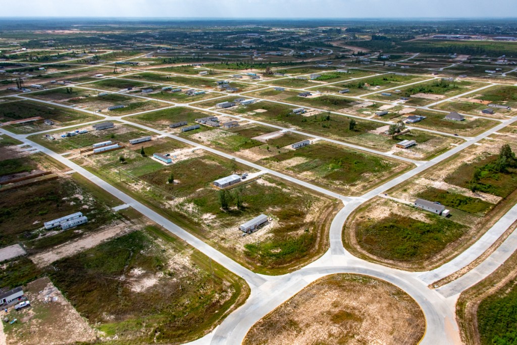
Two weeks short of Harvey’s sixth anniversary, FM1010, the main north/south artery between Huffman and Cleveland is still blown out due to excessive, uncontrolled runoff from Colony Ridge. Colony Ridge is the world’s largest trailer park and it’s just upstream near the East Fork San Jacinto in Liberty County. The productivity loss of local residents could easily have added up to half of a billion dollars by now.
Photos taken 8/12/23
I took all the photos below from a helicopter on Saturday, 8/12/23.
Blown out portion of FM1010, aka the Huffman-Cleveland Roadand Plum Grove RoadThe washout forces tens of thousands of nearby residents to take detour.
During rush hours, the backups on FM2090 from traffic trying to get to US59 can stretch miles because of failure to repair this bridge.
The washed out bridge lies at the end of this 2-mile Colony Ridge water cannon.This Colony Ridge drainage ditch, like most others, does not have backslope interceptor swales to help control erosionor runoff.
Neither does this part of Colony Ridge have detention basins to help reduce the amount of runoff flowing into the East Fork San Jacinto.
Estimated Cost of Delays
I wonder if it’s even possible to accurately calculate the number of “people hours” lost to the senseless washout of the FM1010 bridge. But I will try.
For the sake of argument:
Assume 10,000 commuters are inconvenienced for an hour a day (half hour each way).
Multiply that times 365 days and then again by 6 years. You come close to 22 million hours.
Now multiply that times $25/hour.
Assuming these numbers are even in the ballpark, the washout could have cost local residents more than half of a billion dollars. Geez! How much can a twin culvert bridge and some blacktop cost?!
Expansion Accelerates Despite Access Issue
But that hasn’t stopped the Colony Ridge developer from expanding.
Colony Ridge now comprises more than 30 square miles. It has virtually doubled in size in the last two years.Landsat photo from 7/18/23courtesy of Google Earth.
The development started around 2010. It now occupies 50% more land than Kingwood, which is now more than 50 years old.
The developer must be banking on a rapid increase in demand. He reportedly advertises in Mexico and Central America. The pitch: “Own your piece of America.”
Here’s what that looks like:
Note how the back yard is eroding into the drainage ditch.Photo courtesy of Chris Russo.
Long-Time Plum Grove Resident Worries about Evacuation During Storms
The long ditch above drains into Rocky Branch. According to a long-time Plum Grove resident, the stream was completely invisible from FM1010 “back in 2008 and 2011 even.” Then, he says, “Colony Ridge excavators and dozers showed up.” They widened and deepened the stream, but on the Colony Ridge side of the culverts only!
According to the resident, FEMA engineers have told Plum Grove that an actual bridge is now required to convey all the water and survive any length of time.
The resident vividly recalls Hurricane Rita approaching the Texas coastline in 2005 – before Colony Ridge. He said, “There was complete gridlock thru the City of Plum Grove as people from the Crosby and Beaumont areas were trying to evacuate inland. Plum Grove Road was bumper to bumper for 3 full days. Residents could not leave or get back home due to the gridlock thru our little city. How will THAT play out when the next Cat IV or V storm approaches us now that all the dense forests have been cleared?”
Good question!
Posted by Bob Rehak on 8/13/23
2175 Days since Hurricane Harvey
The thoughts expressed in this post represent opinions on matters of public concern and safety. They are protected by the First Amendment of the US Constitution and the Anti-SLAPP Statute of the Great State of Texas.
https://i0.wp.com/reduceflooding.com/wp-content/uploads/2023/08/20230812-RJR_2135.jpg?fit=1100%2C733&ssl=17331100adminadmin2023-08-13 19:33:252023-08-14 10:35:55Six Years After Harvey, Bridge Still Blown Out at Colony Ridge
Colony Ridge Land, LLC, developer of the world’s largest trailer park in Liberty County, is buying up Harris County property in the floodplain of the East Fork San Jacinto. Since the property in the Cypress Point subdivision was originally platted, flood maps changed in 2001 and are in the process of changing again. Most of the properties face serious flood risk that the current flood maps may not communicate.
Land Remains Uncleared
Development has not yet started. The land is still heavily wooded…so much so, in fact, that dirt roads developed in the 1980s have become overtaken by trees and undergrowth. They are barely passable according to one person I talked to.
Colony Ridge has acquired at least 19 (but not all) properties within red area.What the partially developed area looked like in 1988. Note unpaved roads nearest river.
Back in the late 1980s, the original developer cleared space for roads and platted the land going down to the East Fork. But today, paved roads stop about a quarter mile short of the river. From the air, those old dirt roads look like a slight indentation in the forest canopy.
Looking NE from over the utility corridor that forms the southern limit of the area. East Fork on right flows toward camera.Looking NE from farther north. Old roadway appears as a crease in the jungle.Still looking NE.Note how pavement on Birchwood Drive stops short of entering area.Reverse angle looking S toward Lake Houston visible as blue streak below horizon in upper left. Lake Houston Park on right.
The Big Question
Why did the original developers stop short of paving roads all the way to the river? The answer likely has something to do with floodplains. Note in the image below how several of the lots border or lay within the floodway. Many more lay within the 100- and 500-year floodplains.
How Bad Could Flooding Be?
But those floodplain maps are outdated and can mislead. High-water marks established by HCFCD and contour maps by the U.S. Geological Survey suggest this property has flooded seriously at least 8 times in the last 20 years.
Elevation profile from USGS National Map
From the East Fork to the end of Oaknoll Drive, the elevation rises from approximately 42.5 feet to 67 feet. The 24.5-foot difference might sound like a lot. But consider this.
In 1994, the flood of record for the East Fork in this area (before Harvey), crested at 76.2 feet. That would have put the highest property near Oaknoll under 9 feet of water. The lowest property near the river would have been under 33.7 feet of water.
Then came Harvey. At the nearest gage, the East Fork crested at 81.2 feet.
That would have put the highest and lowest properties under 14.2 feet and 38.7 feet of water respectively.
Even though most of the acquired properties are shown in the 500-year flood plain, most of them have been under water eight times in the 20 years since 1994.
Floodplains change with better understanding of the climate, upstream development, and better measurement technologies, such as LIDAR. Our current flood maps were developed after Tropical Storm Allison in 2001. But we’ve gotten a lot smarter about flood mapping since then.
That’s why Harris County Flood Control District and FEMA are updating flood maps for this area. The floodplains you see above will likely expand by 50% to 100% according to preliminary guidance from Harris County Flood Control. FEMA is in the process of certifying revised maps and should release them later this year or early next for public comment.
Are Readings from FM1485 Analogous to Cypress Point?
Give or take few feet, the flood depths cited above are probably in the ballpark. Even if the high-water marks at Cypress Point are a few feet lower, they still represent serious flooding.
HarrisCountyFEMT.org shows that the width of the floodplain at FM1485 and Cypress Point, lower left, does not vary significantly.
One of the region’s leading hydrologists who has studied this area extensively felt the flood heights at FM1485 would translate well to Cypress Point where Colony Ridge is acquiring property. Colony Ridge has purchased at least 19 properties in the affected area. The map below shows where they are.
Note how virtually all purchases happened after Imelda, which would have put even higher properties under almost six feet of water.
Another property valuation report shows how the land value decreased 73% after Imelda in 2019. Colony Ridge purchased most of the properties in 2020. Bargain hunting?
Homes on Stilts Likely Unaffordable for Colony Ridge Target Market
Many may not have a firm grasp of English. Few likely understand flood risk, especially the nuances of flood maps in flux. And Colony Ridge typically “owner finances,” meaning buyers don’t go through banks which would require flood studies and flood insurance before making a mortgage loan.
Under today’s guidelines for developing land in floodplains, especially this deep in floodplains, homebuilders would likely have to elevate homes on stilts. And elevating homes 35 feet high would likely make them cost prohibitive for most of Colony Ridge’s primary target market.
Watch this one closely to make sure that no rules get broken.
Posted by Bob Rehak on 8/4/23
2166 Days since Hurricane Harvey
The thoughts expressed in this post represent opinions on matters of public concern and safety. They are protected by the First Amendment of the US Constitution and the Anti-SLAPP Statute of the Great State of Texas.
https://i0.wp.com/reduceflooding.com/wp-content/uploads/2023/08/Cypress-Point-Sat-View-Outlined.jpg?fit=1100%2C864&ssl=18641100adminadmin2023-08-04 16:37:572023-08-05 10:22:59Colony Ridge Buying Up Floodplain Land in Huffman
On 7/22/22, I photographed two new developments at different stages of completion east of Huffman-Cleveland Road and south of the Grand Parkway. Both are being carved out of a 3,738-ac tract owned by LH Ranch LTD.
A third part of that tract, west of Huffman-Cleveland Road, is in the planning stages and submitting plats for approval.
General Location
The first two developments are immediately east of Huffman-Cleveland Road and south of Meyer Road. See red area below.
Red outlined area contains the two new developments.The third area is to the west (left) of the red box.
One of the new developments will become a “lagoon community” called Saint Tropez. Another will become a residential community called Los Pinos. The third will also become a residential community.
Saint Tropez
Megatel Homes has begun clearing land for what it says will become a $2 billion lagoon community spanning 1,000 acres.
Looking SW from over Meyer Road at the first part of what will become Saint Tropez.
According to Megatel, the development will eventually feature 4,500 homes, an enormous manmade lagoon with white sand beaches, paddle-boarding, kayaking, a swim-up bar, surf simulator, a water slide tower, a playground, cabanas, soundstage, splash park, and more.
An entertainment district will offer a restaurant, bar, teen arcade, bowling alley, and a children’s immersive indoor play area. That will certainly change the character of the rural Huffman area.
The development will feature both single and multi-family housing. Single-family homes will range in size from 1,500 square feet to 4,000 square feet and sell for between $350,000 to $700,000 each.
Full construction plans and a drainage analysis are not yet available. At this time, the Harris County Engineering Department has only issued a permit for clearing the land, but it shows a general layout.
Plan submitted to Harris County Engineering to obtain clearing permit. Intersection of Meyer Rd. and FM2100 in upper left.
Los Pinos
South of Saint Tropez, the second development is much further along. For it, I have obtained both construction plans and a drainage analysis via a FOIA Request.
Looking SE from over FM 2100. Note the large, linear detention basin in the foreground running diagonally through the frame.
Drainage Features
Phase One of the 130-acre Los Pinos Project will have approximately 250 single-family residential lots. The 1/3rd-acre lots will have about 30% impervious cover.
Plans claim that the total detention storage will exceed Harris County Flood Control District’s (HCFCD) minimum storage requirements. They require 270.4 acre feet, but the developer will provide 366.3 – 26% more.
Phase One sits in the FEMA’s unshaded X zone (higher than the 500-year flood plain). So there is no requirement for floodplain mitigation.
Preston Hydrologic, Inc., which conducted the drainage analysis, says, “The proposed detention basin will reduce the maximum sheet flow depths downstream of the development, for storm events up to and including the 1% AEP storm.” AEP means annual exceedance probability. And 1% refers to a 100-year storm.
The tract drains to Key Gully and two unnamed tributaries within the Luce Bayou watershed. This development falls outside Houston’s city limits in unincorporated Harris County.
Looking east from over FM 2100. Note a second large linear detention pond on the right bracketing the development.
Water in this area naturally flows toward the southeast where it enters Luce Bayou. The detention ponds that bracket the development are designed to contain rain falling on the development and water trying to flow across it.
Map from Preston Hydrologic’s drainage analysisshows layout of detention basins.
Six interconnected, dry-bottom detention basins will mitigate the impacts of development, according to hydrologists. The lots in proposed Phase 1 will drain into Ponds 2 and 6. Ponds 1, 3, 4, and 5 will intercept runoff from undeveloped land.
Peak flow estimate indicates ponds should hold a 100-year rainfalland cut peak outflow roughly in half(red vs. blue curve)
Claims No Adverse Impact
Hydrologists claim the development will cause “no adverse impacts” compared to the pre-project drainage conditions of the receiving streams in the Luce Bayou watershed. That includes downstream properties within the City of Houston.
They also estimate that overlandsheet flow will not cause any adverse impacts downstream of the project site. In fact, the hydrologists claim that the proposed project will reduce peak flow rates and runoff volumes to areas downstream. That, they say, will result in reduced ponding depths in the Huffman Hills subdivision and adjacent properties.
Small Part of Future Development
The 130-acre Los Pinos Phase One tract represents only 0.34% of the larger LH Ranch Tract from which it is carved. The hydrologists caution that future phases will require future studies of their own. They indicate that future uses of the LH Ranch tract may include additional single-family residential development, commercial development, and a wetlands mitigation bank.
The mitigation bank proposal showed that 25% of the LH Ranch tract would be set aside for mitigation.
The LH Ranch tract bridges two watersheds. The western portion drains to the East Fork. The eastern portion drains to Luce Bayou. Both eventually drain into Lake Houston. Much of the land was originally wetlands.
Image from same general area taken on January 2021 when tree canopy did not obscure ground.Note standing water.
Preston Hydrologic believes that the increased runoff from Los Pinos Phase One will not increase erosion in Key Gully. They base that opinion on three factors: a USGS estimate of soil-erosion potential in the area, reduced peak flow, and slower water velocity at the peak.
Potential Problems
Section 5.3 of the drainage analysis cites an inventory of potential problems. Among them: Colony Ridge. Preston’s report says, “Currently, a large developing area adjacent to the Harris-Liberty County line may create problems for water quantity and quality. This development is large-lot rural and uses underground septic systems located in the effective floodplain area of Luce Bayou. Additionally, it is possible that inadequate drainage infrastructure is being provided in the area, which could lead to a possible increase of floodwater peak flow rates downstream in Harris County.”
West of FM 2100, LH Ranch LTD and Friendswood Development applied to the Houston Planning Commission for plat approval of a 927-acre parcel on 8/4/22. This parcel is immediately west of the two projects discussed above. It drains into the East Fork on the left edge of the map below.
No further details are available at this time. I will watch it closely in the future months. One thing is clear: Huffman will never be the same.
Posted by Bob Rehak on 8/9/22
1806 Days since Hurricane Harvey
The thoughts expressed in this post represent opinions on matters of public concern and safety. They are protected by the First Amendment of the US Constitution and the Anti-SLAPP Statute of the Great State of Texas.
https://i0.wp.com/reduceflooding.com/wp-content/uploads/2022/08/20220722-RJR_0726.jpg?fit=1200%2C800&ssl=18001200adminadmin2022-08-09 14:25:202022-09-19 11:50:273738-Acre Property Developing Near Huffman
The Colony Ridge development in Liberty County, aka the world’s largest trailer park, has more than doubled in size in the last 3 years. Measurements in Google Earth show that Colony Ridge, which started clearing land in 2012, has expanded from approximately 8,000 acres in 2019 to almost 20,000 acres today. To put that in perspective, Kingwood comprises approximately 14,000 acres and took more than 40 years to build out.
Colony Ridge started developing on the left (west). It is expanding eastand north.
Growing Pains
But the rapid growth of Colony Ridge has not come without pain:
Rivers of mud continue to flow out of drainage ditches with big rains because the developer flaunted construction regulations for them.
Consequences of Poor Construction Practices
As a result of such drainage issues and exposed soils, more sediment flows downstream than otherwise would. This contributed to sediment buildups on the San Jacinto East Fork (see below). Those, in turn, reduce conveyance and contribute to downstream flooding – unless the public continues to spend millions on dredging.
East Fork Mouth Bar after Imelda but before recent dredging. Average river depth had been reduced to three feet.
Still Not Following Best Practices
Aerial photos taken on 7/22/2022 with Ken Williams and Bill Callegari, two fellow members of the Harris County Community Flood Resilience Task Force, show the current state of the development and construction practices in Colony Ridge. Sadly, not much has improved. For instance, the developer still piles dirt on the edge of ditches without protecting them with silt fences.
Note long drainage ditch cutting diagonally through middle of frame. Developer has piled dirt next to it (middle left of frame) without protecting ditch with silt fencing.Major ditch cutting through older section is sill not protected with back-slope interceptor swales or vegetation.Erosion is rampant.
Water shooting down the ditch above created a major headache during Harvey. See below.
FM 1010 Still Washed Out
Floodwater from the ditch washed out FM 1010. This major N/S thoroughfare still needs repair…five years later!
Break in FM 1010, aka Plum Grove Roadforces residents to detour for miles.
Photos Showing New Development
Area developed last year is starting to fill in with new trailer homes already.Note absence of fire hydrants…still.Looking east at area still under construction.Looking E from NE corner of development.Another area semi-cleared but still unpaved.
If there’s good news in these photos, it is that the developer appears to be leaving more natural ground cover in the newest areas. Still, without vegetation on the sides of ditches, without better construction practices, excess sediment could continue washing into the Lake Houston Area for years to come.
Downstream residents will continue to pay the price for egregious development practices upstream.
Someday, the people who buy these lots will also become flood victims of similar new developments even farther upstream.
Will we continue to repeat mistakes of the past in ever widening circles? Will we continue to sow the seeds of future flooding? Or will we wake up to the fact that we are all part of one giant community?
Posted by Bob Rehak on 7/23/2022
1792 Days since Hurricane Harvey
The thoughts expressed in this post represent opinions on matters of public concern and safety. They are protected by the First Amendment of the US Constitution and the Anti-SLAPP Statute of the Great State of Texas.
https://i0.wp.com/reduceflooding.com/wp-content/uploads/2022/07/20220726-Screen-Shot-2022-07-26-at-10.27.55-AM-2.jpg?fit=1200%2C854&ssl=18541200adminadmin2022-07-26 15:04:302022-08-29 15:09:39Controversial Colony Ridge Development Doubles in Size
This is Part II in a series about how to find and verify flood-related information. Yesterday’s post focused on finding good information about flood vulnerabilities. This second part will focus on reviewing developers’ plans. The second can compound the first.
The very first sentence of the Texas Water Code § 11.086 begins with a warning not to flood your neighbors. It says, “No person may divert or impound the natural flow of surface waters in this state, or permit a diversion or impounding by him to continue, in a manner that damages the property of another by the overflow of the water diverted or impounded.”
The second sentence declares that a person injured by diverted water may sue to recover damages. Of course, at that point the damage has already been done. Lawsuits are expensive and take years. And the defendant, usually a developer, will always point to plans prepared by a professional engineer and approved by a government body. Suing them will require expert witnesses. And the defendant will likely claim that you wouldn’t have flooded except for an Act of God.
Lawsuits are tall, expensive mountains to climb. So concerned residents near new developments are better off closely scrutinizing plans before they’re built and closely monitoring construction to ensure developers follow the plans.
You can’t stop development. But you can ensure developers play by the rules.
But how do you find and verify their plans?
Need to Find and Verify Info
If you notice a large piece of property for sale near you, monitor it closely. Check with the listing agent. Also check Houston’s Plat Tracker website. It’s updated before every meeting of the Planning Commission and shows items on their agenda. Houston also maintains a map-based website that shows projects in various stages of approval throughout the City and its extra-territorial jurisdiction.
Leap into action if you find a potential cause for concern near you. The next step is to obtain the development’s plans, the drainage impact analysis and soil tests. The developer must prove “no adverse impact” to people and properties downstream.
How you obtain those plans and studies depends on the development’s location. If inside a municipality, check with your city council representative. If you live outside a municipality, your best starting point will probably be your county engineer or precinct commissioner.
The plans are public information and must be provided in response to Freedom of Information Act (FOIA) Requests.
Signed, Stamped, Approved and So Obviously Wrong
In every case I reviewed during the last four years where someone flooded because of a new development, something jumped out of the plans that should have raised concerns for reviewers, but didn’t.
For instance, after Colony Ridge engineers apparently mischaracterized soil types, Plum Grove flooded repeatedly. The engineer said soils would let more water soak in than actually could. That meant the developer didn’t have to build as many detention ponds and could sell more lots. But it also contributed to flooding homes downstream.
Concerned citizens must learn how to obtain and review such plans for potential problems or hire a consulting engineer.
Here are some things I’ve learned to look for.
Soil Tests
Are they accurate? Were the samples taken at representative points? Or did they conveniently ignore wetlands? Permeability of the soils will affect the amount of detention needed. The level of the water table could affect the amount of detention provided.
If plans call for a ten-foot deep detention pond, but the soil test encounters a shallower water table, that will compromise the pond’s capacity. Capacity should be calculated from the top of standing water, not the bottom of the pond. If the pond is already half full, that half shouldn’t count.
Floodplain maps in Harris County are currently being revised. That may not be the case in surrounding counties. The lack of updated flood maps endangers current residents, by letting developers build to old and ineffective standards.
Developers often try to beat the implementation of new requirements. This happened in the case of Woodridge Village. It’s also happening in the case of the Laurel Springs RV Park and Northpark South along Sorters-McClellan Road. The entrance to the Northpark development sits in a bowl. A quick check of the elevation profile on the USGS National Map confirmed that. During Harvey, local residents tell me that not even high-water rescue vehicles could get through that intersection. Put the Cajun Navy on standby now.
Wetland Issues
Filling wetlands requires an Army Corps permit for some, but not all wetlands. Whether they fall under the Corps’ jurisdiction depends on how far up in the branching structure of a watershed they are. Those near the main stem are jurisdictional. Three levels up may not be.
The US Fish and Wildlife service has thoroughly documented wetlands in this area. Check their National Wetlands Database and appeal to the Corps if you find a problem. At a minimum, the developer may be forced to buy mitigation credits somewhere nearby, which could help reduce flooding.
Drainage Issues
Is a new development’s detention pond capacity adequate? Is it based on the right percentage of impermeable cover? If the pond(s) fill up, where will the water go?
Calculating detention capacity requires math skills most people don’t have. But you can check the basis for the calculations. Are plans based on new Atlas-14 requirements? Are plans meeting current Houston and Harris County requirements?
Current City of Houston and Harris County Requirements for Detention Pond Capacity
Also see where they’re routing excess water in case of an overflow.
In the case of the Laurel Springs RV Park, the developer said they would route the water to a detention pond near Hamblen and Laurel Springs in anything greater than a two year rain. See below.
Screen Capture from Laurel Springs RV Resort Drainage Impact Report shows that in anything greater than a 2-year rain, overflow water will could threaten homes in Lakewood Cove.
RV Park Site Outlined in White. Overflow described above would presumably follow red path.
Laurel Springs RV Park as of 11/29/21. Detention pond will go in foreground, but overflow will go into pond at top of frame according to text above.
Missing Details from Drainage Impact Analysis
I have requested additional details three times from the City but still have not received them. I suspect they may not exist. All other plan requests have been filled.
So what happens when the Lakewood Cove detention pond fills up? Or gets covered up in a flood? Overflow from the RV park will contribute to flooding someone downstream.
The developer also said excess capacity would get to the Lakewood Cove pond by overland sheet flow. That could threaten homes on the southwest corner of Lakewood Cove – visible in the middle of shot above.
But a City engineer reviewing the plans said overflow would follow the railroad tracks on the western side of the RV park. Hmmmm. Two engineers – one who developed the plans and another who approved them – 180 degrees apart. What’s a concerned citizen to do?
If the engineers who develop and review such plans were always right, no one would ever flood. But we do. So always find and verify those plans.
The thoughts expressed in this post represent opinions on matters of public concern and safety. They are protected by the First Amendment of the US Constitution and the Anti-SLAPP Statute of the Great State of Texas.
https://i0.wp.com/reduceflooding.com/wp-content/uploads/2021/11/20211129-DJI_0877-2.jpg?fit=1200%2C799&ssl=17991200adminadmin2021-11-29 19:09:202021-12-08 15:51:19How to Find and Verify Flood-Related Information: Part II
This morning, the Texas Commission on Environmental Quality (TCEQ), notified me that they again cited the controversial Colony Ridge development in Liberty County for lack of pollution controls.
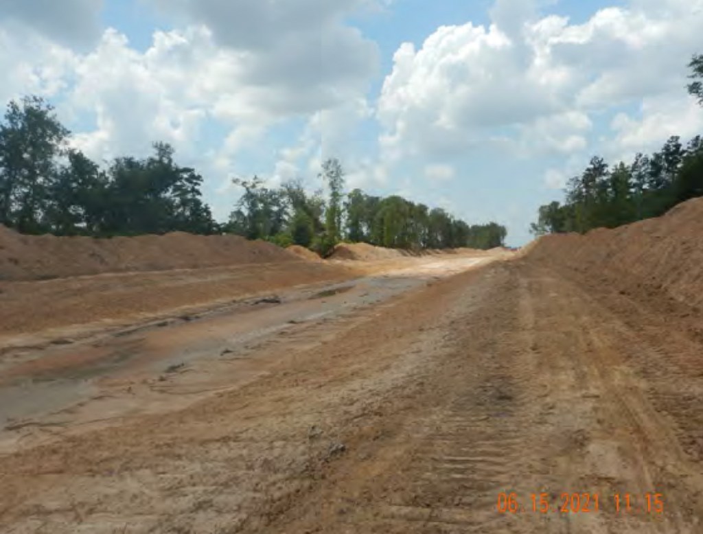
On June 15, 2021, the investigator found active construction along Long Branch Creek. He noted that the slopes of the creek were not stabilized. He also found un-stabilized sediment piles along the banks of the creek, a damaged silt fence, and an unstabilized drainage channel. Additionally, the slopes of Long Branch Creek were also un-stabilized.
Continuing north intoSection 12, the investigator noted more un-stabilized sediment piles on the edges of un-stabilized drainage ditches connected to Long Branch Creek. The slopes of Long Branch Creek were also un-stabilized in Section 12. While documenting active land clearing, the investigator noted an unprotected tributary that flows into Tarkington Bayou.
After reviewing the site’s stormwater pollution prevention plan, the investigator determined that Section 12 did not have erosion control measures installed as prescribed.
TCEQ Investigation #1736609
The investigation confirmed lack of best management practices at the construction site. One alleged violation was issued: Failure to install minimum controls.
From Attachment 4, “Unstabilized slopes in Long Branch Creek. Unstabilized sediment piles on the banks of Long Branch Creek.”
More unstabilized slopes and unstabilized sediment piles leading to Long Branch Creek from Attachment 4.
As per the Construction General Permit (CGP), D. Burton Construction LLC was required to “design install and maintain effective erosion controls and sediment controls to minimize the discharge of pollutants” and to document compliance with the stormwater pollution prevention plan (SWPPP).
That part of the document takes up the first four pages.
Supporting Documentation
A series of attachments make up the the next 181 pages.
Attachment 1: Vicinity Map
Attachment 2: TCEQExit Interview sent on June 24, 2021
Attachment 3: Permit Information
Attachment 4: Investigation Photographs
Attachment 5: Photo Locations Map
Attachment 6: Flyover Photographs
Attachment 7: Records Request Sent on June 16, 2021
Attachment 8: Response to Records Request
Purpose of SWPPP and Control Measures
The primary purpose of erosion control is to protect surface waters. To do that, TCEQ says contractors should protect slopes and channels.
“Convey concentrated storm water runoff around the top of slopes and stabilize slopes as soon as possible. This can be accomplished using pipe slope drains or earthen berms or other flow controls that will convey runoff around the exposed slope.”
“Avoid disturbing natural channels and the vegetation along natural channels, if possible.”
TCEQ
The SWPPP also contains a lengthy discussion of erosion and sediment controls beginning on page 78. I recommend it for anyone who thinks he/she may be receiving eroded sediment from a construction site.
Soil Report Largely Consistent with Earlier Findings Showing Need for Detention Ponds
Starting on page 128, you can also read an extensive custom soil report from the USDA Natural Resource Conservation Service.
They suggest this area will have a high amount of runoff after development. Little water will sink into the soils. And that could increase downstream flooding, unless the developer installs sufficient detention pond capacity.
Colony Ridge is in Liberty County. But if Harris County guidelines applied, they call for .55 acre feet of detention capacity per acre (for developments greater than 640 acres). Thus, if the area under development is 1200 acres, that would call for 660 acre feet of detention ponds (or 100 acres – six and a half feet deep). I saw nothing that large during my last flyover at the end of May.
It’s not clear at this time whether the developer has improved his erosion-control measures. Two calls to the TCEQ have not yet been returned.
Posted by Bob Rehak on 9/3/2021 based on TCEQ Investigation #1736609
1466 Days since Hurricane Harvey
The thoughts expressed in this post represent opinions on matters of public concern and safety. They are protected by the First Amendment of the US Constitution and the Anti-SLAPP Statute of the Great State of Texas.
https://i0.wp.com/reduceflooding.com/wp-content/uploads/2021/09/20210903-Screen-Shot-2021-09-03-at-2.03.57-PM.jpg?fit=1200%2C912&ssl=19121200adminadmin2021-09-03 15:34:322021-09-03 16:04:38TCEQ Again Cites Colony Ridge for Lack of Pollution Controls
In the last year, I have researched and written more than 50 posts that mentioned Colony Ridge, the controversial Liberty County development with suspect drainage practices. In the last six months, County and State officials have stonewalled requests for documents that could help prove or disprove Colony Ridge violations of the County’s own drainage regulations.
Lack of back-slope interceptor swales and drains means water from lots erodes ditchesand sends sediment downstream. Liberty County drainage regulations require back-slope interceptor systems and grass.See Section M on page 100 of Liberty County Subdivision and Development Regulations. But lack of those measures has widened ditch more than 35 feet due to erosion in 6 years, according to Google Earth.
During that year, Wayne Dolcefino, an eminent investigative journalist with a long list of awards, also started investigating Colony Ridge. He, too, has been stonewalled.
Dolcefino and the City of Plum Grove have filed even more requests for information than I and received little. Today, Dolcefino launched another broadside to remind people that their elected representatives seem to be representing a developer instead of them. See his report below.
Dolcefino Stonewalled; Issues Press Release
The tiny Liberty County, Texas town of Plum Grove has been fighting to save itself from real estate developer Colony Ridge, and now the town is battling back with subpoenas for the records that will prove whether missing drainage records ever existed at all.
One of those subpoenas was delivered to LandPlan Engineering—the engineering firm that allegedly prepared the plans for the sprawling Colony Ridge subdivision that caters to illegal immigrants with owner-financed lots that do not require government documents to prove identity.
LandPlan has been asked to produce drainage records, but they have also been asked to show the information that they received about flooding events that have helped swamp Plum Grove properties and destroy the town’s roads. In other words, once Colony Ridge created a subdivision that flooded its neighbors, did anyone care?
The fact that drainage records were missing was uncovered by Dolcefino Consulting, who were hired by the town to investigate possible corruption involving the Liberty County officials who approved what is now becoming the biggest community in the entire county.
“Good Ole’ Boy Protection Racket”
Liberty County has known for months the drainage records were missing and has ignored calls to force LandPlan and Colony Ridge developer Trey Harris to produce the records. An alleged investigation by the Liberty County Attorney Matt Poston has never been produced. Emails show that the county engineering firm LJA hasn’t pressed the issue either.
“There is absolutely no excuse for Liberty County to have not forced the production of these records long ago,” said Wayne Dolcefino, President of Dolcefino Consulting. “The Liberty County Judge Jay Knight has proven his negligence, his absolute disdain for the people of Plum Grove, and the next time it floods, if animals or people die, the blood will be on his hands. That’s the bottom line. I bet he would care if it was his neighborhood.”
The former county engineer Louis Bergman was also subpoenaed. When Bergman left his job with Liberty County, he left with many of the Colony Ridge development records.
“Bergman should have been brought before a grand jury to detail his relationships with Colony Ridge and whether his recommendations to approve these neighborhoods were based on facts or good ole’ boy engineering,” Dolcefino said.
Bergman is the father of the Liberty County District Attorney, who has ignored calls from Dolcefino Consulting.
The flood dangers created by Colony Ridge have threatened the world-famous Ima Survivor Sanctuary in Plum Grove, prompting angry calls for action from hundreds of thousands of supporters across the globe.
“Time is running out Judge Knight,” Dolcefino said. “When Plum Grove proves the truth—and the lawyers at Lloyd Gosselink will—the truth will come out.”
The Plum Grove investigation has led to the filing of a criminal complaint by Dolcefino Consulting against the State Representative for Plum Grove Ernest Bailes.
Bailes refused to provide phone records that were sought in the investigation of his relationship with developer Trey Harris. Bailes has refused to deny acceptance of any trips or private business from Harris. The San Jacinto Sheriff Greg Capers has refused to investigate Bailes.
“This good ole’ boy protection racket would rather protect Representative Bailes than the public right to know,” Dolcefino said. “Since our reporting on San Jacinto County began, we have received some interesting tips. Stay tuned.”
I might add that for months I have been stonewalled, too. Not one of my inquiries about the county’s drainage investigation which was launched last January has even received an “I can’t comment about ongoing investigations”!
Posted by Bob Rehak on 7/15/2021 based on a press release by Dolcefino Consulting
1416 Days since Hurricane Harvey and 655 since Imelda
The thoughts expressed in this post represent opinions on matters of public concern and safety. They are protected by the First Amendment of the US Constitution and the Anti-SLAPP Statute of the Great State of Texas.
https://i0.wp.com/reduceflooding.com/wp-content/uploads/2021/07/20210526-RJR_8518.jpg?fit=1200%2C800&ssl=18001200adminadmin2021-07-15 14:05:372021-07-15 14:05:45Town Fighting for Survival Stonewalled By County, State Officials at Every Turn
Wetlands are nature’s way of slowing water down after a rain. They also filter runoff before it reaches streams, reducing the amount of sediment pollution.
Looking north from a helicopter. Notice how ditch and roads are beginning to push into woods at top of frame.As with previous sections recently developed, Colony Ridge is not too picky about piling dirt next to ditches where sediment can wash back in.Piling dirt next to the ditches seems to be a standard practice.Note how it’s already washing back into the ditch in the lower left of this photo.
If the developer were following best management practices, according to the TCEQ and Stormwater Pollution Protection Plan recommendations, you would expect to see temporary grass, rock gabions, silt fences, and hay bales in these photos. All check the flow of sediment into ditches.
Draining the swampLooking SE toward the east part of Sante Fe (Sections 6-11) already cleared. Note swampy areas at bottom left.
Biden Trying to Restore Clean Water Act Protections
Ironically, all this development comes as the EPA under the Biden administration seeks to put teeth back into the Clean Water Act. The administration is trying to restore the definition of “Waters of the United States” that Trump restricted. Yesterday, the Justice Department submitted a legal filing that begins that process.
The EPA and Department of the Army have formally requested repeal of the Trump-era rule. That rule exempted many developments near upstream tributaries such as Luce and Tarkington Bayous from the need to obtain permits under the Clean Water Act. It basically removed large swaths of land from regulation by the US Army Corps of Engineers.
According to this Associated Press article by Matthew Daly on 6/9/2021, environmental groups and public health advocates said Trump’s interpretation of Waters of the US “allowed businesses to dump pollutants into unprotected waterways and fill in some wetlands, threatening public water supplies downstream and harming wildlife and habitat.”
Daly quotes Jaime Pinkham, acting assistant Army secretary for civil works as saying, “The Trump-era rule resulted in a 25% reduction in the number of streams and wetlands that are afforded federal protection.”
It’s unclear at this time whether rollback of Trump regulations will affect Colony Ridge. Even if the changes survive legal and legislative challenges, it could be years before they take affect.
The thoughts expressed in this post represent opinions on matters of public concern and safety. They are protected by the First Amendment of the US Constitution and the Anti-SLAPP Statute of the Great State of Texas.
https://i0.wp.com/reduceflooding.com/wp-content/uploads/2021/06/RJR_8410.jpg?fit=1200%2C800&ssl=18001200adminadmin2021-06-10 17:39:512021-06-10 17:56:09Colony Ridge Expanding North Into More Wetlands
The Texas Commission on Environmental Quality (TCEQ) finalized nine investigations into Colony Ridge construction practices this week. Eight of the nine found violations. And six of the eight scolded Colony Ridge for lack of best management practices relating to erosion controls. The other two cited Colony Ridge for operating without a permit.
Summary of Violations
The TCEQ meticulously documented the findings with dozens of photos and supporting documents. The nine investigations total 2,341 pages. Below is a summary of the investigation numbers, subdivisions and violations:
#1699286, Sante Fe #6, operating without a permit
#1704908, Long Branch, best management practice (BMP) violations
#174909, Sante Fe #5, failure to meet final stabilization requirements, large bare areas of unstabilized soil
#1704912, Sante Fe #8, erosion control measures not installed
#1404914, Sante Fe #9, erosion control measures not installed
#1704916, Sante Fe #10 and #11, erosion control measures not installed
#1704918, Sante Fe #10 and #11, no violation
#1707467, Sante Fe #10 and #11, operating without a permit
The best management practices and erosion control measures cited above are designed to prevent the rivers of mud seen coming from Colony Ridge. The mud has partially plugged local creeks in Plum Grove, contributing to flooding. It has also contributed to sediment buildup farther downstream near the mouth bar of the San Jacinto East Fork.
Six of the TCEQ violations relate to best management practices and erosion control. For instance:
Planting grass can stabilize soils.
Silt fences can prevent dirt from entering ditches.
Rock gabions can reduce the velocity of water, thus reducing erosion.
But the investigations found little evidence of any such practices. And when they did, the measures were often ineffective due to lack of maintenance. For instance, water eroded around and under silt fences, rendering them useless.
Dirt piled on sides of ditches. No silt fences, grass, or gabions. Photo taken May 26, 2021.
When you clear thousands of acres at a time, erosion control is important to protect downstream neighbors.
Two of the other investigations found Colony Ridge operating without a valid permit.
Conditions For Obtaining Permits
The National Pollution Discharge Elimination System (NPDES) requires developers to formulate Stormwater Pollution Prevention Plans (SWPPP) as a condition of obtaining their permits. The plans should:
Control the perimeter of the site
Protect receiving waters adjacent to the site
Follow pollution prevention measures
Protect slopes and channels
Stabilize the site as soon as possible
Minimize the area and duration of exposed soils at any one time
Part of Colony Ridge expansion area covered in TCEQ investigations. Photo taken March 3, 2021.
The goals of pollution prevention plans include:
Retaining sediment on the property
Selecting, installing, inspecting, and maintaining sediment control measures in accordance with good engineering practices
Removing offsite accumulations of sediment that escapes the property at a frequency sufficient to minimize offsite impacts
Preventing litter from becoming a pollutant source in stormwater discharges
Accumulations of litter on banks of Colony Ridge ditch – definitely not a best management practice. Photo taken March 3, 2021.
Penalties Unclear at This Time
It’s unclear at this time whether the TCEQ violations will result in any fines for Colony Ridge. Typically, the TCEQ gives regulated entities a chance to remedy violations before levying fines. However, the recurring nature of these violations may call for a new approach. TCEQ has warned Colony Ridge about similar issues in the past, saying that Colony Ridge violations could adversely affect human health. However, violations continue.
Clearly, the ability to fix problems without a fine – after silt has been discharged into bayous, streams and rivers – seems like an incentive to ignore, not obey, regulations. Violators can simply fix problems if caught and, if not, take their profits to the bank.
Looking south. Photo taken May 26, 2021. Colony Ridge continues to push north with same construction practices.
Conclusions of All Nine Reports
The reports comprise almost 650 megabytes. They are far too large to post in a forum like this. However, I have captured screen shots of the reports’ conclusions for those who wish more detail.
#1699286: operating without a permit
#1704908: failure to maintain and properly install BMPs
#1740909: failure to achieve final stabilization requirements, large areas of bare soil
#1704910: Failure to maintain BMPs, install them properly and stabilize drainage channels.
#1704912: erosion control measures not installed
#1704914: failure to install even minimum erosion controls.
Posted by Bob Rehak on 6/5/2021, based on TCEQinvestigations
1376 Days since Hurricane Harvey
The thoughts expressed in this post represent opinions on matters of public concern and safety. They are protected by the First Amendment of the US Constitution and the Anti-SLAPP Statute of the Great State of Texas.
https://i0.wp.com/reduceflooding.com/wp-content/uploads/2021/06/20210526-RJR_8409.jpg?fit=1200%2C800&ssl=18001200adminadmin2021-06-05 14:50:582021-06-05 15:04:04Eight TCEQ Investigations Reprimand Colony Ridge Construction Practices
Yesterday, I wrote how the San Jacinto East Fork seemed to have re-routed itself through an abandoned sand mine. This morning I got a call from a couple who live near the mine. The woman and her husband had been trapped in their home for three days by the river which is now – incredibly – running right beneath their home. As of 5 p.m. Tuesday, floodwaters subsided enough for them to boat to safety. But their story is a gripping lesson in how quickly life can change.
Dream Turned into Nightmare
Jack Arnold bought 25 acres in the country back in 2002 to have a retreat from the noise of the city. He works in structural steel and quiet Plum Grove in Liberty County seemed like the perfect place to unwind. He and his sons built a home in 2011 on steel poles 21 feet in the air about 400 feet east of the San Jacinto East Fork.
The spot Arnold cleared for his home in 2011, east of the East Fork San Jacinto which runs through the woods to the left of the red box.
Then three things happened.
In 2012, a sand mine started up about 1100 feet south of him.
Later that year, Colony Ridge started building northeast of him.
His ex-wife sold 16.5 acres of their property to the sand mine, which then expanded around him.
It didn’t take long for Arnold’s flooding woes to start.
Sand Mine and Colony Ridge Permanently Alter Hydrology of Area
Here’s what the surrounding area looks like today.
FEMA’s National Flood Hazard Layer Viewer shows that the sand mine’s dikes have constricted the East Fork floodway (cross-hatched area) about 90%. This puts tremendous pressure on the mine’s dikes as water tries to squeeze through a fraction of the space. That also increases erosion which further breaks down the dikes.The constrictions could be one reason why the river rose 10 feet in 24 hours at this location.
Arnold says his property never flooded in the first five years he lived there. Then in 2015, as Colony Ridge and the sand mine expanded around him, he started flooding regularly. Last Sunday, the water started rising again. This time, it was from an 8-inch rain that areas upstream received. Plum Grove itself received only a little more than 3 inches. Harris County’s meteorologist characterized the 8-inch rain, which fell over a two-day period, as a ten-year rain.
Near Death Experience, Not to Mention…
As floodwater rose around the Arnolds last Sunday morning, they had a hard time understanding why. But it kept coming up and up. Three days later, it’s still four-feet deep (waist high) under their house and moving so fast it could knock strong men over.
Arnold nearly died in a previous flood event when he was swept away. He clung to a tree for two hours until his second wife and stepdaughter rescued him. Then all three had to be rescued by the game warden three days later. Now, Arnold takes no chances. He and his wife have been holed up alone for three days waiting for the water to go down. They each have missed two days of work so far this week, because they couldn’t reach their cars which they parked on higher ground.
Altogether, they have lost nine vehicles, two campers, and a boat since the flooding started. Another reason they were reluctant to leave their home despite being trapped: looters stole all their valuables after they evacuated during a previous flood.
Begging For a Buyout that Hasn’t Yet Come As Flooding Gets Worse
The Arnolds don’t want to move; after all, Arnold built the home with his own hands. But he and his wife just can’t take any more flooding. Now, they just want out. They’re begging for a buyout that hasn’t yet come.
Perhaps worse, the sand mine has been sold to a company that wants to turn it into an RV park. Which means there’s no one to fix the dikes which ruptured during the latest flood. In a phenomenon that geologists call pit capture (or river capture), the East Fork rerouted itself through the sand mine and then filled the mine up like a water balloon. The water balloon then broke more dikes on the southern end of the mine in a location that is not aligned with the bridge openings over the East Fork.
The main current of the river has been running through the mine and under the Arnolds’ home for days now.
House Built in the New River Bed?
Now the Arnolds worry they may have a house built in the river. Of course, they won’t know until the flood water goes down. And even though the water level has lessened slightly since yesterday, it is still too high and too dangerous to venture out. See images below.
Looking SE. Sand mine dikes have broken on the lower right and now water rushes out of the west fork, crosses the mine and goes under Arnolds’ house in the trees on the left.
Looking NW. Note how the pressure of the water has collapsed the swimming pool in their side yard.
Looking NW.The water then rushes back into the mine from the south side of the property.
Posted by Bob Rehak on 5/4/2021 based on personal observations and interviews with Michael Shrader, and Jack and Pamela Arnold
1344 Days since Hurricane Harvey and 593 since Imelda
The thoughts expressed in this post represent opinions on matters of public concern and safety. They are protected by the First Amendment of the US Constitution and the Anti-SLAPP Statute of the Great State of Texas.
https://i0.wp.com/reduceflooding.com/wp-content/uploads/2021/05/20210504-DJI_0704.jpg?fit=1200%2C900&ssl=19001200adminadmin2021-05-04 16:04:052021-05-04 21:35:32Family Trapped For Three Days As Floodwaters Ripped Through Sand Mine, Then Under Their Home