Tag Archive for: City of Houston

Details of Four SJRA Grant Applications for TWDB Flood Infrastructure Funds

Yesterday, I ran an article about Texas Water Development Board (TWDB) Flood-Infrastructure-Fund Grant Applications. It incorrectly stated that the City of Houston had applied for six flood infrastructure fund grants. However, five of those listed were actually submitted by other entities, such as the San Jacinto River Authority (SJRA). Below is more information about those grant applications.

Elm Grove Project Correctly Attributed to City

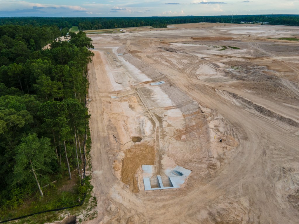
The City did apply for a grant to fund construction of a detention basin on the Perry Homes’ Woodridge Village Property north of Elm Grove Village in Kingwood. It was correctly attributed.

Four Projects Should Have Been Attributed to SJRA

The SJRA submitted four of the five applications that were incorrectly attributed.

  1. San Jacinto River Sand Trap Development
  2. Spring Creek Watershed Flood Control Dams Conceptual Engineering
  3. Upper San Jacinto River Basin Regional Sedimentation Study
  4. Lake Conroe-Lake Houston Joint Reservoir Operations Study

Mayor Pro Tem and District E Council Member Dave Martin personally supported those projects, hence the confusion. TWDB rules for Flood Infrastructure Fund Grants place a premium on support by all affected governmental entities within a watershed. Those include cities, counties, MUDs, river authorities, townships, etc.

Details of SJRA Grant Applications

Here’s more information about those four proposals.

  1. The Sand Trap Study currently underway has to do with identifying acceptable locations for the sand traps. Once identified, the new grant would cover the cost of their detailed design. The proposed study would extend work currently underway.
  2. The Spring Creek Watershed Flood Control Dams Conceptual Engineering Grant would cover the cost of partially designing dams. The San Jacinto River Basin Study identified locations for the dams. But it did not look at construction details. The new study would look at things, such as environmental impacts, utility conflicts, height of embankments, size of reservoir, etc. It continues work to date in the Spring Creek Watershed. San Jacinto River Basin Study partners have not yet released the locations.
  3. The Regional Sedimentation study builds on KBR’s work in 2000. KBR studied portions of the watershed that drain into Lake Houston, but not the East Fork, Caney Creek and Peach Creek. The new study has two objectives: understand where sediment is coming from and what can be done to reduce it. For instance, if the sediment is coming from new developments or sand mines, there may be a need to look at regulations that affect those.
  4. The Lake Conroe-Lake Houston Joint Reservoir Operations Study would look at the best ways to operate the two dams under different storm scenarios. It would assume the construction of additional floodgates on Lake Houston. It would also model storms approaching from different directions. The study will answer questions, such as “What would the effect of pre-releasing water into Galveston Bay be on Cities such as Baytown if a hurricane approaches from the south?” The deliverable: an operations plan.

Sedimentation and Its Role in Flooding

Two large sources of sediment: sand mines and new developments. Here the drainage for the Artavia development tries to find a path to the West Fork, through or around two sand mines. One of the mines was cited by the TCEQ for discharging 56-million gallons of sediment-laden wastewater into the West Fork.
The City, County, State and Federal Government are still working to remove the West Fork Mouth Bar, 1040 days after Hurricane Harvey. This bar is partially the result of excess sedimentation. During Harvey, this bar formed a partial dam that contributed to the flooding of more than 4000 homes and businesses.

More East Fork Gages in San Jacinto County

In addition, the SJRA has applied for a grant to purchase several more stream gages in San Jacinto County. San Jacinto County lies between Cleveland and Lake Livingston.

San Jacinto County partnered with the SJRA on that grant and would provide ongoing maintenance and operations if the application is successful.

Benefits of Additional Gages

Those additional gages would extend the flood-warning time for people in the East Fork Watershed. Such information is crucial for developing evacuation plans in emergencies.

The gages would also help inform the gate operations at Lake Houston. During Imelda, the East Fork received ten times more rain than the West Fork, but the West Fork has far more gages. That hindered understanding of where the danger was coming from and when it would strike.

As news becomes available about other grant applications in the San Jacinto Watershed, I will post it here.

Posted by Bob Rehak on 7/4/2020

1040 Days after Hurricane Harvey

City Applies for TWDB Grants to Turn Woodridge Village Into Detention Basin and More

Correction on 7/4/2020: The article below was based on a City of Houston District E newsletter. It inferred that the City “applied for” five grants (in bullet points below). Other entities, such as the SJRA, applied for those. Mayor Pro Tem Dave Martin personally supports them.

The City of Houston has submitted several applications to the Texas Water Development Board (TWDB) for Flood Infrastructure Fund dollars. Among the projects was one for Taylor Gully Flood Damage Reduction. It consists of evaluating flood reduction alternatives plus design, permitting, and construction of a detention basin located on a 278 acre site to the north of the Elm Grove subdivision.

Looking SW at Woodridge Village as of 6/16/2020

Woodridge Project One of Six Apps

Other applications include:

  • San Jacinto River Sand Trap Development
  • Spring Creek Watershed Flood Control Dams Conceptual Engineering
  • Upper San Jacinto River Basin Regional Sedimentation Study
  • Lake Conroe-Lake Houston Joint Reservoir Operations Study
  • Harris County MUD #153 Siltation Reduction

“All of these projects submitted for funding promote regional resiliency and future sustainability in an effort to protect life and property from future flooding,” said Mayor Pro Tem and District E City Council Member Dave Martin. “The ability to submit these projects to the TWDB for funding would not be possible without State Senator Brandon Creighton’s writing of Senate Bill 7. We continue to applaud the Senator for his forward thinking and hope to receive funding for these projects. State Representative Dan Huberty has also been a vocal proponent for resiliency within our area and just beyond the City boundary. We are thankful to have him as a local engaged leader.”

Looking NW from US59 (foreground) over San Jacinto West Fork at the confluence of Spring Creek (left) and the West Fork (right). Spring Creek splits off to left. Its watershed contains several natural areas that might make candidates for flood control dams.

Neither Martin, nor his office, provided additional details on any of the grant applications.

However, from the wording of the release, it sounds as though state leaders are fully aligned and engaged to support the projects.

Woodridge Village Project Has Long History

The grants, if approved, could help reduce flooding throughout the Lake Houston Area.

The Taylor Gully/Woodridge Village project is the most urgent. Homes around the troubled development flooded twice last year. At a Kingwood Townhall meeting in February, Martin said the County should pay for 100% of that project. But then the County demanded that the City should pay for half of the purchase price of the land. And at the next Commissioners’ Court meeting, Commissioner Ellis changed the deal again. He demanded that the City pay for half of the construction costs also.

Both the City and County have been silent on any deal since then. The County refused a Freedom of Information Act request to release the text of the motion, which was approved in a public meeting. They even protested release of the information to the State Attorney General.

Putting Application in Historical Context

The following is speculation, but speculation based on the historical context. It appears that when County Commissioners voted to demand that the City come up with half the the purchase AND construction costs, the City found it hard. The grant application, if successful, is a way for the City to help the people of Elm Grove, who flooded twice last year after Perry Homes cleared 268 acres of adjacent land.

At the time of the floods, less than 25% of the planned detention pond capacity was in place. Perry has since developed additional detention ponds that provide the other 75%.

However, even that probably won’t be enough to absorb a 100-year rain. That’s because Perry Homes rushed to have the project approved before NOAA’s new Atlas-14 precipitation frequency tables went into effect. The new Atlas-14 standard would require about 40% more detention capacity. And that’s what the purchase is all about.

Rumor has it that political forces are aligned to accelerate this particular request.

Observations on Other Grant Applications

Of the other applications, two surprise me.

A joint reservoir operations study seems necessary. Currently, FEMA is funding a preliminary engineering study to add additional gates to the Lake Houston Spillway. If FEMA also approved the money for construction of the gates, they will be a game changer.

The Spring Creek Watershed flood control dams would provide additional upstream detention. Community leaders identified that as a high priority after Harvey. They would reduce the amount of water coming downstream during a flood.

Harris County MUD #153 contains Lake Houston shoreline where silt from Rogers Gully has accumulated. Earlier this year, Harris County Flood Control cleared a large part of the Gully, but the part owned by the City remains clogged with a mouth bar.

Sand bar blocking mouth of Rogers Gully has backed up water and contributed to flooding. Photo taken 6/16/2020.

Posted by Bob Rehak on 7/3/2020

1039 Days since Hurricane Harvey

Perry Contractors Now Focusing on Finish Work for Detention Ponds

Perry Homes’ current contractors have excavated 3X more detention pond volume in ten weeks than the previous contractors did in virtually two years. During this past week, they finished excavating three ponds on the northern section of Woodridge Village. Together, they comprise 77% of the total detention volume for the whole site.

Excavation Done, but Finish Work Remains

That doesn’t mean they’re totally done with the ponds. Recent aerial photos show that they still have much finish work to do. That includes:

  • Shaping the sides
  • Creating backslope swales
  • Installing pipes to funnel water from the swales into the ponds and channels
  • Ensuring water can flow out of Adams Oaks in Porter on the west side of the subdivision into Taylor Gully as it previously did
  • Creating concrete “pilot channels” in the center of the ponds and larger channels
  • Planting grass along the sides of the slopes to reduce erosion
  • Installing outflow control in several places to hold back floodwaters
  • Building maintenance roads around the ponds

Elm Grove resident Jeff Miller, who monitors the progress of construction daily, says crews are already hard at work on many of those tasks.

Ponds NOT Expanded Beyond Initial Plans

Miller has compared the width and depth of ponds to the initial plans and verified that the ponds are being built to original specifications. Since the ponds were designed to meet pre-Atlas 14 rainfall requirements, that means the site will still hold 30-40% less runoff than needed to meet current regulations.

Still, surrounding residents in Porter, North Kingwood Forest and Elm Grove who flooded twice last year will find three large ponds on the northern section a welcome addition. They provide some measure of extra protection. Residents will have four times more upstream detention volume than they had during Imelda.

Racing Against Risk

With the peak of hurricane season now less than two months away, Perry Homes is in a race against risk. The company may regret the six months of virtual inactivity between the completion of pond S2 and the start of work on ponds N1, N2, and N3 in early April.

The faster pace of current construction puts pressure on Harris County and the City of Houston to complete an offer if an offer will be made. Elm Grove residents lobbied the City and County to purchase the property and build a regional flood detention facility. They center would also help protect downstream residents on the East Fork and Lake Houston.

However, at a Kingwood Town Hall Meeting in February, Mayor Pro Tem Dave Martin announced that the City would not participate in a deal. He said it was the County’s responsibility.

In April, the County announced that it would consider purchasing the land if the City contributed land in lieu of cash to cover half the purchase price.

Then in May, the County increased its demands. The County now wants the City to contribute land in lieu of cash to cover half the purchase AND construction costs for creating additional detention.

County and City Clamp Down on Communications

Since then, the County has clamped down on communications regarding this subject. Rumors suggest that all parties are still trying to make a deal happen. But the County has denied all FOIA requests and referred them to the Texas Attorney General for a ruling on their denials. That often happens when negotiations are in progress, according to a knowledgeable source.

What Happens Next?

At the contractor’s current rate of progress, it’s entirely possible that contractors will complete all work on detention ponds in July.

The City and County blew through a May 15 deadline that Perry put on the deal. But a “For Sale” sign at the Woodland Hills entrance remains on the property.

With approximately $14 million dollars invested in the property, with hurricane season here, with lawsuits pending, and knowing that the amount of detention is insufficient to hold a 100-year rain, Kathy Perry must be sweating bombshells.

Ms. Perry may be hoping for a City/County offer, but she can’t be counting on one. If she were, she could have sold the dirt coming out of those detention ponds. Instead, however, she’s building up land elsewhere on the site to keep her options open and develop the site if a deal falls through.

That dirt will have to be moved again at taxpayer expense if the county builds additional detention ponds.

Pictures of Site as of 6/19/2020

Here’s what the site looked like as of 6/19/2020.

Looking NW from over Taylor Gully toward Pond N2, the largest on the property.
The connecting channel between N1 at the top of the frame and N2 along the western edge of the property has been excavated. Note the pilot channel that contractors have started in the distance.
At Mace Street in Porter, contractors created a concrete face for the twin culverts on the upstream side, but not yet on the downstream side. Note the earthen dam holding water back while contractors complete the pilot channel running off the bottom of the frame.
Above Mace Street, contractors are still putting in pipes between the channel and backslope swales.
The Webb street entrance to the site has been removed to connect N1 (out of frame on the top) with N2 (out of frame on the lower left).
Looking SE at N1.
Looking South at N3, which runs down the eastern edge of the property.
More pipes are being put in to channel water from backslope swales to the pond so water won’t erode the face of the pond. Not the rills already cut in the dirt.
Looking SE. The southern half of N3 where it connects with Taylor Gully in the upper right.
N3’s connection to Taylor Gully is now wide open. It’s not clear how this connection will be completed to release the water at a slow controlled rate.
The two culverts under the bridge over Taylor Gully should slow the water from N2 (upper right) and N1 (out of frame) down.

Need for Grass if Deal Not Reached Quickly

Note how the grass on the southern side of the gully has all died. That raises a question. If Perry, the City and County do not complete a purchase agreement soon, will Perry plant grass on the northern section to slow runoff. Right now, it’s all hard-packed dirt.

Most of northern section is hard packed dirt which increases runoff rate.

Planting grass over an area this large would be a big investment and might get in the way of construction if Perry decides to develop the land. But it will reduce flood and legal risks.

Posted by Bob Rehak on 6/20/2020

726 Days after Hurricane Harvey and 275 after Imelda

Minimum Drainage Standard Recommendations for Communities In or Draining Into Harris County

In April, Harris County Commissioners directed the County Engineer and Executive Director of the Flood Control District to recommend minimum drainage standards for all communities in Harris County. The idea: to protect the County’s $2.5 billion flood bond investment. Lax standards in one place could undermine mitigation projects in another.

High-Level Recommendations

In May, the two executives came back to Commissioners Court. Here is what they recommended. These ideas apply to all cities within Harris County as well as those outside the county, but which drain into Harris County.

The recommendations must be adopted within municipal boundaries AND extraterritorial jurisdictions by December 31, 2020, IF the municipalities in question wish to partner with the county on any flood bond projects. That’s a $2.5 billion stick the county wields and that’s a powerful incentive.

Here are the recommendations:

  • Use Atlas 14 rainfall rates for sizing storm water conveyance and detention systems.
  • Require a minimum detention rate of 0.55 acre feet per acre of detention for any new development on tracts one acre or larger in size. However a single family residential structure and accessory buildings proposed on an existing lot is except from providing detention.
  • Prohibit the use of hydrographic timing as a substitution for detention on any project, unless it directly outfalls into Galveston Bay.
  • Require no net fill in the current mapped 500-year flood plain, except in areas identified as coastal zones only.
  • Require the minimum Finished Floor Elevation (FFE) of new habitable structures be established at or waterproofed to the 500-year flood elevation as shown on the effective Flood Insurance Study.

County Has Hired Engineering Firm to Identify Specific Changes

These are higher-level recommendations than those the County asked the City of Houston to make as a condition for the purchase of the Woodridge Village property in Montgomery County. The reason: The list provided to the City pertained to actual regulations that needed to change as a result of these high-level directives.

The County has hired an engineering firm, EHRA Engineering, to assist communities in evaluating and updating their policies and ordinances at no cost to the community.

End-of-Year Deadline

To help ensure participation, no partnership projects, including flood control or county roadway projects, will be constructed after December 31, 2020, in communities that have failed to implement these minimum standards. Projects started before that date may be continued only if communities are actively working to update their criteria.

Fix Flooding First Initiative About to Be Unveiled

The letter, signed by John Blount, Harris County Engineer, and Russ Poppe, Executive Director of Harris County Flood Control, also hints at something called a “Fix Flooding First” Initiative scheduled for roll out later this month. A Google search for “Fix Flooding First” turned up an initiative in Charleston, SC, but nothing in Harris County yet. Stay tuned.

Exact Text of Language Approved by Commissioners

Below is the exact text of the language in the two page letter unanimously approved by Commissioners and the County Judge.

Page 1
Page 2

For a printable PDF, click here.

Reference to Hydrograph Timing Explained

The reference to hydrograph timing in the letter above refers to the Beat-the-Peak exemptions that Montgomery County offers to developers as an alternative to detention ponds. If developers can prove that their runoff will reach a river or stream BEFORE the peak of a flood, they can avoid building detention. The theory is that they aren’t adding to the peak.

The Artavia Development near FM1314 and the West Fork covers 2200 acres without having one detention pond. Ditches are designed to get water to the river ASAP.

Of course, that only encourages developers to get water to a river faster in a flood. That reduces the time of accumulation and adds to flooding downstream. It’s the exact opposite of what should happen to reduce flooding.

Using Beat the Peak, the 2200-acre Artavia development near the West Fork San Jacinto got away without building any detention ponds. Look out below!

Posted by Bob Rehak on 6/8/2020

1014 Days after Hurricane Harvey

Kingwood Storm Line Inspections Complete

Mayor Pro Tem Dave Martin announced today that the City of Houston has completed Kingwood Storm Line Inspections. Only a few spots needed debris removal. The rest were clear, according to Martin.

City storm line inspection in May 2019 with Elm Grove flood-victim Keith Jennings looking on.

30 Miles of Stormwater Drains Now Clear

When the City encountered debris, crews removed it with specialized equipment and personnel trained to work in confined spaces, says Martin. Public Works inspected approximately 150,000 linear feet or about 30 miles of storm water lines.

Subdivisions Inspected

The communities inspected include:

  • Elm Grove
  • Hunter’s Ridge
  • North & South Woodland Hills
  • Bear Branch
  • Forest Cove
  • Greentree Village
  • Kings Crossing
  • Kings Forest
  • Kings Point
  • Kingwood Lakes
  • Kingwood Place Village
  • Lakeshore
  • Magnolia Point (Huffman)
  • Mills Branch
  • North Kingwood Forest
  • Riverchase
  • Sand Creek Village
  • Sherwood Trails
  • Woodspring Village
  • Woodstream Village
  • Trailwood Village.

Public Works inspected Kingwood villages impacted by Tropical Storm Imelda and others based on the number of reports made to 3-1-1.

Storm Drain Photos Available for Inspection

Martin has posted every community’s storm-line inspection photos in his Facebook Photo Albums. 

How and Why to Report Storm Line Problems

It is critically important that if you identify areas with drainage issues that you report them to 3-1-1.

The City determines larger drainage (or other infrastructure) projects from 3-1-1 reports. The more calls about an issue, the higher the project’s priority.

Join Adopt-A-Drain Program

Martin encourages neighborhoods to Adopt-A-Drain. He gave a shout out to those who have already adopted and named their drains in the Kingwood Area. They include: Big Bertha, Maleficent, Shrader’s Drain, A1 Signs, Lil Bandingo’s Drain, Botta Boom Drain and many more!

“Residents, businesses, and community groups can take advantage of lots of drains and naming opportunities while helping decrease debris in our drainage system,” said Martin. 

Other Ways to Help Ensure Free-Flowing Storm Lines

Here’s how residents can help:

  • Make sure trash cans don’t tip before they are picked up
  • Ensure yard clippings and leaves stay out of gutters
  • Make sure yard crews don’t blow clippings down storm drains
  • Clear gutters before bad weather
  • Never throw trash or other items down drains or inlets.

Posted by Bob Rehak on 6/5/2020

1011 Days since Hurricane Harvey and 260 since Imelda

SJRA Resumes Seasonal Release 3 Days Before Scheduled End

For the record, this morning, the SJRA resumed lowering Lake Conroe just three days before the scheduled end of its Spring seasonal release. As of 1PM, the SJRA is releasing 1581 cubic feet per second. Recent rains raised the lake level more than a half foot from the target of 200 feet to 200.53 feet.

Source SJRA.net as of approximately 11 a.m. on May 29, 2020.

SJRA Coordinated with CoH

The lake had risen to approximately 200.4 feet for the last two weeks of May. And, when heavy rains entered the forecast, readers began to ask whether SJRA would lower it to 200 again. However, SJRA did not resume lowering at that time.

Reportedly, the City of Houston was worried about overloading Lake Houston at a time when:

  • Dam repairs were in progress
  • Heavy rainfall was in the forecast

So the SJRA held water back.

What 500 CFS looks like. Photographed 7/31/2018, during a tour of the Lake Conroe Dam. The current release is three times this rate.

According to sources, the Coastal Water Authority has opened its gates on Lake Houston and is coordinating release rates with the SJRA so as not to flood downstream residents.

Exact Text of Spring Lake Lowering Policy

For the record, here is the official SJRA lake lowering policy renewed with some modifications after months of divisive debate. Lake Houston residents wanted the extra buffer against flooding. Lake Conroe residents claimed there was no proof it worked. They also claimed that it was lowering their property values and destroying their tax base.

In the Spring, the policy calls for:

“Beginning April 1, release only an amount of water from Lake Conroe to create a one foot capacity to catch rainfall and storm runoff (from 201’ mean sea level to 200’ msl). Recapture of lake level beginning June 1.”

Average Lake Level By Month for 46 Years

Also note that the lake level rarely reaches 201. The average varies each month depending on rainfall and evaporation. So when Lake Conroe reached 200.53, it exceeded the norm.

Lake Conroe seasonal levels by month. Source: SJRA

We need to watch this closely. In 2.5 days, this release should stop until the SJRA resumes seasonal releases on August 1. Please report any flooding through the contact page on this web site.

Text of Fall Policy

The fall seasonal lowering coincides with the peak of hurricane season. The SJRA Fall seasonal lowering policy states:

Beginning August 1, release only an amount of water from Lake Conroe to create a one foot capacity to catch rainfall and storm runoff (from 201’ msl to 200’ msl). After September 1, increase capacity an additional six inches (from 200’ msl to 199.5’ msl). If a named storm is predicted to impact our region, the COH may initiate an additional release of six inches (to 199’ msl) by notifying SJRA in writing of their call for release. Recapture beginning October 1.

Posted by Bob Rehak on 5/29/2020

1004 Days after Hurricane Harvey

City of Houston Contractors to Begin East Fork Debris Removal

Disaster Recovery Corporation, a contractor for the City of Houston will soon begin debris removal on the San Jacinto East Fork.

Scope of Work

The scope of this particular phase of debris removal extends from just north of the southern tip of Lake Houston Park to about halfway up the east side of the 5000 acre park. See the start and stop points on the satellite image below.

The City of Houston should begin debris removal on the east side of Lake Houston Park next week.

The distance covered equals 2 miles as crow flies or 3 miles as the fish swims.

Debris Includes…

Here are FEMA guidelines for debris removal. Debris can include trees, sunken boats, old tires, vehicles, and other things washed downstream in floods. It is basically any debris in the water, or below the surface at a depth that is equal to the maximum draft level of the largest vessel that would use the waterway plus 2 feet. Debris also includes trees that are leaning or that pose a threat to public safety.

Beginning First Week in June

Work should start the first week in June. Authorities eventually expect the work to extend up to the Harris County line at FM1485 near the extension of the Grand Parkway.

Debris Removal to Date

Debris removal to date in other places on the East and West Forks and their tributaries has consisted mainly of the removal of downed trees. On Lake Houston, debris removal began almost exactly two years ago.

The trees pose hazards to navigation and can form logjams that back water up in floods, threatening homes and businesses. They also can get hung up on bridge supports and the Lake Houston Dam, threatening infrastructure.

During Harvey, trees swept downstream and caught up in the supports for the Union Pacific and the southbound Highway 59 bridges over the West Fork in Humble. Both bridges had to be replaced. Trees also blocked flow at the FM1960 bridge and the rail bridge in Lake Houston.

Trees enter the waterway when floodwaters undermine river banks or simply rip trees out by their roots.

Downed trees on West Fork after Hurricane Harvey flood. Photo taken September 14, 2017
Dead tree removal on Lake Houston in June 2018.
This pontoon carried dead trees as well as fencing that had been swept into the river. September 2018.

Posted by Bob Rehak on 5/29/2020

1004 Days after Hurricane Harvey and 253 since Imelda

Development Watch List: Orchard Seeded Ranches From the Air

The Romerica high-rise project near the floodway of the San Jacinto West Fork was reborn recently as Orchard Seeded Ranches. Same property. Same developer. Undisclosed concept as of this date.

When the developer sought approval of their general plan from the City of Houston Planning Commission, the City deferred approval. Instead they asked the developer to consult with the City Engineer and Harris County Flood Control, before coming back to the commission.

Despite the location of the development in the floodplain and floodway of the West Fork, ironically, the City had only procedural comments on the plans. The comments had to do with things like the spacing and labelling of streets. Incredibly, they did not refer to potential flooding or wetlands issues.

Pending Regulation Changes Could Affect Development

However, regulation changes are pending. Harris County has made adoption of its Atlas-14-based stormwater design and floodplain standards a condition of participating in all flood bond projects. Those standards would require elevation of any homes built on the Romerica property. In practical terms, that means building on stilts. And that, in turn, means dollars.

Specifically, the County wants the City to change Article III: Standards for Flood Hazard Reduction in the Houston Code of Ordinances, Chapter 19 Floodplain (September 2018):

  • 19-33(a) Base Flood Elevation Requirements –Must also include a provision that no fill will be allowed to elevate structures proposed for the 100-year floodplain.  These structures must be on open foundations designed by a structural engineer.

Where Property Is

Here’s where the property is. It wraps around the Barrington, which was elevated significantly and still flooded during Harvey. It also wraps around River Grove Park Kingwood Country Club, and Deer Ridge Park.

Purple area represents proposed site of Romerica’s Orchard Seeded Ranches Development.

Large Concentration of Forested Wetlands

All aerial photos below were taken on 5/11/2020.

Looking southeast from the southwest corner of Romerica’s property. Hamblen Road enters the from on the middle right. That’s the San Jacinto West Fork cutting through the top of the frame.
Looking southeast while hovering over Woodland Hills Drive. The northern part of Romerica’s property lies between the front and back nines of the Kingwood Country Club Lake Course. That’s the Barrington on the right.
Those same trees serve as a nesting ground for hundreds of great egrets.
Looking southwest from near the entrance from Barrington. Deer Ridge Park wraps around the water tower.
Looking SE over Woodland Hills and the Barrington entrance. The property contains three artificial lakes, which I believe were excavated to elevate the Barrington. Note how high lake level/water table is. River Grove soccer fields are on right. Look closely and you can also see the Kingwood Diversion Ditch entering the park from the lower right.

From the ground, beneath the dense canopy of trees, you can see palmettos galore. Palmetto plants are an important biologic indicator of wetlands. They only grow where the ground is underwater at least part of the year.

Source: USGS National Wetlands Inventory. Blue areas = lake. Green = Forested Wetlands.

Role of Wetlands in Reducing Flooding

The EPA cites flood protection as one of the primary benefits of wetlands.

“Wetlands function as natural sponges that trap and slowly release surface water, rain, … and flood waters. Trees, root mats and other wetland vegetation also slow the speed of flood waters and distribute them more slowly over the floodplain. This combined water storage an braking action lowers flood heights and reduces erosion,” says the Agency.

They continue: “Wetlands within and downstream of urban areas are particularly valuable, counteracting the greatly increased rate and volume of surface- water runoff from pavement and buildings. The holding capacity of wetlands helps control floods… Preserving and restoring wetlands together with other water retention can often provide the level of flood control otherwise provided by expensive dredge operations and levees. The bottomland hardwood- riparian wetlands along the Mississippi River once stored at least 60 days of floodwater. Now they store only 12 days because most have been filled or drained.”

Reasons Romerica Application Previously Withdrawn

Last year, when Romerica tried to develop this area as condos and high rises, they ran into protests from US Fish and Wildlife Service, the Army Corps, environmental groups, and the Kingwood community. Major concerns included the filling of wetlands, nesting bald eagles, river migration, flood dangers to residents, and lack of evacuation routes.

Fence separating Romerica property from Hamblen road after Harvey.

All those concerns still exist. Romerica should take a cue from the Humble ISD. They’ve had two ag barns in this area. The District abandoned one (that was actually on Romerica property), moved to higher ground, is trying to abandon the second, and hopes to move to higher ground yet again.

As of this writing, Romerica has not yet reapplied to the City Planning Commission. Nor has the City adopted all of the County’s Atlas-14 regulations.

Posted by Bob Rehak on 5/27/2020

1002 Days after Hurricane Harvey

The thoughts expressed in this post represent opinions on matters of public concern and safety. They are protected by the First Amendment of the US Constitution and the Anti-SLAPP Statute of the Great State of Texas.

Flood Regs: What County Wants City to Do as Part of Woodridge Village Purchase Deal

Through a Freedom of Information Act (FOIA) request, ReduceFlooding.com has obtained details of Harris County’s request to the City of Houston to revise its flood regs. Complying with the request is one of two conditions the City must meet before the County will purchase Perry Homes’ Woodridge Village.

Background

Woodridge Village twice contributed to flooding in Elm Grove and North Kingwood Forest last year. Ever since, flood-weary residents have pled with Harris County and City of Houston officials to buy the property and build regional floodwater-detention facilities there that would protect them. The City initially declined. The County agreed, but with two conditions.

  • First, the County wanted the cash-poor City to pay for half the purchase through the donation of land that the County could then use to help offset costs for other HCFCD projects.
  • Second, the County wanted the City update to its stormwater and floodplain ordinances to make them consistent with the County’s.

Harmonizing the regulations would provide consistency between the three largest governmental agencies tasked with drainage projects in the our area: Harris County Engineering Department, Harris County Flood Control, and the City of Houston. 

This is the first step in getting all municipalities and County governments that drain to Harris County to adopt similar standards to help reduce flooding risks and protect the billions of dollars of drainage infrastructure investments currently being made in the area.

A Houston Chronicle article (that didn’t even mention Elm Grove) said, that in the future, the county would not share flood bond money with any of 34 different municipalities within its jurisdiction that have not updated and harmonized their regulations with Harris County’s.

So what were the requested changes?

Below are revisions needed for the City of Houston to comply with Harris County Infrastructure Regulations (2019 version) and the HCFCD Policy, Criteria and Procedures Manual.

In all cases cited below, Harris County flood regulations exceed the City of Houston’s. The County does not ask the City to relax any guidelines.

Houston Chapter 9 (Stormwater Design Requirements – July 2019)

General Note – The City updated this Chapter in late 2019 to add Atlas 14 rainfall information for use in storm sewer design. The County also added Atlas 14 to its regulations.

However, the County requests that the City make additional changes as follows:

Section 9.2 Design Requirements:

  • 9.2.01(B)(3)(a)(1) Table of Rational Method Runoff Coefficients – Must be updated for lots greater than ¼ acre to be consistent with Harris County requirements. 
  • 9.2.01(C)(7)(d) Table 9-2 – Revise inlet capacities for Type A, D, D-1, C-2, C-2A, D, D-1, and E inlets to be consistent with Harris County requirements. 
  • 9.2.01(D)(3)(c) Relationship of Structures to Street – Revise finished slab elevation criteria to be consistent with Harris County requirements of 18” above the 100-year floodplain, one foot above the maximum ponding depth within a 10’ radius of the structure or at or above the 500-year floodplain, whichever is higher.
  • 9.2.01(H)(2)(d) Waiver of Detention Requirements – Remove this section; it would allow developments to be constructed without detention. 
  • 9.2.01(H)(3)(a-e) Calculation of Detention Volume – Revise to remove detention rates based on tract size, revise detention rates to be consistent with Harris County requirements of 0.75 acre-feet/acre for storm sewer outfalls and 1.0 acre-feet/acre for roadside ditch outfalls, or HCFCD requirements if outfalling to HCFCD facility.
  • 9.2.01(H)(3)(a-e) Tracts >50 acres – Refer to HCFCD requirements if outfalling to HCFCD facility, otherwise refer to Harris County requirements if outfalling to storm sewer or roadside ditch. 
  • 9.2.01(H)(4) Calculation of Outlet Size – Revise to be consistent with Harris County requirements,  remove minimum restrictor size, remove allowable discharge rates of 0.5 cfs and 2.0 cfs per acre and include calculated allowable rates.  
  • 9.2.01(H)(5)(a) Private Facilities – Include Harris County pumped detention information including detention rate, allowable drain times, and percentage that must be drained by gravity.  Add minimum bottom slopes and pilot channel slopes from Harris County requirements. 

Houston Code of Ordinances, Chapter 19 Floodplain (September 2018)

Under Article III: Standards for Flood Hazard Reduction:

  • 19-33(a) Base Flood Elevation Requirements Must also include a provision that no fill will be allowed to elevate structures proposed for the 100-year floodplain.  These structures must be on open foundations designed by a structural engineer.
  • 19-33(c) AO Zones Revise to require finish floor elevation of three feet above the depth number noted in the specific zone, or 6 feet if no depth number is specified.   
  • 19-34(a)(4)  – Remove this item that allows fill to be placed in the 0.2% floodplain without mitigating excavation. 
  • 19-34(d) Critical Facilities Add requirement for these facilities to have the lowest floor elevated 24” above the crown of the adjacent street if that is higher than 3’ above the 0.2% elevation. 
  • 19-43 (c)&(d) Floodways – Require an engineering report for the foundation in addition to the “no-rise” analysis and mitigation requirements. Add Harris County requirements for foundation design.
  • 19-43(e) Bridges – Add requirement that all bridge construction that modifies the base flood elevation or that modifies the geometry of the bridge or channel must submit a CLOMR and LOMR.
  • 19-75 Manufactured home placement in a floodway or coastal high hazard area – Remove this section that allows for manufactured homes to be placed in these areas.

The County also recommends that the Harris County Floodplain Administrator should review Chapter 19 for additional changes to ensure consistency with Harris County floodplain regulations.

Negotiations Still Reportedly Ongoing

City of Houston did not discuss conditions of the Perry purchase in last week’s City Council session. Neither are County Commissioners scheduled to discuss them this week. However, negotiations with Perry are reportedly continuing despite the passage of Perry’s extended deadline.

Meanwhile, with hurricane season less than two weeks away, Perry Homes’ new contractors continue to put the full-court press on construction of detention ponds. They have made more progress in two months than the previous contractors did in two years.

Posted by Bob Rehak on 5/19/2020 with keyframe from Jim Zura, Zura Productions

994 Days after Hurricane Harvey and 243 after Imelda

HCFCD Finishes Clean-Out of Its Portion of Rogers Gully; But Mouth Bar Remains

Aerial photos taken on April 21, 2020 show that Harris County Flood Control District (HCFCD) finished its Rogers Gully project in the Walden area of Lake Houston south of FM1960. However, a significant mouth bar remains in the portion of the ditch owned by the City of Houston.

Looking west from shoreline of Lake Houston. Harris County Flood Control excavated accumulated sediment earlier this year in the visible portions of Rogers Gully.
Looking east from same position, shows work still remains in the City-owned portion of Rogers Gully.

Project Did Not Extend to Lake Houston

The channel repair project extended from Trophy Place to approximately 1,400 feet downstream. Matt Zeve, Deputy Executive Director of HCFCD, said “We had worked this location a year ago, and the sediment accumulated in this spot again very quickly, so we had to come back.”

However, he added, “We won’t be getting the mouth bar.” The mouth bar is yet another one of the jurisdictional issues that plague homeowners around Lake Houston. The map below shows the HCFCD right-of-way in yellow. City of Houston (COH) is the red (actually COH owns all of the lake area even though it doesn’t show up on the map).

HCFCD excavated the yellow portion of Rogers Gully.

Zeve also said, “The mouth bar will have to be handled by another dredging contract that will come after the COH executes the $30 million program.” The $30 million program refers to the Huberty Amendment to SB500 passed during the last legislature.

The April photo of the mouth bar above was taken after a large rain when the lake level was up slightly. When the level is down, here is what the problem looks like.

Still shot from Jack and Greg Toole’s video. Used with permission.

The Rogers Gully mouth bar still appears to have the potential to back water up and contribute to neighborhood flooding.

Posted by Bob Rehak on 5/10/2020

985 Days after Hurricane Harvey and 234 after Imelda