Mayor Pro Tem Dave Martin announced at 4:31 p.m. Tuesday that Houston Public Works will initiate the temporary lowering of Lake Houston within the hour. The City made this decision after taking into account the fast-changing nature of Hurricane Laura. The Coastal Water Authority will lower Lake Houston to 41.0 ft from 41.59, another six tenths of a foot, which is 18 inches below full pool.
Laura should arrive late tomorrow or early Thursday as a Category 3 storm. Hurricane conditions are expected in Chambers and Liberty County – with 45-60 mph winds east of I-45 throughout the Lake Houston Area.
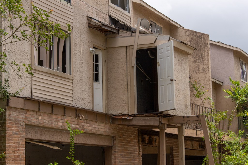
Floodgates on Lake Houston Dam photographed on 6/16/2020.
2 to 4 Inches Expected
The National Hurricane Center predicts that Hurricane Laura will bring 2 – 4 inches of rain to the Lake Houston Area in the next few days. Isolated areas could receive 6 inches. These rainfall amounts exceed the 3 inch trigger to lower Lake Houston, said Martin.
Lake to Be Lowered Another 7.2 inches
As a result of these predicted rainfall amounts in addition to the rainfall that will be accumulated to our east, the Lake will be lowered gradually overnight from the current level, which is 41.6 ft down to an elevation of 41.0 ft. Six tenths of a foot is 7.2 inches.
The Lake will be maintained at a level of approximately 41.0 ft while there is an immediate inclement weather threat. Once that weather has moved out of our area, the Lake will be allowed to naturally refill from the storm’s runoff.
Some fluctuations in Lake level can be attributed to high winds so please keep that in mind when checking Lake levels.
Secure Shoreline Property NOW If You Have Not Already
Property owners were given notice Friday afternoon to secure property along the shoreline for a potential temporary lowering of Lake Houston. If you have not already done so now is the time to take action to secure your shoreline property.
Dave Martin, Mayor Pro Tem
The lake will be lowered at a cautious rate so as to not impact those living downstream. At the completion of this temporary lowering effort the total reduction in the level of Lake Houston from normal pool of 42.5 ft to 41.0 ft will be 1.5 feet.
Martin’s press release made no mention of the SJRA or Lake Conroe. Lake Conroe, which is farther west should receive less rain than Lake Houston from Laura.
Posted by Bob Rehak on 8/25/2020at 6 pm, based on a press release from Houston Mayor Pro Tem Dave Martin.
1092 Days after Hurricane Harvey
https://i0.wp.com/reduceflooding.com/wp-content/uploads/2020/08/20200616-RJR_3283.jpg?fit=1200%2C800&ssl=18001200adminadmin2020-08-25 17:51:182020-08-25 17:51:38Lake Houston Level Now Being Lowered in Advance of Hurricane Laura
These warnings were just issued by Jeff Lindner, Harris County Meteorologist, the National Hurricane Center, and City of Houston:
Hurricane warnings issued from San Luis Pass into Louisiana.
Landfall of a devastating hurricane likely between Galveston Bay and Sabine Pass tomorrow night.
Rush to complete preparations to protect life and property.
Heed all evacuation recommendations.
Discussion
Laura – now a hurricane with sustained winds of 75mph – is continuing to intensify. The hurricane will likely rapidly intensify over the next 24-36 hours, right up to landfall along the upper TX coast. The National Hurricane Center predicts Laura will become a major hurricane with sustained winds over 110 mph by tomorrow night or early Thursday morning when it makes landfall somewhere between Galveston Bay and Sabine Pass.
Track:
Everyone should be planning for the landfall of a very serious hurricane between Galveston Bay and Sabine Pass on the Louisiana border. Additional shifts in the track are possible that could bring the core of Laura into Galveston Bay and Harris/Galveston Counties.
The large wind field will result in strong winds likely 100-150 miles inland across east Texas.
Prepare for power outages extending well inland along with significant wind damage and extended outages.
Intensity:
Prepare for the impact of a major hurricane (cat 3 or higher). Once the inner core of Laura forms, significant intensification is likely, and conditions look very favorable for intensification.
Tropical Storm force winds will begin along the coast at around 8:00 pm Wednesday evening.
Advice from City, Lake Status
“Rainfall amounts in the Lake Houston Watershed over the next six days are expected to be 2 – 4 inches with isolated accumulation of 6 inches possible,” said Dave Martin. “Currently, the Lake Houston Watershed is dry and the projected impact to our area will be to our east with the largest possible impact expected along the East Fork of the San Jacinto River. Lake Houston is already down one foot from normal pool with the possibility of being lowered additionally, if necessary. Please make sure all property along the shoreline is secured in the event additional lowering is ordered.”
“Regardless of where this storm lands,” said Martin, “it is important all residents prepare themselves and have a plan. Hurricane Laura will likely be similar to Ike with severe wind impacts and power outages. The City of Houston has prepared resources to help you get ready for upcoming disasters and make sure you are prepared for this one. Please visit www.readyhoustontx.gov to learn more.
Actions
Prepare for the landfall of a major hurricane along the SE TX coast
Bring in anything in your yard, such as lawn furniture, that could become airborne.
All preparations will be to be competed by 6:00 p.m. Wednesday evening.
Posted by Bob Rehak on 8/24/2020 based on input from the National Hurricane Center and Jeff Lindner, Harris County Meteorologist.
1091 Days after Hurricane Harvey
https://i0.wp.com/reduceflooding.com/wp-content/uploads/2020/08/153403_earliest_reasonable_toa_no_wsp_34.png?fit=897%2C736&ssl=1736897adminadmin2020-08-25 12:30:512020-08-25 12:31:07Laura Intensifying into Major Hurricane; Prepare for Big Winds, Power Outages
Clarification: General plans, as described below, are primarily about street layouts. However, many people have been trying to raise awareness at the Planning Commission that street patterns are affected to a significant degree by the volume and and layout of drainage and detention features. And, of course with Atlas 14 that is more true than ever. Danny Signorelli, CEO of the Signorelli Companies, took issue with this post. I offered him an opportunity to print a rebuttal verbatim. He refused the offer.
According to residents in other parts of the Commons, Signorelli tried to develop this property before and reportedly wanted to add 4-6 feet of fill to the floodplain. It’s not yet clear what they have in mind for this iteration of the project. However, comparing the general plan to FEMA’s National Flood Hazard Layer Viewer shows that parts of the development are still in the flood plain. (See below.)
No Detention Ponds Shown on Plans
The general plan filed with the planning commission also shows that the developer shows no plans for detention ponds on the property. A best practice to reduce flooding is to “retain your rain.”
Here are satellite and close-up views of where the new subdivision would be relative to the the surrounding area and existing parts of the development.
Crossing At the Commons of Lake Houston is in the Huffman area opposite Lake Houston Park and East End Park on the west side of the East Fork.Crossing at the Commons of Lake Houstonrelative to existing streets in the Commons. From General Plan inset.
Floodplain Issues
Parts of the proposed development will be in the floodplain. And those floodplains will soon expand to include even more homes. See the two dotted lines below.
Close up of PDF above shows how 100-year floodplain (dotted line on left) and 500-year (dotted line on right) would impact proposed homesites.Note the drainage easement in the lower left.FEMA’s National Flood Hazard Layer Viewer shows parts of the proposed new 75.3-acre subdivision would be in the 100- and 500-year floodplain.
Ironically, just last night, the City of Houston and its partners (Harris County Flood Control, Montgomery County and the SJRA) presented a draft of the findings of the San Jacinto River Master Drainage Plan. In it, they recommended avoiding flood plain development to keep people out of harm’s way. See slide below from their presentation.
Slide from San Jacinto River Master Drainage Plan Draft Report shows how adding fill to flood plains can affect other homes in area.
The presenter also discussed how the floodplains were expanding due to revisions of flood maps based on new hydraulic and hydrologic modeling not yet been shared with FEMA.
The 100-year floodplain in many areas will likely expand well into the 500. And the 500-year flood plain will likely expand into areas previously not shown in ANY floodplain.
San Jacinto River Master Drainage Plan Draft Report 8/13/2020
Thus, the number of homes affected by floods could greatly expand beyond the number shown above.
Drainage in Commons Already a Problem
Plans also show that homes will be built very close to a drainage easement. Yet existing ditches in the Commons are eroding badly due to lack of maintenance. Below is a picture of one taken in January last year. Residents say the trees are still there and the erosion became much worse during floods in May and Imelda.
Commons drainage ditchphotographed last year.
Less Than One Fourth of Property Now Under Consideration
The tract is 332 acres, but only 75.3 is proposed for development at this time. It is entirely located within the incorporated limits of the City of Houston. The entire tract is adjacent to COH flooding easements for Lake Houston.
How to Voice Concerns, If You Have Them
Here’s how you can voice concerns, if you have them. The City Planning Commission will hold virtual meetings until further notice. So it’s very easy to make public comments. You can sign up to speak by going to the Planning Commission Home Page.
The next Planning Commission meeting is Thursday, August 20, 2020. If you’d like to speak, you must sign up at least 24 hours before the meeting.
Speakers have only TWO MINUTES. Key points to consider:
Floodplain will officially be expanding soon.
Some of these homes are already in it.
Many more soon will be.
That could require fill.
And fill will make flooding worse for other homes near the river on both sides.
No detention ponds or drainage plans are shown.
The Planning Commission should consider these things.
Posted by Bob Rehak on 8/14/2020
1081 Days since Hurricane Harvey
The thoughts expressed in this post represent opinions on matters of public concern and safety. They are protected by the First Amendment of the US Constitution and the Anti-SLAPP Statute of the Great State of Texas.
https://i0.wp.com/reduceflooding.com/wp-content/uploads/2020/08/GE-screenshot.jpg?fit=949%2C708&ssl=1708949adminadmin2020-08-14 17:45:352025-03-24 20:12:08Developer Seeks City Approval to Expand Commons of Lake Houston into Floodplain – Without Detention Ponds
I can’t urge you enough to watch the San Jacinto Watershed Master Drainage Plan Meeting tonight at 6:30.
Flooded Street during Harvey. Photo by Julie Yandell.
Updating of River Models Leads to New Insights
I previewed the presentation this morning and was extremely impressed. The study partners have updated or created hydraulic and hydrologic models for 535 miles of major streams in the river basin. They’ve also integrated the models and accounted for new developments across 3000 square miles in seven counties.
As a result, we now have a much better understanding of:
Where water comes from
Which areas have the highest potential for flooding
Where large regional detention basins can be placed to reduce flooding.
Other strategies to reduce flooding.
New Flood Maps, Sedimentation, Better Warning Systems
You don’t want to hear about this stuff second hand. The presentation also includes discussions of:
How much flood plains have really expanded compared to current FEMA maps.
Sedimentation and strategies to reduce it
Improving flood warning systems
If you’re flooded, or are concerned that you might, don’t miss this. This study will be the cornerstone of grants applications to mitigate flooding in the region.
Cornerstone of Lake Houston Area Mitigation Efforts
Two years ago, before the flood bond vote, community opinion coalesced around a three-part solution to flooding in the Lake Houston Area.
Reduce/delay the input by increasing upstream detention
Increase the throughput by dredging blockages
Speed up the output with additional gates on the Lake Houston Dam.
Tonight, you will get a chance ask questions of the people who have been studying those options and others for 18 months. Here’s how to log in:
Or by phone at 855-925-2801 with Meeting Code: 9742
Order the pizza now.
This study is a cooperative venture of FEMA, Harris County Flood Control, SJRA, City of Houston and Montgomery County.
Posted by Bob Rehak on August 13, 2020
1080 Days after Hurricane Harvey
00adminadmin2020-08-13 16:43:272020-08-13 16:43:38San Jacinto River Watershed Virtual Meeting Tonight Will Unveil Specific Recommendations to Reduce Flooding
In January, the City hired DRC Emergency Services, LLC (DRC) to begin mechanical dredging of the San Jacinto West Fork Mouth Bar. I’ve provided periodic updates on that. According to Houston Mayor Pro Tem Dave Martin, DRC has now officially completed 60% of that project.
In the meantime, other related dredging projects, including East Fork dredging and long-term Lake Houston maintenance dredging are reportedly taking shape. Here’s how pieces of the puzzle fit together. But one piece is still missing – long-term funding to pay for the maintenance dredging.
Two-Phase Program
DRC’s scope of work has two distinct phases:
Phase One will remove accumulated materials near and at the mouth bar on the West Fork of the San Jacinto River.
Phase Two will remove accumulated materials in the East Fork of the San Jacinto River AND other locations in Lake Houston.
West Fork Mouth Bar as of late June 2020.
During Phase One, 400,000 cubic yards of material will be removed over twelve months. To date, DRC has removed approximately 240,080 cubic yards of material. (See photo above.) That’s 60% in approximately 60% of the allotted time, so that part of the project is on schedule.
East Fork Mouth Bar as of May 2020. This areas went from 18 to 3 feet deep during Imelda, according to boater Josh Alberson. The above-water portion of this sand bar has grown three quarters of a mile since Harvey.
Phase Two of the project will consist of:
Hydrographic surveys of the West Fork of the San Jacinto River, the East Fork of the San Jacinto River, and Lake Houston to determine dredge material volumes
City of Houston advertising and awarding a dredging contract to the lowest responsive bidder
Phase Two will run simultaneously with Phase One to expedite dredging.
Dave Martin, Houston Mayor Pro Tem
Mayor Pro Tem Martin did not provide an update on where Phase Two currently stands. But residents have reported seeing survey boats on Lake Houston, and the East and West Forks of the San Jacinto.
Mouth bar forming at Rogers Gully on Lake Houston. Example of kind of projects being considered for Phase 2.Photo late June, 2020.
Long-Term Dredging Plan in Development
Additionally, during Phase Two, City of Houston and its partners will develop a long-term dredging plan for Lake Houston. City of Houston or the Coastal Water Authority will execute the plan.
The intention: to fund dredging operations in perpetuity.
This phased approach will obligate the full grant funding before the 87th legislative session in 2021. This grant funding was made possible thanks to State Representative Dan Huberty (District 127) through the passage of Senate Bill 500.
Mayor Pro Tem Martin credits Huberty for his dedication to the long-term maintenance dredging activities on Lake Houston. “Representative Huberty has been a champion for his residents and a great ally in seeing these additional dredging efforts come to fruition,” said Martin.
$40 Million Project
The total project is valued at $40 million (except for the perpetuity part). Funding for the immediate dredging projects comes through a combination of:
City of Houston Harvey Disaster dollars provided by Governor Greg Abbott
Grant dollars from the Texas Water Development Board (TWDB)
Harris County Flood Control District (HCFCD) Bond Program.
Long Term Funding – Still A Missing Piece of Puzzle
Lake Houston, a City of Houston asset, is losing capacity. Everyone has recognized that fact for decades. But as silt filled the rivers, inlets and lake, maintenance was deferred, reportedly for budgetary reasons. In 2017, during Harvey, the problem became so big that no one could ignore it anymore. Flooding was the immediate problem. But loss of water capacity is an even bigger, longer-term problem.
It’s one thing to have a long-term maintenance dredging plan and another to put it into action. But where will the money come from?
A tax on sand mines? Won’t work. Most aren’t in the City. Or even in Harris County.
Some have suggested creating a taxing district for lakefront homeowners. That won’t work either. Not enough of them. And it would create a stampede for the Oklahoma border. Moreover, it hardly seems fair; the lake is part of a City system that provides water to two million people and generates revenue.
The logical solution seems to be increasing the cost of water. Adding just a fraction of a penny per 1000 gallons should do it. Dredging isn’t just about reducing flooding. Or preserving views for lakefront homeowners. It helps preserve the lake’s capacity. And that benefits everyone.
As we develop a long-term dredging plan for the lake, we also need to consider a sustainable source of financing.
Posted by Bob Rehak on 8/12/2020based, in part, on a release by Houston Mayor Pro Tem Dave Martin
1079 Days after Hurricane Harvey
https://i0.wp.com/reduceflooding.com/wp-content/uploads/2020/08/20200306-RJR_9786.jpg?fit=1200%2C800&ssl=18001200adminadmin2020-08-12 13:45:302020-08-12 16:03:12Long-Term Lake Houston Dredging Plan in Development; West Fork Mouth-Bar 60 Percent Completed
The San Jacinto Regional Watershed Master Drainage Plan (SJMDP) partners will host a virtual public meeting on August 13, 2020. The purpose: to provide information about study’s progress, and encourage public participation and input.
Heat map in draft shows where most flood damage has occurred historically by sub-watershed.
Goals of Project
The SJMDP study began in April 2019 to identify flood mitigation projects that can be implemented in the near- and long-term. Their purpose: to reduce flood risks to people and property throughout the San Jacinto River watershed.
The study area includes nearly 3,000 square miles in seven different counties and approximately 535 miles of stream. Overall, the study aims to:
Provide an up-to-date technical basis to identify flooding vulnerabilities
Understand impacts of future growth
Improve flood resiliency within the watershed.
The SJMDP is scheduled for completion in fall 2020.
Community engagement is an important component of the Harris County Bond Program. The partners want your participation as the program is implemented.
Details of Virtual Meeting
The virtual community engagement meeting will be held on:
Or by phone at 855-925-2801 with Meeting Code: 9742
Note: HCFCD says that the “Join Online” link above will convert from a registration to a presentation link on the day of the webinar.
The meeting will begin with a brief presentation to share project updates, followed by a moderated Q&A session with Flood Control District team members.
Residents will be able to submit questions and comments throughout the presentation. Any comments not addressed during the Q&A session will receive a response after the event.
For Those Who Cannot Attend…
The study partners will post a recorded version of the meeting on the Flood Control District’s website and YouTube channel after the event.
For questions, please contact the Flood Control District at 346-286-4152, or complete the online comment form.
You can also mail comments to:
Harris County Flood Control District
9900 Northwest Freeway
Houston, Texas 77092
Attn: San Jacinto Regional Watershed Master Drainage Plan
For more information about the San Jacinto Regional Watershed Master Drainage Plan, visit www.sanjacstudy.org.
For Those with Disabilities
Those with disabilities can make special meeting accommodations. If needed, please contact 346-286-4152 at least 48 hours prior to the meeting.
Project Funding
The SJMDP is jointly funded with 75 percent from the Federal Emergency Management Agency (FEMA) Hazard Mitigation Planning Program and 25 percent from the four local partners: Harris County Flood Control, Montgomery County, City of Houston and the SJRA.
Posted by Bob Rehak on July 30, 2020
1037 Days after Hurricane Harvey
https://i0.wp.com/reduceflooding.com/wp-content/uploads/2020/07/Screen-Shot-2020-07-23-at-10.42.49-AM.jpg?fit=1200%2C930&ssl=19301200adminadmin2020-07-29 21:26:182020-07-30 00:13:57Your Chance to Ask Questions About the San Jacinto Watershed Master Drainage Plan
On 7/23/2020, consultants for the San Jacinto River Basin Master Drainage Plan gave the SJRA Board and the public a first look at a draft of the plan. The final report is due out at the end of August. The draft shows the broad outline of the team’s efforts.
Draft Shows Broad Outline of Recommendations
It shows the types of recommendations they will make. However, this draft does not yet include specific recommendations as to prioritization of projects. Those will change before the final report. For instance, much of the draft focuses on upstream detention. But specific detention site recommendations have not yet been finalized.
Funding and Partners
Below are the key slides and a brief explanation of the main point behind each. This drainage study is 75% funded by a FEMA Hazard Mitigation Grant and 25% by four local partners: the SJRA, City of Houston, Harris County Flood Control, and Montgomery County.
Scope of Study
The study area covers almost 3,000 square miles and the tributaries listed on the left.The SJRA primarily has responsibility for the portion of the watershed in Montgomery County. However, the scope of the drainage study extends to other counties including Waller, Grimes, Walker, Liberty, and San Jacinto.
Heat Map Shows Where Most Damage Occurs
The team started by looking at where flooding has occurred historically. The tan areas aboveshow where the most damage has occurred.
Goals and Methodology
The partners started by looking at vulnerabilities and identifying mitigation possibilities. Their main goals are in red. The final report will make specific recommendations for detention, buy-outs and improving conveyance. Recommendations will also improve flood warning and communication.The team started by integrating and updating all existing hydraulic and hydrologic models in the watershed as reflected on the latest 2018 lidar terrain data. They now take into account new construction, growth, additions to impervious cover, and Atlas-14 rainfall probabilities (which vary by sub-watershed within the larger watershed).To calibrate and verify its H&H models, the drainage study team examined four historical storms that, together, impacted the entire study area. They then adjusted the models using radar rainfall data, and USGS high water marks and peak flow data. The objective: to make the models reflect “ground truth.”The team is also looking at strategies to reduce sedimentation. However, this is not a major focus of this study. Their purpose is not to evaluate the relationship between sediment and flooding. Other studies will do that.
Three Main Areas of Focus
This slide shows the three major thrusts of drainage study effort over the last 1.5 years. The primary focus has been on: a) identifying the best locations for upstream detention that can reduce the volume of water coming downstream to populated areas during floods, b) where to install additional gages to improve flood predictions and warning times, and c) improving communication during emergencies.This shows the steps the drainage team went through to evaluate and rank-order potential sites for detention.
Areas of Highest Potential for Mitigation
Here’s where they found the highest and lowest potential for mitigation. The box explains the watersheds that see the most effective solutions within the SJMDP study area, as explained in the list to the left of the slide.Some drainage projects recommended in previous plans are no longer possible today because of upstream development. However, areas that once held potential for a single large project still hold potential for several smaller projects that add up to significant flood reduction.
Mitigation Project Funding
The cost all the drainage projects identified adds up to about $3 billion. They only reduce flooding of structures worth about $756 million dollars. Because costs exceed benefits, FEMA will not likely fund all of these.However, many of the projects are in areas with low to moderate income (brown and tan areas). See the large concentration in the eastern watershed. That opens up other sources of funding, such as the Department of Housing and Urban Development where the benefit/cost ratio may not be as important.
Harmonizing Regulations Throughout Region
The team will also make recommendations to harmonize floodplain development regs throughout the region. Continuing to allow unmitigated upstream development in floodplains could destroy any new investment made to protect highly populated downstream areas.
Some Problems May Only Be Solved Through Buyouts
Buyouts usually have a high benefit-to-cost ratio relative to construction projects such as detention ponds. Buyout strategies can target the most vulnerable properties, such as those in the 2- and 5-year floodplains. None of the detention projects recommended by the team will likely remove those from danger.
Steps Still Not Completed
The team has finished the steps in red. They in the process of prioritizing projects and developing a phasing plan. The last bullet point is not part of this study.
More Upstream Gages Needed to Eliminate Blind Spots
The team has also identified locations for additional upstream gages and local partners who can help maintain those gages. Think of these like a “distant early warning” system. They give river forecasters visibility into “blind spots.” Forecasters will be able to add up the rainfall on various tributaries and predict the impact and timing of flooding downstream.That could give people more time to evacuate.
Ways to Improve Communication
The team is also looking at ways to communicate better during flood emergencies. They are looking at inundation mapping, evacuation routes, and improved communication protocols.
Timetable for Remainder of Project
This chart outlines the project workflow. It shows completed steps in red, and incomplete steps in yellow.The final report with specific recommendations should be released at the end of August or in early September.
Every Little Bit Helps
I can’t wait to see this report in its final form. During the presentation, the presenter talked about reducing flooding downstream at the West Fork and I-45 by up to six feet if all upstream projects are implemented.
One thing to keep in mind: there is no single silver bullet that can solve the regions flood problems. All of these steps are additive. In my personal opinion, a foot here and a foot there can help offset future releases from Lake Conroe. People in the Lake Houston Area benefit from any and all upstream improvements.
Posted by Bob Rehak with thanks to SJRA and HCFCD
1064 Days since Hurricane Harvey and 313 since Imelda
https://i0.wp.com/reduceflooding.com/wp-content/uploads/2020/07/Screen-Shot-2020-07-23-at-10.27.52-AM.jpg?fit=1500%2C1141&ssl=111411500adminadmin2020-07-28 16:33:252020-08-03 15:02:43San Jacinto River Master Drainage Plan Draft Provides First Look at Final Report Due Out in August
It’s a minor victory. And it may not actually change anything on the ground. But the City of Houston today sent a signal to developers, who now have to identify flood prone areas on their general plans.
The move should eliminate any doubt among bankers, buyers and real estate agents as to whether a particular property is in a floodway or flood plain.
By following all the other guidelines, developers can still get their plans approved. This change helps people seeking truth and full disclosure in the sales process.
There’s one other key change. Another new requirement is that, as each section of a general plan is platted, it has to adhere to the then current standards. That is important so that the entire development isn’t grandfathered by the approval date of the general plan.
These changes may make some developers think twice about buying and developing flood-prone property. Especially if they target unknowledgeable buyers, such as young people or foreigners, who may be unfamiliar with American flood standards.
Today’s press release by the City of Houston’s Planning and Development department says the changes will go into effect July 24, 2020.
The release is being blasted out to developers also. It’s titled “Platting Updates for Flood Prone Areas.” I have reprinted the full text verbatim below.
IDENTIFICATION OF FLOOD PRONE AREAS ON GENERAL PLAN
Effective July 24, 2020
Flooding events have been increasingly severe in the City of Houston and our region. The 2018 amendment to Chapter 19 City of Houston Code of Ordinances mandated that it was necessary to evaluate development within the 100-year and 500-year floodplains to protect investments made by residents and business owners in real property within the City. Harris County and others have developed their own needs in improving the drainage in their regions.
To mitigate and reduce the risk of flood loss for future development, the 100-year, 500-year floodplains and floodway will be required to be identified on all General Plans submitted to the Department with the Plat Tracker application. Applicants will be required to graphically depict the location of the floodplains and or floodway on their General Plans and provide related note.
This information must be provided as part of initial submittal of a General Plan for Planning Commission consideration. The General Plan application will be marked incomplete if this information is not included as part of the initial submittal.
HOW TO ILLUSTRATE
The way to depict this information correctly is to go to the FEMA website through the following link: https://msc.fema.gov/portal/search#searchresultsanchor.Enter the address, place, or coordinates. The site will produce a map that will identify whether the property is located in the 100-year, 500-year flood plains or floodway. Provide a dashed line on your General Plan identifying the 100-year, 500-year flood plains or floodway as depicted on the FEMA map.
GENERAL PLAN RELATED NOTE
Also, include on the face of the General Plan the following related note as follows: Portions of the property included in this General Plan lie within the known floodway and the 100 and 500-year floodplains. As each section or parcel is platted and developed, the then-current standards of City of Houston [or if ETJ: Harris County] drainage, elevation, and building regulations must be adhered to.
For additional information contact Dipti Mathur at 832-393-6560.
Imagine how the general plan of “Orchard Seeded Ranches” would look. It would clearly show that virtually every property was subject to severe flooding. Also imagine now how those new townhomes in Kings Harbor will look to Chinese investors.
Developers who specialize these types of distress properties may have to rethink their marketing strategies.
Posted by Bob Rehak on 7/17/2020
1053 Days since Hurricane Harvey
https://i0.wp.com/reduceflooding.com/wp-content/uploads/2020/07/Screen-Shot-2020-07-17-at-4.56.38-PM.png?fit=810%2C404&ssl=1404810adminadmin2020-07-17 17:12:202020-07-18 06:48:48City of Houston Will Now Require Developers to Identify Flood-Prone Areas on Their General Plans
How do we break the process of building in floodways and then repairing flooded homes with taxpayer-subsidized flood insurance as many as forty times?
A 66-page study by Erica Vilay and Phil Pollman, two candidates for Masters Degrees in Public Policy from Harvard, examines the broken buyout process for flooded homes in Houston floodways. The study also makes recommendations to improve the process. But they won’t revolutionize it. And that may be what this process needs.
The merit in this study is that it takes a holistic view of buyouts and examines them as one of many alternatives available to flood victims living in floodways. From the public’s perspective, buyouts have unquestionable and compelling safety and financial benefits.
Buyouts produce $7 in benefits for every $1 invested. And they take people out of harm’s way.
Speedier Options Available to People In Time of Need
But the process is slow. People have options. And, according to the study, they almost always prefer those other options. In fact, the rate of buyouts is so slow that it will take the City 60 years to meet its 10-year objective, claim the authors.
The paper cited one property that had been repaired a record 40 times. So why is it so difficult to get people to move out of a floodway into housing that won’t jeopardize their lives or lungs?
Vilay and Pollman examine the reasons. The incentives, they say, all favor rebuilding or selling to developers rather than accepting government buyouts.
Tax-subsidized National Flood Insurance Policy premiums remain affordable, offset risk, and usually reimburse homeowners within 60 days after a storm.
Selling to a developer/investor can happen within days or weeks.
Consummating a buyout through the maze of Federal, State, County and Local government agencies can take years.
Federal funding is slow, inflexible, and extremely complex to manage effectively and efficiently.
At the current closing rate, it would take nearly 60 years to buy out the 7,000 habitable structures in Houston floodways, says the study. But Houston-area realtors sell that many homes in a typical MONTH, according to the Greater Houston Partnership! Even in the middle of a pandemic.
“This is a No Brainer”
So one of the big reasons people are reluctant to be bought out is speed. Their lives have just been destroyed in a flood. They need a place to live. Then along comes the government saying, “Let me buy you out. I’ll get you your money in 2-3 years. Or you can just repair your home for the fortieth time and we’ll pay for it immediately.” This is a no-brainer, say the authors.
How hard are buyouts? The authors claim that “As of January 2020, HCFCD has used $3 million out of a $10 million bucket of federal funding allocated to the City for flood events that occurred in 2015.”
Barriers Beyond Slowness
But degree of difficulty and process slowness aren’t the only reasons people shun buyouts.
People get attached to neighbors and neighborhoods.
They may have family living nearby.
There may be a shortage of affordable housing elsewhere.
Alternative housing may be farther from their work.
They may want to stay within a school system.
Goals: Slow Inflow, Speed Outflow
The authors define two goals. They say we need to:
All of these recommendations are solid and, to a large degree, self-explanatory. They are hard to quibble with if you are trying to improve a process.
Incremental Improvements vs. New Concept
The authors never really address, however, whether incremental improvements will achieve the stated goals. Or whether we need to nuke the process and start over with a revolutionary, new concept.
As I read this study, I kept wondering what Steve Jobs, Jeff Bezos, or Elon Musk would recommend. That’s a pretty steep burden to impose on grad students. But we shouldn’t forget that Fred Smith had the idea for Fedex while still a student at Yale.
Each of those people made the world a better place by designing new products or services that leapfrogged incremental improvements in existing systems and made the old way obsolete.
Inside-the-Box Thinking for an Outside-the-Box Problem
Insi-e the-box thinking will certainly produce incremental improvements. But in the estimated time it will take government to buy out 7,000 homes, Houston realtors will sell more than 5 million. That’s 70,000% better. Which would you rather have in your employ?
So I would ask these questions. What if you:
Privatized this process?
Offered flood victims an “instantaneous home SWAP” as they were ripping out sheetrock?
Made flood insurance reflect its true cost?
If ever there was a need for “business process re-engineering,” this is it.
Posted by Bob Rehak on 7/14/2020 with appreciation and admiration for Erica Vilay and Phil Pollman
1050 Days since Hurricane Harvey
https://i0.wp.com/reduceflooding.com/wp-content/uploads/2020/07/20200627-RJR_0059-1.jpg?fit=1200%2C800&ssl=18001200adminadmin2020-07-14 18:18:182020-07-14 20:23:45New Harvard Study Examines Barriers to Buyouts; Will Process Improvements Be Enough?
Mechanical dredging is slowly but surely downsizing the San Jacinto West Fork Mouth Bar. It’s still about a billion times larger than a snack-sized McDonald’s Oreo McFlurry, but it’s a vast improvement over what it was. It now appears to be about one third of its size in January when most people would have called it super sized.
A Sisyphean Task
Snack-sized puns aside, the job is a Sisyphean task. For those not familiar with the term, Sisyphus was a figure from Greek mythology who angered Zeus. Zeus sentenced him to rolling a boulder up a hill for the rest of eternity only for it to roll back down again every time he got near the top.
Historians and storytellers see many morals in the tale. Be persistent. Work hard. Never give up.
And so it is with those three lonely excavators working on giant sand bar at the mouth of the West Fork where it meets Lake Houston.
Day in and day out, they remove one bucketful at a time. Six months after they started, much of the above-water portion of the sand bar has now been removed. But they still haven’t started to address the matter of cutting a channel that connects the dredged portion of the river with the lake.
Meanwhile, more sand and silt comes down river with every storm.
Comparing Post-Harvey with Recent Photos
Still, if you compare post-Harvey photos with photos taken recently, you can see progress.
Dredgers are slowly reducing the dam behind the dam.
Looking south toward FM1960 in 2017.Looking south today. Little length has been removed, but the width is about a third of what it was after Harvey. Photo taken 6/16/2020.
The dredgers keep nibbling the south edge of the bar, taking row after row of sand, much like eating an ear of corn.
Looking west, upstream, from eastern end.Photo 7/5/2020.Western tip of bar is now only a little wider than the tracks of one excavator. 7/5/2020.Looking east at sunrise on 7/5/2020. Note FM1960 bridge in the extreme upper right.
In the next few months, they may run out of room to maneuver on the bar.
Survey Boat Spotted on Lake Last Week
Residents recently reported seeing a survey boat out on Lake Houston. That’s a good sign. It says that the City, County and State are now looking at what should come next with the $30 million that State Rep. Dan Huberty got the legislature to commit last year as an amendment to SB500. Harris County Flood Control also committed $10 million to dredging in the 2018 flood bond fund.
The City is currently funding the mechanical dredging with $6 million left over FEMA disaster recovery funds. Those should be running out soon if they haven’t already.
To my knowledge, no one has yet addressed the issue of long-term maintenance dredging, although everyone acknowledges the need for it. That river just keeps on bringing sediment.
Posted by Bob Rehak on 7/6/2020
1042 Days after Hurricane Harvey
https://i0.wp.com/reduceflooding.com/wp-content/uploads/2020/07/20200616-RJR_3385-2.jpg?fit=1200%2C800&ssl=18001200adminadmin2020-07-06 20:11:352020-07-06 20:13:28West Fork Mouth Bar Getting Snack Sized