Elm Grove Has 2-3X More Damage Than After May 7th, Much of It Foreseeable and Preventable
Many homes flooded in Elm Grove this week that did not flood on May 7th, or ever before. Estimates from the homeowner’s association range from 2 to 3 times the number that flooded on May 7th. The shocking part: most of the flooding was preventable.
History of Problems with Woodridge Village
On May 7th, floodwater from a new development in Montgomery County contributed to the flooding of almost 200 homes in Elm Grove Village.
On May 8th, Montgomery County Commissioners should have known they had a problem with the development (Woodridge Village). What did they do? They let the developer’s engineering company (LJA Engineering) investigate itself.
The basic problem: Perry Homes, its subsidiaries and contractors had clearcut approximately 268 acres. They filled in natural streams and wetlands without installing needed detention ponds. Runoff from the development then went straight into Elm Grove.
In the weeks that followed, hundreds of Elm Grove residents filed lawsuits against the developer and contractors. In the months that followed:
The Perry gang, managed to complete less than 25% of the needed detention pond capacity, despite ideal construction weather, and then they apparently stopped work altogether.
They finished only two ponds on the southern section and ignored three on the northern. Work came to a virtual standstill almost three weeks ago.
For a breakdown on detention pond capacity and how much had been built before Imelda, click here.
Drone Footage Shows Huge Clearcut Area Where Three Detention Ponds Should Have Been
As work came to a standstill, residents became concerned. Last Sunday, Matt Swint flew his drone over the development to document the status of work on detention ponds. Just four days later, Imelda struck.
Swint captured all three of the images immediately below on 9/15/2019. They show that no progress was made on ANY of the detention ponds planned for the northern section.


No Work Ever Done on Northern Detention Ponds Despite Area Having Been Clearcut for Months
They could have hired extra crews to build those northern detention ponds. But no. Why be aggressive when you’re months behind schedule and have ideal construction weather?
Their lawyers were, however, working overtime, blocking discovery in the court case against the developer and contractors.
A judge failed to recognize the dire threat that Elm Grove residents still lived under. She may have unwittingly contributed to this mess. With no sense of urgency, she tolerated deliberate delays and set a trial date a year away.
Meanwhile, at an August 27th meeting, MoCo commissioners considered a motion to close a loophole that allowed developers to get away without installing detention ponds. Commissioners chose to table the motion. They insisted that Montgomery County didn’t have a flooding problem. They worried that closing the loophole could change the economics of work in progress and harm developers.
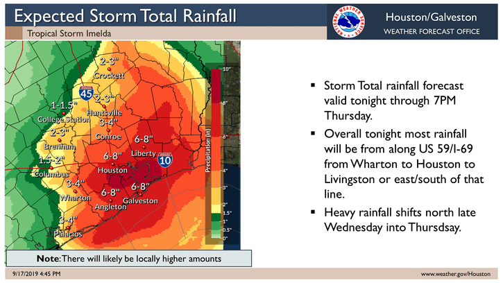
Then came Imelda. The storm dumped almost 12 inches of rain on a development that was designed to retain exactly 12 inches of rain (see page ES-1). But because less than a quarter of the planned detention pond capacity was functional, the plans failed.

Second Verse, Worse than the First
On September 19, Elm Grove flooded again. Worse than on May 7th. Much worse. Beth Guide of the Elm Grove Homeowners Association and numerous homeowners estimate that the water was at least a foot to eighteen inches deeper. The additional water involved twice as many streets, and affected as many as two to three times more homeowners. Now they, too, get to join the lawsuit and battle institutional indifference. (Note: many streets are so congested that it is virtually impossible to get an exact count at this time. That number could change.)
Scenes from Elm Grove, One Day after Second Flood in Four Months
Today, I:
- Witnessed men and women weeping openly as they hauled belongings to the curb for the second time in four months.
- Watched kids discarding Christmas and birthday presents in trash piles that sometimes reached rafters.
- Talked with a family that had just finished installing replacement cabinets from the May 7th flood.
- Saw desperation in the eyes of young couples who feared bankruptcy.
- Met the grown children of elderly people there to help salvage what they could for parents.
Defendants’ Responses to Plaintiffs’ Questions
As this tsunami of heartbreak unfolded in front of me, I could not get the defendants’ responses to the plaintiffs’ simple requests out of my mind.
For instance:
- Request: Identify the entity or individual in charge on May 7, 2019.
- Response: “Defendant objects to this Request for Production on the grounds it is vague, ambiguous, unclear and overly broad with respect to the requesting party’s use of the phrase ‘in charge…'”
Or how about this one:
- Request: Identify the person in charge of permit compliance.
- Response: “Defendant objects to this Request for Production on the grounds that such Request is vague, overly broad, and fails to specify and/or describe with reasonable particularity – as is required by Rule 196.1(b) of the Texas Rules of Civil Procedure — the documents and/or things to be produced. Defendant further objects to this Request for Production on the grounds that such Request is argumentative and assumes the truth of matters which are not in evidence, and which may be in dispute, to the extent that such Request suggests and/or assumes that one specific individual was “… in charge of compliance …” by this Defendant as to the terms and conditions of TPDES General Permit TXR150000.”
Whew! That lawyer must be getting paid by the word. I know some people that could have communicated the same meaning with a finger gesture.
The defendants produced 61 pages of such responses. If you ever need to boil your blood, read it. They use the word “vague” 27 times in response to clear and pointed questions,.
Hearing on Monday
The judge in this case will hear a motion to compel responses on Monday, September 23rd in the 234th Judicial District Court of Harris County. I hope she puts a stop to this nonsense. It’s time somebody did…with the rain train spread out across the Atlantic during the worst part of hurricane season.

What 23% Retention Contributed To
This video shows what the people of Elm Grove faced during Imelda from Woodridge Village and what they will continue to face. With only 23% of the detention capacity in place, it overflowed when the design limits were tested. See video below.

It’s kind of like expecting a car with one tire to work as well as a car with four.

One Day After the Latest Storm


Posted by Bob Rehak on 9/20/2019, with images from Matt Swint, Allyssa Harris, Jeff Miller
752 Days after Harvey and One Day after Imelda
All thoughts expressed in this post are my opinions on matters of public opinion and safety. They are protected by the First Amendment of the US Constitution and the Anti-SLAPP statute of the Great State of Texas.