Lakes Being Lowered in Advance of Expected Heavy Rains

6/14/24, 10:00 AM – The San Jacinto River Authority (SJRA) is lowering Lake Conroe and the Coastal Water Authority (CWA) is lowering Lake Houston in advance of expected heavy rainfall associated with a tropical disturbance in the Gulf of Mexico.

At this hour, forecasters predict storms could drop 3-6 inches of rain on the Houston area with the highest totals near the coast. But rain should drop off fairly sharply inland. However, uncertainty remains about how sharp the drop off will be.

Timing of Rain

Most of the rain should fall Monday through Wednesday, but could start as early as Sunday night. However, some models are beginning to forecast the heaviest rains from Tuesday into early Thursday.

Either way, dam operators should have time to lower their respective lakes and create extra storage capacity for stormwater.

Location of Disturbance

At 7:44 AM EDT, the center of the area of concern had not moved since yesterday. Moisture continues to build in the Bay of Campeche. But forecasters have increased the chances of any disturbance turning into a named storm from 40% yesterday to 50% today.

The National Hurricane Center has this to say: “A broad area of low pressure is forecast to form over the southwestern Gulf of Mexico late this weekend or early next week. Environmental conditions appear conducive for gradual development of this system, and a tropical depression could form during the early or middle part of next week while it moves slowly westward or west-northwestward.”

Houston Will Not Likely Take Direct Hit, But…

Jeff Lindner, Harris County’s meteorologist says, “The Houston area will not likely take a direct hit from the system. While any tropical depression/storm is likely to remain south of the upper Texas coast, the deep ESE/SE fetch of moisture on the northeastern side of the feature will begin to arrive along the Texas coast as early as late Sunday and more likely into Monday and Tuesday.”

He continued, “It should be noted that the broad nature of this system and potentially ill-defined surface circulation will likely result in impacts spread well away from the actual low itself. Also, until any actual surface low forms, uncertainty will remain with the forecasts and impacts.”

Some models are predicting “outer banding features” in the Houston area. Despite a fair amount of uncertainty, the incoming tropical air mass could drop high amounts of rainfall in a short period of time.

That said, the National Weather Service has released this map showing predicted rainfall amounts for the next seven days.

Lakes Conroe and Houston Both Pre-Releasing

In preparation, Lake Conroe began releasing 660 cubic feet per second (CFS) after a City of Houston request early Friday morning. That is the maximum amount the SJRA can release before a storm under its permit. As the lake starts filling, that amount increases.

Mark Micheletti, an SJRA board member, said that SJRA hopes to lower the lake by six inches before the rains arrive.

Simultaneously, the CWA has opened the gates on the Lake Houston Dam. CWA is currently releasing 1335 CFS.

So, Lake Houston is releasing water twice as fast. And Lake Houston is half the size of Lake Conroe. Therefore, areas downstream should see lower lake levels faster. As it should be. Remember that Lake Houston is 30 miles closer to the coast, where forecasters expect the highest rainfall.

All gates on Lake Houston have been fixed and are fully operational.

Wind and Tide Impacts

For many people, rain isn’t the only concern. According to Lindner, “Winds will also start to increase early next week as the pressure gradient tightens between the deepening area of low pressure to the southwest and building high pressure over the SE US. Winds of 20-30mph can be expected across the Gulf/nearshore/and inland bays with 20-25mph across the coastal counties,” according to Lindner.

For boaters and all those who work offshore, nearshore seas will build into the 4-6 ft range by Monday morning and 5-8 ft by Tuesday morning with offshore heights approaching 8-10 ft.

The current tide forecast indicates values of 1-2 ft above normal. But when coupled with the building seas at times of high tide water levels may get close to coastal flooding thresholds. That should happen Tuesday and Wednesday.

Some beach front locations will begin to experience minor coastal flooding around 3-4 ft above normal tide levels.

Given the potential prolonged nature of the ESE winds across the Gulf, we have the potential for tidal trapping. That’s when incoming seas won’t let the previous high tide drain away. This can, over time, build water levels in the bays. 

Posted by Bob Rehak on 6/14/24

2481 Days since Hurricane Harvey

Flickinger Provides Updates On Gates, Dredging, Northpark, More

City of Houston District E Council Member Fred Flickinger addressed a group of local executives at the Kingwood Country Club this morning. He covered a wide range of topics, both in his talk and during Q&A. They included the status of five flood-related topics for the Lake Houston Area:

  • New Gates for the Lake Houston Dam
  • Seasonal Lake Lowering
  • Additional dredging in Lake Houston
  • Kingwood Diversion Ditch expansion
  • Last weekend’s flooding on Northpark Drive
Flickinger addressing the Kingwood Executive Group at the Kingwood Country Club on 4/24/24

Floodgate Construction Could Start in ’25 or ’26

Within two sentences of standing up, Flickinger got straight to the subject of flooding and new, bigger floodgates for the Lake Houston Dam. He said, “Obviously, the big thing is getting additional gates. That is currently pending a FEMA review and approval.”

He continued, “We have about $150 million secured for those. Much of that has come via Rep. Dan Crenshaw’s office. Also the State, thanks to Representatives Dan Huberty and Charles Cunningham, and Dave Martin, my predecessor. Stephen Costello [the City’s Flood Czar] has also all done great work. They’ve all really done yeomen’s jobs getting money for the dam gates.”

Looking S. New gates will be built in the earthen portion of the dam to the left of the four small gates you see now.

“We’re looking at construction probably in late 2025 or sometime in 2026,” said Flickinger. “That’s obviously the biggest key to reducing flooding.”

Flickinger also said that he believes the current Mayor remains committed to the project.

Seasonal Lake Lowering

Regarding lowering Lakes Houston and Conroe, Flickinger said the City and SJRA have moved to an event-driven strategy rather than a seasonal one. Automatically lowering the level of Lake Conroe twice a year to reduce flood risk in the Lake Houston Area generated pushback from Lake Conroe residents.

For some time now, the politically divisive strategy has been replaced by an “as-needed” lake-lowering policy in one or both lakes depending on where and when rain falls.

However, the “as needed” policy requires precise forecasting. And several times lately, rain has shifted at the last minute. Ironically, that supports the need for bigger gates that release water faster. They can create extra storage in Lake Houston while still reducing the lead time needed, so forecasters can be absolutely certain of the need to lower the lake.

After all, that’s the drinking water supply for more than 2 million people. You don’t want to lower it needlessly if it won’t be refilled right away.

More Dredging on Tap

Flickinger next addressed the need for more dredging. He said that the City is currently removing another 800,000 yd³ of sediment between Kings Point and FM1960.

“Again, funding for that largely came from Rep. Dan Crenshaw’s office,” he said. “Some people in the government questioned whether that was Harvey-related sediment. But we got the funding! And dredging has started. So that’s a really good thing.”

Diversion Ditch/Walnut Lane Bridge

“The next issue with flooding,” said Flickinger, “is really the Kingwood Diversion Ditch.” The ditch cuts south from St. Martha’s Catholic Church to River Grove Park through the western portion of Kingwood.

“The Walnut Lane Bridge has about a fourth of the surface area below it that the Kingwood Drive and North Park Bridges have. Because of that, it works somewhat like a dam. Crenshaw just secured $4 million to address that, but we have got to have a cost/benefit ratio of one or greater, which will be a challenge. So, we’re working on that.”

Looking north along Diversion Ditch. Notice how it narrows under the Walnut Lane Bridge.

“And that money probably won’t become available for another six months. Hopefully, we can get that cost/benefit analysis to where we need it by then and use that money to rebuild the Walnut Lane Bridge. It’s a huge deal that affects Trailwood, Forest Cove, and even people who live along Bens Branch.”

“Part of the water from Ben’s branch is actually supposed to go to the lake via the Diversion Ditch,” said Flickinger. (That’s how the ditch got its name.) However, Flickinger noted that when the Diversion Ditch backs up, water goes down Bens Branch instead.

“And we’re getting more and more of that because of the development in Montgomery County…That’s part of why Kingwood High School flooded.”

Northpark Flooding

Last weekend, Northpark Drive flooded near the construction zone.

At the time, I conjectured that one or more of the drains may have been blocked. Flickinger revealed the cause this morning.

He said the drain was never tied into the new drainage system.

“It turns out that they had a change in foremen on the job, and one of the drains was not connected to the storm sewer.”

Houston City Council Member Fred Flickinger

“That is what caused that big fiasco. Now our office is going to contact the construction team every time we have a significant rain event and ask them to double check, so we don’t have any issues obstructing stormwater,” said Flickinger.

“Anytime you’ve got construction, there’s a certain amount of mess associated with it. But obviously, we don’t need somebody causing flooding by forgetting or blocking something.”

Looking E along Northpark on Sunday morning, 4/21/24 at area where drain was not tied in.

Before Flickinger had to leave for a meeting downtown, it became clear to everyone in the room that flooding was one of his primary concerns.

For someone who’s been in the job less than four months, he was very aware of the complex intricacies and interdependencies of the Lake Houston Area’s drainage problems. And that was very encouraging news!

Posted by Bob Rehak on 4/24/24

2430 Days since Hurricane Harvey

All Floodwaters Receding, But Flood Warnings Remain in Effect

1/28/24, 2PM – After a week of near-constant rain and flooding, all river and lake gauges in the area show floodwaters receding, even if they aren’t below flood stage yet.

Whew! If you didn’t flood, you can stop worrying.

Nevertheless, the National Weather Service (NWS) still has flood warnings in effect for the areas:

  • Near the San Jacinto East Fork at FM1485 in New Caney. The warning affects people in Montgomery, Harris and Liberty Counties. Expect moderate flooding, primarily in low lying areas through Tuesday. The river is currently at 62′; flood stage is 58′ at that location.
  • West Fork around US59 until Monday afternoon. The river was at 51.4 feet, but bankfull is 45.3 feet.
  • Around Sheldon, below the Lake Houston Dam until tomorrow morning.

Photos Before, During, After Flood Crests

Below are 18 pictures I and a reader (who prefers to remain anonymous) took this week shortly before and after flood crests arrived. Each is dated and appears in chronological order. Together, they give you an idea of the extent of flooding. People who live in low-lying areas near major rivers were most affected.

But others, still suffering PTSD from previous floods, watched and waited with a sense of impending doom, wondering whether the water would claim their homes. It was a week of high anxiety and sleepless nights for many.

East Fork at Plum Grove

FM2090 over East Fork San Jacinto at Plum Grove. Thursday, 1/25/24.

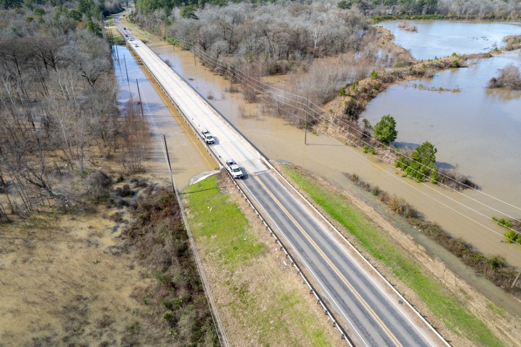
It was hard to tell where the East Fork was at times. The river had penetrated an adjacent sand mine in multiple places and was flowing through it.

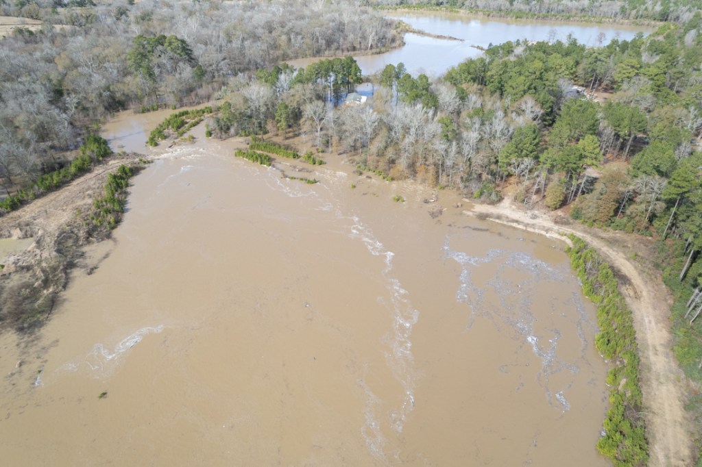
East Fork (upper left) broke through dike of abandoned sand mine and started flowing through it. Thursday, 1/25/24.
Rising water flooded the sand mine and isolated an adjacent house. Thursday, 1/25/24.
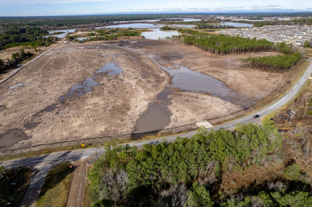
Looking west toward West Fork across Northpark South. Despite the ditch that contractors dug to drain the wetlands, a lot of water is still ponding. Thursday, 1/25/24.

West Fork in Humble/Kingwood Area

On Friday, 1/26/24, rising West Fork floodwaters near US59 invaded the neighborhood north of the bridge.
West Fork at US59 on Friday, 1/26/24. Rising water flooded turnarounds under the freeway on both sides of the river.
Friday, 1/26/24. Confluence of West Fork (right) and Spring Creek (left). Contrast enhanced to show that flow came predominantly from West Fork at this time.
Saturday 1/27/24. Homes isolated by floodwaters just south of New Caney ISD’s New West Fork High School (upper right).
Looking west, farther downstream on the West Fork at homes along Lake Point and North Shore Drives.
Saturday 1/27/24. KSA River Grove Park parking lot, boardwalk, and bridge to soccer fields were all under water.
Saturday 1/27/24. Golf course near Barrington subdivision flooded.
Saturday 1/27/24. Edgewater Park at US59 and West Fork partially underwater.
Kingwood County Club’s Forest Course becomes a Water Course south of Kingwood Greens subdivision.
At Kings Harbor on Saturday 1/27/24, water topped the pier, and the riverwalk, but didn’t get into businesses.
Sunday, 1/28/24. Looking at West Fork and adjacent sand mines from Northpark Woods. Note multiple breaches in dikes of two abandoned sand mines. Photo courtesy of reader.
Sunday 1/28/24. Courtesy of reader. Looking west past Northpark Woods (lower right). Note level of water in ditch. Google Earth measurement shows the water extends more than 3,000 feet up the ditch. That’s more than half a mile.
Farther up the ditch, you can see silty water from the mines on left and right mixing with water in the ditch. Photo courtesy of same reader.

Takeaways from Flood

I took several things away from this experience.

  1. Sediment mainly moves during floods. It’s too early to tell how much moved and whether it will be enough to impair the conveyance of rivers, bayous, creeks and ditches. But this flood represents a major opportunity for the engineers conducting the SJRA’s sedimentation study.
  2. Even relatively small amounts of rain (a couple inches per day) caused some major heartburn.
  3. The SJRA’s modeling nailed the flood peak on the West Fork. Even when the National Weather Service was predicting a peak in the 52′ range at US59, the SJRA said it would be 53.5′. The actual peak was 53.71, within tens of an inch.
  4. SJRA claimed the rainfall in the Lake Creek watershed was a major contributor. They don’t control that. It joins the West Fork downstream from the Lake Conroe Dam. A gage on Lake Creek showed 9.8 inches fell there in five days – among the highest totals for the region.
  5. The recent freeze killed a lot of vegetation that would normally have slowed runoff. That contributed to faster, higher peaks, according to testimony given during the SJRA board meeting last week.
  6. The SJRA did a much better job of communicating its gate operations to the public during this storm than ever before. It sent out a stream of press releases explaining what it was doing and why. I even received a personal call from an SJRA board member at 9pm before they increased their release rate to 19,500 cfs.
  7. The timing of the calls to news media got the news of the release on the 10 o’clock news before people went to bed. During Harvey, that didn’t happen. Many people were caught sleeping in bed by rising flood waters and had to evacuate by boat. Lesson learned.
  8. We need to do a damage assessment both upstream and downstream from the Lake Conroe dam to see where damage was concentrated. Did the SJRA do a good job of balancing upstream and downstream interests? Could gate operations have been improved?
  9. The SJRA says it waited to release water until it got within 6 inches of the top of its tainter gates. Had the water gone over the top of the tainter gates, they could have lost control. The gates would have become inoperable and the dam could have been placed in jeopardy.
  10. One leading hydrologist told me, “Understanding watershed hydrology is difficult. It rained quite a bit over a very large area. Watersheds all respond differently. The timing of the runoff reaching channels is crucial. How it combines with all of the other runoff from different places is key.”
  11. We need more floodgates on Lake Houston.

The worst of this event is behind us. Now comes the hard part. Cleaning up.

I wasn’t able to cover every area that flooded during this event. So, if you have photos of the flood or its impact that you would like to share, please submit them through the contact page of this website. Understand that all photos used here are in the public domain and may be shared by others. Finally, please indicate whether you would like a picture credit, and if so, how it should read.

Posted by Bob Rehak on 1/28/2024

2343 Days since Hurricane Harvey

Flood Watches and Warnings Extended, Streams Starting to Flood

Update: I just got word that SJRA is starting to increase the release rate from Lake Conroe to up to 19,500 cubic feet per second as of 9PM Wednesday night. Their modeling suggests that will cause the West Fork at US59 to peak at 53.5 feet – above the major flood stage. The previously forecast peak this afternoon was 51.8 feet and flood stage is 49.3 feet. People in low-lying areas near the river, even those in elevated homes, should consider evacuating. The river may not recede below flood stage before next weekend.

National Weather Service (NWS) flood watches and warnings have been extended. Continued heavy rainfall today has many streams especially in the northern part of the Houston Region coming out of their banks.

NWS Houston/Galveston Office predicts that showers and thunderstorms will continue through at least 7am tomorrow, with most areas experiencing a 60% chance of rain. While additional accumulations should be mild tomorrow, the Weather Service warns that higher amounts are possible in thunderstorms. The last wave of this marathon mess should push through overnight tonight. The sun may poke out by Thursday afternoon.

Rain-swollen confluence of San Jacinto West Fork (r) with Spring Creek (l) at US59 at noon Wednesday. The normal river bank is defined by the arc of small shrubs just right of center.
Low-lying streets in Lakewood Cove were already under water at noon today. West Fork is in upper left.

In the meantime, we aren’t out of the woods yet.

Flood Watch Through Noon Thursday

NWS has extended flood warnings and issued flood watches for large parts of SE Texas.

A flood watch means flooding is possible in the highlighted areas above.

Flood Warning Through Midnight Tonight

Much of the area picked up another 1-3 inches today with much higher totals off to the north and northwest from Columbus to Brenham to Lufkin where a swath of 8-12 inches has fallen since Sunday night, according to Harris County Meteorologist Jeff Lindner.

A flood warning means flooding has already occurred or is expected in highlighted areas above.

Upstream run-off continues to work into creeks in northern Waller, northwest Harris, and Montgomery Counties along with the San Jacinto River basin.

Areas with Flooding Concerns

The Harris County Flood Warning System shows that several channels are already out of their banks (red dots) or in danger of coming out (yellow triangles).

Harris County FWS as of 5PM on 1/24/24

For up-to-the-minute readouts on the status of a channel near you, go to Harris County Flood Warning System. Use the “Map view options” to select Channels, Channel Status. Under site selection, choose All.

Streams with Highest Flood Risk

According to Lindner, several creeks feeding into Lake Houston are already flooding. They include:

Upper Spring Creek: 

Low land flooding of rural lands near the creek as well as roadway crossing across the creek is occurring from upstream of SH 249 to the headwaters. Several low bridge crossings over the creek are flooded and some impassable. The creek will peak tonight and begin a fall into Thursday. No structures have flooded. Any low-land flooding downstream of SH 249 will be limited as the capacity of the channel increases.

Little Mound/Upper Cypress Creeks: 

Low-land flooding is ongoing along Mound Creek from eastern Waller County into extreme western Harris County. Water levels will peak tonight, then fall into Thursday. Flow from Little Mound Creek will route into upper Cypress Creek where a rise to near bankfull is likely around Sharp Rd. Sharp Rd may become inundated on Thursday. No structure flooding foreseen.

West Fork of the San Jacinto River: 

The river is rising and will exceed its banks this evening and continue to rise into moderate flood levels over 50.0 ft on Thursday with a forecasted peak near 52.0 ft on Friday. At these levels, low land flooding will occur along much of the river from upstream of US 59 to Lake Houston.

The US 59 turn arounds under the US 59 bridge crossing will be under several feet of water. The City of Houston has already closed off traffic under the turnarounds.

Several streets on the north bank of the river will be flooded including Lakeshore, Northshore, River Bend, and Lake Point.

The few structures in this area are elevated and could potentially become cut-off into the weekend as water levels remain elevated. At these levels back water will also begin to affect tributary drainage channels into the river and higher than normal water is likely along these tributaries. No flooding of homes is expected in Kingwood.

East Fork of the San Jacinto River:    

The river is rising and will exceed its banks early Thursday and then continue to rise into moderate flood levels by late Friday into Saturday. FM 1485 west of the river bridge will be flooded and impassable for an extended period of time. Additionally, some roads on the west side of the river just downstream of FM 1485 will be flooded and elevated structures cut-off. Elevated structures downstream on the east river bank off River Terrace Rd will be cut-off. The river is forecasted to remain well above flood stage through the weekend. 

Lake Houston: 

Water levels will be elevated likely to the top or just over the top of bulkheads and docks in the lake as upstream flows are passed through the lake. Additionally, large amounts of floating debris will make any boating hazardous into the weekend.

Lower San Jacinto River below Lake Houston: 

While flooding is currently not forecasted, given the amount of water that will be moving through Lake Houston and over the spillway, a rise to potentially near flood levels is certainly possible downstream of Lake Houston at Sheldon, Banana Bend, and Rio Villa. Low lying roads near the river may become inundated. Any possible flooding at locations below Lake Houston would be this weekend.   

Lake Releases

At 5PM 1/24/24, the SJRA dashboard showed that Lake Conroe as at 203.78 feet, almost 3 feet above its normal elevation of 201 feet. SJRA has temporarily closed Lake Conroe because of high currents, submerged objects and floating debris.

Because of continuing high inflows, SJRA was releasing 16,525 cubic feet per second at 5PM. They have steadily increased the volume released for the last three days.

To put this in perspective, 16,525 CFS is half the discharge rate of Lake Conroe during the October 1994 storm. And it’s about a fifth of the maximum release rate during Hurricane Harvey in 2017.

Farther south, Houston Public Works has had its flood gates wide open since Sunday. Regardless, water is now going over the spillway. Normal lake level is 42.4 ft and it’s currently at 43.57 ft.

According to the Harris County Flood Warning System, water has been going over the top of the spillway since 4AM this morning.

Helpful Resources

Weather conditions can change rapidly. For current information, go straight to these sources:

Posted by Bob Rehak on 1/24/24 at 6PM

2339 Days since Hurricane Harvey

NWS Issues Flood Watch

Early this morning, the National Weather Service issued a flood watch for areas north of the Houston Metropolitan area. It will remain in effect through midnight tonight.

As of 2PM, NWS extended the flood watch to include Harris, Fort Bend, Brazoria, Galveston, Chambers, and Liberty Counties through Wednesday morning.

Harris County Meteorologist Jeff Lindner predicts heavy rainfall toward I-10 and the coast by tonight. More rain on top of what has already fallen along with elevated creeks and streams led to issuing the flood watches.

Five of the six watersheds most in danger of flooding flow into the Lake Houston Area. And the SJRA is releasing water from Lake Conroe.

Flood watch map from NWS Houston/Galveston office for Wednesday AM

Forecast for Next 48 Hours

The ground has generally been saturated by yesterday’s rain and NWS predicts additional heavy rains today and tomorrow. The total could approach another 4.5 inches in the Lake Houston Area and even more to the north and west.

Those same areas received the highest rainfall totals yesterday on 1/22/24. Luckily, the rain has been fairly spread out until now.

Only One Stream in Region Currently Out of Banks

The San Jacinto West Fork came out of its banks at Highway 30 yesterday afternoon and is still out at noon on Tuesday, although waters have receded approximately a foot since the peak early this morning.

However, the Harris County Flood Warning system is also flashing warning signs for areas in the upper Cypress and Spring Creek Watersheds. All of those creeks are still within their banks as of noon Tuesday.

The map below shows the rainfall totals for the last 48 hours. Note how they peak in the north and west.

A gage on the Trinity River just west of Lake Livingston (not shown below) received 4.8 inches in the last 36 hours.

Two-day totals as of Noon 1/23/24

Lakes Conroe and Houston Both Releasing Water

Heavy rains north and west of Lake Conroe have led the San Jacinto River Authority (SJRA) to open the floodgates at Lake Conroe. The lake level is currently at 201.61 feet (normal 201) and the SJRA is releasing at a rate of 2665 cubic feet per second as a precaution against much larger releases later.

The City began releasing water from Lake Houston last Sunday in anticipation of this rainfall. At the noon hour on 1/23/24, Lake Houston is still slightly below normal. It is at 41.57 feet; normal is 42.4. But there’s much more headed toward the dam.

How to Monitor Flood Potential

If you live near water, monitor conditions closely.

Remember: It’s not just the rain that falls where you are at that causes flooding. Look upstream to see what’s coming at you.

We should begin to see some rises in the Lake Houston Area soon because of Lake Conroe releases and the heavy rainfall upstream on Spring and Cypress Creeks. They are the three main tributaries that govern the volume of water flowing into Lake Houston from the west.

The West Fork at US59 is still well below flood stage because of the Lake Houston release. Regardless, the river rose there almost 2 feet in the last 16 hours.

Streams Most in Danger of Flooding

Jeff Lindner, Harris County’s meteorologist, expects the heaviest rains to shift from the north toward the south later today. Lindner said, “Rises will continue along upper Spring and upper Cypress Creeks this morning as upstream run-off moves downstream.” 

“No flooding is currently expected,” continued Lindner, “but high flows in these creeks will continue today into tomorrow. This area will be particularly sensitive to additional rainfall and will need to be monitored closely.”

“Also watch the San Jacinto River basin,” said Lindner. “Due to the widespread nature of the rains, run-off is starting to work into the basin and minor flooding will be possible along the East Fork of the San Jacinto River later this week.”

Lindner says the Harris County streams most in danger of flooding include:

  • Cypress Creek
  • Spring Creek
  • Little Cypress Creek
  • Lower South Mayde Creek
  • Willow Creek 
  • San Jacinto River basin

All but Mayde Creek flow into Lake Houston. If you are unfamiliar with the watersheds around us, here is a map.

watershed map of Harris County
Harris County Watershed map by HCFCD

Posted by Bob Rehak on 1/23/24

2338 Days since Hurricane Harvey

City Will Lower Lake Houston Sunday in Advance of Heavy Rainfall

Houston District E City Council Member Fred Flickinger announced today that Houston Public Works will lower Lake Houston beginning Sunday afternoon. They expect to complete the lowering before rain starts on Monday. Houston Public Works is actively monitoring weather forecasts.

The National Weather Service has predicted 3-5+ inches of rainfall in our watershed beginning Monday through the coming week. A forecast of 3+ inches of rain triggers the opening of the Lake Houston Spillway Gates. 

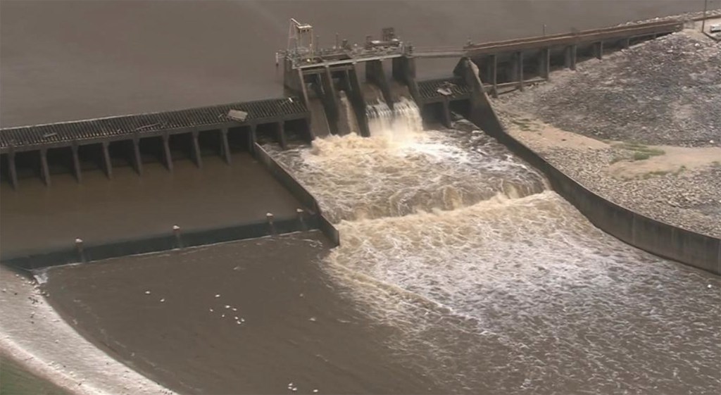
Gates on Lake Houston. File photo of 2019 release.

Flickinger advises property owners along the lake secure their property, including patio and outdoor furniture.

The Gates will remain open to manage storm inflows until the inclement weather has moved out of our region.

Lake Houston is currently at 42.22 ft (normal pool is 42.4) and Lake Conroe is at 200.64 ft (normal pool is 201.

The City put the lake-lowering policy in place after Hurricane Harvey. It has saved many homes and businesses from flooding during many events since then. The City is even planning on adding additional floodgates to Lake Houston to lower water faster.

Monitor Current Weather Events

To monitor current Lake Houston water levels, visit www.coastalwaterauthority.org.

To see current levels for Lake Conroe you can visit www.sjra.net.

For up-to-the-second weather for your zip code, visit the National Weather Service. NWS published the warnings below on Sunday, 1/20/24.

From Weather.gov on 1/20/24. As of 9:45am.
From Weather.gov as of 1/20/24 at 3:30pm. Updated frequently.

More than the Lake Could Flood, So…

Please keep in mind that flash flooding, affecting roadways and inland neighborhoods, is also possible in this storm. That’s a separate issue. Most storm drains are designed to handle only an inch of rainfall per hour.

Stay weather aware and avoid roadways if possible during rain events. It only takes 6 inches of water to move a car. If you see rising water near a stream, bayou or underpass, always turn around, don’t drown.

For more information, please contact the District E office at (832) 393-3008 or via email at districte@houstontx.gov.

Posted by Bob Rehak on 1/20/24

2335 Days since Hurricane Harvey
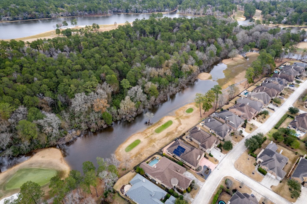
TWDB to Consider $50 Million Grant for Lake Houston Gates

Save the date. On December 7, 2023, the Texas Water Development Board will consider a $50 million grant to the City of Houston for structural improvements to the Lake Houston Dam. The improvements will extend the life of the dam and enable rapid lowering of lake levels in advance of a flood.

The project, led by outgoing Houston Mayor Pro Tem Dave Martin and Chief Recovery Officer Stephen Costello, will benefit thousands of residential properties in the surrounding area.

Make sure the next mayor supports it. Get out and vote. Better yet, take your neighbors with you!

Background

The $50 million grant will complement funds from other sources including FEMA. The addition of new tainter gates will enable Lake Houston to shed water faster before and during storms, reducing the risk of flooding.

Until now, pre-releasing water has been risky. The old gates on the Lake Houston dam can release only 10,000 cubic feet per second. As a result, to significantly lower the lake, releases must start far in advance of a storm. But storms can veer away during that extended time. That increases the chances that the City could waste water.

After several years of study, the City has found that the optimal option would be to add tainter gates to the eastern, earthen portion of the dam. But the cost increased significantly compared to the crest gates initially favored.

Proposed location for new tainter gates
Proposed location for new tainter gates.

Earlier this year, the Legislature set aside more funds for the new tainter gates and specifically directed the Texas Water Development Board (TWDB) to provide those funds. The TWDB’s executive administrator has recommended authorizing the funds. The Board just needs to approve them.

TWDB Board Meeting In Houston

The TWDB board will consider the approval at a rare Houston meeting at the Harris County Flood Control District in early December.

Date/Time:
Thursday, December 07, 2023; 9:30 AM
Location:
In person at 7522 Prairie Oak Drive
Michael Talbott Pavilion, Harris County Flood Control District Service Center
Houston, TX 77086

To view the webinar online, you must register for details.

Visitors who wish to address the Board should complete a visitor registration card and attend the meeting in person. The Texas Open Meetings Act prohibits visitor participation by telephone only. The visitor registration card is available and should be completed and submitted by e-mail to Customer Service no later than 8:00 a.m. on December 7, 2023, or in person at the registration desk.

Here is the full agenda. The $50 million grant for more gates is #14. Here is the backup information.

New, higher capacity gates were one of the three primary recommendations made by the Lake Houston Area Task Force after Harvey to mitigate flooding in the area. If all goes according to plan, construction could start in mid-2026, according to Costello.

Will Next Houston Mayor Support the Project?

Large infrastructure projects like this depend on unwavering political support. Completion of this project could take until the NEXT mayoral election. In the meantime, make sure we elect a mayor who will support the Gates Project until then. Keep it moving forward.

In that regard, John Whitmire has already demonstrated his support. If you haven’t yet voted, make sure you do. Take your neighbors, too. And then walk around your block and knock on some doors. Keeping this project will depend on turnout in the current runoff election.

So far, Acres Homes has had eight times more early voters than Huffman. And fewer than 4,000 people have voted in Kingwood.

As of 12/1/2023 according to Harris Votes.

The last day for early voting is December 5th. Polls are open from 7 am to 7 pm except for Sunday when they open at noon. Your last chance to vote is on Election Day, December 9th. For complete election information, visit Harris Votes.

Posted by Bob Rehak on 12/1/2023

2285 Days since Hurricane Harvey

Why Lake Houston Is So Full in a Drought

I flew over Lake Houston this morning in a helicopter. I expected to see the barren lake bed in places like you could during the 2011 drought. However, much to my surprise, the lake was virtually full.

Coastal Water Authority Shows Lake Down Only 6 Inches

The Coastal Water Authority, which manages the lake for the City of Houston, shows Lake Houston is only down a half foot.

Coastal Water Authority dashboard as of 8/12/23 at 6PM

Water was lapping at the edge of the the spillway.

Lake Houston Dam spillway. Photo take 8/12/23 at approximately 10am.

SJRA Shows Lake Conroe Down About 15 Inches

Lake Conroe is down about 15 inches from its normal conservation pool (the target level). And it hasn’t released any water downstream toward Lake Houston in months. The SJRA’s dashboard shows

SJRA Dashboard on 8/12/23 at 6PM.

Luce Bayou InterBasin Transfer Canal Bringing the Water

So what’s keeping Lake Houston full? What is offsetting drought and evaporation?

A quick check of the gages on the Harris County flood warning system shows areas far upstream have gotten small amounts of rain. But the most water we saw moving all day was coming from the Trinity River via the Luce Bayou InterBasin transfer project.

Luce Bayou Inter-Basin transfer canal bringing water to Lake Houston from the Trinity River on 8/12/23 at 9 am.

Gages upstream from Lake Livingston, which captures water coming down the Trinity River from Dallas/Fort Worth, recorded approximately 11 inches of rain in June, July and August (to date).

Lake Conroe got enough rain to offset some evaporation but not enough to supply Montgomery and Harris Counties.

It’s nice to have backups for Lake Houston in a drought, especially widely scattered backups that can capture rain moving through different parts of the region.

Posted by Bob Rehak on 8/12/23

2174 Days since Hurricane Harvey
Heavy Upstream Rainfall Now Working Its Way Down

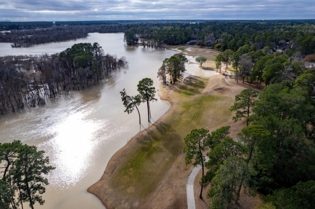
While no flooding in the Lake Houston Area is predicted at this time, the East and West Forks of the San Jacinto are swelling because of 5-9 inches of upstream rainfall–mostly to the north and northwest. As that stormwater works its way downstream, residents should be prepared to take action.

Cumulative rainfall totals including last three days. Note band of heavy rainfall up to almost 9 inches that will funnel down into the East and West Forks of the San Jacinto.

Meteorologists warned us that rainfall totals for Wednesday through Friday could creep upwards of 8-inches where cells started to train. And that is exactly what happened.

Since Wednesday, 7-9 inches of rain fell across southeast Grimes County and western Montgomery County into central Walker County. This caused significant rises on the upper and middle Spring Creek tributaries in northern Waller and southeast Montgomery Counties and Lake Creek. Rises are also ongoing along the West/East Forks of the San Jacinto River (see below).

The threat for additional heavy rainfall will shift south and east today.

Overall the trend in the Lake Houston Area for this afternoon, tonight, and Saturday will be for slowly decreasing rain chances and amounts.

Mainly San Jacinto Watershed Impacted

Because of frequent breaks and manageable rates in the rain, most watersheds have responded well. Getting 8 inches in three days is not as bad as getting 8 inches in three hours…especially when the grounds were so dry.

However totals have eventually piled up across northern Waller, western Montgomery, and central Walker Counties impacting mainly the San Jacinto River watershed. 

Spring Creek: 

Rises are ongoing along Spring Creek and its tributaries such as Mill, Walnut and Threemile Creeks. They are all producing high flows into Spring Creek from northern Waller, SE Grimes, and SW Montgomery Counties. While Spring Creek will rise today with these inflows, no significant flooding is expected. The channel capacity of the main creek is much larger and should be able to handle incoming inflows.

West Fork of the San Jacinto River: 

Inflows will be moving down Lake Creek which has recorded 7-9 inches of rainfall across the upper headwaters of the basin in western Montgomery County as well as local inflow below Lake Conroe Dam and ongoing minor releases from Lake Conroe (around 6,000 cfs this morning). The river is expected to rise to near 48.0 ft over the weekend as upstream run-off moves downstream. This is currently about 1 ft below flood stage at Humble (US 59).

From Harris County Flood Control Flood Warning System
East Fork of the San Jacinto River: 

Upstream run-off from Walker and San Jacinto Counites will move downstream toward New Caney (FM 1485) and Plum Grove over the next few days. The river is currently forecasted to rise above flood stage late this weekend and potentially approach moderate flood levels late Sunday into Monday.

The upstream rainfall could impact FM 1485 and low lying areas near the river downstream of the SH 99/FM 1485 bridge crossing.

Jeff Lindner, Harris County Meteorologist
Lake Conroe Report

Lake Conroe released water all day yesterday at more than 6000 cubic feet per second (CFS). Today, the rate has slowed slightly to just under 6000 CFS. The lake level is holding steady at 202.54 feet as of 4/7/23 at 10:40 AM. That’s about a foot and a half above its normal level.

The San Jacinto River Authority adopted a compromise lake lowering policy. In April, May, September and October, they are lowering Lake Conroe a half foot WHEN the City of Houston requests it. The releases are not as great, nor are they automatic as in previous years.

Lake Houston

Lake Houston opened all its floodgates on Tuesday and has released water steadily throughout this event. The lake level was at 41.7 feet at 9:30 AM. Normal is 42.4. So the precautions seem to have paid off. But a test still lies ahead.

Posted by Bob Rehak on 4/7/23

2047 Days since Hurricane Harvey
Rainfall Predictions Increasing, City Lowering Lake Houston

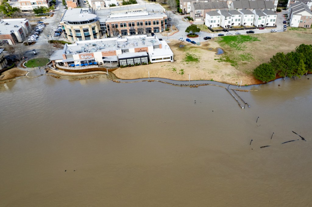
New forecasts that show higher than previously predicted rainfall amounts for the next three days have caused the City to begin lowering Lake Houston.

Widespread 3-6 Inches Expect, Higher Isolated Totals

All week long, meteorologists have predicted heavy rains starting on Wednesday, 4/5/23, through Friday, 4/7/23. This morning, guidance from Harris County Meteorologist Jeff Lindner indicated that the rainfall could be even heavier than previously predicted. Instead of widespread 2-4 inches, Lindner now predicts widespread 3-6 inches. Last night, ABC13 predicted up to a foot of rain in isolated places, especially north and west of US59, i.e., the San Jacinto Watershed.

Three day totals predicted by the National Weather Service on 4/5/23

Lake Lowering Began at Noon

As a result, the City of Houston began lowering Lake Houston today at noon.

According to Mayor Pro Tem Dave Martin, Houston Public Works, Coastal Water Authority, and San Jacinto River Authority have worked together closely over the last 24 hours to monitor local forecasts. Based on this morning’s forecast within the San Jacinto Watershed, the City decided to open the floodgates on the Lake Houston Spillway Dam.

Property owners should make arrangements to secure boats and other items along the shoreline.

City of Houston

Houston Public Works will keep the flashboard and tainter gates open throughout the inclement weather and Coastal Water Authority will continue storm operations allowing the inflow to pass through Lake Houston until the weather threat concludes.

SJRA NOT Lowering Lake Conroe Level

SJRA has confirmed they will NOT lower Lake Conroe. This will maximize the City of Houston’s lake-lowering efforts.

Atmospheric Squeeze

An approaching low-pressure system from the northwest will stall when it encounters a high-pressure system over the Gulf.

The two fronts will funnel moisture from both the Pacific and Gulf between them. That’s because in the Northern Hemisphere, high-pressure systems rotate clockwise and low-pressure systems rotate counterclockwise. So atmospheric moisture will be squeezed between them along a steady line for days. Think of meshed gears.

Because of dry grounds, moisture that falls during the first day will likely soak in. But after that, runoff rates will increase.

The areas receiving the most rainfall will likely be north and west of Houston, because that’s where the frontal boundary will likely linger longest.

Flooding Outlook

Street flooding will be a concern through Friday. 

Says Lindner, “Smaller creeks, rural watersheds, and San Jacinto River system will be the most vulnerable to higher run-off flows. While widespread creek and bayou flooding is currently not expected, some watersheds may experience significant rises and a few locations potentially to flood levels. Any sustained training of heavy rainfall over any certain watershed for an extended period of time could result in flooding. It will be important to monitor rainfall amounts and locations through the period for any significant watershed responses.

Watch the following watersheds closely: Willow Creek, Little Cypress Creek, Cypress Creek (and Waller County tributaries), Spring Creek (and Montgomery/Waller County tributaries), Bear Creek, South Mayde Creek, Cedar Bayou, East/West Forks of the San Jacinto River, Keegans Bayou, Clear Creek, Halls Bayou.  

For Current Information 24/7

Bookmark these links to monitor weather and lake conditions, especially if you live in low-lying areas with a history of flooding:

Posted by Bob Rehak on 4/5/2023 at Noon

2045 Days since Hurricane Harvey