Mouth Bar Dredging: First Pictures of Next Phase
Earlier this month, the State, Harris County and City of Houston announced the next phase of West Fork mouth bar dredging. Late last week, it got underway in earnest.

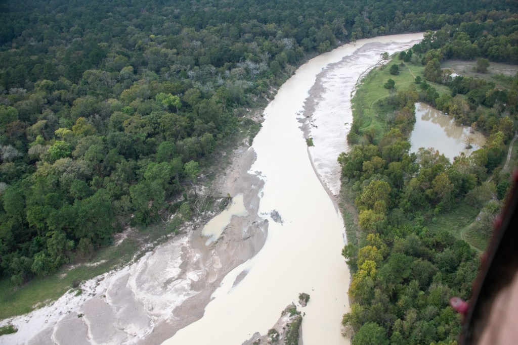
How Mechanical Dredging Works
Rachel Taylor took the ground-level pictures below earlier today from her back yard in Atascocita Point. They show mechanical excavators eating away at the mouth bar and loading the spoils on barges.


Mechanical dredging is slower and more labor intensive than hydraulic dredging, but can mobilize faster. In hydraulic dredging, dredgers pump the spoils to a placement area via pipelines. That is faster, but has higher overhead. It also creates more noise.
Hydraulic Dredging Options
The hydraulic pipelines can stretch miles. In the case of the first phase of West Fork mouth bar dredging, they stretched 10 miles upstream. It took five booster pumps to get the material all that way to a sand mine on Sorters just south of Kingwood Drive.
Luckily for us, the pipe from the first phase of mouth bar dredging is still at the Army Corps dock opposite Forest Cove.


At some point in this project, dredging may switch from mechanical to hydraulic. The fact that the Great Lakes dredge remained here bodes well. It chewed through 500,000 cubic yards of debris at the West Fork mouth bar in less than three months. Officials expect mechanical dredging of 400,000 cubic yards to take 8 -12 months.
Additional Dredging Targets and Financing
Other targets reportedly include the East Fork Mouth Bar and several mouth bars that have formed at the mouths of ditches or streams leading into the lake.
State Representative Dan Huberty helped bring $30 million to this phase of dredging via an amendment to SB500 in the last legislature. That money will funnel through Harris County via the Texas Water Development Board. The County also included $10 million in the 2018 flood bond. And the City is applying $6 million left over from a FEMA/TDEM grant for debris removal from Harvey.
For more details on this next phase of dredging, see the previous post on this project.
Two Phase Project Outlined In Grant
Harris County’s proposal for the grant from the Texas Water Development Board (TWDB) calls for splitting the project into two phases.
- Phase One will focus on the West Fork Mouth Bar using the City’s $6 million and $10 million from the TWDB grant.
- Phase Two will focus on the East Fork Mouth Bar using the remaining $20 million from the grant.
- The $10 million from the County flood bond will fund surveys, formulation of specs, bidding, project management and more.
Progress Result of Pulling Together
All this is great news for the Lake Houston Area. The entire community worked since Harvey to make this happen through all levels of government.
As we look at other flooding problems in the area, it’s important not to get discouraged and to remember that we can make progress if we all pull together.
Posted by Bob Rehak on 1/26/2020 with photos from Rachel Lavin Taylor
880 Days since Hurricane Harvey