Tag Archive for: Ramsey

Natural Disasters Don’t Care About Partisanship. Neither Does Mayor Whitmire. 

1/26/26 – Progressives are wrong to critique local leaders for working across the political aisle on flooding: an Op-ed about partisanship originally published in the Houston Chronicle Opinion Section.


Houston Mayor John Whitmire (l) with Harris County Precinct 3 Commissioner Tom Ramsey coordinating first responders after severe flooding in Kingwood. (Personal image substituted for copyrighted Chronicle image.)

For eight years, I have hosted the website ReduceFlooding.com, which focuses on the need to reduce flooding in Houston. Pretty straightforward.

This also means I spend plenty of time interacting with government officials at all levels. 

People form governments to solve the big problems that individuals can’t. That is especially true for local governments. Municipalities provide police and fire protection, build and maintain water and sewer systems, manage garbage, repair streets and do all of the critical and unglamorous work of making a city run. That includes flood mitigation.

Recently, however, partisans have been politicizing local governments by insisting elected officials become involved with issues over which they have little, if any, control.  They confuse virtue with partisan purity.

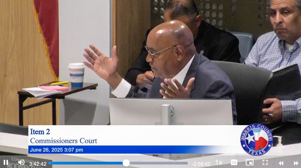
Here in Houston, the most notable examples are the progressive attacks on Mayor John Whitmire.

I have followed the Chronicle’s coverage of extremists within the mayor’s own Democratic Party. They criticize him for not adequately towing the party line.  My understanding is that his cardinal sin was attending a fundraiser for U.S. Rep. Dan Crenshaw, a Republican. 

As someone who has written extensively about flood issues since Hurricane Harvey, I can tell you that Crenshaw has helped bring hundreds of millions of dollars in flood-mitigation assistance to the Houston area, including $47 Million for additional flood gates for the Lake Houston Dam, more than $100 million for San Jacinto River dredging, $80 million for Community Project Funding Grants to date, and approximately $50 million for Kingwood High School Flood Barrier. Crenshaw also played a pivotal role in securing $25 million federal dollars for the North Shepherd-Durham renovation project..

I fail to see the sin in working across the partisan divide to improve the lives of Houstonians. I have no problem with our mayor attending any event for any elected official of either party if it will help us get the critical funding that Houston needs to improve infrastructure and control flooding. Floodwater does not discriminate based on party affiliation. It destroys the homes and lives of Democrats and Republicans alike.

Before Whitmire was first elected mayor, he asked me to educate him about local flood issues in Kingwood. Then he asked me to set up meetings with flood victims and community leaders so he could learn firsthand about their needs. It didn’t matter whether they were Republicans or Democrats — they were human beings who needed help.

For the partisan extremists, however, purity is more important than solving citizen’s everyday problems. Their mantra has become “Whose colors are you wearing?” Blind obedience to the political party is more important than working together toward common goals that make communities better places to live.

And it’s about more than campaign events.

For instance, on a cold and blustery Saturday morning earlier this month, I saw a refreshing example of what it looks like when local politicians put partisan purity aside: Whitmire himself working shoulder to shoulder with more than a hundred volunteers to improve public safety in Kingwood. For this lifelong Democrat, it didn’t matter that Kingwood is Republican-friendly territory. What mattered was coming together to solve the problem of runaway vines taking over the median of Kingwood Drive. The vines were choking trees, spilling into the roadway, crowding traffic, limiting visibility, and creating a public safety hazard.

Kingwood residents have long recognized the vines as a nuisance. They dodge them every day on their way to and from work. To help control them, District E City Council Member Fred Flickinger has organized a series of trim-fests called “Median Madness.”

Vines had become especially troublesome in front of Kingwood High School – home to thousands of inexperienced teenage drivers. So, on that Saturday morning, more than a hundred volunteers showed up for “Median Madness: Round 5” to attack the vines in front of the high school.  Most of the volunteers were students from the high school itself.

No one wore a red shirt or a blue shirt. No clothing shouted political slogans. Everyone came with work gloves and work boots. To make their community a better, safer, more beautiful place to live and work. For the benefit of everyone — regardless of political affiliation.

And when the camera crews left and the press was finished covering the Median Madness event, the mayor didn’t leave with them. He stayed to help clear the vines and improve traffic safety — in blue jeans and work boots with lopping shears – like everyone else.

Like I said: critical and unglamorous work.

In doing so, Whitmire set an example of what public service should be. He put politics aside and worked with residents for the good of the community – young and old, male and female, Democrats and Republicans. He communicated an unspoken message about the importance of public service for scores of high school students.

I have seen this practice repeatedly with Whitmire. He focuses on issues that actually improve residents’ lives. He sees past the debilitating, divisive national dialog undermining trust in government. Even if it means toiling in miserable weather for hours on a Saturday morning.

In the end, our steady 76-year-old mayor taught everyone at Median Madness perhaps the most important lesson of all without saying it outright. He showed that we have more to gain by working together than fighting each other. Public safety requires cooperation not competition. And that’s a pretty important lesson. 

It’s a lesson the progressive activists in Whitmire’s own party still need to learn. 

Bob Rehak is the host of ReduceFlooding.com and Precinct 3 representative to the Harris County Community Flood Resilience Task Force. 


Posted by Bob Rehak on 1/26/26

3072 Days since Hurricane Harvey

Harris County Passes Ramsey Resolution on Scarborough Development In MoCo

12/13/25 – On 12/11/25, Precinct 3 Commissioner Tom Ramsey, PE, introduced a resolution in Harris County Commissioners Court that urges Montgomery County (MoCo) to impose certain conditions on the proposed 5,300-acre Scarborough Development west of Kingwood. Harris County Flood Control tried to buy the property after Hurricane Harvey because they feared that if it got developed, “it would be like aiming a fire hose at Kingwood and Humble.” Ryko, the property owner at the time, quoted a price far over market value. So, the deal fell through. But those fears still exist.

While Harris County can’t force MoCo to do anything, the proposed conditions include:

  • Adopting Harris County’s proposed minimum drainage standards
  • Recognizing the extreme flood risk of development for current residents in both counties
  • Using portions of the property for flood mitigation and parks
  • Ensuring development meets or exceeds Harris County standards including:
    • Finished floor elevations
    • Placing mitigation ponds outside the 100-year floodplain and floodway
  • Fostering growth of wetlands and water filtration.
Scarborough bought most of the land you see in this picture between Spring Creek (l) and San Jacinto West Fork (r). Base flood elevation at the confluence is 25.1 feet above ground level using old, pre-Harvey flood maps.

Ramsey’s resolution is high-level; most resolutions are. But it makes good points. For instance, while MoCo’s new Drainage Criteria Manual is a vast improvement over their previous one, it still falls short of Harris County’s on several key criteria including finished floor elevations and placing fill in the 500-year floodplain. Those concerns are expressed in the text below.

Exact Text of Harris County Resolution


WHEREAS, Harris County leads the country in flood prevention investments with $3.5 billion being spent on flood mitigation projects in the next few years, and calls upon Montgomery County leadership to adopt the minimum drainage criteria as per the previously approved Harris County Commissioner’s Court document; and

WHEREAS, the land under development in Montgomery County for the Scarborough Lane Project, is situated in close proximity to Spring Creek, Cypress Creek, and the San Jacinto River, and the historical flood data of this tract of land causes concerns for residential development, and any further development on this property in the flood zone may result in a negative impact to current residents of Montgomery and Harris counties; and

WHEREAS, portions of this property should be reviewed and considered for flood mitigation, flood preservation and park development; and

WHEREAS, any development of this parcel should meet or exceed the Harris County standards, including the finish floor elevations of the structure, and any mitigation ponds be considered only outside the current 100-year floodplain and all the floodway; and

WHEREAS, any mitigation completed should consider trying to hold back water early in a storm, detaining the first of the water that falls; and

WHEREAS, this tract of land renders a significant and affordable flood mitigation opportunity that would not only prevent flood damage, but foster wetland growth and ground water filtration; and

NOW, THEREFORE BE IT RESOLVED the Harris County Commissioners Court calls upon the Montgomery County leadership to take into consideration the concerns described above.

Considerations Related to the Scarborough Lane Project

IT IS HEREBY ORDERED that this resolution be spread upon the minutes of The Harris County Commissioners Court this 11th day of December 2025.


Ramsey’s Motion Passed Unanimously; Next Up CoH

County Judge Lina Hidalgo, Ramsey and all three other commissioners voted for Ramsey’s resolution. It passed 5-0.

Houston City Council will reportedly consider a similar resolution on Wednesday. District E Council Member Fred Flickinger says he is optimistic that he has the votes to get it approved.

Note that the City actually has a bigger stick in this fight because most of the land lies within the City limits or the City’s Extra Territorial Jurisdiction (ETJ). ETJ helps cities plan and regulate development in unincorporated areas near their borders, influencing growth before annexation.

On October 30, Scarborough and its engineers met with the City and Harris County to discuss their plans. At the time, they presented some high-level documents claiming that half the land would be preserved as green space. That’s certainly a step in the right direction. But is it enough? We will be in a better position to tell when we’ve reviewed their complete plans. And when Harris County Flood Control and FEMA release updated flood maps.

In the meantime, I’ll be watching to see what City Council does next Wednesday.

Posted by Bob Rehak on 12/13/25

3028 Days since Hurricane Harvey

The thoughts expressed in this post represent opinions on matters of public concern and safety. They are protected by the First Amendment of the US Constitution and the Anti-SLAPP Statute of the Great State of Texas.

Remaining Flood-Bond Funds Going Only to Equity Projects

6/27/25 4PM – In a marathon discussion yesterday that stretched for hours, Harris County Commissioners Court struggled with how to plug a $1.3 billion shortfall in 2018 Flood-Bond funding. In the end, they voted 4-1 along party lines to apply all remaining flood-bond money exclusively to projects that ranked in the top quartile on Rodney Ellis’ Equity Prioritization Index.

Precinct 1 Commissioner Rodney Ellis arguing that remaining flood-bond funds be directed only to projects with a high “equity” component.

This will effectively defund all projects that fall into the second, third and fourth quartiles on Ellis’ Equity Prioritization Framework.

The Motion

Commissioners voted 4:1 to use all available flood-bond funds:

“To fully fund all current and future needs for projects in Quartile One, according to the 2022 Prioritization Framework, and direct the Harris County Flood Control District to work with court officers and report to Commissioners Court a project schedule by September 18th, 2025, on all future projects with a recommendation.”

Impact of Cuts

Precinct 3 Commissioner Tom Ramsey, the dissenting Republican, said, “It was like a bunker-busting bomb exploding yesterday. They blew up the 2018 bond program.” The decision will eliminate funding for 44 of the 48 bond projects that Ramsey had in his precinct.

“There’s no longer any money for them,” said Ramsey.

Ramsey will lose $424 million of flood-bond funding. He added, “Projects in the top quartile eat up every remaining available dollar in the bond. Every bit of it. There’s none left. Not a single dime.”

Want to see whether a project near you was killed? Here is a list of Flood-Bond Projects divided into Commissioner Rodney Ellis’ Equity Quartiles.

Only those marked with a #1 in the Quartile Column will be pursued at this point. The rest are effectively dead unless funding can be found elsewhere.

No Projects Left in Lake Houston Area

All HCFCD flood-bond projects in the Lake Houston Area fell below Ellis’ Equity Quartile #1 into the second, third, or fourth quartiles.

Following the Democratic plan will eliminate $20 million for Lake Houston Floodgates See Project G-103-Gates.

It will also eliminate any help for the Kingwood Diversion Ditch. The Kingwood Area Drainage Analysis called that the most important project in the area. And Kingwood experienced the highest flooding in the county during Harvey.

worst first
Chart showing feet above flood stage of 33 gages of misc. bayous in Harris County during Harvey. Gage on far left is Kingwood.

This doesn’t mean those projects will automatically die. But it is a setback.

It means project leaders will have to seek funding elsewhere for money that HCFCD had already committed years ago and that voters approved.

In that regard, Houston City Council Member Fred Flickinger had this to say about the Commissioner Court’s decision.

“Obviously the County’s handling of the flood bonds has been a concern for several years. Commissioner Ramsey is continuing to fight for our area to complete the necessary flood mitigation projects.

“However, regardless of the outcome at the County level, I have full confidence that the schedule I laid out in last year’s town hall meeting will in fact be held with the support of Representative Cunningham, Senator Creighton and Mayor Whitmire.”

Commissioner Ramsey also described the Gate project as his “Rubicon,” a reference to a Roman battle that represents a point of no return, i.e., a battle that must be won at all costs.

Uncertainty Surrounds 95 Active Projects

Ninety-five projects that fall into quartiles 2, 3 and 4 are listed as “Active.” HCFCD says it will move forward with any projects already in progress. But it’s unclear whether future stages will be implemented, i.e., moving from engineering to construction. We may know more in September.

HUD Project Deadlines Tightened Even More

Yesterday’s decision could affect U.S. Department of Housing and Urban Development (HUD) CDBG-MIT and CDBG-DR grants under review by the Texas General Land Office (GLO). Harris County Flood Control applied for 29 such grants.

HCFCD says they are moving forward with all HUD projects.

But GLO stressed the tightness of a February 28, 2027 deadline for 11 CDBG-DR projects valued at roughly $320 million. With only 20 months remaining to complete the projects, County Commissioners voted yesterday to take another three months to schedule projects.

For that group of projects, deadlines may be a bigger threat than funding. Think 17 months is plenty of time? It’s taken Harris County four years to get to this point with these projects! More uncertainty won’t speed things up.

Before the meeting, GLO Commissioner Dawn Buckingham warned county leaders to use the HUD funds “as quickly as possible.”

How Meeting Unfolded

Precinct 1 Commissioner Rodney Ellis, a master of political theater, packed the first two hours of Commissioners Court with surrogates during the public-comment portion of the meeting. The same people and groups that Ellis used to tarnish previous Harris County Flood Control District administrators showed up again. They even carried similar signs.

Over and over and over again, they complained about the lack of bond-program:

  • Equity
  • Results
  • Transparency

Dr. Tina Petersen, executive director of HCFCD, then led off the discussion with a PowerPoint presentation that she had been working to compile since February. The last slide shows how her team explored five different scenarios for maximizing available funding. (See her entire detailed report here.)

That set the stage for Precinct 1 Commissioner Rodney Ellis’ 20-minute boilerplate rant about historical discrimination against poor neighborhoods and how rich neighborhoods get all the money.

Disconnect between Ellis Rant and Reality

But there’s a basic disconnect between the rant and reality. Note that of all HCFCD spending since 2000, money has gone disproportionately to watersheds with a majority low-to-moderate-income (LMI) population. Between 2000 and 2022, 61% went to the one third of watersheds with an LMI-majority population. So, poor watersheds already receive the lion’s share of funding – almost twice as much as middle and upper income areas.

Busting the Myth: In Harris county, poor, not rich neighborhoods have gotten the lion's share of flood mitigation dollars since 2000.
Busting the Myth: Between 2000 and 2022, in Harris county, poor, not rich neighborhoods have gotten the lion’s share of flood mitigation dollars since 2000.

Regardless, Ellis was on a roll. And by the time he was done, three of his Democratic colleagues (Hidalgo, Garcia and Briones) were demanding more equity.

They voted to ignore all five of the scenarios that Petersen spent months working on and focus only on projects that ranked high on Ellis’ equity scale.

When Ramsey pointed out that one of the poorest neighborhoods in Precinct 3, Barrett Station, was defunded, Ellis shot back that his equity formula was “agnostic” to politics. But the numbers tell a different story.

Little wonder that the county released no information on this issue before the vote yesterday. Opposition to Ellis’ ringers might have had time to organize.

Expect frequent updates on this in coming months as the situation evolves.

To view video of the discussion, look for Item 2 here. Public appearances come before Item Two, and there are several breaks during the discussion.

Posted by Bob Rehak on 6/27/25 at 4PM

2859 Days since Hurricane Harvey

HCFCD Announces Kingwood Projects

5/16/2025 – Harris County Flood Control District (HCFCD) made several announcements about projects recently that will affect Kingwood and areas upstream.

Two Stormwater Detention Basins Now on Bid List

The District expects two major detention basin projects to go out for bids soon. The:

  • East TC Jester Basin on Cypress Creek will bid in the third quarter this year.
  • Woodridge Village Basin on Taylor Gully will bid in the first quarter next year.

The clearcutting of the Woodridge Village flooded hundreds of homes in Elm Grove, Sherwood Trails and Mills Branch twice in 2019. HCFCD started excavating an additional detention basin in 2021 to help address the risk of downstream flooding. But they were forced to discontinue the excavation in 2023 when they applied for a HUD grant to finish the project.

HCFCD held a press conference about funding availability at the TC Jester property in 2022.

Ten More Maintenance Projects in Kingwood

HCFCD also announced 10 more maintenance projects on area channels. They expect to start eight this year.

What Will Happen Where

The map below shows the location of the projects. It’s keyed to the numbers above in the first column.

The maintenance will help ensure the continued effectiveness of the area’s flood control systems.

HCFCD will repair or replace…

  • Existing damaged concrete channel linings
  • Slope paving
  • Outfall pipes

…for the following channels

  • G103-38-02-X005 (Kingwood Diversion Ditch) 
  • G103-80-01-X012(Green Tree Ditch) 
  • G103-41-00-X014 (Sand Branch) 
  • G103-33-03-X003 (Hidden Pines to Bens Branch) 
  • G103-38-01-X015 (Chestnut Ridge Rd. to Kingwood Diversion Ditch) 
  • G103-38-01-X016 (Chestnut Ridge Rd. to Kingwood Diversion Ditch) 

HCFCD will also remove sediment from:

  • G103-80-01-X013 (Green Tree Ditch) 
  • G103-33-04-X007 (Kings Crossing Ditch) 
  • G103-41-00-X013 (Sand Branch) 

They will repair erosion on:

  • G103-33-01-X007 (North Park Dr. to Bens Branch) 
  • G103-80-03.1-X037 (Taylor Gully) 

Finally, HCFCD will reshape side channels on:

  • G103-33-04-X007 (Kings Crossing Ditch) 
  • G103-41-00-X014 (Sand Branch)  

During this time, residents in work areas may notice crews with large trucks and heavy equipment such as excavators and bulldozers. Stay well clear of the equipment.

HCFCD estimates it will complete all this work by early 2026. The District and Precinct 3 Commissioner Tom Ramsey who helped arrange the work stated that each specific effort will move on its own timeline. 

Posted by Bob Rehak on 5/16/2026

2817 Days since Hurricane Harvey

Ramsey, Flickinger Discuss Status of Flood Projects

1/16/2025 – Harris County Precinct 3 Commissioner Tom Ramsey, PE, and Distict E Houston City Council Member Fred Flickinger discussed the status of numerous flood projects at a meeting of the Kingwood Area Republican Women today at the Oakhurst Golf Club.

Ramsey addressing Kingwood Area Republican Women’s Club today.

Among the projects they covered were:

  • Taylor Gully Improvements/Woodridge Village Detention
  • Kingwood Diversion Ditch Improvements/Upstream Detention
  • Additional Floodgates for Lake Houston
  • Legal Changes Governing Pre-Release of Water from Lakes
  • Edgewater Park
  • Dredging
  • Medians
  • Flood Tunnels
  • Subsidence

Below are the highlights. They also discussed other issues such as median maintenance, vine control, crime, taxes, government waste, elections and more. But I will focus primarily on infrastructure issues related to flooding – especially Taylor Gully and Woodridge Village, because of pending approvals this month.

Taylor Gully/Woodridge Village

After Perry Homes clearcut approximately 270 acres in Montgomery County, hundreds of Kingwood homes flooded twice in 2019 along Taylor Gully. Taylor Gully runs through the northern part of Kingwood from Kingwood Park High School to White Oak Creek.

Taylor Gully/Woodridge Village

Harris County Flood Control District (HCDFC) began working on mitigation plans in 2021 and presented preliminary recommendations to the community in December, 2022.

The county had high hopes for funding from the Texas General Land Office (GLO) and U.S. Department of Housing and Urban Development (HUD), but those ran into a potential snag. Taylor Gully improvements fit within available HUD funding, but Woodridge Village (the former Perry Homes Property) did not. HCFCD hoped to build more stormwater detention basin capacity on Woodridge to help control Taylor Gully expenses downstream.

Regardless HCFCD pressed forward. They combined the two projects. And according to HCFCD, both now fit with available funding capacity (see “above the line” list on page 2) of the list being presented to Commissioners Court next week on 1/23/25.

The county purchased Woodridge Village in February 2021. Shortly thereafter, HCFCD began an excavation and removal (E&R) contract to get a “head start” on the basins. Indeed, the head start brought the total stormwater detention on the site almost to Atlas-14 standards.

However, HCFCD was forced to terminate the E&R contract before the basins could be completed. That was to comply with HUD requirements while HUD considered the grant application.

This is potentially great news for the people who live in Sherwood Trails, Elm Grove, Mills Branch and Woodstream.

Watch commissioner’s court closely next Thursday. The Kingwood area drainage study named this project as one of the two most important in Kingwood.

Kingwood Diversion Ditch and Upstream Detention

The Kingwood Diversion Ditch was the other of the two most important projects. The Diversion Ditch takes floodwaters out of Bens Branch, which runs diagonally through the center of Kingwood from St. Martha Catholic Church to River Grove Park.

Improving the Diversion Ditch would reduce flood risk for hundreds of homes and apartments, Kingwood High School, Town Center, and Kings Harbor. Both Bens Branch and the Diversion Ditch currently have a two-year level of service. That means they have a 50% chance of coming out of their banks in any given year.

The District started preliminary engineering in mid-2021. HCFCD will finally present that report to Commissioners Court on February 6, 2025.

Ramsey estimated today that the project could cost $60 million. However, he also indicated that U.S. Congressman Dan Crenshaw “got us enough money so we can do the final engineering.”

Eric Heppen, Precinct 3 engineer, later stated that once Commissioners Court approves the preliminary report, it will be made public.

Flickinger emphasized that he is talking with Montgomery County, trying to get them to retain more of their floodwaters. He raised concerns about a new 200,000 sq. ft. convention center planned for US59 at Valley Ranch. “That will generate a lot of runoff that could come down to us, unless we work together to find a way to hold that water up there.”

Houston City Council Member Fred Flickinger at same meeting.

Additional Floodgates for Lake Houston

Shortly after Harvey, many people pinned their flood-mitigation hopes on additional floodgates for the Lake Houston dam. The idea: to lower the lake faster when it becomes certain that a storm will flood the area. The existing gates have 1/15th the capacity of Lake Conroe’s. So Lake Houston must start releasing far earlier in advance of storms than Lake Conroe. And by the time Lake Houston is lowered, storms can veer away, wasting valuable water.

So Conroe tends to hold its water back until it is absolutely certain. At that point, it has no other choice than to release water at high rates that flood people downstream.

Being able to lower Lake Houston faster would let Lake Conroe release earlier and slower, smoothing out flood peaks downstream.

Ramsey estimated the cost of 11 new floodgates that could release 80,000 cubic feet per second at $150 million. He said the final engineering should be completed this year. He also said that bidding and construction could start in 2026.

Legal Changes Governing Pre-Release of Water

Flickinger addressed a related legal issue. State law limits the release of water from lakes; it must be only for defined beneficial uses and flood control is not one of them.

So, Flickinger is working with State Rep. Charles Cunningham to change that and increase the limit. “Bottom line,” he said, “is that we need to release more water sooner rather than holding it back until we’re adding to the crest of the flood.”

Flickinger is also working with the San Jacinto River Authority on these changes.

Edgewater Park

After Harvey, the County acquired land on the northeast corner of the West Fork and US59, which will turn into Edgewater Park. It will also connect the Houston Parks Board’s West Fork Greenway with the Spring Creek Nature Trail. Ramsey said the plans will be made public very soon. After the meeting, Precinct 3 engineer Eric Heppen confirmed the plans were 99% complete.

Ramsey said, “Soon, you’ll be able to go from Kingwood to Tomball and not cross a road.” That should be a tremendous draw for hikers and bikers and the entire area.

Dredging

Flickinger discussed two aspects of dredging not covered in last night’s post. First, he is seeking additional funding to continue the current program while the dredge is on the lake. Second, he feels opportunities exist to increase efficiency.

I asked what he meant by that. FEMA restrictions on the funds currently being used limit the dredging to “pre-Harvey” conditions. That means, Callan Marine, the contractor, must dredge to different depths to match the exact bottom profile that existed before Harvey. And that requires repositioning the dredge more than if you were just dredging to a uniform depth across wide areas.

The search for additional funding has led Flickinger to the City, the Coastal Water Authority (CWA) and former State Representative Dan Huberty. Huberty was appointed to the board of CWA last last year by Houston Mayor John Whitmire.

Medians

Several people from the audience questioned Flickinger about the medians along Kingwood Drive. He touted the success of his first Median Madness event in November 2024 and announced another on February 22, 2025. Mark your calendar now.

More than 50 volunteers participated in the last vine-cutting extravaganza. He hopes for many more volunteers this time.

Flood Tunnels

The county is getting ready to launch the next phase of its flood tunnel study. Ramsey emphasized that there isn’t enough room in Harris County to poke enough holes in the ground to solve all of our flooding problems. He sees tunnels that carry floodwater from strategic locations as essential parts of the solution.

Eric Heppen, Ramsey’s engineer said that by burying the 40 foot tunnels 80 feet underground, you can double the conveyance in some watersheds, sidestep environmental issues, and avoid having to condemn property.

But many issues have yet to be worked out. For instance, will tunnels be constructed to relieve 2-year, 5-year, 10-year, 25-year or 50-year flooding? More to follow when details become available.

Subsidence

Harris County estimates the area east of Lake Houston will grow by 18,000 homes in the next 10 years. But there currently are no plans to provide them with surface water. So, they will pump groundwater. That means subsidence. And subsidence means flooding, according to Ramsey. He pointed to Conroe as an example. The City’s groundwater pumping has caused subsidence as far south as Harris County.

Posted by Bob Rehak on 1/16/25

2697 Days since Hurricane Harvey

North Houston Association Identifies 27 Strategic Flood Reduction Priorities

9/19/24 – On Tuesday 9/17/24, the North Houston Association held a reception for members and the press to promote 27 strategic flood-reduction priorities in the new state flood plan.

The state flood plan contains thousands of recommendations from 15 different river basins around the state. However, the boundaries of the North Houston Association (NHA) fall entirely within the San Jacinto River Basin (Region 6). And NHA represents interests only in the northern part of the basin.

North Houston Association Service Area

The Association represents business interests primarily in northern Harris and southern Montgomery Counties.

The 27 priorities extend from northern Montgomery County to central Harris County. They also spread from Waller and Grimes Counties on the west to Liberty County on the East. See map below.

For a comprehensive description of each project and its importance, see: https://www.north-houston.com/nha-strategic-flood-reduction-priorities.

Summary of Each Recommendation

Below is a high level summary of each NHA recommendation. For maps and additional details including benefits, funding potential partnerships, and costs, click on the embedded links.

  1. Garret’s Creek Stormwater Detention Basin will provide approximately 16,850 acre-feet of storage capacity to reduce flood risk along Lake Creek and the San Jacinto West Fork.
  2. Caney Creek Stormwater Detention Basin at FM 1097 will provide approximately 13,900 acre-feet of storage capacity to reduce damage downstream. Steep terrain at this site allowed for necessary volume within a smaller footprint which minimizes land acquisition costs.
  3. East Fork San Jacinto Winters Bayou Dam and Stormwater Detention Basin will provide 45,055 acre-feet of storage capacity north of Cleveland.
  4. Little Caney Creek Stormwater Detention will provide approximately 17,500 acre-feet of storage capacity and will reduce flooding along both Lake Creek and the West Fork.
  5. Joint Reservoir Operations Study for Lake Conroe and Lake Houston will determine the most efficient and safe way to operate the two reservoirs in series. The study will include:
    • Evaluation of synced operations protocols
    • Joint notification protocols
    • Public communication strategies
    • Pre-release procedures
    • Related impacts on water supply
    • Development of a forecasting tool for Lake Houston.
  6. Caney Creek Stormwater Detention Basin at SH105 will provide approximately 28,090 acre-feet of storage capacity to reduce downstream damage. Again, the steep terrain minimizes land acquisition costs.
  7. Another Caney Creek Stormwater Detention Basin in Lake Creek Watershed will provide approximately 19,750 acre- feet of storage capacity.
  8. Peach Creek Stormwater Detention Basin at SH105 will provide approximately 36,197 acre-feet of storage capacity.
  9. Walnut and Birch Creek Stormwater Detention Basins in the Spring Creek Watershed will provide approximately 12,159 acre-feet of storage capacity and 7,731 acre-feet respectively.
  10. River Plantation Channel will widen a 9.3- mile-long stretch of the West Fork to increase conveyance capacity and lower the water surface elevation.
  11. Peach Creek Channelization at I-69 would widen a 4.3-mile-long stretch of the creek to increase conveyance capacity and also provide approximately 800 ac-ft of detention volume.
  12. Spring Creek Woodlands Channel improvements include a 9.7-mile long, 500-feet-wide “benching plan.” It would accommodate increased flow by excavating a series of steps in the floodplain and reduce flood elevations by 3.5 to 8 feet. The project would also provide 12,500 ac-ft of detention volume to mitigate adverse impacts downstream.
  13. West Fork San Jacinto Sediment Removal and Sand Trap Development would try to intercept sand and sediment before it reaches the Lake Houston Area. Miners would remove sand from the river in select locations.
  14. Caney Creek Channelization at I-69 would “bench” a 7.8-miles of the creek to increase conveyance capacity. To offset adverse downstream impacts, the program would require approximately 530 ac-ft of detention volume upstream.
  15. Willow Creek Detention Basins include nine areas along Willow Creek totaling 900 acres. Another 450 acres would be acquired for floodplain preservation.
  16. Spring Creek at I-45 channelization would provide a 300-foot-wide benched improvement stretching 6.9 miles. The project would also include approximately 8,000 ac-ft of detention volume upstream of offset potentially adverse impacts downstream.
  17. Little Cypress Creek Frontier Program acquires land for future, regional stormwater mitigation projects such as stormwater detention and conveyance.
  18. Cypress Creek Implementation Plan outlines a comprehensive, watershed-wide approach to flood mitigation including stormwater detention basins, channel improvements, and right-of-way acquisition for floodplain preservation.
  19. Cypress and Little Cypress Creek Storm Tunnels would convey some stormwater underground to reduce surface flooding.
  20. Kingwood Benching would widen the West Fork to 3,500 feet starting at the elevation of 42 feet. It will require over 30.5 million cubic yards of excavation over a surface area of 3,527 acres. Mitigating potential downstream impacts will also require approximately 923 ac-ft of detention volume upstream.
  21. Greens Bayou Mid-Reach Program will make numerous channel improvements to provide at least a 10-year level of service within the project area.
  22. West Fork San Jacinto Lake Houston Dam Project will add 11 tainter gates to the dam to provide more controlled releases during floods and reduce flood risk.
  23. Greens Bayou Flood Tunnel will reduce surfaces flooding by conveying stormwater underground.
  24. Halls Bayou Flood Tunnel. Ditto.
  25. Halls Bayou Vision Plan and Federal Study would provide a comprehensive flood-reduction plan involving more than 30 separate projects within the watershed.
  26. Luce Bayou Interagency Coordination. The Luce watershed covers about 227 square miles, of which only 23 square miles are within Harris County. Solving flooding problems here will require cooperation with other counties.
  27. Jackson Bayou. A recently completed comprehensive planning effort included a combination of channel conveyance and stormwater detention improvements. Now the challenge is to make them real.

Cooperative Effort

Any effort as large as this involves many community groups, companies and governmental organizations working together. US Representative Dan Crenshaw, Harris County Commissioners Leslie Briones and Tom Ramsey, Freese Nichols, Halff, Quiddity Engineering, and the SJRA all sponsored Tuesday’s event. But there were many other participants including the Greens Bayou Coalition, the Cypress Creek Flood Coalition, the East Aldine District, North Houston District and more.

Subcommittee members within NHA’s Water Committee who crafted the list above.

Eligibility for Funding from State

Alan Black of Quiddity Engineering and a former Acting Director of the Harris County Flood Control District, explained how NHA compiled its list. In addition to the reasons listed in each link above, he emphasized the importance of funding and the state flood plan.

“Every single one of these projects in this plan are included in the recently completed state flood plan,” he said.

Alan Black, VP of Quiddity Engineering, one of the events sponsors.

“The reason that’s important is that since 2019, the state legislature has appropriated more than $1 billion to the Flood Infrastructure Fund. And recently, in the 2023 legislature, they added criteria that said those funds can’t be spent on anything except projects in the state flood plan. So every one of these projects is eligible for funding through state appropriations,” said Black.

Call to Action

Black also acknowledged that a billion dollars is wholly inadequate to fund all the projects in the state plan. He estimated the $54 billion of projects currently included in the plan could easily double within the next five-year planning cycle.

“So my call to action,” said Black, “is to encourage each of you to talk with your state representatives, your state senators, and say, ‘Continue to provide meaningful investment into the flood infrastructure fund, so we can see these projects come to fruition.'”

Posted By Bob Rehak on 9/19/24

2578 Days since Hurricane Harvey

Ramsey to Discuss Proposed County Tax Increase Thursday Night at Town Hall

Harris County Precinct 3 Commissioner Thomas Ramsey PE will discuss the proposed 2024 budget and a potential county tax increase Wednesday at 6 PM at the George H.W. Bush Community Center in Spring.

The community center is at 6827 Cypresswood Drive.

Bring Your Questions

Scan the QR code below to familiarize yourself with the budget. After answering a few high-level questions, it takes you to a summary of this year’s shortfall and ways you could make it up – if you don’t want to raise taxes.

Where to Review the Proposed Budget

The web address listed on the right takes you to a page that includes links to the actual budget documents for past years and this year. Comparing them lets you see how priorities have changed.

The amount of expenses you have to cut if you don’t want to increase taxes is about $200 million.

At the same time, we have critical needs in criminal justice and “maintenance and operations.” For instance, Beryl just trashed the entire county. I’ve created several recent posts that talk about the need to clear ditches and streams of blockages.

Here’s a Harris County Flood Control District presentation that summarizes its needs. And HCFCD is just one department within the county. So what to do?

Come prepared to talk about what you would cut.

Commissioner Ramsey should have a few suggestions in that regard.

Your Needs, Your Dollars, Your Decision

I’m not going to make any recommendations about the proposed county tax increase. While there certainly are legitimate needs, I’ve been burned too many times in recent years by broken promises under the guise of equity.

In selling the 2018 Flood Bond, the county told us it would fix the worst flooding first. But we’re no longer allocating bond money on the basis of flood damage.

With the 2022 Bond, Democrats promised to give each precinct a guaranteed minimum. That lasted until the day after voters approved the bond. How many times will people fall for the false promises?

Some Thought Starters and Head Scratchers

I’d like to see wasteful spending cut. For instance, today we learned about corruption charges by County DA Kim Ogg brought against a county employee responsible for distributing ballot paper during the botched 2022 election.

According to the complaint, the employee allegedly held a private-sector engineering job that paid $250,000 while also being paid $90,000 by the county to distribute ballot paper. Miraculously, most of the paper he failed to distribute was in Republican-leaning precincts.

By the way, on Election Day 2022, the employee reported working 18 hours for Harris County but also claimed to work 8 hours for his other employer. 

Then, of course, there was the whole issue of replacing an election system that had worked well for years (in which elected officials oversaw elections) with an Elections Administrator’s Office. Someone with no election experience headed that office, which terribly botched the narrow 2022 election. She hired more political friends, also with no experience.

Luckily, that $15-million line item got the axe. See page 101 in the budget.

But the $21-million budget for the Office of County Administration did not. That was another Hidalgo innovation that previous administrations did not feel the need for. That department’s budget tripled in two years. (Line 200, Page 100)

And can someone tell me why public defender expenses have more than doubled in less than 2 years? (Page 101)

The closer you look at this year’s proposed budget, the more questions you will have. Bring your list to the:

George HW Bush Community Center
Thursday at 6PM.
6827 Cypresswood Drive, Spring, TX

Please don’t blame the proposed county tax increase on Commissioner Ramsey. He is a conservative voice of reason and responsibility on Commissioners Court.

Posted by Bob Rehak on 8/14/24

2542 Days since Hurricane Harvey

The thoughts expressed in this post represent opinions on matters of public concern and safety. They are protected by the First Amendment of the US Constitution and the Anti-SLAPP Statute of the Great State of Texas.

Ramsey Hosting Infrastructure Meeting at KHS Tonight

Harris County Precinct 3 Commissioner Tom Ramsey’s Office will host a meeting about local infrastructure at Kingwood High School tonight. The meeting will include representatives from the City of Houston, San Jacinto River Authority, Congressman Dan Crenshaw’s office, and Harris County Flood Control District.

6:30-8:00 PM

The infrastructure meeting will follow an open-house format. After brief remarks, residents will be free to mingle with representatives from the various organizations at tables set up throughout the room. So you can come and go as you please.

This will give everyone a chance to discuss issues in depth. See details below.

Focus on Infrastructure

Infrastructure covers a lot of territory. Drainage. Roads. Parks. Water. And more.

Ever wonder:

  • What’s holding up those new floodgates on the Lake Houston Dam?
  • Whether seasonal lowering of Lake Conroe will return if this turns out to be the hurricane season everyone is predicting?
  • What is really being done to reduce flood risk in this area?
  • When will Edgewater Park become a park?
  • Are mitigation efforts keeping us ahead of upstream development?
  • Can the SJRA help reduce sedimentation from sand mines?
  • What happened to the Harris County investigation of Colony Ridge impacts?

So many questions! Tonight’s your chance to ask them. And get answers from people who can do something about your concerns.

Be there. Let local leaders know what your infrastructure priorities are.

Posted by Bob Rehak on on 4/25/24

2431 Days since Hurricane Harvey

Harris County To Reconsider Colony Ridge Impacts

On Tuesday, 1/9/24, Harris County Commissioners court will consider a motion by Precinct 3 Commissioner Tom Ramsey, P.E. to monitor the potential flooding, housing, and environmental impacts of Colony Ridge on Harris County. (See Item 282 on the Agenda.)

Ramsey submitted a similar item for the 10/10/23 session of Commissioners Court. The Court took no action at that time, but agreed to revisit the issue. Now is that time. And the political landscape has changed.

How Tuesday’s Discussion Will Differ from October’s

The discussion on Tuesday will probably differ radically from October’s.

First, Tuesday’s agenda item is broader; it includes housing and environmental impacts, not just flooding.

Second, in October, the discussion quickly devolved into an argument about the credibility of media allegations that triggered a special session of the State Legislature. Among other things, the media allegations concerned illegal immigration. At the time, County Judge Lina Hidalgo characterized them as “conspiracy theories.” Things went downhill from there.

Ultimately, the State Legislature decided not to do anything about Colony Ridge except build a DPS substation there to beef up law enforcement.

But since then, things have changed.

DOJ/CFPB Lawsuit Changes Political Landscape

The U.S. Department of Justice and the Consumer Financial Protection Bureau have filed a lawsuit against the developer for predatory lending practices targeted mainly at Hispanics.

The 45-page lawsuit alleges that the developer violated the:

  • Fair Housing Act
  • Consumer Financial Protection Act
  • Interstate Land Sales Full Disclosure Act
  • Equal Credit Opportunity Act

It also offers specific examples of alleged abuses, including:

  • Sky-high interest rates
  • Untrue statements in marketing materials
  • Omitting material facts
  • Failing to provide required accurate translations
  • Failing to report and disclose other required information
  • Marketing in Spanish but providing legal documents that buyers couldn’t understand in English
  • Foreclosing on properties multiple times

The inclusion of housing issues in Tuesday’s agenda may broaden the base of support for action re: Colony Ridge. Suddenly, we’re talking about people allegedly abusing Lina Hidalgo’s, Lesley Briones’ and Adrian Garcia’s core constituents. All three are Hispanic.

The lawsuit has already motivated LULAC (the League of United Latin American Citizens) to join the fight. The headline of this press release on their website says, “LULAC SUPPORTS FEDERAL ACTION IN MASSIVE REAL ESTATE FRAUD CASE THAT TARGETED LATINOS IN TEXAS.” As a result…

Commissioners may now see Colony Ridge as abusing immigrants, not helping them achieve the American Dream.

Plus, Colony Ridge is expanding into Harris County. That brings the issue much closer to home for Commissioners. We could soon be talking about how the Colony Ridge developer affects voters in Harris County, not voters in Liberty county.

Putting a Finer Point on Upstream Flooding Study

Even though Commissioner’s Court did not approve Ramsey’s Colony Ridge motion last October, the other commissioners didn’t totally ignore him. Commissioner Rodney Ellis also expressed concern about flooding issues originating outside Harris County.

On December 5, 2023, Commissioners Court approved a study of several watersheds including the East Fork San Jacinto River, which drains Colony Ridge. The purpose: to identify potential flood impacts due to unmitigated flows coming into Harris County from upstream counties and to evaluate the impacts of the increased flows on erosion and sedimentation issues.

If approved, Ramsey’s agenda item for next Tuesday, could put a much finer point on that. Instead of looking at flooding issues that originate in surrounding counties in general, it would specifically look at erosion issues originating in Colony Ridge. That could potentially lead to more legal action against Colony Ridge depending on what they find.

At a minimum, I hope it stimulates a discussion about two things:

In regard to the latter, I would point out that Harris and Liberty Counties have almost identical regulations for construction of drainage ditches. However, we get very different results.

The image on the right was taken over Colony Ridge. Such erosion contributes to the buildup of sediment that reduces the conveyance of rivers and streams, contributing to flooding.

For more information and issues relating to Colony Ridge, see this post.

Posted by Bob Rehak on 1/5/2024

2320 Days since Hurricane Harvey

The thoughts expressed in this post represent opinions on matters of public concern and safety. They are protected by the First Amendment of the US Constitution and the Anti-SLAPP Statute of the Great State of Texas.

Karma Strikes Again: Colony Ridge Drainage Systems Severely Eroding

October 8, 2023 – Karma is fast catching up with the corner-cutting Colony Ridge developer in Liberty County. Drainage infrastructure that doesn’t meet Liberty County regulations is fast eroding.

And tomorrow, a special session of the Texas legislature will start investigating the embattled development. The special session will focus on crime, infrastructure, illegal immigration, and more.

To offset negative publicity, the developer invited legislators to meet at his development last week and tour it.

But just before the meeting, Liberty County deputies, a narcotics unit, and SWAT team responded to an abduction at gunpoint. They also launched a manhunt for two escaped suspects in the sprawling development, which is now 50% larger than Manhattan.

On the day of the developer’s meeting, the main entrance to the development flooded. Badly. Ditches designed to keep roads clear in a 5-year storm overflowed during a 1-year rain.

The next day when the storm clouds cleared, an aerial survey showed that Colony Ridge drainage channels and stormwater detention basins were badly damaged.

Had the developer simply followed Liberty County regulations, he could have reduced or avoided the costly damage.

Missing Erosion Controls

Section 50 of Liberty County’s Subdivision and Development regulations specifies requirements for construction of drainage ditches and stormwater detention basins.

The County emphasizes the need to control erosion and sedimentation. It warns these twin threats can have very serious effects on stormwater ditches and basins. Specifically, they can:

  • Cause slope failures
  • Reduce the efficiency of drainage channels
  • Clog drainage culverts
  • Reduce channel capacity
  • Reduce maintainability of drainage facilities
  • Increase maintenance costs
  • Require more frequent repairs
  • Increase turbidity
  • Impair water quality.

To counter these problems, the regulations say…

“Interceptor structures and backslope swale systems are required to prevent sheet flows from eroding the side slopes of open channels and detention facilities.”

Liberty County Subdivision and Development Regulations, Page 100

The diagram below explains how they work.

backslope interceptor design

The regulations also specify design requirements for these structures and other erosion control measures. Altogether, Colony Ridge apparently violated requirements for:

  • Backslope interceptor and swale systems
  • Bermuda grass on side slopes of channels and ditches
  • Erosion controls around outfall pipes
  • Geo-textile bedding under rip rap
  • Pilot channels at the bottom of detention basins
  • Maintenance strips
  • Storage of excavated dirt
  • Side-slope angles

Not all locations in Colony Ridge exhibit all problems. Regardless, karma was swift. Thursday’s 1-year rain severely eroded the side slopes of channels and basins. Eroded sediment also started filling in new ditches and basins.

Repairs and compliance – if attempted – will be costly and time consuming.

Karma Hurts Residents Upstream and Down

While critics might rejoice at the karma, others will pay the price. The developer’s practices increase flood risk for people in Colony Ridge as well as those downstream.

  • In the development, erosion threatens property.
  • Downstream, sediment reduces the conveyance of streams, increasing flood risk.

TCEQ has warned the developer about his construction practices before. But many dubious practices continue. See photos below.

The first two are NASA satellite images from Google Earth. I shot the rest on 10/6/23 with one exception.

Threat to Colony Ridge Residents

When a three-mile ditch down the center of Colony Ridge was completed, it was about 120 feet wide at the yellow line.

August 2017

Today, it’s 76 feet wider.

Residents on EACH side lost 38 feet of their back yards.

This ditch has steadily widened since its construction. Without backslope interceptor swales or grass to reduce erosion, millions of cubic feet of dirt swept downstream from this single ditch.

Then, when the water slowed at the headwaters of Lake Houston, the sediment dropped out of suspension, reducing the conveyance of the East Fork San Jacinto.

Here are several shots showing what that erosion damage looks like up close from a helicopter.

The ravine forms more ravines.
No room for a maintenance road here.
Or here.

Virtually every ditch in Colony Ridge has erosion and compliance problems. Here’s another one.

No maintenance road. No backslope interceptor swales. No grass on sides of ditch. Note: home on right has no back fence. What happened to it?
Note piles of dirt stored where they can erode back down into ditches.

Even detention basins in the newer sections of Colony Ridge have erosion problems. Again, most don’t have grass on the side slopes. Nor do they have backslope interceptor swales. Many, like the one below, don’t have room for maintenance roads.

Note the erosion threat already to these recently placed mobile homes in a newer section of Colony Ridge.
Erosion will soon threaten one of the new roads in Colony Ridge. Regs specify that rip rap like you see here should have had a geo-textile lining under it to reduce erosion.
Erosion washed sediment into new basin. Also note how erosion is starting to block the outfall at the lower right.
No backslope swales here. Not much Bermuda grass either. Regs say “side slopes shall be no steeper than 3 horizontal to 1 vertical (3:1).”
No grass or backslope interceptor system here. No pilot channels either.
Note piles of excavated dirt stacked on both sides of road, eroding back into ditches.

As all those ditches and basins gradually fill in, they will add to future flood risk.

But repairing such issues will be a big, costly challenge – one that the developer has ignored for years.

Threat to Downstream Residents

All this erosion also contributes to downstream flooding and likely violates Section 11.086 of the Texas water code. It states that “No person may divert … the natural flow of surface waters in this state … in a manner that damages the property of another…”

Where does all that eroded sediment eventually go? To Lake Houston, of course.

East Fork San Jacinto downstream from Colony Ridge on Thursday 10/5/23 – same day as shots above.

The river slows down where it meets the headwaters of Lake Houston. That causes sediment to drop out of suspension.

Harris County, City of Houston and the State just finished a major dredging effort on the East Fork that cost the public tens of millions of dollars.

Before dredging, it looked like this.

East Fork Mouth Bar after Imelda and before dredging. This bar grew 4,000 feet between Harvey and Imelda.

But the cost is only part of the issue. Reduction in the river’s conveyance contributed to the flooding of thousands of nearby homes during Harvey and Imelda.

Harris County Commissioners Court May Address Issues on Tuesday

Drainage is a public-safety issue. And it’s not the only one caused by the developer’s disregard for regulations.

  • Colony Ridge has filled in wetlands.
  • TCEQ has also documented problems with the Colony Ridge sewage system that led to a 48,000 gallons of fecal matter escaping into Lake Houston, the source of drinking water for 2 million people.
  • Colony Ridge does not have enough fire hydrants or water pressure to comply with the Liberty County fire code.

Harris County Commissioners Court may discuss these problems on Tuesday at the request of Precinct 3 Commissioner Tom Ramsey, PE. See Item 406 on the Agenda.

The developer alleges that racism motivates criticism of his Hispanic development. But racism does not explain flooding, feces and fire.

The failure of a developer to follow regulations shouldn’t pit Liberty County against Harris County, rich against poor, or Democrats against Republicans.

We all suffer equally. We all face increased risk. And Colony Ridge is one issue where we should all find common cause.

I hope that Commissioners Courts in both counties support the legislature’s investigation into Colony Ridge. I also pray that both Counties can work together to protect all residents.

Posted by Bob Rehak on 10/8/23

2231 Days since Hurricane Harvey

The thoughts expressed in this post represent opinions on matters of public concern and safety. They are protected by the First Amendment of the US Constitution and the Anti-SLAPP Statute of the Great State of Texas.