Milton To Make Landfall Near Tampa in Hours
10/9/24 at 5 PM – Tropical storm force winds from Hurricane Milton can already be felt in the Tampa Bay Area. The storm is moving toward Tampa at 17 MPH. On the forecast track, the center of Milton will make landfall near or just south of the Tampa Bay region this evening.

According to the National Hurricane Center, it will then move across the central part of the Florida peninsula overnight, and emerge off the east coast of Florida on Thursday.

120 MPH Cat 3 Storm at Present
Maximum sustained winds are near 120 MPH with higher gusts. Milton is a category 3 hurricane on the Saffir-Simpson Hurricane Wind Scale. Milton could still be a major hurricane when it reaches the coast of west-central Florida this evening. And it will remain a hurricane while it moves across central Florida through Thursday. Milton should weaken over the western Atlantic and become extratropical by Thursday night.
Hurricane-force winds extend outward up to 35 miles from the center and tropical-storm-force winds extend outward up to 255 miles. Central pressure is 948 mb.
“Life-threatening hurricane-force winds, especially in gusts, are expected to spread inland across the peninsula and to portions of the Florida east coast tonight and early Thursday,” warns NHC.
Add to that the risk of strong tornadoes. Warnings are already up.

9-13 Feet of Surge Predicted Just South of Tampa
Even though meteorologists have tightened their estimates, storm surge is still a significant threat. The deepest water will occur along the immediate coast near and to the south of the landfall location. There, surge will be
accompanied by large and dangerous waves. Surge-related flooding depends on the relative timing of the surge and the tidal cycle, and can vary greatly over short distances.
NHC predicts the eye will pass just south of Tampa and has scaled back surge predictions there too 6-9 feet, considerably lower than the 10-15 feet predicted yesterday.
However, slightly south, surge predictions still range from 9-13 feet down to Boca Grande, and 8-12 feet down to Bonita Beach.

NHC says, “There will likely be a noticeable gradient of surge heights to the north of the landfall location, however, the risk of devastating storm surge still exists across much of the west-central and southwest coast of Florida given the size of the storm.”
“Water levels will rise rapidly as the eye approaches, and strong onshore winds on the backside of the hurricane will also cause a rapid rise in water as the center makes landfall.”
Up to 18 Inches of Rainfall
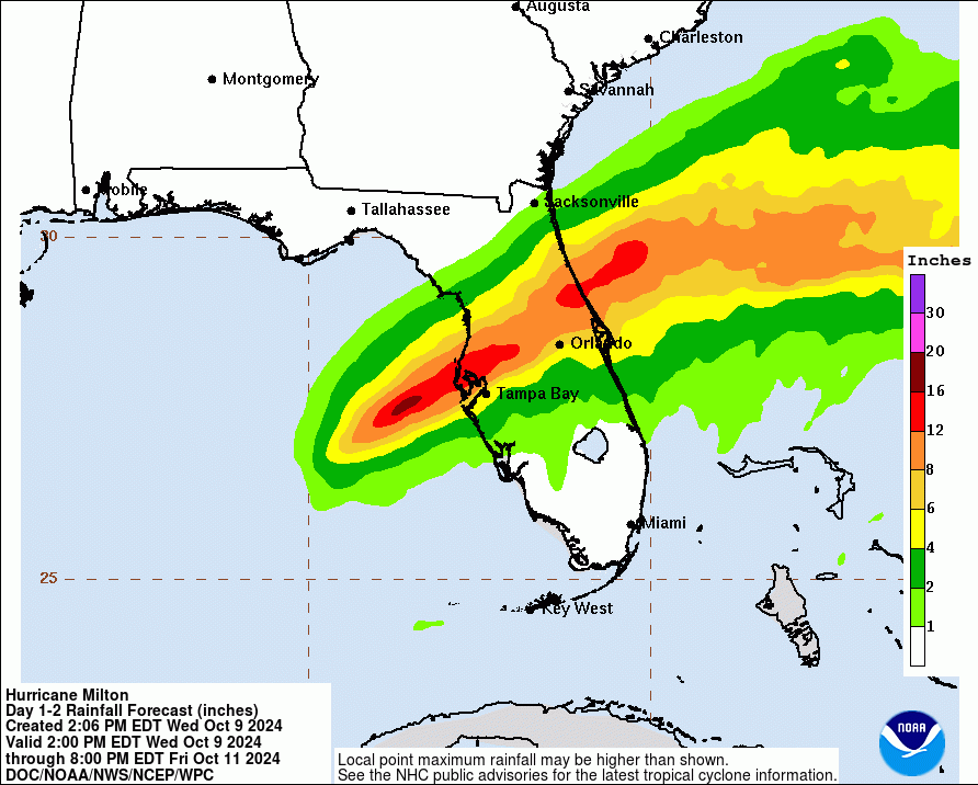
Rainfall amounts of 6 to 12 inches will be common. Localized totals up to 18 inches are expected across the central to northern portions of the Florida Peninsula through Thursday.

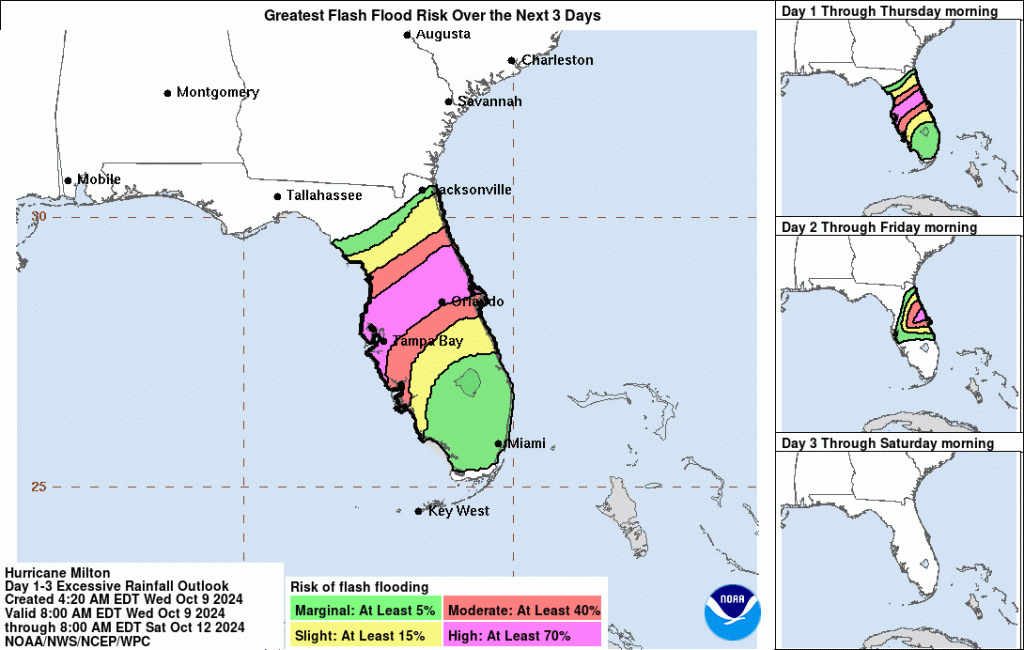
Life-Threatening Flood Potential
This heavy rainfall brings the risk of catastrophic and life-threatening flash and urban flooding along with moderate to major river flooding, especially in areas where coastal and inland flooding combine to increase the
overall flood threat.

About the only thing left to do at this point is pray for a speedy recovery. But based on Houston’s experience with Hurricane Harvey, I can promise you that recoveries from storms of this magnitude are anything but speedy.
That’s the main reason why I continue to post “Days since Harvey” with all of my posts. I want people to understand how long recovery and mitigation take.
Posted by Bob Rehak on 10/09/24 based on information from the NHC and Harris County Meteorologist Jeff Lindner
2598 Days since Hurricane Harvey


