Tag Archive for: san jacinto

San Jacinto River Watershed Master Drainage Plan Meeting Thursday at 6:30 p.m.

Harris County Flood Control District, Montgomery County, City of Houston, and San Jacinto River Authority (SJRA) will host a virtual public meeting on August 13, 2020. Purpose: to provide information about work to date in the San Jacinto Regional Watershed Master Drainage Plan (SJMDP) and give you a chance to provide input.  

Light pole near River Bend in North Shore as Harvey receded. Note the "wet marks" several feet up on pole. Photo by Jim Balcom.
Light pole near River Bend in North Shore as Harvey receded. Note the “wet marks” several feet up on pole. Photo by Jim Balcom. Water was so high that rescue boats had to dodge electrical wires.

About the Study and Its Goals

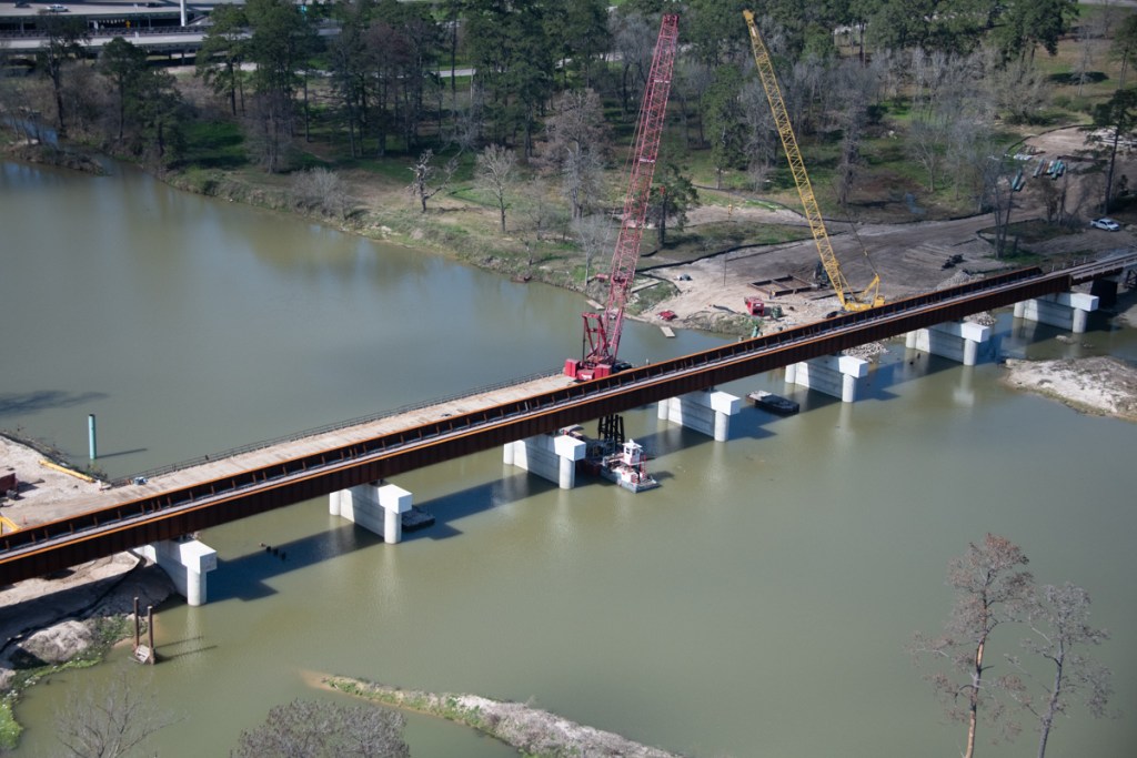
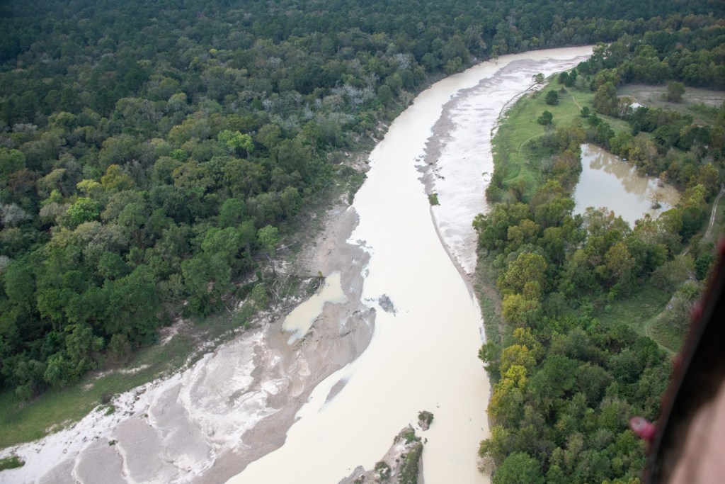
The study began in April 2019. Its goal: to reduce flood risks to people and property throughout the San Jacinto River regional watershed by identifying future flood mitigation projects for the near- and long-term. The SJMDP study area covers nearly 3,000 square miles in seven different counties and includes approximately 535 miles of stream.

The SJMDP team has updated and integrated hydraulic and hydrologic models for all the major streams in the watershed. This provides the technical basis for identifying vulnerabilities. It also allows the team to estimate impacts to existing infrastructure from future growth.

Meeting Details

Community engagement is an important component of the Bond Program. Feedback from residents helps “ground truth” models, assumptions and plans. So please attend the virtual meeting, ask questions, and volunteer feedback.

Thursday, August 13, 2020

6:30 p.m. to 7:30 p.m. 

Join online at PublicInput.com/SanJacMasterPlan

Or by phone at 855-925-2801 with Meeting Code: 9742 

You can register now, download a reminder for your calendar, submit questions, and sign up for future updates on this important study.

The meeting will begin with a brief presentation to share project updates, followed by a moderated Q&A session with Flood Control District team members. Residents will be able to submit questions and comments throughout the presentation. Any comments not addressed during the Q&A session will receive a response after the event. 

A recorded version of the meeting will be available on the Flood Control District’s website and YouTube channel after the event.

Funding for Study

A Federal Emergency Management Agency (FEMA) Hazard Mitigation Planning Program funds 75% of the study. The four local partners contribute equally to the rest.

For More Information

For questions, please contact the Flood Control District at 346-286-4152, or complete the online comment form. Comments may also be mailed to the Harris County Flood Control District, 9900 Northwest Freeway, Houston, Texas 77092, Attn: San Jacinto Regional Watershed Master Drainage Plan. For more information about the San Jacinto Regional Watershed Master Drainage Plan, visit www.sanjacstudy.org.

Posted by Bob Rehak on 8/12/2020

1079 Days since Hurricane Harvey

Union Pacific Almost Done Removing Last Remnants of Old Railroad Bridge

Replacement of the old Union Pacific Bridge across the San Jacinto West Fork is nearing completion.

Less than a month ago, crews constructing the new railroad bridge still had to remove the supports for the old bridge. See below the old four-post steel-frame structures between the new cement supports.

Photo taken on January 20, 2020 shows old supports still in place between new concrete supports.

By 2/13/2020, however, only one of the old supports remained. See photo below.

Photo taken on 2/13/2020 shows only one of the old supports remains.

Reason for New Bridge

Union Pacific started reconstructing the bridge after Harvey. Trees swept downstream by the flood caught on the old supports and backed water up.

Trees caught in Union Pacific Railroad Bridge supports during Hurricane Harvey.

The result: the tracks were destroyed. UP had to reroute northbound rail traffic out of Houston for months as they literally built a new bridge around the old one.

Harvey knocked out the Union Pacific Railroad bridge over the San Jacinto River near I-69.

The concrete supports for the new bridge are spaced much farther apart. Thus, they should allow trees to pass through in a flood and eliminate backwater effects.

Photo taken 2/13/2020, the same time as the first shot above. This is from the other side of the bridge.

Other Sign Job is Nearing Completion

Notice in the picture above that crews have already started removing the temporary bridge for cranes on the north side of the river.

All of this is good news from flood remediation and mitigation perspectives. It is yet one more sign that life is finally starting to return to normal after Harvey. The bridge should also help the community deal better with the next major storm.

Posted by Bob Rehak on 2/17/2020

902 Days since Hurricane Harvey

The Day That the San Jacinto West Fork Turned White

On Monday, November 4, I flew up the San Jacinto West Fork in a helicopter and was shocked by what I saw. The West Fork had turned milky white. Here are a series of shots starting at the confluence of the West Fork and Spring Creek and heading upstream. Spring Creek angles off to the top of the frame; the West Fork goes right.

Starting at the 59 Bridge…

Note the difference in color between Spring Creek and the West Fork, angling off the right side of the frame. Also note for contrast the normal looking browning water going into the West Fork from the woods at the bottom.
As we turned up the West Fork, I took this shot. Note the color of the pond at the top of the frame for comparison.
This is the first sand mine going upstream. Note the difference in the water heights between the pit (top) and the river bottom. Also note the pipe sending mine wastewater into the West Fork.

Moving North Past the First Mine

A little farther upstream, though, the water was still white.
I debated on adjectives: chalky or milky?

At the Hallett Mine North of Northpark Drive

The Hallett pond on the west side of the river was emptying into the West Fork. Hallett is north of Northpark Road off Sorters.
On the northern side of the Hallett Mine, we spotted this giant breach that had also been open in October. Notice the eroded shoreline opposite the breach. Water must have shot out of that pit with some force.
This was as far north as we went: the northernmost part of the Hallett Mine. Note the color of the pond on the right for contrast. The water looked less white than farther downstream, but still far from its normal brownish color that you see in the pond.

TCEQ Investigating White West Fork

I don’t think we ever found the source of the whitish discoloration although we found several mines contributing to it. When we got to the northern part of the Hallett Mine, time, fuel and air traffic restrictions dictated that we break off the exploration. So…

These photos were sent to the TCEQ and SJRA for investigation. This is the major source of Houston’s drinking water, folks!

Posted by Bob Rehak on 11/7/2019

800 Days since Hurricane Harvey

The thoughts expressed in this post represent my opinions on matters of public policy and safety. They are protected by the First Amendment of the US Constitution and the Anti-SLAPP Statute of the Great State of Texas.

New Union Pacific Railroad Bridge over San Jacinto Will Have Wider Spans

Many readers have asked what the Union Pacific Railroad (UP) is doing to its bridge over the San Jacinto near US59. According to the Houston Chronicle, UP is widening the spans to reduce the potential for catastrophic damage in the event of another storm like Harvey.

If you have children or grandchildren that love trains, cranes and building things, you’ll want to share this post with them. It’s a real life example of a massive (re)construction project in the middle of difficult circumstances and a testament to the kind of brainpower and brawn that built this country.

A New Bridge Rises from the Old

These photos taken on Monday of this week (11.4.2019) illustrate how a new Union Pacific bridge is rising in the same place as the old one. With wider spans, the bridge will now also require different construction.

Wider concrete supports and a steel bed will replace the old tubular supports. UP constructed a temporary bridge next to the new bridge to hold the construction cranes.
This wide shot taken on 11/4/2019 shows how much wider the new spans are compared to the old.

Problems with Old Union Pacific Bridge

Back in 2017, the supports of the old bridge caught many trees swept downstream by Harvey. As you can see in these photos, the old bridge had two or three times the number of supports. David Seitzinger, a Kingwood resident, identified the supports and the trees they caught as a contributor to flooding in this analysis of water levels, flows and timing during Hurricane Harvey.

Photo from September 14, 2017. Harvey knocked out the old bridge. It took weeks to repair and shut down northbound rail traffic.
During Harvey, those old supports caught debris floating downstream that partially dammed the river and destroyed the railroad. Photo from UP report on flood.

A Marvel of Engineering Ingenuity

Current photo shows how the narrow spacing of supports for the temporary bridge are still catching debris floating downstream.
When complete, the bridge will border Harris County Precinct 4’s new Edgewater Park (lower right).
The wider spans should help protect the commercial areas south of the river from flooding.

This presentation explains the importance of railroads to the region’s economy and damage that Harvey did to UP.

The progress of this construction is another encouraging sign of recovery from Harvey.

Posted by Bob Rehak on 11/6/2019 with thanks to the Union Pacific Railroad

799 Days after Hurricane Harvey

What Rivers Looked Like Before the EPA Regulated Water Pollution

Something happened today that made me realize how, as a society, we are losing sight of the things that caused us to regulate the environment 50 years ago. As a result, some bad history could repeat itself

After seeing yesterday’s post about the West Fork mouth bar, a reader named Suzanne Kite sent me a link to an article on BusinessInsider.com. Little did she know that – for me – it would be a free ride on an emotional roller coaster in the wayback machine. The article talked about pollution of America’s rivers before the EPA…and focused on Cleveland, Ohio.

How Physical Landscape Shaped Political Landscape

About two thirds of Americans alive today had not yet been born when Cleveland’s Cuyahoga River caught fire in 1969. So they have no memory of the event that helped give birth to the EPA.

The Cuyahoga River caught fire a total of 13 times dating back to 1868. It was one of the most polluted rivers in America. Photo: Cleveland State University Library.

I remember it vividly. I was born in Cleveland, not far from the Cuyahoga River. Some of my earliest and happiest memories of childhood revolved around clam bakes with my family in Lake Erie in the early 1950s. But then we had to stop. The clams, they said, were contaminated with pollution from the Cuyahoga.

When the Cuyahoga caught fire, it came to symbolize out-of-control pollution. It became the spark that led to the creation of the EPA.

Says Aylin Woodward, author of the BusinessInsider.com article, “The disaster prompted a public outcry that in part led to the formation of the US Environmental Protection Agency (EPA) in 1970. The EPA was charged with regulating the country’s polluted air and waterways…”

“Documerica” Photo Archives

She continued. “Soon after its founding, the agency dispatched 100 photographers to capture the US’ environmental issues as part of a photo project called Documerica. The photographers took about 81,000 images, more than 20,000 of which were archived. At least 15,000 have been digitized by the National Archives, and the images now function as a kind of time capsule…”

The archives actually show many photographs of pollution coming from sand and gravel mines.

If you like looking at old photos, you will find this collection fascinating. This BusinessInsider article shows how people and businesses back then used rivers as sewers. A separate article in the Smithsonian goes into even more detail on the Cuyahoga.

Environmental Degradation Preceded Population Loss

Cleveland was a once-proud and booming city that symbolized America’s industrial might. In 1950, it ranked as the seventh largest city in the country. Houston at the time ranked only 14th with a little more than half of Cleveland’s population. In the latest census (2010), however…

Cleveland ranked 45th and had lost more than half the population it had 60 years earlier. It continues to lose population at an alarming rate.

San Jacinto Problems Not New

An alarming number of readers who saw yesterday’s post about the San Jacinto West Fork mouth bar commented on the massive amount of sediment pollution. They believe that not enough is being done to reduce the amount of sediment coming downstream.

Mouth bar blocking the West Fork of the San Jacinto. Photographed from a drone operated by Franz Willette of BCAeronautics.

Not all, but much of that sediment, in my opinion, came from approximately 20 square miles of sand mines upstream that were inundated by three so-called 500-year storms in 2015, 2016 and 2017. The rate of deposition has increased exponentially as you can see in the graph below.

Sudden exponential growth in mouth bar volume. Graph compiled by RD Kissling from Google Earth historical satellite photos.

FEMA believes that at least 500,000 cubic yards of sediment came downstream during Harvey. The City of Houston believes the number is closer to 1.4 million cubic yards.

All of that sediment pollution threatens the main source of the City’s drinking water by reducing its capacity.

Let’s Learn from History

The point of all this: history is repeating itself.

In 2006, American Rivers named the San Jacinto one of the 10 most endangered rivers in America… because of sand mining. And it has only become worse since then.

These developments make me fearful of the future that my children and grandchildren will inherit. If you share these feelings, please continue to apply pressure on elected representatives to push sand mines further back from the river.

What good is cheap concrete if the environment has become so degraded that people move elsewhere?

Posted by Bob Rehak on 7/13/2019

684 Days since Hurricane Harvey

Living Landscape: San Jacinto River Before Lake Houston and Now

Geologic change happens so slowly, most people won’t live or stay long enough in one place to perceive it. Then something happens to make you crank up the Wayback Machine and look more closely. Yesterday was one of those days for me. The Army Corps announced that it was going to begin dredging part of the West Fork mouth bar area.

That raised the question, “Which part?” That wasn’t announced. So I asked Tim Garfield, retired chief geologist for one of the world’s largest oil companies, what he would do. He felt it was important to re-establish the river’s natural channel. So I asked him where it was. (Spoiler alert: It’s between the mouth bar and Atascocita Point.) But in the process of figuring this out, I learned many more things about the mouth bar and a river I take for granted. I’ll save those for the end.

70 Years of Change on the River

Garfield led me to the Perry-Castañeda Map Collection of Texas Topographic Maps at the UT Library Online. He found this map from 1949 of Moonshine Hill. It’s exactly 70 years old! The 1949 date means we can see where the river was before the dam and lake were built in 1955.

The San Jacinto in 1949 before Lake Houston was impounded in 1955. For a higher resolution version of this map, click here. This map shows what geologists call “the relict channel.”

Kingwood, Atascocita and Huffman Before Settlement

This map shows areas that would eventually become Atascocita, Kingwood, and Huffman. It includes the area where the mouth bar has formed between Kings Point and Atascocita Point.

You can tell a lot by looking at this map. You can tell even more when you superimpose it over a satellite view of the area today in Photoshop. Suddenly, you see how the landscape has changed. In fact, it changed so much that I had problems aligning the two images.

Map Superimposed Over Satellite Image At Varying Opacities

However, the county line and 1960 are still in the same location. So I used those as reference points. Then I varied the opacity in the top layer (the old map) so that you could see more and more of the current landscape. At different percentages, you can see how various features have changed over time.

Here’s what the sequence looks like starting with 1949 and today. I started by cropping tighter on the area of interest, the West Fork where the Corps is dredging. I include several different opacity ratios because some changes become more apparent at one ratio than another.

100% opacity for 1949 map.
0% 1949 and 100% today.
60% 1949 and 40% today.
50% 1949 and 50% today.
33% 1949 and 67% today.
25% 1949 and 75% today.

Most Visible Changes

Starting from the left:

  • In the 33/67 image, notice how the river once meandered near US59 and how much further south it was.
  • In the 50/50 image, notice how much of the Romerica land was swamp in 1949…and still is.
  • In the 75/25 image, notice how much the river migrated north just north of Kings River estates.
  • In the 25/75 image, notice how much area the lake claimed.
  • In the 33/67 image, notice how far north the river has shifted under the West Lake Houston Parkway bridge.
  • In the 33/67 image, notice how Atascocita Point has grown past the relict channel.
  • In the 60/40 image, notice how the mouth bar grew at the confluence of a relict stream bed within the lake and the relict channel of the West Fork. You can also see this pretty clearly in the 25/75 image.
  • In the 25/75 image, notice how the relict West Fork channel used to hug Atascocita Shores.

Key Map

This image shows locations referenced above for those who may not be familiar with them.

Key to locations

Do you see other things that I did not? Please let me know through the contact form on this web site.

As the dredging program moves forward, these maps may also help inform dredging strategy. Stay tuned.

Posted by Bob Rehak on 6/13/2019

653 Days after Hurricane Harvey

Partners Outline Goals and Scope of San Jacinto Regional Watershed Master Drainage Plan

Earlier this year, I posted about FEMA funding approval of the San Jacinto River Basin Study. The four partners in the project, Harris County Flood Control, SJRA, Montgomery County and City of Houston, have released a fact sheet that outlines the objectives and scope of their study.

The study will cover 3000 square miles from the upper reaches of the San Jacinto River watershed in Walker, San Jacinto and Grimes Counties in the north to I-10 on the south.

Map of 3000 square-mile study area

Now called the “San Jacinto Regional Watershed Master Drainage Plan,” goals include:

  • Identifying the region’s vulnerabilities to flood hazards using Atlas 14 rainfall totals
  • Developing approaches to enhance public information and flood-level assessment capabilities during a flood
  • Evaluating flood mitigation strategies to improve community resilience
  • Providing a comprehensive Flood Mitigation Plan that supports the needs and objectives of each regional partner.

Download the PDF to learn more. This is not a detailed discussion, just a two-page, high-level overview. To read the entire detailed document that FEMA approved, click here.

Consultants should complete the plan/study by about April of next year. For more information about the project, see the Harris County Flood Control District Web Site.

Flood control also has a useful page dedicated to updating Kingwood residents on the status of projects affecting the Lake Houston area.

Posted by Bob Rehak on 5/29/2019

638 Days since Hurricane Harvey

SJRA Responds to Post about SB 2126 Opening Door to River Mining

Letter to the Editor

RE: “Caution: SB 2126 Opens Door to Sand Mining in Rivers”

Bob,

Thank you for your work with Reduce Flooding to raise awareness about flooding and flood-related issues since Hurricane Harvey.  You have done a tremendous job of helping to educate the public on the causes of flooding and providing status updates on current and future flood-related projects and initiatives. Regarding your April 25 post titled ““Caution: SB 2126 Opens Door to Sand Mining in Rivers,” I want to clarify what SB 2126 is and what it is not.  

Chuck Gilman, the author of this post, is
Director of Water Resources and Flood Management for the
San Jacinto River Authority

The concept behind SB 2126 is to create a proactive approach toward removing sediment from the river before it is deposited in Lake Houston.  If you’ll recall the KBR report from 2000 noted “For long-term sediment management consideration, sedimentation basins, either on-channel or off-channel, are the most effective approach to minimizing sediment buildups and maintain the life of the channel conveyance.”  That is what we are attempting to accomplish with this program. 

The strategies and programs that could be implemented if SB 2126 is approved would not be river mining or dredging.  Any kind of dredging (either hydraulic or mechanic) would be very limited in scope, allowing conservation and reclamation districts to restore conveyance in the rivers in a strategic location through small-scale, periodic, targeted removal of sediment in the river.  This could be as large-scale as the current dredging project currently in progress, or as simple as the construction of sand traps that are dredged annually.  Regardless, your point about oversight and management is well noted, and is a requirement for this program to be a success.  

The San Jacinto River Authority has secured the support from the sand mining industry through the Texas Aggregates and Concrete Association to explore options to remove sand, gravel, shell, and other aggregates from the river—all without a cost to taxpayers.  Ideally, the SJRA would be the public agency overseeing and managing the program, conducting the necessary studies, and coordinating with the appropriate state and federal agencies to determine where and how much material should be removed. Partners from the private sector could then remove the material as directed by SJRA.  

After Hurricane Harvey, Governor Abbott tasked all of us with flood control and flood management. SB 2126 creates opportunities for public-private partnerships to help preserve the channel conveyance capacity of the San Jacinto River.  As we know in the Lake Houston area, this sediment impedes the flow of storm water where the West Fork converges with Lake Houston.  

Senator Creighton has led the effort to develop a flood resiliency funding bill in the Senate this legislative session (SB 7), and continues to seek other options to help create a regional flood management effort in the San Jacinto Basin.  This bill would simply create another tool in our toolbox to help reduce potential flooding in the future.  

As stewards of the San Jacinto River and its water supply, the SJRA supports Senator Creighton’s proactive approach to managing sediment in the river. We are trusted partners with the State of Texas, Harris County Flood Control District, and FEMA to execute $2.5B in flood control bond projects like the comprehensive San Jacinto Watershed Master Drainage Plan.  We value our role as a community partner and appreciate the opportunity to further reduce the risk of flooding by providing oversight and management of this plan.

Chuck Gilman
Director of Water Resources and Flood Management
San Jacinto River Authority

For additional information on SJRA visit our website at www.sjra.netor like SJRA on Facebook 
@SanJacintoRiverAuthority

Posted verbatim from SJRA letter by Chuck Gilman on 4/23/2019

602 Days since Hurricane Harvey

A Dirty Job, But Someone Has To Do It: Life of a Dredger on the West Fork

Since last September, the Army Corps of Engineers has had two contractors, each with approximately 30 people, working 24/7 on the the West Fork of the San Jacinto.

Moving 1.9 Million Cubic Yards of Earth

Together, they’re removing approximately 1.9 million cubic yards of sediment left behind by Hurricane Harvey that is blocking the conveyance of the river. It’s hard to move that much sand and silt without getting your hands dirty, as these pictures by the Army Corps clearly demonstrate.

One crew started at River Grove and is working downstream toward the mid-point of a 2.1 mile stretch of the West Fork. The other started at the mid-point and is working downstream toward where Ben’s Branch enters the river, just past Kings Harbor.

The Corps uses approximately 10 miles of 22- and 24-inch pipeline weighing more than 5 million pounds to pump sediment from the river back upstream to two placement areas. One is south of Kingwood College off Sorters Road, shown below. The other is off Townsend in Humble.
The pipe floating in the foreground is rubber and designed to float. This gives the dredge room to maneuver. The pipe in the background with the orange flotation collars is rubber and bends a little. The steel pipe above does not bend.
Farm Boy is helping to anchor the dredge while a service boat transfers crew.
Looking toward the rear of the dredge. The blue part is the pump. The red containers in the background house electric motors. Cables tie the dredge to a CenterPoint substation in Forest Cove.
Before dredging, this giant dune almost completely blocked the West Fork about a half mile downstream from River Grove Park. The Great Lakes Dredge and Dock crew is still working to remove it. While it looks like all sand from the air, beneath the surface, crews are encountering dead trees and roots that get caught in cutter baskets on the dredge. (Photo by Bob Rehak)
When that happens, productivity slows and crews must manually pick the material from the chisels on the dredge.
Note the pile of roots and sticks growing the men.
Here you get a better idea of how the roots and vines can clog the intakes on the cutter head. Dredging needs to stop many times each day to remove this material.
The “chisels” on the cutter head break up sand which the “cutter basket” then sweeps up. Pumps inside the steel cage suck the sand into the pipe and pump it back upstream to placement areas.
Once the dredge starts pumping again, the flow must be calibrated with three booster pumps attached to each line. At least one crew member mans each booster pump to coordinate with the others. They must avoid over- or under-pressure situations.
This shows a close up of one of the three booster pumps used by Great Lakes, the Army Corps’ lead contractor on the job. Callan Marine is a subcontractor to Great Lakes and also has three booster pumps.
This shot gives you an idea of how massive these pipelines are…
…and how much sediment they can pump per minute. There’s enough sediment moving here to fill up a dump truck in less than a minute.
The Eagle Sorters Mine is dredging this pit even as Army Corp contractors fill it up. Sand and silt recovered from the river may wind up in roadbeds or be used for mortar in the construction trades.

1.4 Million Cubic Yards Recovered to Date

Corps Engineers said that since Sept. 20, 2018, approximately 1.4 million cubic yards of Hurricane Harvey silt and debris have been pumped into the two placement areas. Ultimately, they expect to pump approximately 1.8 -1.9 million cubic yards to meet FEMA requirements, restore the river to pre-Harvey conditions, and to reduce flood risks.

Safety Warning

These images illustrate why boaters should stay away from the West Fork for now. It’s not safe. The FEMA funded emergency flood action should complete in early May, 2019.

Posted by Bob Rehak on 4/3/2019 with images courtesy of the Army Corps of Engineers

582 Days since Hurricane Harvey


San Jacinto River at Its Finest: Nature the Way It Was Meant to Be

Today, I took a much needed rest from floods, sand mines, sedimentation and tax appraisals. A friend took me and two others out on his boat for a day long encounter with nature. We explored the West Fork, East Fork, Taylor Gulley, Caney Creek, Peach Creek and Luce Bayou. It was a cool, overcast day…the kind that’s perfect for nature photography. Diffused light. Saturated colors. Quiet moments. An intense feeling of beauty and oneness with nature.  Restful and rejuvenating. It taught me that there are still places on the San Jacinto that haven’t been screwed up yet. Places worth fighting for. Today reminded me of something Ansel Adams once said, “If you want to preserve nature, inspire people with its beauty.” Here’s my humble attempt. I hope you enjoy these moments as much as I did. Most were taken far up the East Fork.

Posted on 9/29/2018 by Bob Rehak with grateful thanks to Josh Alberson, his boat, and the Creator.

396 Days since Hurricane Harvey