Tag Archive for: Halls Bayou

Baseless Claims of Historic Racism, White Supremacy in Allocation of Flood Funds

Members of the Northeast Action Collective (NAC) have falsely alleged “historic racism” in the allocation of flood-mitigation funds. And without evidence, the group also cited “a rising white supremacist movement” in Harris County as a reason to move money from high-income to low-income watersheds “as quickly as possible.”

Analysis of historical funding data obtained from Harris County via a Freedom of Information Act (FOIA) Request shows that minority and low-income watersheds have received the lion’s share of funds since 2000. Yet at the 6/29/21 Harris County Commissioners Court meeting, NAC members claimed the opposite.

From Baseless to Bizarre

“Historic racism” and “white supremacy” were just two of dozens of baseless and bizarre claims in the group’s manifesto.

NAC also claimed that:

  • It is “fighting for better drains and more regular drain upkeep.” NAC then blames the Harris County Flood Control District (HCFCD) for being insensitive to residents needs. Perhaps that’s because HCFCD is not responsible for street drainage; the City and (in unincorporated areas of Harris County) Precinct Commissioners are.
  • “The City won’t pay attention to neighborhoods where Black and Brown people live” … even as they complained to County Commissioners.
  • HCFCD has “underfunded” Greens and Halls Bayous for decades while ignoring the fact that the entire county was underfunded before the 2018 flood bond.
  • HCFCD needs more transparency, even though NAC ignored readily available information about HCFCD spending.
  • The flood bond was supposed to counteract historic racism, even though the language approved by voters never mentions race.

These claims deserve closer scrutiny. Let’s look at some of the most serious falsehoods.

Racial Equity Not in Flood-Bond Language

NAC claims the flood-bond promised racial equity in the distribution of funds; it didn’t. The text of the flood bond never mentions race, minorities, historic underinvestment, income, social justice, social vulnerability or any of the other things NAC says it does. Those concepts were all heaped onto the one mention of “equitable” in the bond language (paragraph 14G). It puts equity in a geographic context with a prefatory clause focused on political boundaries. (“Since flooding issues do not respect jurisdictional or political boundaries, the Commissioners Court shall provide a process for the equitable distribution of funds…).

Areas, such as Lake Houston, asked to include that because flood mitigation requires upstream detention in other counties. The inability to cross political boundaries for flood mitigation would handicap areas near the county line forever.

Historic Racism Not Evident in Funding

NAC claims “historic racism” in flood mitigation funding, but refuses to acknowledge historic advantages in funding:

  • Eight minority and low-income watersheds (out of 23 total) received 71% of all HCFCD capital funds between 2000 and Harvey. ($1.1 billion out of $1.5 billion.) The other 15 higher income watersheds split the remaining $400 million. So “historic racism” in funding does not exist, at least not in Harris County and not at HCFCD. See links to data and related articles below.
  • Out of 23 watersheds, Halls and Greens Bayou Watersheds alone received $222 million between 2000 and Harvey. That’s 15% of all funding during those years.
  • They also received another $200 million out of $1.1 billion spent since Harvey – 18%.
HCFCD Capital-Improvement Spending between 2000 and Harvey arranged by percentage of low-to-moderate income (LMI) residents. Halls has the highest LMI % and Little Cypress the lowest. The top eight watersheds (darker blue) have LMI percentages above 50%; the others below. Data obtained via FOIA request.
New detention basin at Hopper and US59, photographed in April. One of four new basins in the Halls Bayou watershed that doesn’t exist according to NAC.

“Rising White Supremacist Movement” Not Seen in Funding or Evidence

NAC claims, “The most viable path to equity is to reallocate money for projects in wealthier watersheds to projects in watersheds with predominantly BIPOC and LMI residents.” (BI-POC stands for Black, Indigenous and People of Color. LMI stands for Low-to-Moderate Income.) But NAC doesn’t stop there.

Because of “a rising white supremacist movement in Texas and the county, and decades of underinvestment, the only strategy rooted in justice is to move as much money as quickly as possible to low-income watersheds.”

Northeast Action Coalition

Then NAC claims that its members do not believe that “current HCFCD leadership is actually committed to racial equity or justice.” I guess they don’t get out in the neighborhood much and look at all the flood-mitigation projects going in!

One of three new detention basins under construction in the Greens Bayou Watershed. It doesn’t exist either according to NAC.

Demand for Transparency That Already Exists

The NAC manifesto also demands, “full transparency on spending.” Yet:

  • HCFCD supplied historical funding data going back more than two decades. NAC and partner organizations ignored it.
  • All HCFCD spending is audited.
  • HCFCD’s website details spending and projects in each watershed.
  • It also shows – by watershed – all active construction and maintenance projects, and their value.
  • All HCFCD expenditures are approved by Commissioners in open, public meetings.

When Commissioners Ellis and Garcia claim that all the funding is going to rich watersheds and none to poor watersheds, they should know better. They approved all the money going to low-income areas!

The Real Problem

In the 18 years between 2000 and Harvey, the Flood Control District had only $1.5 billion to spend on capital improvement projects. Even with partner funding, that works out to only a little more than $80 million per year. According to multiple sources, for decades HCFCD had to save up money – sometimes for years – to afford construction projects. So, in some years, there were NO flood-mitigation projects at all, anywhere in the county.

Despite that, eight LMI watersheds received $1.1 billion out of $1.5 billion total dollars. That’s 71% of all capital spending – hardly “historic racism” or evidence of “white supremacy.” The other 15 more affluent watersheds combined got only 29%.

The sad fact is that no one in Harris County got enough flood-control dollars to prevent flooding before Harvey. It took Harvey to wake voters up to the need for better flood control.

In fairness, as I have shown in related articles below, minority, low-income watersheds did suffer a disproportionate share of damage in the last two decades. But dollars have flowed to that damage. Those damaged communities have received the vast majority of flood-mitigation funds.

Halls and Greens didn’t flood because of racism. And shouting racism from the rooftops won’t fix their flooding problems. It will only cloud issues and divide people.

For More Information

In early March, I submitted a FOIA request to Harris County for capital improvement funds by watershed dating back to 2000. Here is the county’s response: HCFCDs historical construction funding by watershed.

I then compiled a summary spreadsheet that includes related information, such as population and watershed size, also supplied by the County in response to my FOIA request.

After analysis, I published these findings:

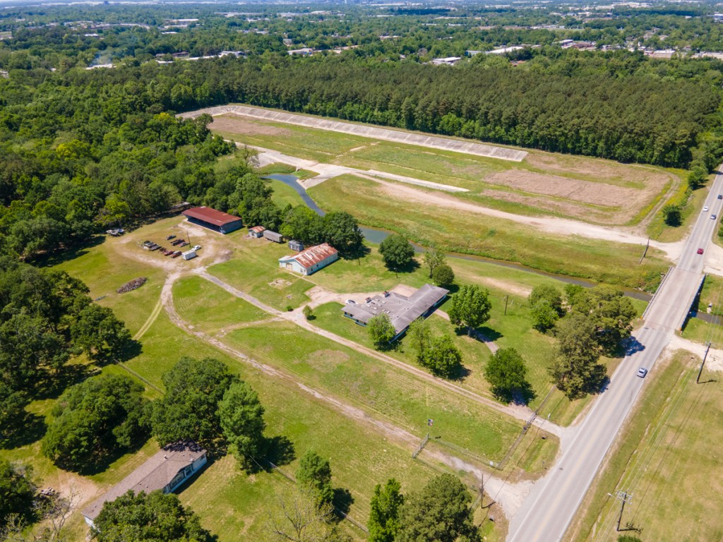
Also, here are several articles with aerial photos that show what the money bought.

Finally, here’s an article about how Commissioner’s filled a potential shortfall in partnership funds to prevent possible delays in construction of flood mitigation projects. Trust To Fully Fund Flood Mitigation Projects Without Partner Assistance For At Least Next Six Years.

Posted by Bob Rehak on July 7, 2021

1408 Days after Hurricane Harvey

The thoughts expressed in this post represent opinions on matters of public concern and safety. They are protected by the First Amendment of the US Constitution and the Anti-SLAPP Statute of the Great State of Texas.

Six Low-Income Watersheds Receive More Funding than 15 Higher Income Watersheds Combined

Third of an eight-part series on flood-mitigation funding in Harris County

Some people and their representatives in low-to-moderate-income (LMI) watersheds have complained that they get “no” flood-mitigation funding and that the money is all going to richer watersheds. Allegedly, that’s because home values are higher there and thus favor higher benefit/cost ratios (a sort of systemic racial discrimination). But is that true? Do higher home values in a neighborhood really translate into “projects funded”? No. The allegation ignores many other factors that enter into funding, such as damage and population density. Density is two to three times higher in low-income neighborhoods and that influences damage totals. When you look at funding outcomes as opposed to a sliver of the mitigation process, low-income neighborhoods get far more money. Here’s how it breaks down.

Where Money is Really Going

Recently, I obtained flood-mitigation funding data for every watershed in Harris County via a Freedom of Information Act (FOIA) request. It sheds new light on this subject.

In addition to the quartile comparisons I did in earlier posts, I also compared the top quartile (six watersheds) to the rest with one exception in each group noted in previous posts and the footnote below.* The data showed that six watersheds with the highest percentages of LMI residents (meaning low income) have received 56.8% of HCFCD spending out of the 21 remaining watersheds since 2000.

Harris County Flood Control District data obtained via FOIA request.

A second pattern also clearly emerged from the data. Long before “equity” guidelines were put in place, HCFCD spending closely tracked flood damage. It still does. And the most damage occurred in lower-income watersheds.

In this post, I will examine both trends by looking at six watersheds with the highest percentages of LMI residents. They include Brays, Greens, Sims, Halls, Hunting and White Oak Bayous. 

As a group, they:

  • Comprise 30.9% of the square miles in the county
  • Received 56.8% of total spending – $1.52 billion of the $2.6 billion spent by HCFCD since 2000.

That’s more than 15 higher income watersheds combined.

Dollars Flow to Damage

But if you stopped there, you could conclude that these six watersheds were getting more than 2-3X their fair share of funding. However, also consider that they had 144,754 out of the 222,739 structures damaged in Harris County during Allison, Tax Day, Memorial Day and Harvey floods.

One thing is certain: these six watersheds have not been at the “back of the bus.” They received more than $1.5 billion out of $2.6 billion invested by HCFCD since 2000. 

The data DISPROVES discrimination on an income or racial basis. Money is not going disproportionately to rich neighborhoods. Far from it. It’s going disproportionately to poor and minority neighborhoods. However, that is also where the most flood damage occurred. Let’s take a closer look at each of the six low-income watersheds.

Brays Bayou:
  • Received 19% of total spending since 2000, but represents just 6% of the county’s area.
  • Received more than half a billion dollars since 2000, the most of any watershed, and about one-fifth of all flood-mitigation spending in 23 watersheds in 21 years.
  • Received the second most funding since Harvey ($130,685,844.43).
  • Got 4 times the average and 7 times the median of flood-mitigation funding for all watersheds.

It certainly seems like an outsized injection of flood-mitigation funds. But the improvements also protect some major infrastructure and employment centers including the Texas Medical Center. See this photo essay taken from the air.

Also consider that Brays had the most damage in four major storms (Allison, Tax Day, Memorial Day, Harvey) – 32,194 structures flooded. 

Brays has the fifth highest percentage of low-to-moderate income residents (58%).

HCFCD construction is on-going in this watershed.

Greens Bayou:

Commissioners Ellis and Garcia often cite Greens Bayou as a “back-of-the-bus” watershed. They also say, that if the County doesn’t fix it, “we’ll have blood on our hands.” 

Greens received the 3rd most dollars since 2000 and the 2nd most since Harvey. That’s 11% and 14% of all HCFCD spending respectively during those two time periods. Only in Harris County politics can you call second place out of 23 “back of the bus.” 

But Greens also had the second most damage in four major storms (28,815 structures). 

Greens Bayou has the sixth highest percentage of LMI residents in the county (57%).

HCFCD construction is also on-going in this watershed.

Halls Bayou:

Mr. Ellis and Mr. Garcia also consider Halls Bayou funding to be “back of the bus.” It comprises only about 2.4% of the county but received almost 5% of total spending since 2000. It also received:

  • The fourth most funding per capita ($841.77)
  • The third most funding per square mile ($3,031,912)
  • The eighth most funding since 2000 ($128 million).

Residents still believe they received “nothing,” but I photographed eight large detention ponds recently completed or under construction. Four are right next to US 59.

Halls has the highest percentage of LMI residents (71%) in Harris County.

HCFCD construction is on-going in this watershed.

Sims Bayou:

Sims Bayou runs through the southern part of the county. It:

  • Ranks as the 8th largest watershed.
  • Received the 6th most funding since 2000 ($165,013,368)
  • Has the 7th largest population (310,537)
  • Has the 5th highest population density (3755 per sq. mi.)
  • Had the 6th most damage (18,122 structures)

Sounds proportional and it is. 

However, these calculations do not include $254 million, which the U.S. Army Corps of Engineers spent on Sims between 1990 and 2015 (by itself) for a major flood-reduction project. The Corps’ contribution to Sims Bayou alone was almost 10% of all HCFCD spending since 2000 ($2.68 billion).

If you add the Federal contribution to HCFCD’s funding, Sims would have ranked second on the list of flood-mitigation dollars received since 2000. Only Brays received more.

Sims has the third highest percentage of LMI residents (65%).

Hunting Bayou

Hunting Bayou is one of the county’s smaller watersheds. It comprises 31 square miles or 1.7% of the county’s land mass. That ranks it as the 19th largest bayou out of 23. And it has the 14th largest population (78,213). Yet, since 2000, it has:

  • Had the seventh most damage (15,728 structures)
  • Received the third most dollars per capita since 2000 ($952.18)
  • Received the fourth most dollars per square mile ($2,402,908)

Hunting Bayou has the second highest percentage of LMI residents (69%).

HCFCD construction is on-going in this watershed.

White Oak

White Oak Bayou is the sixth largest watershed in Harris County. Yet it received 13% of the flood-mitigation funding since 2000 – $349 million, the second highest total of any watershed. It also ranked second in dollars received per square mile – $3.14 million.

But also consider that it had the third highest number of damaged structures – 24,989 in Allison, Tax Day, Memorial Day and Harvey floods combined.

51% of the residents in White Oak qualify as low-to-moderate income. 

HCFCD construction is on-going in this watershed.

Damage-to-Dollar Rankings

“Damaged structures” and funding received had the highest correlation of any relationship I tested. For math majors, the coefficient was .86. That’s high. A perfect correlation would be 1.0. For the less technically inclined, see the table below.

Contrary to the “rich-watersheds-get-all-the-money” narrative, flood-mitigation funding, data shows that HCFCD is putting the most money in the hardest hit watersheds.Dollars flow to damage.

Many projects in these lower income watersheds are still under construction or preparing for it. And major storms have not yet tested many recently constructed improvements. Regardless, their residents are safer than they otherwise would be. And they can take some comfort in knowing that the system is working for them, not against them. 

For more information, see: 

Posted by Bob Rehak, based on information compiled from a FOIA request and Federal Briefings

1394 days since Harvey 

*Omits Vince Bayou in low-income group because it is entirely within the City of Pasadena, which has responsibility for it. Includes White Oak Bayou instead. Also omits Little Cypress, which has a very small population and is an experiment by HCFCD in preventing future flooding.

The thoughts expressed in this post represent opinions on matters of public concern and safety. They are protected by the First Amendment of the US Constitution and the Anti-SLAPP Statute of the Great State of Texas.

Halls Bayou Illustrates Cost, Difficulty of Flood Mitigation in Overdeveloped Areas

Flooding within the Halls Bayou watershed illustrates what happens when development, density, lack of detention and insufficient distance from streams put people and their property in harm’s way. Instead of protecting a strip of green space near the bayou years ago, developers built right up to the edge. As density increased and developers built further upstream without sufficient detention, people who crowded the Bayou then started to flood repeatedly.

As the images below show, once developed, the cost and time of mitigation increases exponentially.

All of that argues for better planning and the protection of green spaces that can accommodate future floods and flood mitigation projects throughout the region.

Halls Bayou Not Unique

This same scenario happened repeatedly in other Houston watersheds: Greens Bayou; Brays Bayou, White Oak Bayou, and Cypress Creek, for instance. But let’s save those for future posts. For now, let’s go back in time.

Solution Well Known for More than a Century

In 1913, recognizing the potential for continued growth, a well-known landscape architect, Arthur Comey created the first comprehensive plan for the Houston Park Commission. He observed that Houston ranked far behind other major U.S. cities in parkland. It had one acre of park for every 685 residents. Seattle was a distant second at 224 residents per acre.

To address this inequity, Comey’s plan included a visionary idea. Noting that the city’s network of bayous were already “natural parks,” he proposed a series of linear and large parks along their lengths.

As he wrote, the “bayous and creek valleys readily lend themselves to trails and parks and cannot so advantageously be used for any other purpose.”…

Unfortunately, developers ignored him.

About Halls Bayou

The Halls Bayou Watershed comprises a city within a city.

  • Older homes and businesses are densely packed.
  • Many are built right up to the edge of the Bayou.
  • 70% of the population is low-to-moderate income.
  • You see far more signs in Spanish than English

Economically, the area looks poor. Culturally, it feels rich.

Frankly, as I drove through it last weekend to photograph flood mitigation projects, it felt much more vibrant than more affluent neighborhoods father to the north or south.

For the most part, people have fixed their homes since the last big flood. These folks may be poor, but the vast majority take great pride in what they have.

The map below shows the route of Halls Bayou through surrounding mid-north neighborhoods. Homes are packed so close to the bayou that it’s hard to see it in places, so I outlined the route in red.

Route of Halls Bayou through mid-north part of Houston. Airline Drive is on left, I-45 in middle and US 59 on right.

Now, let’s superimpose floodplains over the same area.

Floodway = cross hatch, 100-year floodplain = aqua, and 500-year floodplain =tan. Map last updated in 2007 based on data from Tropical Storm Allison.

North to south along US 59 (on right), the floodplain extends almost 3 miles. And it will extend even farther when new maps based on Atlas 14 are officially released based on Harvey data. The image below shows what the area around US 59 and Halls looked like in 2002 shortly after Tropical Storm Allison.

Note subdivisions built right next to bayou.

Next, see how that area looks today where Halls Bayou crosses under US 59. Two large detention ponds exist where the subdivisions used to be.

Note the two large detention ponds, one on either side of the freeway. The one on the left was substantially completed in 2015 and the one on the right in 2018.

Each detention basin took about three years to build.

Time, Costs of Buyouts

Before HCFCD could construct the detention ponds, it had to buy out homes in adjacent subdivisions and demolish them. Buyouts near the detention areas above began in 2002 when HCFCD received a large grant from the federal government after Allison. Google Earth images show that the buyouts took at least another three years.

Then Flood Control had to get permits from the City of Houston to demolish the streets. That took additional years.

So from 2002 until the completion of construction took 13 to 16 years (2015 and 2018). But the construction itself took only 3 years.

Thus, the total project took 4-5X longer than construction.

$1 of Prevention Worth a $1000 of Flood Mitigation

This area started to develop in the 1940s. The earliest image in Google Earth (1944) shows that it was at the edge of the City then. With more wetlands and farm land to absorb rainfall, the flooding problems were probably not as bad. A few scattered subdivisions pressed against the edges of the bayou. But the lots were large. And had green space been set aside then, the story today might be different.

Halls Bayou in 1944. Note: only two subdivisions started to encroach on the bayou. Rest was rural.

Compare again the shot above with the one below for a dramatic example of infill development. The shot above is NOTHING like today’s below.

Compare the dramatic increase in density with the decrease in bayou width.

Just looking at these two maps, you can see how the dramatic increase in density limits flood mitigation possibilities and raises costs.

We no longer have any easy solutions.

To make matters worse, despite flooding, people often fight buyouts. Most people in neighborhoods like this depend on support networks of friends and family. They fear leaving those networks. Many date back generations.

Should Have Known Better

Developers and home buyers knew or should have known this area was flood prone. But still, they built or bought here at great risk to themselves, and ultimately at great cost to the community.

That raises the question: Why were people allowed to build so close to the bayou in the first place? Why wasn’t sufficient green space left along the bayou to widen it or build detention ponds?

There are no simple answers to that question. Residents may not have felt at risk until upstream development sent more water downstream faster. They may not have been knowledgeable enough about flooding to ask the right questions.

Some just wanted to live close to work. Some wanted to be near family and friends. Some needed the support. And some just pushed their luck because they liked the view or location and the lots were cheap. Regardless, everyone is paying the price for decisions often made decades ago.

Posted by Bob Rehak on April 28, 2021

1338 Days since Hurricane Harvey

Four Halls Bayou Detention Ponds Recently Completed; Four More Virtually Done

If you saw the recent front page article in the Houston Chronicle about Halls Bayou, you would think that Harris County Flood Control District (HCFCD) relegated residents in the watershed to “the back of the bus.” Even before the bond, Halls received four floodwater retention projects, three of which are major. HCFCD is trying to expand the fourth of those. And since the flood bond, HCFCD has virtually completed four more floodwater retention projects..

Here’s what I found by simply driving around after consulting the HCFCD website and Google Earth Pro. I wish the Chronicle writer had done the same. There’s just no substitute for laying eyeballs on the job sites before riling up millions of people. Let’s start with the flood-bond projects first. I took all the photos below on 4/25/21 and 4/26/21.

Almost Completed Stormwater Detention Basins in Halls Watershed

Basin on Little York east of US59
New basin at Hopper and US59
Third new basin north of Helms Road east of Airline Drive
Fourth new basin south of Helms Road west of Airline Drive.

Recently Completed in Halls Watershed

Hall Park Stormwater Detention Basin East of US59 at Parker. Google Earth images show this project was substantially completed in 2018.
Bretshire Stormwater Detention Basin West of US59 at Parker. Google Earth images show this project was substantially completed in 2015.
Keith Weiss Park Stormwater Detention Basin on Halls Bayou east of Aldine Westfield. Google Earth images show this project was substantially completed in 2015.
West of Aldine Westfield, there’s a small basin owned by TxDOT. HCFCD hopes to enlarge this basin into the surrounding wooded areas as part of bond project C-25. Google Earth images show the first phase of this project was completed in 2012.

Funding “Shortfall” Not Yet Known

The Chronicle writer also claimed a “funding shortfall” for Halls of $272 million. Curious that he would make this statement just days before the GLO announces the winners of a statewide competition. Harris County could get some, none or all of its requests. To be clear, the competition is stiff; Harvey affected more than 40 counties. Regardless, there’s more than $2 billion up for grabs ($1 billion in this round and $1.144 billion in the next). It seems to me, the Chronicle writer could have waited a few days to publish results rather than rumors.

We Need Real Historical Data on Flood Mitigation Spending

Whether you agree with Rodney Ellis, Adrian Garcia and Lina Hidalgo or not, they have fought tenaciously for their constituents. They succeeded in reordering the priorities in flood-bond spending to serve low-to-moderate income neighborhoods first. For the Chronicle to imply that they failed their constituents is an insult to the Judge and Commissioners.

And to imply that all the money is going to more affluent neighborhoods is simply false. That claim seems designed to inflame racial hatred. Kingwood, for instance, has NEVER received one federally funded capital improvement project from HCFCD. Yet the Chronicle’s readers evidently concluded rich neighborhoods get all the money. Again, there’s no substitute for research.

From the Chronicle writer’s Twitter feed.

Inflaming racial tensions based on false information is the last thing America needs at this time.

In my opinion, we need facts, not fiction. Asserting discrimination is not the same as proving it.

Chronicle Article Also Ignores Tax Issue, Funding Realities

The Chronicle’s “HCFCD-puts-poor-people-at-the-back-of-the-bus” narrative also ignores the mechanics of funding projects. Before the flood bond vote in 2018, I spent an hour with former County Judge Ed Emmett discussing funding needs. A high priority at that point was to make local tax dollars stretch as far as they could by leveraging partner funding.

The need to leverage partner funding was even addressed in the final flood bond language. Paragraph 14 G states “…the commissioners court shall provide a process for the equitable expenditure of funds recognizing that project selection may have been affected in the past and may continue to be affected by eligibility requirements for matching Federal, State and other local government funds.”

Nobody stretches local tax dollars like the US Department of Housing and Urban Development (HUD). HUD is one of the main sources for funding projects in low-to-moderate income neighborhoods. Why?

HUD often offers a 90% match.

But there are two catches. First, you’re only eligible if at least 70% of residents that benefit from a project qualify as “low-to-moderate income” (LMI). Second, HUD is slow. To put “slow” in perspective, the Texas General Land Office just started accepting HUD grant applications from Imelda last Saturday. Imelda happened 586 days ago.

Looking at the flood bond spreadsheet (Page 6 of 10) and the expected partnership share of Halls Bayou Projects, you can see that 90/10 ratio reflected in most of the projected funding for Halls.

It’s unclear whether voters would have approved a flood bond that was 9X higher, especially when everyone, rich and poor alike, expressed concerns about not getting their fair share.

Alternative Sources of Halls Funding More Risky

Had HCFCD tried for FEMA funding instead, the low home values in Halls neighborhoods may have yielded a poor Benefit/Cost Ratio. Commissioner Ellis constantly reminds people about the perils of FEMA funding when applied to LMI neighborhoods.

So really, HCFCD had no choice but to focus on HUD for Halls projects.

  • The neighborhoods qualified.
  • The HUD match was far higher.
  • That minimized a tax increase.
  • It also maximized the number of possible Halls projects.

This was not a “gamble” as the Chronicle headline implied; it was actually the least risky option that seemed to benefit the most people.

Map above taken from HUD CDBG-MIT Draft Grant Application from Halls Bayou Watershed shows that 144,000 people in the watershed qualify as LMI (low to moderate income). That’s 70.6% of the total residents. To see the complete draft, visit this page.

We all need to calm down and wait to see how much money HUD grants the Hall’s Bayou Watershed projects. Brittany Eck of the GLO told me that she expects decisions by the end of this month. That’s this Friday.

Posted by Bob Rehak on 4/27/2021

1337 Days since Hurricane Harvey and 586 since Imelda

The thoughts expressed in this post represent opinions on matters of public concern and safety. They are protected by the First Amendment of the US Constitution and the Anti-SLAPP Statute of the Great State of Texas.