Tag Archive for: Fred Flickinger

City Mobilizing for More West Fork Dredging

Mobilization for the next phase of San Jacinto West Fork dredging is underway. The City of Houston and its contractor DRC (a subsidiary of Callan Marine) are already staging equipment in two places on the West Fork.

The program, funded by FEMA, will remove an estimated 800,000 cubic yards of silt and sediment between the original location of the West Fork Mouth Bar and FM1960. The contractor will use primarily hydraulic dredging and the program will take approximately two years, according to District E City Council Member Fred Flickinger.

West Fork Dredging Project Dates Back to Dave Martin Era

Flickinger credits his predecessor, former Council Member Dave Martin, and Chief Recovery Officer Stephen Costello’s tireless efforts in protesting the initial amount proposed for dredging by FEMA back in 2019. FEMA’s initial proposal, based on a four-page, table-top study produced by the Army Corps, called for dredging 283,000 cubic yards.

Martin strongly disagreed with the Corps’ report and appealed it while the City produced its own 94-page technical report. It showed a much higher volume deposited by Harvey. Remember: Harvey funds could not be used to address sediment deposited before Harvey. The City report produced by Tetra Tech relied extensively on core samples. Tetra Tech proved that Harvey laid down the sand in the mouth bar and that the dredging volume should be closer to a million cubic yards.

In August 2020, FEMA and the Corps finally concurred with the City, after extensive discussions and a massive assist from U.S. Representative Dan Crenshaw. Crenshaw and others had been pushing FEMA for years for the additional dredging.

Current Status

The new West Fork dredging program should be ready to go within weeks. DRC is currently bringing in the equipment that they will need.

DRC plans to use primarily hydraulic dredging. They will attack the area between where the mouth bar was (south of Scenic Shores in Kings Point) and the FM1960 Bridge. See map below.

Map from City study showing area of focus.
Hydraulic dredge being assembled at old Army Corps mobilization site south of Forest Cove pool. Photo taken 4/1/24.
DRC is also starting to stockpile mechanical dredging equipment such as these pontoons on Berry Madden’s property south of River Grove Park (top center).

This is good news. The new West Fork dredging will help ensure that water doesn’t back up like it did before. It’s not a guarantee against flooding. Dredging is only one part of a multi-faceted mitigation program that also includes more upstream detention and new floodgates on the Lake Houston dam. More news on those topics to follow.

Posted by Bob Rehak

2407 Days since Hurricane Harvey
City Will Lower Lake Houston Sunday in Advance of Heavy Rainfall

Houston District E City Council Member Fred Flickinger announced today that Houston Public Works will lower Lake Houston beginning Sunday afternoon. They expect to complete the lowering before rain starts on Monday. Houston Public Works is actively monitoring weather forecasts.

The National Weather Service has predicted 3-5+ inches of rainfall in our watershed beginning Monday through the coming week. A forecast of 3+ inches of rain triggers the opening of the Lake Houston Spillway Gates. 

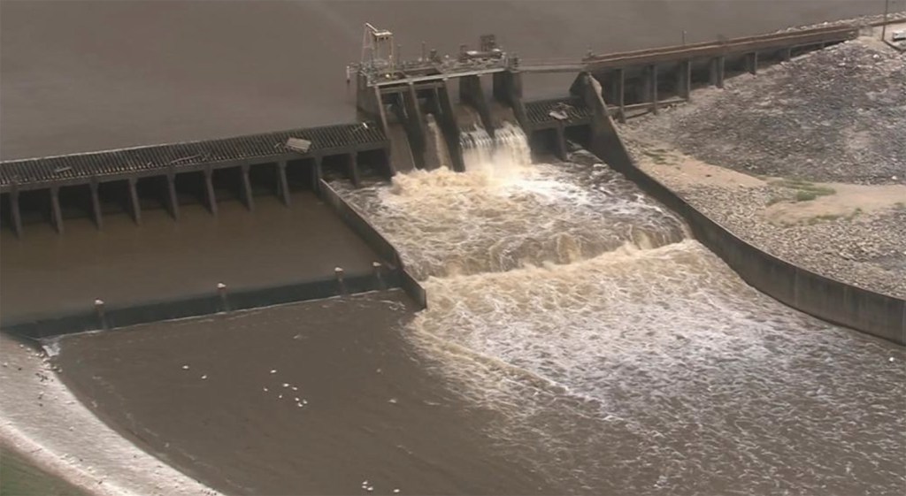
Gates on Lake Houston. File photo of 2019 release.

Flickinger advises property owners along the lake secure their property, including patio and outdoor furniture.

The Gates will remain open to manage storm inflows until the inclement weather has moved out of our region.

Lake Houston is currently at 42.22 ft (normal pool is 42.4) and Lake Conroe is at 200.64 ft (normal pool is 201.

The City put the lake-lowering policy in place after Hurricane Harvey. It has saved many homes and businesses from flooding during many events since then. The City is even planning on adding additional floodgates to Lake Houston to lower water faster.

Monitor Current Weather Events

To monitor current Lake Houston water levels, visit www.coastalwaterauthority.org.

To see current levels for Lake Conroe you can visit www.sjra.net.

For up-to-the-second weather for your zip code, visit the National Weather Service. NWS published the warnings below on Sunday, 1/20/24.

From Weather.gov on 1/20/24. As of 9:45am.
From Weather.gov as of 1/20/24 at 3:30pm. Updated frequently.

More than the Lake Could Flood, So…

Please keep in mind that flash flooding, affecting roadways and inland neighborhoods, is also possible in this storm. That’s a separate issue. Most storm drains are designed to handle only an inch of rainfall per hour.

Stay weather aware and avoid roadways if possible during rain events. It only takes 6 inches of water to move a car. If you see rising water near a stream, bayou or underpass, always turn around, don’t drown.

For more information, please contact the District E office at (832) 393-3008 or via email at districte@houstontx.gov.

Posted by Bob Rehak on 1/20/24

2335 Days since Hurricane Harvey