Tag Archive for: east fork

Perry Homes’ Contractors Return to Woodridge Village, But Undo Some Previous Work, Add to Sediment-Laden Runoff

After pulling all construction equipment from the Woodridge Village site in December, Perry Homes’ contractors returned this week. They are still working on the S2 (second southern) detention pond. But the new work appears to undo some previous work, and make sediment-laden runoff worse.

Woodridge Still Far Short of Promised Detention Capacity

After about 15 months of working on the Woodridge Village site, Perry Homes still has only 23% of the detention capacity installed. And even that does not yet meet Montgomery County regulations (see below). None of the work this week focused on new detention ponds that would reduce flood risk for Elm Grove residents.

Perry Homes had promised to build three ponds on the northern section. But they have not started any of those yet.

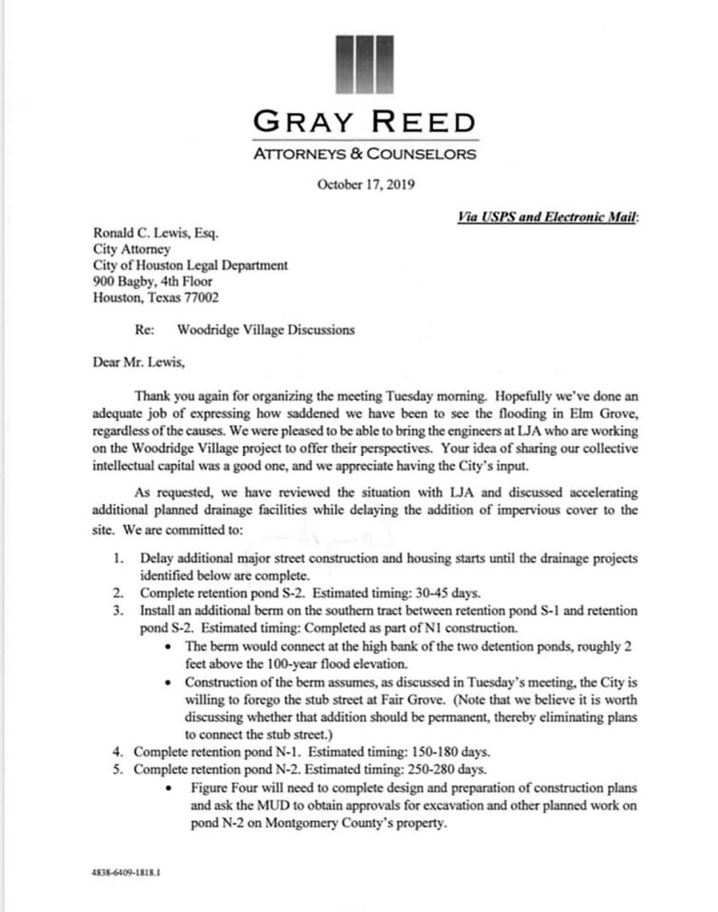
And Far Behind Schedule

On October 17th last year, an attorney for Perry Homes, J. Carey Gray, promised the Houston City attorney that Perry would have S2 completed in no more than 45 days. It has now been 86 days since Mr. Gray sent his letter and the work is still far from complete. I’m sure this creates an embarrassment to the Mayor of Houston, especially considering that Perry Homes gave $5000 to his re-election campaign. It creates the appearance of trying to buy favors.

Still Does Not Comply With MoCo Regulations

I previously detailed seven Montgomery County regulations that Perry Homes’ detention ponds did not meet. Perry Homes did not:

  • Put 30-foot wide maintenance roads around the ponds.
  • Place backslope interceptor swales around the ponds.
  • Have effective erosion control measures in place.
  • Implement protective measures for their overflow spillway.
  • Prevent increases in downstream flood levels.
  • Prepare a geotechnical report (that they shared with Montgomery County) showing groundwater levels at detention pond sites.
  • Ensure complete drainage of the detention pond.

Detention Pond Falls Short of Promised Capacity

Calculations for the capacity of the detention ponds begin from the bottom of the pond – when empty. When partially filled with water, the calculation begins from the top of the water. The bottom 2-3 feet of S2 has retained water for months, indicating that part of the pond is below the water table. So you can subtract about 20% of capacity that LJA Engineering promised and that Rebel Contractors initially built.

Adding Maintenance Road, Subtracting Backslope Swales

The flurry of work this week centered around creating the maintenance road that regulations demand. Or perhaps Perry is just building up the lip of S2 to compensate for the water it holds. Both are potentially good things.

However, workers also started filling the backslope interceptor swales they previously built. This created a sharp slope next to neighboring residents’ property and increased runoff toward the residents during last night’s rain.

Contractors placing dirt along the southern edge of the S1 pond to build a road earlier in the week.
Elm Grove Trail on left. Woodridge Village on right of silt fence. Note how land is being sloped toward Elm Grove.

An interceptor swale collects water above slopes and diverts it to the bottom of a detention pond through pipes so runoff does not create erosion on the slopes that lead to the pond.

Perry Homes has given no reason why they started filling in the swale they previously built that complied with MoCo regulations.

Looking west from Village Springs Drive. In the foreground, you can see how workers built a road and filled in the interceptor swale between it and Elm Grove on the left.
Still looking west. From this drain pipe, you can better see the grassy swale previously created to drain water into the detention pond (right) and to keep it out of Elm Grove (left).
Reverse shot, looking east. Here you can see how workers filled in the swale and created a road three to four feet high. Residents worry about the effect.
Looking east near the entrance to Taylor Gully from the road, the change in drainage toward Elm Grove (right) becomes very apparent. Picture taken Friday afternoon before rain. Road was uncompacted except for the weight of the small bulldozer spreading dirt (see first picture above).

Same Changes Between S1 and Sherwood Trails

The same changes appear along the southern edge of S1, north of Sherwood Trails, though the road does not appear as high and there also appears to be a shallow swale.

Looking west along the southern edge of Woodridge Village S1 detention pond, toward Woodland Hills from Fair Grove.

No Effective Erosion Control Yet

Perry Homes has also failed to put effective erosion control measures in place in Woodridge Village. For instance, most pond banks do not yet have grass planted on them.

The new road covered up what little grass had grown around the ponds. And raw dirt now fills the former interceptor swale.

A one-inch rain last night swept sediment into the pond, which emptied into Taylor Gully and Caney Creek before joining the East Fork of the San Jacinto.

Massive Pollution

Boater Josh Alberson took the dramatic picture below this afternoon where Caney Creek joins the East Fork. The East Fork water looks natural, but the water coming from Caney Creek via Taylor Gully is clouded with sediment. Woodridge Village is the only large source of exposed earth up Taylor Gully at this time. (Alberson verified that this sediment-laden runoff was NOT coming from the Triple PG mine up White Oak Creek.)

Water from Taylor Gully (right) merging with East Fork water (left) on Saturday afternoon, 1/11/2020, after a 1-inch rain last night.

Posted by Bob Rehak with images from Josh Alberson, Edythe Cogdill and Nancy Vera

865 Days since Hurricane Harvey and 114 since Imelda

The thoughts expressed in this post represent opinions on matters of public concern and safety. They are protected by the First Amendment of the US Constitution and the Anti-SLAPP Statute of the Great State of Texas.

West Fork Mouth Bar Dredging Set to Start As TWDB Considers Grant to Extend Program

On December 30, 2019, the City of Houston issued a Notice To Proceed (NTP) for debris removal services. Specifically, that means the large silt deposit at the confluence of the West Fork of the San Jacinto River and Lake Houston. The area is commonly known as the “mouth bar.” See below.

Mouth Bar of the San Jacinto West Fork looking upstream. Picture from 12/3/2019.

Mechanical, Not Hydraulic Dredging

The City hired DRC Emergency Services, LLC (DRC) under an existing contract to begin mechanical dredging of the mouth bar “this week,” according to Houston Mayor Pro Tem Dave Martin.

Mechanical dredging differs from hydraulic dredging. With hydraulic dredging, contractors continuously pump sediment from the river to a placement area onshore via long pipelines. With mechanical dredging, they scoop it out of the river and dump it on barges. Then they ferry the barges to the placement area where trucks transport the sediment to its final location.

Hydraulic dredging takes less time once started, but the prep can take months. Mechanical dredging takes longer, but can start immediately.

The City will begin the hydraulic dredging with $6 million of FEMA money left over from Hurricane Harvey debris removal funds. The Texas Division of Emergency Management and Governor Greg Abbott allocated that money specifically for Lake Houston and approved the remaining funds for mouth-bar dredging.

Two-Phase Grant

Next week, another $30 million should become available to extend the program. SB500 earmarked that money for dredging of the San Jacinto East and West Fork Mouth Bars. The Texas Water Development Board (TWDB) will consider Harris County’s grant application. Approval is expected.

The grant application proposes removing sediment in two distinct phases:

  1. Near and at the mouth bar on the West Fork of the San Jacinto River
  2. In the East Fork of the San Jacinto River AND other locations in Lake Houston.
Mouth Bar on East Fork San Jacinto grew 4,000 feet since Harvey.

Phase-One Funding and Objectives

To complete Phase 1, Harris County proposed taking $10 million of the $30 million to provide a total $16 million for DRC dredging operations.

Phase 1 should remove a minimum of 400,000 cubic yards (CY) of material in eight to twelve months. The Army Corps of Engineers previously removed 500,000 cubic yards from the West Fork Mouth Bar for $17 million in about three months.


During Phase 1, the County will begin some activities for Phase 2. They include:

  • Hydrographic surveys of the West and East Forks, and Lake Houston
  • Development of plans and specifications
  • Identification and permitting of additional disposal sites
  • Competitive bidding

Since the TWDB grant money can only be used for dredging, Harris County will pay for the activities above out of the 2018 HCFCD Bond Program. The fund allocated $10 million for dredging in Lake Houston.

Phase-2 Funding and Objectives

The remaining $20 million from the $30 million TWDB grant will go toward Phase 2 dredging.

During Phase 2, Harris County, City of Houston (COH), HCFCD, SJRA, and Coastal Water Authority (CWA) will develop and execute a plan for the COH or CWA to assume all long-term dredging operations on Lake Houston.

The County does not intend to assume long-term responsibility for maintenance dredging of a City property, i.e., Lake Houston.

TWDB Meets Next Week to Approve Grant

The Texas Water Development Board (TWDB) will meet on Thursday, January 16, 2020, to approve the $30 million grant. “We are in the final stages of agency approval to continue dredging the lake and river,” said State Representative Dan Huberty. His amendment to SB500 last year dedicated the money for dredging this area. “By approving this amount, the legislature as a whole made a clear and concise statement that Lake Houston and the San Jacinto River are vital resources for the entire region and must be maintained.”

SB500 was a supplemental appropriations bill. The grant itself will technically come from the new Texas Infrastructure Resiliency Fund, created last year by SB7. Senator Brandon Creighton authored SB7.

Harris County Engineer John Blount submitted the grant application to TWDB in late December after receiving approval from County Commissioner’s Court.

“Due to the urgency of this issue, multiple entities worked together to craft a plan that could be executed immediately, allowing the first phase to begin as soon as possible,” said Huberty.

Kudos Go To…

“I would like to thank everyone who has worked to create the final grant program under the supplemental funds we received from the Legislature,” said Huberty. “It would have not been possible without Governor Greg Abbott, Lieutenant Governor Dan Patrick, Speaker Dennis Bonnen, former Appropriations Chairman John Zerwas, Senate Finance Chairwoman Jane Nelson, State Senator Brandon Creighton, Chief Nim Kidd, Mayor Sylvester Turner, Chief Recovery Officer Stephen Costello, Harris County Commissioner’s Court, Harris County Engineer John Blount, Harris County Flood Control District Executive Director Russell Poppe, Harris County Flood Control District Deputy Director Matt Zeve, Houston Mayor Pro Tem Dave Martin and many more.”

To View TWDB Board Meeting Live

Tune in to the live TWDB Board Meeting next Thursday, January 16, 2020 at 9:30 AM by visiting: http://texasadmin.com/tx/twdb/.

Posted by Bob Rehak on 1/8/2019

863 Days since Hurricane Harvey and 111 since Imelda

Harris County Approves TWDB $30 Million Grant Application for Dredging at Confluence of San Jacinto and Lake Houston

In the last legislative session, State Representative Dan Huberty sponsored an amendment to Senate Bill 500. The amendment earmarked a $30 million grant for additional dredging at the confluence of the San Jacinto River and Lake Houston. Last week, Harris County approved the grant application to the Texas Water Development Board. That will actually transfer the money so that it can be put to work.

How $30 Million Grant Would Be Spent

County Engineer John Blount explains how the money would be spent in his cover letter that accompanied the request to Commissioners.

“The approach to completing work under the grant,” says Blount, “would be for the County to receive the grant funds, make the City of Houston a subrecipient to start immediate dredging, and to develop a long-term plan for keeping the region’s raw water supply viable with adequate reservoir capacity. The County would be reimbursed from the grant for administrative and other related expenses incurred.”

County Plays Central Role In Coordinating Effort

Blount concludes, “If authorized, the County will work with the Flood Control District, Budget Office, County Attorney, City of Houston, and the State of Texas, to advance all necessary applications and agreements needed to initiate the dredging activities funded in the 2019 legislative session. Grant awards, if made, will be presented to Commissioners Court for consideration at a future date.”

Commissioners Court approved the motion unanimously in its Tuesday, December 17th meeting. And by Friday, the actual grant application had been sent to the TWDB, according to Matt Zeve, Deputy Executive Director of Harris County Flood Control. The TWDB board should consider the request at its first board meeting in January, tentatively scheduled for the 10th. Huberty expects quick approval because the Legislature earmarked the money specifically for this purpose.

Water Supply, Not Just Flood Mitigation, An Issue

Dredging affects more than flood mitigation. It also affects water capacity for Lake Houston. The lake supplies drinking water for 2 million people. The Interbasin Transfer Project will soon bring 500,000 gallons per day from the Trinity River. But a growing East Fork mouth bar could soon block Luce Bayou. That’s where the water will enter the lake to be used by the Northeast Water Purification Plant.

As a result of sediment deposited during Harvey and Imelda, the East Fork Mouth Bar grew southward 4000 feet and now has almost reached the point where Luce Bayou and water from the Trinity River will enter Lake Houston. Photo taken 12/3/2019. Water flows from left to right.

West Fork Also Plays Role in Water Transfer

That’s also why the West Fork must remain clear. It brings water, when needed, from Lake Conroe.

Looking south across the mouth bar of the San Jacinto West Fork toward Lake Houston. Photo taken 12/3/2019.
Reverse angle. Looking northwest toward the San Jacinto River and the West Lake Houston Parkway Bridge. Note the submerged sand about to break through the water surface around the mouth bar. Photo taken 12/3/2019.
Kayaker RD Kissling standing in less-than-knee-deep water 700 yards south of the West Fork Mouth Bar. Photo taken November, 2019.

Like icebergs, sand bars mostly exist below the surface. What you see above water is a small percentage of what exists below water.

These photos illustrate why more dredging is essential. The mouth bars form dams behind the dam that block the free flow of water and decrease reservoir capacity.

Exploring Most Cost-Effective Options for Future

Between June when the Legislature approved the money and now, the City, County and State have explored ways to work together to ensure they spend the money cost-effectively. The county hired a consultant to explore the merits of do-it-yourself dredging vs. hiring a contractor. At the moment, the partners lean toward the contractor approach. It offers long-term flexibility as they explore future needs around the lake.

In addition to the $30 million from the State, the City of Houston allocated $6 million from money left over from Harvey disaster recovery funds. The County also allocated $10 million in its flood bond for dredging.

Initial Disposal Site Already Approved

The Army Corps approved Barry Madden’s property as a disposal site for the spoils. Madden’s property is opposite River Grove Park. That puts it miles closer to the Mouth Bar than previous placement areas used by the Corps. That should reduce costs by reducing the need for booster pumps and fuel.

The pieces of the puzzle are starting to come together.

Posted by Bob Rehak on 12/23/2019

846 Days since Hurricane Harvey and 95 since Imelda

East Fork Water Shockingly Clear with Mines Closed

The attorney general has had production at the Triple PG mine on Caney Creek shut down and the breaches in the mine’s dikes closed since early November. Also, the Texas Concrete mine in Plum Grove on the East Fork closed. And the TCEQ is forcing them to fix breaches and replant exposed areas before abandoning the mine. It could just be a coincidence, but water clarity on the East Fork and Caney Creek have improved to a shocking degree with both of the major mines out of action. See below. Said Kingwood resident John Knoerzer, “This is the clearest I’ve ever seen the East Fork.”

Photo taken by John Knoerzer on East Fork at East End Park on 12/20/2019.

It’s not Cozumel, but it’s far better than the opaque brown liquid we had.

Return of Eagles

Resident Josh Alberson reports that he’s seen cormorants, pelicans and bald eagles return to the East Fork and Caney Creek. “They were feasting on the white bass.” Says Alberson, “Last Sunday, we saw more birds than we had every seen working. It was National Geographic worthy, but I couldn’t get close enough to get any quality pics or video.” He attributes all the birds to both the bass and the clarity of the water. “It helps the birds spot the prey,” he says.

Only problem: there’s so much sand in Caney Creek that it’s hard to boat upstream. Josh Alberson informs me that his jet boat got stuck on a giant sand bar immediately downstream from the Triple PG mine. Boats with propellers can’t get through at all, he says.

Please Help Document Wildlife and Water Clarity

It seems to me that this change, if it is permanent, is important to document. Any boaters or jet skiers who can make it upstream, please send pics through the submissions page on this web site.

Posted by Bob Rehak on 12/21/2019

844 Days after Hurricane Harvey and 93 since Imelda

The thoughts expressed in this post represent opinions on matters of public concern and safety. They are protected by the First Amendment of the US Constitution and the Anti-SLAPP Statute of the Great State of Texas.

Triple PG Sand Mine Agrees to Terms of Restraining Order

The Triple PG Sand Mine in Porter has agreed to the terms of a restraining order. The order will force the mine owner to build dikes that can withstand the force of future rains and that can prevent future discharges of process wastewater into the City of Houston’s drinking water.

Repeated breach in dike of Triple PG Sand Mine that allowed process water to mingle with water in Caney Creek (lower left).

Certification by Licensed Professional Engineer Required

Furthermore, according to the agreement, a licensed, professional engineer must certify that the dikes can withstand the force of future rains. No more building dikes out of sand. Given where the mine is located – at the confluence of two floodways – it’s not clear whether future breaches are 100% avoidable. It’s also unclear whether a professional engineer would put his or her reputation on the line with such a promise given this particular mine’s history and location.

Southern Perimeter Lacks Effective Dikes

The entire southern perimeter of the mine is flush with the land south of the mine. There appear to be no dikes. So this could be a massive construction job. Dozens of homes south of the mine flooded during Imelda. Debris and damage patterns suggest that floodwaters entered their homes directly from the mine, not from White Oak or Caney Creeks.

The back of Tom Gill’s garage above faces the Triple PG mine. Scouring from the direction of the mine indicates which direction floodwaters came from.
Debris washed away from mine in Walden Woods subdivision south of it.

Background of Case

In May and again in September, the Texas Commission on Environmental Quality (TCEQ) reported that multiple breaches in dikes at the Triple PG Sand Mine on Caney Creek led to the escape of process water and sediment into the City of Houston’s drinking water supply. The TCEQ had previously cited the mine for similar environmental violations in 2015.

As a result of leaving the breaches open for prolonged periods, the Texas Attorney General sued the mine earlier this month. If the suit is successful, Triple PG could be liable for penalties exceeding $1 million.

Goals of Attorney General

Two weeks ago, I described what the original petition involved. The AG wants to force the mine to stop alleged pollution of the drinking water of the nation’s fourth largest city.

Both the injunction and restraining orders seek the same things: to get the mine to fix breaches so it stops allegedly emitting process water. The initial focus: sealing the mine off so that process water stops intermingling with drinking water. In the long term, however, the state wants to force the mine to build dikes sufficient to withstand the force of future floodwaters.

Requirements of Restraining Order

The agreed temporary restraining order requires the defendant to:

  • Not engage in any operations at its dredge facility that discharge process wastewater from the defendant’s property
  • Not PRODUCE any process wastewater that must be discharged
  • Immediately begin repairing damaged or breached berms
  • Hydraulically isolate any industrial waste within the mine
  • Halt the influx of water from creeks
  • Halt the outflow of waste from pits
  • Construct the repairs to prevent discharges from pits during future rain events
  • Cease and prevent all discharges of any industrial waste and or process wastewater from the mine into waters of the state
  • Within 14 days, hire a professional engineer to assess whether the berms can permanently prevent future discharges
  • Not destroy records
  • Certify all efforts at compliance, also within 14 days

The amended restraining order reset the date for the hearing on a temporary injunction from October 24 to 28th. The last order again resets the hearing date to November 12th.

So why the restraining orders when the original suit asked for an injunction? Generally, restraining orders are sought as a form of immediate relief while a plaintiff pursues a more permanent injunction, although injunctions can also be temporary.

Full Text of Legal Filings to Date

Below are links to the full text of documents filed to date in the case. I obtained them from the Travis County District Clerk in Austin.

For one PDF that contains all the docs above, click here.

Explanation of “Agreed Order”

Notice the word “agreed” in many of the document titles above. An Agreed Order refers to a written agreement submitted by both parties to a case resolving issues between them.

After rendering decisions, courts will often command counsel for both parties to see if they can come up with wording of an order satisfactory to both. If they can, it becomes an “agreed order,” which the court will then enter. (If not, the judge will formulate his/her own order.

Turning the Tide on the East Fork?

If this sticks, it could change the way Triple PG does business forever. It could also improve life on the East Fork of the San Jacinto for residents who have complained about sediment buildups, flooding, polluted water, loss of riparian vegetation, destruction of wetlands, fish kills, and more.

Posted by Bob Rehak on 10/31/2019

793 Days after Hurricane Harvey and 42 since Imelda

How Much Water Came from Where on the East Fork During Imelda ?

The San Jacinto East Fork watershed is immense. Many homes, vehicles, businesses and properties flooded along it during Imelda. Northeast Harris and East Montgomery counties, which contain the East Fork and its tributaries, received some of the heaviest rainfalls during that storm. So how much water came down them? And how did the peaks compare to Harvey?

East Fork Totals Computed by Harris County Flood Control

Jeff Lindner, Harris County Flood Control’s meteorologist computed the peak flows in cubic feet per second for ReduceFlooding.com.

He used the following gages. They are the closest to Kingwood and Huffman :

  • Peach Creek at FM2090
  • East Fork at FM1485
  • Caney Creek at FM2090

The peak flows in cubic feet per second past these gages during Imelda were:

  • East Fork = 34,600 cfs
  • Peach Creek = 32,800 cfs
  • Caney Creek = 9,230 cfs
  • Total = 76,630 cfs

Numbers Probably Understate True Peaks

The peaks probably exceeded those farther downstream. But we have no way of telling by how much because those are the closest gages to Lake Houston.

Many storm drains and smaller tributaries without gages enter into the flow downstream of those gages. For instance, White Oak Creak, Taylor Gully, Red Gully, Mills Branch, Luce Bayou and more all enter into the East Fork before it reaches Lake Houston. And all of those carry a lot of runoff from developed areas, i.e., areas with a lot of impervious cover, meaning high runoff rates.

East Fork San Jacinto and its tributaries. Source: https://www.harriscountyfemt.org

Net: Look at the 76,630 cubic feet per second as a minimum.

Comparison of Harvey to Imelda

How did the peaks on these three tributaries compare to Harvey? Consulting the SJRA’s peak flow map from Harvey, we can see that Harvey dumped much more rain:

  • Caney Creek = 20,00 cfs
  • Peach Creek = 31,300 cfs
  • East Fork = 119,000 cfs
  • Total = 170,000

So Harvey generated peak flows rates twice as high as Imelda. Only Peach Creek had a higher peak during Imelda than Harvey.

Importance of Looking Upstream when Comparing Storms

Remember, when comparing storms, it’s not just how much rain fell on you. It’s how much fell upstream from you. Rainfall patterns can produce dramatically different flooding patterns. During Imelda, while 20 inches of rain were falling on Patton Village, Lake Conroe received only two inches.

Posted by Bob Rehak on 10/17/2019, with thanks to Jeff Lindner and Harris County Flood Control

779 Days since Hurricane Harvey and 28 since Imelda

More Breaches Discovered at Triple PG Sand Mine; Implications for East Fork Flooding

The Triple PG Sand Mine on Hueni Road in Porter breached its dikes during Imelda in more places than originally observed. Despite the breaches still being open, and despite multiple investigations into the mine’s operations, the mine resumed business today. Trucks went in and out all afternoon. At the end of this post, I will discuss some of the implications of these multiple breaches and their possible contribution to flooded homes.

Second Flyover Reveals More Breaches

During my initial helicopter flyover on 9/28/19, I could only observe three breaches in the Triple PG Sand Mine dikes because of inclement weather. On a second flyover on 10/2/19, I observed several more. Other people discovered several more from the ground or boat.

Here’s what I saw from the air and ground. These pictures have been sent to State Representative Dan Huberty, the TCEQ and the Mine Safety and Health Administration in the Department of Labor. The TCEQ forwarded them to the Attorney General’s office.

Below: the approximate locations of breaches for orientation purposes. All aerial photos taken on 10/2/19.

Approximate locations of eight breaches in the Porter Triple PG mine during Imelda.

Breach #1

Partial breach along Caney Creek in the northern section of the mine, looking south toward the mine’s ponds.

Breach #2

Another pond in the far northern area shows evidence of a breach and severe erosion. This shot looks northwest.

Breach #3

Looking NW from over the main dike that separates the main part of the mine from the northern area. The dike cuts from the upper left toward lower right and has a massive breach. The angle of the downed trees suggests that Caney Creek overflowed on the north, swept through all the ponds to the north and then broke into the mine through this breach.

Breach #4

Partial breach. Hovering over Caney Creek in the foreground, looking west into the pit.

Breach #5

Hovering over Caney Creek in the foreground, looking west into the pit. This breach was opened in May and never closed properly.
Same breach, but photographed from the reverse angle. Hovering over the pit, looking east toward Caney Creek.

Breach #6

The southern dike of the mine is behind these trees. It obviously didn’t hold back water sweeping through the mine. It pushed these fences in from the north toward the south. Photo taken 10/6/19.
Many homes immediately below the mine flooded also. The so-called dike that runs along the southern edge of the mine is really flush with the ground level in this area. Photo taken 10/6/19.

Breach #7

Hovering over the pit looking toward the west dike of the mine and White Oak Creek, which breached into the mine.
Reverse shot. Looking east into the mine from over White Oak Creek.

Breach #8

The mine’s main stockpile sits on the western side of the mine. Rain seems to have washed much of it into the creek below the dike.

Direction of Flow

Note additional erosion to main stockpile. It sits at the confluence of two floodways: Caney Creek’s and White Oak Creek’s. You can see the influence of those two creeks in the erosion. This shot faces west. Caney Creek came in from the north (right to left). White Oak Creek came in from the west (top middle to left middle). Note the sand pushed up against the building. See close up below.
Sand pushed up against northern edge of building indicates the main flow came from the north…Caney Creek.

Sand Clogging River

Much sand now clogs the river that wasn’t there before Imelda. No doubt, some sand came from river bed and bank erosion. But it’s hard to believe that none of it came from the Triple PG Sand Mine, which sits in two floodways and whose dikes breached in at least eight places.

The shot below looks across the northeastern section of Riverchase. Many homes flooded in this area. When you look at the river, you can see a possible contributing factor: giant sand bars that consume two-thirds of the width of the river.

The breaches, the sand clogging the river, and the flooded homes all argue for moving mines back farther from rivers. Texas is the only state that has no minimum setbacks for mines. During Imelda, the East Fork and its residents paid the price for that policy.

Northeastern Riverchase, where several homes flooded near the river. Note giant sand bars just beyond the trees. Residents have commented on all the sand in streets. East End Park lies to the right of the giant bar. It also suffered from massive sanding during Imelda, in the area immediately opposite the bar.
A reverse shot of this bar shows that it is not only wide and long but tall. It reaches into treetops. The helicopter was hovering over East End Park for this shot and the camera is looking north.

Altogether, I took almost a thousand shots from the air last Wednesday along the East Fork between 99 and Lake Houston and from Lake Houston up the West Fork to the Woodlands. More findings in future posts.

Posted by Bob Rehak on 10/6/2019 with help from Josh Alberson and Charlie Fahrmeier

768 Days since Hurricane Harvey and 17 since Imelda.

All thoughts in this post represent my opinions on matters of public interest and safety. They are protected by the First Amendment of the US Constitution and the Anti-SLAPP statute of the Great State of Texas.

Triple PG Mine Dikes Breach in Multiple Places, Contributing to Giant East Fork Sand Buildups

Of all the sand mines on the East and West Forks of the San Jacinto, the Triple PG Mine is unique. It alone sits inside the confluence of TWO floodways. The Prabhakar Guniganti family owns the mine. So far they have cleared, grubbed and mined about 700 of the 2000 acres they own in the area. But that hasn’t stopped them from receiving timber exemptions from the Montgomery County Appraisal District on the land being mined (that has no timber).

After Harvey, when I found 30 acres of sand up to 15 feet deep covering East End Park (just downstream from the mine), I rented a helicopter to see where the sand came from. That’s when I discovered this horrific mine for the first time.

Owned by Cardiologist Turned Sand Miner

Prabhakar Guniganti is a cardiologist from Nacogdoches who has broadened his practice into mining and land development.

I hope he’s better at cardiology than mining. His mine has received 15 citations in the last two years from the Mine Safety and Health Administration (see the MSHA site for a key to the citations). The one highlighted in yellow had to do with a breach.

Fifteen in two years averages out to more than one every other month. And that does not even include notices of enforcement from the Texas Commission on Environmental Quality, for instance when Tony Buzbee, candidate for Mayor discovered a massive breach in the dike of the Triple PG mine back in May.

Will This Never Stop?

Last week, Charlie Fahrmeier, a Lake Houston Area resident and an expert in sediment control, observed the same breach open AGAIN. Right above East End Park, which was destroyed by sand AGAIN.

So Friday, I rented another helicopter to see what I could see. What I saw turned my stomach. There was more than one breach. There were at least two and possibly three.

It appeared that Caney Creek (from the north) and White Oak Bayou from the west “captured the pit.” The streams then apparently crossed the mine sweeping out through the breach on the southeast side back into Caney Creek and then down the East Fork of the San Jacinto River.

White Oak Creek approaches the mine from the west and Caney Creek runs along its north and east sides. From the images below, taken a week after Imelda, it appears that the both creeks captured the mine and cut across it. From FEMA’s National Flood Hazard Layer Viewer.

Where Breaches Occurred

The TCEQ fined Triple PG $16,875 for breaches one and two that were first reported after the May 7th storm. TCEQ has opened another investigation into the most recent breaches. Fines could be more substantial this time.

Three Breaches from the Air

Looking north from over the pit toward Caney Creek out of frame on the top. Water likely entered the mine from the north as Caney Creek reached flood stage and cut across the point bar above the mine.
Taken 9/27/19.

A reverse shot shows how water tore through the mine.

Looking south from over Caney Creek, you can see how current ripped through the mine. The road across the mine in the middle of the frame had been recently repaired when I took this shot on 9/27/19.
At the far end of the shot above on the west (right) side of the mine, I found this breach near White Oak Creek. Taken 9/27/19.
Looking east, directly across the mine, I saw this breach in the same location as the May breach. That’s Caney Creek in the background. Taken 9/27/19.
This close up shot of the same breach looking west from over Caney Creek shows how flimsy the repair was from earlier in the year. It was nothing but some sand dumped into a hole. Taken 9/27/19.

Designed to Fail?

Two engineers told me that patch looked like it was “designed to fail.” Mine Safety and Health Administration regulation §56.20010 regarding retaining dams specifies that “If failure of a water or silt retaining dam will create a hazard, it shall be of substantial construction and inspected at regular intervals.” Clearly, sand is not substantial. “Built properly, that repair would not have reopened in this past flood,” said Fahrmeier.

 TCEQ Requirements for Dike Construction and Repairs

Here are the TCEQ requirements for constructing dikes and levees. Note the paragraph on page 2 about structural integrity. “Construction must be based upon sound engineering principles. Structural integrity must withstand any waters which the levee or other improvement is intended to restrain or carry, considering all topographic features, including existing levees.”

These dikes had the structural integrity of a sand castle at a beach when the tide comes in.

Also interesting: Paragraph 4, Rights of Third Parties to be Protected. It’s a good read as far as regulations go.

Certainly, East End Park, just downstream was not protected.

KSA just finished cleaning up East End Park from Harvey. The organization spent close to $200,000 to restore trails covered in sand that reached to the treetops. Now the entire Kingwood community will have to sacrifice again. This area used to be a boardwalk over wetlands. The sign used to be shoulder high. Now it’s knee high.
Another trail covered in sand and silt. Not all of this came from the mine; some came from river erosion. But the serious problems first appeared after the mine.

How to Tell Mine from River Sedimentation

Charlie Fahrmeier who first discovered the most recent breach said that when he discovered it, water and sediment was streaming out of the mine. The water color was distinctly different from the color of water coming down Caney Creek. If the creek were responsible for all the sedimentation, the colors would have been reversed.

Caney Creek Now Averages 1.7 Feet Deep

In a future post, I will examine the growing mouth bar on the East Fork. That’s right. The East Fork and Caney Creek are barely navigable now. John Alberson took his jet boat up Caney Creek today and noted giant sand bars stretching across the river below the pit. He said the deepest part of the creek was 1.7 feet. The more sand there is in the creek and East Fork, the less room there is for water, so the higher the water rises during a flood.

How to File a Complaint With Mine Safety Authorities

I encourage everyone to file a Hazardous Condition Complaint with MSHA.  You can do it online at https://lakmshaegov01.msha.gov/HazardousConditionComplaint.aspx.  If they get enough complaints it could elevate the review. 

Here’s some information you’ll need to file:

  • Mine ID: 4104950
  • Mine Name: Triple PG Sand
  • Mine Operator: Triple PG Sand Development LLC
  • Mine is in two zip codes but breaches appear to be in 77365.
  • Location of Breach #1: Long 30.102968°, Lat -95.171932°
  • Location of Breach #2: Long 30.055360°, Lat -95.104712°
  • Location of Breach #3: 30.065451°, Lat -95.102904°

Please help shut this mine down. It’s dumping its process water loaded with sediment and chlorides into your drinking water. Moreover, the City doesn’t have enough money to dredge the East Fork and its tributaries every time we get a big rain. Let’s stop this problem at the source. We need sand for concrete, but we don’t need it from this mine.

Posted by Bob Rehak on 9/29/2019

761 Days since Hurricane Harvey

The thoughts expressed in the post represent my opinions on matters of public interest and safety. They are protected by the First Amendment of the US constitution and the Anti-SLAPP statute of the great State of Texas.

East Fork Rose 11 Feet Today; Almost Out of Banks at FM1485

The East Fork of the San Jacinto at FM1485 received almost 10 inches of rain today, including almost two inches in one hour late this afternoon.

Just upstream at 2090, the East Fork also received more than 10 inches in heavy bursts throughout the day.

As a consequence, the East Fork has risen 11 feet in the last 20 hours. It currently stands at about 57 feet. Flooding becomes likely at 60 feet.

Therefore, the river has three more feet to rise before coming out of its banks at FM1485.

Stay alert. For the most up to date information, consult:

  • HarrisCountyFWS.org
  • Click on the gage nearest you.
  • Select “For more information”
  • Click on the Rainfall and/or Stream Elevation tabs to see graphic representations like those above.

Better yet, establish an account and sign up for automated alerts. You can customize your preferences or accept defaults for as many gages as you wish.

The ground is already saturated. So any additional rainfall will result in rapid runoff So good luck to East Fork residents tonight and tomorrow.

Jeff Lindner, Harris County Meteorologist says “Additional rainfall amounts of 2-4 inches with isolated amounts up to 6 inches will be possible in this area with totals west of I-45 generally less than 2 inches.”

Posted by Bob Rehak on 9/18/2019 at 6pm

750 Days since Hurricane Harvey

Wednesday AM River, Lake Report: No Problems Yet

Here’s a river/lake report as of 7a.m. Wednesday, 9/18/19. During the early morning hours, TS Imelda was downgraded to a depression. The center of the storm moved north and is now over northern Harris County. Parts of the Lake Houston area received 4-5 inches of rain. Regardless, thanks to aggressive action by the City and luck in rainfall patterns, at this hour, no flood threat exists in our area from rivers or Lake Houston.

Little Rain So Far Upstream on West Fork

Rainfall around Lake Conroe overnight. Source: Harris County Flood Warning System

Luckily, very little rain fell upstream from us on the West Fork. In fact, the Lake Conroe area generally received less than a quarter inch of rain. Lake Conroe is releasing NO water at this hour. It’s level has not changed appreciably over night. It remains about 2.5 feet below normal.

West Fork and Lake Houston Still Below Normal Levels

Rainfall in Lake Houston Area. Source: Harris County Flood Warning System
West Fork status at Lake Houston Parkway. Source: Harris County Flood Warning System.

The West Lake Houston Parkway gage at the West Fork received a little more than four inches of rain in the last 24 hours. But the river is still within 6 feet of overflowing and the Lake itself is still about a foot below normal.

Source: USGS as reported by Coastal Water Authority.

Openning Gates Reduced Flood Threat

Source: Coastal Water Authority

Looking at the right of the graph above, you can see how yesterday’s decision to open the gates on Lake Houston lowered the level by an addition 1.3 feet. This helped offset the heavy rains that fell directly over the lake an in nearby tributaries.

The heaviest rain in the Lake Houston area appears to be 5.72 inches in Liberty County on the East Fork northeast of Lake Houston Park.

Overbank Flooding Limited to Southern Harris County So Far

The only flooding in Harris County from the heavy rains yesterday occurred in the extreme southern part of the county where the heaviest rains fell.

Flash Flood Watch Remains In Effect

Remain alert throughout today. A flash flood watch remains in effect for our area through tomorrow morning and will likely be extended.

Forecasters expect the heaviest rains with daytime heating. They predict that a band of rain will set up east of US59 this afternoon.

Conditions could change rapidly, especially now that the ground is fully saturated.

In the meantime, remain alert for street flooding and avoid travel if possible.

Posted by Bob Rehak on 9/18/2019 at 7 a.m.

750 Days since Hurricane Harvey