
Mining Technology Feature Article about Sand Mining in the Wake of Hurricane Harvey
A lady named Molly Lempriere from Mining Technology magazine (a Global Data publication) contacted me from the UK for an interview. She said she was “writing an article about the effect of sand mining in the wake of Hurricane Harvey and its impact on flooding.”
These were the questions she asked and my responses. Since most of you don’t read Mining Technology, I wanted to share them with you. Her article has not yet appeared and may not. She has not responded to my queries about its publication date.
When we experience a disaster like Harvey, it’s important to examine all the factors that contributed to the damage, and mitigate each to the extent possible.
Q. How long have you been campaigning against sand mining?
A. I’m not campaigning against sand mining per se. I’m campaigning against reckless sand mining. I began in September 2017, when it became apparent that giant sand deposits left by Hurricane Harvey contributed to billions of dollars in damages in my area.
Q. How devastating was Hurricane Harvey to the surrounding area?
- FEMA (Federal Emergency Management Agency) received more than 16,000 claims from residents and 3,300 from businesses in the Lake Houston area.
- Harris County Flood Control documented more than 5,500 damaged structures in the Humble and Kingwood areas alone. Note: One structure, such as an apartment complex, might include hundreds of people.
- At least ten people (that I know of) died.
- After 11 months, only half of the residents who flooded are fully back in their homes.
- City of Houston estimates Lake Houston area damages to be in the billions.
- City of Houston estimates this area’s tax revenues were reduced 20-30 percent.
- Our local school district documented $97.5 million in damages to its facilities so far; two still have not re-opened.
- Kingwood High School closed for 7 months; 4000 students had to be bused to another high school more than an hour away the entire time.
- U.S. Army Corps of Engineers will begin an emergency $70 million dredging project this week.
- 44 percent of all Lake Houston Area Chamber of Commerce businesses were adversely affected (100% within certain areas up to 1.5 miles from the San Jacinto River).
- Union Pacific Railroad had to replace its bridge, disrupting rail traffic for weeks.
- TxDoT had to replace part of the I-69 bridge for more than $20 million. All traffic in and out of Houston was delayed for months.
- A new hospital facility is still under repair after 11 months.
- Lone Star College lost 6 of its 9 buildings in Kingwood for most of the school year and won’t be fully operational until 2019.
- Kingwood’s library closed for more than eight months.
- Two local parks were inundated with sand; some dunes exceed 10 feet in height.

Harvey knocked out the Union Pacific Railroad bridge over the San Jacinto River near I-69. It disrupted rail traffic for weeks. Picture taken 9/14/2017.
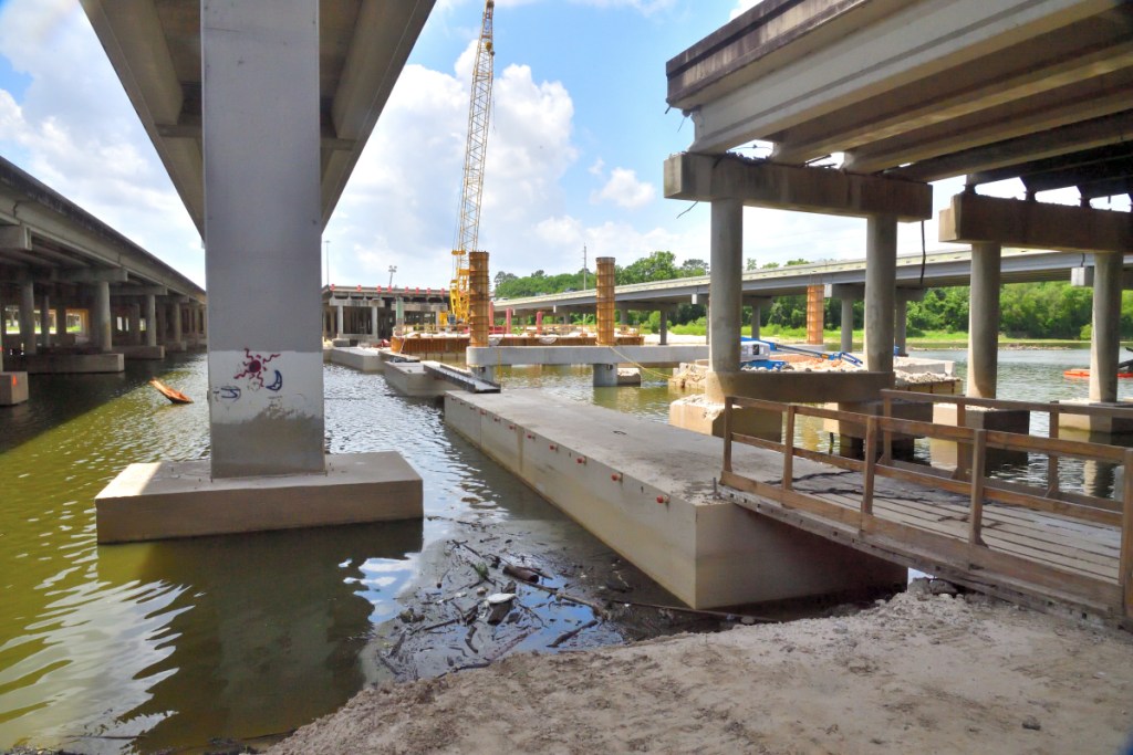
TxDoT had to replace the I-69 southbound bridge at a cost of more than $20 million. The bridge re-opened in July, 2018.
Q. Were the effects of sand mining on flooding considered previously?
A. Yes.
- State Representative Dan Huberty introduced legislation in 2011 to regulate sand mines due to concerns about the increasing rate of sedimentation.
- Former State Senator Tommy Williams introduced legislation to tighten restrictions on sand mining near rivers. TACA lobbied against it and it failed.
- Prior to that, Texas implemented a pilot program for a small portion of the Brazos river that restricted sand mining within the 100-year flood plain.
- Lake Houston, the main source of drinking water for America’s fourth largest city, is losing capacity at an increasing rate– even as the City plans to supply another 1.5 million customers with water from the lake.
- Area around Kingwood’s only boat launch has required dredging at an increasing rate.
Q. To what extent are sand mines directly to blame?
A. Asking the question this way is like asking what percentage of a train wreck was due to poor visibility, excessive speed, tight curves, or a tired engineer. It’s impossible to quantify.
However, sand miners deserve part of the blame. They contributed to the problem by pushing the safety envelope. They built mines in floodways, lobbied against common sense regulations that could have minimized damage, and ignored best practices commonly observed in other states that reduce erosion.
Certainly, not all sand mines share equally in the blame; some operate more responsibly than others. Certainly, part of the sand comes from natural sources. And certainly, Mother Nature pushed the limits with Harvey.
However, TACA wants people to believe that no sand came from mines because of the way they are designed.
Aerial and satellite imagery show the TACA claims to be misleading. See:
- Do Local Sand Mines Follow Best Practices?
- West-Fork Sand Stockpiles
- A Fast, Easy Way to Research Flood Hazards and Your Neighbors
With one exception, all area sand mines have chosen to locate, at least partially, in floodways. Some are entirely in floodways. That means they are in the main current of the river during floods. At the peak of Harvey, that current carried approximately 150,000 cubic feet per second down the West Fork of the San Jacinto River where miners had exposed almost 20 square miles of sand IN THE FLOODWAY.
One mine, whose dikes have repeatedly broken, leaves only 40 feet of unvegetated sandy buffer between operations and the river. Its dikes are not sloped like best management practices recommend.
As a consequence of ignoring best management practices for setbacks, buffer zones, slopes, and vegetative erosion controls, the dikes in that mine have broken repeatedly. Floodwaters go over and through its dikes, washing sand downstream.
That sand then constricts the carrying capacity of the river, reduces the river’s gradient, and blocks drainage ditches. In these ways, sand mines contribute directly to flooding.
TACA has fought legislation that: prohibits mining in these dangerous areas, leaves natural buffers against flooding, and makes miners responsible for cleanup.
Q. What more needs to be done to protect the local area against sand mining?
A. Several things.
- If all sand mines followed best management practices commonly used in other states for setbacks, erosion controls, buffer zones, vegetation, reclamation, and construction, I believe we could radically reduce the amount of sand coming from mines during floods.
- Mining in floodways should be outlawed. It’s reckless. It has also proven dangerous, and harmful.
- When dikes are breached, owners should promptly repair them. In one case, a broken dike has gone unrepaired for three years while the mine emits sand and sediment directly into the San Jacinto River. In another case, a dike went unrepaired for eight years.
- Sand miners should acknowledge that they are part of the problem instead of denying it. They should post remediation and cleanup bonds rather than externalizing their cleanup costs to downstream residents.

A mine whose dikes were breached and remained open for eight years was repeatedly flooded.
Q. On ReduceFlooding.com you mention that there are multiple agencies with conflicting mandates that govern the river. So is it the mining that’s inherently bad or the management?
A. This question belies TACA’s role in aggressively lobbying against common-sense regulations that would protect residents.
Conflicting mandates have nothing to do with bad management; they’re about focus. Only one agency focuses on flood control. Others focus on conserving and selling water.
Q. Are there lessons that could be learned from other sand mining operations around the world?
A. Yes. If Texas sand miners followed the best management practices (BMPs) from other states and countries, many of the problems here could be reduced or eliminated.
Communication of BMPs also needs to be improved. Louisiana has an excellent guide to best management practices for sand mining. It’s clear, concise, candid, well written and well illustrated. It was developed by government and industry working together, and clearly lays out the dangers if best practices are not followed.
Alaska discourages mining within 1000 feet of a public water source. That could help here. The San Jacinto River is the main source of water for millions of people.
Q. Is there a way for TACA and sand mining to help reduce flooding risks?
A. Yes.
- Don’t locate sand mines in floodways.
- Follow best management practices used in other states and countries.
- Quit misleading people, especially legislators.
- Acknowledge the risks and dangers; quit pretending they don’t exist.
During Harvey, when the San Jacinto River Authority had to open the floodgates on Lake Conroe, approximately 150,000 cubic feet per second swept through 20 square miles of sand mines.
Partially as a result, one particular sand dune that the Army Corps of Engineers expects to begin dredging next week grew 1,500 feet in length and 12 feet in height in one day during Harvey. It completely blocked a drainage ditch that empties the western third of Kingwood. More than 650 homes and a high school that depend on that ditch flooded. Result: more than $250 million dollars in damages. Did all of that sand come from mines? No. Did mines contribute? Yes.
Q. What ideally would you like to happen next?
A. We need to:
- Stop sand mining in the floodway of the main drinking water source for America’s fourth largest city.
- Establish minimum setbacks between mines and rivers, especially the San Jacinto.
- Create a clear, concise set of best management practices (BMPs) that everyone can read and understand.
- Raise awareness of BMPs.
- Follow BMPs.
- Increase fines for those who fail to follow BMPs.
- Remediate abandoned mines.
- Within active mines, immediately re-vegetate areas that are no longer being actively mined.

All but one of the West Fork mining operations are not only in the floodplain, they are in the FLOODWAY! The Red cross-hatched areas above show the floodway, while the Aqua shows the 100-year flood plain.
Q. Is there anything else that you’d like to add?
A. I contacted TACA. They did not respond to me.
Posted 8/5/2018 by Bob Rehak
341 Days since Hurricane Harvey


