Photo of the Day #274

Looking northwest from the southeastern tip of the proposed high-rise marina district

Photo of the Day #273

Looking northwest from the southeastern tip of the proposed high-rise marina after Harvey. Every home in the Barrington (background right) flooded during Harvey. Proposed high rises would be built along the northern shore of the lake in the upper right.

Photo of the Day #272

Site of proposed marina after Harvey. Fresh sand deposits reached almost five feet in height.

Photo of the Day #271

Shoreline of the proposed marina district after Harvey. Sand five feet deep and giant trees knocked over. Imagine what such a flood could do to boats.

Photo of the Day #270

Before dredging, this small area (center left) represented the only way for all water falling on the western third of Kingwood to exit to river. Sand deposited on shore was five feet deep.

Photo of the Day #268

Before dredging, water could barely get past this giant sand bar at River Grove Park. In the background, you can see part of the area proposed for a new high-rise marina district.

Photo of the Day #267

Hundreds of homes above this blockage at River Grove Park flooded during Harvey. While the sandbar looks small from the air, it is up to 15 feet high where it meets the drainage ditch. In the background, upper right, you can see part of the area proposed for development of a high-rise marina.

Photo of the Day #266

The small rivulet above the sandbar now represents the only way for water falling on the western third of Kingwood to get to the river. Hundreds of homes above this blockage flooded during Harvey. The Barrington, Kingwood Lakes, Kings Forest and Trailwood all had homes that flooded. While the sandbar looks small from the air, it is up to 15 feet high where it meets the drainage ditch. The Army Corps removed most of this bar.

Photo of the Day

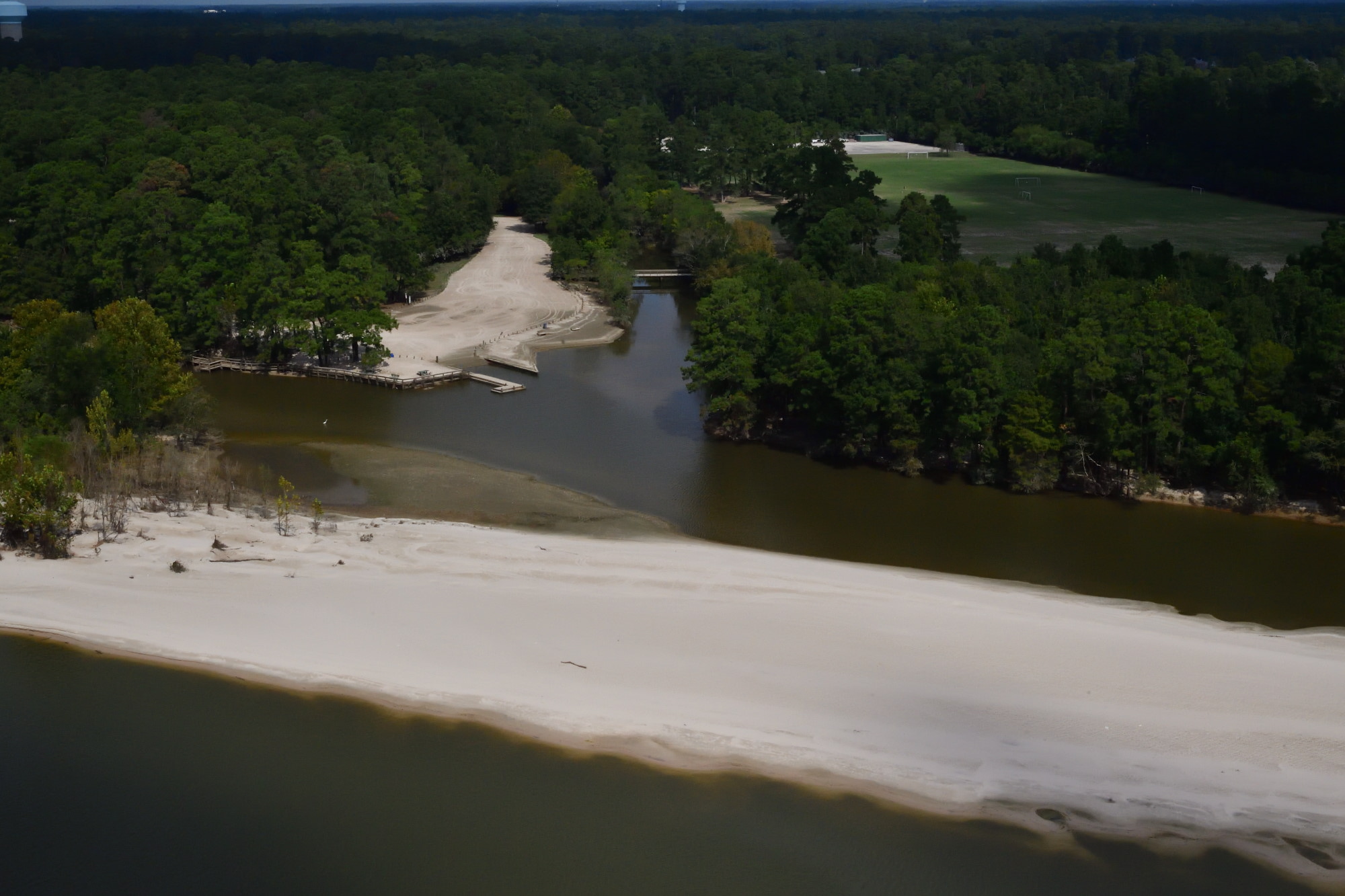
Before recent dredging, the drainage ditch in the center of this frame above was blocked by the giant sandbar cutting through the frame. The Barrington, Kingwood Lakes, Kings Forest and Trailwood all had homes that flooded as a result of this blockage.

Photo of the Day #265

Looking northeast toward Huffman from the confluence of the East and West Forks of the San Jacinto at the southern tip of Kings Point in Kingwood. Luce Bayou entrance in background.