Photo of the Day 91

Looking south across Spring Creek toward Costco and Deerbrook Mall. Everything up to the mall flooded. Note the major sand deposit in the background next to US59 and Costco.
Looking south across Spring Creek toward Costco and Deerbrook Mall. Everything up to the mall flooded. Note the major sand deposit in the background next to US59 and Costco.

Looking south across Spring Creek toward Costco and Deerbrook Mall. Everything up to the mall flooded. Note the major sand deposit in the background next to US59 and Costco.

Confluence of the west fork of the San Jacinto (left) and Spring Creek (right). Looking southeast. Note US59 in the upper left and Costco in the upper right. Sand carried all the way through the confluence to the empty commercial space on the south side of the river (background).

Confluence of the west fork of the San Jacinto (left) and Spring Creek (right). Looking southeast while hovering over the west fork. Note US59 in the background. Note fresh sand covering both banks of both bodies of water.
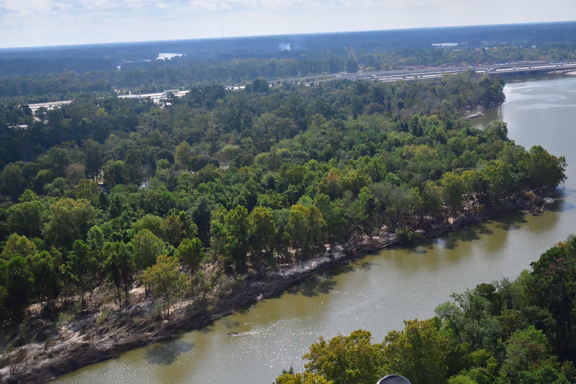
West fork of the San Jacinto below the sand mines. Looking downstream toward US59. Note several feet of sand deposited on the shore by Hurricane Harvey.

West fork of the San Jacinto below the sand mines. Looking downstream toward US59 (upper part of frame). Note several feet of sand deposited on the shore by Hurricane Harvey.

West fork of the San Jacinto where it makes an s-turn below the sand mines west of Kingwood. Looking west toward Sorts-McClellan Road.

West fork of the San Jacinto below the sand mines. Looking downstream toward Sorter’s McClellan Road. Note how shallow the river is at this point with logs hung up in the sand.

The southernmost sand mine on the west fork of the San Jacinto. By Sorters Road and White Sands Drive. Looking north, so the sand washing out of the mine on the right is actually moving southeast downstream.

Sand mining operation on the west fork of the San Jacinto River. Looking east toward Kingwood. Altogether the sand mines on the west fork adjacent to Kingwood cover 4 square miles or about 2400 acres. They stretch from below Kingwood Drive to the Riverwalk community in Porter off FM1314.