Hurricane Watch for Port Aransas to High Island
As of 4am Saturday, 9/19/20 (the 1-year anniversary of Imelda), the National Hurricane Center issued:
- Hurricane Watches for Texas coast from Port Aransas to High Island
- Tropical Storm Watches east of High Island into Louisiana and from Port Aransas to the Rio Grande
- Storm Surge Watches from Port Mansfield, TX to Cameron, LA including all inland bays.
Discussion
There is an increasing risk of heavy rainfall and flooding along the northwest Gulf Coast Sunday through at least the middle of next week. Beta is forecast to move slowly toward and along or offshore of the coast through that time and create life-threatening storm surge.
Lake Friday, a USAF mission found a stronger tropical storm with winds of 60mph and a fairly large area of 40-50mph winds. Ships and oil platforms in the north-central Gulf of Mexico have reported winds above 40mph. The wind field is starting to expand toward the north.
Track:
Beta is moving NNE at 12mph. Faster than expected. Beta will turn west around mid-day Saturday and decrease forward speed into early next week. This will bring Beta toward the middle Texas coast.

As Beta approaches the mid TX coast, weakening high pressure to the north will turn the storm toward the north and northeast. However, forecasters have lower-than-normal confidence as to when all this will happen.
The current National Hurricane Center forecast track is near the center of consensus for major global models, but shifts in this track will remain possible both toward the north or south.
Intensity:
Beta intensified despite wind shear. As Beta moves over very warm western Gulf of Mexico waters, intensification will likely continue for the 24-48 hours. NHC now forecasts Beta to become an 80mph hurricane. As Beta begins to turn northeast and skirt the middle and upper TX coast, the storm may weaken. Some uncertainty remains in the intensity forecast.
Tropical storm force winds will likely begin to arrive along the middle TX coast Sunday evening and spread northward into Matagorda Bay and along the upper TX coast by Monday. Hurricane conditions could reach the Matagorda Bay region on Tuesday.
Impacts
Storm Surge:
Water level rises along the upper TX coast will begin on Saturday and worsen Sunday into Monday due to the expansion of the tropical-storm-force wind field. This large wind field will also develop large swells over the NW Gulf of Mexico by Sunday into Monday with swells reaching 15-25 feet. On Sunday into Monday, expect 4-8 feet waves breaking on beaches. These large swells will lead to wave run up on top of elevated tides.
Large waves will accompany the higher tides. The prolonged nature of the event will result in significant beach erosion and damage to fragile dunes.
Expect inundation of low lying roads near the coast. Once the water begins to rise on Saturday evening, some low lying areas may remain flooded into the middle of next week.
Jeff Lindner, Harris County Meteorologist
Ferry operations at both the Galveston-Bolivar and the Lynchburg sites may be impacted.
For SE Harris County:
From Saturday night into next week, coastal flooding will be possible in El Lago, Nassau Bay, Shoreacres, Seabrook and portions of Baytown near Goose Creek and Cedar Bayou.
This includes all areas around:
- Clear Lake
- Along Taylor’s Bayou in Shoreacres and Taylor Lake Village
- Around the San Jacinto Monument and Lynchburg Ferry landing
- In Seabrook areas along and east of Toddville Rd and in the waterfront area east of HWY 146.
- The lower San Jacinto River at Rio Villa and other low lying areas south of US HWY 90.
- Low lying areas in Galena Park and Jacinto City near the Houston Ship Channel
- Lower portions of Greens and Hunting Bayous south of I-10.
Most flooding will happen in streets, low marsh lands, roads near Galveston Bay and around Clear Lake and some subdivisions streets.
Wave action from ENE/E winds across Galveston Bay of 2-4 feet will be possible on top of these tides along the west side of Galveston Bay and 1-3 feet in Clear Lake which may damage docks, bulkheads, and moored vessels.
Rainfall
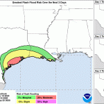
Rainfall will strongly depend on the track of Beta. Small changes could result in significant differences in rainfall amounts. Heaviest rains will likely be near the coast and offshore.
Any deviation of the track northward would bring the heavy rainfall further inland, likewise any south or east shift in the track would keep the heaviest rains off the coast.
- Coast: 8-12 inches
- Coastal counties: 6-8 inches
- South of I-10: 4-6 inches
- South of Hwy 105: 3-5 inches
- North of Hwy 105: 1-3 inches

HCFCD models suggest that basin average rainfall totals of at least 6 inches would fill smaller creeks and bayous in Harris County (Willow Waterhole, Keegans Bayou, Willow Creek, Upper Little Cypress Creek).
Basin average amounts of 7-8 inches would fill Clear Creek, Hunting Bayou, Armand Bayou, Cypress Creek, Halls Bayou, Greens Bayou, White Oak Bayou, Buffalo Bayou, Cedar Bayou, and various smaller tributaries.
Addicks and Barker Reservoirs are currently empty.
Winds:
Tropical storm force winds may start Sunday evening around Matagorda Bay. Sustained 40mph winds likely spread northward along the upper TX coast on Monday including Galveston Bay.
Hurricane conditions will be possible near Matagorda Bay on Tuesday and across portions of coastal Matagorda, Brazoria, and Galveston Counties into Wednesday.
Across Harris County wind will increase into the 25-35mph range on Monday and possibly 40-50mph range on Tuesday into Wednesday with higher gusts, especially near Galveston Bay.

Posted by Bob Rehak on 9/19/2020 at 4am based on data from the National Hurricane Center and Harris County Meteorologist Jeff Lindner.
1117 Days since Hurricane Harvey and 1 Year since Tropical Storm Imelda


