Tag Archive for: sand mines

Are Sand Mine Dikes Designed to Fail?

After 2.5 years of examining photos and videos of the so-called “dikes” in sand mines, I have come to believe that some are designed to fail. In some cases, mines cause them to fail.

In most cases, the “dikes” are not really dikes. They’re just the edges of pits that miners have excavated. Or roads around the pits made of sand that easily erode.

And because miners mine so close to the river, when those pits fill with water, they overflow. The resulting erosion cuts channels between the pit and the river that allow the pits to discharge a portion of their wastewater. Lake Houston and public drinking water become collateral damage.

High Cost of Flimsy Construction

After the storm, miners throw some sand in the breach and wait for it to happen again. The sand creates only the appearance of a fix.

Month after month, I’ve photographed active breaches, “patched” breaches, and scars in the landscape from older breaches. Many reopen multiple times.

Breaches are so common that, in my opinion, they may be part of some miners’ business plans.

High Cost of Silt

If discharges consisted of plain water, I might not care. But the water usually carries silt with it. Miner’s settling ponds can fill with silt which has little marketable value. Flushing it downriver solves another problem.

Miners externalize their cleanup costs by foisting them off on an unsuspecting public. That sediment clogs rivers that must be dredged to avoid flooding. It reduces the capacity of the lake. And it escalates the City’s water treatment costs.

A retired high-level Public Works manager told me he routinely investigated and found breaches at sand mines during floods. In his opinion, many of the breaches were intentional and the floods created the perfect “cover” for the illegal discharges. “Blame it on Mother Nature,” he said.

West Fork Images from February Flyover

Below, a sampling of more than 1000 images I took on 2/13/2020. The first batch shows mines on the San Jacinto West Fork between SH242 and US59. I traveled NW to SE toward 59. I’ve arranged images in the same order.

Sand mine pond and water’s path to the river (right). Pond is full to the brim and will overflow on a minor rain.
Another angle looking north toward the same breach.
West Fork is migrating toward pit on right and will soon enter it. A powerful argument for reasonable setbacks from river.
Dike erosion at Liberty Materials Mine. The TCEQ alleges this mine discharged 56 million gallons of that white gunk into the West Fork last November. This breach has been like this for months.
Another pond at the same mine. The only thing holding back another illegal discharge is a feeble road made of sand. See close up in next pic of area near poll just left of center.
Close up of road in upper left of previous photo. Note how water seeping through it is already causing road to collapse.
Silt spreading into settling pond. See also reverse shot below.
Reverse angle from previous shot, but same pond. See West Fork in background and note how road in foreground was cut by spreading silt.
Site of previous double breach at RGI mine. Note gray area in second row of dikes. Process water from the pond behind it broke into the settling pond in the foreground and from there into the West Fork. TCEQ cited owners.
Two separate ponds may have shared this same “wash” to the river (foreground). Pond in middle right is actively discharging into river. See reverse angle in next shot.
Same discharge as in previous shot. From this angle it is easier to see the active discharge.
Same breach from third angle. From this angle, you can clearly see the path and the discharge.
This pond has been discharging into the river for months. Note the difference in the color of the river water and discharge water. This indicates the discharge water is still holding silt.
Reverse shot of same breach highlights both the path and the color difference of the discharge.
This pond is leaking into a drainage channel that parallels Northpark Drive south of Oakhurst.
Former breach at Eagle mine on Sorters Road. West Fork in foreground.
Scars from previous breaches. One of these was intentional, though I’m not sure which. See video below.
Video by resident who wishes to remain anonymous shows intentional breach at the mine above.
Another scar from previous breach.
Confluence of Spring Creek (left) and West Fork San Jacinto (right). Facing west. Note color difference in water. It’s frequently visible.
Same area looking southeast toward Humble. West Fork on left.
Same area looking NE toward Kingwood. West Fork comes in from left.
Between the 59 bridge in the previous shot and this area, the Army Corps spent more than $90 million removing sediment from the West Fork. The City, County and State could spend another $35 million removing this blockage.

East Fork Images from February Flyover

Breach into Caney Creek at Triple PG sand mine was open for months and became the focus of a suit by the Attorney General. Note steepness of sides of “fix,” and erosion along side. Best Management Practices call for sloping and planting sides of dikes to reduce erosion.
Wider shot shows just how much forest was blown out in this breach, leading one to wonder whether this was caused solely by nature.
Another former breach into Caney Creek from the Triple PG mine. Only this eroding road stands between the mine and the creek.
Also at the Triple PG mine in Porter, this breach into White Oak Creek remained open for months. It, too, was the subject the Attorney General’s lawsuit. A restraining order against the mine calls for repairs to be certified by a professional engineer. This looks as though they may have tried to add concrete to the sand and stabilize it with rebar. However, note that the concrete, if that’s what it is, doesn’t rise much above the water. The road is made from eroding sand that will blow out in the next storm.
Reverse shot of same breach looking west. No concrete or rebar visible here – only rilling along steep sides of road. Rilling is the term for those vertical erosion channels.

Posted by Bob Rehak on 2/24/2020

909 Days since Hurricane Harvey and 158 since Imelda

The thoughts expressed in this post represent opinions on matters of public concern and safety. They are protected by the First Amendment of the US Constitution and the Anti-SLAPP Statute of the Great State of Texas.

Progress on Pipeline Repairs at Sand Mines

In the last month, workers made progress on pipeline bed repairs to two area sand mines. But repairs at one sand mine look substantial. At another, they look superficial. Triple PG in Porter is still edging into the danger zone.

Exposed by Erosion When Mining Came Too Close

In December and January, I posted about pipelines exposed when sand miners mined too close to them. Floodwaters then swept through the mines and undercut the pipelines, creating safety hazards.

Pipelines exposed by erosion at Liberty Materials Mine in Conroe. Photo taken January 20, 2020.

Several HVL (highly volatile liquid) pipelines (above) and one natural gas pipeline (below) were affected at mines in Conroe and Porter.

Exposed natural gas pipeline at Triple PG mine near Caney Creek in Porter. Photo taken December 3, 2019.

Here’s where things stand on repairs at both mines as of last week..

Triple PG Mine in Porter: Another Big Cover Up

The Triple PG Mine in Porter has covered up the exposed natural gas pipeline with sand. As of 2/13/2020, Triple PG had made no other visible attempts to stabilize the area, which is subject to repeated erosion. Harvey first exposed the pipeline, which Triple PG subsequently covered. Then Imelda re-exposed it. And Triple PG re-covered it.

Fresh sand covers exposed natural gas pipeline. Will it be washed away a third time in the next big storm?

Readers may remember that after Harvey, Kinder Morgan tunneled 75 feet under the mine and spliced in a replacement for the section that had been exposed. They then filled the cutoff section with inert gas. So the exposed section was not active.

Still, without further stabilization, the pipeline will likely be exposed again and again by future storms.

Triple PG still has made no attempt to stabilize erosion creeping toward the HVL pipelines that cross the mine in a utility corridor. The same erosion that exposed the natural gas pipeline will threaten those in future storms.

Five pipelines carry highly volatile liquids through this utility corridor. Triple PG mines sand from either side of them. During floods, Caney Creek runs through this mine creating the erosion you see here.

Liberty Materials Mine in Conroe: Fix Nearing Completion

At a Liberty Materials Mine in Conroe, a much more substantial fix is underway by the pipelines. The mine spanned both sides of the utility corridor. Water from one side, trying to get to the river on the other, washed under several HVL pipelines, exposing them.

Repairs began in January and were well under way in February. Crews first expanded the washed out area under the pipelines. Then they placed two giant culverts under the pipelines to allow water to move from one side to the other. They also cemented the culverts in place and drove vertical steel reinforcements in the ground to prevent re-exposure of the pipelines.

Two giant culverts will now carry water under the pipelines. Shown above: the outfall.
Steel reinforcements rise above the level of the pipelines to help retard erosion. Photo taken 2/13/2020.
Rip rap and other reinforcements will also help retard erosion.
Inlets for the culverts. Photo taken 2/13/2020.
Looking west toward The Woodlands. San Jacinto West Fork is at far end of sand mine. Note all the sand and sediment that has washed under this area to the far side of the steel reinforcements.

As of 2/13/2020, crews were filling dirt in under, around and over the pipelines.

The repairs here appear much more substantial than in the Triple PG mine. I just hope the volume of sand washing from one section of the mine to the other does not clog the culverts. The steel reinforcements will protect the pipelines in this location, but water has a habit of flowing around obstacles.

Posted by Bob Rehak on 2/23/2020

908 Days after Hurricane Harvey 157 since Imelda

Latest Sand Mine Breaches and Near Breaches

In the continuing saga of sand mining on the East and West Forks of the San Jacinto, I present the results of my January 20, 2020, flyover. I found three breaches and two near breaches between I-45 and the East Fork. See below.

Liberty Materials Mine in Conroe

Let’s start upriver on the San Jacinto West Fork near Conroe. These first two images come from the Liberty Materials Mine that the TCEQ cited for allegedly discharging 56 million gallons of white slime into the river.

In this photo you can see that road (upper right) has repairs blocking a previous breach. However, discharge continues to flow through the dike. This indicates potential structural instability that might jeopardize the dike in a major flood and cause another massive discharge.
A couple hundred yards away at the same mine, there’s so little road left, driving a car across it could cause collapse of the remaining dike. That jeopardizes safety of workers and the safety of drinking water. Only four or five feet separates a massive mining pond from the West Fork in the foreground.

There sure is a lot riding on that little spit of sand. If this one blows out, I pray the TCEQ and Attorney General goes after them for gross negligence. How could they ignore this?

Hallett Mine in Porter

The next two shots come from the Hallett Mine in Porter. They show the same issue from two different angles.

Looking toward the pond.
Looking toward the West Fork. Another portion of the mine lies on the far side of the river.

Abandoned Mine in Porter

This is the drainage ditch that parallels Northpark Drive before it enters the river. This mine appears to be abandoned. Regardless, sediment, seems to consistently wash out of it. This breach has been open for since 2015.

Triple PG Sand Mine in Porter on Caney Creek

The Attorney General is suing this mine for breaches that remained open for months after the May floods last year. Currently, the mine is operating (but not dredging) under a temporary injunction until the case goes to trial on June 22. While mine owners have closed other breaches on White Oak and Caney Creeks, this breach remains open. Technically, it doesn’t connect with with river until a flood. But during floods, photographic evidence shows that Caney Creek reroutes itself through the mine, raising pressure that causes dikes in other places to collapse.

The shot below shows headward erosion toward five pipelines carrying highly volatile liquids.

Such breaches and near breaches create a good argument for creating minimum setbacks for mines from the creeks and rivers that supply our drinking water.

Sadly, legislation that could have done that died in committee during the last session. But there’s always next year. I will continue to monitor how well the mines do until new measures can be reintroduced. Pressure is building throughout the state to control air and water pollution from aggregate mines.

Posted by Bob Rehak on 2/12/2020

897 Days since Hurricane Harvey

The thoughts expressed in this post represent opinions on matters of public concern and safety. They are protected by the First Amendment of the US Constitution and the Anti-SLAPP Statute of the Great State of Texas.

Triple PG Sand Mine Agrees to Terms of Restraining Order

The Triple PG Sand Mine in Porter has agreed to the terms of a restraining order. The order will force the mine owner to build dikes that can withstand the force of future rains and that can prevent future discharges of process wastewater into the City of Houston’s drinking water.

Repeated breach in dike of Triple PG Sand Mine that allowed process water to mingle with water in Caney Creek (lower left).

Certification by Licensed Professional Engineer Required

Furthermore, according to the agreement, a licensed, professional engineer must certify that the dikes can withstand the force of future rains. No more building dikes out of sand. Given where the mine is located – at the confluence of two floodways – it’s not clear whether future breaches are 100% avoidable. It’s also unclear whether a professional engineer would put his or her reputation on the line with such a promise given this particular mine’s history and location.

Southern Perimeter Lacks Effective Dikes

The entire southern perimeter of the mine is flush with the land south of the mine. There appear to be no dikes. So this could be a massive construction job. Dozens of homes south of the mine flooded during Imelda. Debris and damage patterns suggest that floodwaters entered their homes directly from the mine, not from White Oak or Caney Creeks.

The back of Tom Gill’s garage above faces the Triple PG mine. Scouring from the direction of the mine indicates which direction floodwaters came from.
Debris washed away from mine in Walden Woods subdivision south of it.

Background of Case

In May and again in September, the Texas Commission on Environmental Quality (TCEQ) reported that multiple breaches in dikes at the Triple PG Sand Mine on Caney Creek led to the escape of process water and sediment into the City of Houston’s drinking water supply. The TCEQ had previously cited the mine for similar environmental violations in 2015.

As a result of leaving the breaches open for prolonged periods, the Texas Attorney General sued the mine earlier this month. If the suit is successful, Triple PG could be liable for penalties exceeding $1 million.

Goals of Attorney General

Two weeks ago, I described what the original petition involved. The AG wants to force the mine to stop alleged pollution of the drinking water of the nation’s fourth largest city.

Both the injunction and restraining orders seek the same things: to get the mine to fix breaches so it stops allegedly emitting process water. The initial focus: sealing the mine off so that process water stops intermingling with drinking water. In the long term, however, the state wants to force the mine to build dikes sufficient to withstand the force of future floodwaters.

Requirements of Restraining Order

The agreed temporary restraining order requires the defendant to:

  • Not engage in any operations at its dredge facility that discharge process wastewater from the defendant’s property
  • Not PRODUCE any process wastewater that must be discharged
  • Immediately begin repairing damaged or breached berms
  • Hydraulically isolate any industrial waste within the mine
  • Halt the influx of water from creeks
  • Halt the outflow of waste from pits
  • Construct the repairs to prevent discharges from pits during future rain events
  • Cease and prevent all discharges of any industrial waste and or process wastewater from the mine into waters of the state
  • Within 14 days, hire a professional engineer to assess whether the berms can permanently prevent future discharges
  • Not destroy records
  • Certify all efforts at compliance, also within 14 days

The amended restraining order reset the date for the hearing on a temporary injunction from October 24 to 28th. The last order again resets the hearing date to November 12th.

So why the restraining orders when the original suit asked for an injunction? Generally, restraining orders are sought as a form of immediate relief while a plaintiff pursues a more permanent injunction, although injunctions can also be temporary.

Full Text of Legal Filings to Date

Below are links to the full text of documents filed to date in the case. I obtained them from the Travis County District Clerk in Austin.

For one PDF that contains all the docs above, click here.

Explanation of “Agreed Order”

Notice the word “agreed” in many of the document titles above. An Agreed Order refers to a written agreement submitted by both parties to a case resolving issues between them.

After rendering decisions, courts will often command counsel for both parties to see if they can come up with wording of an order satisfactory to both. If they can, it becomes an “agreed order,” which the court will then enter. (If not, the judge will formulate his/her own order.

Turning the Tide on the East Fork?

If this sticks, it could change the way Triple PG does business forever. It could also improve life on the East Fork of the San Jacinto for residents who have complained about sediment buildups, flooding, polluted water, loss of riparian vegetation, destruction of wetlands, fish kills, and more.

Posted by Bob Rehak on 10/31/2019

793 Days after Hurricane Harvey and 42 since Imelda

More Breaches Discovered at Triple PG Sand Mine; Implications for East Fork Flooding

The Triple PG Sand Mine on Hueni Road in Porter breached its dikes during Imelda in more places than originally observed. Despite the breaches still being open, and despite multiple investigations into the mine’s operations, the mine resumed business today. Trucks went in and out all afternoon. At the end of this post, I will discuss some of the implications of these multiple breaches and their possible contribution to flooded homes.

Second Flyover Reveals More Breaches

During my initial helicopter flyover on 9/28/19, I could only observe three breaches in the Triple PG Sand Mine dikes because of inclement weather. On a second flyover on 10/2/19, I observed several more. Other people discovered several more from the ground or boat.

Here’s what I saw from the air and ground. These pictures have been sent to State Representative Dan Huberty, the TCEQ and the Mine Safety and Health Administration in the Department of Labor. The TCEQ forwarded them to the Attorney General’s office.

Below: the approximate locations of breaches for orientation purposes. All aerial photos taken on 10/2/19.

Approximate locations of eight breaches in the Porter Triple PG mine during Imelda.

Breach #1

Partial breach along Caney Creek in the northern section of the mine, looking south toward the mine’s ponds.

Breach #2

Another pond in the far northern area shows evidence of a breach and severe erosion. This shot looks northwest.

Breach #3

Looking NW from over the main dike that separates the main part of the mine from the northern area. The dike cuts from the upper left toward lower right and has a massive breach. The angle of the downed trees suggests that Caney Creek overflowed on the north, swept through all the ponds to the north and then broke into the mine through this breach.

Breach #4

Partial breach. Hovering over Caney Creek in the foreground, looking west into the pit.

Breach #5

Hovering over Caney Creek in the foreground, looking west into the pit. This breach was opened in May and never closed properly.
Same breach, but photographed from the reverse angle. Hovering over the pit, looking east toward Caney Creek.

Breach #6

The southern dike of the mine is behind these trees. It obviously didn’t hold back water sweeping through the mine. It pushed these fences in from the north toward the south. Photo taken 10/6/19.
Many homes immediately below the mine flooded also. The so-called dike that runs along the southern edge of the mine is really flush with the ground level in this area. Photo taken 10/6/19.

Breach #7

Hovering over the pit looking toward the west dike of the mine and White Oak Creek, which breached into the mine.
Reverse shot. Looking east into the mine from over White Oak Creek.

Breach #8

The mine’s main stockpile sits on the western side of the mine. Rain seems to have washed much of it into the creek below the dike.

Direction of Flow

Note additional erosion to main stockpile. It sits at the confluence of two floodways: Caney Creek’s and White Oak Creek’s. You can see the influence of those two creeks in the erosion. This shot faces west. Caney Creek came in from the north (right to left). White Oak Creek came in from the west (top middle to left middle). Note the sand pushed up against the building. See close up below.
Sand pushed up against northern edge of building indicates the main flow came from the north…Caney Creek.

Sand Clogging River

Much sand now clogs the river that wasn’t there before Imelda. No doubt, some sand came from river bed and bank erosion. But it’s hard to believe that none of it came from the Triple PG Sand Mine, which sits in two floodways and whose dikes breached in at least eight places.

The shot below looks across the northeastern section of Riverchase. Many homes flooded in this area. When you look at the river, you can see a possible contributing factor: giant sand bars that consume two-thirds of the width of the river.

The breaches, the sand clogging the river, and the flooded homes all argue for moving mines back farther from rivers. Texas is the only state that has no minimum setbacks for mines. During Imelda, the East Fork and its residents paid the price for that policy.

Northeastern Riverchase, where several homes flooded near the river. Note giant sand bars just beyond the trees. Residents have commented on all the sand in streets. East End Park lies to the right of the giant bar. It also suffered from massive sanding during Imelda, in the area immediately opposite the bar.
A reverse shot of this bar shows that it is not only wide and long but tall. It reaches into treetops. The helicopter was hovering over East End Park for this shot and the camera is looking north.

Altogether, I took almost a thousand shots from the air last Wednesday along the East Fork between 99 and Lake Houston and from Lake Houston up the West Fork to the Woodlands. More findings in future posts.

Posted by Bob Rehak on 10/6/2019 with help from Josh Alberson and Charlie Fahrmeier

768 Days since Hurricane Harvey and 17 since Imelda.

All thoughts in this post represent my opinions on matters of public interest and safety. They are protected by the First Amendment of the US Constitution and the Anti-SLAPP statute of the Great State of Texas.

Energy Resources Committee Hearing Testimony Monday on Bill To Regulate Quarry Reclamation

People in the Hill Country are up in arms about aggregate production operations (APOs). The Lake Houston Area is not alone. State Representative Kyle Biedermann of Fredericksburg has introduced yet another bill to regulate APOs. Biedermann’s bill, HB2871 focuses on mine reclamation. His bill targets APOs that quarry and crush rock, but the bill, if passed, would affect sand mines in our area, too.

Focus on Reclamation

HB2871 requires miners to acquire a reclamation permit BEFORE they can acquire a production permit. It would also require them to file a performance bond ensuring reclamation BEFORE acquiring that production permit.

Abandoned sand pit in Humble remains unfenced despite being next to areas where children play.

Gives Primary Enforcement Responsibility to Railroad Commission

HB2871 places the burden of enforcement on the Texas Railroad Commission. However, it allows the Railroad Commission to use the resources of the Texas Commission on Environmental Quality (TCEQ).

I first learned about HB2871 from a Hill County group protesting the permitting of a quarry. They approached me asking for support. It certainly appears that our interests align. And the author wrote the bill in such a way that it would apply to this area, too. I have previously blogged about the problem of abandoned and unsafe sand pits. We have many in the Lake Houston area. Once the last truckload of profit goes out of a mine, owners have little incentive to reclaim it.

Currently, owners are required to file a reclamation plan before getting a reclamation permit, but there is no requirement to actually execute the plan when they are done mining.

This page on the Hill Country group’s web site explains their loss of faith in the TCEQ, and hence, their desire to have the Railroad Commission oversee regulation.

How to Act NOW

On Monday, the House Energy Resources Committee will consider HB 509 and HB 2871. Representatives Biedermann, Wilson, and their staff have worked hard to draft these bills. Now we need to back them and help get them passed into law! HB 509, you may remember, requires a permitting agency to consider the aggregate impact of multiple mining operations in a small area before permitting any more.

Below are the names, phone numbers and email addresses of all the members of the House Energy Resources Committee who are soliciting comments. If you have friends or relatives living in any districts below, reach out to them: their voices as constituents may be even more powerful. Please call or write and encourage friends and relatives to do the same.

Chris Paddie, Chairman (Marshall/Northeast Texas)
chris.paddie@house.texas.gov
(512) 463-0556

Abel Herrero, Vice Chairman (Corpus Christi area)
abel.herrero@house.texas.gov
(512) 463-0462

Rafael Anchia (NW Dallas)
rafael.anchia@house.texas.gov
(512) 463-0746

Ernest Bailes (Huntsville, Liberty)
ernest.bailes@house.texas.gov
(512) 463-0570

Tom Craddick (Midland area)
tom.craddick@house.texas.gov
(512) 463-0500

Drew Darby (San Angelo area)
drew.darby@house.texas.gov
(512) 463-0331

Charlie Geren (NW Fort Worth)
charlie.geren@house.texas.gov
(512) 463-0610

Roland Gutierrez (SE San Antonio, Live Oak, Universal City, Converse)
roland.gutierrez@house.texas.gov
(512) 463-0452

Cody Harris (Hillsboro, Corsicana, Palestine)
cody.harris@house.texas.gov
(512) 463-0730

Mary Ann Perez (Pasadena, Baytown)
maryann.perez@house.texas.gov
(512) 463-0460

Jon Rosenthal (Far NW Houston)
jon.rosenthal@house.texas.gov
(512) 463-0722

Here is a SAMPLE EMAIL developed by the Hill Country group. Remember to tweak the copy so that it applies to this area, not just the Hill Country.

Posted by Bob Rehak on 4/5/2019

584 Days since Hurricane Harvey

First Proposal to Improve Sand-Mine Regulation in House

On December 11, 2018, Texas State Representative Terry Wilson introduced HB509. HB509 is a bill to regulate aggregate production operations (APOs). APOs include sand mines.

HB509 Stipulates Consideration of Hydrologic Impact During Permitting

Currently, sand mines in Texas are permitted and inspected by the Texas Commission on Environmental Quality (TCEQ).

New legislation proposed by Representative Terry Wilson of Marble Falls would require regulators to consider hydrologic impacts of sand mining during the permitting process.

HB509 enables the Texas Railroad Commission to work with the TCEQ; adopt, amend and enforce rules pertaining to aggregate production operations; issue and revoke permits; and inspect APOs without notice. It also:

  • Creates criminal penalties for non-compliance.
  • Requires a hydrology assessment of the operation’s impact on surrounding surface and groundwater – including water availability.
  • Enables regulators to consider the cumulative impact of multiple APOs in an area when evaluating new applications.
  • Requires the operation to prevent material damage to the hydrologic balance outside the permit area.
  • Requires public notice of permit applications
  • Provides for public comment on permit applications
  • Makes permit approval contingent on past performance
  • Requires permitting agencies to publish the public comments
  • Allows the agencies to deny permits based on public comments
  • Grandfathers operations with existing permits

New Fines and Creation of a Criminal Offense

A person commits an offense if the person “knowingly makes a false statement, representation, or certification, or knowingly fails to make a statement, representation, or certification, in an application, record, report, or other document filed or required to be maintained under this chapter or under an order of decision issued by the commission under this chapter.”

Violators may be punished by fines of up to $10,000 and a year in prison.

Positives of HB509 from Residents’ Perspective

While this bill will not immediately and directly address sand-mine issues on the San Jacinto, I think it could eventually help this area. Things residents will like include:

  • Significant penalties for false statements!
  • Having more eyes on the problem; TCEQ complains that it doesn’t have enough staff to enforce regulations.
  • River-impact assessments, especially the idea of looking at the cumulative impact of all providers in the area! Twenty square miles of sand mines between US59 and I-45 on the West Fork have decimated the environment immediately upstream from the drinking water source for 2 million people.
  • Public hearings for permits. Right now, regulators hear one side of the story.
  • Making the permit application approval contingent on past performance. This gives sand miners the ultimate incentive to comply with regulations: “Don’t comply and you’re out of business in this state.”

Shortcomings From Residents’ Perspective

Things residents probably won’t like include:

  • Grandfathering existing operations; the cumulative impact of sand mining is already a huge problem on the San Jacinto. However, I’m not sure a fair alternative exists, short of buyouts.
  • Lack of definitions for what they’re trying to prevent under “hydrologic impact.” That creates flexibility to cover unforeseen consequences, but also leaves a huge “out.” HB571 in the 2011 session, the first bill to regulate sand mining in Texas, also lacked specificity. It said for instance that the mines had to comply with all applicable laws and regulations, but did not specify what they were. It left lots of wiggle room. This could, too.
  • No prescription for minimum setbacks from rivers or prevention of mining in floodways.
  • Use of the words “designed to” in front of hydrological impacts. That creates a big “out.” Anybody who places a bale of hay in drainage ditch on the mine could say he designed the drainage to prevent erosion, However, the real issue is what happens when the river reroutes itself through mines during a flood.

Lack of Specificity Concerning Hydrologic Impact

My biggest concern is the lack of specificity re: adverse hydrologic impacts. No references exist in the bill to:

  • Dangers of river migration
  • River capture of sand pits
  • Draw down of the water table
  • Effects of such drawdowns on surrounding vegetation and farms
  • Repeated breaches of dikes
  • Increases in rates of sedimentation
  • Loss of downstream lake capacity at increasing rate
  • Poor water quality
  • Loss of river conveyance
  • Increases in erosion
  • Escape of chlorides from wash pits during floods
  • Contamination of groundwater and wells by chlorides
  • Pipeline corrosion
  • Loss of riparian vegetation
  • Downstream flooding
  • Eventual need for dredging and other costly remediation.

All in all, though, it’s a good start and can only help curb the excesses of sand mining in the long run.

Read the bill in its entirety. Here is the current text of proposed House Bill  509 for 2019.

About Congressman Terry Wilson

Congressman Wilson represents the area west of Austin. His district includes Burnet, Milam and Williamson Counties and the cities of Round Rock and Marble Falls. His web page in the House of Representatives states that he was born in Odessa, Texas, and that “He is a lifelong conservative Republican, committed husband and father, and a decorated combat veteran. He holds a BS in Business Administration from Texas A&M University and an MS in Strategic Logistics Plans and Management from the Air War University.”

Wilson retired from the Army after serving more than 30 years. Since retiring from the Army, he has leveraged his military experience as an advocate for small businesses.

No Other Bills Filed in House or Senate So Far

Neither Representative Dan Huberty, nor Senator Brandon Creighton, have so far introduced any new legislation affecting sand mining. Wilson’s HB509 appears to be the only bill regulating sand mining filed so far in either the House or Senate as of Christmas Eve, 2018.

As always, these are my opinions on matters of public policy. They are protected by the First Amendment of the United States Constitution and the Anti-SLAPP statute of the Great State of Texas.

Posted by Bob Rehak on 12/24/2018

482 Days after Hurricane Harvey

Tax Bill Inequity: How You Make Up for Sand Miners

‘Tis the season…for tax bills. As I paid mine this weekend, I reflected on how Montgomery County’s under-appraisals of sand mines resulted in over-taxation of other properties there and elsewhere. Here’s how.

Lone Star College System Provides Basis for Comparson

The Lone Star College System taxes property in several counties including Montgomery and surrounding counties. That includes northern Harris County. Lone Star’s tax rate is identical in each: 0.107800. However, because Montgomery County consistently under-values sand-mine properties, other property owners there and in surrounding counties must pay more than their fare share of Lone Star taxes to balance Lone Star’s budget.

In September, I ran a series of posts focused on sand mine appraisals in Montgomery County. The first examined the sand mine on the East Fork. The second examined multiple sand mines on the West Fork. The third talked about how Montgomery County consistently under-classified the use of sand-mine land. Of the 53 different parcels of land sampled, not one was classified as a sand mine.

Montgomery County classified:

  • 16 parcels as “Timber” even though there was no or little timber on them and the land was clearly being used for sand mining.
  • 31 parcels as “Vacant” despite mining operations on the property.

To be fair, miners had not yet timbered parts of several parcels intended for expansion.

The Timber Dividend in Sand Mines

I started digging back into the sand-mine property tax bills to see how much of a break these big businesses were getting compared to me.

One 10-acre parcel owned by Guniganti Family Property Holdings on the East Fork (see below) received a timber exemption even though there’s scarcely a tree on the property and the land hasn’t been in timber for years. It clearly doesn’t meet the qualifications for the timber exemption as outlined by the Texas State Comptroller. The official that I talked to in the Montgomery County Appraisal District office agreed.

Montgomery County Parcel R53336, part of the Guniganti mine on the East Fork. Tax due to the Lone Star College system equals $10.78 for all ten acres thanks to a timber exemption. The 10 acres is inside the aqua-colored line.


Guniganti LSC tax bill for ten acres above shows $10.78 total for ten acres thanks to the timber exemption.

On those 10-acres, the Guniganti’s paid a total of $10.78 in tax to the Lone Star College System or $1.08 per acre. By comparison, I paid $338 to Lone Star for my one-acre residential lot in northern Harris County. That means, the Guniganti’s paid 313 times less per acre for their income producing property. And they own more than 1700 additional acres of land with the timber exemption.

Another example: Edward Boettcher Jr. from Brenham owns one sixth of a 367-acre parcel on the West Fork also used for sand mining. He received a timber exemption on his property which reduced the LSC taxable value by 96%. That meant he paid a total of $11.28 to the Lone Star College District for his 61-acre share of the income-producing property. He paid $0.18/acre – 1878 times less than I paid. 

Boettcher will pay only $11.28 to LSC on his share of one-sixth share of 367 acres.

Vacant Land That’s Not

And what about that land classified as “Vacant”?  RGI Materials owes Lone Star $296.27 on 134.6 acres of land, or $2.20/acre – 154 times less than I paid as an individual on non-income producing land.

RGI did NOT have a timber exemption so they paid $296.27 to LSC in taxes on 135 acres classified as vacant.

Inconsistencies Abound

The 53 different parcels of land examined in September received 10 different types of classifications even though they were all being used for the same purpose – sand mining. Only one parcel was classified as commercial and only two were classified as industrial. The vast majority were classified as vacant rural land or timberland. After calling these inconsistencies to the attention of the Montgomery County Appraisal District almost two months ago, it appears that little or nothing has changed. Spot checks failed to turn up any reclassifications. Vast differences and inconsistencies remain…even among sand mines.

By the way, the state comptroller’s office says, and I quote, “Sand mines should be classified as sand mines.” That means they should be valued according to their income producing potential. It doesn’t appear that Montgomery County appraises them that way; the values rarely change from year to year – not what you would expect from depleting assets.

Season for Sharing

Yes, ’tis the season for sharing. And those generous sand miners are sharing their tax obligation with you through dubious exemptions, mis-classifications, and valuations that have nothing to do with the income-producing value of the land.

Someone has to make up the difference in the Lone Star College System budget and luckily (for the sand miners), that’s you and me.

These appraisals and tax bills illustrate how we’re all connected. It also underscores the need for consistent appraisals and state oversight of appraisal districts.

Luckily for residents of Harris County, only the Lone Star College portion of tax bills is affected. Residents of Montgomery County, however, take the full hit; all portions of those tax bills are affected.

These are my opinions on matters of public policy, protected by the First Amendment of the United States Constitution and the Anti-SLAPP statute of the great State of Texas.

Posted by Bob Rehak on 11/18/2018

447 Days since Hurricane Harvey

PS: I should add that the Lone Star College System has nothing to do with appraisals or exemptions.


Montgomery County Says It Will Re-evaluate Sand Mine Appraisals

The Montgomery County Tax Appraiser’s office has indicated it will look into sand mine appraisals after two reports last week by ReduceFlooding.com that showed thousands of acres used for sand mining were not being appraised as sand mines.

Same mine, same use, same owner, radically different appraisals on each side of the county line. Montgomery County granted a timber exemption even though there is practically no timber on the the triangular one behind $56.25 per acre. Harris County appraised the land just inches south at market value. The difference is more than 12X.

17 East Fork Sand Mine Parcels Not Classified as Sand Mines

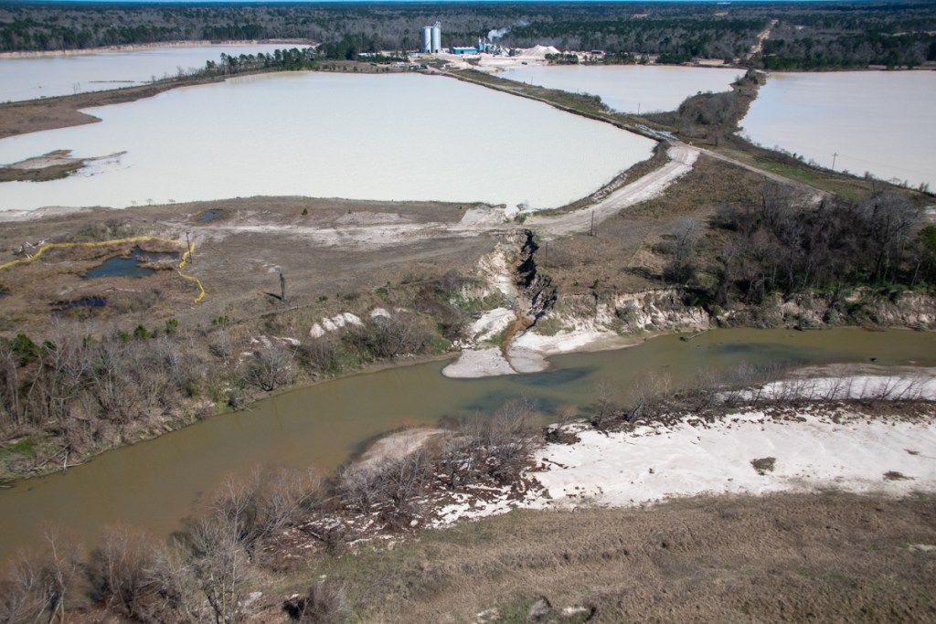
The first report reviewed 17 parcels of land on the East Fork that comprised one 2000-acre sand mine complex. Seven of those parcels received ag/timber exemptions even though they are used for sand mining. The owner paid only $3,189 in tax on 1741 acres classified as ag/timber, or $1.83 per acre.

Seven other parcels on the East Fork, owned by the same group were classified as “E4 – Vacant Rural Land over 5 acres Non-Ag” or “C1 – All Vacant Res Lts & Vacant Res Tr < 5 Acres.” Of those seven parcels, two were being mined and were definitely not vacant.

Of the 17 East Fork parcels, a total of nine (more than half) were being mined, yet not one of those was classified as being mined. Seven of the parcels being mined received ag/timber exemptions even though they were not “principally” used for agriculture or timber, one of the five standards that land must meet to qualify for that exemption. Two other parcels being mined were classified as “vacant” even though they were clearly not vacant.

35 West Fork Sand Mines Not Classified as Sand Mines

The second report reviewed 36 additional parcels of land on the West Fork. All of those were used for sand mining. However, not one was classified as a sand mine using the code G3 in State Comptroller’s  Texas Property Clasification Guide.

  • 2 were classified as “A1 – Single-family residential.”
  • 6 were classified as “D1 – Qualified Ag/Timber.”
  • 1 was classified as “E3 – Other Improvements over 5 acres Non-Ag.”
  • 24 were classified as “E4 – Vac Rural Land over 5 acres Non-Ag”
  • 1 was classified as “F1 – Commercial (real).”
  • 2 were classified as “F2 – Industrial (real).”

“That’s not right.”

Altogether, I sampled 53 different sand mine parcels in Montgomery County.

All 53 were classified as something other than sand mines.

When these inconsistencies were called to the attention of a representative of the Montgomery County Appraisal District, he seemed genuinely upset – not only by the inconsistencies, but by the apparent misclassifications. After reviewing several examples, he said, “That’s not right!” He vowed to look into the issue, asked me to send him a list of the misclassified properties, and said, “I pay my fair share of tax and want to make sure everyone else does to.”

“They Should Be Classified as What They Are – Sand Mines.”

Another official at the State Comptroller’s office verified that G3, the classification for sand mines, was still active and appropriate.

When asked if counties had the discretion to appraise mines as something else, he said, “They should be classified as what they are – sand mines.”

Regarding coding, the State Comptroller’s office does allow counties to create their own designations, for instance S for sand. However, they must report the mines to the state as G3. A quick check of neighboring counties found that some, do indeed, use alternative designations. For instance, Liberty County classifies several sand pits as “S.” Harris County just calls them sand pits. I could see no comparable alternative in Montgomery County.

Multiple Classifications Used for Similar Properties

“Multiple classifications for similar properties are highly unusual,” the official in the State Comptroller’s office said. “And you wouldn’t classify an occupied property as vacant. Maybe at one point in time they were vacant or in timber. But they no longer are. Sounds like they slipped under the radar of the chief appraiser.”

Need for Uniform Standards of Appraisal

He further stated that such appraisals are usually based on estimates of reserves, much like oil and gas. When asked if there was a specific procedure to follow for such appraisals, he said, “There are several appraisal standards and methods such as USPAP. Counties just have to pick one and stick with it, so they can be consistent and justify their appraisals.” USPAP stands for Uniform Standards of Professional Appraisal Practice.

“Usually, sand mine appraisals are based on tonnage, remaining reserves, and a formula for discounted cash flow. The law says you must use standard methods and appraisal practices,” said the source in the Comptroller’s office.

Most Likely an Oversight

The Montgomery County Appraisal District office also felt the appraisal inconsistencies were most likely an oversight. “The number of sand mines out there is minuscule compared to the number of homes, businesses, ranches and farms. They probably just slipped through the cracks. We rely a lot on self-reporting for these types of properties. Owners are supposed to tell us when the use of a piece of property changes.” Other counties also seem plagued by inconsistencies when it comes to sand mine appraisals, though not to the degree Montgomery County is.

Ready for a Rollback?

Mines that were receiving the ag/timber exemption which requires a special application, may be in for a large surprise if the mines are reappraised. According to state guidelines, the properties are subject to a rollback tax dating to the change of use or five years. Reappraisal equals the difference between the timber valuation and the market valuation plus 7% interest per year. Some mines have been using the ag/timber exemption for many years so penalties could add up quickly. See the State of Texas Guidelines for Appraisal of Timberlands in Chapter 2 and the rollback procedures in Chapter 3.

Same Land, Same Owner, Same Use on Different Sides of County Line – A 12X Difference

To put this issue in perspective, let’s look at the lone mine on the East Fork owned by the Guniganti Family Property Holdings LLC. The Harris/Montgomery County line bisects the lower part of the mine.

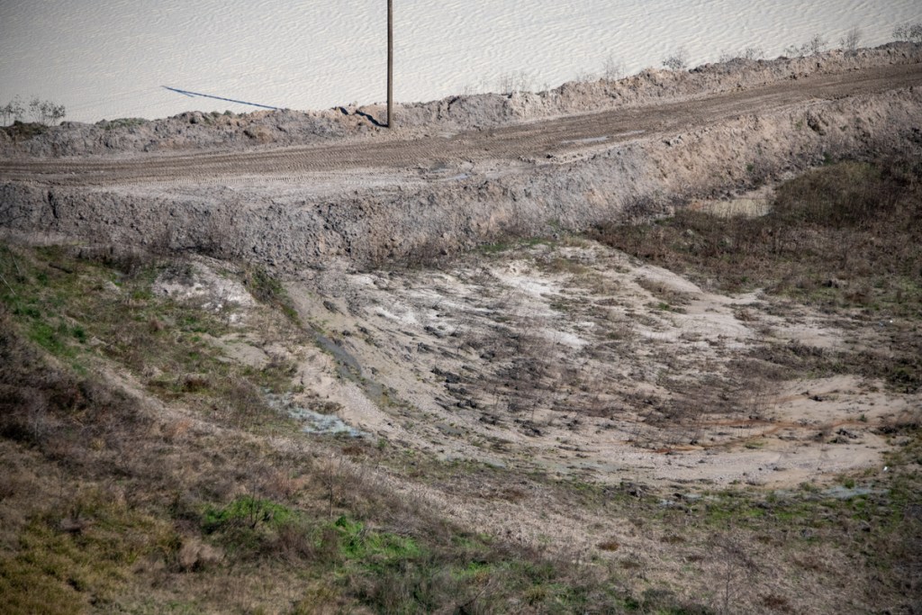
The land on the Montgomery County side is assessed as “ag/timber” even though it has been a sand pit for thirteen years. Because of the ag/timber exemption, Montgomery County taxes the land based on an assessed value of $56.25 per acre.

Montgomery County appraised the pit as timber even though it contained none.

Just inches to the south, land on the Harris County side used in an identical fashion is classified as a sand pit. That pit is taxed at its market value, which is $701.73 per acre. That’s more than a 12x difference in the taxable value for land on the same property.

Inches to the south, Harris County appraised the same land at its MARKET value for 12X more.

Montgomery County schools and hospitals could have a nice Christmas this year if all that so-called vacant land and timber land in sand mines gets re-appraised.

As always, these are my opinions on matters of public policy, protected the the First Amendment of the U.S. Constitution and the Anti-SLAPP statute of the Great State of Texas.

Posted 10/1/18 by Bob Rehak

398 Days since Hurricane Harvey


Report on September Meeting of Lake Houston Area Grassroots Flood Prevention Initiative

Matt Zeve, Bill Fowler and I each made presentations at the Lake Houston Area Grassroots Flood Prevention initiative this evening.

Zeve Addresses Flood Bond and Flood Map Updates

Zeve, Director of Operations for Harris County Flood Control District spoke about the recently approved $2.5 billion Harris County Flood Bond and updates to flood maps. He indicated that timetables for projects should be completed within the next several weeks. He also indicated that the county has already approved drainage work in Huffman and fielded numerous questions from the audience about Taylor Gully, Ben’s Branch, upstream detention and more. Zeve expects flood maps to be updated in 2021 and stated that mitigation efforts could affect those, but that homeowners will have a chance to appeal them.

Rehak Presents Updates on Dredging, The Mouth Bar and Sand Mining

Bob Rehak updated residents on .Dredging, The Mouth Bar and Sand Mining. Dredging, he says, officially started today though not in the way that some expected. The first of two dredges launched today, a 270-ton diesel powered dredge. The launch had been delayed by a key part that had to be remanufactured and reshipped, then inclement weather. The tall construction cranes had to shut down every time lightning was heard in the area because they act like lightning rods. When the dredge finally started making it’s way downriver today, a mechanical dredge had to clear the way. The river was 18 inches deep in places but the dredge draws 3.5 feet of water. That’s how bad the sedimentation was; we needed a dredge for the dredge.

Dredging will take place to the left of the white line, but not to the right. Chimichurri’s in Kings Harbor is the dividing line. Those thousands of numbers on the image represent survey points by the Army Corps Average depth around the mouth bar is 1-3 feet. Max depth is 5 feet in some cross sections. Water will actually have to flow uphill about 40 feet to get past the mouth bar.

Dredging will start near Chimichurri’s just east of West Lake Houston Parkway. The Corps and Great Lakes will then work their way back toward River Grove Park. They expect to finish dredging by April 1, next year. Demobilization could take until early May.

Rehak also addressed the issue of the mouth bar and updated residents on political efforts by City, County, State and Federal officials to jumpstart the next phase of dredging before this one ends so that $18 million in mobilization and demobilization fees do not have to be duplicated for a second job. No plans have gelled yet, but Houston City Council Member Dave Martin may have an announcement to make at his Town Hall Meeting on October 9.

The final part of Rehak’s presentation addressed efforts to reduce sedimentation at its source to reduce the cost of dredging over the long run. Potential solutions include upstream detention, sand traps, and legislation or regulation that changes the way sand mines operate. Rehak specifically mentioned that moving sand mines out of the floodway would solve a host of problems.

Grassroots Co-Chair Clarifies Lake-Lowering Policies, Floodgate Possibilities, and Need for Flood Insurance

Bill Fowler, co-chair of the Lake Houston Area Grassroots Flood Prevention Initiative, opened the meeting by updating the community on policies to coordinate the lowering of Lake Conroe and Lake Houston to provide residents with extra protection from flooding when severe weather is expected. Fowler also gave an update on additional flood gates for Lake Houston. Then he discussed flood insurance and the related issue of redrawing flood plain maps which Harvey made obsolete. Copies of Fowler’s presentations can be found here.

Zeve did not work from a presentation. His remarks were supported by material from the Harris County Flood Control District website. He did, however, specifically urge residents to review the ever expanding Kingwood section of the site.

Diverse Audience of Approximately 200

Approximately 200 residents attended the meeting. Surprisingly, about a third of those did not flood during Harvey. The large turnout by non-flooded residents may have had to do with the flood insurance theme. Fowler emphasized that everyone needs flood insurance;

45 percent of the people who flooded in Harvey were outside of the 500-year flood plain and 64% of those did not have flood insurance.

Thanks to Volunteers

Many thanks to Dianne Lansden, also a co-chair for the Lake Houston Area Grassroots Flood Prevention Initiative for coordinating the meeting; Fran Barrack for refreshments and Bill McCabe for sign ins.

Posted by Bob Rehak on September 18, 2018

385 Days since Hurricane Harvey