
Dawn of a Disaster: Harvey Remembered
8/29/25 – Eight years ago today, the Lake Houston Area woke up to the dawn of a disaster. During the previous day and night, the San Jacinto River rose 22 feet above flood stage at US59.

It swept several townhomes in Forest Cove off their foundations. And destroyed all the rest for blocks around.
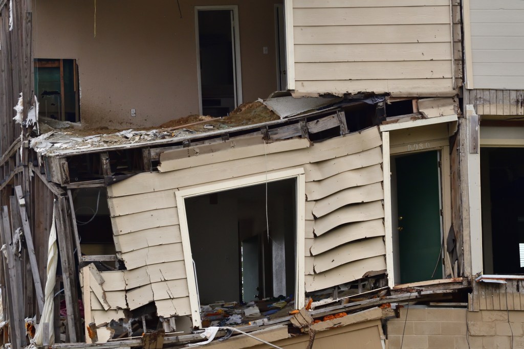
Rising floodwaters eventually claimed the lives of 15 people in the Kingwood area – 12 of them in a senior center more than a mile from the river.

Harvey was not a single day event. It lasted the better part of a week. Different areas fell to its driving rains and howling winds at different times.

The Lake Houston Area bore the brunt of not only the storm, but water funneled downstream from an area 50% larger than Harris County itself.

That included a massive 79,000 cubic feet per second from Lake Conroe, the largest release ever by the SJRA.

Before It Was All Over…
16,000 homes and 3,300 businesses in the Lake Houston Area flooded.

Damage included 44% of all businesses in the Lake Houston Chamber and 100% of all businesses in Kingwood’s Town Center.

Kingwood High School flooded to the second floor. Thousands of students would be bussed to another high school for a year.

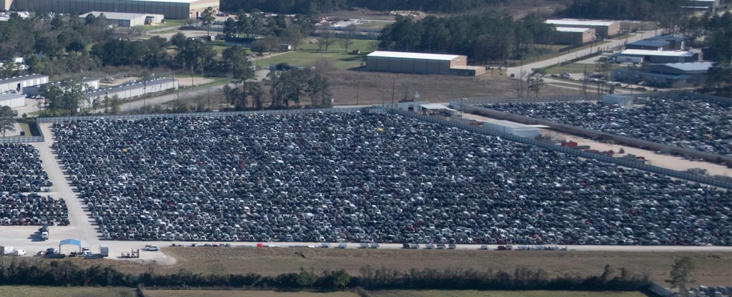
The flood also destroyed thousands of cars. The owners parked many of them on higher ground that they thought was safe.
Displaced families shuffled from one safe haven to another as the floodwaters spread.

Neighborhoods turned into islands, like lily pads, as rising water cut off evacuation routes for those who waited too long.

Raging currents damaged the West Lake Houston Parkway Bridge. They also wiped out the UnionPacific bridge which they had to completely rebuild.

Rushing floodwaters also destroyed the southbound US59 bridge.

TXDoT spent almost a year repairing the southbound lanes. Their supports were weakened by scouring.

Grocery stores? Restaurants? Gone. People lived on Igloo cooler cuisine, potato chips and granola bars.


Communications? Knocked out.
Electricity? Gone. For days or weeks in some cases. Gas stations couldn’t pump gas. Forget about air conditioning. People gutted homes in sweltering heat.

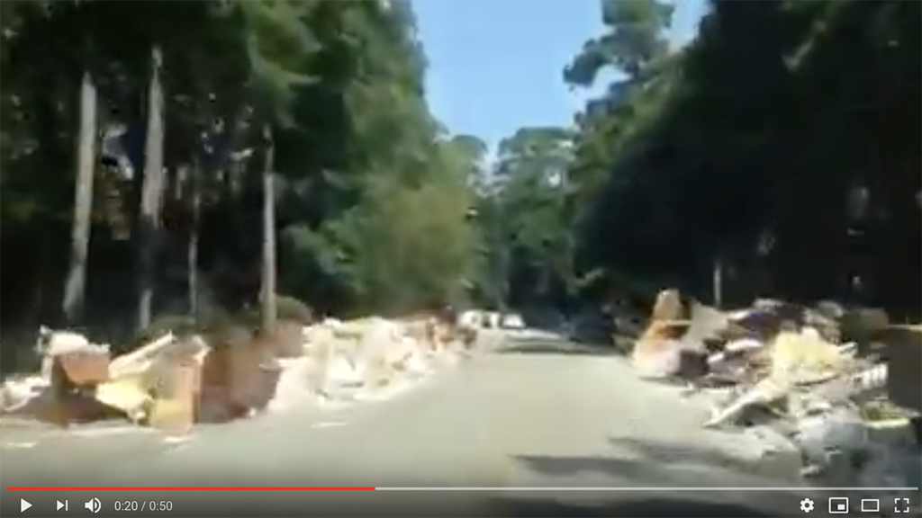
Mountains of discarded family treasures littered streets for weeks as looters pillaged the community.
Families lived in campers and RVs or with friends for months while restoring homes.


Troubles Just Beginning
But the hardest part was still to come: understanding why all this destruction happened and determining what could be done to prevent it from happening again. And finally, organizing politically to build the solutions.
We would soon discover that as much as we were united by disaster, we were also divided by recovery. That would become the dawn of a another disaster. But more on that in a future post.
For more on Harvey, see the Flood Control District’s full 32-page report on the storm.
Posted by Bob Rehak on 8/29/25 with thanks to the hundreds of people who have contributed pictures
2922 Days since Hurricane Harvey


