
Wastelands to Wetlands: A Vision for Restoring the San Jacinto West Fork
3/29/25 – Every time I fly over the San Jacinto West Fork, I wonder, “What would it take to transform all the wastelands to wetlands again?”

That burning question has guided much of my research for the last eight years. I don’t have all the details worked out, but I would like to share a vision for restoring the area’s:
- Natural beauty
- Recreational potential
- Ability to:
- Reduce flooding and sedimentation
- Attract economic development.
The restoration would be incremental and generational. It will not happen overnight. And the timing will, no doubt, depend on how much sand remains.
All the more reason for all parties to agree on a vision that can guide future restoration and redevelopment. So, let me propose a vision to start the debate and stimulate ideas. All of us are smarter than one of us.
The Vision
I would like to see a mile-wide, 20-mile long recreational area between I-45 and I-69 with lakes and ponds, all connected by hike-and-bike trails. It would be called the Montgomery County Lake District. And it would connect to the West Fork and Spring Creek Greenways.

Such an area would feature kayak launches and fishing piers. It would also feature covered pavilions, restrooms and parking lots in the higher elevations near the edges of the preserve.
Constructed wetlands would filter runoff from nearby developments.
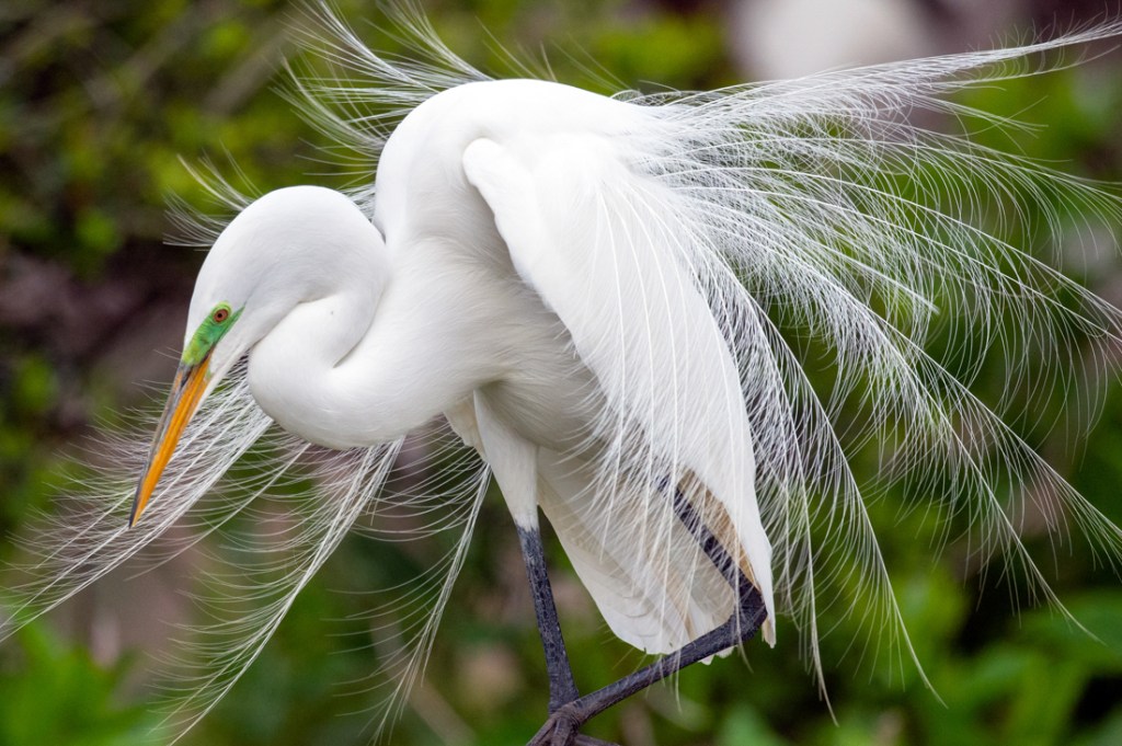
Islands in the larger lakes and ponds would attract birds and bird watchers, much like the Houston Audubon Society’s Smith Oaks Sanctuary in High Island.
The floodplains would be planted with native grasses, wildflowers, and flood-resilient trees such as willow and bald cypress.
Some of the pavilions might even have educational exhibits that explain about restoration efforts and the native wildlife.
To put this concept in perspective, Lake Houston Park – not far away on the East Fork – is already the largest urban nature park in North America. The area in the floodplains and floodway of the West Fork between 59 and 45 could be TWO TO THREE TIMES LARGER. Restoring and preserving it could draw national attention to Montgomery County and Houston as a role model.
What Would It Take?
From an exclusively physical point of view, turning old sand mines into sanctuaries would likely require the actions below. (I’ll discuss financial, permitting, legislative and other needs in future posts.)
With effort, the sand pits could be transformed into giant detention basins that hold hundreds, if not thousands, of acre feet of stormwater during floods. They could also intercept sediment carried downstream by the river during floods.
The design would likely incorporate overflow weirs to accommodate flood pulses.
For safety and flood resilience, we would need to regrade the pits. The edges should be shallow and gradual. Avoid sharp drop-offs that could challenge young swimmers or waders.
Gradual slopes also help with replanting native vegetation. We should use dense plantings of native trees and wildflowers to create visual buffers.
The area would also feature educational signage along trails to encourage outdoor activities, environmental awareness and collective action.
We should collectively buy and preserve any not-yet-spoiled land between the mines also, so trails can be continuous along the entire length of the river.
Make Miners Part of the Solution
Prior to a mine’s closing, miners should re-contour any high, steep pitwalls, overburden piles, or embankments. Slopes should not exceed a 2:1 (50%) grade, with gentler 3:1 slopes preferred to enhance stability and allow vegetation to take hold.
Avoid long, continuous slopes to reduce erosion and break them up with terraces to facilitate seeding and maintenance.
Where runoff concentrates, install lined channels or rock chutes to convey water safely downslope without gullying. Use riprap to protect outlets, dissipate energy and prevent scour.
As mines near the end of their producing life, begin revegetating all areas not occupied by water bodies. Reclaim the land progressively in phases, as production ends in one part of the mine and continues elsewhere. Prompt reclamation prevents abandoned pits from becoming illegal dump sites.
Mines need to demobilize all equipment and remove industrial materials, fuel tanks, maintenance shops, debris piles, etc. The final land surface should be free of trash, waste and equipment.

The goal: a stable site with self-sustaining vegetation, no significant sediment leaving the property, and no uncontrolled discharges into the West Fork or its tributaries.
All these recommendations are consistent with TCEQ Best Management Practices for Sand Mining in the San Jacinto Watershed and case studies from around the world.
Additional Efforts
A vision is just the glue that guides the efforts of many different parties as they work together to achieve common goals. Of course, creating such a transformation takes more than a vision. It takes sweat, money and leadership. So we also need to:
- Identify and Enroll Stakeholders
- Engage Engineers to Develop a Design
- Obtain Permits from Multiple Levels of Government
- Initiate Legislative Efforts to Create a Redevelopment Authority/District
- Raise Funds and Apply for Grants
- Provide for Ongoing Maintenance
I’ll discuss these additional topics in future posts to keep the length of this one manageable.
Please stay with me and share these posts with friends, families and neighbors. Also, please contribute your own ideas through the contact form of this website.
Together, we can turn sand into sanctuaries and wastelands into wetlands again.
Posted by Bob Rehak on 3/29/25
2769 Days since Hurricane Harvey
The thoughts expressed in this post represent opinions on matters of public concern and safety. They are protected by the First Amendment of the US Constitution and the Anti-SLAPP Statute of the Great State of Texas.

