Reduce Flooding - NOW!
Days since Harvey
i
Reduce Flooding
  • Home
  • News
  • Overview
  • Reports
  • Funding
  • Legislation
  • Sand Mining
  • Lake Lowering
  • Impacts
  • Links
  • Submissions
  • Gallery
  • Pic of Day
  • Contact
  • Click to open the search input field Click to open the search input field Search
  • Menu Menu

Photo of the Day 102

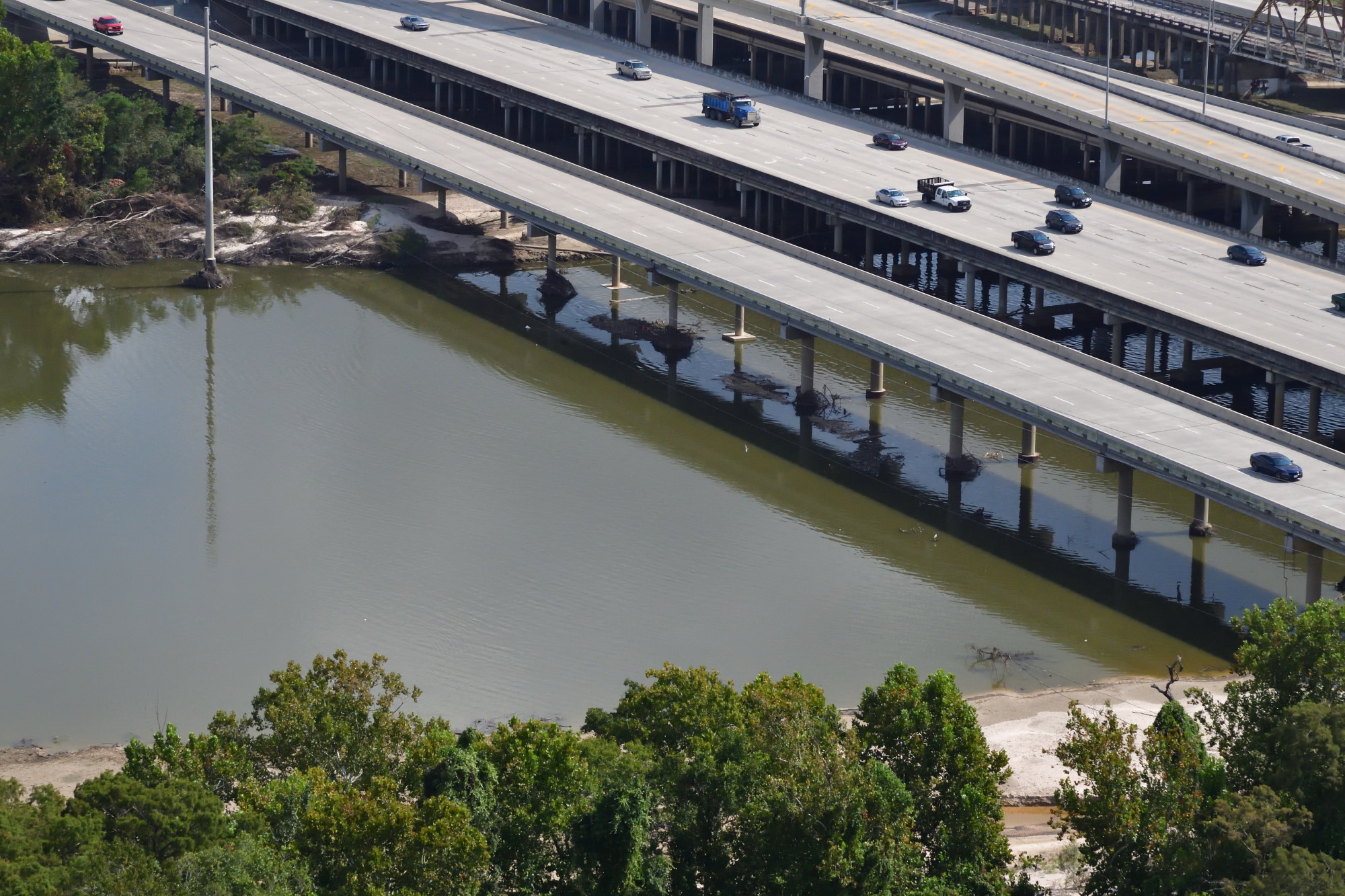
Hurricane Harvey left several feet of sand on both shores of the west fork of the San Jacinto River near US59. The supports for the southbound lanes (second from left), were undermined by the storm.

Share this entry
  • Share on Facebook
  • Share on X
  • Share on Pinterest
  • Share on LinkedIn
  • Share on Tumblr
  • Share on Vk
  • Share on Reddit
  • Share by Mail
0 0 admin admin2018-07-12 01:32:042018-07-10 07:32:31Photo of the Day 102
Link to: USGS Report on Peak Streamflows During Harvey Significantly Revises Flood Probabilities Link to: USGS Report on Peak Streamflows During Harvey Significantly Revises Flood Probabilities USGS Report on Peak Streamflows During Harvey Significantly Revises Flood P... Link to: Photo of the Day 103 Link to: Photo of the Day 103 Photo of the Day 103
Scroll to top Scroll to top Scroll to top