Tag Archive for: West fork san jacinto

Sand Mine Leaks Upstream from Blocked Drainage Ditch

Just upstream from the blocked drainage ditch at Northpark Drive and the San Jacinto West Fork, Hallett Materials operates the biggest sand mine between I-69 and I-45. The mine complex sprawls across several square miles and has several leaks. During the last flood in January, those leaks likely contributed to sedimentation in the West Fork and a blocked drainage ditch immediately downriver from the mine.

Blocked Northpark Ditch at West Fork
Contrary to a popular narrative among miners, this sand did not come from Spring Creek. That’s another watershed. Picture taken on 2/5/2024. The Hallett Mine is to the left (upstream) of the channel.
This picture of the blockage above shows the height of the sand relative to the top of the banks. Courtesy of a resident who prefers to remain anonymous.

Location of Mine Relative to Blockage

In late January, the West Fork experienced an estimated five-year flood after several days of nearly constant rains. Waking up after the flood was like a bad hangover. The blocked ditch above was just one of the problems. It is immediately downstream from the giant Hallett mine. See below.

Landsat image from Google Earth. Arrow shows direction of river’s flow. Circle shows location of blockage. Numbers show approximate location of leaks listed below.

Mine Leaks in Multiple Places

Let’s take a closer look at each of those three areas.

  1. One pond was wide open to the river through a large gap in its dike. The gap appears to have remained open since at least July 2023 and enlarged.
  2. A pipe was expelling water from a second pond straight into the river.
  3. A bulldozer appeared to have helped a third pond overflow across a road. Wastewater from the settling pond then flowed through woods and neighboring properties on its way to the river.

Pictures Taken on Feb. 8, 2024

Leak #1

Notice the huge gap in the dike of the pond in the center of the image below. Also notice that pond’s elevation compared to the one on the right.

The dike breach (center of image) first showed up in Google Earth in July 2023. It now appears considerably larger, indicating severe erosion from the recent flood.

The drought last summer and fall certainly didn’t cause the breach to enlarge.

Historical images in Google Earth show that this pond frequently breaches its dikes in different places. Something’s going through there!

Leak #2

A little farther downstream on the west side of the river, a pipe drains another Hallet pond directly into the river.

I photographed Hallett piping water into the river at this same location in 2020.
Leak #3:

Haven’t seen this before! On the east side of the river, in the woods next to Hallett’s main settling pond, a bulldozer apparently created a path for water to escape across a maintenance road. Water then flowed through woods 600-feet wide and onto neighboring properties before entering the river just above the blocked channel. See the series of images below.

Notice bulldozer tracks to left of perimeter road and wet area on road in the middle of the frame.

Flying closer, you can see that the bulldozer had pushed dirt from the road into the pond (see below, right side of frame).

Silty wastewater then escaped from the pond into the woods on the left.
The silty wastewater then migrated south (top of frame) through the woods.
Along the way, it invaded neighboring properties.
Then it drained back across the access road and into an abandoned mine (top of frame).

Hanover Estates now owns that abandoned mine. In the photo above, note the open path to the river in the upper right. It’s shown below in more detail.

Closer shot of wastewater exiting Hanover pond through another breach that leads straight to blockage (circled in red in the distance).

Apportioning the Relative Contribution of Different Sources

The Hallett mine owner told me that sand can’t escape his pits. I remain skeptical.

To be fair, some of the sediment in the channel blockage likely came from river-bank erosion and sand bars upstream.

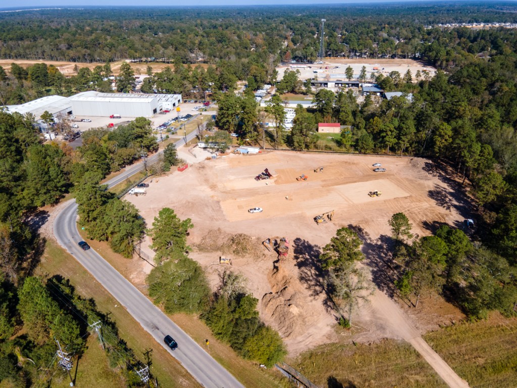
Also, a new development called Northpark South, now in the clearing stage, likely also contributed to the blockage. Silty stormwater flows unchecked from it into a second abandoned mine (also owned by Hanover Estates) and then into the blocked drainage ditch.

Northpark South, which drains into Northpark ditch is being built over wetlands.
Northpark South photo from January 24, 2024, looking south toward abandoned mine, blocked ditch and river in distance.

No one can say that Hallett and Northpark South contributed all of the material in the blockage. But it would be hard to pretend that none of it came from them.

The mine is still leaking two weeks after the flood!

And even before the flood, a giant ravine was sending stormwater from Northpark South into the second abandoned mine on the south side of the ditch.

ravine at Northpark South
Northpark South on December 28, 2023 before flood. Note ravine caused by erosion.

That mine drains into the blocked channel directly above the blockage. (See very first shot in this post.)

The SJRA, which is investigating sedimentation in the river basin, relies on a sediment gauge at I-45 – upstream from the mines and most of the new developments along the river. So they can’t really help sort out this issue.

The Calm After the Storm

Now that the immediate danger has passed, we need to investigate the contribution of mining and floodplain development to sedimentation.

When rivers and ditches fill up with sludge, it reduces conveyance.

Then, when the next flood comes, instead of water staying within the riverbanks, it may back up or overflow into living rooms.

The greatest area of deposition will normally be where floodwater slows down as it reaches a standing body of water like Lake Houston. We’ve seen what that led to.

Corporate waste-disposal practices are matters of public safety and concern. We need to examine them more closely.

If Hallett and/or the Northpark South developer wish to respond to this editorial, I will be happy to post their points of view.

Posted by Bob Rehak on 2/9/24

2355 Days since Hurricane Harvey

The thoughts expressed in this post represent opinions on matters of public concern and safety. They are protected by the First Amendment of the US Constitution and the Anti-SLAPP Statute of the Great State of Texas.

Humble ISD Clearing Site for New Ag Barn Far from West Fork Floodway

On November 6th, the Humble ISD (HISD) broke ground for its new 6.9-acre North Agricultural Science Center at the intersection of Ford Road and Mills Branch Road, opposite the entrance to North Kingwood Forest.

Artists Renderings of new HISD Agricultural Science Center between Porter and North Kingwood Forest. Courtesy of Humble ISD.

Replacement for Flooded Ag Barn Near Deer Ridge Park

The site lies less than a quarter mile south of the new Humble ISD north transportation center. And it’s within four miles of Kingwood and Kingwood Park High Schools.

The new ag center will replace the existing Kingwood Ag Barn located on Woodland Hills Drive at Deer Ridge Park. That facility flooded numerous times since it opened in 1995. The most extensive flooding happened during Hurricane Harvey in 2017.

Site of OLD ag barn location near Deer Ridge Park was in San Jacinto West Fork floodway (cross-hatched area). Source: FEMA National Flood Hazard Layer Viewer.

The new North Agricultural Science Center should eliminate worries of West Fork flooding due to its location on higher land. However, it is still near Mills Branch Creek which flooded Mills Branch Road during Imelda. See the flood map below.

Site of NEW ag barn where Mills Branch Road turns north into Ford Road in Porter. Yellow-green line is Harris/Montgomery County Line. The nearby floodway is for Mills Branch Creek.

Humble ISD received a FEMA grant of more than $8.8 million after the Kingwood Ag Barn flooded during Harvey.

“Hurricane Harvey flooded our current ag facility up to the rafters,” Dr. Elizabeth Fagen, Humble ISD superintendent, said. “Since that time, every time we see significant rain, our students are forced to evacuate a lot of animals to a separate ag facility.”

Aerial Photos

These photos show the new site being cleared on 11/19/2020. The first looks north toward the new HISD transportation center by the cell tower. That’s Ford Steel on the left and the northeast corner of Woodridge Village beyond that.

Site of new HISD Ag Science Center where Mills Branch Road (bottom left) turns into Ford Road (upper left) at county line.
Reverse shot looking south. Mills Branch Road on right with entrance to North Kingwood Forest in upper right. The triangular area opposite the entrance to NKF is a detention pond.

Dirt from the detention pond is apparently being used to build up the site slightly to elevate it above the Mills Branch floodplain.

Details of New Ag Science Center

The center measures 29,000 square feet. It will hold:

  • 70 pigs
  • 70 goats or lambs
  • 20 poultry and rabbit pens
  • 24 cattle.

The new center will also include a practice arena, teacher offices, restrooms, a designated turnout area, comprehensive security measures, and expanded parking.

Veterinary schools often make Ag or FFA experience in high school a condition of admissions.

Larkin Le Sueur, Career and Technical Education Director for Humble ISD, said, “This new facility will offer expanded space for students to interact with their animals and also expand FFA opportunities for our district.” 

The new center will cost $4.5 million to construct. HISD chose Stantec to design the project and DT Construction to build it. It will open in the 2021 school year.

Posted by Bob Rehak on 11/19/2020 with input from Humble ISD, Jeff Miller and Chris Bloch

1178 Days since Hurricane Harvey and 427 since Imelda

Close-Up Photos of Noxxe’s Devastation

The oil and gas company with the joke name (Exxon spelled backwards) is no joking matter. After flooding from Hurricane Harvey, Noxxe left a mile-long trail of devastation in Forest Cove for taxpayers to clean up. The company’s toxic legacy includes dozens of abandoned wells, toppled tanks, and twisted, rusting, ruptured pipes – all in the floodway of the San Jacinto River West Fork, which supplies drinking water to two million people.

Meeting with Texas Railroad Commission

After a series of posts on this subject, I received a call from the Texas Railroad Commission (TRRC). TRRC took control of Noxxe’s operation after the company went bankrupt in February.

Sign posted on entry to Noxxe lease

The Commission’s District Cleanup Coordinator invited me to tour the site with him and discuss the status of cleanup. There’s good news and bad.

Good News

  • Tanks have been drained of toxic chemicals.
  • Some wells have been plugged.
  • TRCC believes the oil spilled on the ground will degrade naturally.
  • A small check dam should keep oil-contaminated rainwater from washing into the river (except in floods).

Bad News

  • Many of the wells have NOT been plugged.
  • Oil has spilled on the ground.
  • Rusting, oil-covered equipment litters the property.
  • Legally, the state has no recourse against the company’s management or the property owners.
  • The State Comptroller’s Office has taken over bidding for cleanup jobs like this, but reportedly has no specialists in toxic waste cleanup.
  • The Comptroller’s Office has reportedly established an “approved vendor list” for these jobs, but the list doesn’t have enough vendors to handle all the work needed in the State.
  • TRRC has no budget to handle the Noxxe job and may not get it.
  • Thieves steal equipment with salvage value.
  • Brine (saltwater produced with oil and gas) has contaminated many parts of the site, killing vegetation.

Ground-Level Photos

These photos represent only a small portion of the site. But I’m sure you get the picture.

Editorial Opinion

Texas and Texans make their living from minerals. But left like this, those minerals may be the death of us, too. Noxxe has given a black eye to the entire oil and gas industry, which has thousands of reputable companies and millions of hard-working people in Texas.

Posted by Bob Rehak on 9/26/2020

1125 Days after Hurricane Harvey

The thoughts expressed in this post represent opinions on matters of public concern and safety. They are protected by the First Amendment of the US Constitution and the Anti-SLAPP Statute of the Great State of Texas.

Union Pacific Traffic Over San Jacinto West Fork Now Fully Back and Better

On my most recent flight down the San Jacinto West Fork, I was treated to a rare experience. Just as we flew over US59 heading east, what seemed like a mile-long train started to cross the new Union Pacific rail bridge. As we crossed over the train, the engineer saw me leaning out the door of the helicopter to grab the perfect shot. I think he knew we were documenting progress of the bridge. In salute, or maybe out of pride, he let out a massive blast from his giant air horn. Both the helicopter pilot and I broke out into huge smiles.

A Stirring Moment

It was a stirring moment for someone who has always admired trains. Railroads opened up this country, supported the growth of our cities, and still carry the much of the commerce of our nation on the backs of their rails.

Harvey destroyed the ancient Union Pacific bridge over the West Fork.

Shot taken on March 3, 2018, approximately six months after Harvey. Repairs on the old bridge were still in progress at that point.

But now UP is back. Bigger and better than ever. The sleek new bridge sports wider supports, designed to let fallen trees pass through in the next flood. That should eliminate backwater effects caused by logjams. Compare the “after” shot below.

May 11, 2020. The new UP bridge has wider supports to eliminate logjams in floods.

A Three-Year Project

The construction of the new bridge took almost three years.

  • First UP had to restore the old bridge to keep traffic flowing.
  • Then the company had to build a new bridge between the supports of the old bridge.
  • Finally, once the new supports were in, they had to remove the old ones.

All of that took a little less than a thousand days. And it was fascinating to watch. The result is a tribute to the genius of American engineering and know-how.

Second Major Mitigation Project to Be Completed in Area

This marks the completion of second major flood mitigation project in the Lake Houston Area. The first was TxD0T’s reconstruction of the US59/I69 bridge a few hundred yards to the west. That delayed hundreds of thousands of commuters for 11 months.

The train stretched almost a mile toward Kingwood Drive as it barreled southward. Hopefully, the new bridge may also help reduce train delays at major intersections.

Other Mitigation Projects Still in Development or Being Studied

Other major mitigation projects still in progress or development include:

  • West Fork dredging to restore conveyance and channel of the river
  • Additional floodgates for the Lake Houston Dam, to let water out faster
  • The search for suitable upstream detention to help hold back water during floods
  • Multiple ditch repairs throughout the area
  • Drainage studies throughout the San Jacinto River Basin that will undoubtedly lead to additional mitigation projects

Posted by Bob Rehak on 5/26/2020 with gratitude to the men and women of Union Pacific

1001 Days after Hurricane Harvey