Reservoir Coordination Still Elusive After 53 Years
4/6/26 – One of the biggest “lessons learned” from Harvey is that coordinated Joint Reservoir Operations are crucial. The San Jacinto River Basin has two reservoirs controlled by dams. But coordinating their operation to reduce flooding remains elusive after 53 years.
The San Jacinto River Authority (SJRA) finished the Lake Conroe dam in 1973, but is still seeking public input on its Joint Reservoir Operations Study. They hope to have a first draft of the study by the end of 2026.
Benefits of Reservoir Coordination
Other authorities around the world have long recognized the benefits of coordinating the operations of multiple dams on their rivers. Benefits include:
- Enhanced flood control and mitigation – By acting in tandem, dams can reduce flood peaks more efficiently than isolated dams.
- Improved water security and drought resilience – Coordinated dam systems can manage water storage across a basin to alleviate water stress during dry seasons.
- Reduced sediment transport – Tandem operation can reduce peak flows that cause heavy erosion, clogging rivers and downstream lakes.
- Increased hydropower generation – Although not a factor in the San Jacinto Basin, coordinated operations allow water to be used multiple times as it passes through a series of dams, exponentially increasing total energy output from the same water resource.
- Environmental sustainability – Strategic releases of water can sustain downstream ecosystems, habitats, and species, as seen in the U.S. Sustainable Rivers Program.
- Improved navigation and trade – A system of coordinated locks and dams can regulate river flow consistently, facilitating the transport of goods via barges and promoting regional economic development.
- Water security – Upstream dams can supplement the water supply in downstream dams that may support major metropolitan areas. Lake Conroe, for instance, provides backup to the smaller Lake Houston, which is the primary water supply for more than 2 million people.
River Authorities that Manage Multiple Dams for Flood Control
Examples of coordinated management abound. Take for instance:
- In Texas, the Lower Colorado River Authority (LCRA) provides a textbook example of coordinated dam management for flood control through the Highland Lakes system. The LCRA manages a “staircase” of six dams northwest of Austin. All six assist with flood mitigation. They operate as an integrated unit to protect downstream communities.
- Tennessee Valley Authority manages a network of 9 main-river dams and 22 tributary dams. The system is designed to catch heavy runoff in tributary reservoirs before it reaches the main river, significantly reducing flood risks for downstream cities like Chattanooga. The TVA operates these dams as a single unit. That way, they also ensure a consistent water depth of at least 11 feet along the entire 652-mile main channel. That lets 28,000 barges transport goods annually.
- The Columbia River System (CRS) consists of 14 federal dam projects managed as a coordinated system for power, flood control, and fish protection.
- California Department of Water Resources found that “weather-informed reservoir operations” at Lake Oroville and New Bullards Bar Reservoir can further reduce flood risk for communities along the Yuba and Feather rivers during extreme atmospheric river storm events and potentially benefit water supply during drier periods.
- In the Delaware River Basin, a “flexible flow management program” mitigates flooding impacts immediately downstream of reservoirs.
Two Key Houston-Area Reservoirs Have Different Missions, Management
So, why can’t the SJRA manage two dams?
For one thing, SJRA only controls Lake Conroe. The Coastal Water Authority controls Lake Houston.
For another, the two dams have slightly different goals and radically different construction.
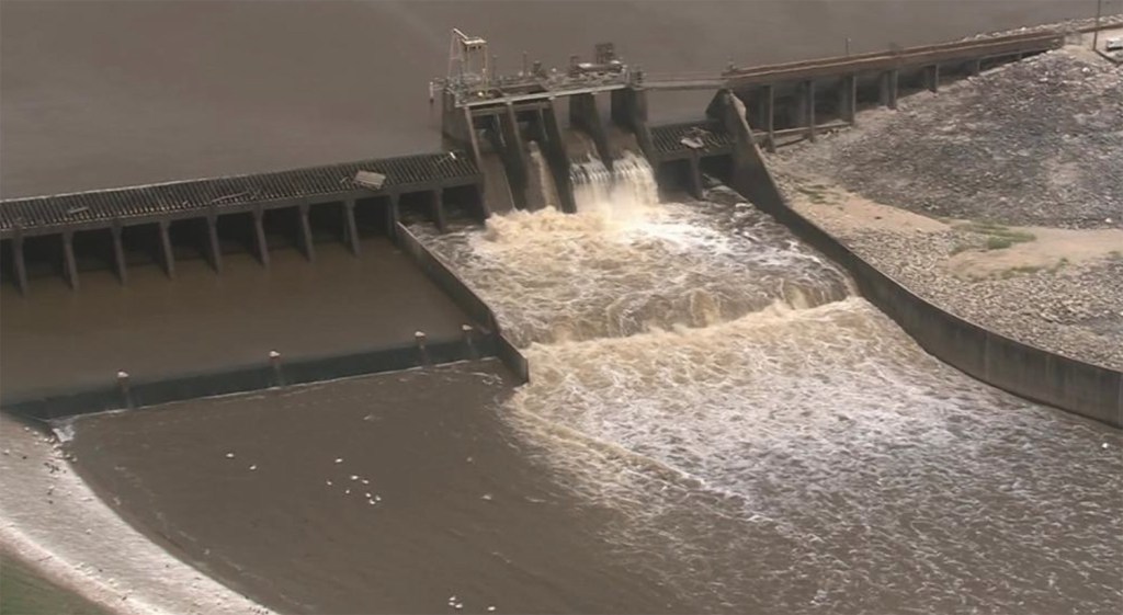
- Lake Conroe was conceived as a water supply and flood control reservoir (even though SJRA now claims Lake Conroe is strictly for water supply). Lake Conroe’s tainter gates can release 150,000 CFS.
- Lake Houston, on the other hand, is primarily for water supply. It has limited flood control capability because of its fixed height spillway. Lake Houston has only four small gates with a combined release capacity of 10,000 cubic feet per second (CFS).
Engineers are currently studying ways to add more and bigger tainter gates to Lake Houston. The current plan under study would boost the release rate to 78,000 CFS, thus matching the highest release rate ever from Lake Conroe (during Harvey). That would enable better coordination between the dams.
Why It Matters
Timing of releases can materially affect downstream flooding in a densely developed floodplain. During Harvey, a wall of water 11 feet high was going over the Lake Houston spillway. 16,000 homes and 3300 businesses behind the dam flooded. It backed water up for miles. Lake Houston’s Dam had 5X more water going over it than Niagra Falls usually does – enough to fill NRG Stadium in 3.5 minutes – 425,000 CFS.

Twenty percent of all homes and forty percent of all businesses in the area were affected.
Lake Houston Area Flood Task Force
Getting the water out faster is crucial. But it must be done safely. In a way that doesn’t hurt downstream interests.
While Coastal Water Authority figures out how to add more gates, SJRA is building a forecasting tool for the entire watershed that has the potential to:
- Improve coordination between the dams
- Inform decisions about pre-releases and gate operations
- Enhance emergency management
For More Information
See SJRA’s presentation at the Humble Civic Center on 3/5/26 for more on Joint Reservoir Operations.
See ReduceFlooding’s new Lessons page for more “lessons learned” about flooding. It’s my attempt to distill my most important findings from more than 3000 posts since Harvey.
Posted by Bob Rehak on 4/6/26
3142 Days since Hurricane Harvey
The thoughts expressed in this post represent opinions on matters of public concern and safety. They are protected by the First Amendment of the US Constitution and the Anti-SLAPP Statute of the Great State of Texas.