HCFCD Report Puts May 2024 Flood in Historical Perspective
A report issued by Harris County’s Meteorologist Jeff Lindner puts the May 2024 flood into historical perspective.
Significant flooding occurred along the West and East Forks of the San Jacinto River as well as the lower San Jacinto River below Lake Houston.
While rainfall occurred over a 7-day period, the most intense rainfall in Harris County fell on Thursday, May 2nd. Lindner’s report starts by covering the rainfall totals and intensity during different lengths of time. Then, he discusses the resulting flood heights and impacts.

Total Rainfall in 7-Day Period
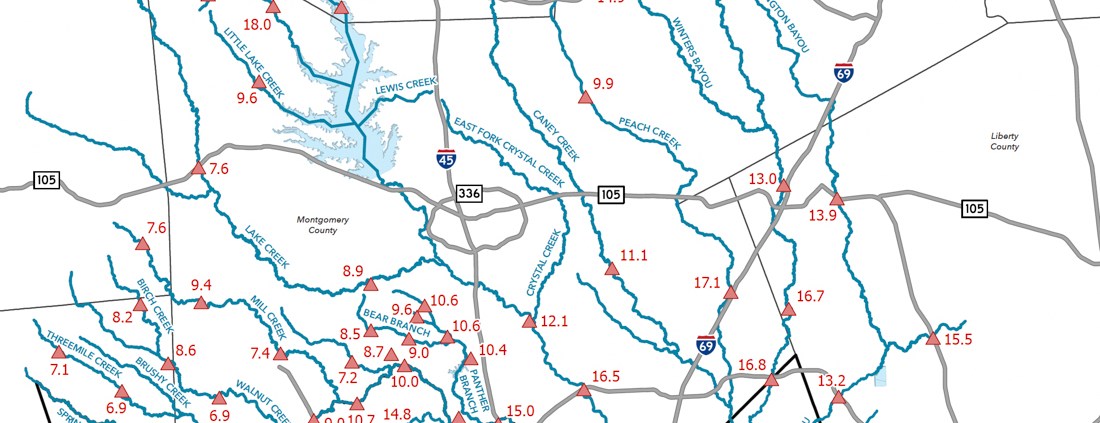
Total rainfall amounts for the seven-day period averaged 10.0-17.0 inches across the extreme northern and northeastern portions of Harris County. Southern and central Montgomery County were also affected as well as northern Liberty County.
A maximum 7-day rainfall of 16.8 inches was recorded on the East Fork of the San Jacinto River at FM 1485.
The table below indicates maximum rainfall for Harris County gages.

Using Atlas-14 Rainfall Exceedance Probability Tables, Lindner says rainfall during the 7-day time period ranged from:
- 5- to 10-year events on the San Jacinto West and East Forks as well as below Lake Houston
- 2- to 5-year events on Cedar Bayou.
- 2- to 10-year events along Luce Bayou.
Maximum 2-Day and 3-Hour Rainfall Totals
The max rainfall for those same watersheds during the peak 48-hours ranged from 2- to 10-year events.
During the peak 3-hour time period, however, gages on Willow Creek, Spring Creek, Luce Bayou, Cedar Bayou, and the San Jacinto recorded 25- to 50-year rains. The short, high-intensity rains resulted in deep street and flash flooding.
North of Harris County, the rainfall got much more intense.
Locations of Heaviest Rainfall
The majority of the heavy to excessive rainfall occurred across areas north and northeast of Harris County. This was across the headwaters of the West and East Forks of the San Jacinto River, Luce Bayou, and Lake Creek.
Rainfall amounts over the 7-day period averaged 15.0-18.0 inches over southern Walker and northern Montgomery County which drain into Lake Conroe. They averaged 15.0-20.0 inches across eastern Walker County, northern Montgomery County, and San Jacinto County which drain into the East Fork of the San Jacinto River.
“No two storm events are exactly the same with respect to the location, duration, and maximum totals of rainfall.”
Jeff Lindner, Harris County Meteorologist
Comparisons with Other Storms
The May 2024 rainfall had some similarities to the October 1994 flood. Nearly 30 inches fell across Lake Creek and the northwest portions of the Spring Creek watersheds in 1994. In 2024, the highest totals occurred farther to the north – from north of Lake Conroe to northwest of Lake Livingston.
In those locations, the rainfall exceeded 1994. That resulted in near record inflows for both Lake Conroe and Lake Livingston.

Flooding in Historical Perspective
Rainfall is only a starting point when investigating flooding. You must also look at rainfall distribution, intensity, longevity, previous heavy rainfall, ground saturation, already swollen watersheds, and convergence of peak flows.
Much of the upper portions of the San Jacinto basin stretch across parts of Montgomery, Walker, and San Jacinto Counties. In April, they experienced rainfall 150% to 500% above normal.
Rainfall on April 28th-29th primed already wet soils for maximum run-off. Then, those same areas received additional excessive rainfall on May 1st-2nd. The second episode generated widespread and significant flash flooding and run-off into the rivers and creeks that drain to Lake Houston.
Second Highest Peak on East Fork
The East Fork exceeded the expected elevation of a 500-year storm. At FM1485, only Harvey exceeded the May peak.

Five-hundred year flooding on a 20-year rain resulted when peaks from different rounds of rainfall piled on top of each other from different watersheds.
Fifth Highest Peak on West Fork
West Fork flooding was less extreme. This was the fifth highest flooding on the West Fork since 1994. The May flood qualified as a 10- to 50-year storm based on gage readings at US59.

Fourth Highest Peak at Lake Houston Dam
The height of water going over the spillway at the Lake Houston Dam was the 4th highest peak since 1979.
Downstream at Highway 90, residents saw the 9th highest peak since 1979. Downstream areas saw between a 10-year and 50-year flood.
Third Highest Volume of Stormwater Flowing Into Lake Houston
The table below summarizes volumes of water in cubic feet per second flowing into Lake Houston from the various watersheds during different storms. This May’s event was the 3rd highest total since 1994. Only Harvey and October 1994 surpassed it.

House Flooding Estimates
Flood depths ranged from 6 inches to several feet in some of the lowest lying homes. The damage numbers below apply only to Harris County. The numbers were supplied by City of Houston and Harris County Engineering.
- 20 homes flooded with an additional 16 having water in sheds, garages, or other non-living areas on the West Fork.
- 32 homes flooded with an additional 8 having water water in non-living areas on the East Fork.
Upstream, the flood damage in Montgomery and Liberty Counties was much greater. However, I do not have final totals for those areas yet.
Maps, Tables Galore
Lindner’s report also includes 15 pages of rainfall intensity maps and tables for different watersheds and gages. It’s a treasure trove of information including high water marks. Click here for the full report. For future reference, that’s under the link to the Major Storms tab on the Reports Page. You can compare full reports on other storms there.
Many thanks to Jeff Lindner and his team. They keep hundreds of gages around Harris Country watersheds working to provide timely, life-saving information via the Harris County Flood Warning System.
Posted by Bob Rehak on 5/15/24
2451 Days since Hurricane Harvey


