
Why So Much Flood Damage?
Part 1 of a three part series – We can’t stop flooding because we can’t control rainfall. But we can control flood damage – by regulating where and how we build. So, why do we experience so much flood damage?
If our scientific and regulatory systems always worked, homes would never flood. But they do flood. Why? Root causes include:
- Inaccurate predictions of future rainfall
- Conflicting standards and building codes
- Building too close to threats
- Upstream changes that undermine downstream assumptions
- Difficulty of adapting to those changes downstream
- Historical unwillingness to fund flood mitigation at meaningful levels
To keep this post from getting too long, I’ll consider the first three today, the second three tomorrow, and what we can do about them after that.
Inaccurate Predictions of Future Rainfall
Drainage studies start with worst-case rainfall estimates. When engineers design a community, these estimates form the design basis for:
- Channels
- Detention basins
- Subdivisions
- Building codes
- Drainage
- Roads
How much rain you predict determines how wide the channels need to be, how high buildings should be elevated, etc.

Worst-case estimates are based on a branch of mathematics called Extreme Value Analysis (EVA).
By definition, EVA uses extremely small data sets. That limits their reliability.
EVA has one other huge limitation. It assumes stationary, underlying processes. And many believe climate is changing.

So, estimates get updated periodically – especially after major storms such as Tropical Storm Allison in 2001 or Hurricane Harvey in 2017. A 1,000-year storm before Harvey is now considered a 100-year storm! But some areas still use estimates from the 1980s. As a result…
The margin of safety you thought you had when you bought your home may not exist today.
To add to the confusion, different areas within a watershed may use different rainfall probabilities. Right now, engineers throughout the region are designing subdivisions that appear to be outside of floodplains but actually are inside of them.
That’s because of inconsistent adoption of new rainfall probabilities. Some areas use lower standards as a way to attract new development. It’s a competitive tool that reduces developer’s costs.
As if the hodgepodge of standards weren’t complex enough for elected officials, regulators, engineers and residents to understand, the environment around us is constantly changing. The population of the Houston region grew 75% since 2000.
Our drainage systems are designed, built and maintained in pieces. At different times. By different people. Using different assumptions, rules, budgets and goals.
Conflicting Standards, Building Codes and Enforcement
That makes it difficult for engineers designing a new subdivision to know what to do.
But a standard has evolved in the industry called “no adverse impact.” The idea: a new development should not cause flood peaks to rise higher or faster downstream.
Engineers estimate adverse impacts by comparing pre- and post-development runoff rates, and recommending flood-mitigation measures such as stormwater detention basins to compensate for any increase in runoff caused by developments. They don’t always get it right.
In addition to the uncertainty discussed above:
- Local officials may not want to adopt new higher standards because it could make them less attractive to developers and reducing tax revenue.
- Contractors may not always build what engineers designed or regulations specify.
- Local regulators may not have the staff to monitor compliance with regulations.
- Business people rarely go beyond the minimum that regulations specify because it raises their costs.
- A few may cut corners by falsifying drainage studies to reduce their costs.
Whatever the reason(s), consequences can be devastating.

Even when regulations agree between different jurisdictions, outcomes may differ radically. Harris and Liberty Counties, for instance, have virtually identical regulations for the construction of drainage ditches. The regulations are designed to reduce erosion that can, in turn, reduce the conveyance of rivers downstream.

In the example above, the 3-mile long ditch on the right has expanded almost 80 feet between 2017 and 2023.

All that erosion contributed to the formation of a 4,000-foot sand bar where the San Jacinto East Fork meets Lake Houston. Sediment drops out of suspension where water slows down as it meets a standing body of water.

We frequently see similar runoff from sand mines and developments in Montgomery County.

Such sedimentation reduces conveyance at unnatural (accelerated) rates and creates blockages in the river.

Sixteen thousand homes and 3,300 businesses flooded in the Lake Houston Area, according to the Lake Houston Chamber.
Sedimentation is a maintenance issue everywhere at every scale. The montage below shows representative images of roadside ditches in Harris County that have filled in. During storms, blocked storm pipes trap water in neighborhoods.

In 2009, Harris County revised its floodplain development standards. The new code affected things such as:
- Elevation above the 100-year floodplain
- Acceptable foundation types in flood- hazard areas
- Building in floodways including width, depth, bracing and other requirements for piers
- Where fill can and cannot be used
- Detention pond requirements
- Wind resistance
- Elevation above street level
After Harvey, Harris County Engineering compared damage found in subdivisions built before and after the new standards.
Subdivisions built with the updated standards experienced one twentieth the amount of damage.
However, “grandfathering” of new developments under older regulations often contributes to insufficient mitigation that can affect property owners downstream. For instance, one recently completed 77-acre RV park in the Kingwood area has a detention basin that holds half the stormwater required by new regulations, even though it was built after they went into effect.
Building, Buying Too Close to Threats
The goal of many engineering studies is to build “safely” near water. What do you have to do to protect a family from a hundred-year flood?
These scientific-looking studies are incomprehensible to most people. Yet the engineering seals on them create a sense of security. So does the availability of nationally subsidized flood insurance.
Given those reassurances and given that some people will pay a premium to live near water despite the threats, some developers push the envelope into areas prone to flooding. That’s how we get high-density development in floodplains.

Similarly, some developers pave over wetlands and ponds that are nature’s stormwater detention systems.


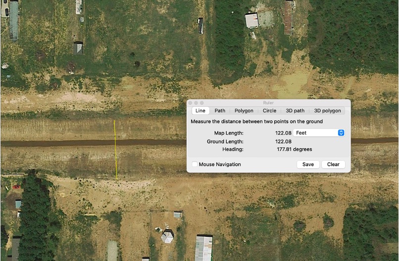
Loss of these wetlands reduces floodwater storage. Before development, this area was a 10-year flood zone.
It’s sometimes possible to fix flood threats after the fact. But building on properties like you see here leaves little room for mitigation.
More to Follow
Come back tomorrow when I’ll elaborate on three more root causes of flood damage.
- Upstream changes that undermine downstream assumptions
- Difficulty of adapting to those changes downstream
- Historical unwillingness to fund flood mitigation at meaningful levels
Posted by Bob Rehak on 11/19/23
2273 Days since Hurricane Harvey
The thoughts expressed in this post represent opinions on matters of public concern and safety. They are protected by the First Amendment of the US Constitution and the Anti-SLAPP Statute of the Great State of Texas.


