
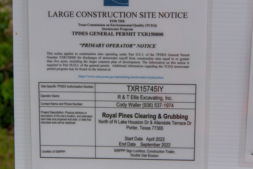
Royal Pines Goes Pineless
About a month after it began, the developers of Royal Pines have cleared a swath of trees about 1,000 feet wide and a half mile long.
Photos Taken 5/15/22


Clearing Started Before Permits Issued

Plans Show 80+ Homes in Pre-Atlas 14 Floodplain
The following links will show you the general plan and layouts for the first three sections:
- General Plan (202 acres)
- Section 1 Plan (100 lots on 17.1 acres)
- Section 2 Plan (56 lots on 13.2 acres)
- Section 3 Plan (105 lots on 18 acres)
Note the dotted lines that snake their way through the top of the development. Those represent the 100- and 500-year floodplains.

Notice how a large part of the development is in “Zone X (Shaded).” That’s the area between the limits of the base flood (100-year or 1% annual chance) and the 0.2-percent-annual-chance (or 500-year) flood. I counted more than 80 homes in that zone. I also see six inside the 100-year zone.
Keep in mind that these flood zones are based on pre-Atlas 14 estimates. FEMA shows this area was last mapped in 2014. When FEMA approves new flood maps in the next few years, those zones will expand to take in more of the subdivision.
The subdivision at buildout will comprise more than the three sections. Houston Business Journal said Royal Pines will ultimately feature between 350 and 450 homes targeted at first-time home buyers.
Posted by Bob Rehak on 5/15/2022
1720 Days since Hurricane Harvey
The thoughts expressed in this post represent opinions on matters of public concern and safety. They are protected by the First Amendment of the US Constitution and the Anti-SLAPP Statute of the Great State of Texas.


