
Update: Lake Conroe Holding Steady, Lake Houston Rising, East Fork Expected to Rise 10 Feet in Next 24 Hours
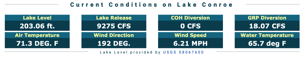
Last night’s storms in the Houston area did not drop as much rain as the previous night. As a result, the SJRA is holding the level of Lake Conroe steady by releasing 9270 cubic feet per second.
However, the level of Lake Houston has risen from 42.85 last evening to 43.46 this morning. That’s a rise of .61 feet or 7.32 inches overnight. And it could get worse as more water works its way down the East Fork, Spring Creek and Cypress Creek.

To Get Whole Picture, Look Upstream in All Directions
Flooding upstream affects the level of Lake Houston. For instance, tributaries of Spring and Cypress Creeks have been flooding. So has Caney Creek. And the East Fork San Jacinto River is expected to crest above flood stage later today. This map from Harris County Flood Warning System shows the problem areas where people need to remain alert.

For instance, look at this.
The hydrographic for the San Jacinto East Fork near FM2090 shows the river could rise 10 feet in the next 24 hours!
National Weather Service

Jeff Lindner, Harris County Meteorologist says, “The East Fork is rising quickly this morning and will exceed flood stage this afternoon and rise to moderate flood levels late tonight into early Monday. At the current forecast levels widespread low land flooding is expected downstream of the gages at both Plum Grove and FM 1485 (New Caney). At the forecasted levels FM 1485 is likely to be inundated with water west of the bridge crossing and become impassable. The river is forecast to fall below flood stage Wednesday or Thursday.

About the West Fork San Jacinto, Lindner says, “The river is rising this morning mainly from inflow from both Spring and Lake Creeks. The river is forecasted to rise to near flood stage early Monday and hold around flood stage for a couple of days before falling around mid week.” Starting early Monday, Lindner expects minor low land flooding near the rise with possible impacts to roads on the north side of the river and east of US 59 as well as the US 59 turn-arounds.
Remain Cautious
Put it all together and the message is “Caution,” especially if you live near one of those gages colored red or yellow. But at this time, authorities have predicted no widespread flooding in the Lake Houston Area.
The SJRA posted a situational update for Lake Conroe as of 9 a.m. on Sunday morning, May 2, 2021. The SJRA notice says: “Water level at Lake Conroe is beginning to decrease. With no additional rain in the forecast today, SJRA and MoCo Constable Precinct 1 will continue to monitor lake level and open Lake Conroe as soon as it is safe to do so. Reservoir releases are holding steady and not expected to increase. The Constable’s office urges boaters to tie up their vessels to assist with boating safety. If you find your boat is missing, contact the Sheriff’s office non-emergency line 936-760-5800. We will provide another update Sunday afternoon. Real time lake conditions available below.”
The SJRA closed Lake Conroe to boaters Saturday, when the lake rose two feet overnight from Friday.
How Close Was It?
These pictures taken by a Lake Conroe resident on Sunday morning show what a close call some residents there had.

In reference to the fact that SJRA had lowered the lake one foot in April as part of its seasonal policy, the resident who took these pictures said…
“Think what an extra foot would have done to that homeowner.”
Lake Conroe resident
That extra foot gave the homeowner the buffer needed to avoid flooding.

Rainfall Totals for Last Two Waves of Thunderstorms
This rainfall map from the Harris County Flood Warning System shows the 9-day totals for all gages in the Houston region. The 9-days include the storm that wiped out the 1-foot buffer that the SJRA created when it lowered Lake Conroe beginning in April. Note how the northwest portion of the region received the most rain…two to four times the amounts shown on Lake Houston Area gages.

As wet as it has been for the last several days, we lucked out compared to our neighbors to the northwest.
The sun is shining. At least for now. More thunderstorms predicted for Tuesday. I’m going out NOW to take my dog for a slosh. While I can.
Posted by Bob Rehak on 5/2/21 at 10am based on info provided by SJRA, HCFCD, Coastal Water Authority, NWS and Lake Conroe residents
1342 Days since Hurricane Harvey

