Heavy Rainfall Update and Flash Flood WARNING
The NWS has issued a flash flood warning for portions of northwest Harris County. Showers and thunderstorms have developed overnight in a SSW to NNE band over the region along a line from near Huntsville to Matagorda Bay. Storms will continue to develop and train in this band for the next several hours.
Thus far, rainfall rates of 1-2 per an hour have been observed both on radar and real time gages with storm totals upwards of 4.0-5.0 inches from Huntsville to Trinity.
Air mass is extremely moist and is capable of producing rainfall rates of 2-3 inches per hour. Street flooding will be a concern this morning for the morning rush hours.
Jeff Lindner, Harris County Meteorologist
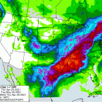
The NWS has upgraded portions of SE TX into a moderate risk for flash flooding today (see below).

As of 6:01am, the NWS has also issued a Flash Flood WARNING for extreme NW Harris County, northern Waller County and W/NW Montgomery County until 900am.

Types of Flood Risks
A line of training excessive rainfall extends from near Hempstead to NW of Lake Conroe. HCFCD gages in N Waller County have recorded over 3.0 inches in the last 1-hr and an additional 2-3 inches will be possible yielding short term rainfall amounts of 4-5 inches in an hour or two. Even with dry grounds, this rainfall rate will convert quickly to run-off resulting in flash flooding.
This band of heavy rainfall will very slowly progress south and east with time this morning. Heavy rainfall move from western and northwest Harris County into NE and central Harris County.
Significant street flooding and flash flooding will be possible with these kind of rainfall rates along with rapid rises on creeks and bayous.
Most storm sewers in the Houston area are designed to handle 1 to 2 inches per hour. My rain gage received 1.2 inches in the last 20 minutes.
Band of heavy rainfall is progressing southward into northern and northeast Harris County.
HCFCD gages along FM 1960 near I-45 have recorded 1.0 inch in 15 minutes recently with hourly rates of 2-3 inches possible from Spring to Kingwood to Huffman. This band will slowly build southward into Aldine, Crosby, and Baytown over the next 1-2 hours.
Rainfall amounts of 4-5 inches over northern Waller County have generated significant rises on the creeks that feed into upper Spring Creek. A significant rise on upper Spring Creek from the headwaters to east of Hegar Rd is likely late this morning. Some impacts may be possible at Field Store Rd and other low lying road crossings on the upper portion of Spring Creek. No widespread significant flooding of upper Spring Creek is currently expected.
Street flooding is the main threat.
The SJRA has increased the volume of its release from Lake Conroe to 1590 cubic feet per second as of 7am. Despite that, the level of the lake is up to 201.68 feet. 201 is the normal target.
Be prepared for heavy, intermittent rains lasting all day today, tomorrow and into Sunday morning.
Posted by Bob Rehak on 4/30/2021 at 7:30am, based on information from the NWS and Harris County’s Meteorologist Jeff Lindner
1340 Days since Hurricane Harvey