Remember Uncertainty With Marco, Laura; It’s Why We Need More, Bigger Gates on Lake Houston
Many anxious flood victims worry openly on social media about about the possibility of flooding by back-to-back tropical events. Should we lower Lake Conroe? Is it too late? Will we flood again? Why aren’t they releasing water?
The novelty of having two tropical storms in the Gulf simultaneously has added a high degree of uncertainty to weather forecasting at the moment. The forecast tracks, intensities and dangers of Marco and Laura seem to change every few hours.
This is precisely why we need more and bigger flood gates on Lake Houston.
By the time we are certain what will happen with these storms, it will likely be too late to release water if we need to.
The bewildering multitude of competing weather forecast models complicates matters. They show landfall anywhere from Corpus Christi to the Mississippi just two days before the storms’ arrival. It reminds me of a fortune cookie I once got. It said, “A man with two clocks never knows what time it is.”

Marco Weakening Before Making Landfall
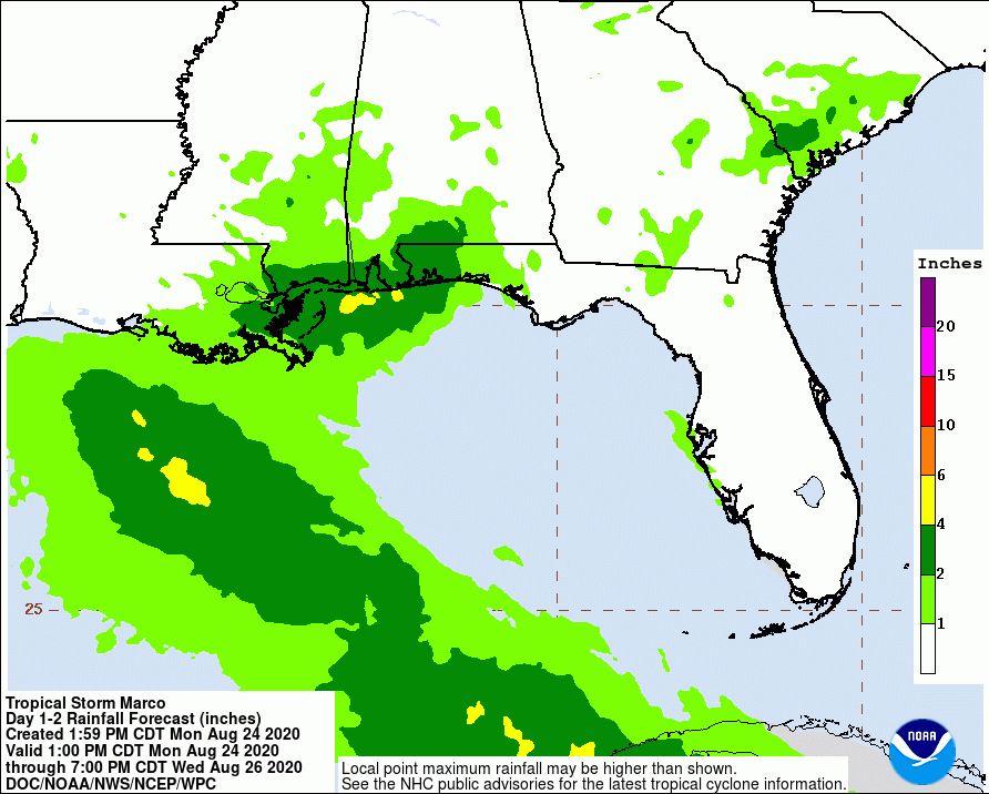
Since this morning, the cone of uncertainty for Marco has shifted inland again and the storm has been downgraded to a tropical depression. The only coastal watches or warnings remaining in effect have to do with Laura which will follow Marco later this week. (See more below.)

The National Hurricane Center shows only a slight chance of flash flooding for the areas hit directly by Marco and those are far east of us. Rainfall potential from Marco through Wednesday evening for the Houston Area is less than an inch, according to the latest NHC predictions.

At 1 p.m. Monday, the NHC issued an advisory stating that, “It is reasonable to assume that sustained tropical storm force winds will no longer reach the northern Gulf coast. Therefore, all wind and surge warnings for the Gulf coast associated with Marco have been discontinued.”
Laura Remains Potent Threat
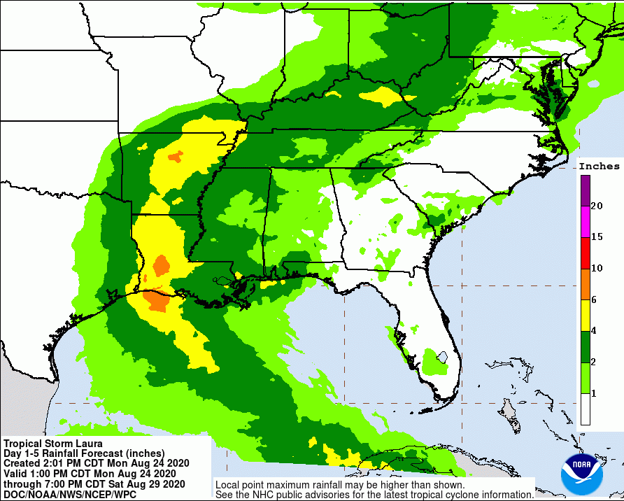
Even though Laura’s cone of uncertainty has shifted slightly east today, the Houston Area remains on the western edge of the cone.

At the moment, NHC predicts Laura will bring Houston 2-4 inches of rain, and the Lake Conroe area less than 2.

That’s enough to raise the chance of flash flooding to 5-10%.

Laura’s maximum sustained winds are near 60 mph with higher gusts. NHC predicts little change in Laura’s strength today, but predicts the storm will strengthen when it moves into the Gulf of Mexico. They foreast Laura will become a hurricane on Tuesday, with additional strengthening on Wednesday. Tropical-storm-force winds currently extend outward up to 175 miles, primarily to the northeast and east of the center. As Laura approaches the Gulf Coast, swells will cause life-threatening surf and rip-current conditions.
Tropical storm force winds should reach the Texas coast between 8 a.m. and p.m. on Wednesday. Most of the Houston Area will have a 40-50% chance of experiencing winds greater than 39 mph.
Alert Houston has just issued the following notice:
“The National Weather Service has issued a Tropical Storm Watch for Houston. Coastal portions of the city are also under a Storm Surge Watch. Although the exact track and intensity of Laura is still unknown, Houston residents should pay close attention and begin taking steps in the event an emergency situation develops.”
Jeff Lindner, Harris County Meteorologist, put a finer point on it. “Tropical storm force winds are likely along and east of I-45 with sustained winds of 35-45mph across portions of Galveston, Harris, Montgomery and Walker Counties. Strong winds of 45-55mph will be possible across Chambers, Liberty, San Jacinto, Polk, and Trinity Counties. It is possible that near hurricane conditions could scrape close to eastern Chambers and eastern Liberty counties.”
To Lower or Not to Lower, That is the Question
So with:
- People panicking
- Forecasts changing hourly
- Lake Conroe Association restocking its war chest
- Wildfires burning up the west
- Drought spreading into parts of Texas
- The Nation’s foremost hurricane experts predicting only 1-2 inches of rain for Lake Conroe and 2-4 for Lake Houston…
…what do you do? Order the lakes lowered or keep them where they are?

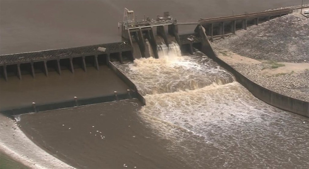
The answer is obvious. You enlarge the discharge capacity of Lake Houston by adding more and bigger gates to the spillway.

Lake Conroe can release water 15 times faster than Lake Houston. 150,000 cubic feet per second vs. 10,000. With that in mind, the likelihood, at this hour (5pm Monday), is that water released from Lake Conroe could not get into the Gulf before Wednesday when the storms arrive.
And that, in a sentence, is why we need more and bigger flood gates on the Lake Houston Dam. Remember Marco and Laura, and that knot in the pit of your stomach, the next time the subject of gates comes up.
By the way, neither Lake Conroe, nor Lake Houston, is releasing water at this time. Lake Conroe is at 199.76 feet above sea level and Lake Houston is at 41.6 feet. Both are already below their normal levels, though not as low as many would prefer. At 4:24 this afternoon, the SJRA issued a press release saying that, “We continue to watch Laura closely. Right now the projected totals of rainfall in the Lake Conroe watershed are very low.”
Posted by Bob Rehak on 8/24/2020 at 5 pm
1091 Days after Hurricane Harvey


